
Published: Friday, October 30, 2026 | By Meteorologist Mike Witcher | eastTNweather
Good morning, East Tennessee, and happy Friday! A big pattern change is coming, and it’s not this weekend. It’s next week.
This weekend, a little wave of energy swings through, and we’ll see very little rain out of it.
Trick-or-treat looks good. High school football looks good.
But a potentially stronger storm system is heading our way for the middle and latter part of next week.
That one could bring a decent amount of rain, some strong winds, and maybe even a mountain wave event by Wednesday.
Yesterday's Almanac
We continued to trend above average Thursday.
We were in the mid 70s after morning lows in the 40s. That’s well above the average high for this time of year.
A Quiet, Mild Friday
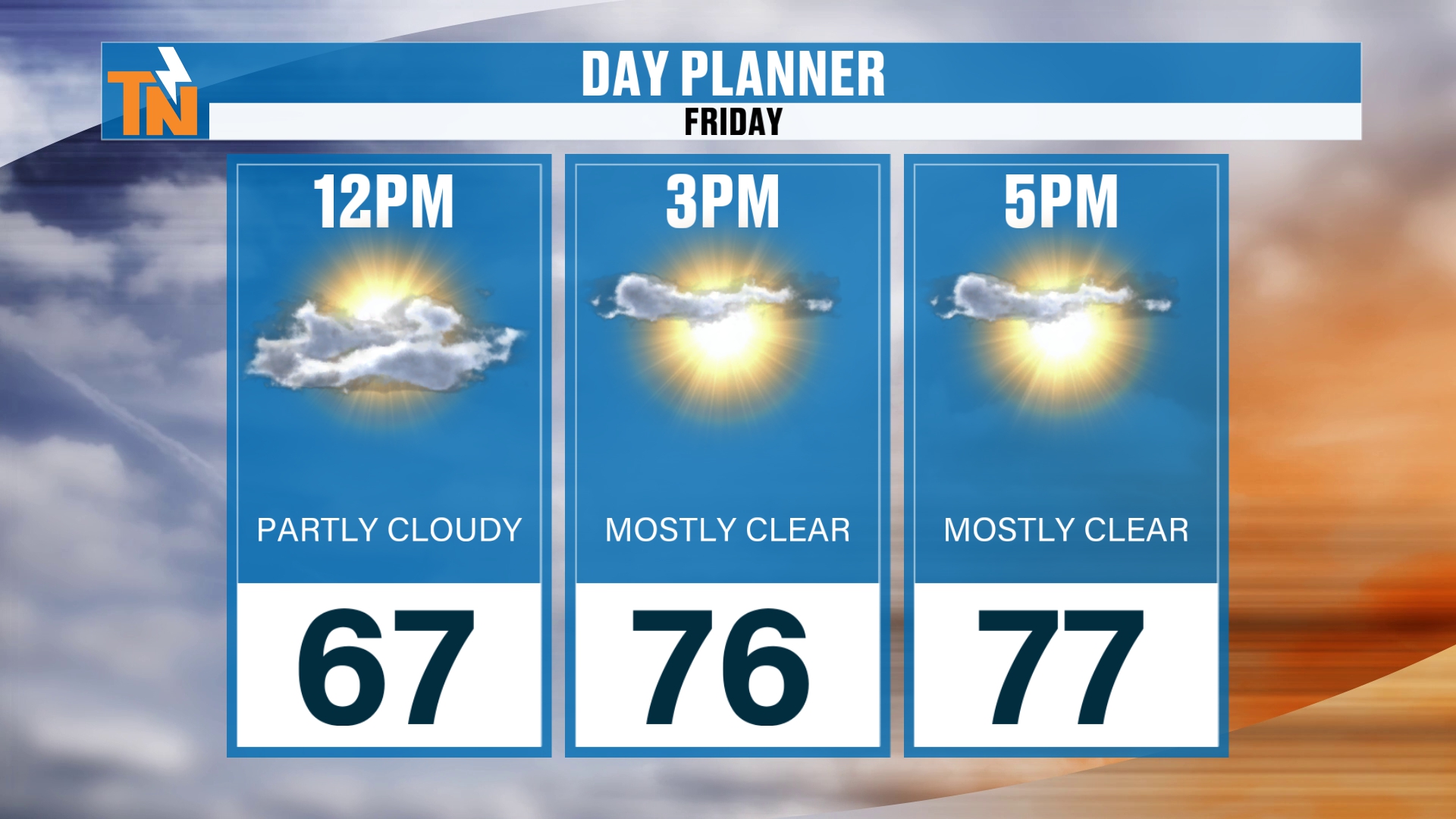
We’ve got a few mid and high level clouds this morning, and a little fog developing in some spots. All in all, a nice, quiet start to the day.
We’ll see plenty of sunshine, with high clouds increasing through the day as that southwesterly flow continues.
We start in the 30s, 40s and 50s, which is a touch warmer than yesterday.
Lunchtime is in the upper 60s. When the kids head home from school, we’re in the mid 70s. And the evening rush hour stays in the mid to upper 70s.
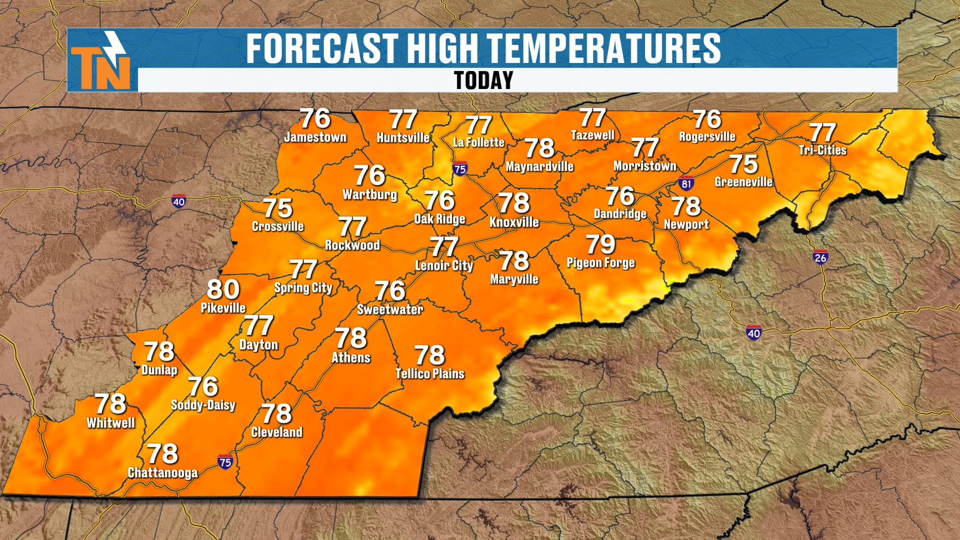
Forecast highs are in the upper 70s. That’s about 10° above average for this time of year.
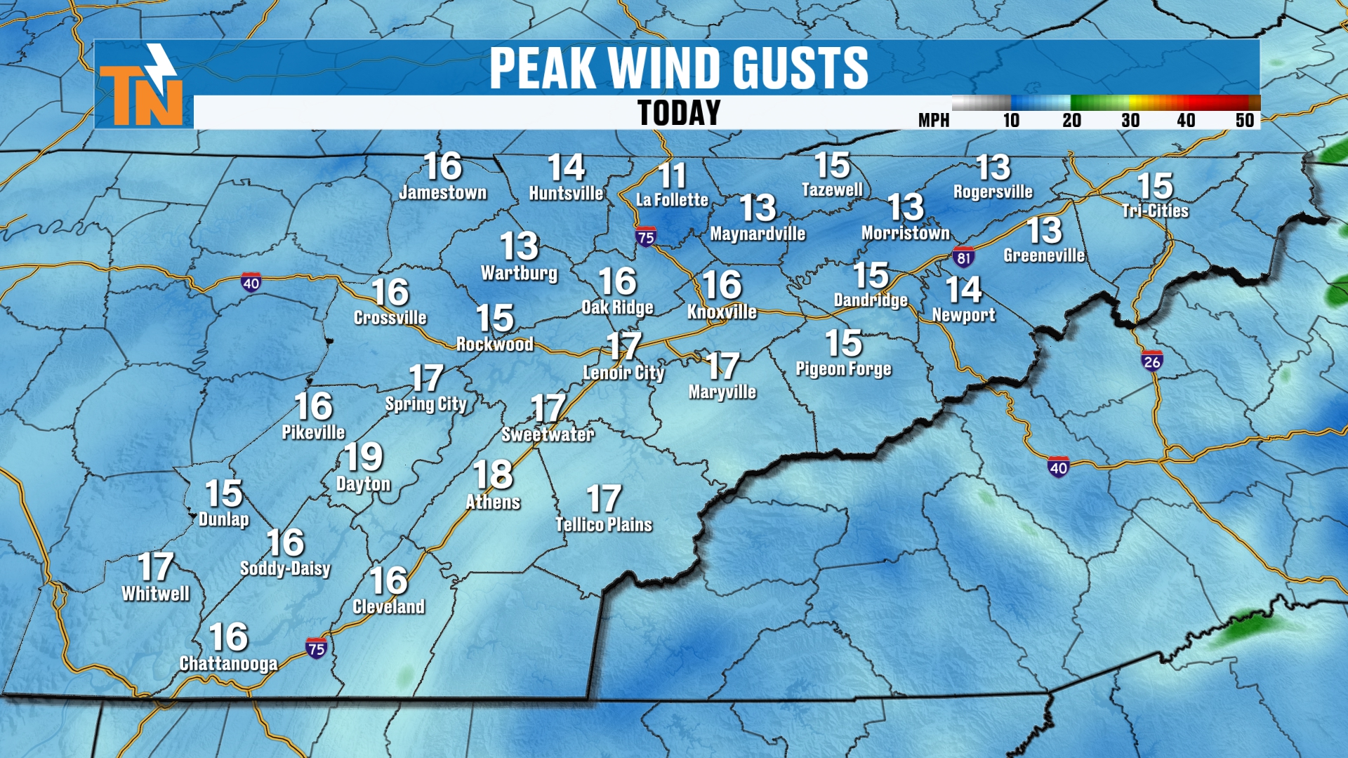
We’ll see wind gusts of about 15 to 20 mph at times. That’s not strong. It’s just a solid October breeze in the afternoon.
High School Football Tonight
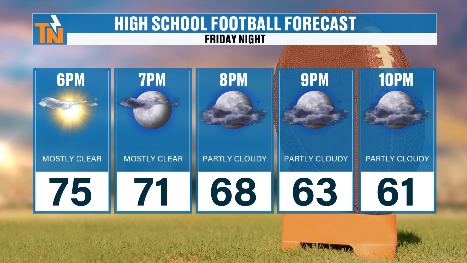
If you’re heading to the game, enjoy it! You’ll want a jacket once the sun goes down.
Kickoff is right around 71°. By 9 PM, toward the end of the games, we drop to about 63°.
Trick-or-Treat Forecast: Mild and Mostly Rain-Free
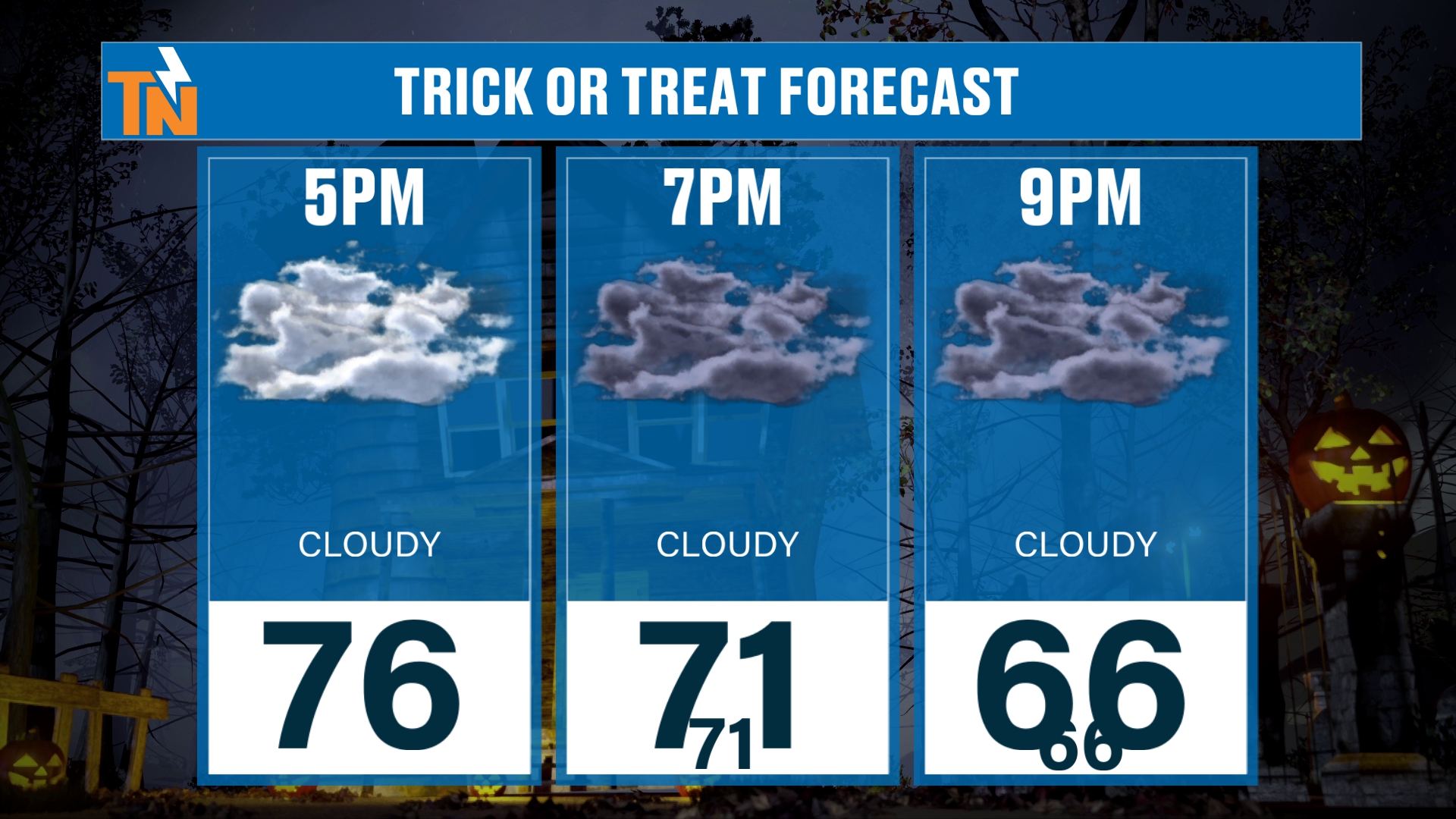
Saturday brings increasing clouds, becoming mostly cloudy. It should stay rain-free.
Highs are in the mid 70s. By 7 PM we’re at 71°, and by 9 PM we’re at 66°.
Cloudy skies, but nice and mild for the trick-or-treaters. Enjoy it!
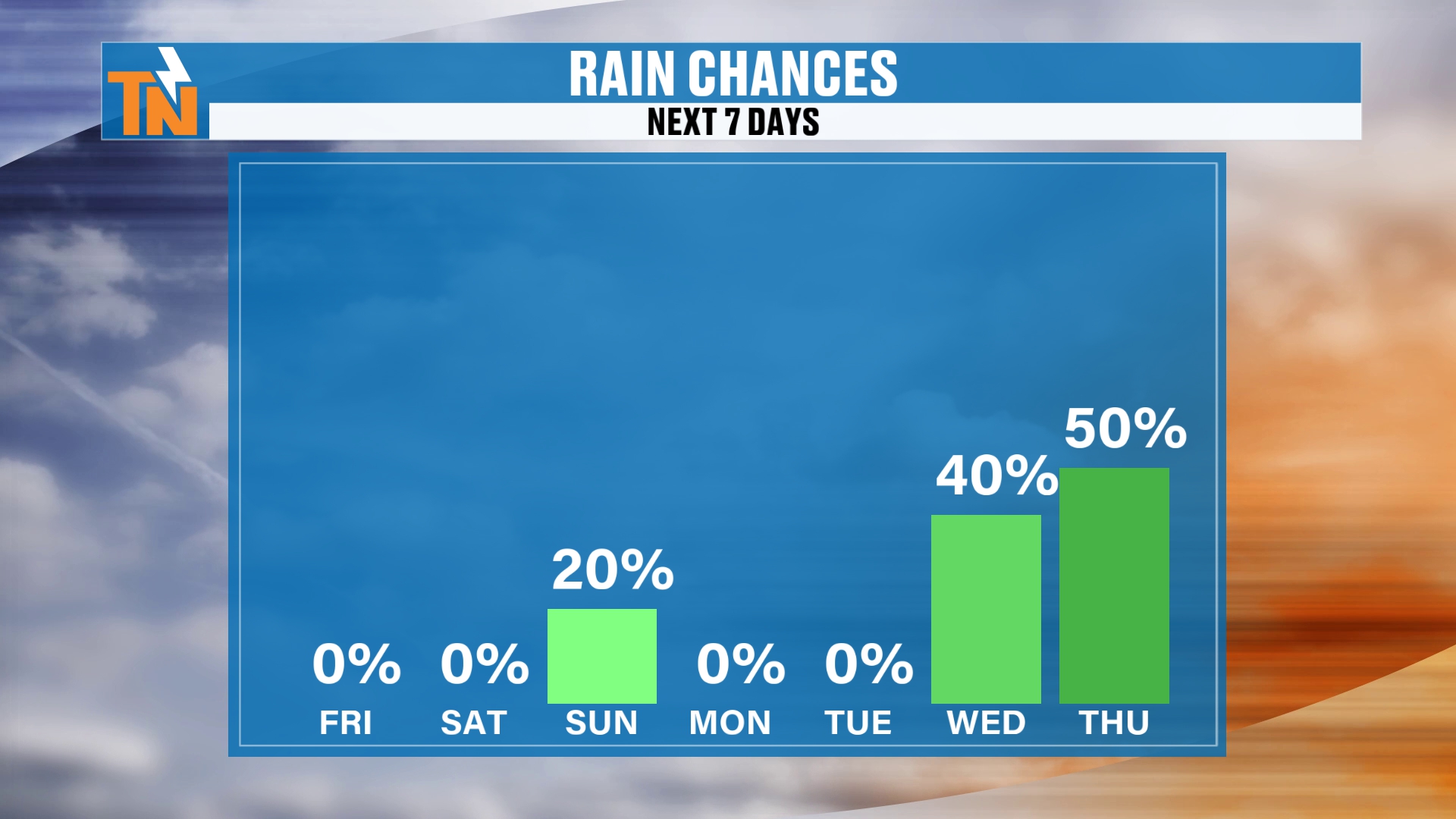
I’ve taken the rain chance down to about 20% on Sunday. We do have a better chance for some rainfall west of Interstate 75, but generally speaking it’s going to be light.
Then the rain chances ramp up next week. Wednesday and Thursday are the days I’ll be watching.
Why the Weekend Stays Mostly Dry
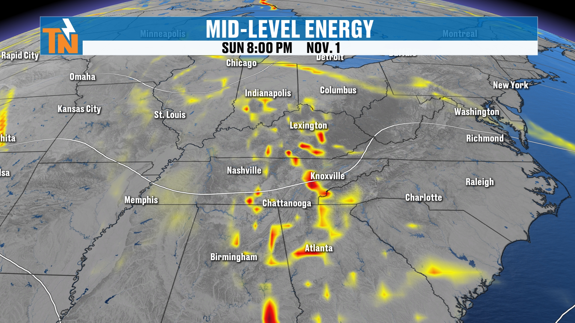
Here’s our little piece of energy. It’s an open wave at the 500 millibar level, about 18,000 feet up.
As it comes through, it gives us lift, which gives us clouds. And if there’s enough moisture, it gives us some rain.
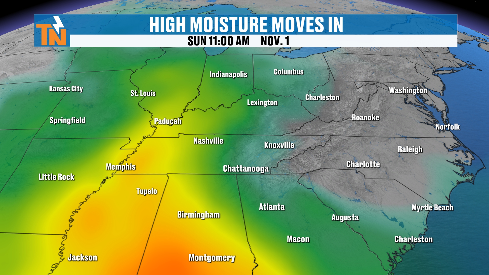
Speaking of moisture, I’ve shown you the high precipitable water values all week long. They’re back into West and Middle Tennessee.
But notice how it just fades away. We don’t get that high moisture surge we were looking at earlier this week.
High pressure is going to dominate East Tennessee, and that keeps a lot of moisture from getting through.
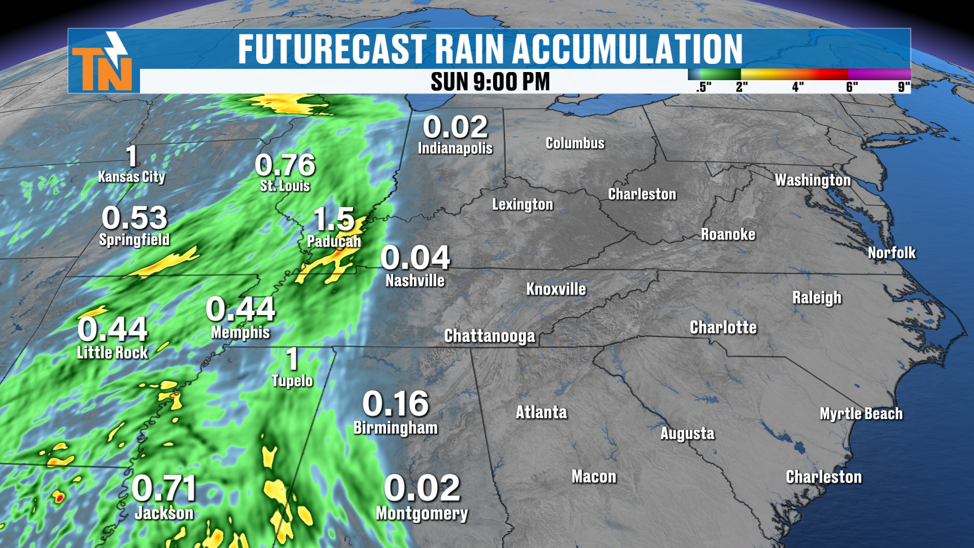
The heaviest rain stays back in West and Middle Tennessee. Memphis, Paducah, Little Rock and northern Mississippi look like the bullseye.
We’ll see if it shifts east a little, but it doesn’t look like much for us.
Big Pattern Change Next Week
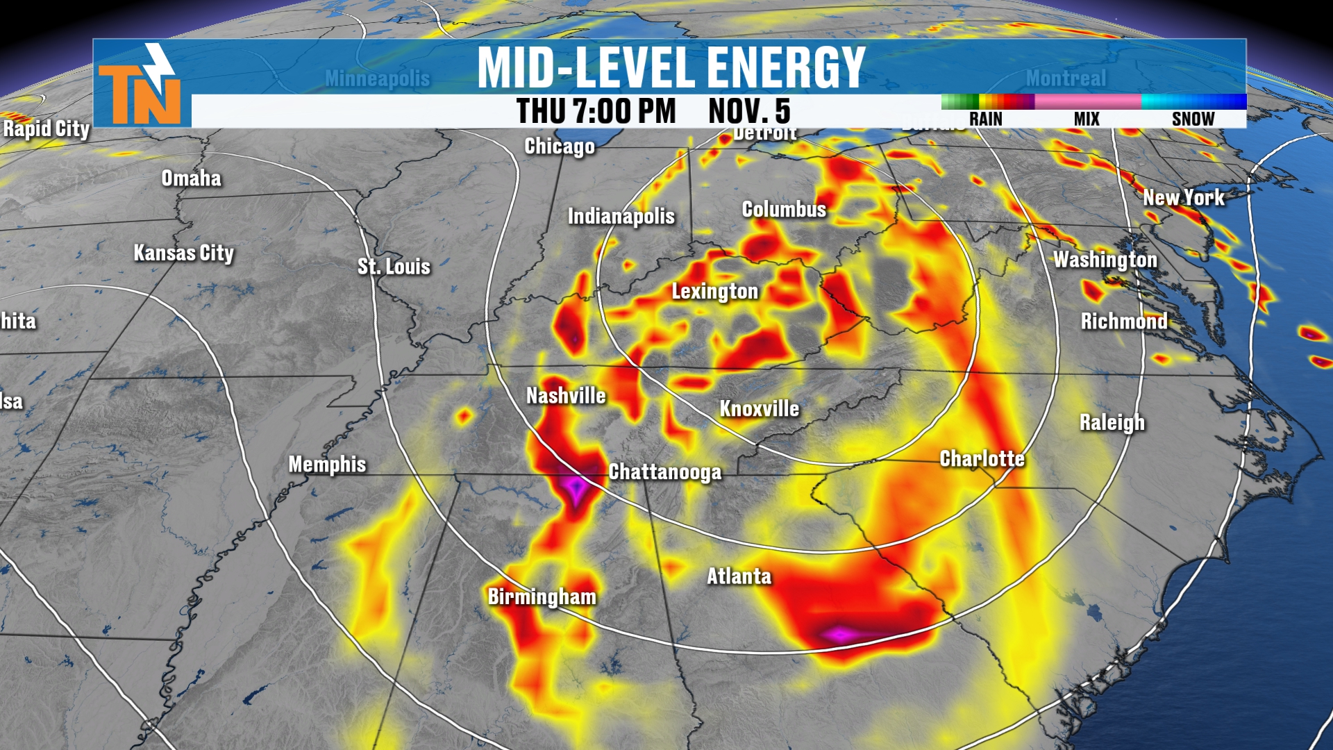
Here’s where I want to be careful. This is model guidance, and guidance is not gospel.
But a big, deep trough is going to develop across the West Coast toward the end of the weekend. It follows right on the heels of that open wave on Sunday.
That trough spins across the middle of the country. It pulls in much cooler, drier air from Canada, and it pulls in a lot more moisture from the Gulf.
Put it all together, and that’s a big pattern change.
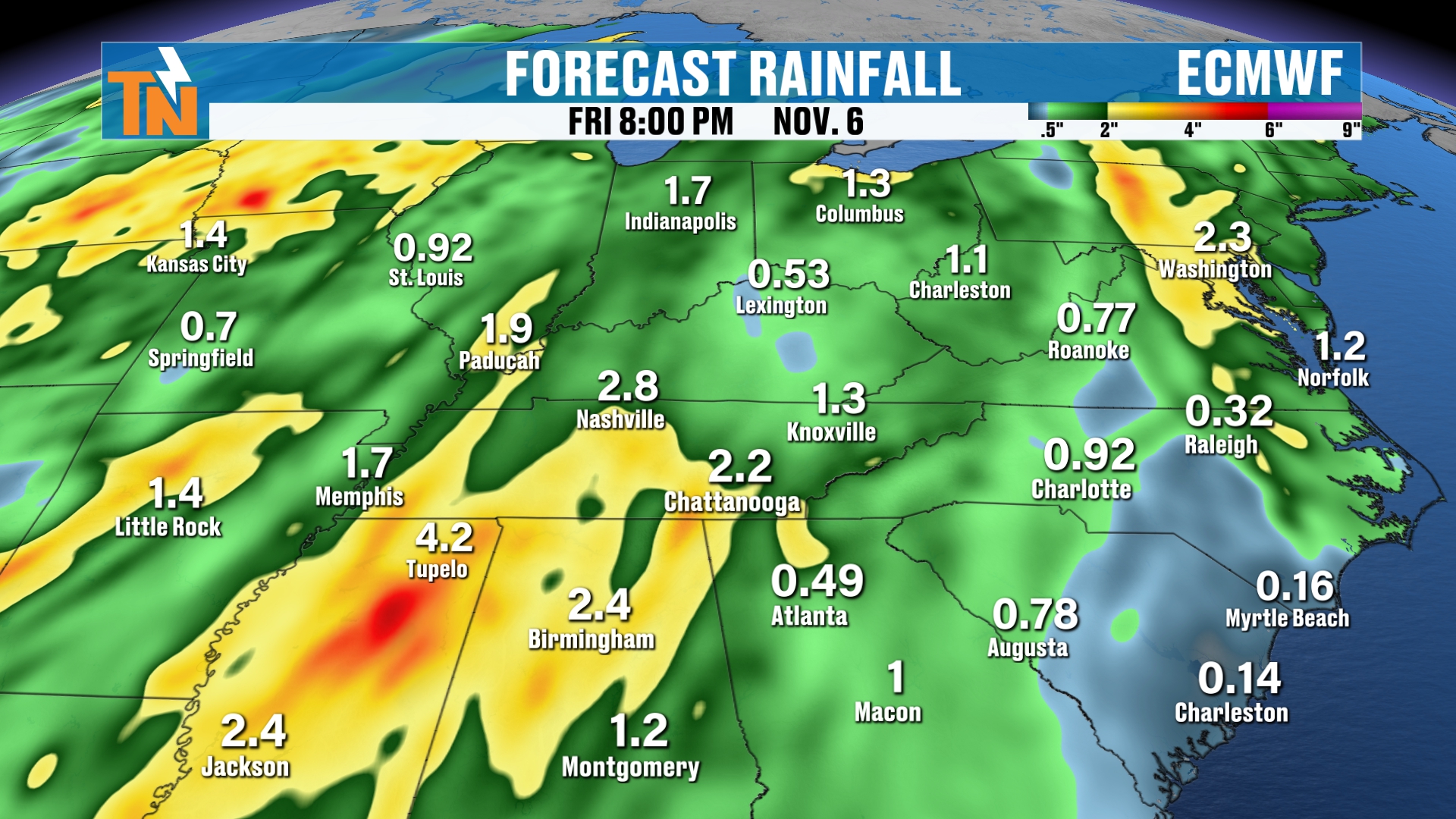
All of the models are showing it. Maybe one to two inches of rain, maybe one to three, across parts of the region.
It’s going to produce a lot of wind. And we could see some severe weather out ahead of this system. Maybe not here locally, but around our region.
Behind it, I think we could cool down Thursday, Friday and Saturday as northwesterly flow sets up and draws in that cooler, drier air.
Wednesday and Thursday are the best chances for rain. Temperatures could fall into the 60s by Friday and Saturday.
What the Climate Prediction Center Says
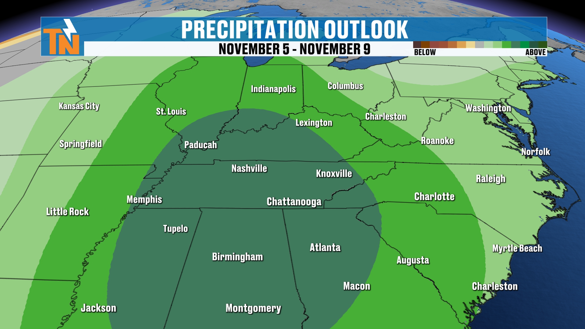
The Climate Prediction Center has well above average probabilities for above-average rainfall. That’s the storm system I’m talking about for the middle of next week.
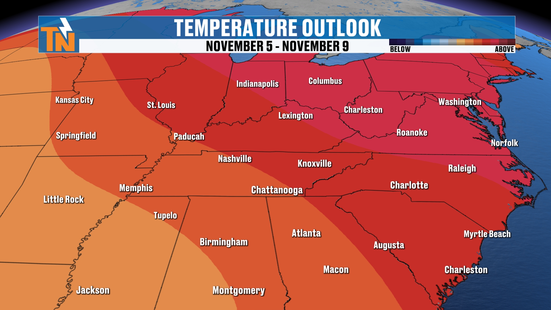
The 6 to 10 day outlook, which takes us toward the end of the seven days, still favors warmer than average weather.
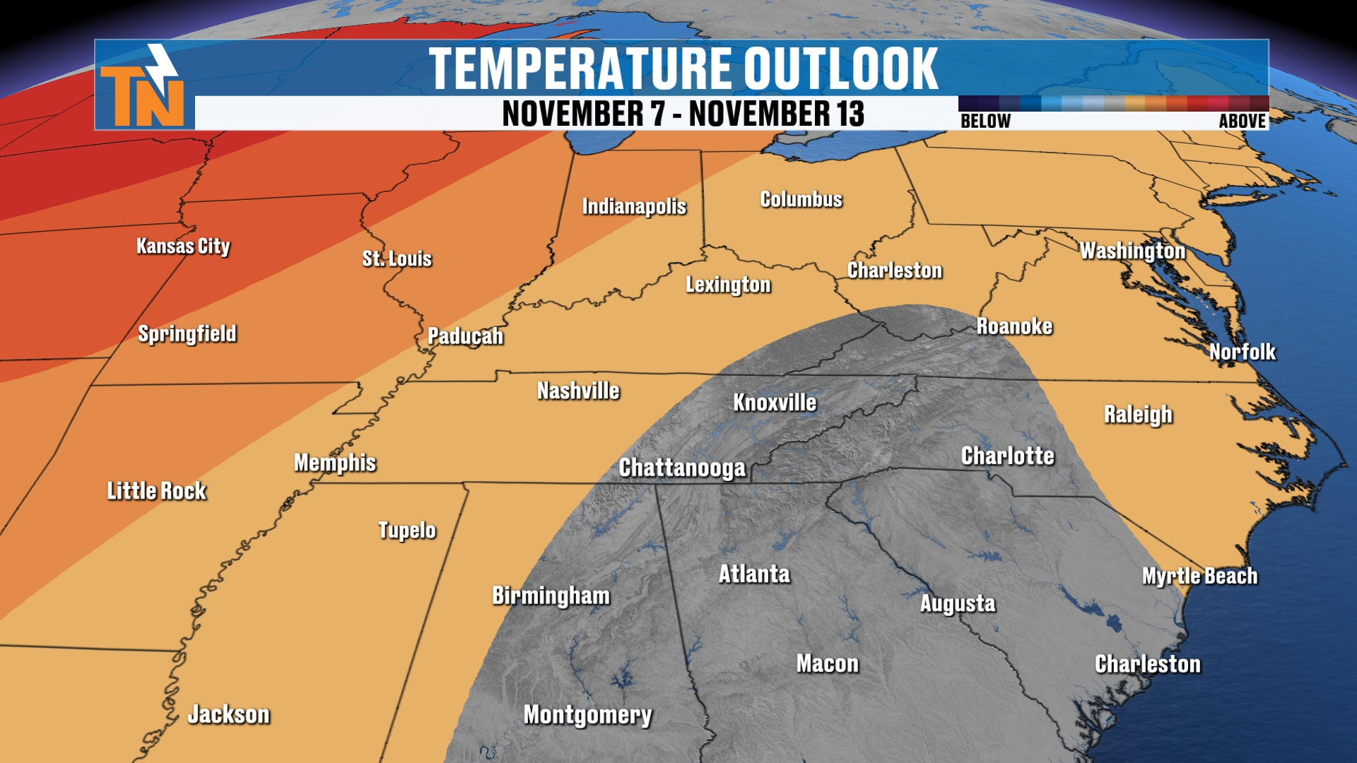
Then in the 8 to 14 day outlook, we’re looking at either average or maybe even slightly below average temperatures as we get into the middle of the second week of November.
Bottom Line
FRIDAY: Plenty of sunshine, with high clouds increasing. Upper 70s, about 10° above average. Gusts 15 to 20 mph.
FRIDAY NIGHT: Football kickoff around 71°, dropping to about 63° by 9 PM.
SATURDAY (HALLOWEEN): Mostly cloudy and rain-free. Mid 70s. Trick-or-treat at 71° by 7 PM and 66° by 9 PM.
SUNDAY: Light rain chance of about 20%, mainly west of I-75.
WEDNESDAY AND THURSDAY: The big pattern change arrives. Rain chances of 40% and 50%, with strong winds and 1 to 2 inches of rain possible.
FRIDAY–SATURDAY (NEXT WEEK): Cooler behind the system, with temperatures falling into the 60s.
November is right around the corner, my friends! And happy birthday to anybody celebrating on Halloween.
Make sure you download the FREE eastTNweather app from your app store. It’s 100% free, it’s all weather all the time for East Tennessee, and it travels anywhere you go.
And if you’re watching on YouTube, don’t forget to LIKE, SHARE, SUBSCRIBE and hit the bell.
Catch up on all of my recent daily forecasts anytime, and keep checking back for the potential of wind, rain and maybe some severe weather next week.
I’m Meteorologist Mike Witcher.
Have a great Friday!
eastTNweather — Weather When You Want It.