
Weekend Recap and Monday Setup
Happy Monday! Hope you had a great weekend.
We went from warm summerlike conditions on Saturday to a much cooler Sunday, with highs only reaching the 50s and 60s. Knoxville topped out at 63°, and that cooler trend is sticking with us to start the new week.
This morning begins on a chilly note, and a weak boundary is sliding through the region. It won’t bring much in the way of rain, but it will keep things breezy and slightly below average.
Monday Forecast: Breezy, Cool, and Mostly Sunny
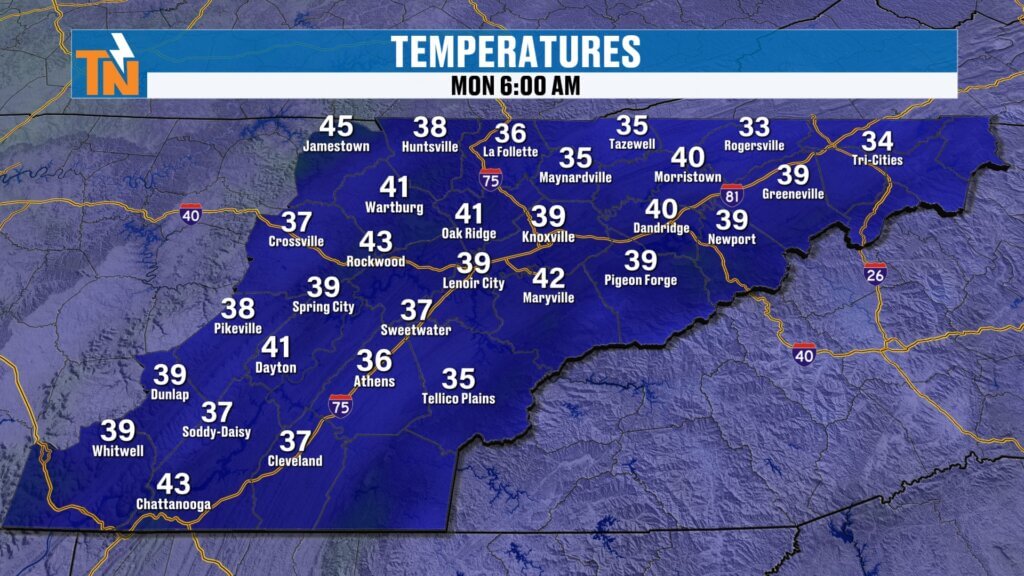
Temperatures started off cold with many locations in the 30s and 40s:
- 34° in Rogersville and Johnson City area
- 41° in Greeneville
- 39° in Knoxville
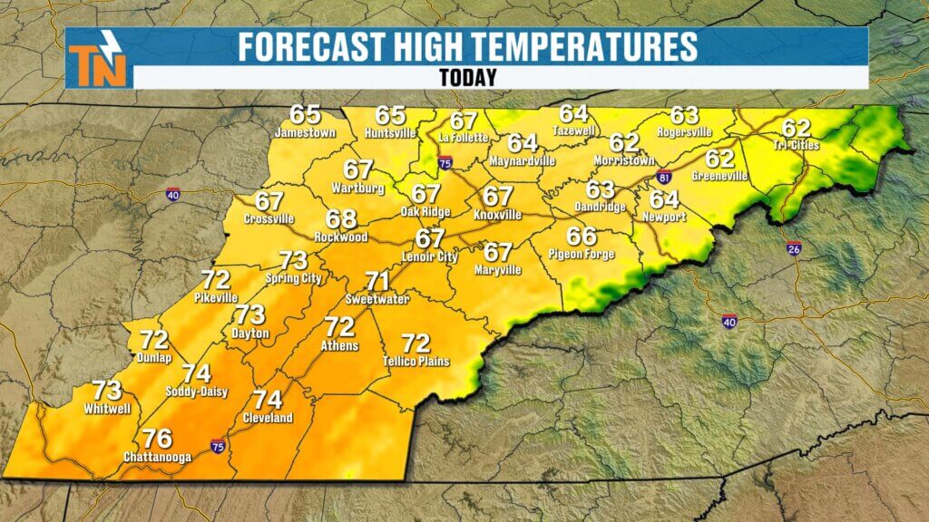
Through the day:
- Highs: Mid to upper 60s for most
- Cooler north, warmer south (low 60s Kingsport area vs mid 70s Chattanooga)
- Winds: Westerly shifting northwest, breezy through the afternoon
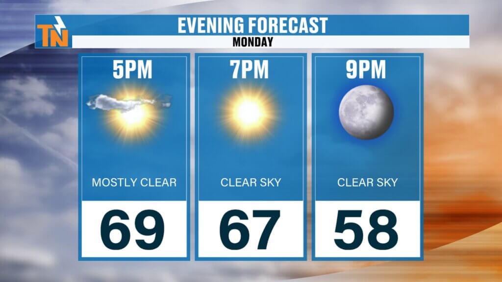
By evening:
- 67° at 7 PM
- 58° by 9 PM
A nice, cool spring day overall, just a bit breezy.
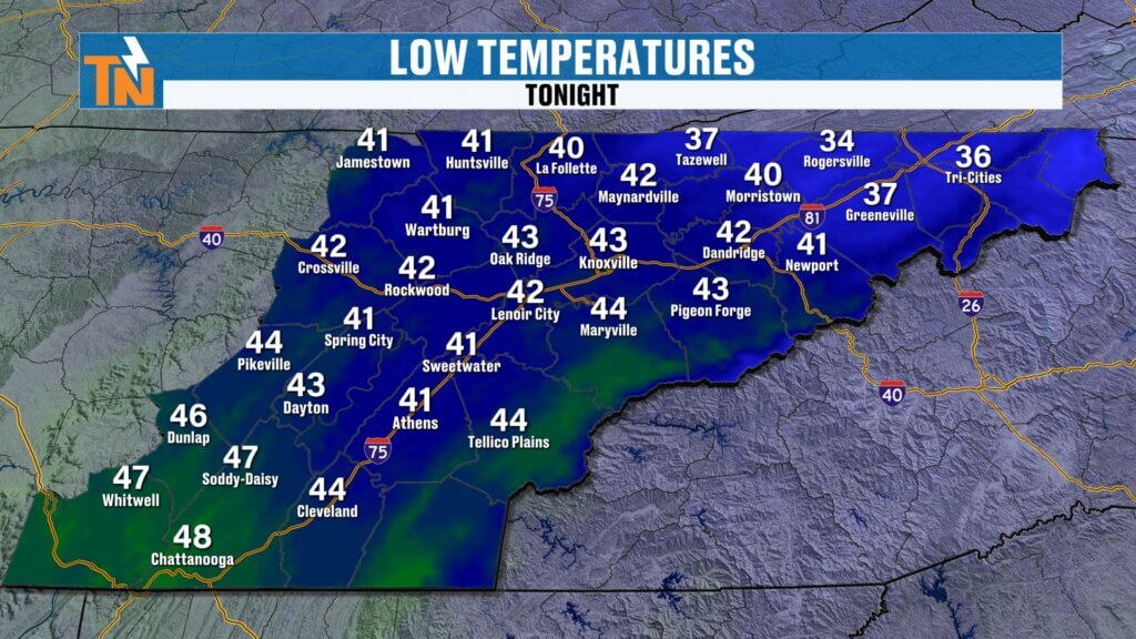
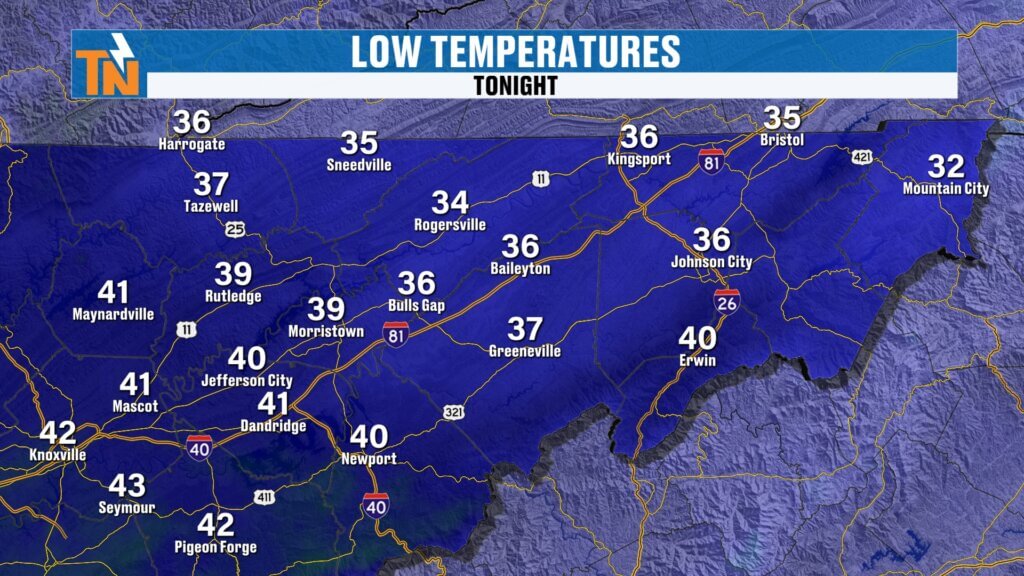
Tuesday Morning: Frost Risk in Upper East Tennessee
Another chilly night is ahead.
- Most areas: 40s
- Upper East Tennessee: 30s
Frost is possible in spots like:
- Bristol around 35°
- Mountain City near 32°
- Kingsport mid 30s
If you’ve got sensitive plants, keep that in mind early Tuesday morning.Around 62° by 7 PM
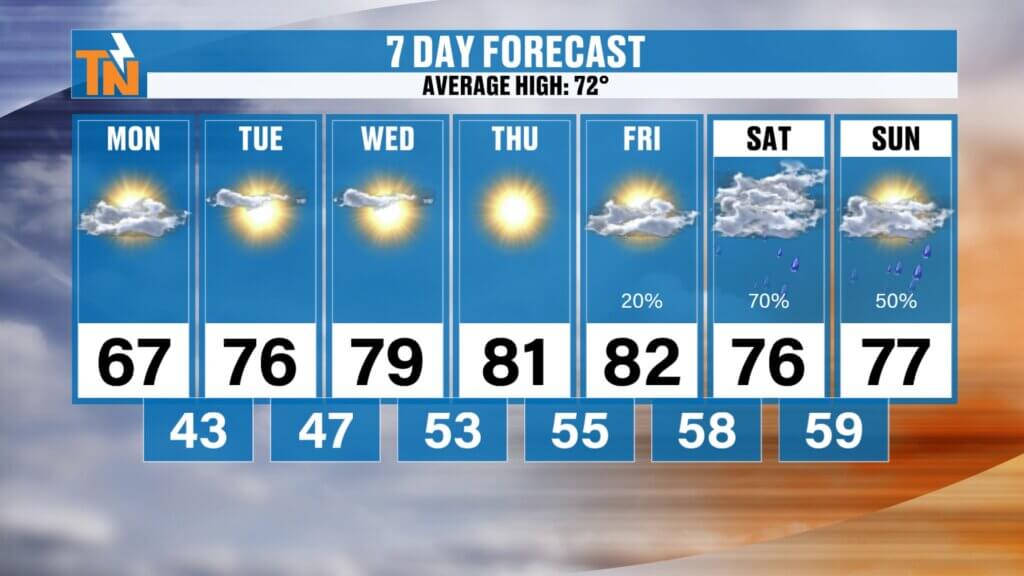
Midweek Outlook: Dry and Warming Up
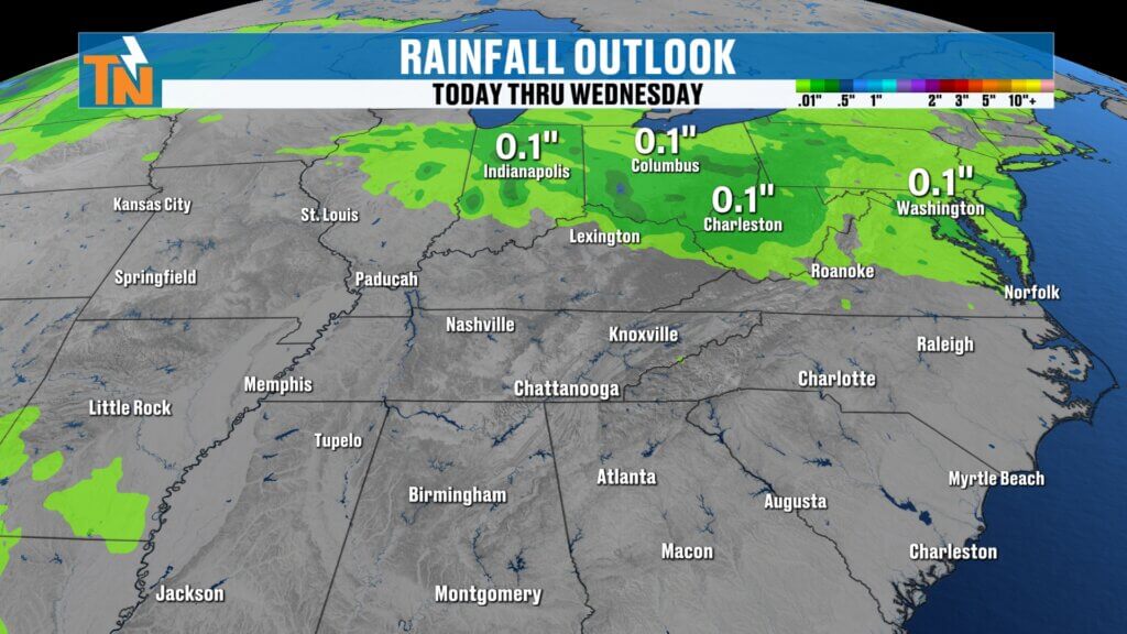
Rain chances remain very limited through the work week.
- Tuesday: Mid 70s
- Wednesday–Friday: Upper 70s to low 80s
- Mostly sunny skies with dry conditions
It’s a classic spring warm-up after a cool start to the week.
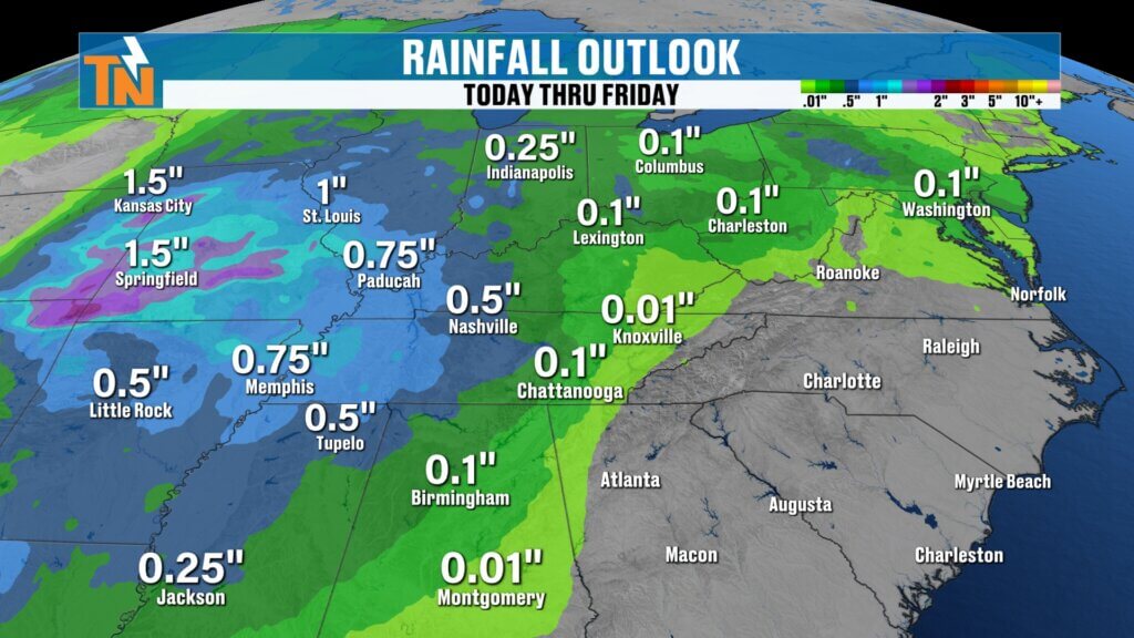
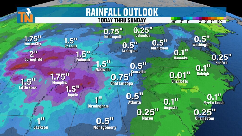
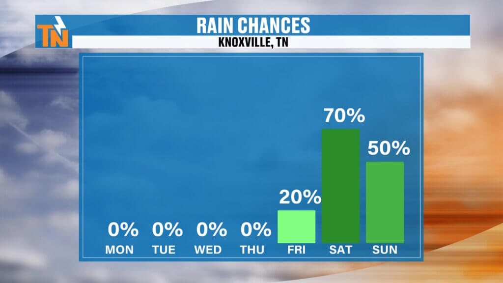
Weekend Forecast: Rain Chances Increase
The next system arrives just in time for the weekend.
- Friday night into Saturday: Rain chances begin increasing
- Saturday into Sunday: Better coverage of showers
Rainfall potential:
- Around 0.75″ to 1″ possible
- Heavier totals likely west of East Tennessee
- Lighter amounts possible in Upper East Tennessee
Event Impact: Weekend Festivals
With rain chances increasing, this could impact outdoor plans, including events like the Dogwood Arts Festival and other local festivals across East Tennessee.
It’s not a washout yet, but definitely something to watch closely as timing gets refined.
7-Day Snapshot
- Monday: Mid to upper 60s, breezy
- Tuesday: Mid 70s
- Wednesday–Friday: Upper 70s to low 80s
- Weekend: Mid to upper 70s with increasing rain chances
Average high this time of year is around 72°, so we’ll swing from slightly below to well above average as the week goes on.
Final Thoughts
Cool and breezy today, chilly again tonight with a frost risk in spots, then a warm and dry stretch before rain returns this weekend.
Make sure to check back in for updates as we fine-tune that weekend system.
Have a great Monday!