
Good morning and happy Sunday!
We finally got some much needed rain around the area. And now a pattern change sets in.
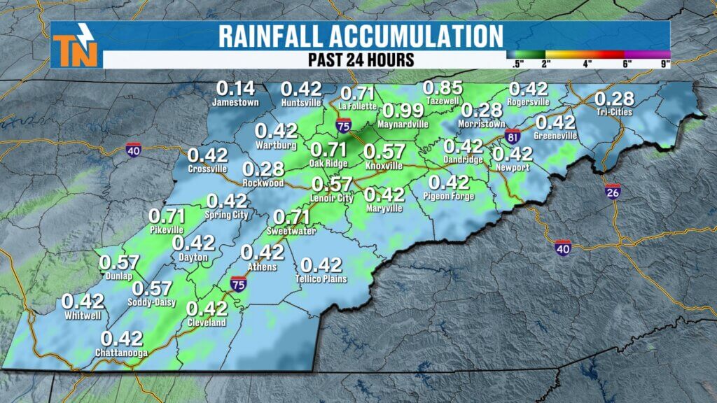
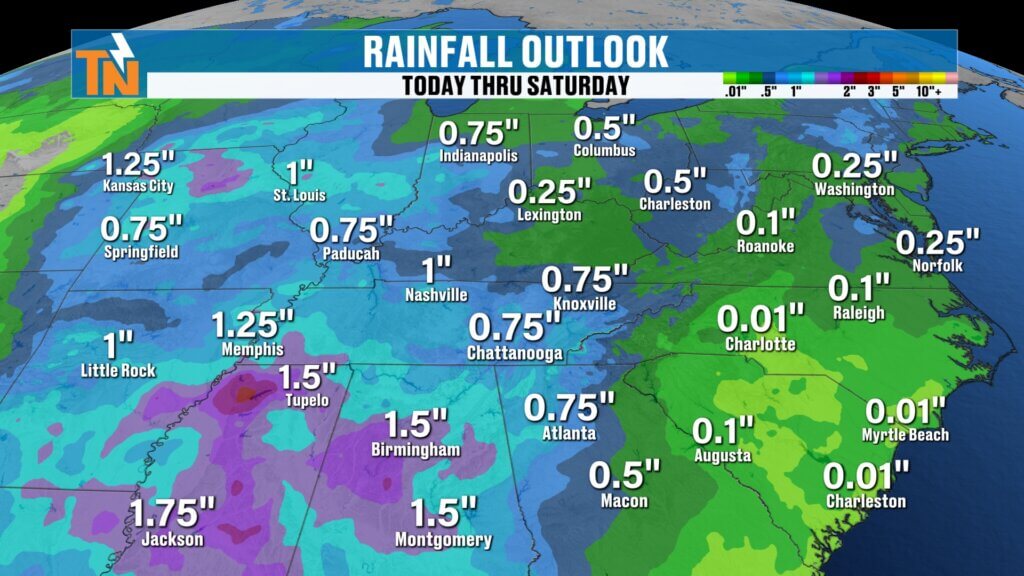
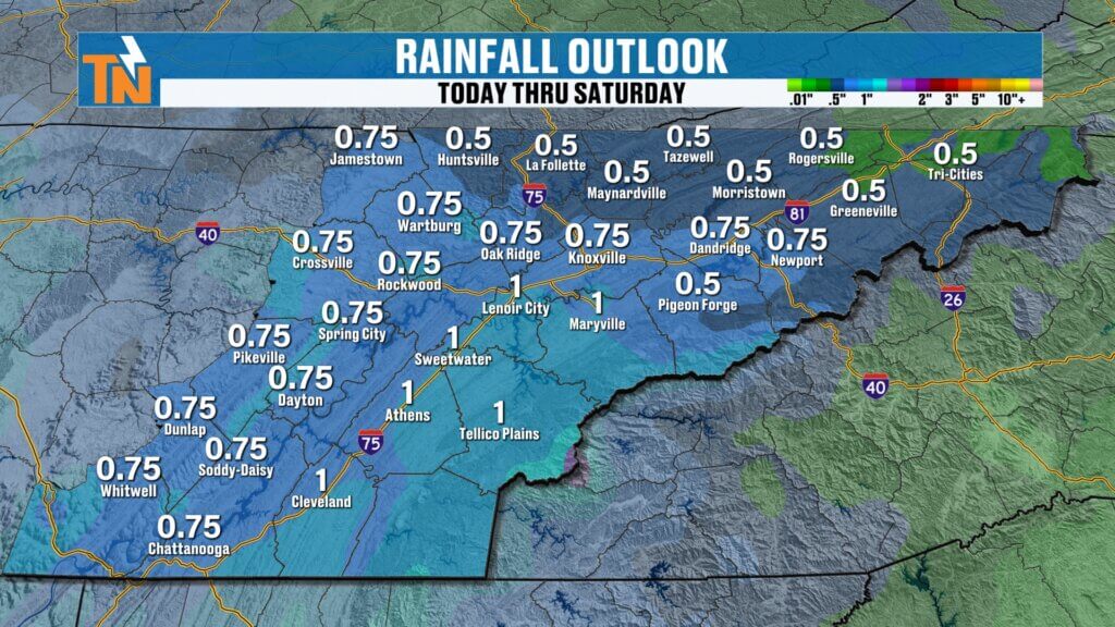
Rain Recap: Much Needed Moisture Arrives
We finally picked up some much-needed rainfall across East Tennessee. While amounts varied, it was a helpful system overall:
- Around 0.25″ at the airport
- Near 0.39″ in Crossville
- Around 0.32″ in Chattanooga
- Lighter totals across the Tri-Cities
Many areas generally saw between a quarter inch to three-quarters of an inch of rain. Not a drought-buster, but definitely a step in the right direction.
Big Change: Cooler and Drier Air Moves In
Behind the cold front, conditions are changing quickly.
- Skies clearing with abundant sunshine
- Northerly winds bringing in cooler, drier air
- A noticeable drop in temperatures across the region
This is a classic post-front setup with refreshing air replacing the recent warm and humid pattern.
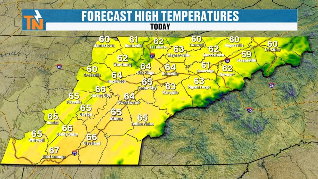
Sunday Forecast: Breezy and Much Cooler
Temperatures this morning are running 5 to nearly 20 degrees colder than yesterday.
- Morning lows: 30s and 40s
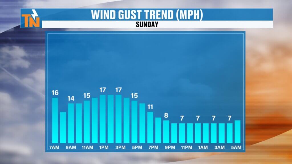
- Winds: North at 15 to 20 mph at times
- Afternoon highs: Mid to upper 60s (about 20 degrees cooler than Saturday)
It’s going to feel much more like a typical spring day compared to the summerlike warmth we just had.
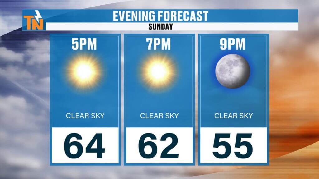
By this evening:
Cool and comfortable conditions settling inble across the northern Plateau. It will feel much cooler, especially Sunday morning and again Monday morning.This won’t eliminate the drought, but it will provide another round of beneficial rainfall.
Around 62° by 7 PM
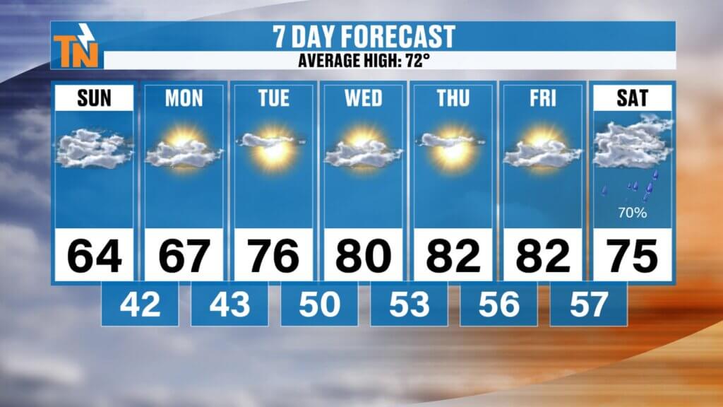
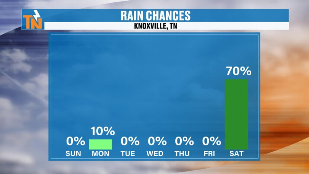
Early Week Outlook: Quiet with a Small Caveat
The start of the week looks mostly dry and calm.
- Monday: Mostly dry, but a very slight (10%) chance of a stray shower with a weak boundary
- Tuesday through Thursday: Dry conditions continue with plenty of sunshine
Overall, not much to worry about through midweek.
Warming Trend Returns Midweek
Temperatures will rebound quickly:
- Monday and Tuesday: Mid to upper 60s to low 70s
- Wednesday through Friday: Back into the 80s
Another warm stretch sets up as high pressure builds back in.
Next System: Rain Chances Increase Late Week
Looking ahead, the next meaningful weather system arrives late in the week.
- Rain chances increase Friday into Saturday
- Potential for around 1 inch of rainfall locally
- Could signal a shift toward a wetter pattern beyond the 7-day forecast
This could be another opportunity for beneficial rain, especially with ongoing dry conditions still in place.
Weekend Ahead: Plan for Rain
If you have outdoor plans next weekend, keep this in mind:
- Friday night into Saturday looks unsettled
- Higher rain chances and falling temperatures
- A wetter setup compared to this weekend
Details will continue to come into focus over the next few days.
Final Thoughts
We finally picked up some helpful rain, and now we’re enjoying a refreshing cooldown. Quiet weather sticks around for a few days before another round of rain arrives late week.
Enjoy the sunshine and cooler temperatures today, and have a great Sunday!