
Happy Monday, East Tennessee!
We made it through another weekend, and wow—what a difference compared to the one before it. This time, we enjoyed plenty of sunshine, perfect for getting outside and soaking it all in. Rain was pretty scarce yesterday, with only a few light showers in parts of Greene County and up toward the Tri-Cities area. High temperatures topped out in the mid to upper 80s, which is right where we should be for early August. Saturday brought similar weather, thanks to a strong ridge of high pressure stretching from the Northeast all the way into the Tennessee Valley.
Right Now Across East Tennessee
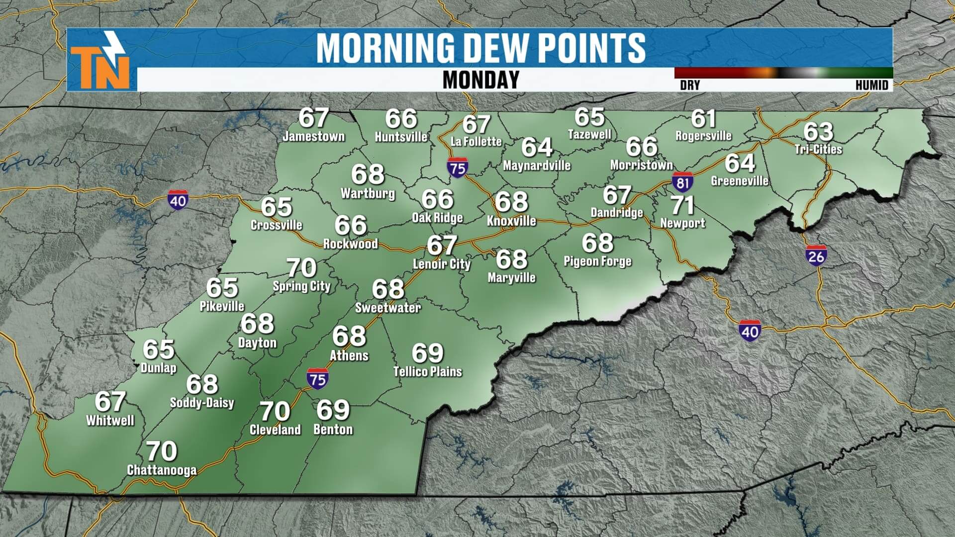
This morning, the radar is pretty quiet locally. We do have some showers over Georgia, South Carolina, and into parts of North Carolina, and some of that energy may drift our way later today. For now, though, we’re starting the day with comfortable temperatures—60s and 70s across the region. Even spots like Greenville, Rogersville, and the Tri-Cities are starting out a little warmer than the past couple of mornings. Dew points are also creeping up, which is a sign we’re about to feel a bit more humidity.
Today’s Forecast – Spotty Showers, Mostly in the Mountains
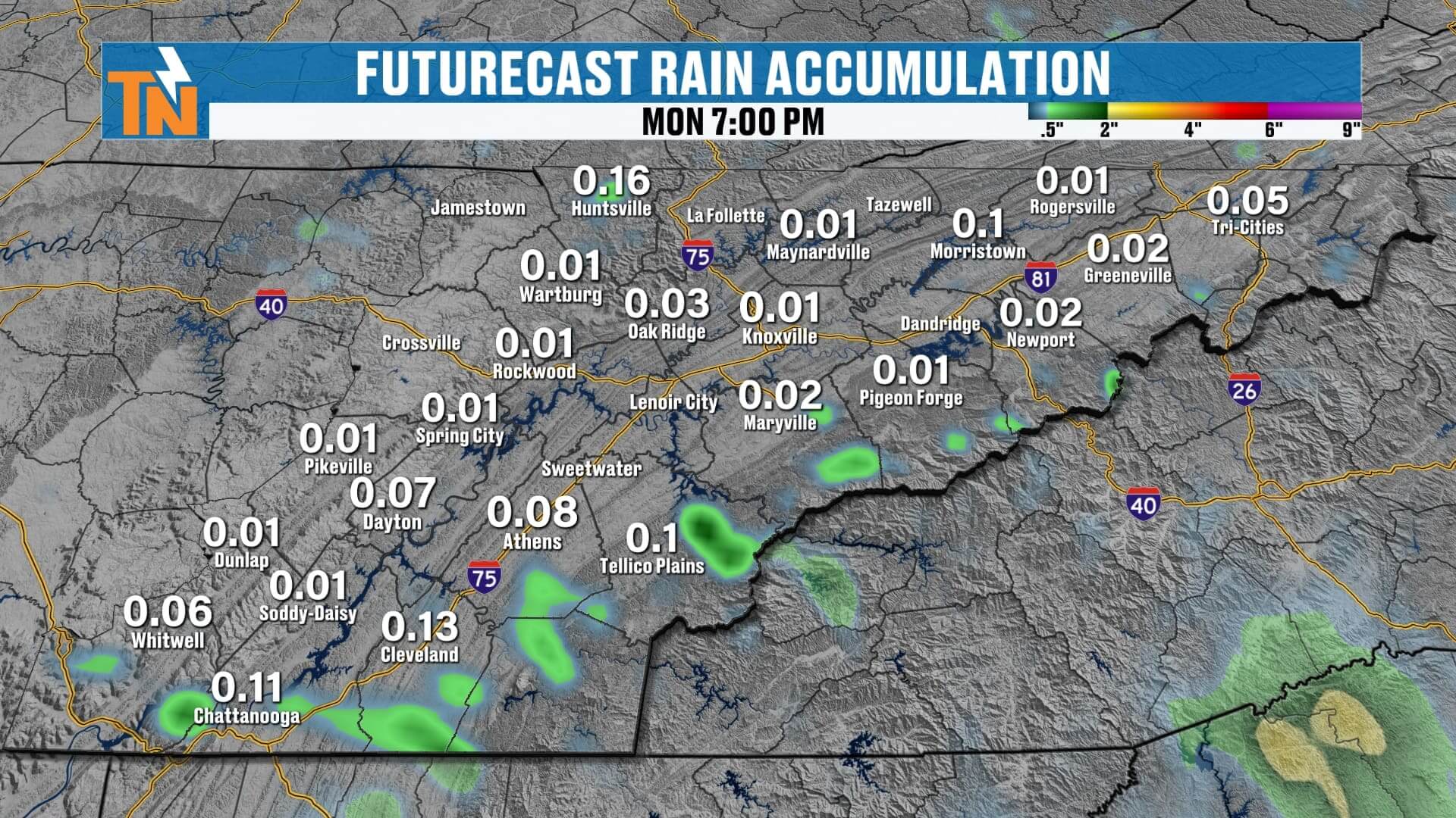
Clouds will be on the increase through the day as moisture pushes in from the south and southeast. This will help spark a few slow-moving showers and thunderstorms, especially in the higher elevations. If you’re in mountain counties—Sevier, Cocke, Blount, Monroe, or even down toward Polk and Bradley—keep an eye out for a few pop-up storms. The Plateau may see a stray shower, but the overall coverage will stay low for most of the valley.
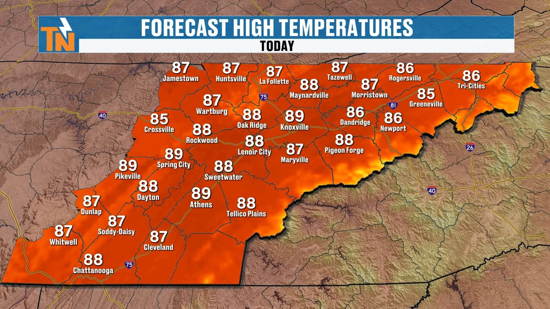
High temperatures will return to seasonal norms—upper 80s in most locations—but the higher humidity will push heat index values into the mid-90s. This evening will stay warm, with temperatures around 86° by 6 p.m. and 78° by 10 p.m.


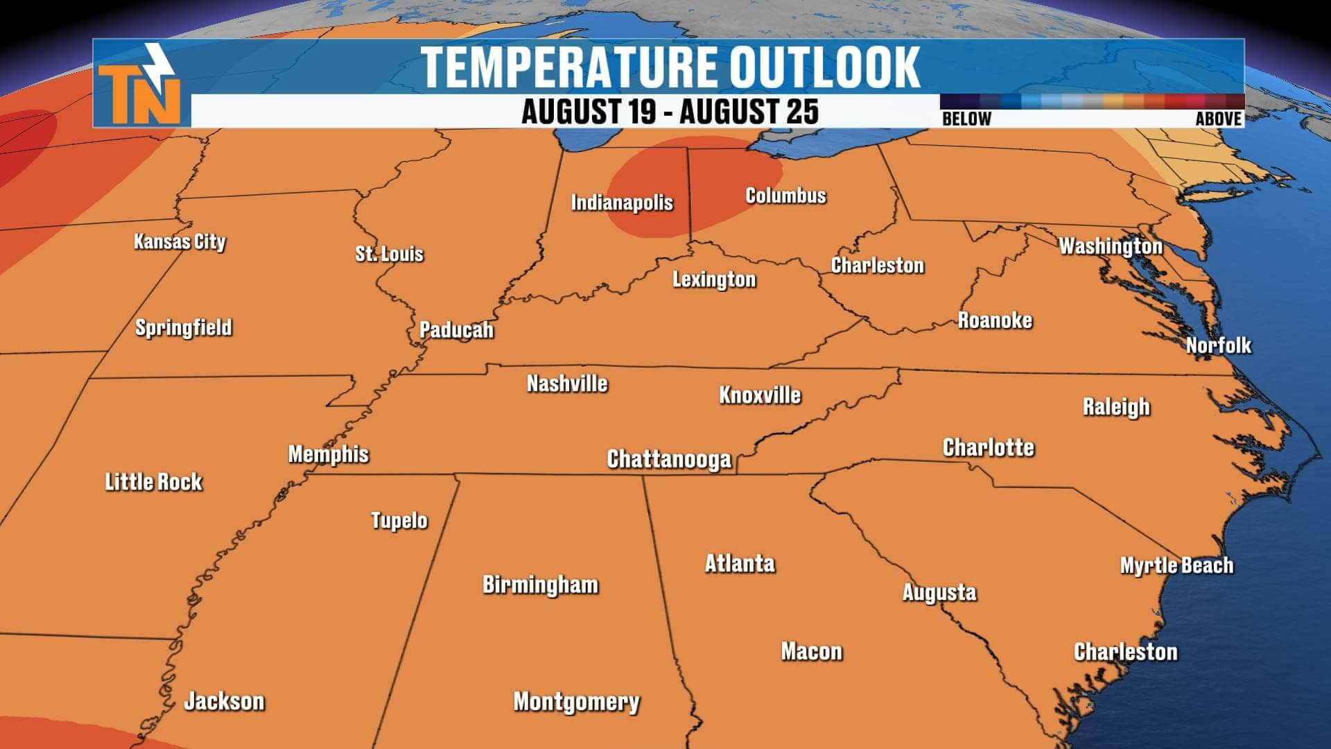
Looking Ahead – Heat, Humidity, and Increasing Rain Chances
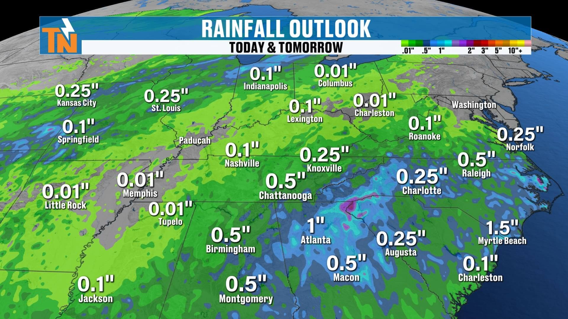
For the rest of the week, we’ll keep highs in the upper 80s to low 90s, but humidity will make it feel more like the upper 90s to near 100°. That’s because dew points will continue climbing, pulling more moisture into the atmosphere. This extra moisture will not only make it feel hotter—it will also give us better chances for tropical-like downpours.
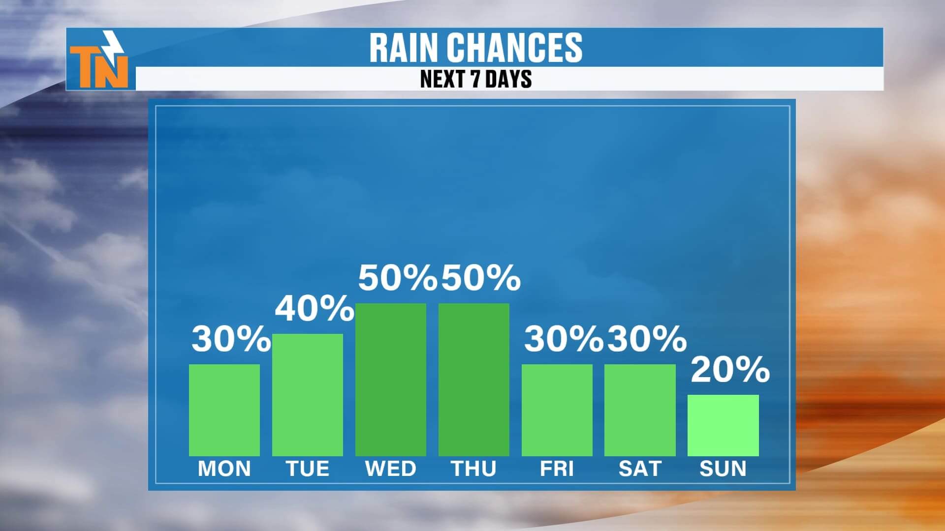
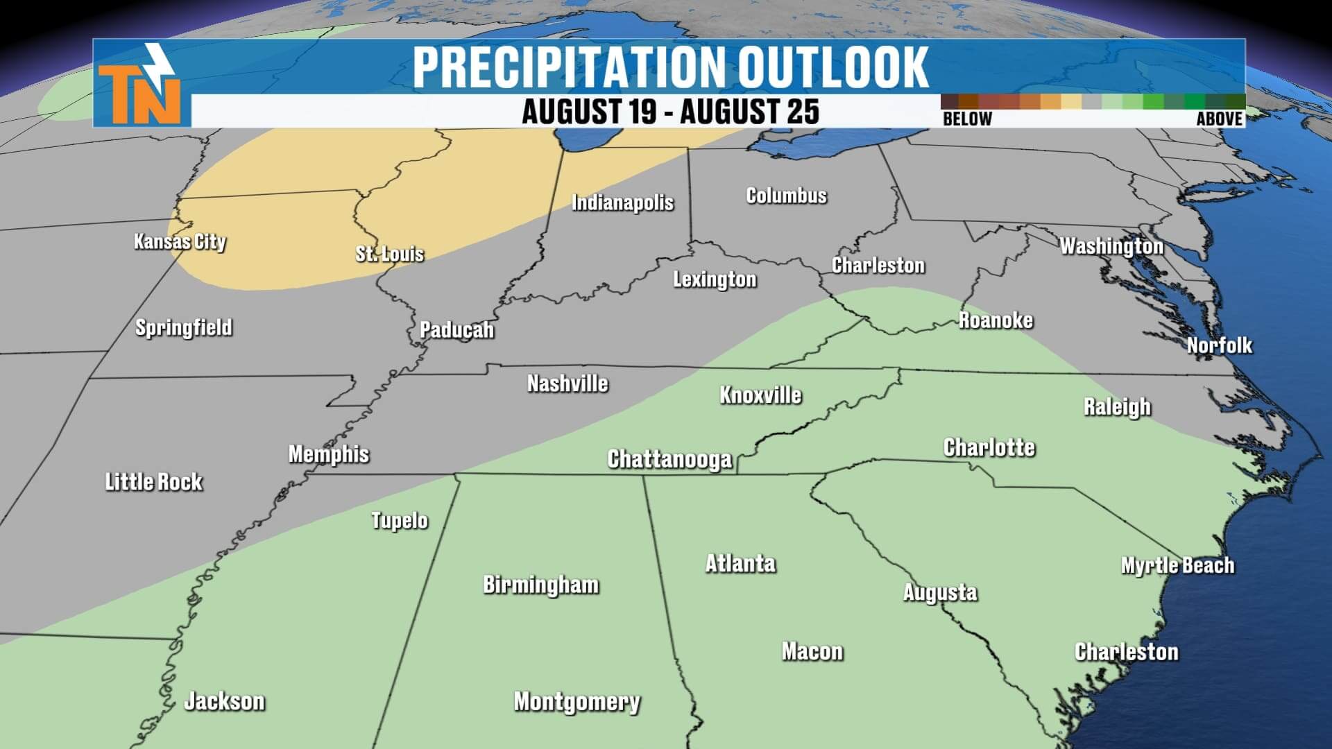
Starting Tuesday and lasting into Thursday and Friday, we’ll have a better shot at seeing more widespread rainfall. These will be the type of storms that can dump a lot of rain in a short time, so we’ll need to watch for localized flooding and flash flooding, especially by midweek. Coverage will average 30% today, 40% Tuesday, and around 50% for Wednesday and Thursday before tapering off into the weekend.
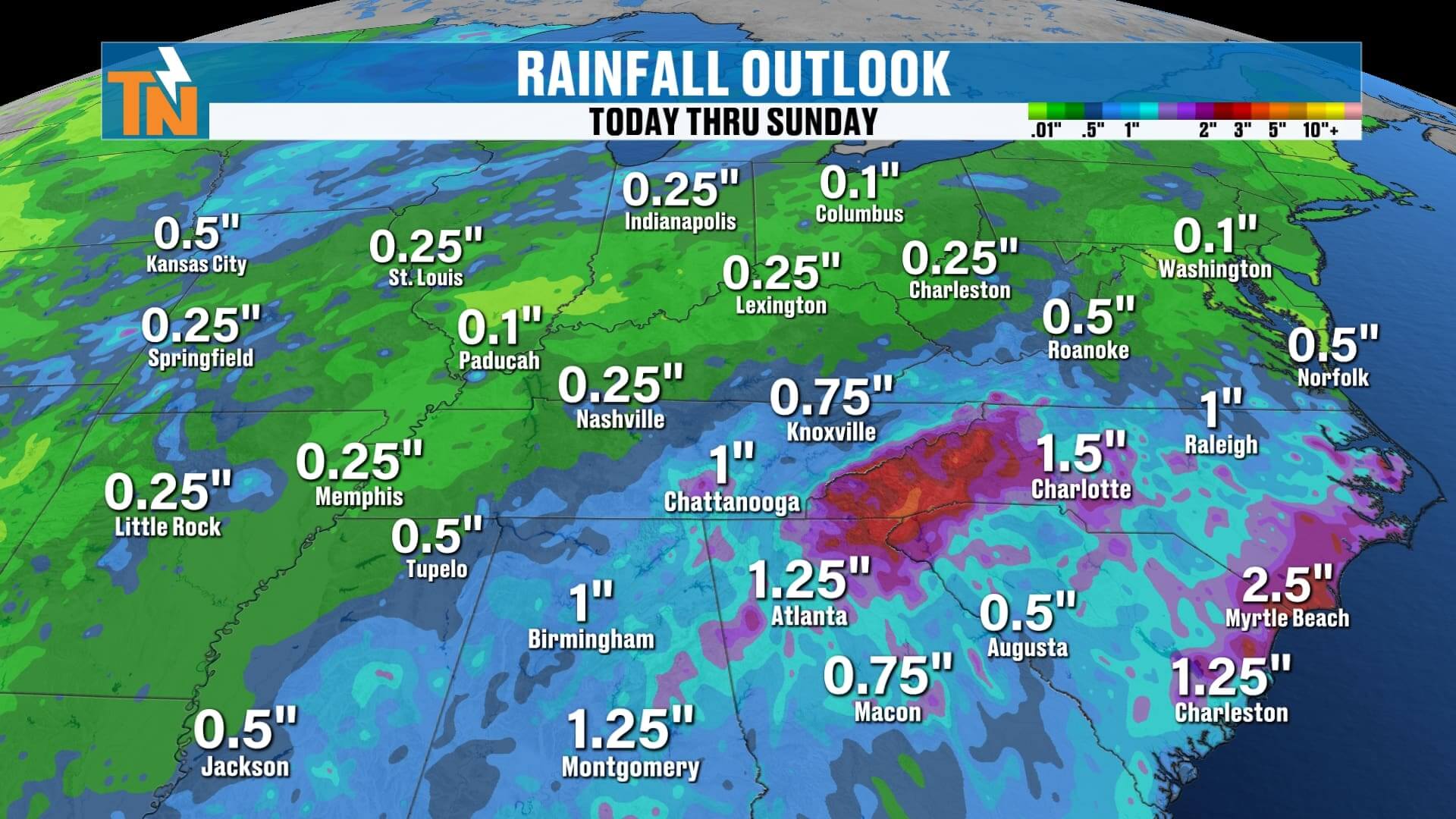
By the time we wrap up the week, some parts of East Tennessee could see over an inch of rain.

Tropical Update – Watching the Atlantic
We are still keeping an eye on the tropics. Right now, we have:
-
Invest 97L with a 90% chance of development over the next 7 days.
The wave coming off Africa is one to watch closely—it has the potential to develop into our next named storm over the next several days. If it becomes organized, the next name on the list is Erin. While the current model guidance suggests it may curve away from the U.S. mainland and perhaps only threaten Bermuda, it’s still too early to say with certainty.
Remember—the peak of hurricane season is September 10, so we are only ramping up from here. Tropical activity historically increases over the next few weeks, and this season is looking active.
Track it with the eastTNweather app—DOWNLOAD my FREE app now at https://onelink.to/easttnweather!

ABOVE AND BEYOND THE 7 DAY FORECAST
Bottom Line for East Tennessee:
-
Warm and humid today, spotty mountain showers.
-
Heat index values mid-90s today, upper 90s to near 100° later this week.
-
Increasing rain chances midweek with potential for heavy downpours.
-
Tropics are getting busy—stay tuned for updates.
Stay cool, stay weather aware, and as always, I’ll keep you posted on every change.
Have a great day, and I’ll see you in the next update!
— Mike