The Setup
Two cold fronts are lining up. The first arrives this evening with showers and a few thunderstorms. The second pushes through Sunday and drags in a much colder Canadian air mass.
Severe Risk
SPC keeps a Level 1 (Marginal) risk mainly along the Cumberland Plateau. Damaging wind is the primary threat; pea-size hail is possible with colder air aloft.


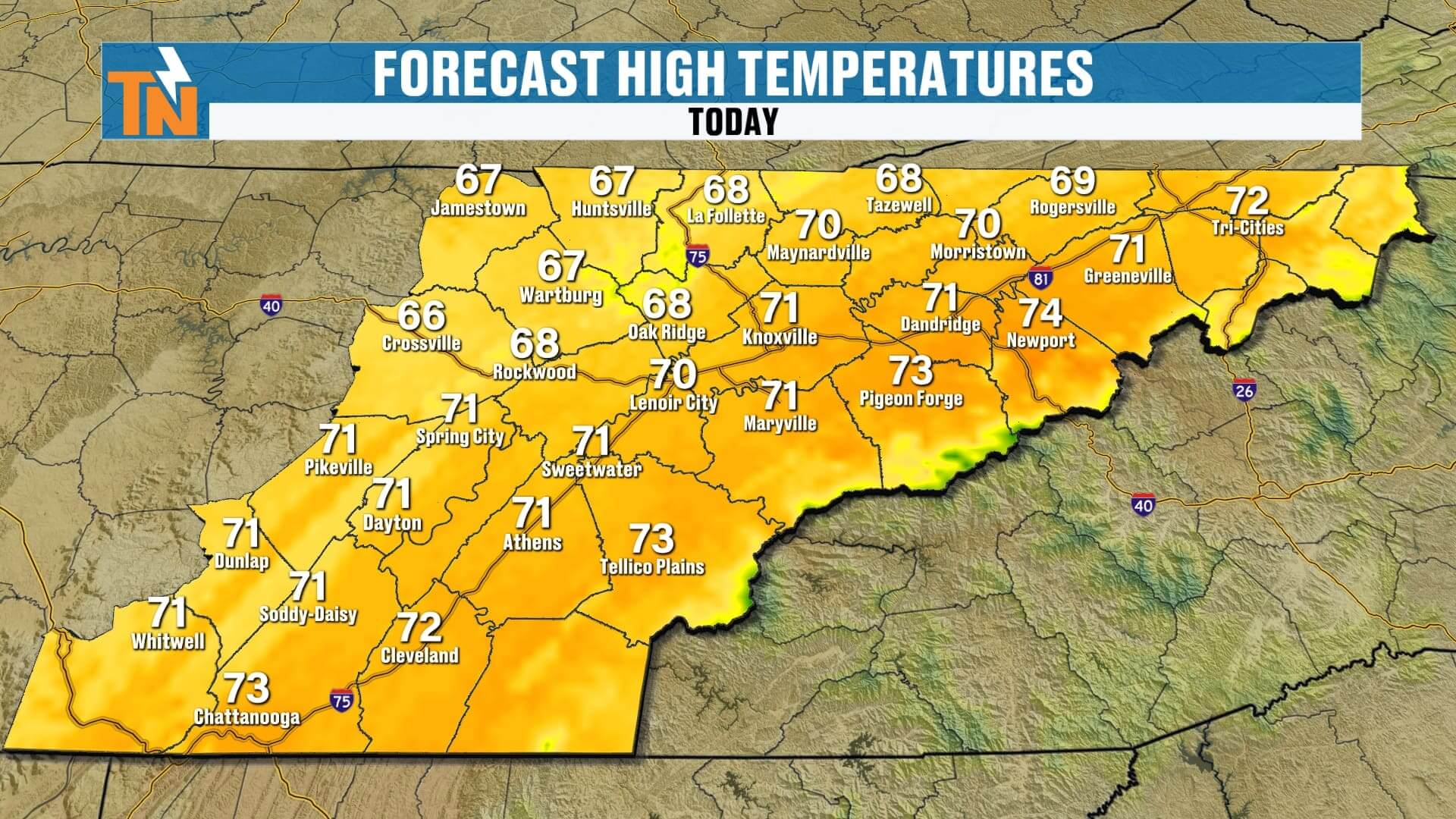
Today
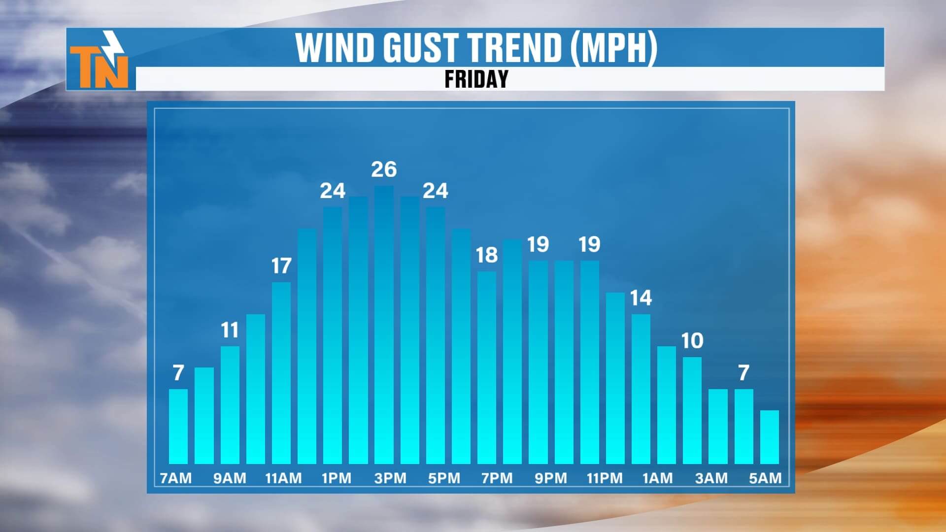
A quiet, milder start in the 30s/40s/50s. Increasing clouds and a gusty breeze (near, but generally below, advisory criteria). Highs in the 60s to near 70.
This Evening / High School Football Timeline
• 3–6 PM: Mostly fine for school pickup and the commute
• ~6–8 PM: Showers/storms begin edging into the Plateau and northern valley
• 8 PM–Midnight: Line of showers/storms progresses through the valley and into the mountains
• After Midnight: Rain tapers from west to east
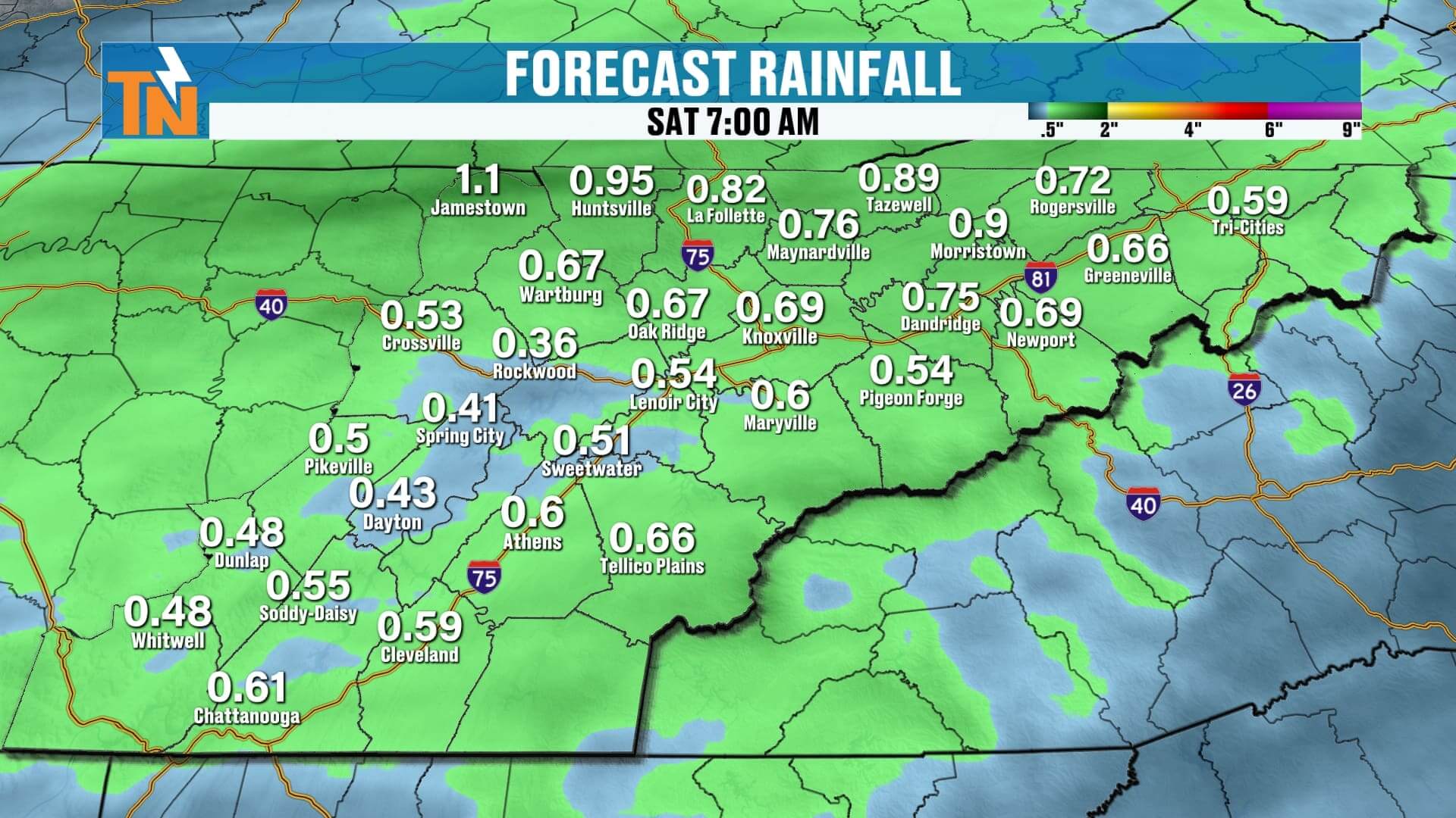
Rain Totals (Front #1)
General 0.50″ to 0.75″, locally higher.


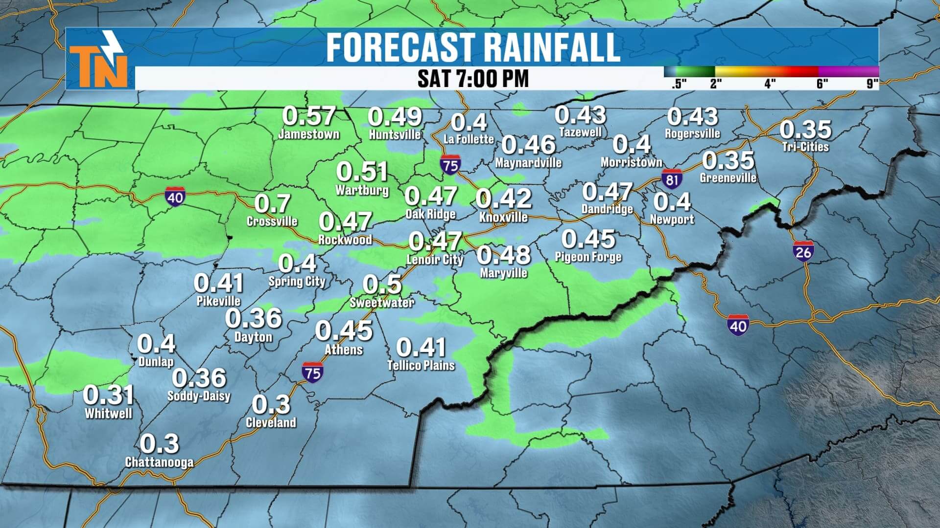
Saturday
Not a dramatic temperature drop. Mostly dry with leftover clouds and a spotty shower. Highs again near 70.
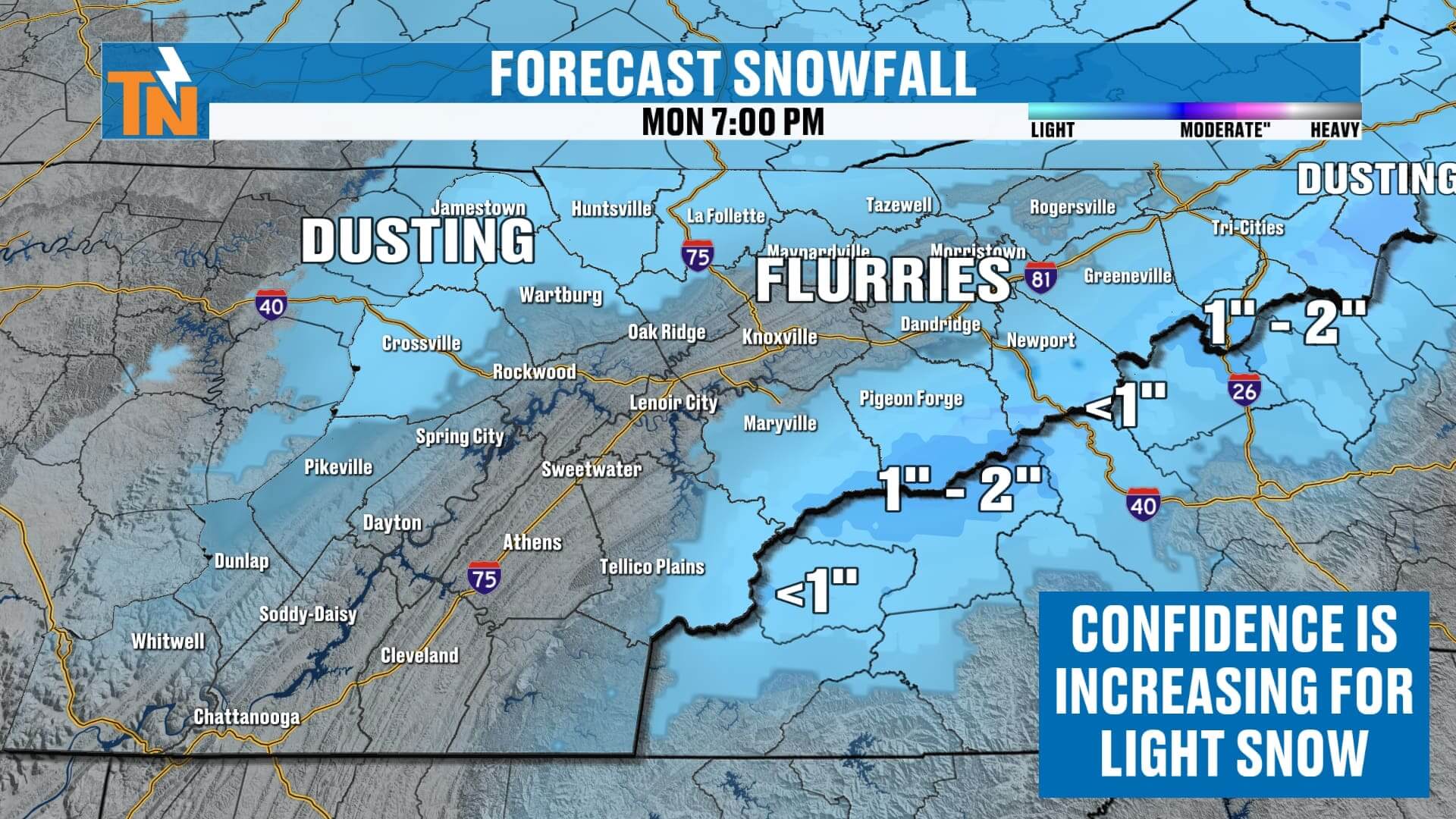
Sunday → Monday (Front #2 & Cold Blast)
A deeper trough dives in with a reinforced shot of cold air. Temperatures peak late morning to midday Sunday (around the 50s) and then fall during the afternoon and evening. Snow chances arrive Sunday night into Monday:
• Valley: Flurries possible
• Cumberland Plateau: Dusting to around 1″ on grassy/rooftop surfaces
• Highest Smokies Peaks: 1″–3″ possible
7-Day at a Glance
• Fri: Near 70, evening storms
• Sat: Near 70, mainly dry
• Sun: Early high in the 50s, falling late; rain to snow showers late
• Mon–Tue: Winter preview; highs in the 40s, lows in the 20s (hard freeze)
• Wed–Thu: Moderating back into the 50s/60s
Heads-Up/How to Track It
Turn on notifications and check the interactive radar in the East Tennessee Weather app—great for timing tonight’s line into your neighborhood. I’ll post updates on snowfall potential for Sunday night into Monday in the app, too.