
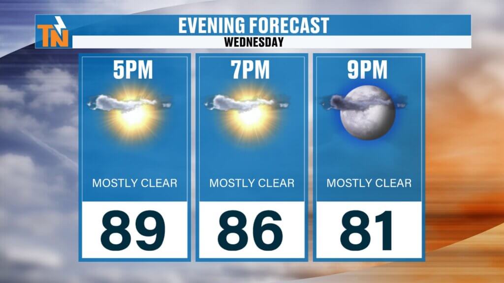
Happy Wednesday, everybody!
We’re halfway through the work week, and summer is starting to make itself known across East Tennessee.
The heat is building, the humidity isn’t going anywhere, and while most communities will stay dry today, a few locations could see scattered showers and thunderstorms capable of producing localized flooding.
The good news? A cold front arriving Friday will trim the humidity just enough to make next weekend a little more comfortable.
Let’s break it all down.
Wednesday Weather Recap: Heat and Humidity Continue to Build
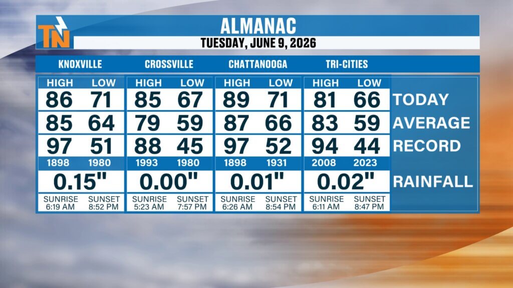
Tuesday brought another round of summerlike weather to East Tennessee.
Most communities topped out in the mid to upper 80s, while the Tri-Cities area remained slightly cooler, reaching 81 degrees.

We also saw some impressive thunderstorms develop during the afternoon and evening hours. One of the highlights was a beautiful shelf cloud that rolled through portions of Loudon, Roane, and Lenoir City. If you haven’t seen those photos yet, make sure to check out my social media pages.
And remember, if you ever capture interesting weather photos, you can easily submit them through the East Tennessee Weather App.
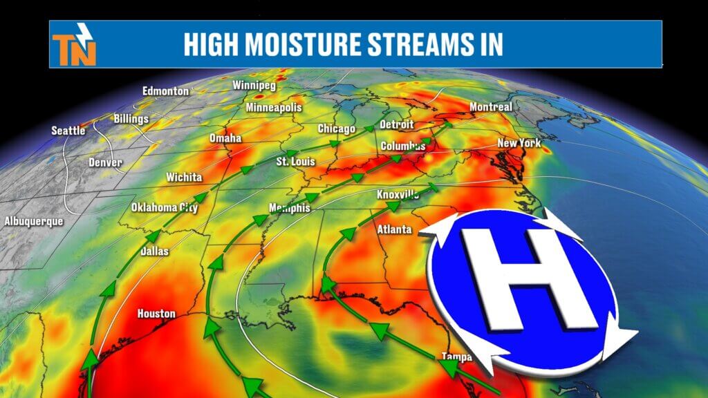
High Pressure Remains in Control
The overall weather pattern hasn’t changed much.
A strong ridge of high pressure remains anchored across the southeastern United States. While that generally promotes hot weather and limits widespread rainfall, we still have enough moisture and a few small disturbances moving through the atmosphere to trigger isolated showers and thunderstorms.
One of those disturbances is currently moving southeast from the Ohio Valley and will primarily impact portions of Upper East Tennessee later today.
Because of that setup, the Weather Prediction Center has highlighted portions of Northeast Tennessee with a Level 1 risk for localized flooding and flash flooding.
Best Chance for Rain Today
Not everyone will see rain today.
In fact, many locations across the central and southern Tennessee Valley may stay completely dry.
The greatest chance for showers and thunderstorms will be across:
- Rogersville
- Greeneville
- Kingsport
- Johnson City
- Bristol
- Portions of Hawkins County
- Portions of Washington County
Most of the activity is expected to develop late morning into the afternoon hours.
Areas south of Interstate 40 should remain mostly dry with only isolated storm chances.
Another Muggy Morning Across East Tennessee
The humidity continues to make its presence known.
Morning temperatures are starting out in the 60s and lower 70s, and dew points remain in the upper 60s to lower 70s.
If you received rain yesterday, you likely woke up to:
- Dense dew on the grass
- Areas of patchy fog
- A sticky feel to the air
This tropical-like air mass remains firmly in place through the remainder of the work week.
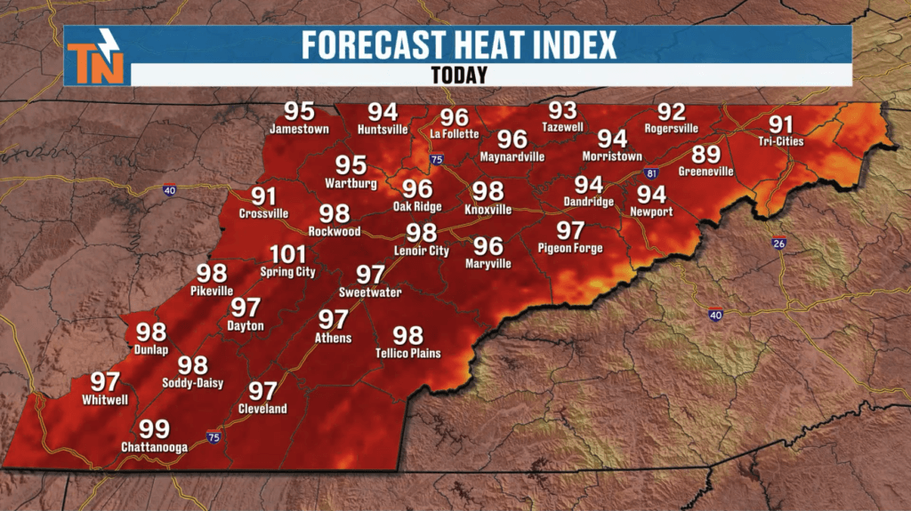
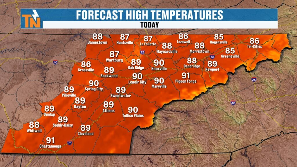
Heat Index Values Climb Into the Upper 90s
Today marks the beginning of a hotter stretch of weather.
While actual air temperatures will climb into the upper 80s and lower 90s, the humidity will make it feel significantly hotter.
Expected afternoon heat index values:
- Mid 90s for most locations
- Upper 90s in the warmest valleys
- Near 100 degrees in isolated spots
If you have outdoor plans, make sure you’re staying hydrated and taking breaks in the shade.
This is the type of weather where heat stress can sneak up on you quickly.
Friday Cold Front Brings a Brief Change
The next notable weather maker arrives Friday.
A cold front will move into East Tennessee during the afternoon and evening hours, bringing:
- Increasing clouds
- Scattered showers
- A few thunderstorms
- Brief heavy rainfall
At this time, widespread severe weather is not expected.
Could we see a few stronger thunderstorms? Absolutely.
Could we see some localized flooding issues? Possibly.
But right now, this does not appear to be a major severe weather event.
The front should move through fairly quickly.
What the Cold Front Means for the Weekend
The biggest impact from Friday’s front won’t be the rain.
It will be the temporary reduction in humidity.
Notice I said temporary.
We’re not talking about fall-like air. We’re not talking about crisp mountain mornings.
We’re simply talking about a slight drop in dew points.
Instead of oppressive humidity, we’ll shift back into typical East Tennessee summer humidity.
You’ll notice the difference, but it won’t last long.
Weekend Forecast: A 50/50 Summer Weekend
Saturday looks to be the better day of the weekend.
- Partly sunny skies
- Slightly lower humidity
- Warm temperatures
- Lower rain chances
By Sunday, moisture begins increasing once again.
That means:
- More humidity
- More clouds
- Higher chances for scattered afternoon thunderstorms
The overall pattern remains very summerlike.
Long Range Outlook
As we head into next week, temperatures ease back slightly into the lower and middle 80s.
That doesn’t mean cool weather is arriving.
Instead, additional cloud cover and scattered thunderstorms will help hold temperatures down a few degrees.
Rain chances increase again Monday through Wednesday as another series of disturbances moves through the southeastern United States.
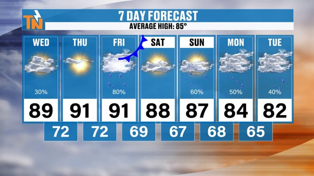
East Tennessee 7-Day Forecast
Wednesday:
- Isolated showers and storms, mainly Upper East Tennessee
- Hot and humid
- High: 89°
Thursday:
- Mostly sunny and hot
- High: 91°
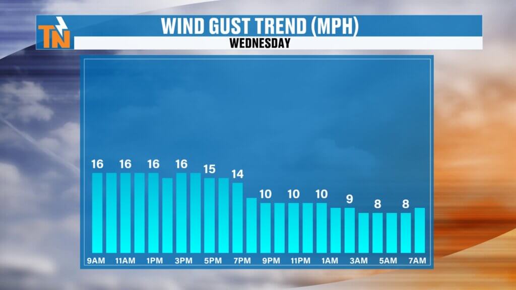
Friday:
- Scattered showers and storms with a cold front
- High: 89°
Saturday:
- Partly sunny
- Slightly less humid
- High: 86°
Sunday:
- Increasing humidity
- Isolated afternoon storms
- High: 87°
Monday:
- More scattered showers and storms
- High: 84°
Tuesday:
- Continued storm chances
- High: 85°
Bottom Line
The biggest weather stories over the next several days are simple:
- Heat continues to build.
- Heat index values approach 100 degrees.
- Isolated flooding remains possible today, especially across Upper East Tennessee.
- A cold front arrives Friday with scattered storms.
- The weekend will be a little less humid, but summer isn’t going anywhere.
Have a fantastic Wednesday, everybody.
And don’t forget, if you want a quick weather update, check out One Minute With Witcher on the East Tennessee Weather App. It’s fast, easy, and designed specifically for your phone when you’re on the go.