
Happy Saturday, everybody!
Thanks for checking in this morning. I hope you have a great day ahead.
If you’ve been following along the last several days, we’ve been tracking a disturbance that could have brought some showers and storms into East Tennessee today. The good news? Today is shaping up drier than expected, making this the best day of the weekend for outdoor plans.
But changes are coming.
A cold front arrives Sunday, bringing scattered showers, thunderstorms, and much-needed relief from the heat and humidity.
Let’s break it all down.
Friday Recap: Hot, Muggy, But Quiet
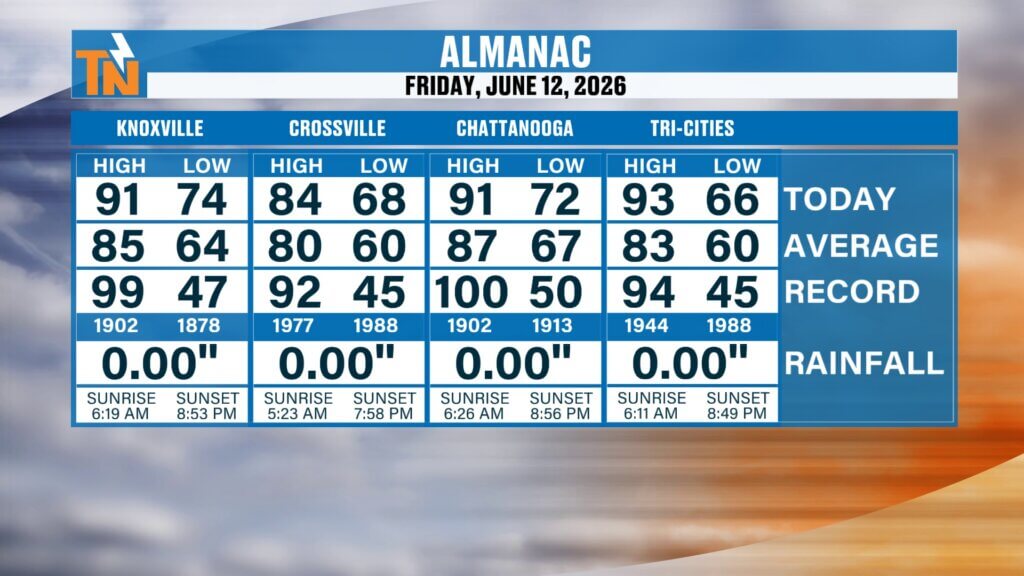
Friday turned out to be another classic June day across East Tennessee.
Temperatures climbed into the upper 80s and lower 90s, putting us well above average for this time of year.
Despite earlier concerns about stronger storms, severe weather never materialized. We only saw a few isolated showers and some special weather statements.
That’s always good news.
Forecasts don’t always line up exactly as expected, but when “less severe” is the outcome, that’s a win.
High Pressure Still Controlling the Pattern
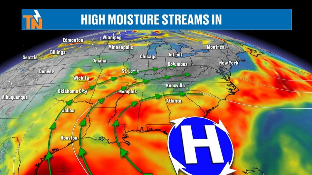
A ridge of high pressure remains anchored across the southeastern United States.
That ridge continues to dominate the overall weather setup, keeping us hot and mainly dry.
However, the atmosphere is beginning to shift.
Moisture levels remain elevated, and another upper-level disturbance is moving in. While we don’t have enough deep moisture for widespread rain today, that changes quickly overnight into Sunday.
That’s when our next round of showers and storms arrives.
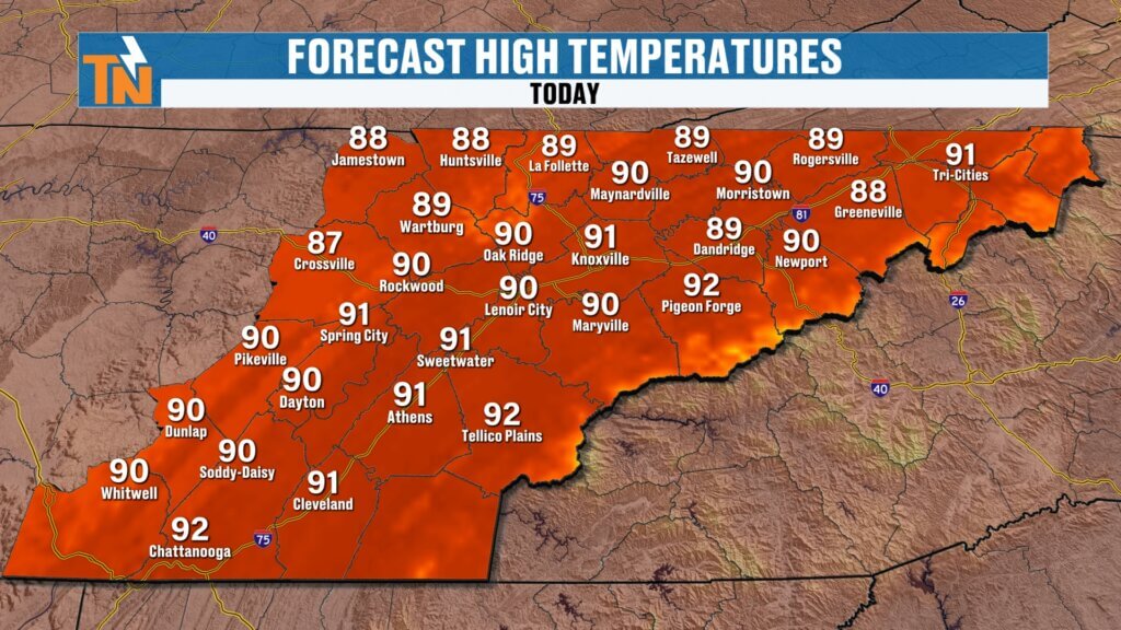
Saturday Forecast: Hot, Humid, and Mainly Dry
Today will be the best weather day of the weekend.
We’ll start with plenty of sunshine this morning, followed by increasing clouds during the afternoon.
Most locations stay rain-free throughout the day.
That’s a big change compared to some earlier model runs, but newer guidance has finally caught up and now supports a much drier forecast for today.
Expected conditions today:
- Mostly sunny skies
- Hot temperatures
- Muggy humidity
- Light winds
- Very limited rain chances
This is a great day for:
- Yard work
- Pool time
- Hiking
- Festivals
- Outdoor dining
Morning Conditions: Warm and Sticky
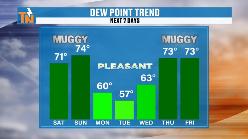
Temperatures this morning are starting out in the 60s and lower 70s.
Dew points remain in the mid to upper 60s, so while humidity is slightly lower than the past few days, it still feels muggy outside.
Technically, we’re a degree or two cooler this morning compared to recent mornings, but honestly, you probably won’t notice much of a difference.
It still feels like summer.
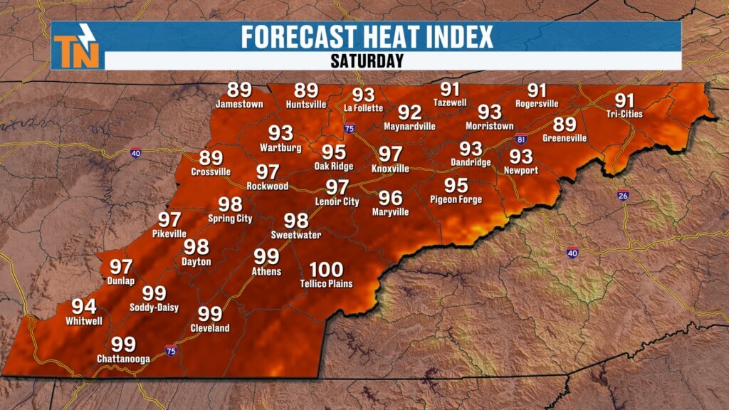
Afternoon Heat Index Near 100°
High temperatures this afternoon will climb into the upper 80s and lower 90s.
With the humidity factored in, heat index values will push into the low to mid 90s, with a few spots potentially reaching the upper 90s.
That means:
- Stay hydrated
- Take breaks if working outside
- Don’t leave pets or kids in vehicles
- Wear light clothing
It’s another hot one.
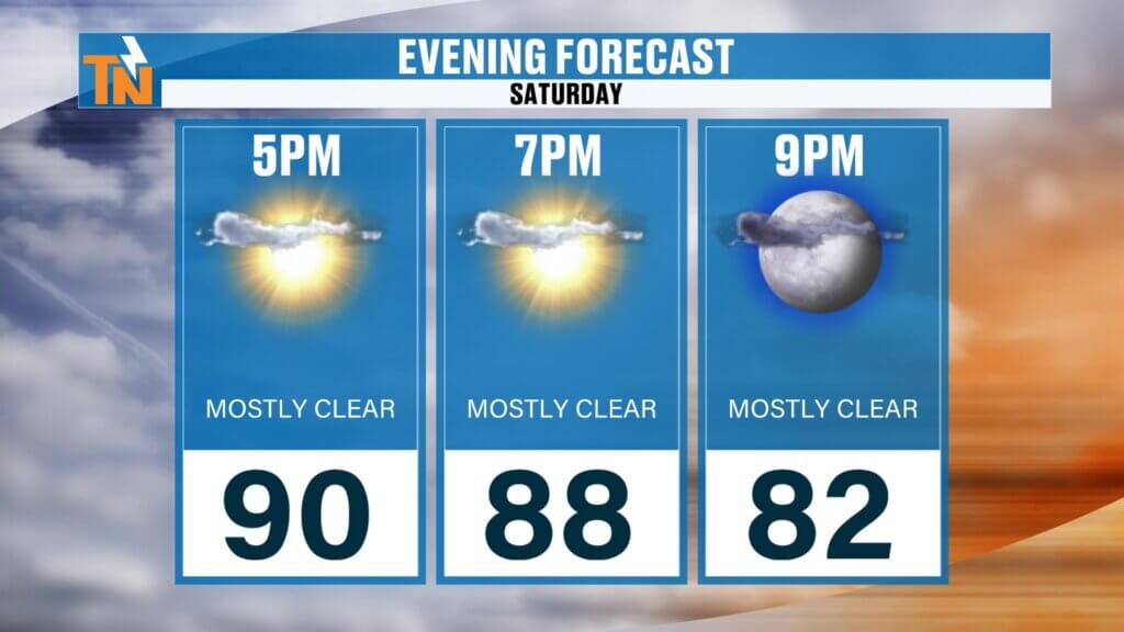
Saturday Evening Looks Great
If you have evening plans, conditions look favorable.
Temperatures will slowly fall:
5 PM: 88°
7 PM: 85°
9 PM: 81°
Warm and muggy, but overall pleasant for a June evening.
Rain chances remain very low through sunset.
Sunday Brings the Next Cold Front
Changes begin overnight tonight.
A wave of energy will move in late tonight into early Sunday morning, bringing scattered showers and thunderstorms.
Sunday’s setup includes:
- Early morning showers
- A possible midday lull
- Additional storms redeveloping during the afternoon
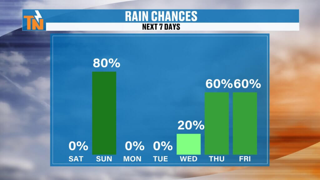
Rain chances are high at 80%, but this does NOT mean it rains all day.
It will be an on-and-off type day.
If you have outdoor plans Sunday, you’ll want to keep an eye on radar.
Better Weather Returns Early Next Week
Behind Sunday’s cold front, we’ll finally get some relief.
Monday through Wednesday looks significantly better:
- Lower humidity
- Lower dew points
- Cooler temperatures
- More comfortable mornings
Highs drop into the lower 80s.
That’s going to feel much better compared to the upper 80s and lower 90s we’ve been dealing with.
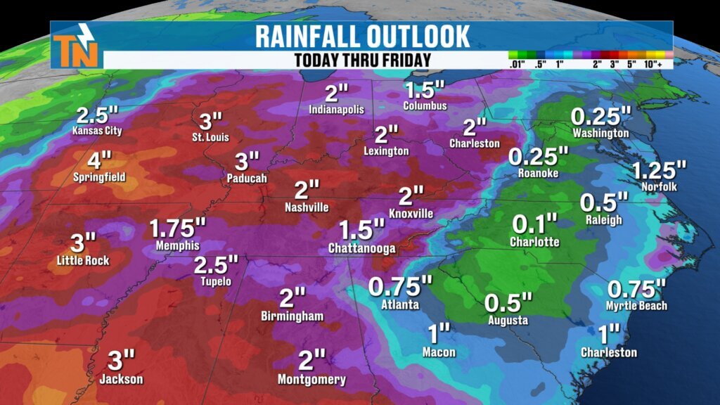
Another Storm System Late Next Week
The quiet stretch doesn’t last forever.
By Thursday and Friday, another stronger storm system looks to move in.
Early model guidance suggests:
- 1 to 2 inches of rainfall possible
- Increasing thunderstorm chances
- Potential for heavier rain
We’ll keep fine-tuning that forecast through the week.
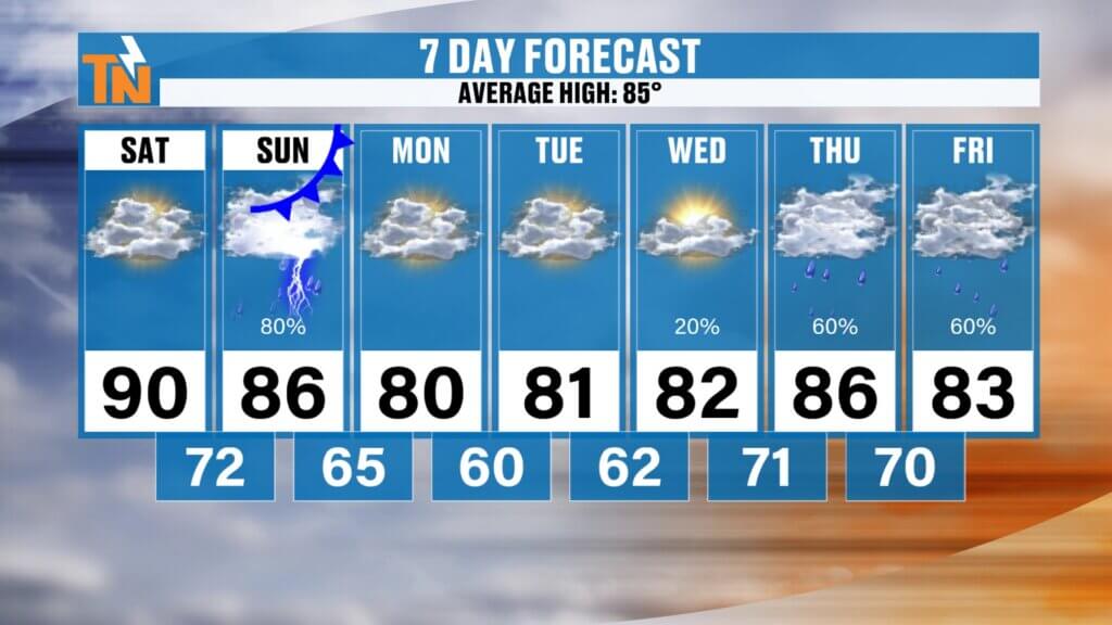
East Tennessee 7-Day Forecast
Saturday:
- Hot and humid
- Mostly dry
- High: 91°
Sunday:
- Scattered showers and thunderstorms
- High: 85°
Monday:
- Less humid
- Mostly sunny
- High: 82°
Tuesday:
- Comfortable
- Partly sunny
- High: 81°
Wednesday:
- Pleasant
- Mostly sunny
- High: 83°
Thursday:
- Increasing clouds
- Storm chances return
- High: 85°
Friday:
- More widespread rain and storms
- High: 84°
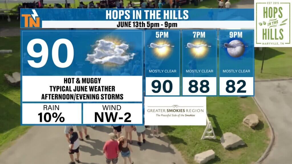
Hops in the Hills Forecast
If you’re looking for something to do tonight, I’ve got a great idea.
Head to Hops in the Hills in downtown Maryville.
It’s happening tonight from 5 PM to 9 PM, and East Tennessee Weather will be there with our tent set up, the 24-hour weather channel running, and plenty of opportunities to meet and hang out.
Forecast for the event:
5 PM: 88°
7 PM: 85°
9 PM: 81°
Hot and muggy, but dry for most of the event.
Come by and say hi!
Bottom Line
Saturday is the better day of the weekend.
Today:
- Hot
- Muggy
- Dry
Sunday:
- More showers
- More storms
- Cooler air begins moving in
Then next week:
- Lower humidity
- Cooler temperatures
- More comfortable weather
Enjoy the dry weather today while you can.
And if you haven’t downloaded the East Tennessee Weather app yet, now’s the time. It’s the easiest way to track storms, get alerts, and send in your weather photos.
Have a great Saturday, and hopefully I’ll see you tonight at Hops in the Hills.