
Good morning and Happy Sunday.
Thanks for checking in with your East Tennessee weather update. We’re heading into another warm, almost summer-like day across the region, but there are a few changes on the horizon as a weak cold front approaches later tonight.
Another Toasty Day Across East Tennessee
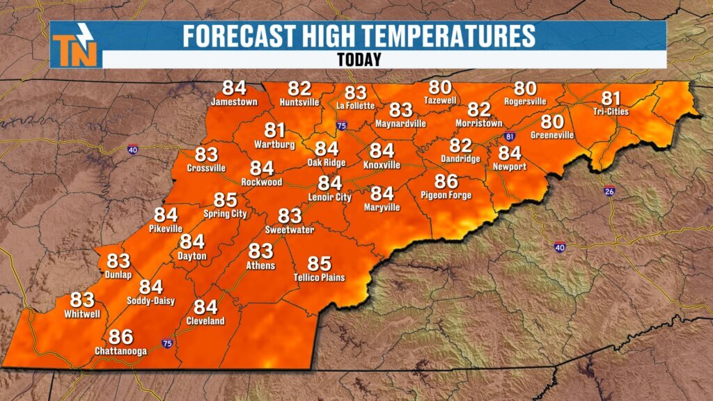
Yesterday brought widespread warmth with highs climbing into the 80s, even upper 80s in parts of Chattanooga. Today will be very similar—if not slightly warmer in some spots.
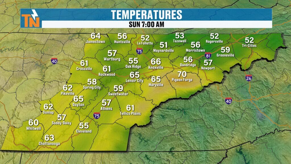
We’re starting the morning off mild and comfortable:
- 50s to 60s across the region
- Mid 60s in Knoxville and Chattanooga
- Cooler pockets in the Tri-Cities
By this afternoon, expect:
- Highs in the low to mid 80s
- A few spots pushing the upper 80s
- Near-record warmth (record: 87° set in 1907)
If you’ve got outdoor plans, today is a great day to be outside.
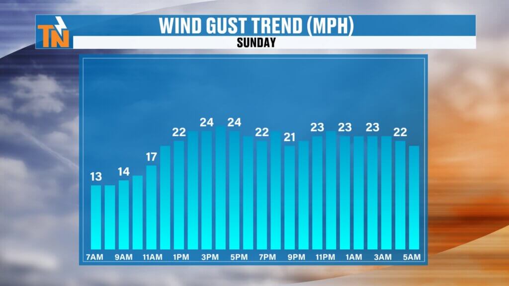
Breezy Conditions and Elevated Fire Concerns
Winds will pick up out of the southwest throughout the day, gusting up to around 20–25 mph.
That breeze will:
- Help boost temperatures
- Increase fire concerns across East Tennessee
- Continue to spread smoke from ongoing wildfires
Not ideal conditions with active fires in the region.
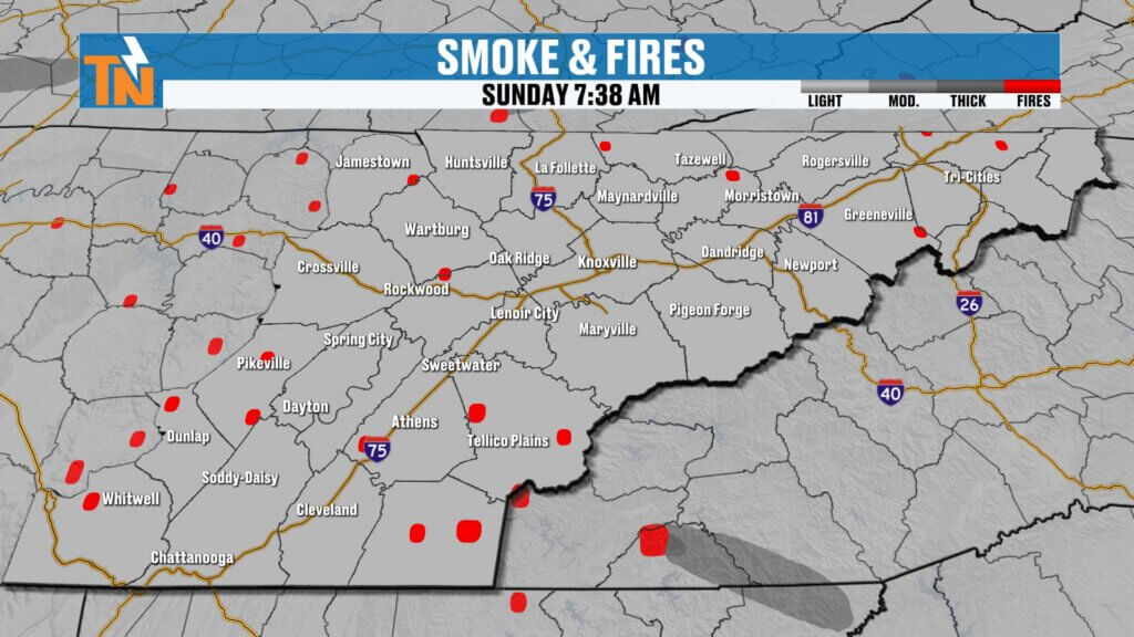
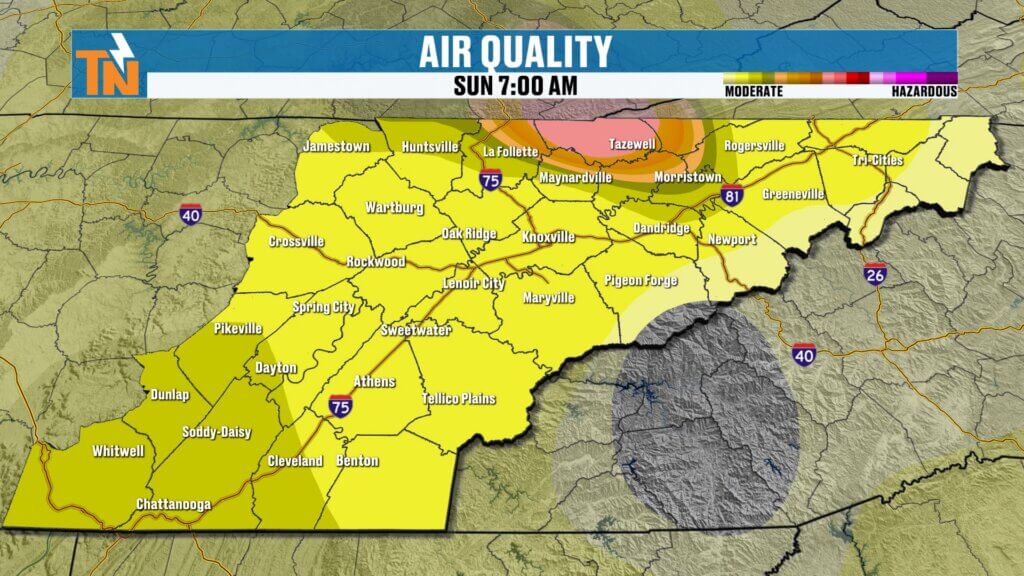
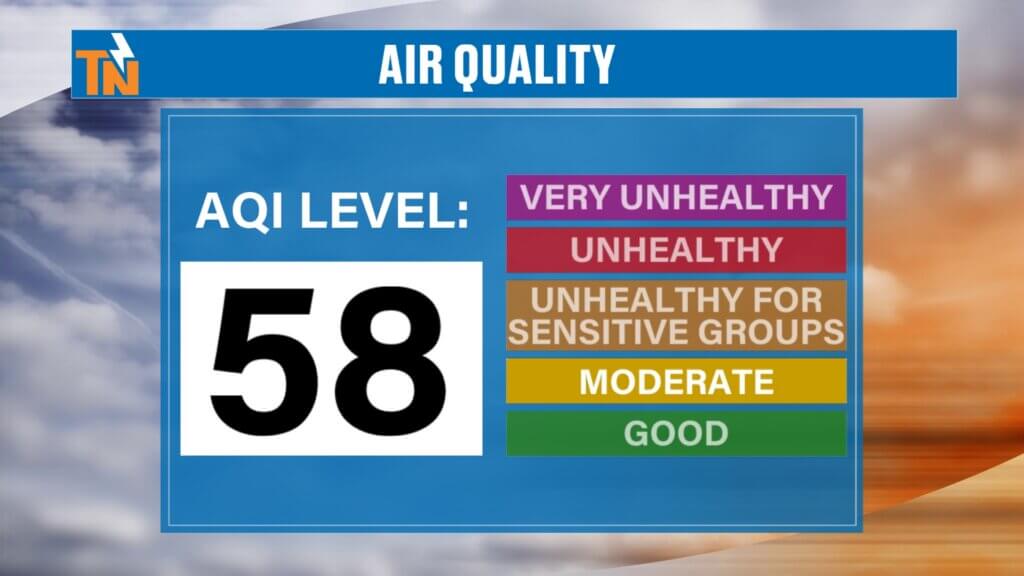
Hazy Skies and Air Quality Alert
Smoke from regional fires will continue to impact air quality today.
- Expect hazy skies at times
- Air quality remains in the moderate category
- Slight improvement from yesterday, but still noticeable
Areas like Polk County and surrounding regions may see thicker smoke at times. If you have respiratory sensitivities, you may want to limit prolonged outdoor exposure.
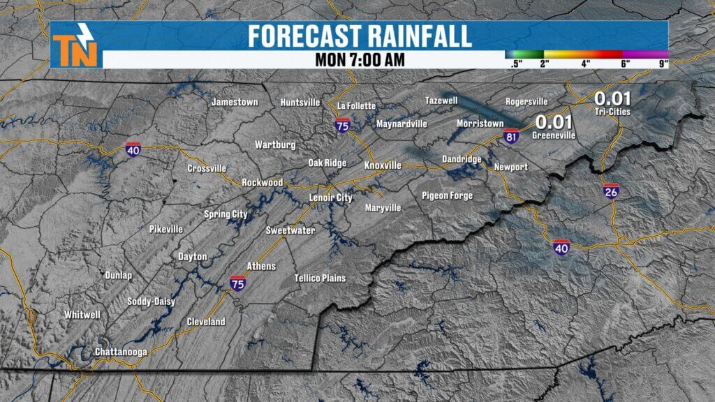
Cold Front Arrives Tonight (Limited Impact)
A cold front will begin moving into East Tennessee later this evening and overnight.
What to expect:
- Mostly dry conditions for most areas
- A slight chance for a few light showers
- Best chance north and northeast of Knoxville, including the Tri-Cities
- Maybe a brief rumble of thunder
Overall, this is not a significant rainmaker.
Monday: Cooler, Drier, and Breezy
Behind the front, a noticeable change arrives.
- Morning lows: 40s to low 60s
- Afternoon highs: mid 60s (cooler north, slightly warmer south)
- Breezy winds shifting out of the north
The big story will be the dry air moving in.
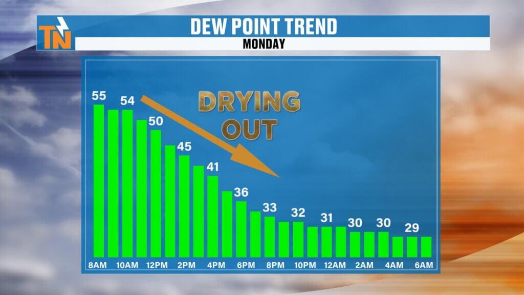
Dry Air Brings Clear Skies
As the front passes, much drier air settles into the region.
- Dew points drop into the 40s by afternoon
- Even into the 30s by Monday night
- Expect crisp, clear blue skies
This dry pattern will stick around through Tuesday and most of Wednesday.
Midweek and Late Week Outlook
Looking ahead, the weather stays fairly quiet.
- Tuesday–Thursday: Dry with highs in the 60s
- Late week: Temperatures climb back into the 70s
- Friday: Next cold front brings a chance for light rain
Rainfall still looks limited overall, with no major soaking expected.
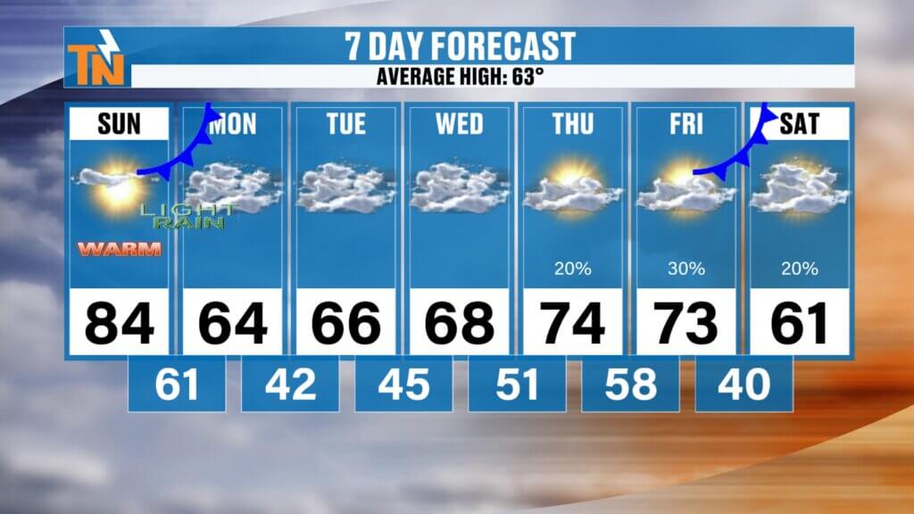
7-Day East Tennessee Forecast Snapshot
Next Weekend: Cooler, near seasonal averages
Sunday: Hot and breezy, highs near 84
Monday: Cooler, breezy, highs mid 60s
Tuesday: Sunny and comfortable
Wednesday: Continued dry and mild
Thursday: Slightly warmer
Friday: Chance for light rain with a front

Community Event Spotlight
Next Saturday, come out and join us at Timber Creek Landscape Supply in Powell (off Emery Road) from 10 AM to 2 PM.
- Meet and greet with me
- TK’s Gourmet Food Wagon
- Tiki’s Shaved Ice
- Spend $60 or more and get a free lunch
We’ll have the East Tennessee Weather tent set up—come hang out and kick off spring with us.
Final Thoughts
Enjoy the warm, breezy Sunday—it’s a great day to get outside. Just keep in mind the smoky skies and elevated fire concerns.
A weak cold front brings only minor changes tonight, followed by cooler, drier, and beautiful weather to start the week.
Have a great day, and I’ll see you back here soon..