
Published: Monday, July 27, 2026
By Meteorologist Mike Witcher | eastTNweather
Good Monday morning, East Tennessee!
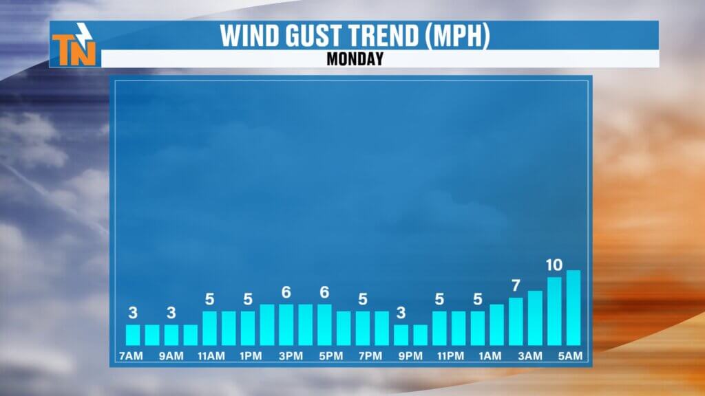
Some of us were awakened overnight by loud thunderstorms, frequent lightning, and gusty winds, while others slept right through it. That’s the nature of summertime thunderstorm complexes—they can be very localized.
The good news is that today’s weather improves considerably. The bad news? We’re not finished yet. Another round of thunderstorms is expected tonight into Tuesday morning, followed by a stronger threat Tuesday afternoon as a cold front moves through the Tennessee Valley.
Let’s break it all down.
Overnight Storms Delivered Wind, Lightning, and Heavy Rain
A cluster of thunderstorms rolled through portions of East Tennessee overnight, producing multiple Special Weather Statements, frequent lightning, torrential rain, and strong wind gusts.
Meanwhile, even stronger storms developed across Middle Tennessee before weakening somewhat as they moved east overnight.
Those storms are now moving out, leaving behind mostly cloudy skies to start the day.
Sunshine Returns This Afternoon
Today’s forecast is much quieter than tonight’s.
As the overnight disturbance exits, we’ll gradually lose the deeper moisture that fueled those early morning storms. Clouds will slowly break, allowing sunshine to return during the afternoon.
Rain chances today are very low, making it a great opportunity to get outside before our next round of active weather arrives.
The downside?
The sunshine means temperatures and humidity will climb quickly.
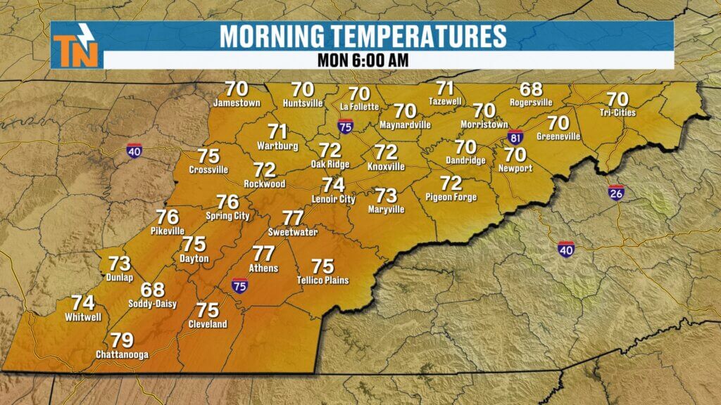
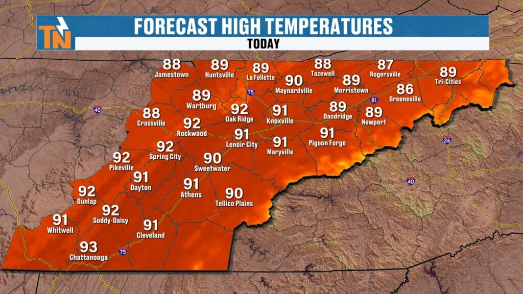
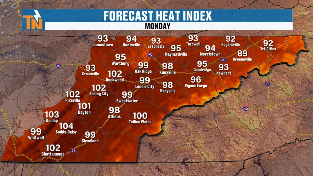
Morning lows started in the 70s with muggy conditions already in place. By this afternoon, highs will climb into the lower to middle 90s, with heat index values approaching 100 degrees.
It’ll feel every bit like late July.
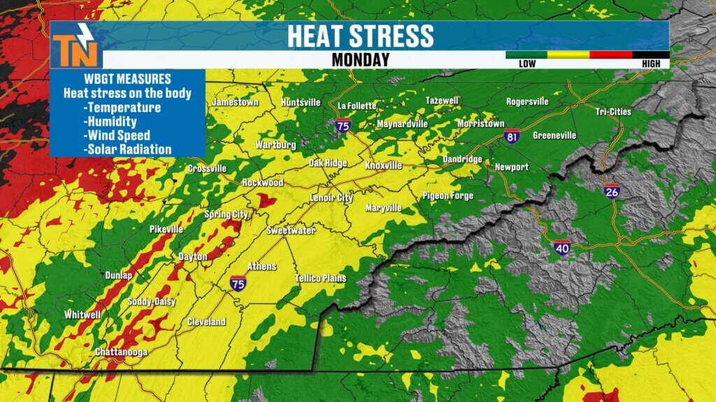
Heat Stress Increasing
With students beginning to return to school and fall sports practices getting underway, today serves as another reminder that heat safety matters.
Wet Bulb Globe Temperature values continue climbing today, indicating increasing heat stress during the afternoon.
If you’re coaching, practicing, working outside, or spending extended time outdoors:
- Drink plenty of water.
- Take frequent breaks.
- Find shade whenever possible.
- Never ignore signs of heat-related illness.
Today’s heat isn’t quite at advisory levels for most of East Tennessee, but it will still be uncomfortable.
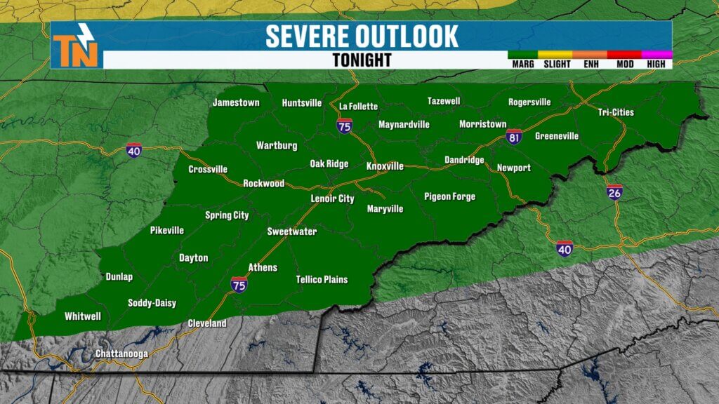
Another Round of Storms Tonight
Attention quickly shifts to tonight.
The Storm Prediction Center maintains a Level 1 (Marginal Risk) for severe thunderstorms as another cluster of storms develops upstream and dives southeast in the northwesterly flow.
These overnight thunderstorm complexes are notoriously difficult to forecast.
Exactly where they form, how quickly they organize, and how long they survive all determine who receives the strongest storms.
At this point, confidence is highest that another organized cluster moves into portions of East Tennessee sometime overnight into Tuesday morning.
Primary threats include:
- Damaging wind gusts
- Frequent lightning
- Torrential rainfall
- Localized flooding
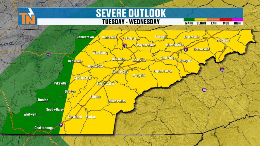
Tuesday Could Become More Active
What happens Tuesday depends heavily on tonight’s storms.
If overnight storms linger well into Tuesday morning, they may limit afternoon instability and reduce the severe threat.
However…
If skies clear and sunshine returns during the afternoon, the atmosphere could rapidly destabilize ahead of an approaching cold front.
That scenario would support another round of potentially stronger thunderstorms Tuesday afternoon and evening.
We’ll continue refining that forecast throughout the day.
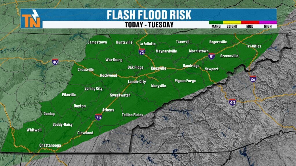
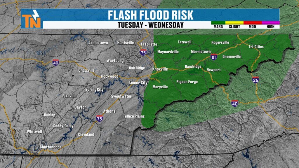
Flood Threat Continues
Heavy rainfall remains another concern.
The Weather Prediction Center continues highlighting East Tennessee for localized flooding and flash flooding through tonight and Tuesday.
Fortunately, once the cold front moves east Tuesday night, much drier air begins filtering into the Tennessee Valley.
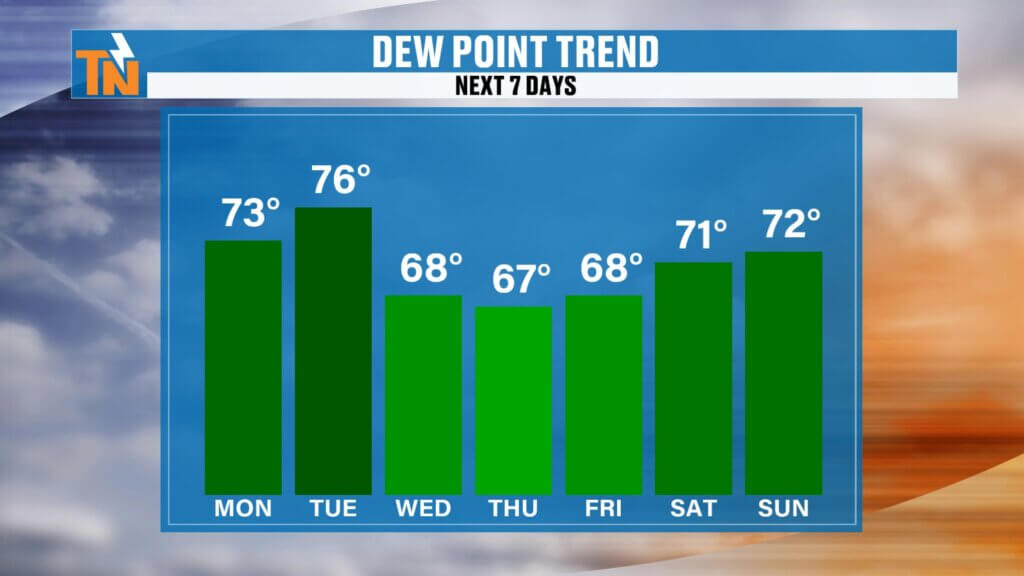
Comfortable Air Finally Arrives
This has been the good news we’ve been talking about for several days.
Behind Tuesday’s cold front:
- Dew points begin falling.
- Humidity decreases noticeably.
- Heat index values come down.
- Mornings become much more comfortable.
Temperatures remain warm through the end of the week, generally in the upper 80s, but it simply won’t feel as oppressive outside.
That break from the humidity will be welcomed across East Tennessee.
Regional 7-Day Forecast
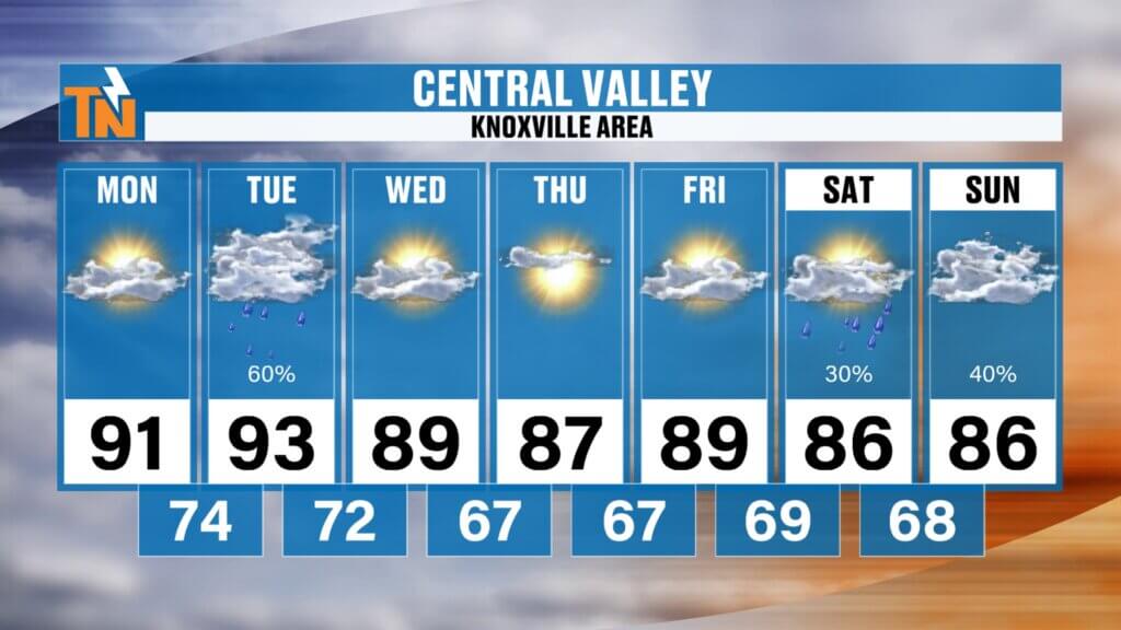
Central Valley (Knoxville)
- Monday: Hot and humid, afternoon dry
- Tonight: Storms possible overnight
- Tuesday: Highest severe weather risk
- Wednesday-Friday: Upper 80s with lower humidity
- Weekend: Another chance for scattered thunderstorms
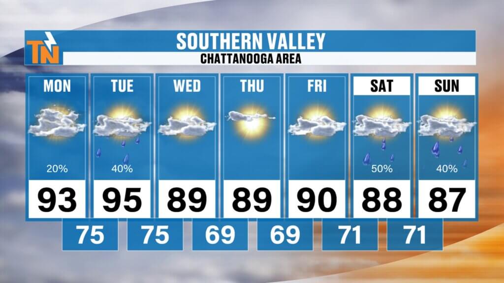
Southern Valley (Chattanooga)
The hottest part of East Tennessee remains the Southern Valley, where heat index values Tuesday could approach 107°before humidity gradually eases later in the week.
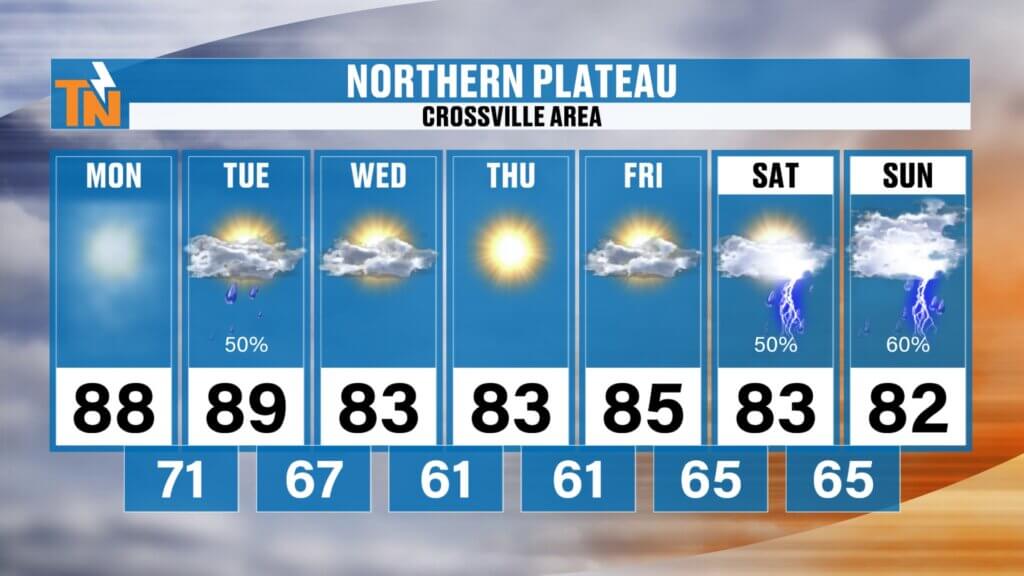
Northern Plateau
Hot today and Tuesday before noticeably cooler mornings arrive Wednesday through Friday.
Weekend temperatures remain comfortably in the lower 80s with another chance for showers and storms.
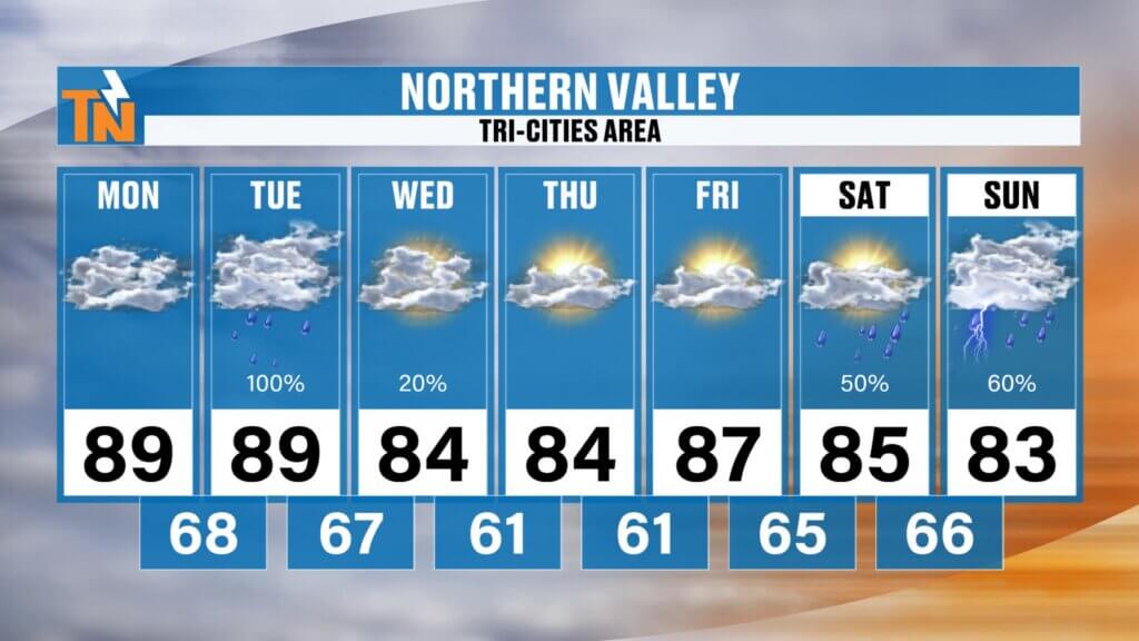
Northern Valley & Tri-Cities
This area continues to have one of the better chances for overnight thunderstorm complexes through Tuesday before drier air settles in later this week.
Weekend Preview
It’s still early, but another disturbance may approach next weekend, bringing another chance for scattered showers and thunderstorms.
I’ll be keeping a close eye on that forecast, especially with several outdoor events scheduled across East Tennessee—including Sips of Summer in Historic Downtown Clinton, where I’ll be attending.
Stay tuned for updates as we fine-tune that forecast throughout the week.
Bottom Line
- Overnight storms have moved out.
- Today turns hot, humid, and mainly dry.
- Another cluster of storms arrives tonight.
- Tuesday remains our highest-impact weather day with the potential for strong to severe thunderstorms.
- Much more comfortable air arrives behind Tuesday’s cold front and sticks around through late week.
Be sure to keep the FREE eastTNweather App handy. It includes lightning alerts, interactive radar, watches and warnings, and live severe weather coverage whenever storms threaten.
Have a great Monday, stay weather aware, and thanks for trusting eastTNweather to keep you ahead of the storm.
#EastTNWeather #TNwx #KnoxvilleWeather #SevereWeather #Thunderstorms #StormAlert #DamagingWinds #Flooding #HeatIndex #WeatherUpdate #MikeWitcher #EastTennessee #Lightning #ColdFront