
Published: Saturday, July 26, 2025
By Meteorologist Mike Witcher | eastTNweather
Good Sunday morning, East Tennessee!
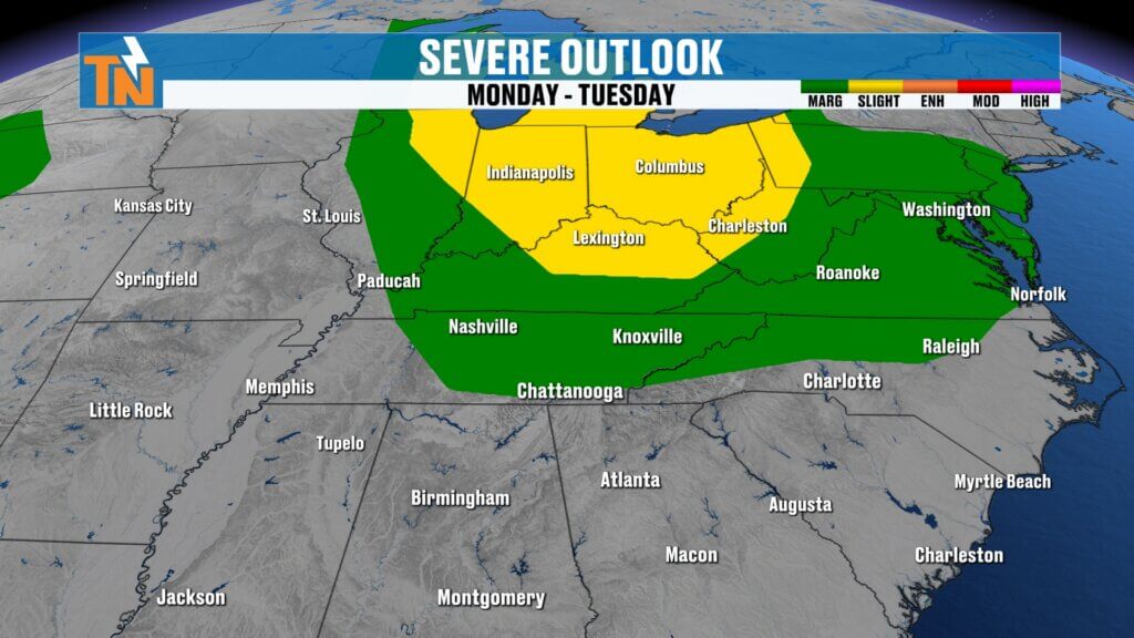
After a few overnight showers, today is shaping up to be one of the better days to get outside before our weather turns much more active. While today will feature more sunshine, rising humidity, and seasonable warmth, our attention quickly shifts to Monday and especially Tuesday, when the risk for severe thunderstorms increases across the Tennessee Valley.
Here’s what you need to know.
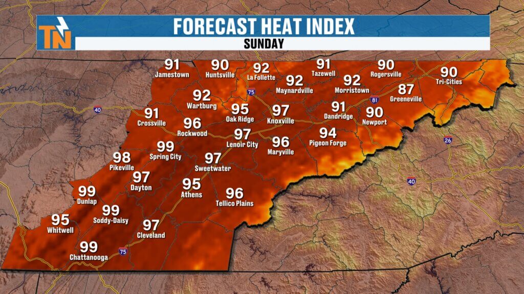
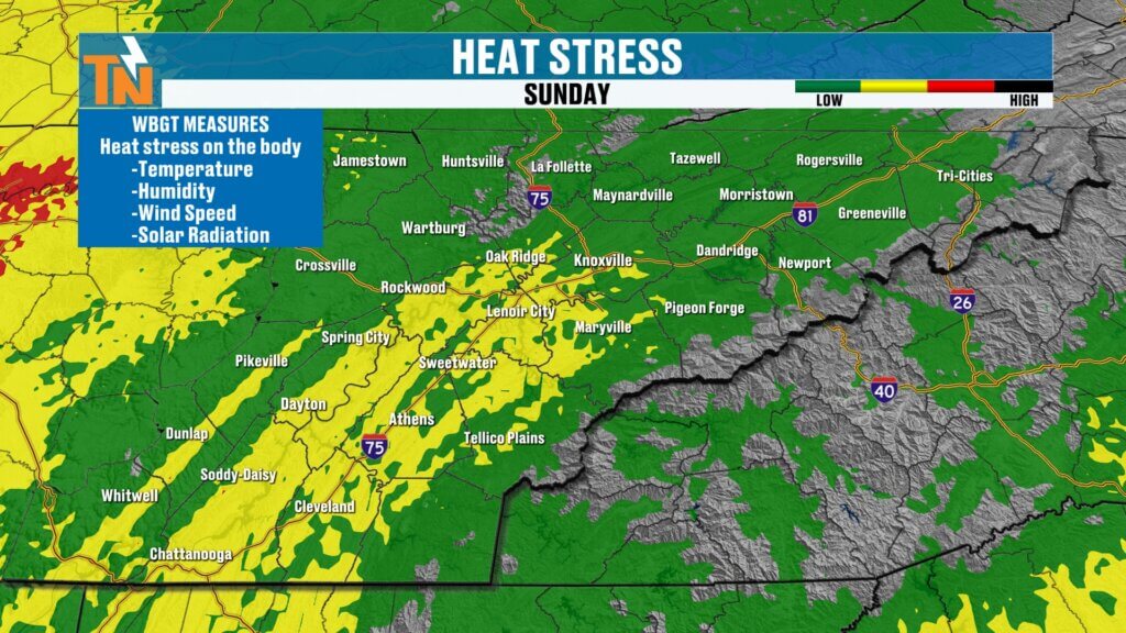
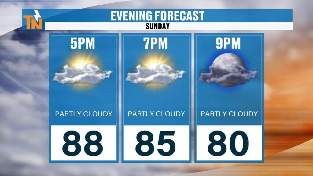
Quiet Weather Returns Today
Overnight disturbances produced scattered showers across portions of East Tennessee, but those are already moving out early this morning. As we move through the day, skies will gradually brighten, allowing temperatures and humidity to climb.
A stray shower can’t be ruled out this afternoon, but most communities will remain dry.
If you’re planning to spend the day on the lake, by the pool, or enjoying one of East Tennessee’s parks, today is a great opportunity. Just remember to stay hydrated as the humidity begins building once again.
Morning temperatures are starting much warmer than the last few days, with readings in the 70s and even a few locations near 80°. Winds will remain light, allowing highs to climb back to around 90° this afternoon.
With dew points climbing, heat index values will push into the upper 90s to near 100°.
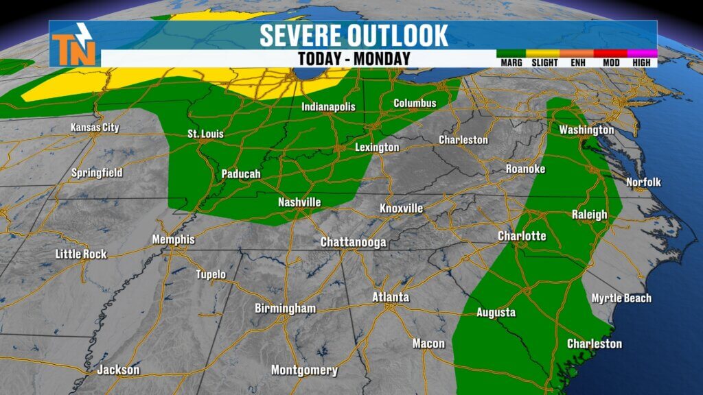
The Pattern Turns More Active
The overall weather pattern hasn’t changed much.
A strong ridge of high pressure remains anchored over the western United States while a broad trough continues across the eastern half of the country. That setup creates a northwesterly flow aloft—a pattern that frequently sends clusters of thunderstorms southeast toward Tennessee during the summer months.
Those disturbances will become increasingly important over the next 48 hours.
Monday Begins the Transition
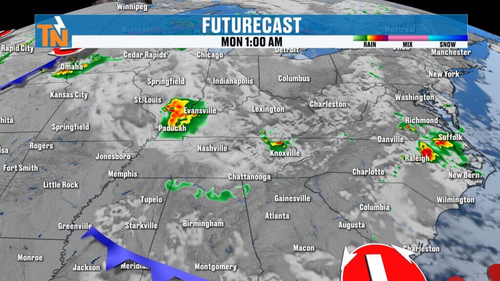
Today’s severe weather threat stays well to our west and northwest, but that activity begins moving closer Monday.
A weakening complex of thunderstorms may approach Monday morning before another disturbance develops later Monday afternoon and evening.
While some storms may weaken before arriving, they’ll still need to be monitored for heavy rainfall, lightning, and gusty winds.
The atmosphere continues loading with heat and humidity, creating plenty of fuel for stronger storms.
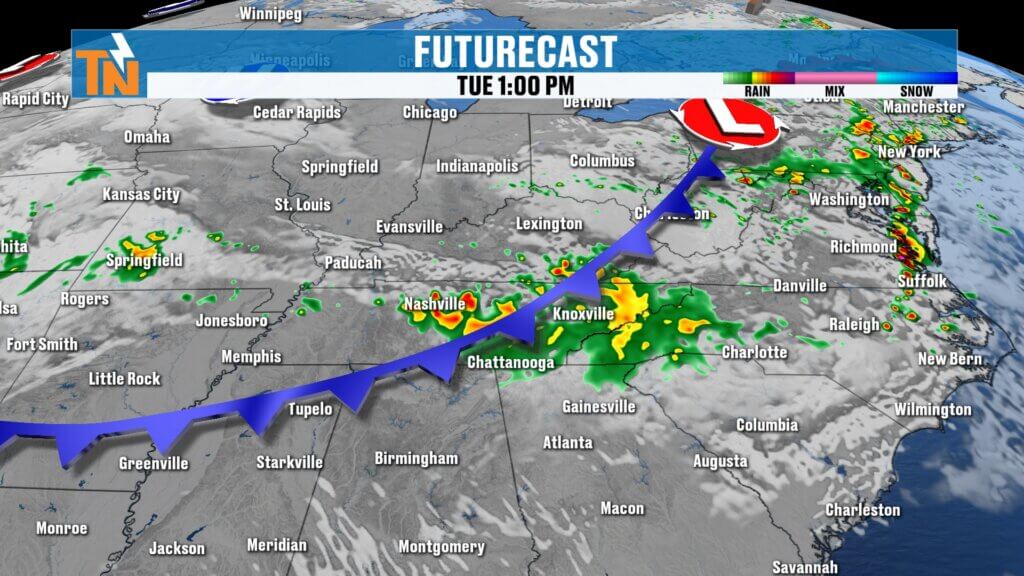
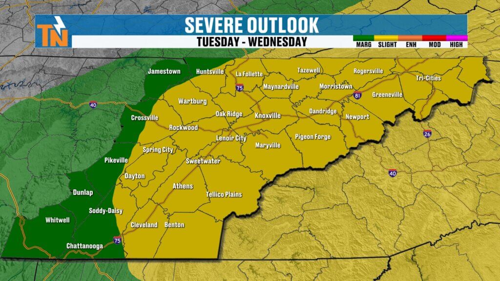
Tuesday Looks Most Concerning
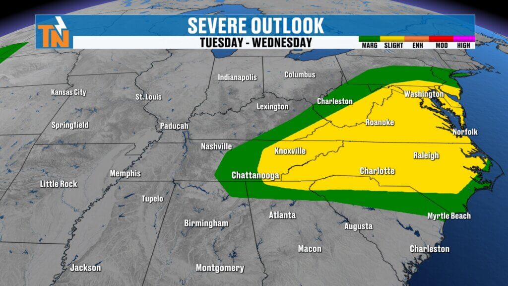
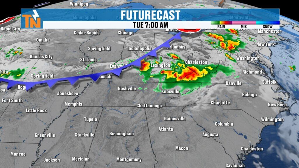
Tuesday currently appears to be the most active day of the forecast.
The Storm Prediction Center has placed much of East Tennessee under a Level 2 (Slight Risk) for severe thunderstorms.
Several ingredients are expected to come together:
- A cold front approaching from the northwest
- Very warm, humid air across the Tennessee Valley
- Multiple disturbances riding through the northwesterly flow
- Plenty of atmospheric instability
If everything comes together as expected, storms Tuesday afternoon and Tuesday night could produce:
- Damaging straight-line winds
- Torrential rainfall
- Frequent cloud-to-ground lightning
- An isolated tornado or two
Forecast confidence continues to increase that Tuesday will be our highest-impact weather day this week.
As always, exact timing and storm intensity will become clearer over the next 24 to 36 hours.
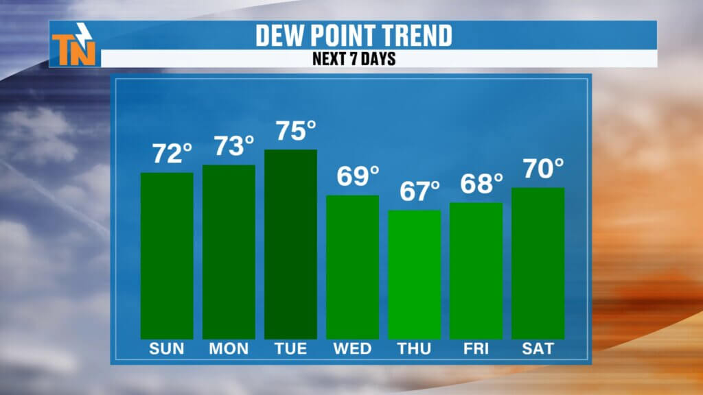
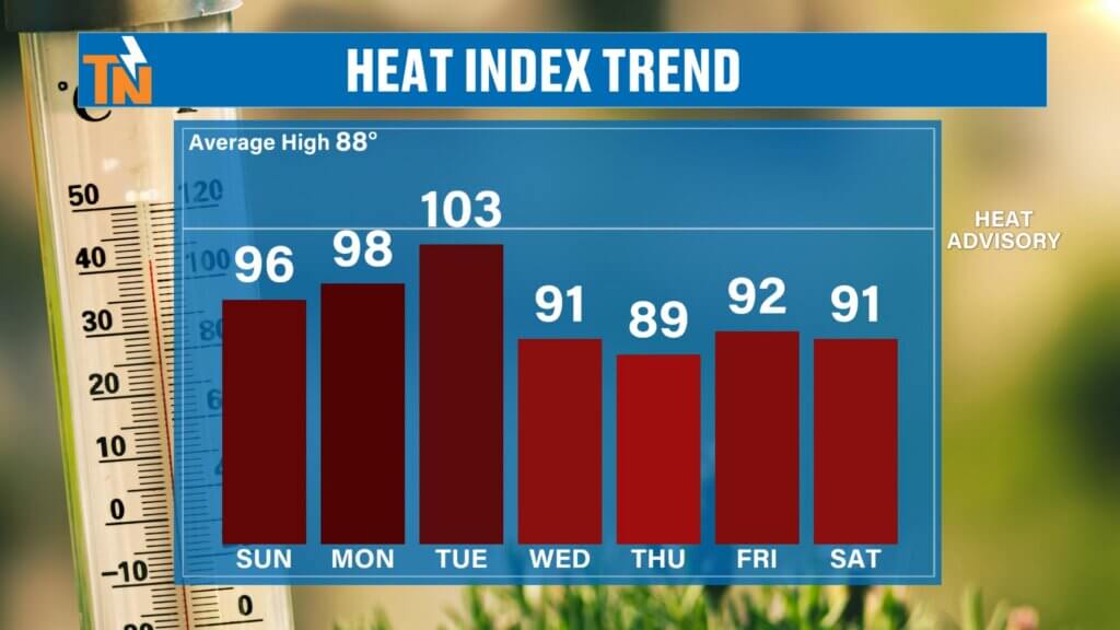
Relief Arrives Behind the Front
The same cold front responsible for Tuesday’s severe weather also brings some good news.
Unlike our previous front, this one should provide a much cleaner sweep of drier air.
While afternoon temperatures won’t fall dramatically, dew points are expected to drop noticeably.
That means:
- Lower humidity
- Lower heat index values
- More comfortable mornings and evenings
- Less oppressive summertime air
It won’t feel like fall, but it will certainly feel much better than the tropical air we’ve experienced recently.
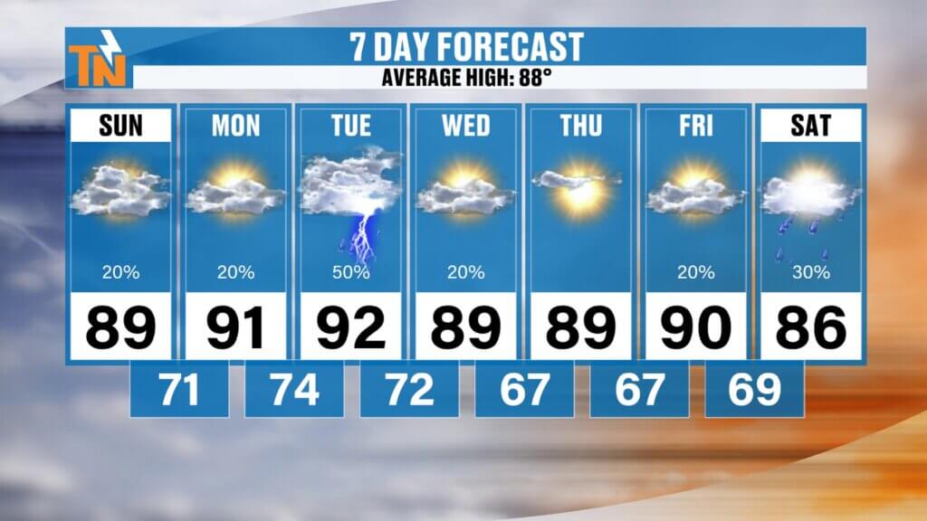
7-Day Forecast Overview
Central Valley (Knoxville)
- Sunday: Near 90°, mostly dry after morning showers
- Monday: Warm and humid with isolated storms possible
- Tuesday: Highest severe weather risk
- Wednesday: Storms ending, becoming less humid
- Thursday-Friday: Near 90° with more comfortable air
Southern Valley (Chattanooga)
A hotter forecast continues with highs near 90° through midweek before slightly drier air arrives late Wednesday into Thursday.
Cumberland Plateau
Storm chances increase Monday and Tuesday before noticeably more comfortable conditions arrive behind the cold front.
Northern Valley & Tri-Cities
Warm and humid through Tuesday with the threat for stronger thunderstorms before improving weather settles in later Wednesday.
Bottom Line
Today is a much quieter weather day across East Tennessee, making it an excellent opportunity to enjoy the outdoors.
However, don’t let today’s calm weather fool you.
The atmosphere is reloading for Monday and especially Tuesday, when another round of strong to severe thunderstorms could impact much of the region.
We’ll continue refining the timing and threats over the next day, so make sure you stay weather aware.
The FREE eastTNweather App remains your best tool for receiving severe weather alerts, lightning notifications, interactive radar, and live coverage whenever storms threaten.
Have a great Sunday, enjoy the beautiful weather, and be sure to check back later today and Monday as we continue tracking East Tennessee’s next round of potentially severe weather.
East Tennessee weather, Knoxville weather forecast, Tennessee severe weather, East Tennessee storms, Knoxville severe weather, East Tennessee forecast, Tennessee weather today, severe thunderstorms Tennessee, Knoxville radar, East Tennessee weather app, Tennessee flooding, Mike Witcher weather, Tennessee heat index, East Tennessee weekend weather
#EastTNWeather #TNwx #KnoxvilleWeather #SevereWeather #Thunderstorms #StormAlert #Flooding #EastTennessee #WeatherForecast #MikeWitcher #HeatIndex #Lightning #DamagingWinds #WeatherUpdate