
Good Morning, East Tennessee
Happy Tuesday, everybody! Thanks for checking in this morning.
We continue to deal with a very active and moisture-rich weather pattern across East Tennessee. After days of much-needed rainfall, we’ve officially shifted from drought concerns to localized flooding and flash flooding concerns in some areas. More rain is on the way today, but there is a little bit of relief in sight later this week.
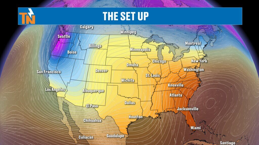
Why It’s Staying So Wet
The weather pattern hasn’t changed much — and that’s the problem.
High pressure remains anchored across the Southeast while low pressure spins across Texas. That setup is creating a moisture funnel straight out of the Gulf of Mexico, continuously feeding East Tennessee with deep tropical moisture.
In simple terms:
- Lots of moisture in the atmosphere
- Daily rounds of rain showers and storms
- Repeated downpours over the same areas
- Increased flooding concerns through the week
This isn’t just scattered summer rain — this is a prolonged wet pattern.d of rain we see.
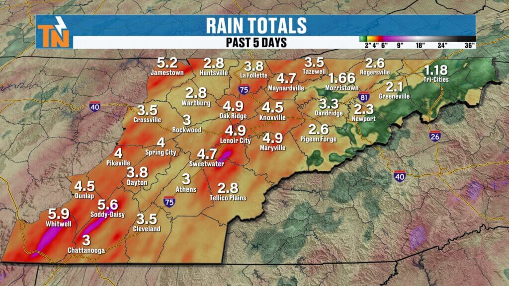
From Drought to Flooding Concerns
Just a couple of weeks ago, East Tennessee was dealing with worsening drought conditions.
Fast forward to now:
- Many locations have picked up 2 to over 5 inches of rainfall in the last 5 days
- Gatlinburg and portions of North Carolina have already experienced flooding issues
- Some areas are now dealing with saturated ground and standing water concerns
This rain has been extremely beneficial for drought improvement, and we’ll get another update from the U.S. Drought Monitor on Thursday.
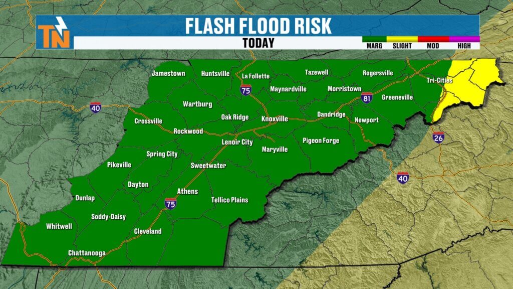
Flooding Risk Continues Today
The Weather Prediction Center has once again highlighted East Tennessee with a Level 1 to Level 2 flooding and flash flooding risk.
Why?
Because with already saturated ground, it won’t take much additional rain to cause:
- Ponding on roads
- Water collecting in low-lying areas
- Localized flooding
- Isolated flash flooding concerns
If heavier rain repeatedly moves over the same location, flooding issues could develop quickly.
Today’s Forecast: Similar to Monday
Today looks very similar to what we saw yesterday.
What to expect:
- Light rain showers this morning
- Mostly cloudy and muggy conditions
- Dry breaks during the day
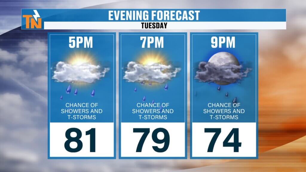
- Showers and thunderstorms redeveloping this afternoon and evening
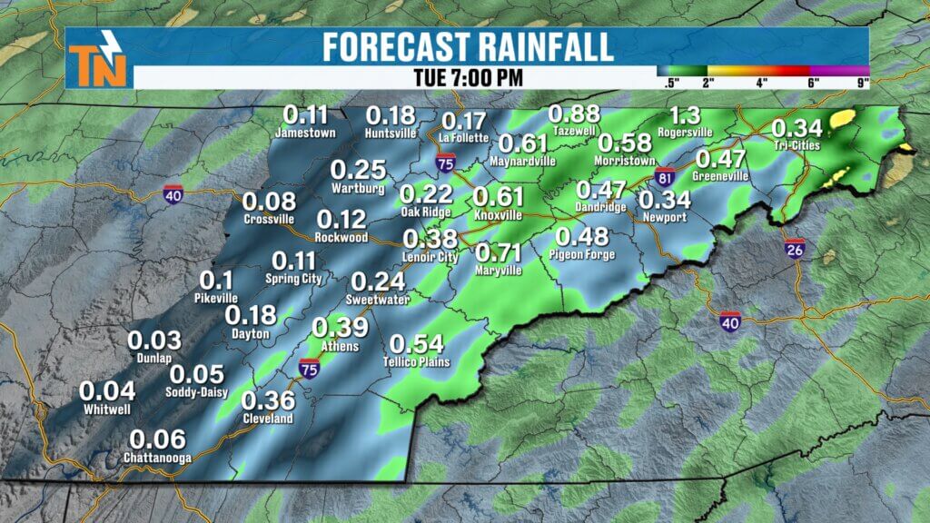
Rainfall totals will vary greatly:
- Some communities may only see around 0.10″
- Others could pick up over 0.75″ in heavier downpours
It’ll be another feast-or-famine setup.
Mild and Muggy Conditions Continue
Temperatures this morning are starting in the 60s and 70s, and yes — it still feels muggy outside.
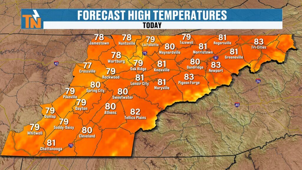
Forecast highs today:
- Upper 70s to low 80s
- Right around average for late May
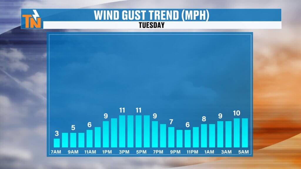
Winds will be a touch breezier than yesterday, but nothing too significant.
Best Chance for Evening Showers
If you have plans this evening, be ready to dodge a few showers and thunderstorms.
Rain chances look a bit higher:
- East of Interstate 75
- Across the mountains and foothills
- Into the evening hours
Temperatures by 7 PM will still be hovering near 79°. Use extra caution if you run into heavier downpours.
Brief Break Arrives Thursday Into Friday
There is some encouraging news.
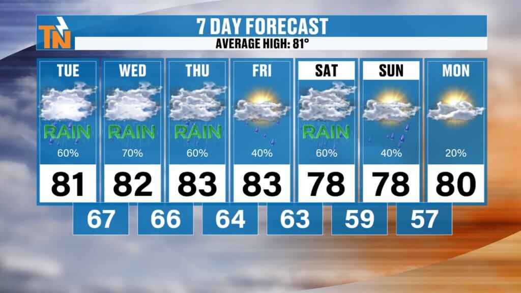
A weak backdoor cold front arrives later this week, helping to temporarily lower humidity and shut down rain chances for a bit.
Expected trend:
- Thursday morning: lingering showers possible
- Thursday afternoon into Friday: noticeably drier
- Friday: likely the driest day of the week
But the break won’t last long. Rain chances begin creeping back in Friday night into the weekend, especially south of Interstate 40. won’t feel cool, but it also won’t be excessively hot — just warm, humid, and damp.
Looking Ahead Into June
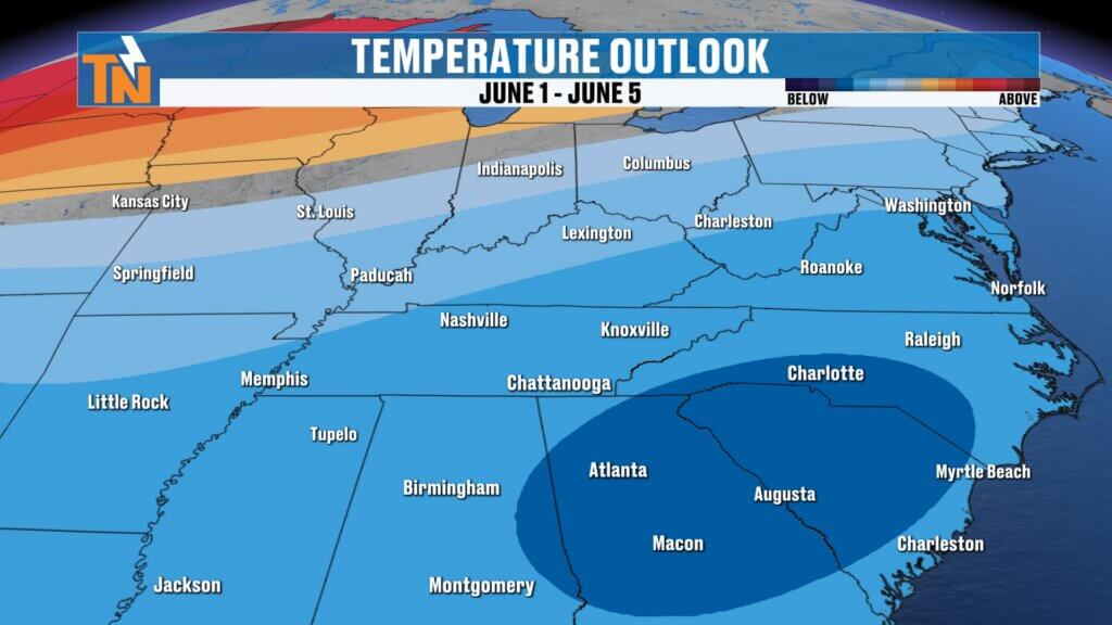
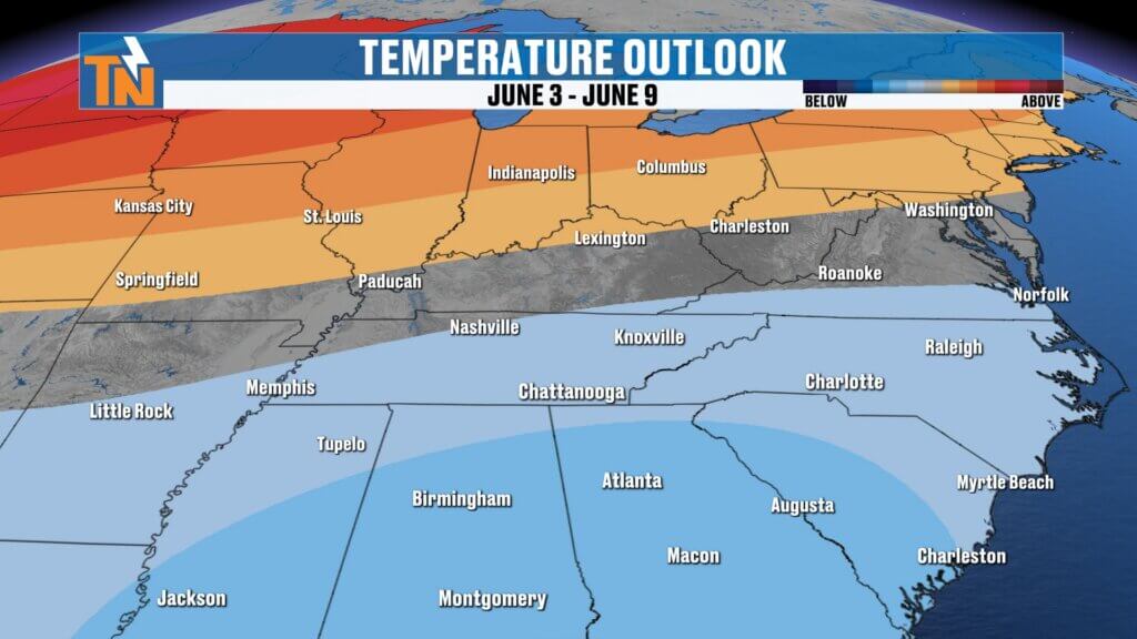
As we wrap up May and head into early June, cooler-than-average temperatures may settle in.
The Climate Prediction Center continues signaling:
- Slightly cooler conditions
- More seasonable temperatures
- A continued active weather pattern at times
Bottom line: keep the umbrella nearby for a few more days, but a small break from the rain is finally on the horizon.