
Published: Sunday, August 9, 2026
By Meteorologist Mike Witcher | eastTNweather
Happy Sunday, everybody!
Before we get into today’s forecast, I want to talk about the microburst that hit West Morristown Saturday afternoon.
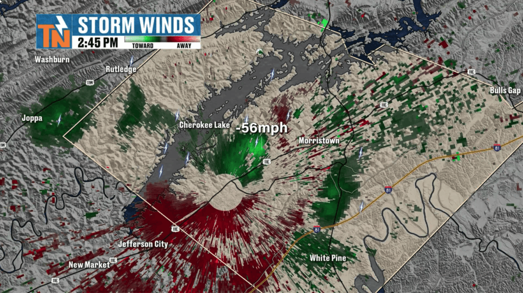
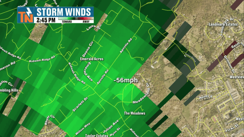
A thunderstorm collapsed on itself near the Emerald Acres community, producing a sudden burst of wind estimated around 56–60 mph and knocking down trees across the neighborhood.
That’s a microburst.
Think of it as a powerful rush of air coming DOWN from a thunderstorm, hitting the ground and spreading outward. It can happen incredibly quickly and produce wind damage that can sometimes resemble severe thunderstorm—or even tornado—damage.
Now let’s talk about today, because more thunderstorms are coming.
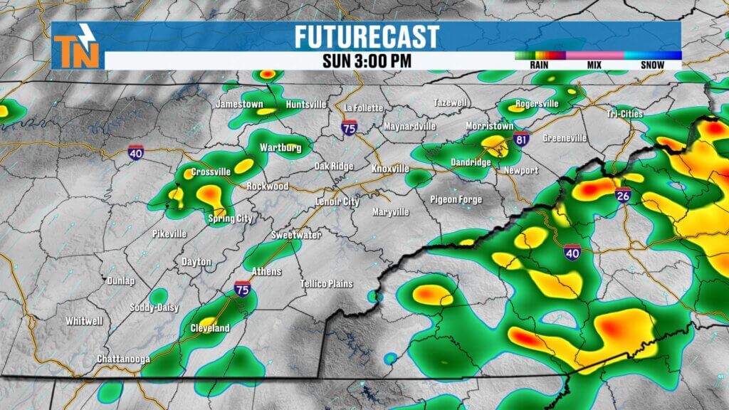
Storms Develop Again This Afternoon
We have another upper-level disturbance moving through the region today while plenty of moisture remains available in the atmosphere.
That combination will help scattered showers and thunderstorms develop again, generally beginning around late morning to lunchtime and increasing during the afternoon.
Not everyone gets rain, but any storm that develops could produce:
- Tropical-like downpours
- Frequent lightning
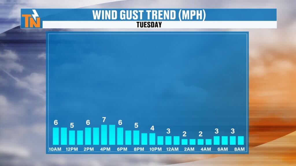
- Strong, gusty winds
- Localized flooding
- An isolated damaging wind gust
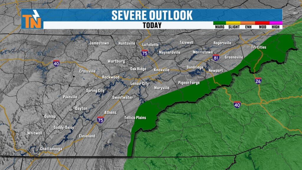
The Storm Prediction Center has a Level 1 severe weather risk primarily across the mountain counties of East Tennessee and into western North Carolina.
Remember what happened in Morristown Saturday: it doesn’t necessarily take a widespread severe weather outbreak to create localized wind damage.
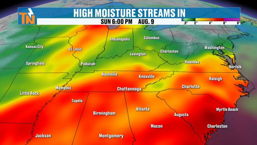
Water-Loaded Atmosphere
Heavy rain remains another concern.
There’s plenty of moisture available for thunderstorms to work with, so some storms could unload a tremendous amount of rain over a relatively short period.
That’s especially important if storms repeatedly affect the same location.
As I always say, this is guidance, not gospel. Futurecast gives us an idea of how the atmosphere may evolve, but don’t concentrate on one particular storm showing up over one particular town.
The message is simple: scattered storms develop this afternoon, and some could pack a punch.
Hotter & Muggier Sunday
You probably noticed the difference when you stepped outside this morning.
The humidity is back!
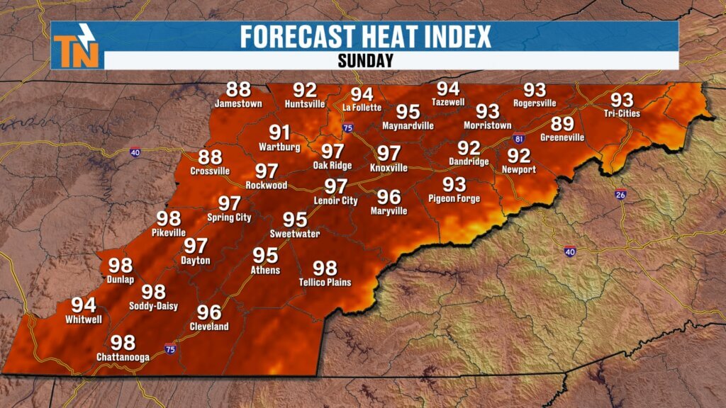
Temperatures started in the 60s and 70s, and we’ll climb into the upper 80s and lower 90s this afternoon.
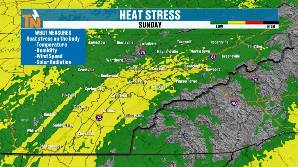
Combine that with the humidity and heat index values climb into the mid and upper 90s.
That’s the air you can wear!
Monday: Back to School & More Storms
For the kids heading back to school Monday, the morning should begin relatively quiet.
Then we do it again.
Daytime heating will help scattered showers and thunderstorms blossom during the afternoon. Once again, some could produce locally heavy rain and strong, gusty winds.
The Weather Prediction Center continues to highlight a localized flooding risk as this humid and stormy pattern continues.
I’m Watching Wednesday Closely
Here’s the part of the forecast I’m paying particularly close attention to.
As we move beyond Tuesday, a northwesterly flow becomes established across our region with several disturbances riding through the pattern.
One of those disturbances could arrive late Wednesday.
Some guidance suggests we could potentially see an MCS — a mesoscale convective system — diving toward our region.
In simple terms, that’s a large organized cluster of thunderstorms capable of producing heavy rain, lots of lightning and strong winds.
We’ve already dealt with several of these northwest-flow systems this summer.
It’s too early to get specific about timing, placement or intensity, but Wednesday is absolutely a day I’ll be watching.
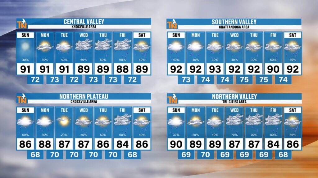
The 7-Day Pattern
Unfortunately, there’s no major pattern change showing up yet.
It’s basically wash, rinse, repeat:
Hot.
Humid.
Afternoon storms.
Locally heavy rain.
Repeat.
Dew points remain in the 70s through much of the next seven days, keeping heat index values in the upper 90s and occasionally near 100°.
Rainfall over the next week could generally total 1–3 inches, but summertime thunderstorms don’t distribute rainfall evenly. Some communities could receive considerably more while others receive much less.
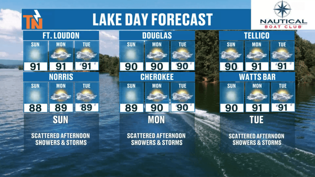
Heading to the Lake?
Go early!
The morning hours offer the best opportunity to enjoy the lakes today before thunderstorms begin developing.
And remember: lightning is your first line of defense.
Download the FREE eastTNweather app, allow location services and notifications, and use the interactive radar to track storms while you’re outside.
If you receive a lightning notification, open the radar and see exactly what’s developing around you.
And if this forecast helped you, please LIKE this video, SUBSCRIBE to the eastTNweather YouTube channel and turn on notifications.
I’m Meteorologist Mike Witcher.
Grab that cup of coffee, enjoy your Sunday, and stay weather aware!
eastTNweather — Weather When You Want It.
Morristown microburst, Morristown Tennessee storm damage, West Morristown storm, East Tennessee weather, Knoxville weather, Tennessee thunderstorms, East Tennessee thunderstorms, Knoxville thunderstorms, Tennessee severe weather, East Tennessee flooding, Tennessee flash flooding, Smoky Mountains weather, Wednesday severe weather, MCS thunderstorms, mesoscale convective system, Mike Witcher, eastTNweather
#eastTNweather #TNwx #Morristown #MorristownTN #Microburst #SevereWeather #StormDamage #Thunderstorms #HeavyRain #FlashFlooding #KnoxvilleWeather #EastTennessee #SmokyMountains #Weather #MikeWitcher