
Published: Wednesday, August 19, 2026
By Meteorologist Mike Witcher | eastTNweather
Good morning and Happy Wednesday!
We’re starting the day with something we haven’t been able to say a whole lot this summer:
It actually feels pretty refreshing outside!
Temperatures are starting in the 60s across much of East Tennessee thanks to some drier air that’s settled into the region. We’ve got a little patchy fog and a few high clouds around this morning, but otherwise we’re setting ourselves up for a beautiful Wednesday with plenty of sunshine.
Enjoy it, because our next cold front arrives Thursday.
Sunshine & Warmer This Afternoon
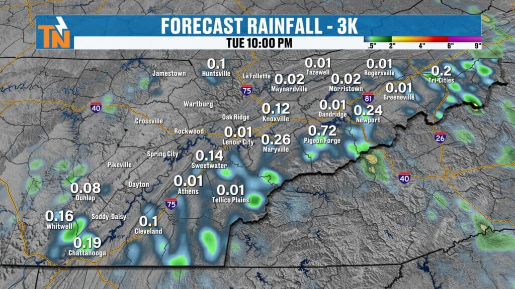
There’s a cluster of thunderstorms to our north and northwest this morning, but that activity should weaken before reaching East Tennessee.
That leaves us dry today.
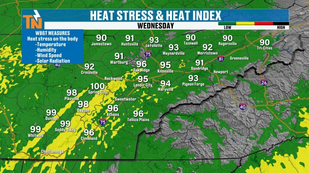
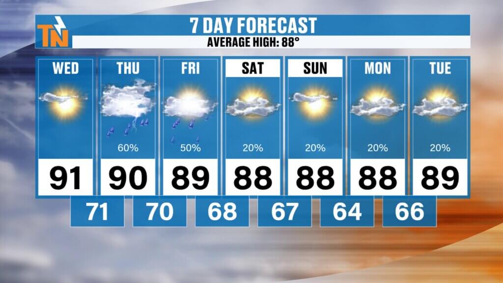
After our comfortable start, temperatures climb into the upper 80s and lower 90s this afternoon.
Humidity will also gradually begin increasing ahead of our next cold front, so we’ll bring back a little more of a heat index.
The Southern Valley, including Chattanooga and the Sequatchie Valley, will feel the hottest with heat index values potentially approaching 100°.
It is still August, after all!
Thursday Is All About Timing
Our next cold front moves into the Tennessee Valley Thursday, bringing an increasing chance for showers and thunderstorms.
But there’s an important question we’re still trying to answer:
What time does the rain arrive?
Most guidance currently brings a round of showers and thunderstorms into the region during the morning hours Thursday.
If that happens, the morning rain and cloud cover should limit instability and substantially reduce our opportunity for strong or severe thunderstorms later in the day.
But if this system slows down and arrives later Thursday, the atmosphere will have more time to destabilize.
That could open the door for a few isolated strong to severe thunderstorms.
Right now, we’re not under an organized severe weather risk, but it’s something I’m watching closely.
This is one of those forecasts where a difference of just a few hours can make a BIG difference.
I’ll continue updating the timing as newer guidance comes in.
Heavy Downpours Possible
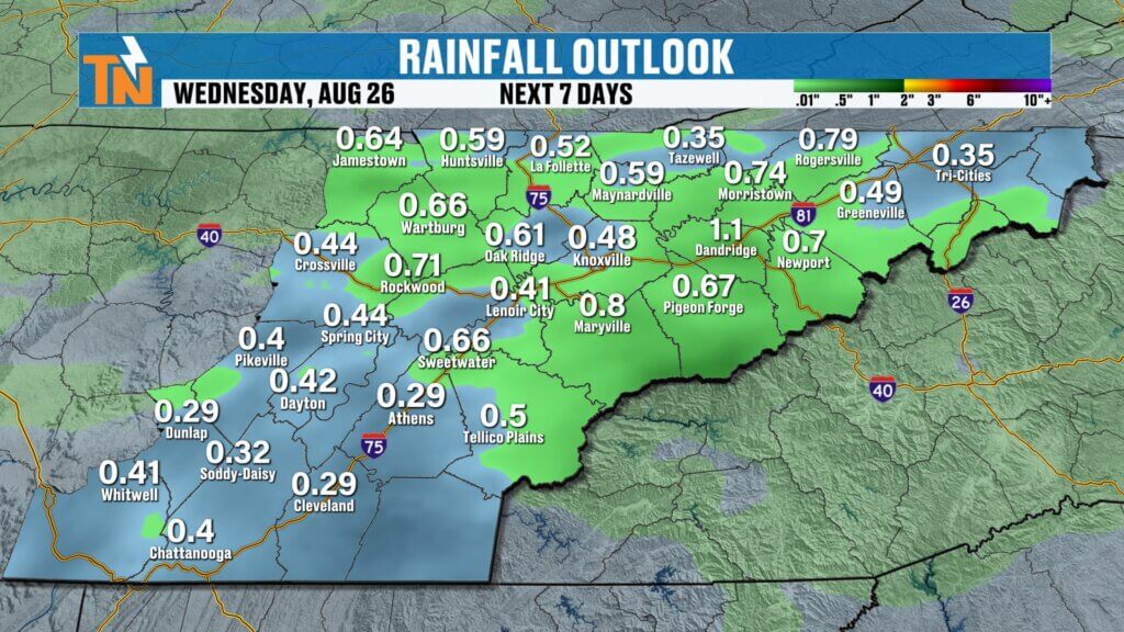
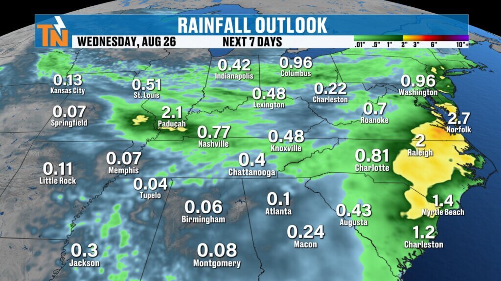
Regardless of the severe weather potential, there’s plenty of moisture available for these storms.
That means some could produce locally heavy rainfall.
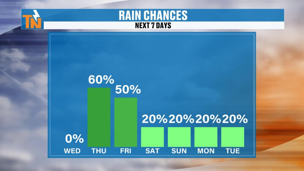
I’m currently carrying around a 60% chance of rain Thursday, but that may need to increase as we get closer and confidence in the timing improves.
As always:
Model guidance is guidance, not gospel.
Don’t concentrate on an exact rainfall number or an exact storm over your town. We’re looking at the overall pattern and adjusting the forecast as new information arrives.
Another Round Friday
Thursday’s front slides south, but we’re not completely finished with the rain.
Another upper-level disturbance arrives Friday, giving us another opportunity for afternoon and evening showers and thunderstorms.
After that, things begin looking considerably better.
Weekend Looking Pretty Good!
A trough begins digging into the eastern United States this weekend, eventually helping push another cold front through the region.
That should bring in somewhat drier and more comfortable air, particularly by Sunday.
Right now, I’m only carrying around a 0–20% chance of rain Saturday and Sunday.
So if you’ve got outdoor plans this weekend, keep them!
We’re still in August. It’ll still be warm. But lower humidity could make the mornings and evenings feel considerably better.
Lake Forecast
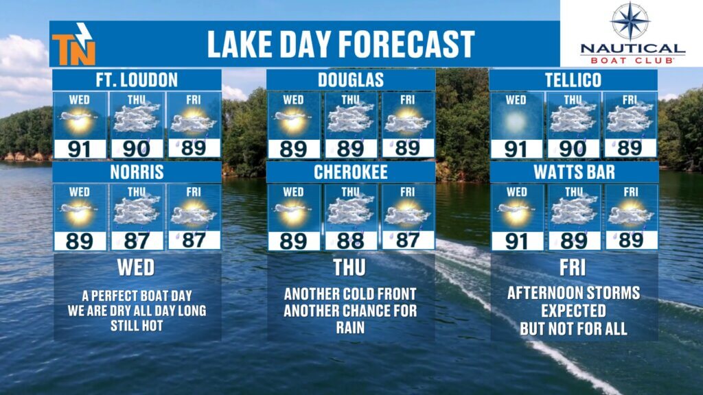
WEDNESDAY: ⭐⭐⭐⭐⭐ — Get out there! Sunshine and dry weather.
THURSDAY: ⭐⭐ — Showers and storms possible, especially depending on the timing of the front.
FRIDAY: ⭐⭐⭐ — Morning may offer your best opportunity before afternoon/evening storms develop.
WEEKEND: ⭐⭐⭐⭐ — Looking increasingly favorable, especially Sunday.
And don’t forget: when you’re on the water, lightning is your first line of defense.
Keep the FREE eastTNweather app with you, allow location services and notifications, and use the interactive radar to track anything developing around you.
Bottom Line
TODAY: Refreshing start → sunny, warm and dry afternoon.
THURSDAY: Cold front arrives. Rain likely. Severe potential depends heavily on timing.
FRIDAY: Another opportunity for afternoon and evening storms.
SATURDAY & SUNDAY: Looking mostly dry with slightly lower humidity. Sunday could be particularly nice.
NEXT WEEK: A northwesterly flow may return, potentially bringing additional opportunities for showers and thunderstorms.
For now, enjoy this beautiful Wednesday!
If this forecast helped you, LIKE the video, SUBSCRIBE to the eastTNweather YouTube channel and click the bellso you’re notified when I post the latest update.
And make sure you download the FREE eastTNweather app. It’s all weather, all the time, built specifically for us right here in East Tennessee.
I’m Meteorologist Mike Witcher.
Have a great Wednesday!
eastTNweather — Weather When You Want It.
East Tennessee weather, Knoxville weather, Tennessee weather forecast, Knoxville forecast, East Tennessee thunderstorms, Thursday storms East Tennessee, Knoxville thunderstorms, Tennessee cold front, East Tennessee weekend forecast, Knoxville weekend weather, East Tennessee severe weather, Chattanooga weather, Tri Cities weather, Smoky Mountains weather, East Tennessee lake forecast, Mike Witcher, eastTNweather
#eastTNweather #TNwx #KnoxvilleWeather #EastTennessee #WeatherForecast #ColdFront #Thunderstorms #SevereWeather #HeavyRain #Knoxville #Chattanooga #TriCities #SmokyMountains #WeekendWeather #LakeWeather #MikeWitcher