
Big Picture Pattern Change
Good morning and thanks for checking in.
We continue to track a significant pattern change across the country. A strong low pressure system near Baja California is pumping in deep Pacific moisture, while a trough to our north and a building ridge combine to funnel that moisture straight into the Southeast.
What this means for East Tennessee: a shift from quiet weather to a much wetter, more active setup over the next 24 to 72 hours.
Tuesday Forecast: Warm, Breezy, Limited Rain
Today is the transition day:
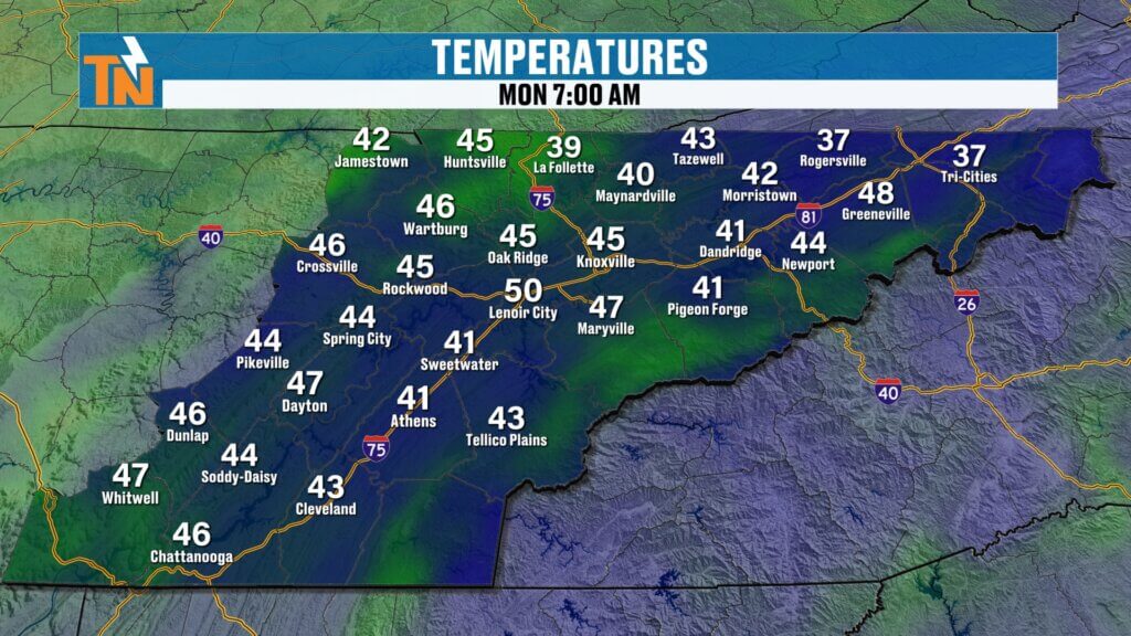
- Morning lows: 40s and 50s
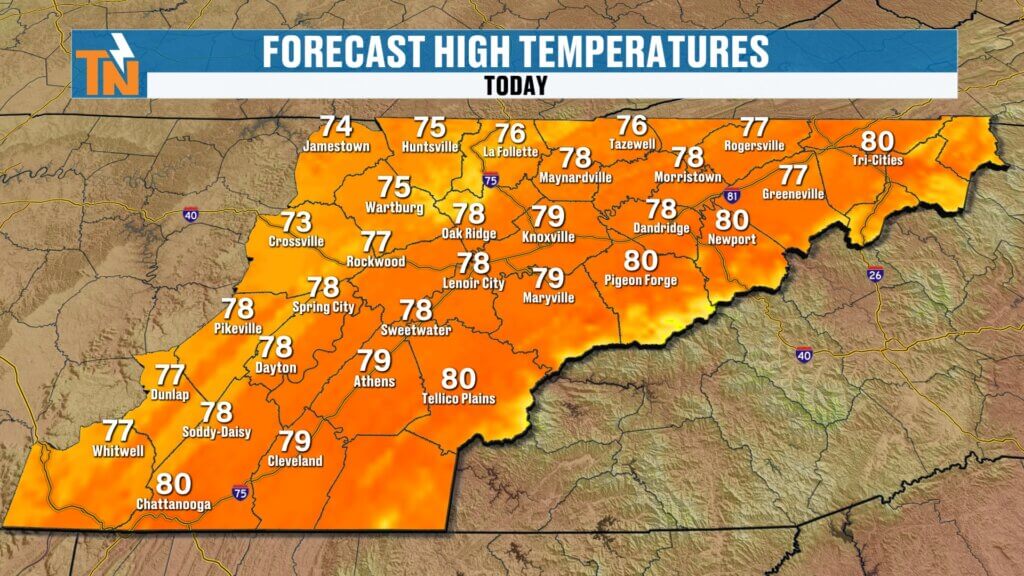
- Highs: Upper 70s
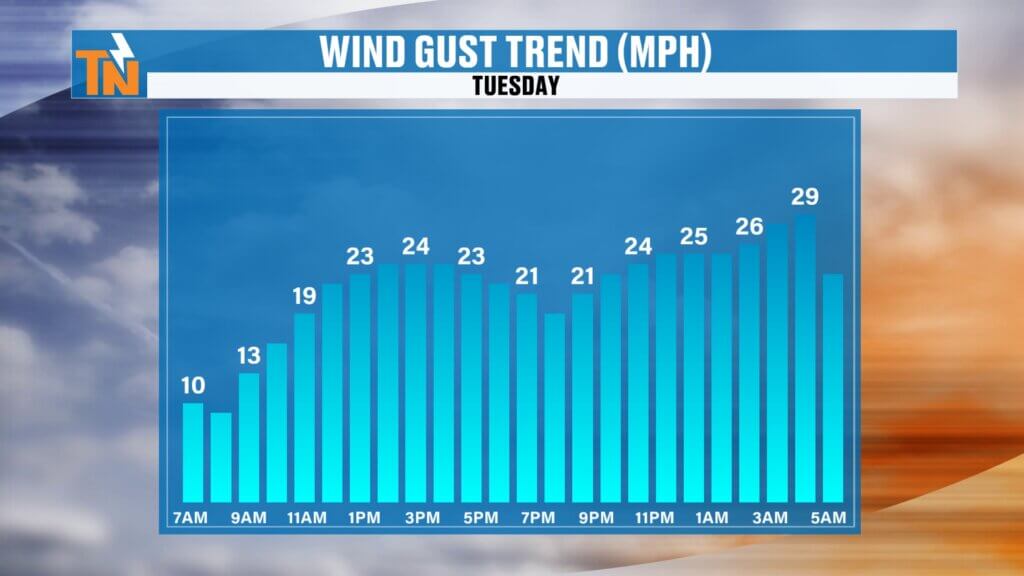
- Winds: Increasing, breezy at times
- Rain: A few scattered showers or storms possible late
Most of today stays dry, and any rainfall will be light and spotty. This is just the beginning of the wetter pattern.
Tonight: Rain Begins to Increase
As we head into the evening and overnight hours:
- Showers become more widespread
- Wet roads possible by early Wednesday morning
- A few rumbles of thunder can’t be ruled out
This sets the stage for a more impactful day on Wednesday.
Wednesday: Two Rounds of Storms
Wednesday is the day to watch.
Round one:
- Morning showers and a few thunderstorms
- Some breaks possible midday
Round two (main concern):
- Late afternoon through evening (5 PM – 10 PM)
- Stronger storms develop
- Heavier rainfall and stronger winds possible
This second round is where we’ll see the greatest impacts.
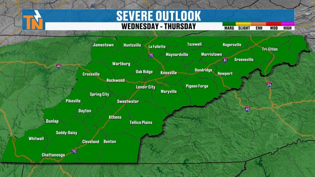
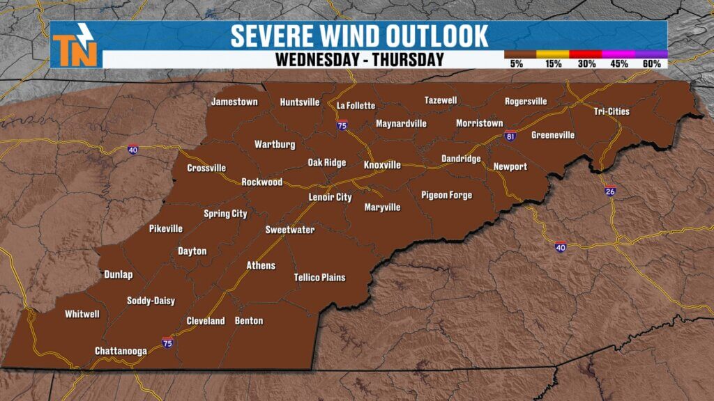
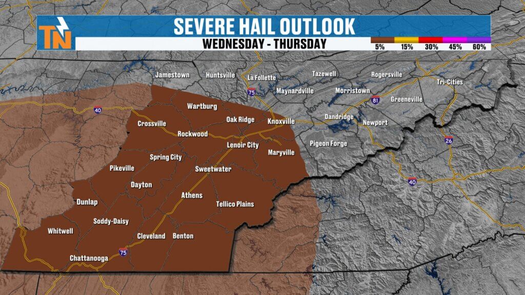
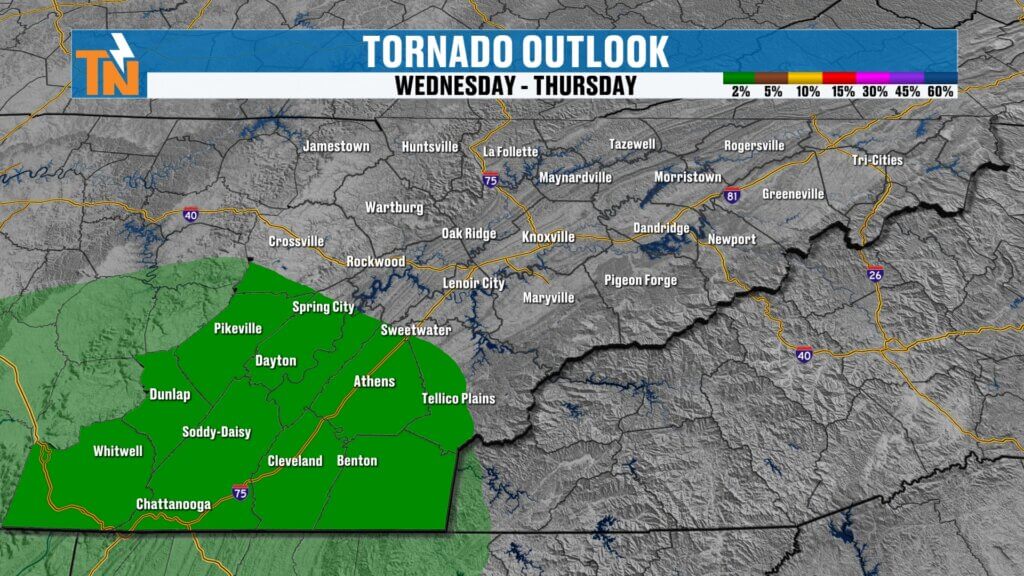
Severe Weather Risk
The Storm Prediction Center has placed parts of the region under a level 1 risk for severe storms.
Main threats:
- Damaging winds
- Isolated hail (mainly south of I-40)
- Low tornado risk (focused across the southern valley and plateau)
The best chance for stronger storms will be south of Interstate 40 where atmospheric energy and moisture are higher.
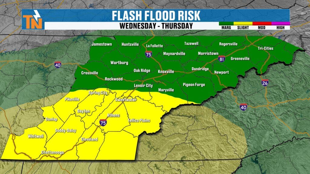
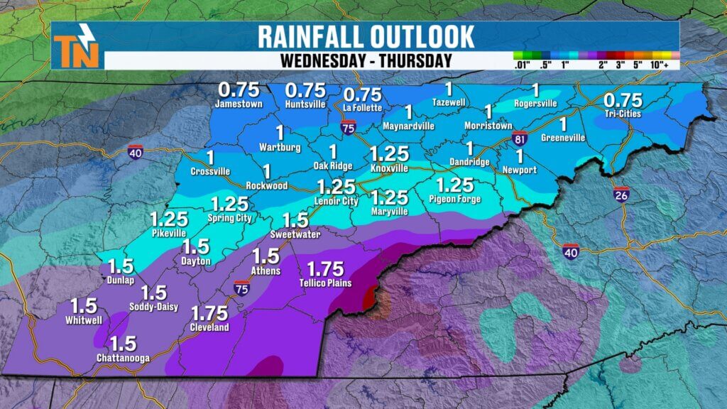
Flooding and Heavy Rain Concerns
This is a major part of the forecast.
The Weather Prediction Center has issued a level 1 and level 2 risk for excessive rainfall.
Rainfall totals:
- North of I-40: 0.5 to 1 inch
- South of I-40: 1 to 2+ inches
- Isolated higher totals possible
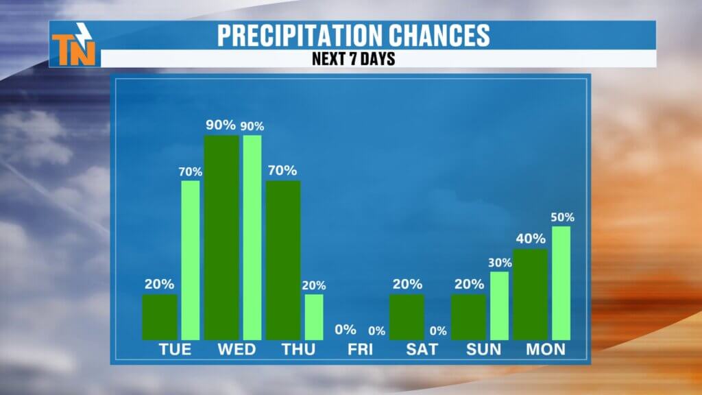
Over a 7-day stretch:
- 1 to 2 inches north
- 2 to 3 inches south
That’s a lot of rain in a short period, especially after dry conditions—so localized flooding is possible.
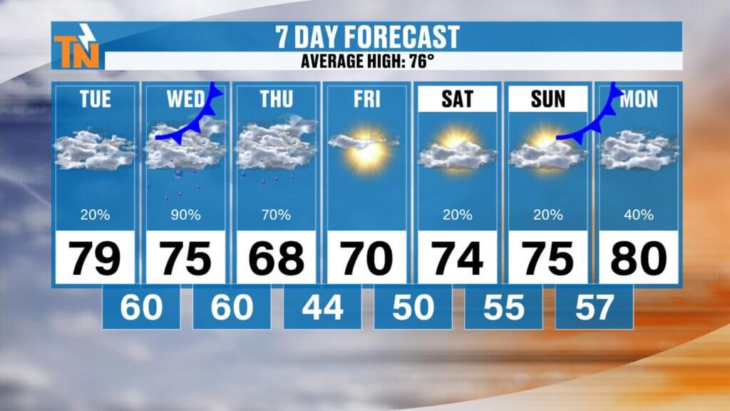
Temperature Trend
- Today and Wednesday: Mid to upper 70s
- Thursday: Near 70 after the front passes
- Friday–Saturday: Mid to upper 70s
- Next week: Another system may cool things down again
Late Week and Beyond
- Thursday: Rain tapers off
- Friday and Saturday: Drier
- Next week: Rain chances return
This is not a one-and-done system—we’re entering a more active stretch overall.
Final Thoughts
We’re moving from dry to very wet in a hurry. Today is calm, but by Wednesday evening, we’ll be tracking heavy rain and the potential for strong storms.
Stay weather aware, especially Wednesday afternoon and evening.