
Rain Recap and Ongoing Drought
Happy Friday! Thanks for checking in with your morning weather update.
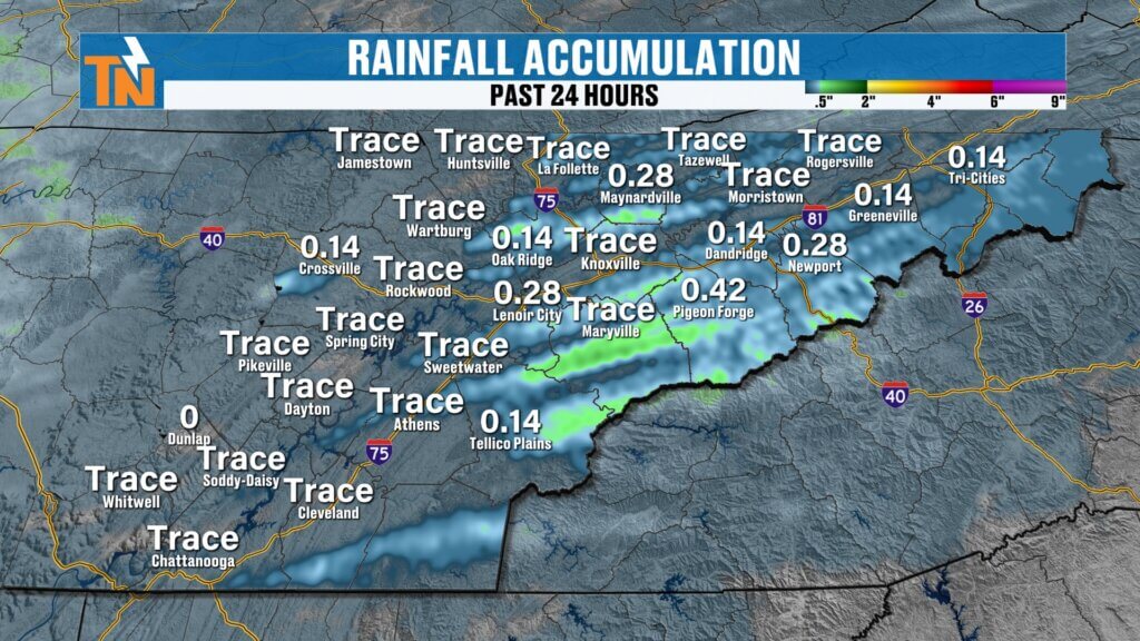
We finally picked up some much-needed rain across East Tennessee, but it was a classic feast-or-famine setup. Some communities saw over a quarter inch of rain with a line of showers and thunderstorms, while others barely got anything. A few storms even produced gusty winds, but overall, we’ll take the rain.
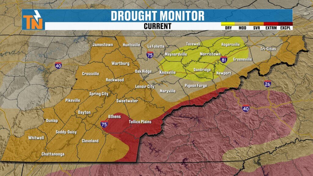
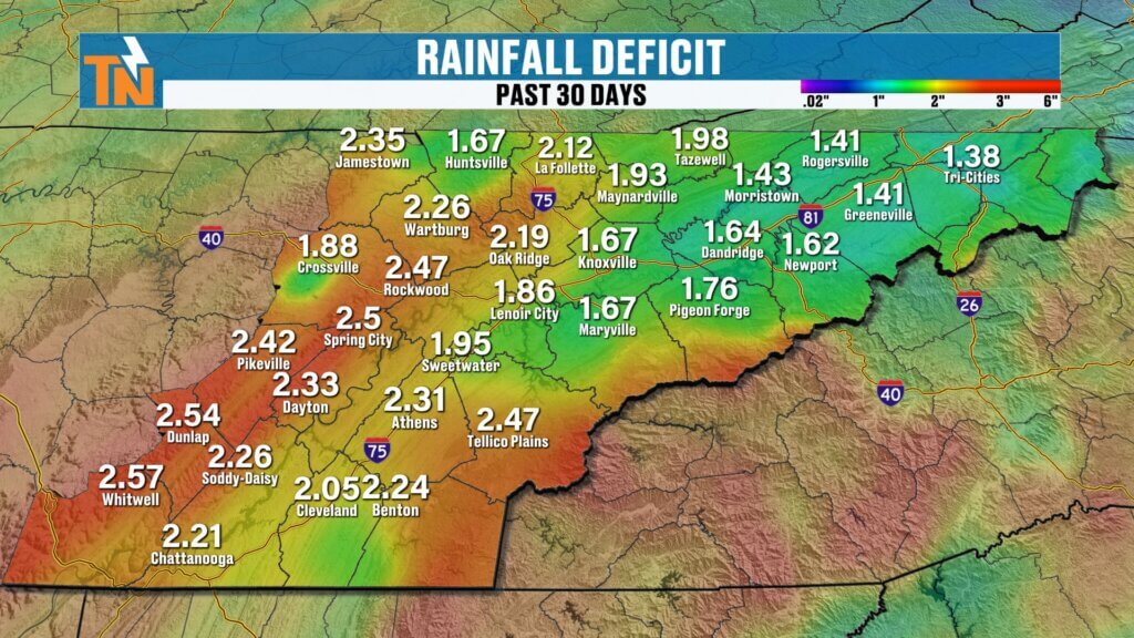
That said, we’re still dealing with a rainfall deficit. Over the past 30 days, many areas are running 2 to 2.5 inches below normal. The latest drought monitor shows worsening conditions:
- Areas previously not in drought are now classified as abnormally dry
- Extreme drought continues to expand across the foothills and Smoky Mountains
- Severe drought is growing across the northern Cumberland Plateau
Bottom line: we still need more rain.
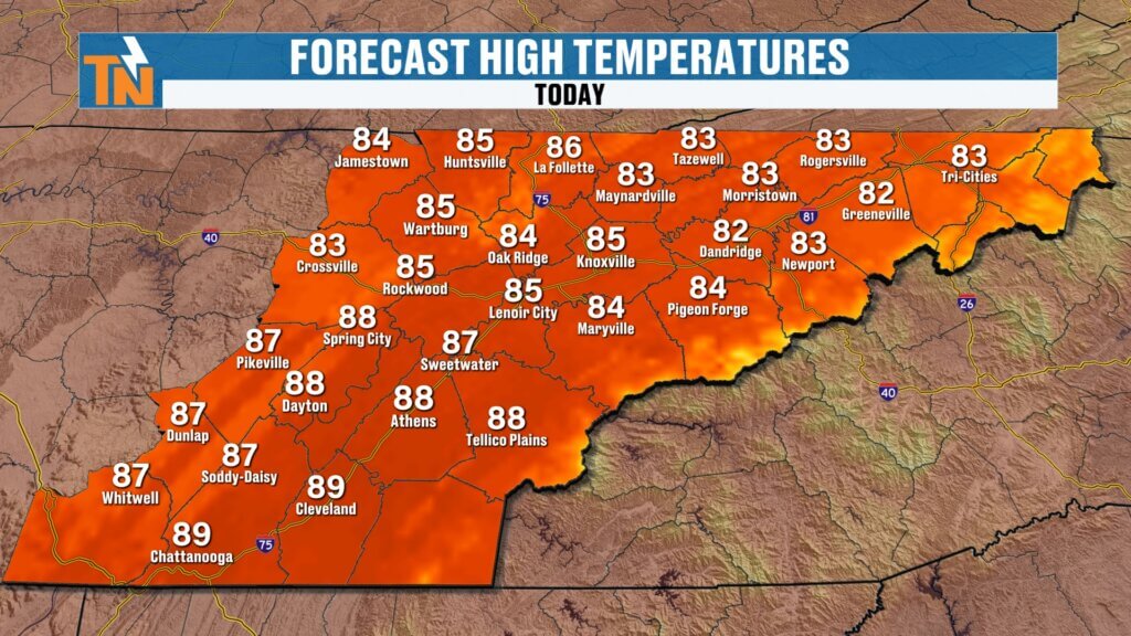
Today’s Weather: Warm, Quiet, and Above Average
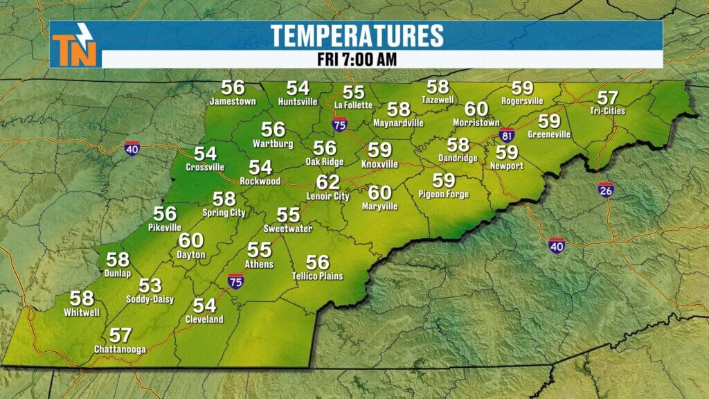
We start the day off mild with temperatures in the 50s and 60s. Winds will be lighter today compared to the past few days, making for a comfortable start.
- Afternoon highs: Mid 80s (near record levels)
- Sky: Mostly sunny with a few clouds
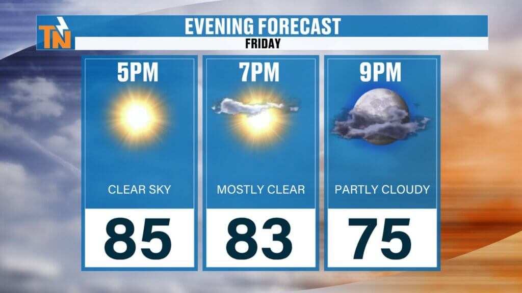
- Evening temps: Around 83° by 7 PM
Another warm and quiet day across the region.Another warm and quiet day across the region.
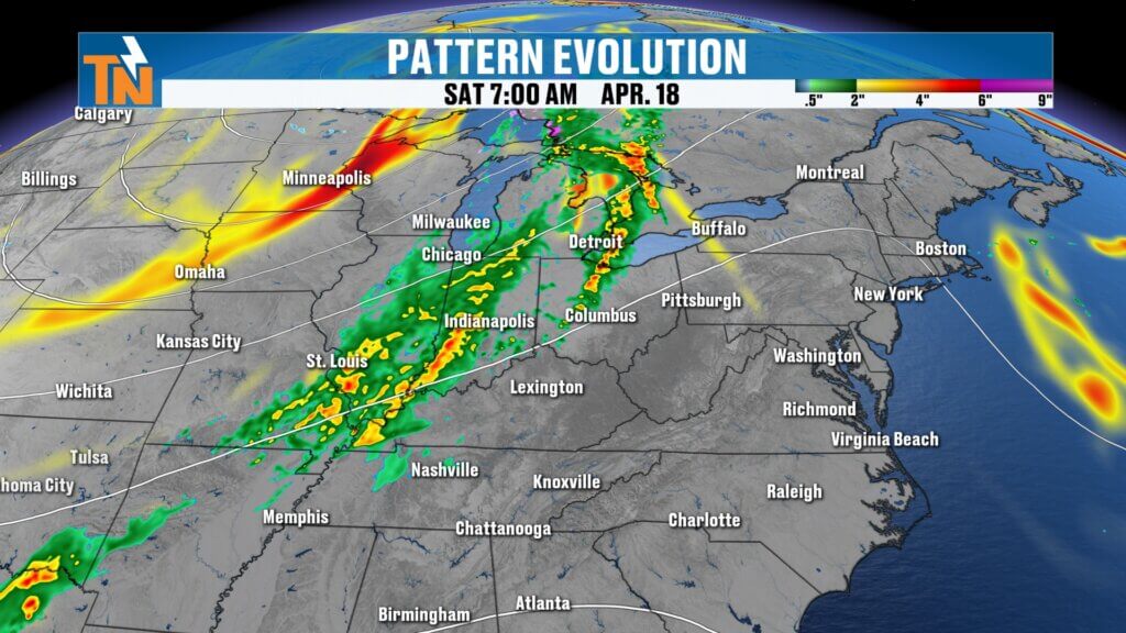
Saturday Setup: Increasing Wind and Storm System Approaches
Saturday will start off warm and mostly dry, but changes are on the way.
- Winds increase through the day
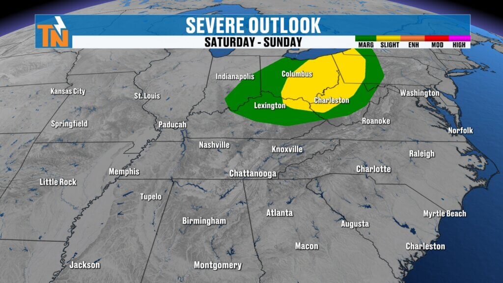
- A stronger storm system develops to our north and northwest
- Severe weather risk increases across the Ohio Valley
If you have travel plans north along I-75, be aware of potential strong to severe storms closer to Kentucky and beyond.
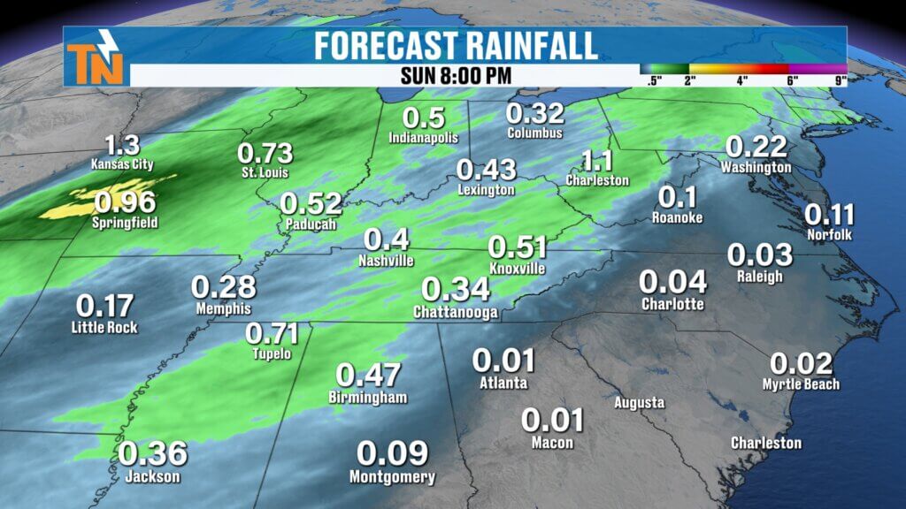
Saturday Night into Sunday: Rain Returns
A deeper trough will dig into the region, pushing a cold front through East Tennessee late Saturday into Sunday.
- Showers and thunderstorms increase late Saturday
- Rain continues into early Sunday
- Expected rainfall: Around 0.30″ to 0.50″+
This won’t eliminate the drought, but it will provide another round of beneficial rainfall.
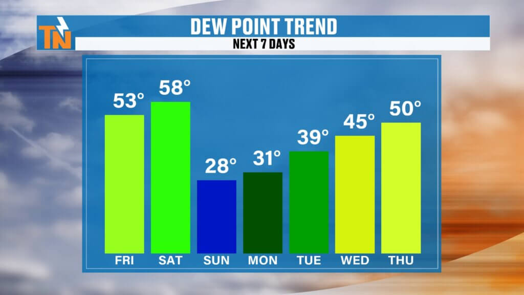
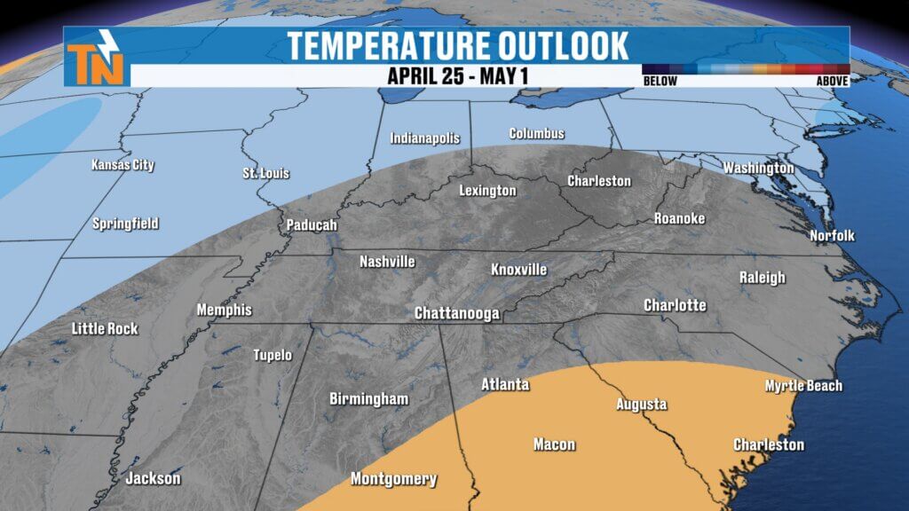
Big Pattern Change: Cooler Air Returns
Behind the cold front, a noticeable shift arrives:
- Highs drop from the mid 80s to the 60s Sunday and Monday
- Drier air moves in quickly
- Humidity drops significantly
In fact, the air may turn very dry again, which could elevate fire danger heading into early next week.ng to around 40 percent tonight as the first disturbance moves through.

Bronco Super Celebration Forecast
The Bronco Super Celebration in Townsend continues with great weather overall.
- Friday: Sunny, warm, mid to upper 80s
- Saturday: Warm with increasing clouds and wind
- Rain holds off for most daytime events
- Saturday night into Sunday: Rain moves in
If you’re staying into Sunday morning, plan for wet conditions.
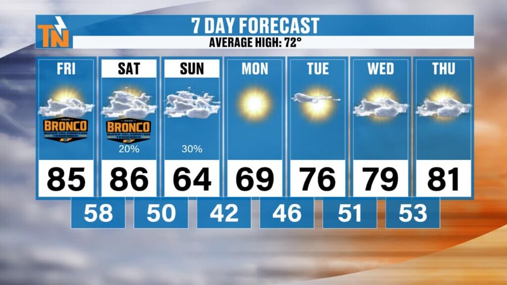
7-Day Forecast Overview
- Friday: Warm and sunny, mid 80s
- Saturday: Warm, breezy, increasing clouds late
- Saturday night/Sunday: Showers and storms, cooler
- Sunday/Monday: Highs in the 60s
- Midweek: Warming back into the 70s and 80s
A quick drop in temperatures followed by another warm-up.
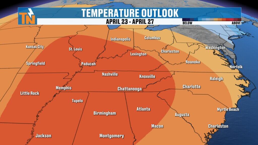
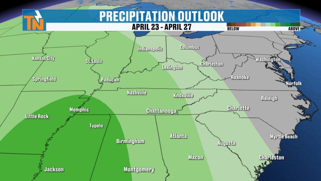
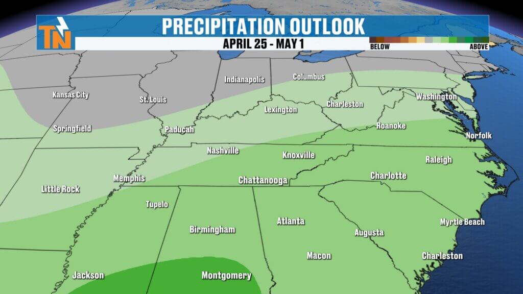
Looking Ahead: Late April Trends
Beyond the 7-day forecast:
- Temperatures likely stay above average overall
- Rain chances may gradually increase late April into early May
- A more typical “April showers” pattern could finally develop
And yes… we need those showers if we want those May flowers.
Final Thoughts
We’re getting some rain, but not enough to erase the drought just yet. Enjoy another warm day today and most of Saturday, then be ready for showers and a big cooldown heading into Sunday.
Have a great Friday, and thanks for checking in!Have a fantastic Thursday, and thanks for checking in!