
Happy Thursday, and thanks for checking in with your East Tennessee weather update!
A strong ridge of high pressure continues to dominate the region, bringing summerlike warmth. However, two disturbances and associated cold fronts will bring increasing chances for showers and thunderstorms, along with a return to more seasonable temperatures by the end of the weekend.
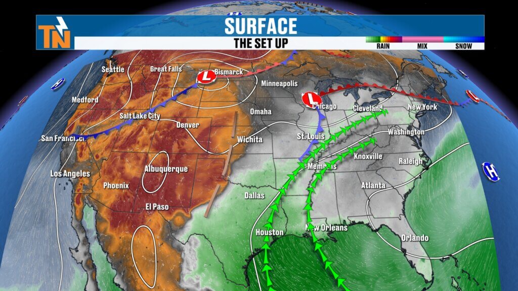
Big Picture Weather Pattern
The current weather setup features a ridge of high pressure across the eastern United States, keeping temperatures well above average. Embedded within this pattern are two disturbances:
- Disturbance #1: Arrives tonight into early Friday morning.
- Disturbance #2: A stronger system expected Saturday night into Sunday.
While most of the deeper moisture remains west of the Mississippi River, enough instability will develop to trigger isolated showers and thunderstorms as these systems move through.
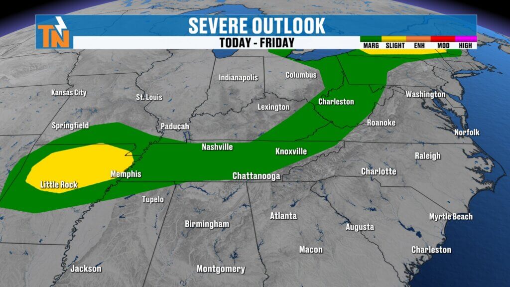
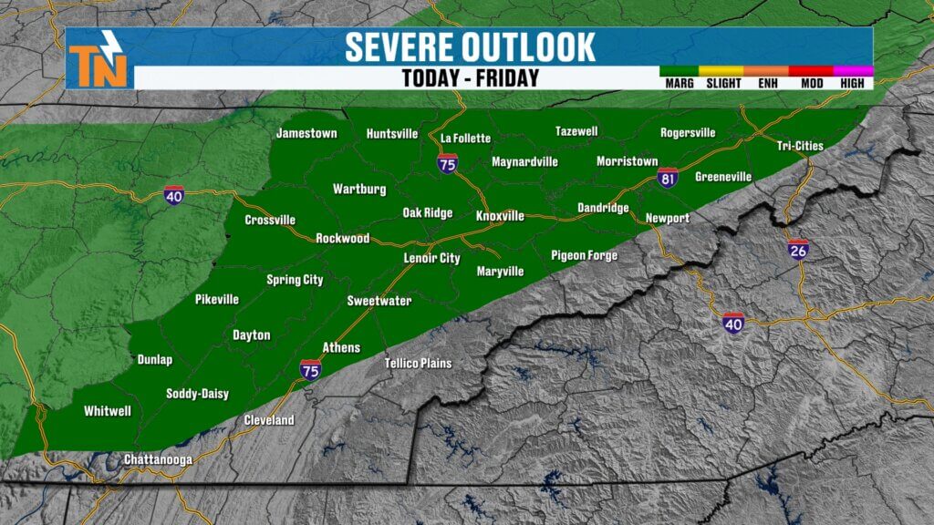
Severe Weather Potential
The Storm Prediction Center has placed much of the Appalachian region, including East Tennessee, under a Level 1 (Marginal) risk for severe weather.
- Storms will be isolated in nature.
- The main threats include gusty winds and brief heavy downpours.
- The greatest chance for storms will occur during the evening and overnight hours.
From now through lunchtime, expect increasing clouds but generally dry conditions. Storm chances will rise after sunset and continue through around midnight before gradually weakening.e.This pattern keeps East Tennessee warm and predominantly dry through the remainder of the week.
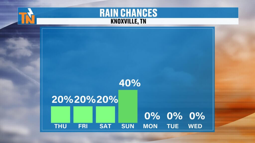
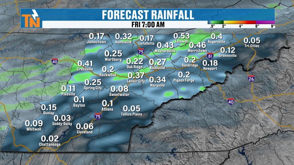
Rainfall Potential
Recent model guidance suggests slightly higher rainfall totals than previously expected, which is welcome news given ongoing dry conditions.
- Most areas: 0.10 to 0.50 inches of rain.
- Isolated pockets: Up to 0.75 inches where heavier downpours occur.
Although not drought-busting, this rainfall will provide beneficial moisture to the region.Temperatures around 81 degrees by 7 PM.
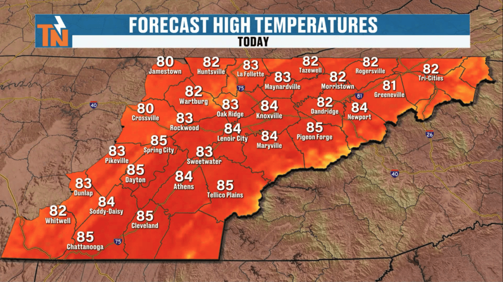
Today’s Forecast
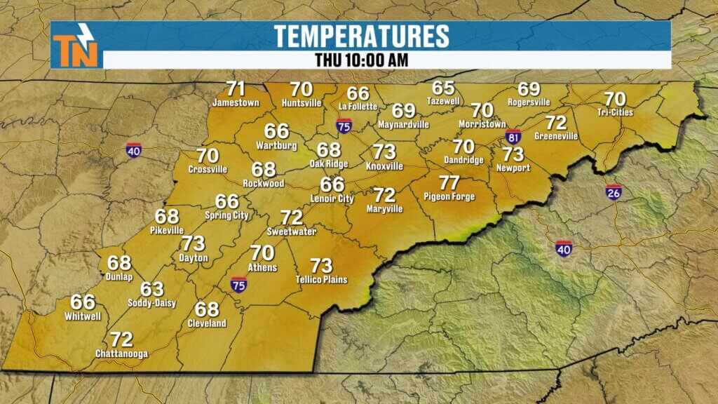
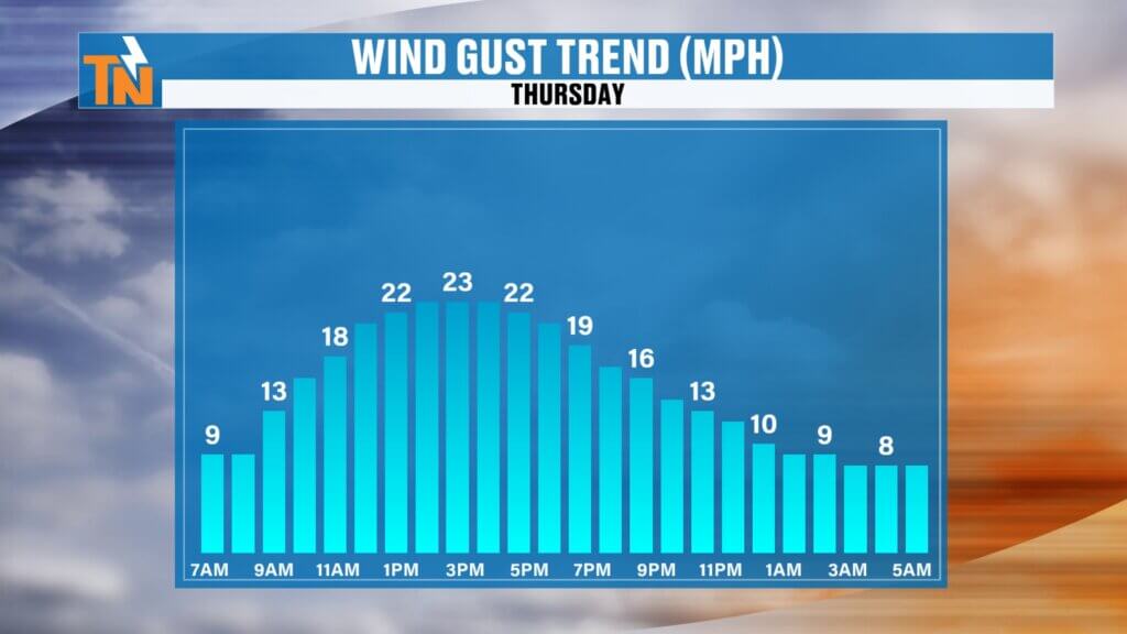
Another warm and breezy day is ahead.
- Morning temperatures: 50s to near 60 degrees.
- Afternoon highs: Low to mid 80s, near record levels.
- Sky conditions: Increasing clouds through the day.
- Winds: Breezy at times.
Rain chances remain low during daylight hours, increasing to around 40 percent tonight as the first disturbance moves through.
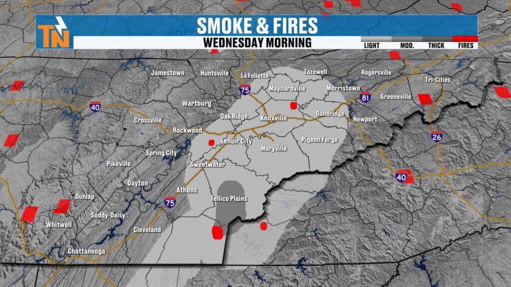
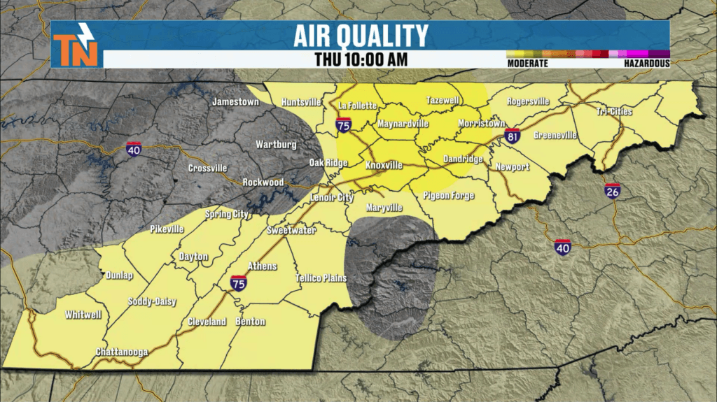
Smoke and Air Quality
Ongoing wildfires continue to impact air quality across parts of East Tennessee.
- Smoke from a fire in Polk County may drift into the foothills and mountain communities.
- As the cold front passes, shifting winds should help clear the smoke from the region.
- Fire danger decreases locally as moisture increases but may shift eastward into the Carolinas.
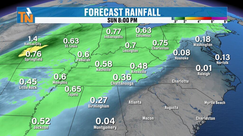
Second Disturbance and Weekend Pattern Change
A stronger system is expected to arrive late Saturday into Sunday.
- Increased chances for more widespread rainfall.
- Introduction of cooler air behind the front.
- Transition from summerlike warmth to more seasonable temperatures.
Temperature Trend
- Today through Saturday: Highs in the low to mid 80s.
- Sunday: Cooling to the upper 60s.
- Early next week: Highs in the 60s and 70s with comfortable conditions.
This shift will provide a refreshing break from the recent heat.Weather” on the East Tennessee Weather app for quick and convenient updates.
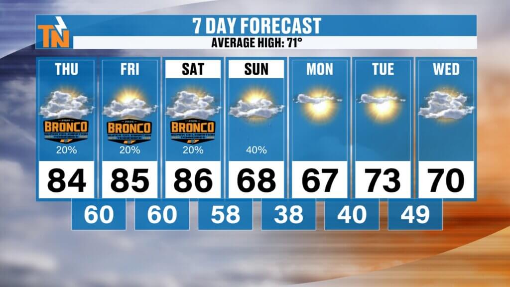
7-Day Outlook
- Thursday: Warm with increasing clouds; isolated storms tonight.
- Friday: Dry and breezy with continued warmth.
- Saturday: Mostly dry and warm.
- Saturday night into Sunday: Showers and thunderstorms with cooler temperatures.
- Monday through Tuesday: Seasonable and comfortable with highs in the 60s and 70s.
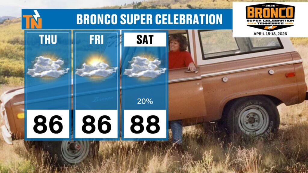
Bronco Super Celebration Forecast
The Broncos Super Celebration in Townsend, Tennessee will experience mostly favorable weather conditions.
- Daytime hours through Saturday: Warm and largely dry.
- Tonight: A slight chance for isolated showers or storms.
- Saturday night into Sunday: Better chances for rain as the second disturbance moves in.
Overall, the event should enjoy pleasant weather with only limited interruptions.
Final Thoughts
East Tennessee will continue to enjoy warm, springlike weather for the next couple of days before a pair of disturbances bring beneficial rainfall and a return to more typical temperatures. While severe weather is not expected to be widespread, it’s wise to stay weather-aware this evening and overnight.
Have a fantastic Thursday, and thanks for checking in!