
Good Morning, East Tennessee
Happy Thursday, everybody! Hope you have a great day.
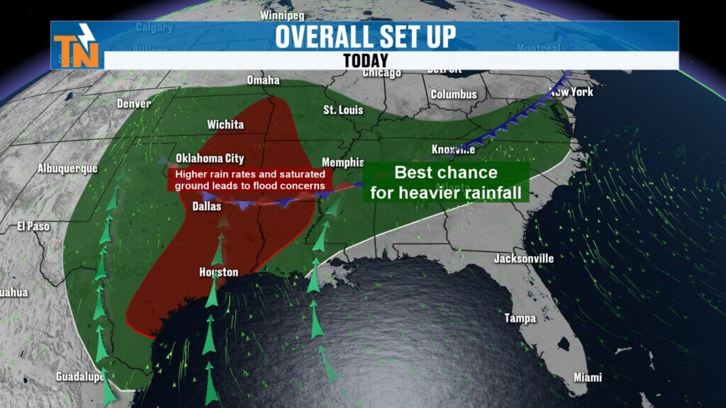
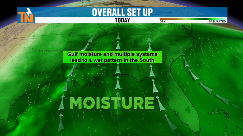
We’ve been talking about it for several days, and now the transition is officially underway — East Tennessee is settling into a much wetter weather pattern. Multiple disturbances moving through the atmosphere, combined with deep Gulf moisture, will keep rounds of showers and thunderstorms in the forecast for days to come.
Why the Weather Pattern Is Turning Wetter
The big-picture setup is driving all of this active weather.
A large trough-and-ridge pattern across the country is putting East Tennessee under a persistent southwesterly flow. That setup acts like a conveyor belt, sending wave after wave of moisture-rich disturbances into the Tennessee Valley.
What that means for us:
- Repeated rounds of showers and thunderstorms
- Moderate to occasionally heavy rainfall
- Muggy conditions sticking around
- Localized flooding concerns where heavier rain repeatedly falls
This isn’t a one-and-done rainmaker — this is a pattern that looks locked in for several days. s we head deeper into May.
Rainfall Already Underway
Rain moved in yesterday and continues this morning.
The heaviest rainfall so far has favored the Cumberland Plateau, where some areas officially picked up around three-tenths of an inch of rain. A few stronger thunderstorms also developed Wednesday, but widespread severe weather is not expected today.
That said, a few stronger storms with gusty winds can’t be ruled out.
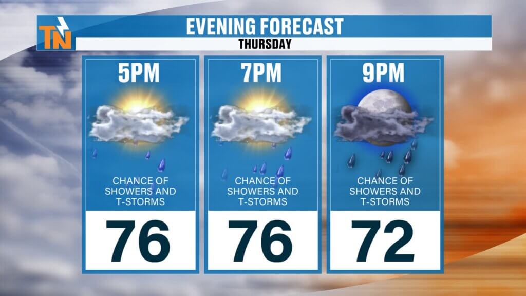
Today’s Forecast: Rainy, Muggy, and Mild
Expect periods of rain through much of the day today.
The rain will be hit-and-miss at times, meaning some communities may see repeated heavy downpours while others only pick up light rainfall. It’s very much a feast-or-famine setup.
Potential impacts:
- Ponding water on roads
- Localized flooding in poor drainage areas
- Reduced visibility during heavier downpours
Some locations may receive over an inch of rainfall today, while others may barely pick up a tenth of an inch.
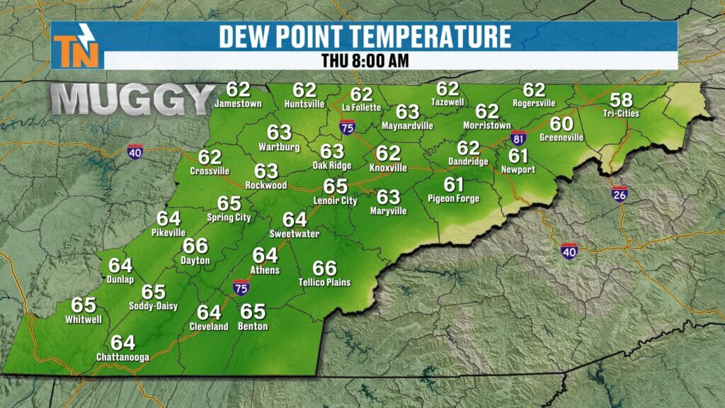
Humidity Is Back in Full Force
You’ll notice the humidity the moment you step outside.
Temperatures this morning are much warmer than yesterday, starting in the upper 60s with dew points also in the 60s. In other words — it’s muggy.
After recently experiencing the dry mountain air out west, the East Tennessee humidity definitely makes its presence known.
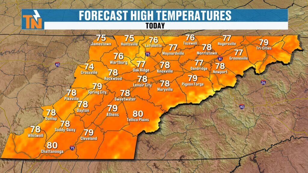
Temperatures Stay Near Average
Thanks to clouds and rain coverage, temperatures won’t climb much today.
Forecast highs:
- Upper 70s to low 80s
- Right around seasonal averages for this time of year
It won’t feel cool, but it also won’t be excessively hot — just warm, humid, and damp.
Savannah Bananas Forecast: Keep the Rain Gear Handy
If you’re heading to see the Savannah Bananas at Covenant Health Park tonight or at Neyland Stadium on Saturday, keep an eye on the radar.
Repeated rounds of rain remain possible, and forecast rain chances stay elevated through the weekend. While it won’t rain nonstop, periods of rain are likely. tures this morning are generally in the 40s and 50s before warming quickly this afternoon.
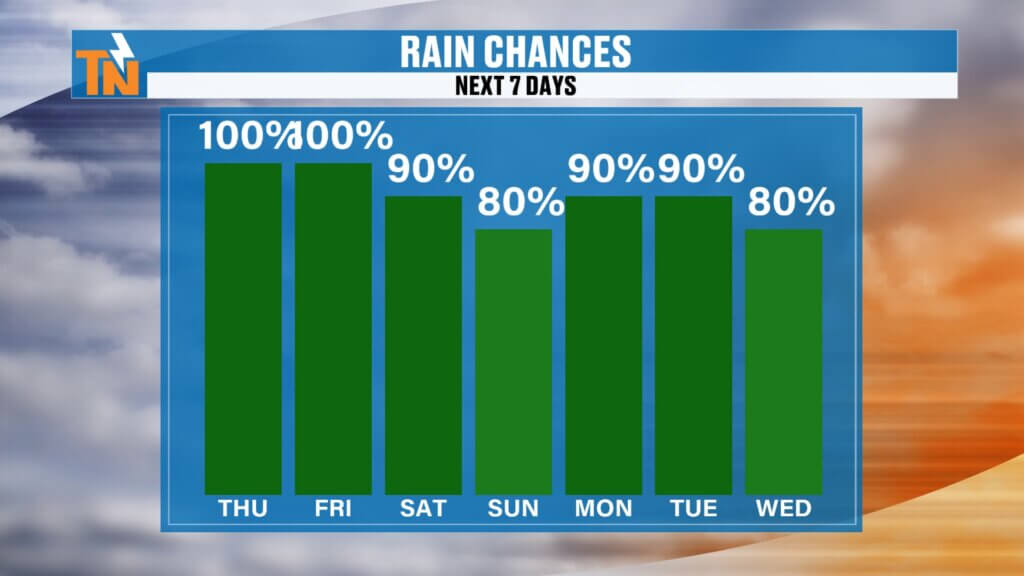
Heavy Rain Adds Up Through the Weekend
The next seven days could bring significant rainfall totals across East Tennessee.
Forecast rainfall totals:
- 1 to 3 inches for many locations
- Locally higher amounts possible where storms repeatedly track over the same areas
Because of this, the Weather Prediction Center has highlighted parts of East Tennessee for excessive rainfall concerns through Friday and Saturday. While widespread flooding isn’t expected, localized flooding issues may develop where heavier rain lingers.
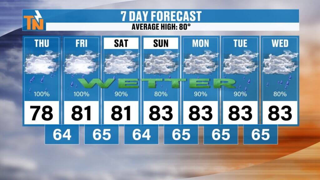
7-Day Forecast: Rain Sticks Around
The overall pattern stays active.
Expect:
- Highs mainly in the upper 70s to low 80s
- Daily rain chances
- Humid conditions
- Repeated waves of showers and storms
No major cold air is moving in — just a prolonged stretch of unsettled summerlike weather.
Bottom line: keep the umbrella nearby and don’t expect perfectly dry days anytime soon. East Tennessee is entering a much wetter stretch of weather.