Good morning and happy Sunday, everyone! Thanks for checking in — we’ve got a major winter storm developing for the mountains of East Tennessee, and this one’s going to bring our first true blast of Arctic air and significant mountain snow. This system marks the start of a very active, cold, winter-like pattern that will stick around for the next several days.
The Setup
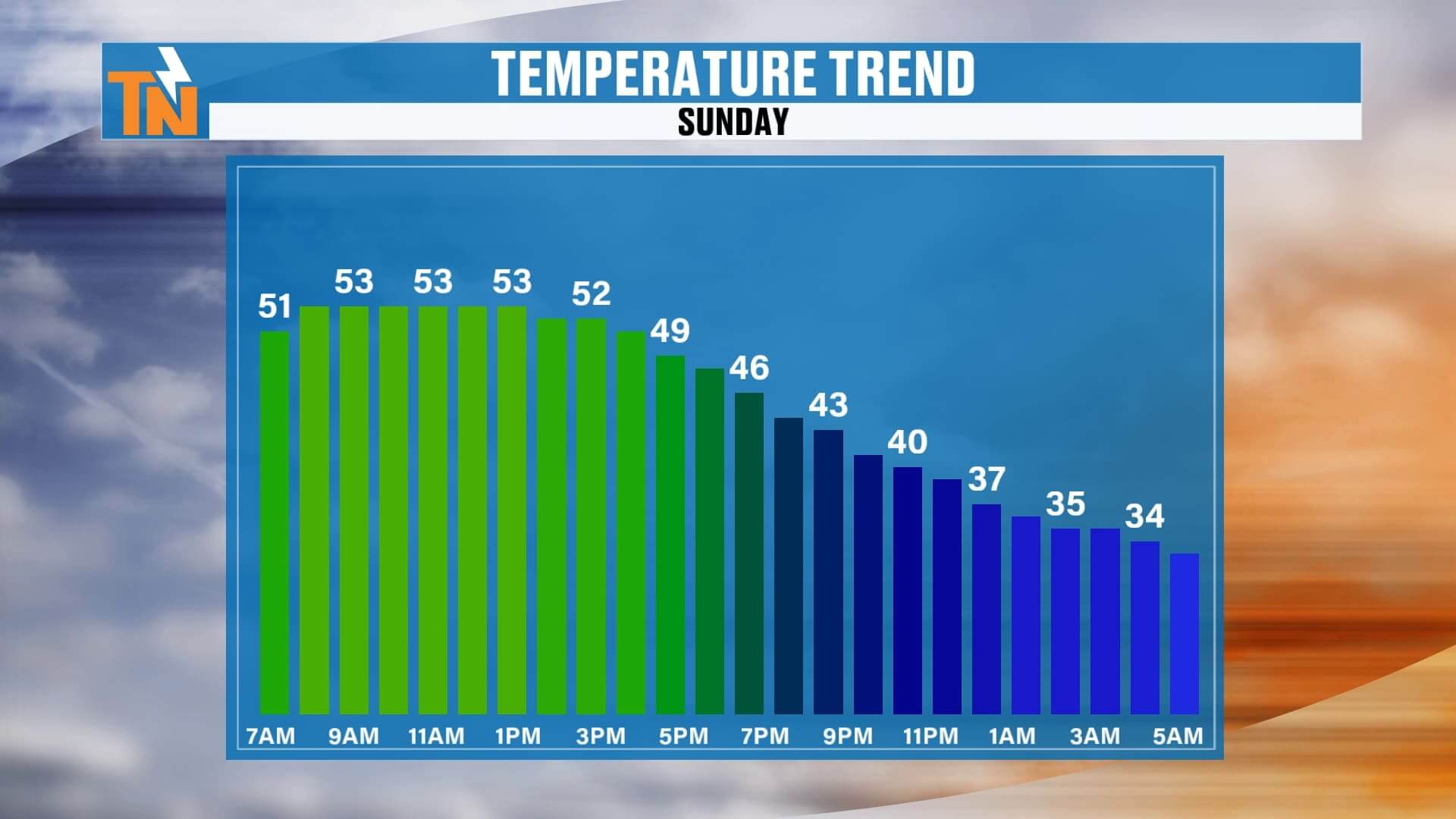
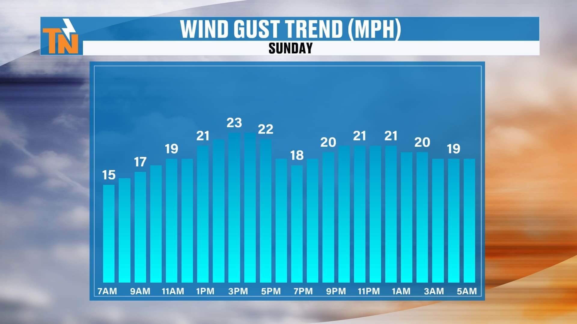
A strong cold front is sliding through today, bringing a quick temperature drop and gusty winds. Today’s highs will top out only in the 50s, much colder than yesterday, and by this evening temperatures will tumble as the Arctic air begins to spill in.
Behind this front, two waves of energy will move through — one overnight tonight and another Monday into Monday night — each reinforcing the cold and adding to snow totals in the higher elevations.
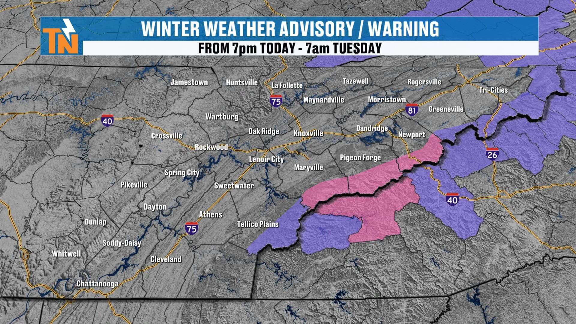
The National Weather Service has issued a Winter Storm Warning for the highest peaks of the Smokies, surrounded by Winter Weather Advisories for nearby mountain counties. More counties could be added as the storm evolves.
Today
Chilly, breezy, and gusty with northwest winds. No major precipitation during the day, but the setup is changing fast. Clouds increase late, and snow begins developing across the highest elevations after sunset.
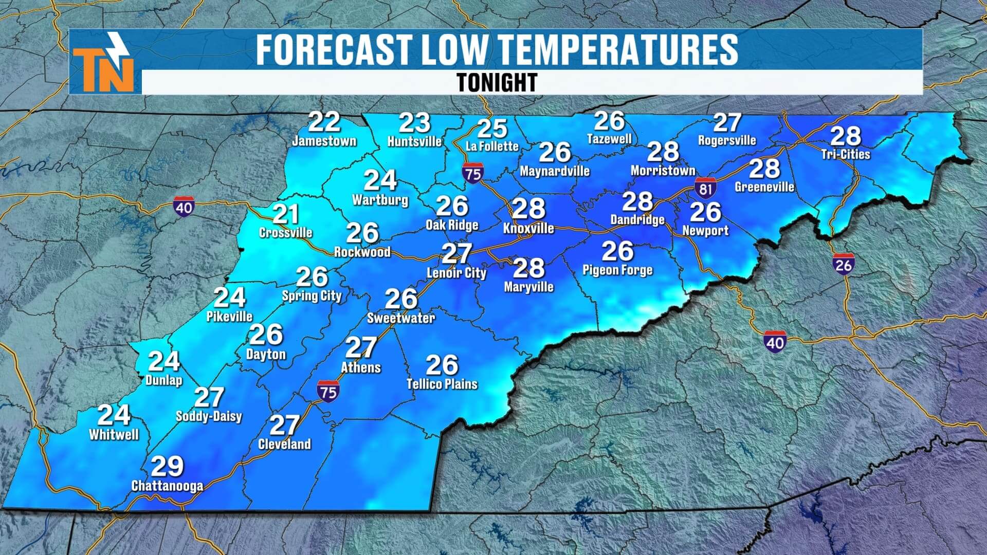
Tonight into Monday Morning
Light snow will begin to fall across the mountains, gradually expanding westward. By sunrise Monday, the Smokies could already have a couple of inches on the ground. The Plateau (especially Fentress, Cumberland, Scott, and Campbell Counties) may see a dusting to 1 inch, mainly on grassy areas and rooftops.
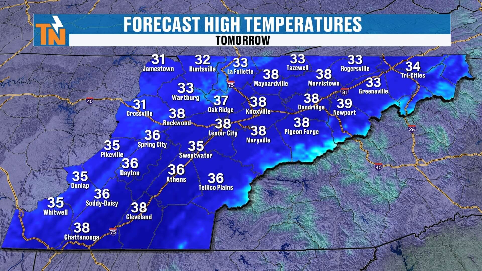
Monday & Monday Night — The Main Event
The second wave of energy swings in Monday afternoon, generating instability snow showers that will impact the Plateau and potentially the Valley. The mountains will get absolutely hammered with strong northwest flow — classic orographic lift, squeezing out moisture and producing heavy snow through Monday night.
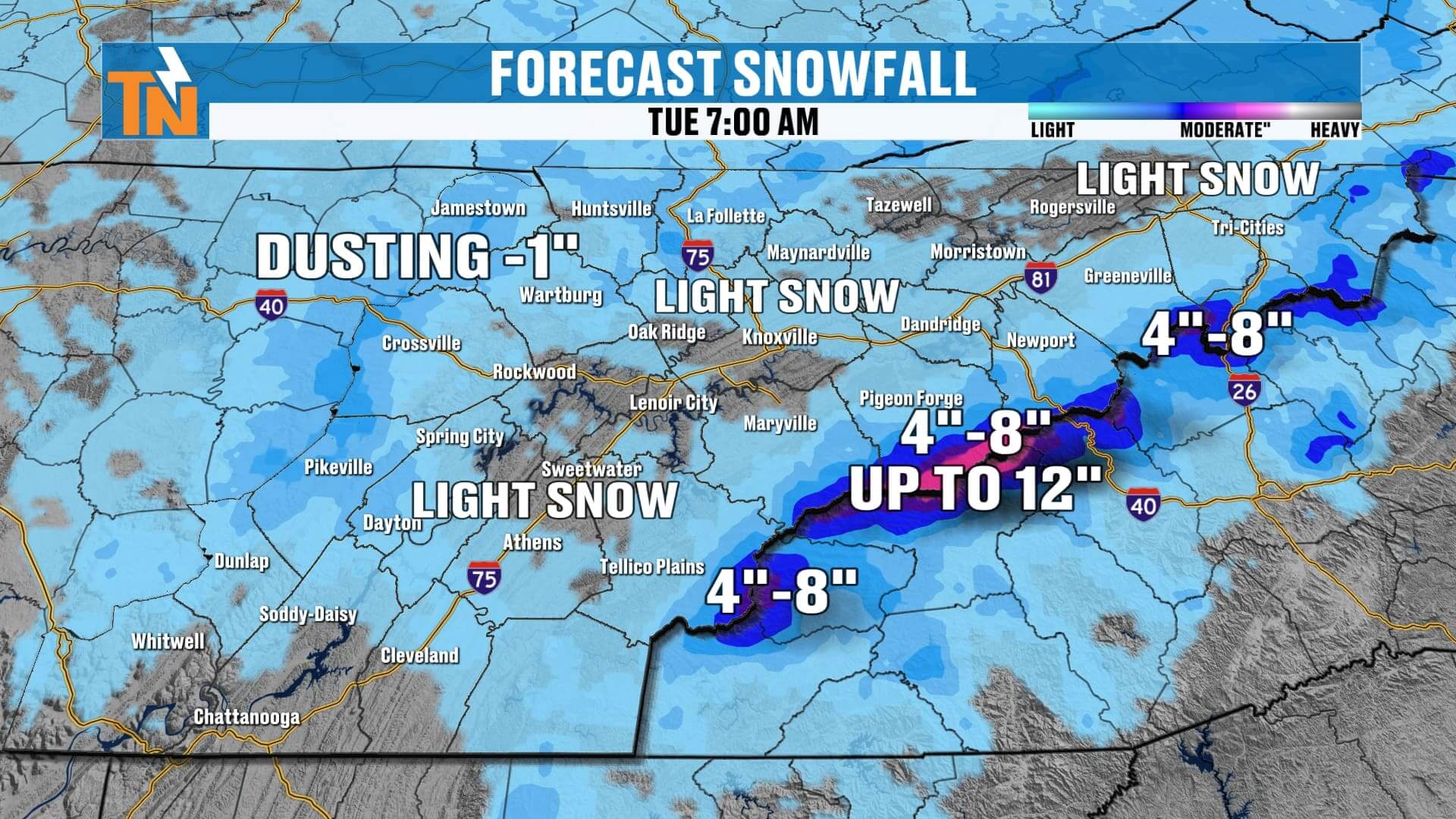
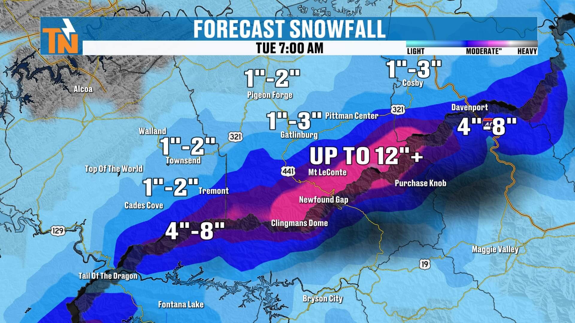
Expected Snow Totals (Sunday Night–Tuesday Morning)
-
Smoky Mountains (highest peaks): 4–8 inches common, up to 10–12+ inches on Mount LeConte, Clingmans Dome, and Newfound Gap
-
Foothills (Towns, Cosby, Cades Cove, Pigeon Forge, Gatlinburg): 1–3 inches
-
Cumberland Plateau (Crossville, Jamestown, Fentress, Scott): Dusting to 1 inch
-
Knoxville & Valley locations: Flurries possible, no accumulation
Road Conditions
Road temperatures tonight will dip into the 20s on the Plateau, allowing for a light coating on secondary roads early Monday morning. In the Valley, roads should remain above freezing, so any flakes will melt on contact. By Monday afternoon, road temps rise back into the 30s and 40s — meaning limited travel impacts outside the mountains.
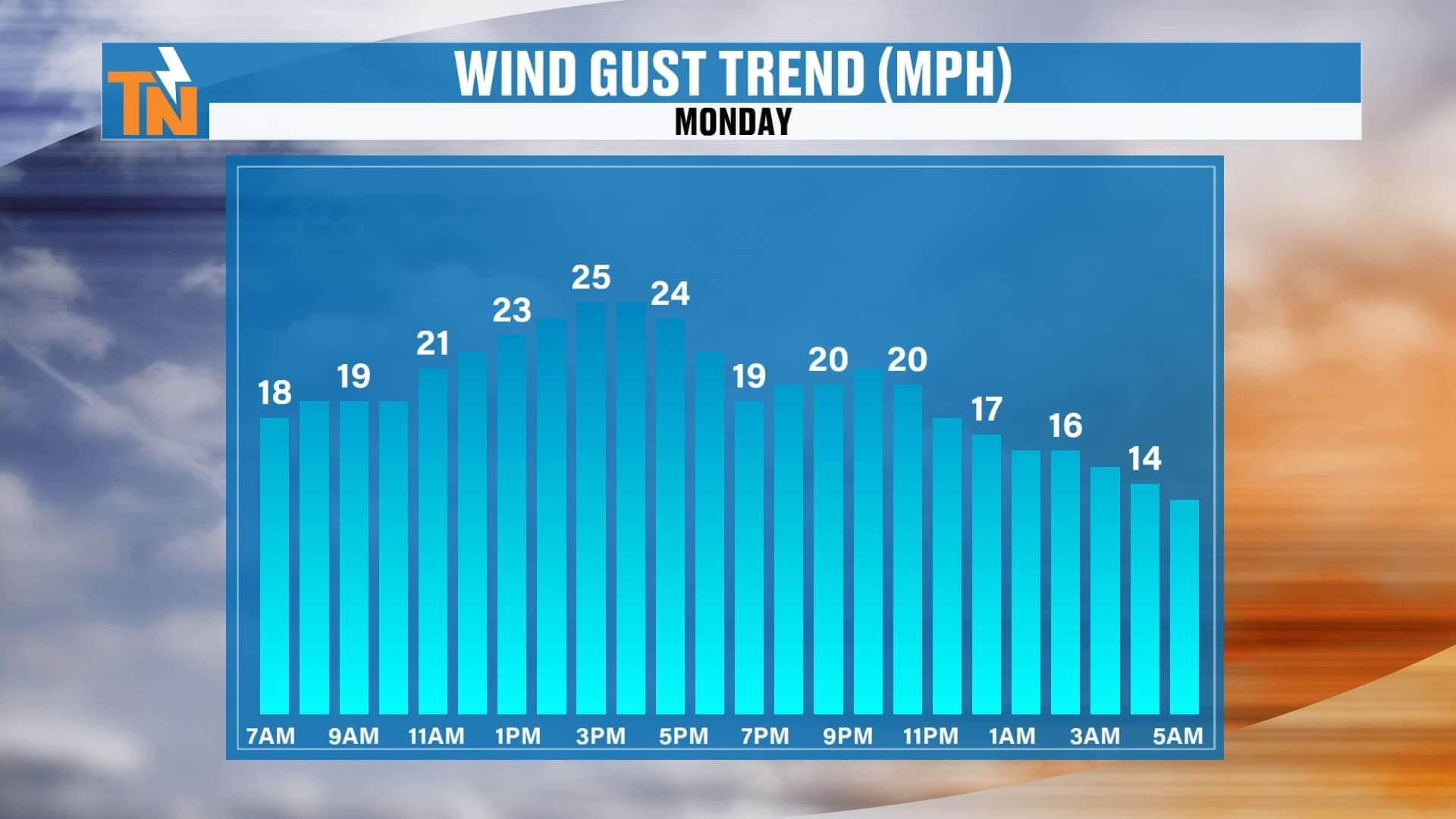
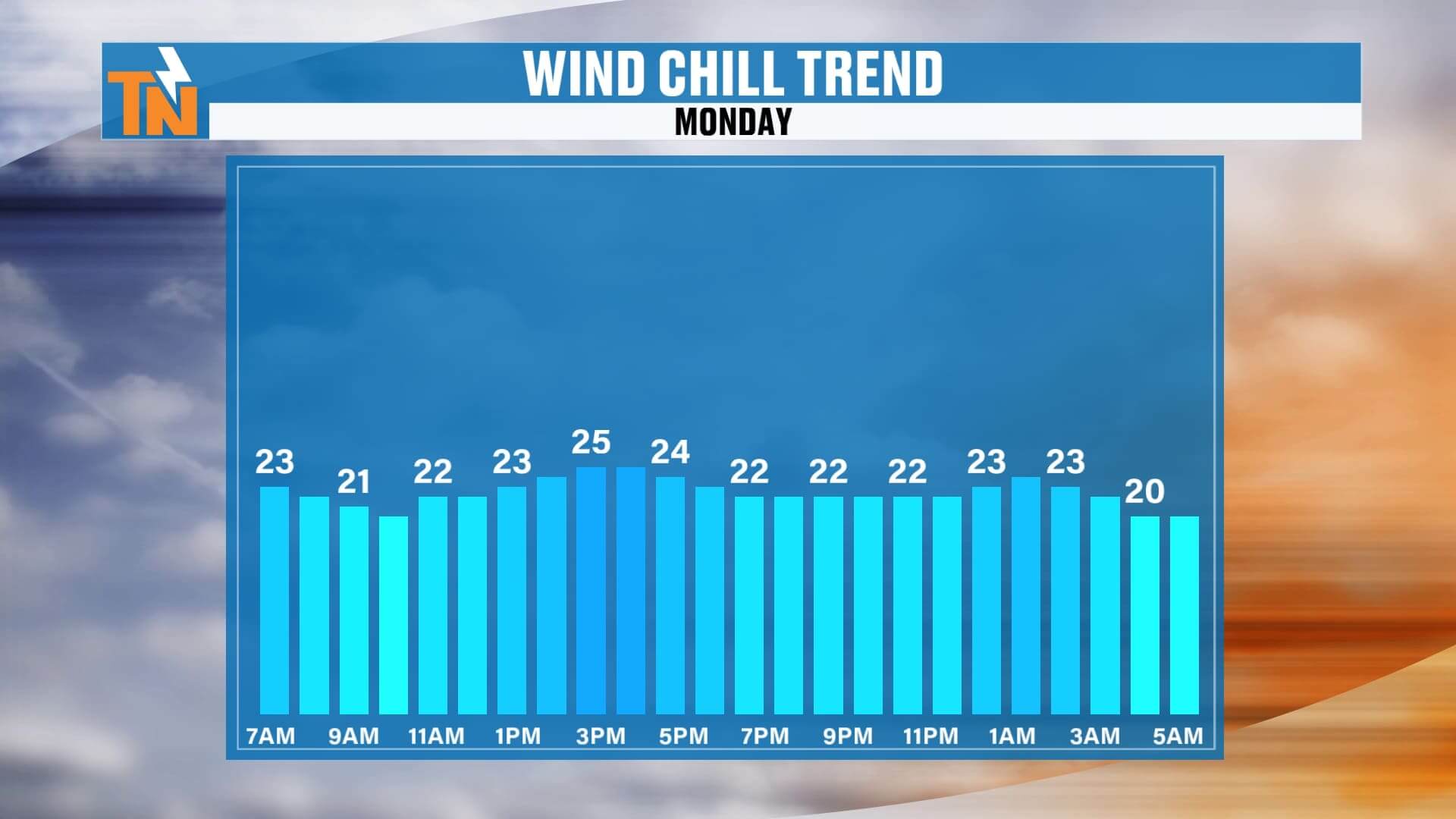
Wind & Cold
Today will be breezy, but Monday will feel brutal. Morning lows in the 20s, afternoon highs struggling to reach the upper 30s, and wind chill values in the 20s all day long. This will be the coldest air we’ve felt so far this season.
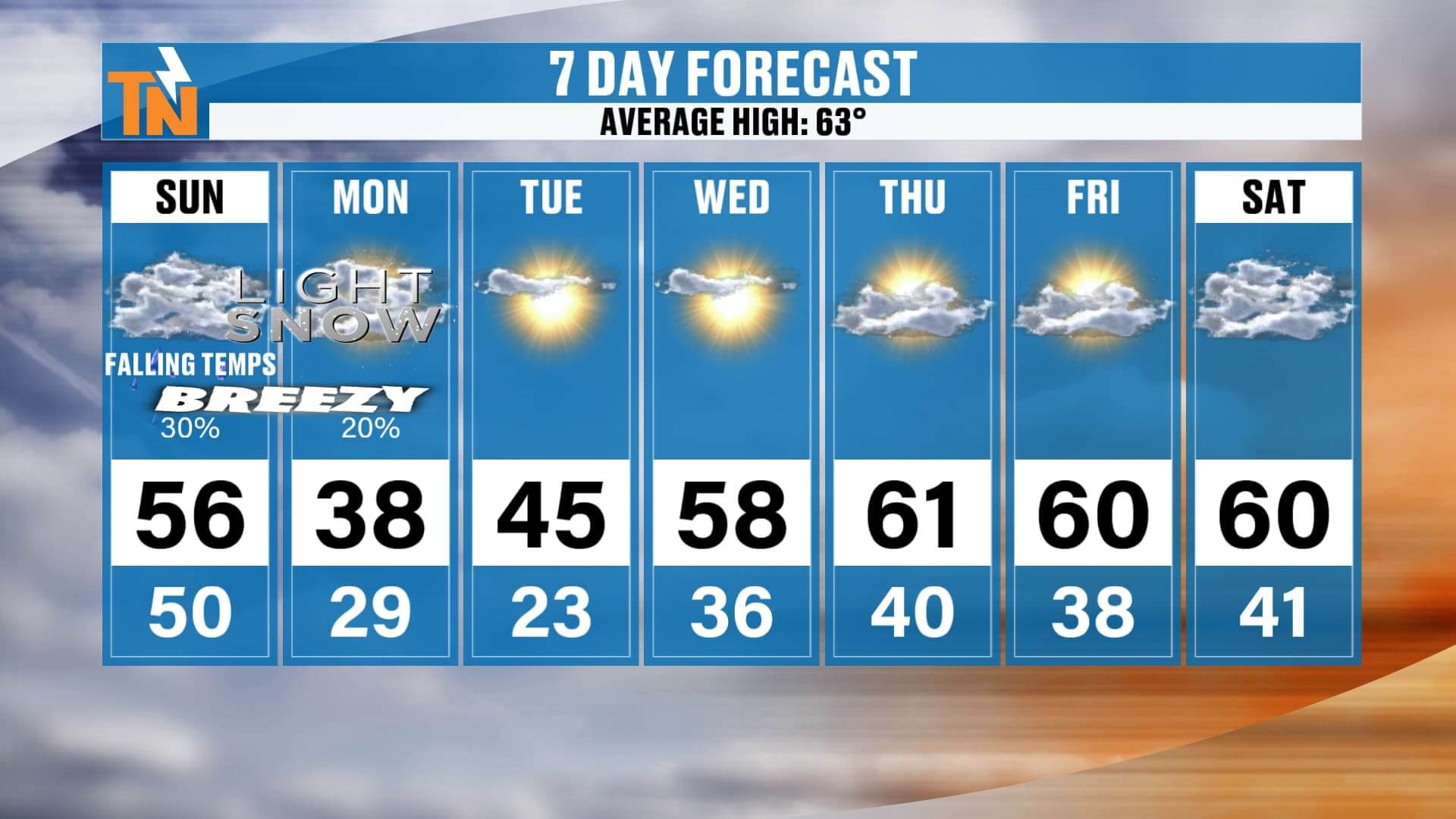
7-Day Outlook
-
Sunday: 50s early, falling late. Breezy and cold.
-
Monday: 38°, snow showers Plateau & mountains, flurries valley. Bitter wind chills.
-
Tuesday: 45°, clearing but still cold morning lows in the 20s.
-
Wednesday–Friday: Warming trend — 50s to near 70° by next weekend.
This is our first true taste of winter — snow for the Smokies, flurries for the Valley, and an Arctic blast for everyone.
Stay tuned for updates throughout the day as the storm unfolds. Track radar, snowfall, and temperature trends anytime with the East Tennessee Weather app, and for quick video updates, check out Witcher’s One Minute Weather — free in your app store.
Bundle up — winter is here in East Tennessee!