
Good morning, everybody, and thanks for checking in! I’m Meteorologist Mike Witcher.
After several days of unsettled weather, we’re finally settling into a more typical July pattern. High pressure is building back into the Southeast while the upper-level low that brought our recent rounds of rain has shifted into Texas.
That doesn’t mean we’re completely dry, though.
A southeast flow around the high will still bring enough moisture into East Tennessee for a few afternoon showers and thunderstorms—especially south of Interstate 40.
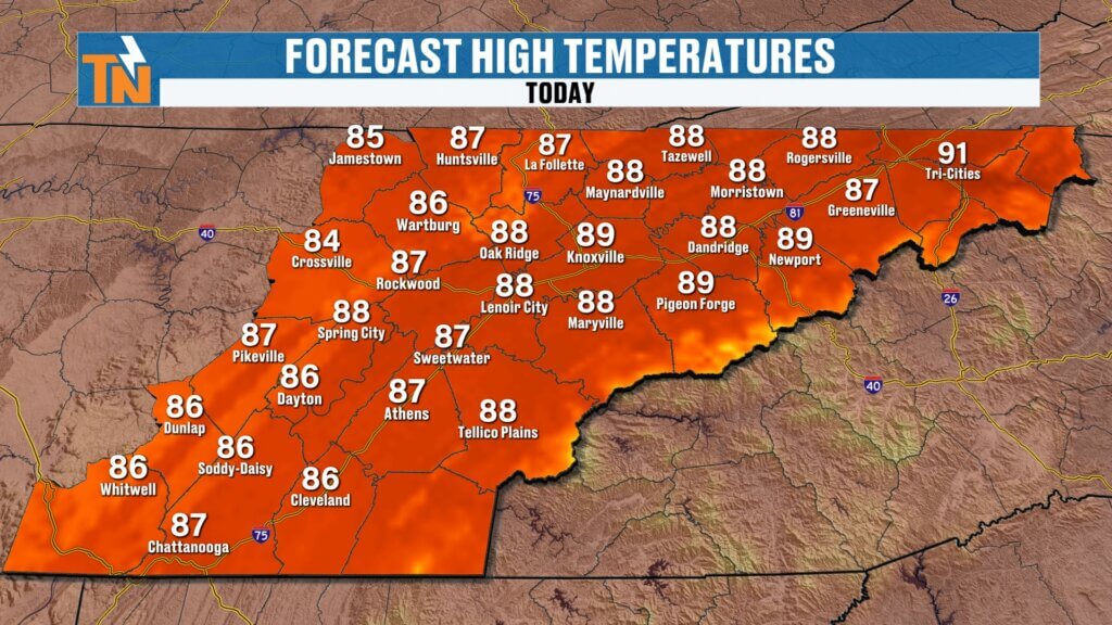
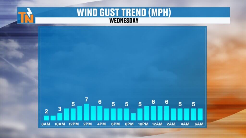
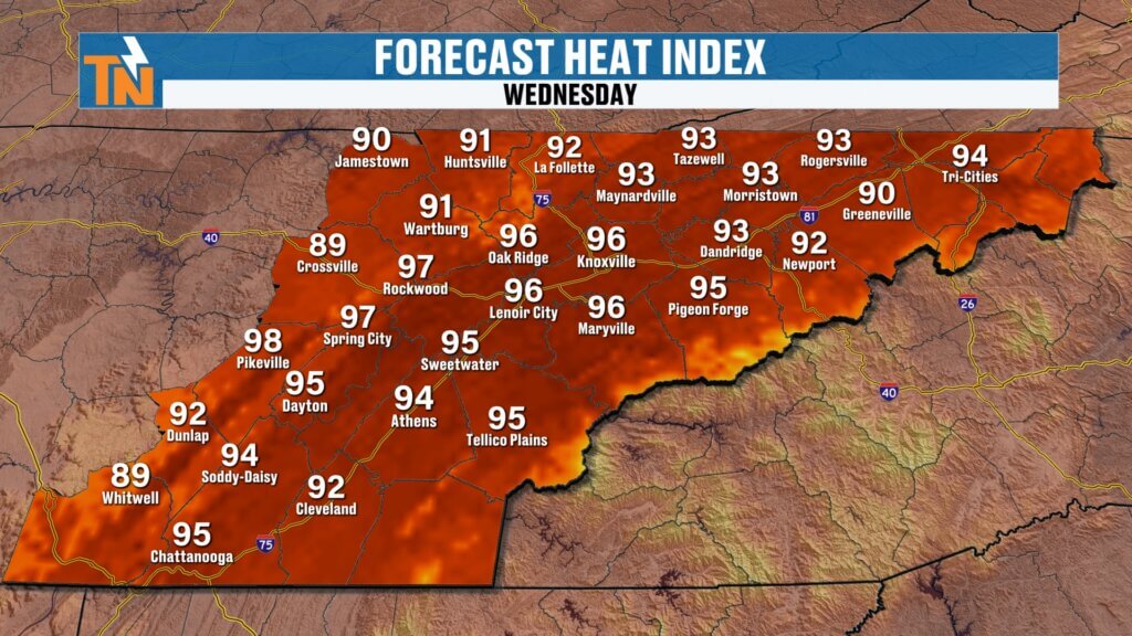
Today’s Forecast
Most of the day will feature a mix of sunshine and clouds, with the best chance for showers developing during the afternoon.
The focus will be:
- Monroe County
- Polk County
- Southern Valley communities
- Areas south of Interstate 40
Those storms will drift from the southeast toward the northwest, which is opposite of the typical west-to-east storm motion we’re used to seeing. That’s all thanks to the current weather pattern with high pressure to our northeast and the upper-level low well to our southwest.
North of Interstate 40—including much of Upper East Tennessee—expect more sunshine and fewer opportunities for rain.
Any storms that do develop will gradually fade after sunset.
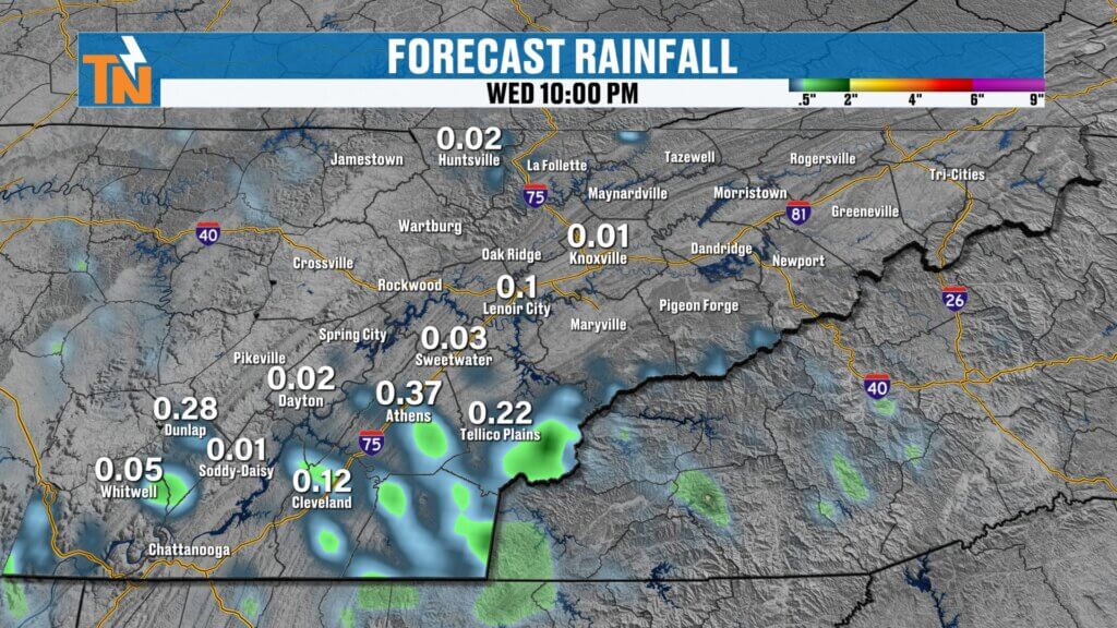
Heavy Rain Still Possible
Even though storm coverage will be limited today, the atmosphere remains loaded with moisture.
That means any thunderstorm that forms will be capable of producing:
- Tropical-like downpours
- Frequent lightning
- Brief gusty winds
- Localized heavy rainfall
Most communities will stay dry, but those that do get a storm could see a quick inch of rain in a short amount of time.
Temperatures
Morning temperatures begin in the 60s and lower 70s under humid conditions.
Winds stay light throughout the day.
Afternoon highs climb into the middle and upper 80s, making today feel much more seasonable for mid-July.
Locations south of Interstate 40 will stay a bit cooler thanks to additional cloud cover and scattered storms, while northern sections of the Valley and Upper East Tennessee warm into the upper 80s and lower 90s.
Heat index values climb back into the middle 90s this afternoon.
Heat Returns
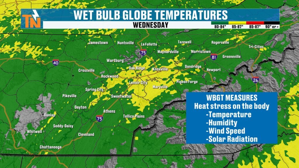
With humidity remaining elevated, the Wet Bulb Globe Temperature begins creeping back into the yellow category.
While today’s heat isn’t extreme, anyone working outside should still remember to:
- Stay hydrated
- Take regular breaks
- Spend time in the shade when possible
As humidity continues increasing later this week, those heat stress values will continue rising.
Weekend Rain Chances Increase
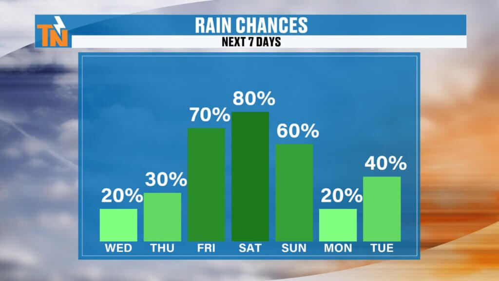
Beginning Friday, our weather pattern becomes more active once again.
A trough approaching from the northwest will increase the coverage of afternoon showers and thunderstorms Friday through the weekend.
These won’t be all-day washouts.
Instead, expect the typical summertime pattern of scattered afternoon and evening storms that develop with daytime heating.
The atmosphere will remain rich in moisture, so any storm that forms will be capable of producing heavy tropical-like rainfall.
Flooding Concerns Return
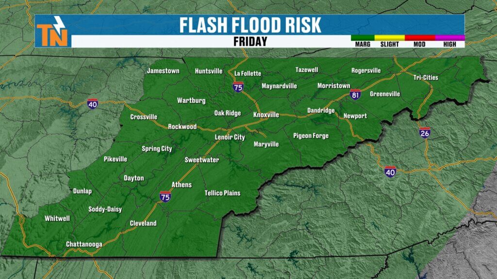
Because of the high moisture content, the Weather Prediction Center has already highlighted parts of East Tennessee for excessive rainfall.
Current outlook:
- Friday: Level 1 flood risk
- Saturday: Level 1 flood risk
- Sunday: Flood risk may decrease slightly, but scattered storms remain likely
Remember, forecast rainfall maps show the potential for heavy rain—not a guarantee that your neighborhood will receive those exact totals.
The important takeaway is simply that some communities could receive locally heavy rainfall this weekend.
Regional Forecast
Central Valley (Knoxville Area)
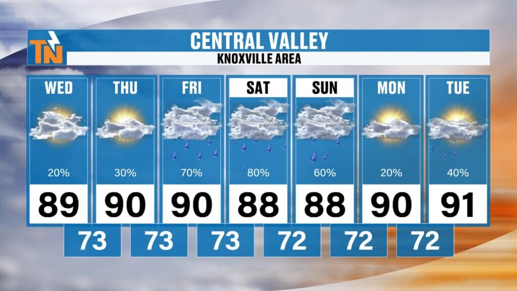
- Highs: Upper 80s to lower 90s
- Increasing afternoon storm chances Friday through Sunday
- Warm, humid nights in the 70s
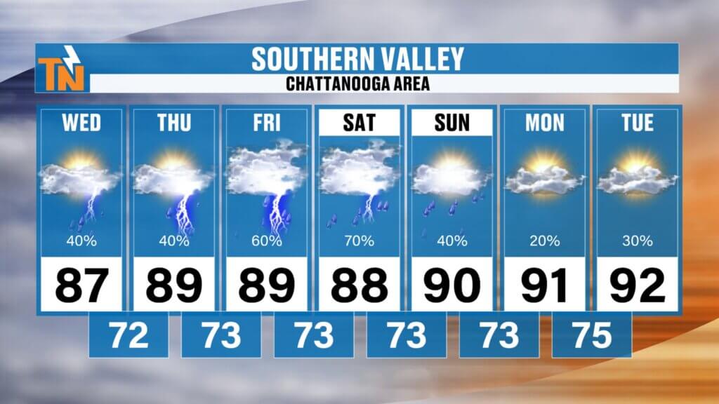
Southern Valley (Chattanooga Area)
- Slightly cooler today due to increased cloud cover and higher rain chances
- Upper 80s through the weekend
- More scattered storms expected than areas farther north
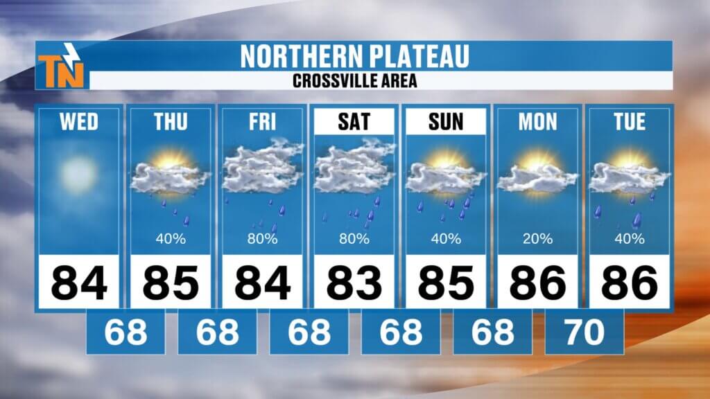
Cumberland Plateau
- Highs in the middle 80s
- Mostly dry today
- Better rain chances arrive Thursday through Sunday
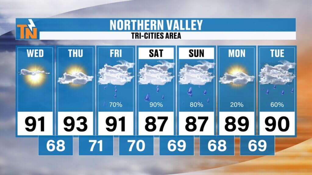
Upper East Tennessee
- Warmest area today and Thursday
- Lower 90s possible
- Lower rain chances through Thursday
- Storm coverage increases heading into the weekend
The Bottom Line
Today’s forecast features:
- More sunshine than the past several days
- Isolated afternoon storms mainly south of Interstate 40
- Highs in the upper 80s
- Heat index in the mid-90s
- Storm motion from southeast to northwest
Looking ahead, expect increasing humidity and more widespread afternoon showers and thunderstorms Friday through the weekend.
No need to cancel outdoor plans—but you’ll definitely want to keep an eye on the radar and be ready to adjust if storms develop nearby.
Have a great Wednesday, and don’t forget to check out my One Minute with Witcher forecast on social media, YouTube, and the free East Tennessee Weather App for a quick forecast update anytime during the day.