
Good morning, East Tennessee!
Happy Friday, and thanks for checking in with your local forecast. I’m meteorologist Mike Witcher with your eastTNweather update. We’re heading into the weekend with a beautiful stretch of weather, all thanks to a strong ridge of high pressure setting up across the region.
Before we dive into today and the weekend forecast, let’s look back at where we’ve been.
Weather Headlines
-
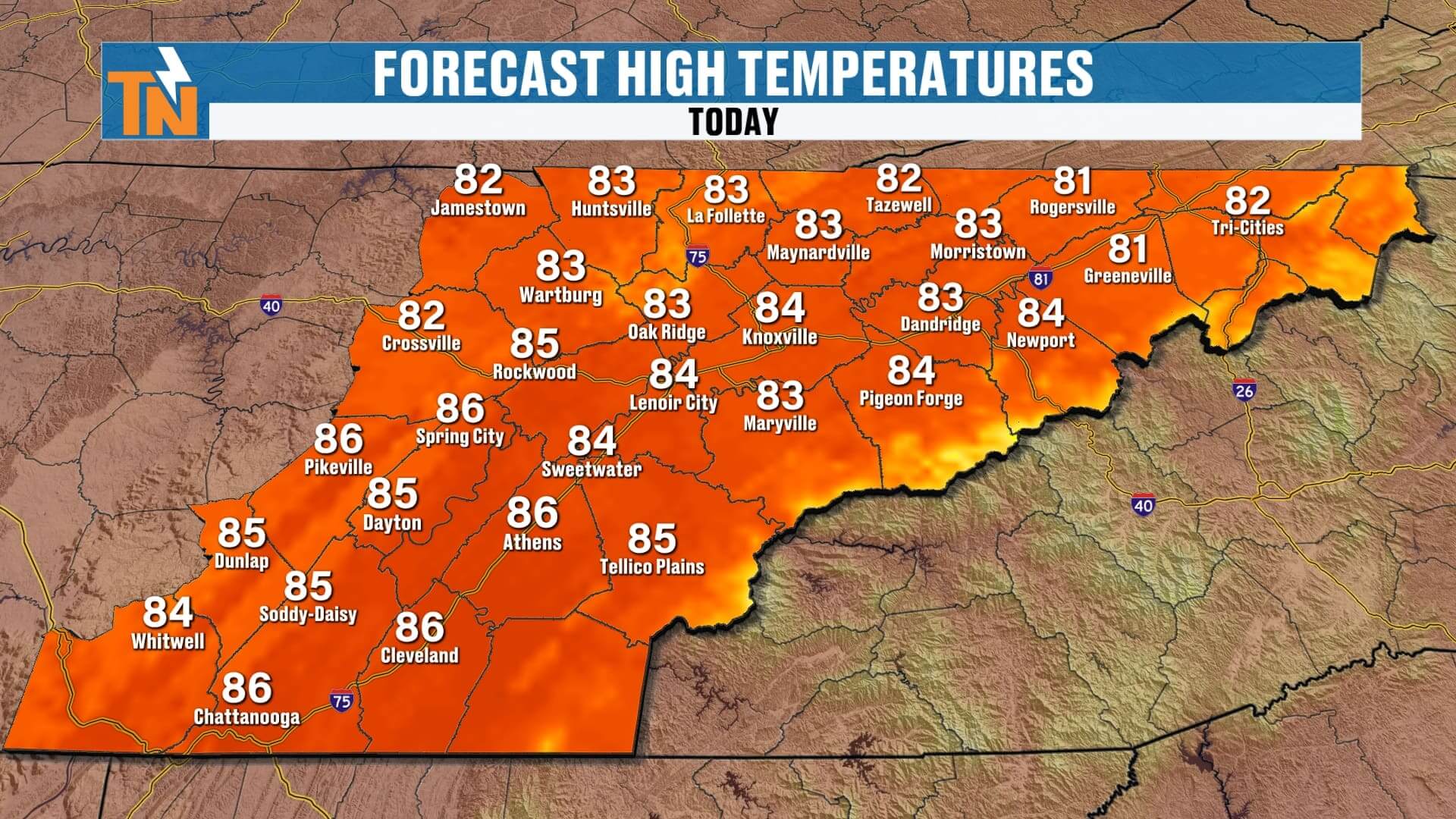
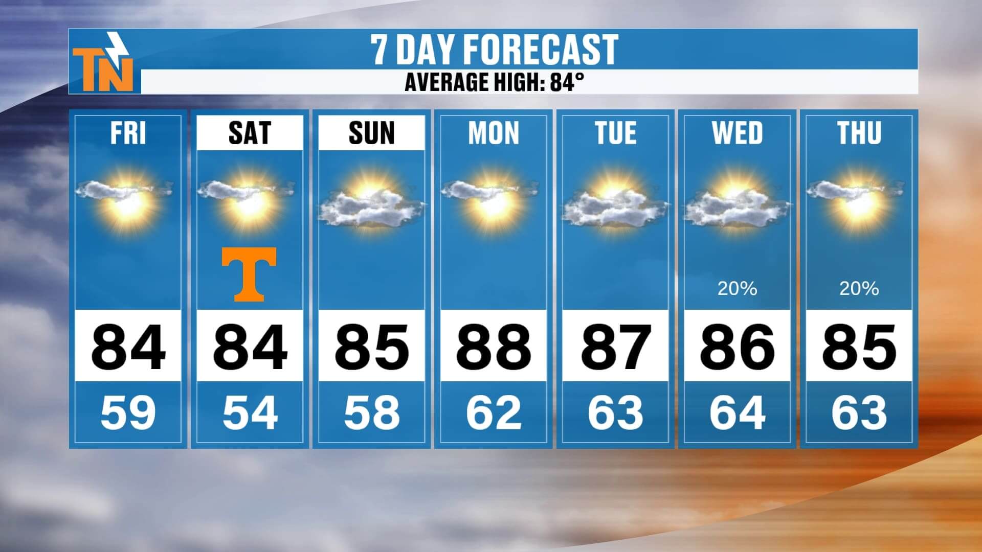
️ Friday: Sunny, comfortable, highs in the 80s
-
Saturday UT Football: Hot and sunny, 84° at kickoff, low 80s by game’s end
-
️ Sunday: More clouds, 10–20% chance for a stray shower
-
️ Next Week: Dry and trending above average, highs mid to upper 80s
-
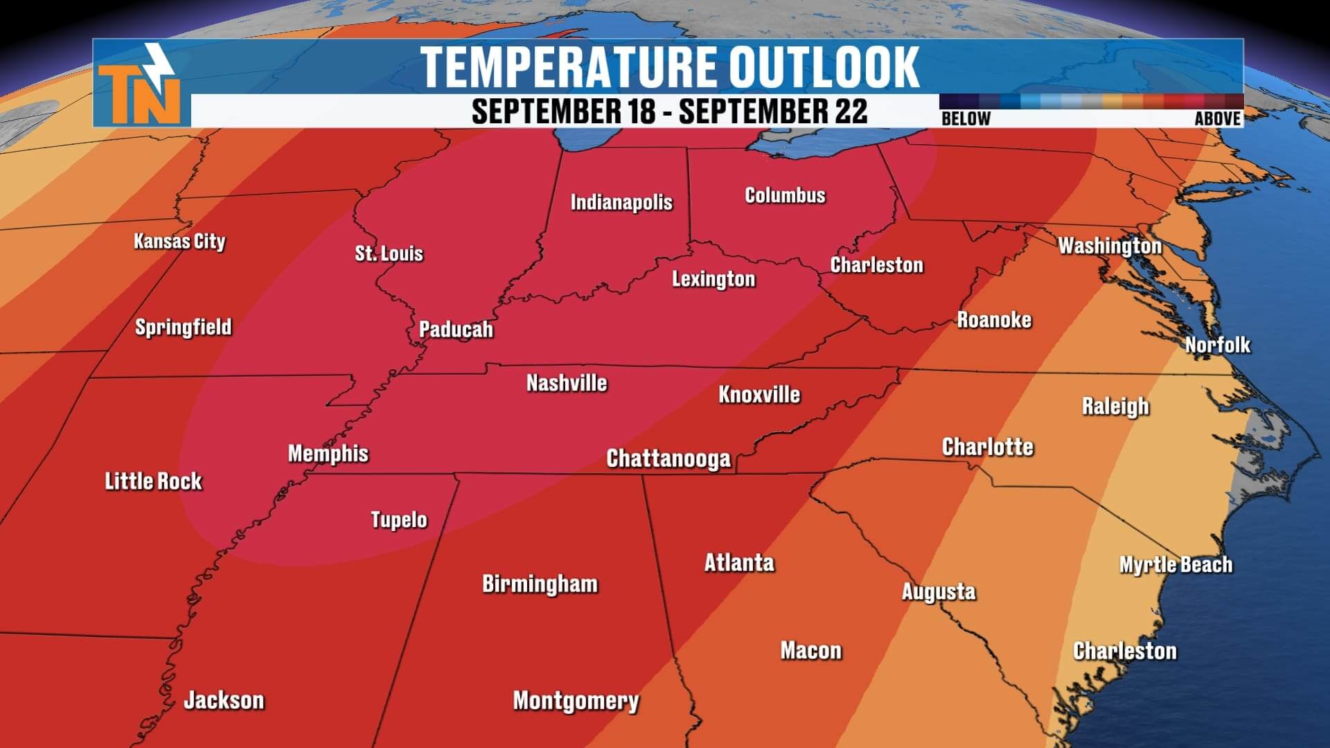
September Outlook: Warmer, drier pattern may persist into early October
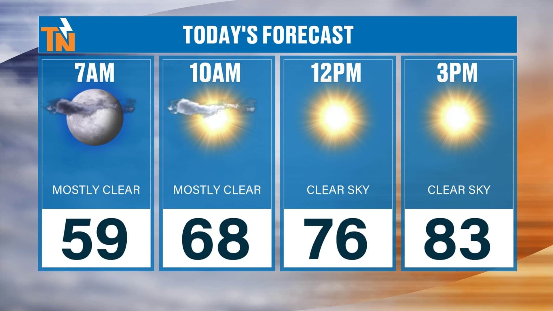
Today’s Forecast: Sunshine Dominates
A ridge of high pressure continues to build in, supported by what meteorologists call an Omega block pattern. This setup features two low-pressure systems on either side of the country, with a strong ridge of high pressure holding steady in between. For East Tennessee, that ridge means dry skies, abundant sunshine, and a warming trend as we head into the weekend.
-
Morning: Starting comfortably in the 50s
-
Lunchtime: Mid-70s, perfect for getting outside
-
Afternoon: Highs in the low to mid-80s across the Valley, with a few pockets of upper 80s in the Southern Valley
-
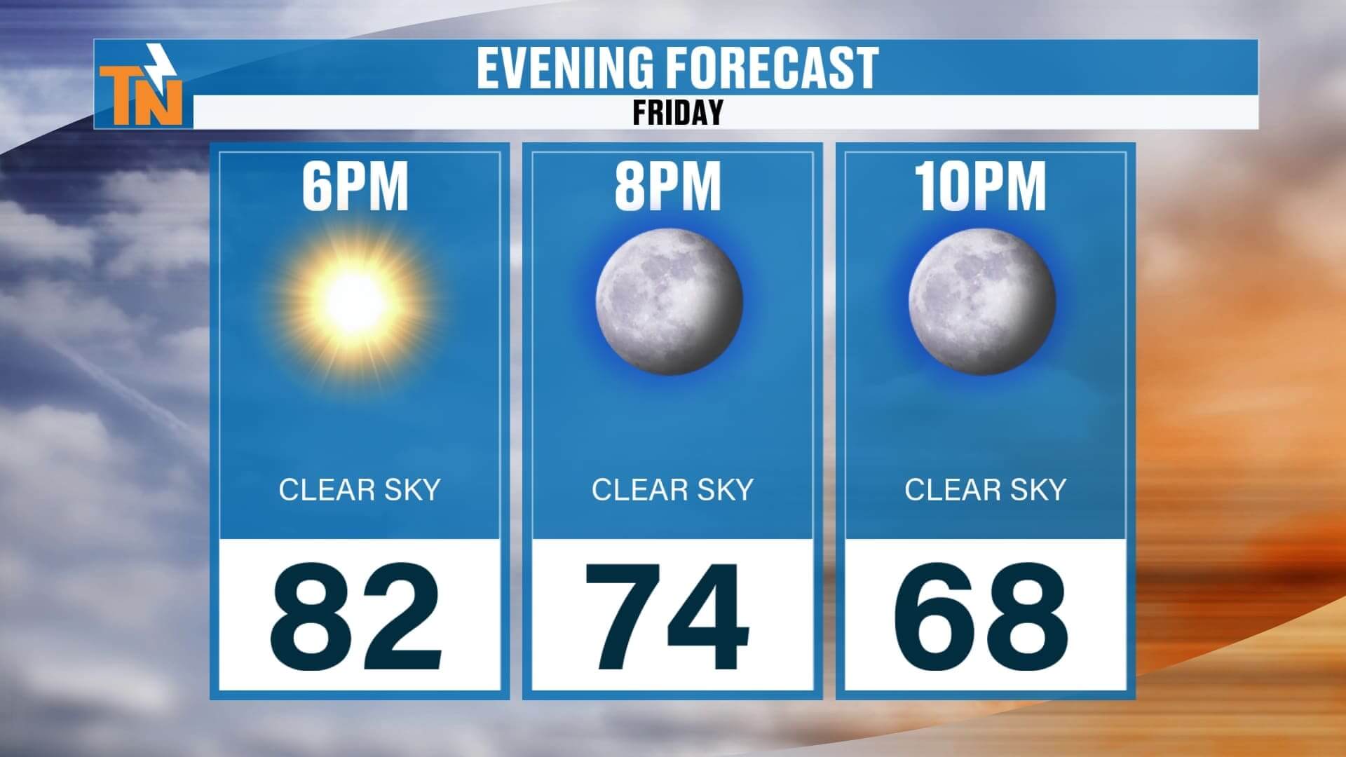
Evening: Gorgeous weather for Friday night football or dinner on the patio
Expect fewer clouds than yesterday and zero chance of rain.
UT Football Saturday: Picture-Perfect Weather
Tennessee fans, you couldn’t ask for a better forecast for Saturday’s home game at Neyland Stadium.
-
Morning Tailgates: Cool start near 59°
-
Noon: Temperatures warming quickly, around 76°
-
Kickoff (3:30 PM): 84°, sunny and toasty
-
Fourth Quarter: Sliding down into the low 80s by sunset
It’ll feel more like a late-summer football game than early fall, so pack sunscreen, sunglasses, and plenty of water. The good news—no rain to worry about during tailgates or the game.
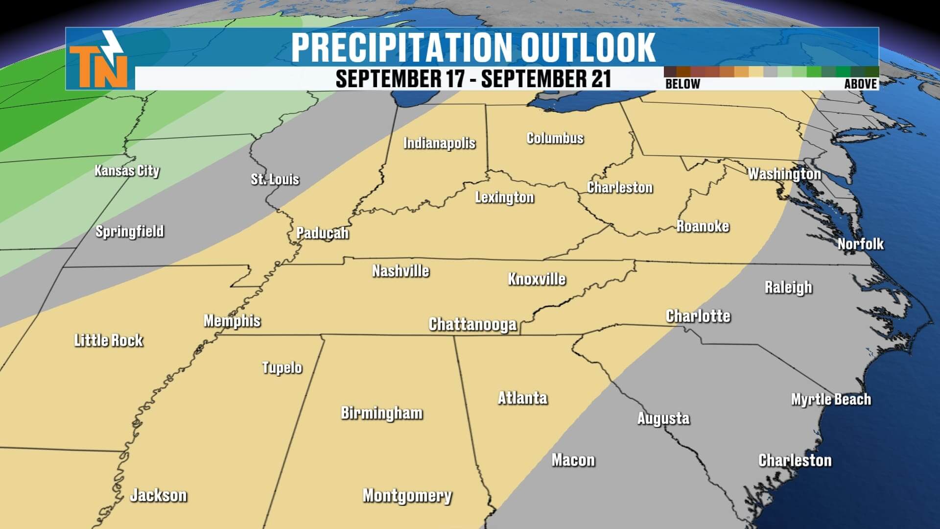
Sunday: A Slight Chance of a Stray Shower
While Saturday looks bone-dry, Sunday brings a subtle change. A piece of upper-level energy dives southward, bringing more clouds and just enough instability to spark an isolated shower.
-
European model: Suggests light rain possible across Middle Tennessee into West Tennessee
-
American model: Shows little to no rainfall for our area
-
In-house futurecast: Indicates clouds increasing Saturday night into Sunday morning
Bottom line: I’ve added a 10–20% chance for a stray shower on Sunday. Most of us will stay dry, with the best rain chances further west.
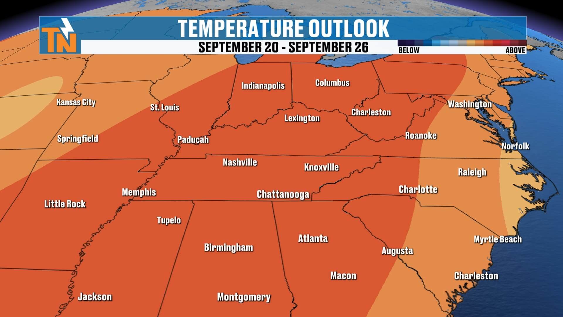
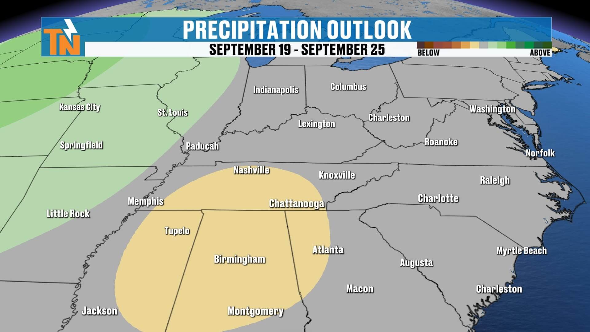
Extended Outlook: Dry & Warmer Than Average
Looking at the big picture into next week:
-
Highs: Mid to upper 80s, trending above average
-
Lows: Staying mild in the 60s
-
Rain chances: A slight uptick Wednesday–Thursday (around 20%), but overall the drier-than-average trend continues
-
Long-range outlook: The Climate Prediction Center keeps us in the warmer and drier category through late September and possibly into October
For those wondering about the tropics—quiet for now, which is great news this time of year.
ABOVE AND BEYOND THE 7 DAY FORECAST
Final Word
East Tennessee, we’re stepping into the weekend with abundant sunshine, warm afternoons, and zero rain concernsfor Friday or Saturday. Neyland Stadium’s home opener will be picture perfect, though toasty, with mid-80s at kickoff. Sunday brings a slight shower chance, but the trend overall is for dry, above-average temperatures through next week and beyond.
Don’t forget—you can always track the latest forecast, check interactive radar, and get push alerts by downloading the eastTNweather app. It’s your one-stop shop for weather across Knoxville, the Smoky Mountains, the Plateau, and the entire East Tennessee region.
Enjoy your Friday, have a fantastic weekend, and I’ll see you back here with more updates!