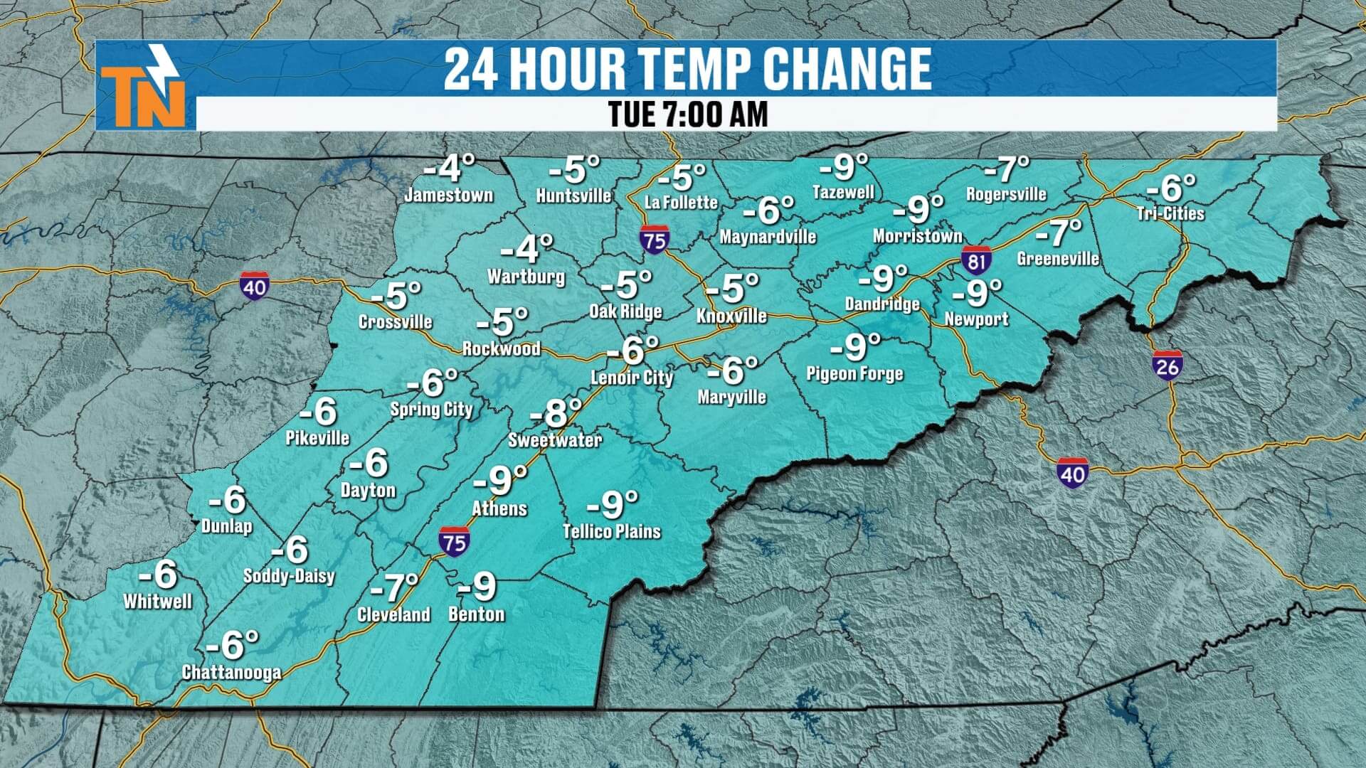
Good morning and happy Tuesday, everyone! It’s another cold, raw winter morning across East Tennessee. Temperatures are running 5 to nearly 10 degrees colder than yesterday, and it feels every bit like it.
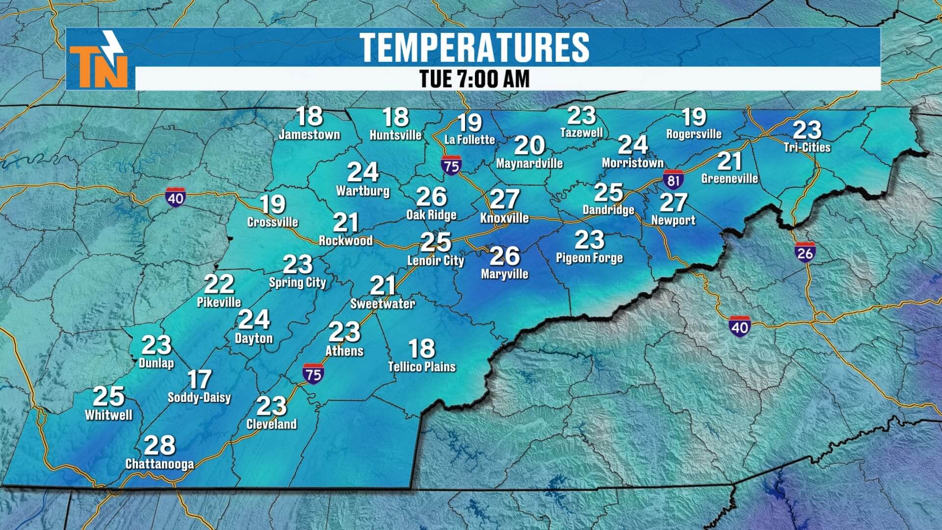
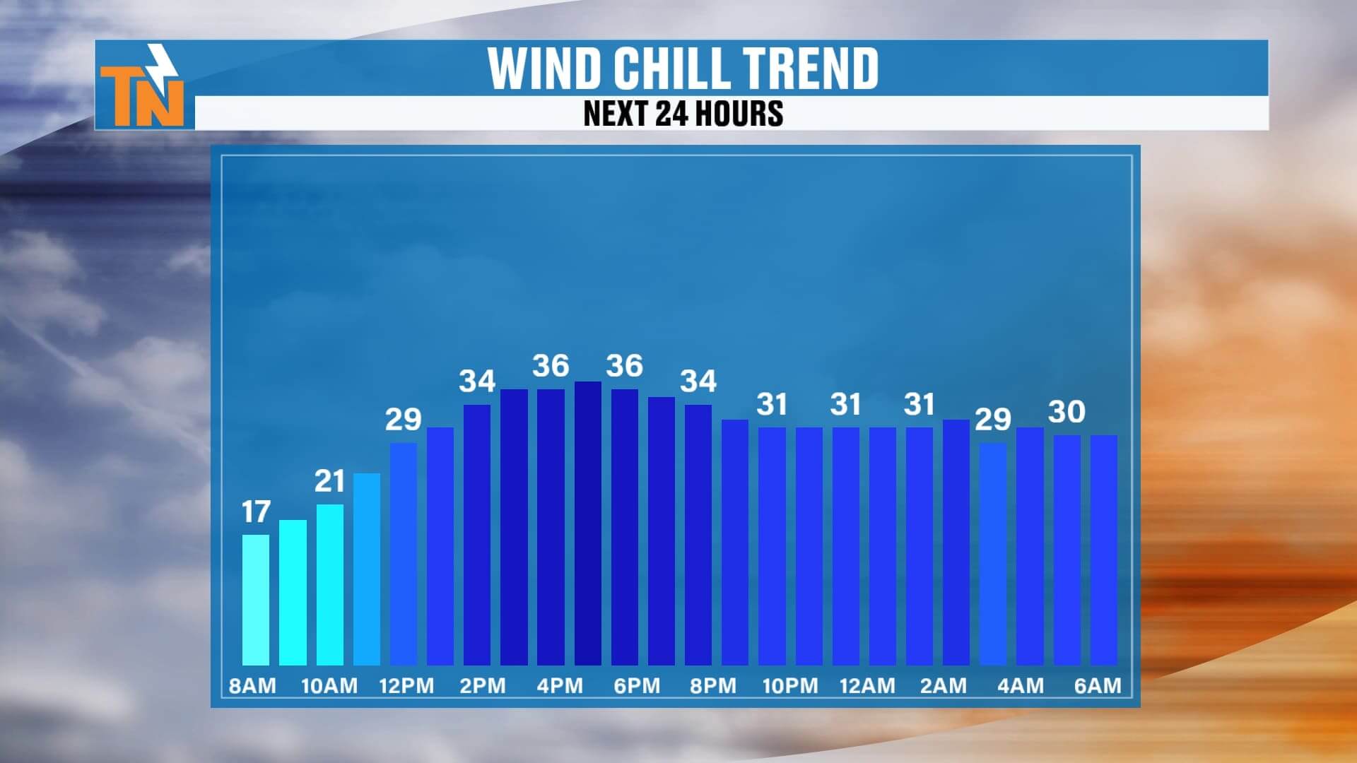
We’re waking up to teens and 20s across the region — 18° in Scott County, 25° in Loudon County, 27° in Chattanooga — and around Knoxville it feels like 16° with single-digit wind chills. The wind is still light but enough to make that morning air bite.
If you still have any snow or ice left on the ground from yesterday, it’ll stick around through sunrise. But as we head toward mid-morning, ground temperatures will warm and melt away the remaining snow and ice by late morning.
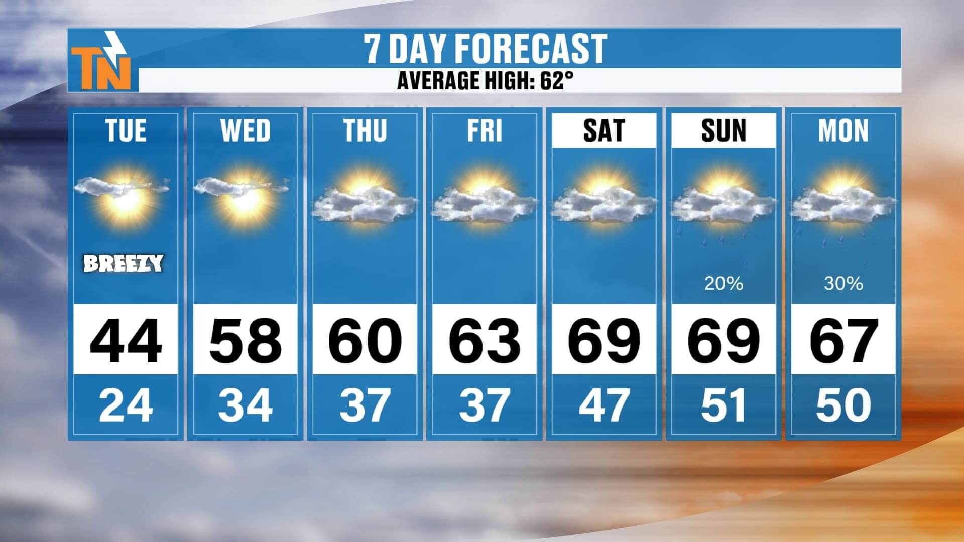
Afternoon Outlook
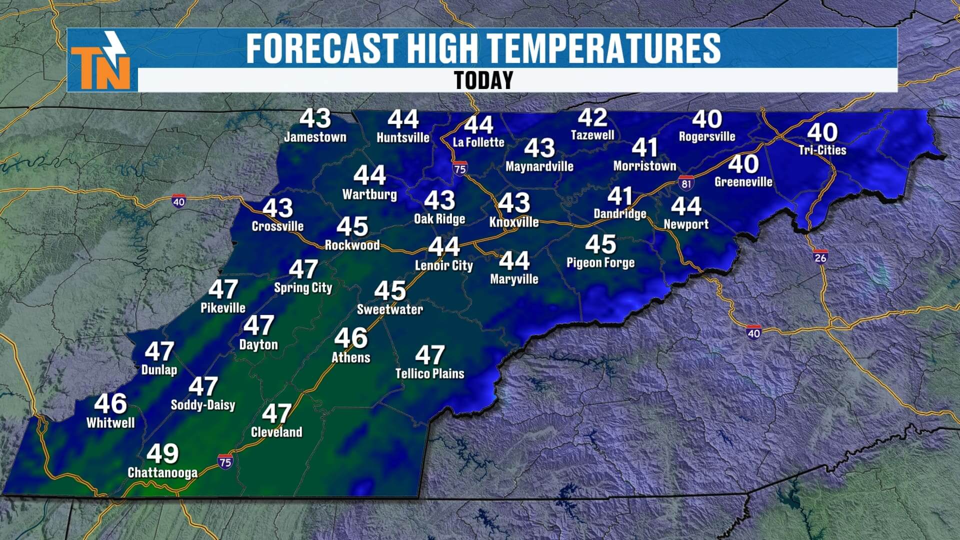
Sunshine returns, but don’t let it fool you — it’s still cold. Highs will reach the low to mid-40s, yet with a lingering breeze, it will feel like the 30s all day long. So bundle up if you’re heading out this afternoon.
Looking Ahead — Big Pattern Flip
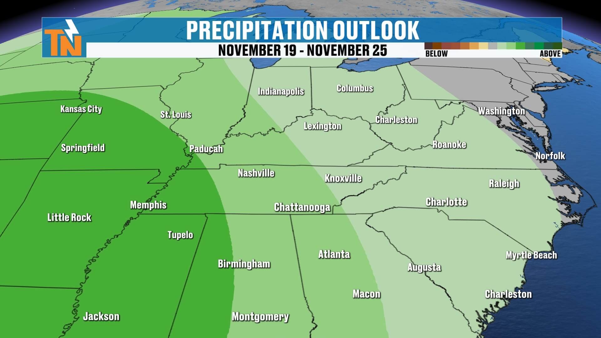
The trough responsible for this Arctic chill is moving out, and a ridge of high pressure will build in from the west, setting the stage for a dry and much warmer stretch through the weekend.
Here’s what that means:
-
Today: 44°, sunny but cold, wind chills in the 30s.
-
Wednesday: 58°, lighter winds, still sunny.
-
Thursday & Friday: 60s, mild and pleasant.
-
Saturday–Monday: Near 70°, staying mostly dry with only a small chance of rain late Sunday into Monday as another front approaches.
Enjoy the sunshine and get ready for that warm-up — it’s going to feel like a completely different season by the weekend.
If you have any snow photos from yesterday’s system, send them my way! You can share them on social media or upload them through the East Tennessee Weather app — and don’t forget to check out Witcher’s One Minute Weather for quick daily updates.
Have a great Tuesday!