
Good morning.
Thanks for checking in and hope you have a great day. We’re settling into a familiar pattern—warm, breezy, and a few pop-up storms, but bigger changes are on the way this weekend.
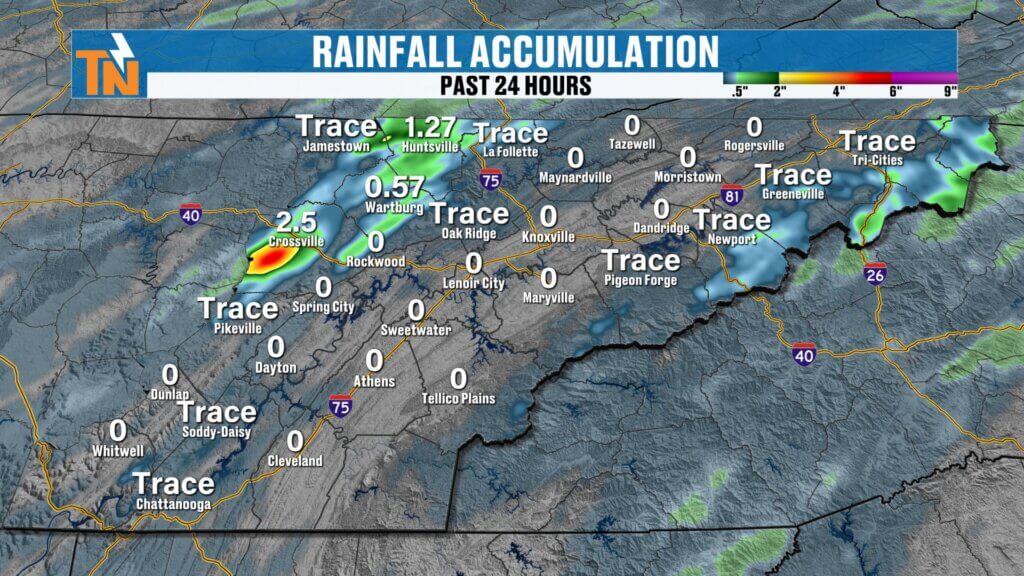
Recent Rain Recap
Some areas picked up much-needed rainfall yesterday.
Not widespread, but beneficial where it fell
Over 2.5 inches of rain in parts of the Cumberland Plateau
Line of storms brought localized heavy downpours
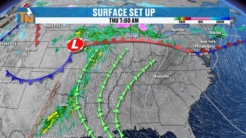
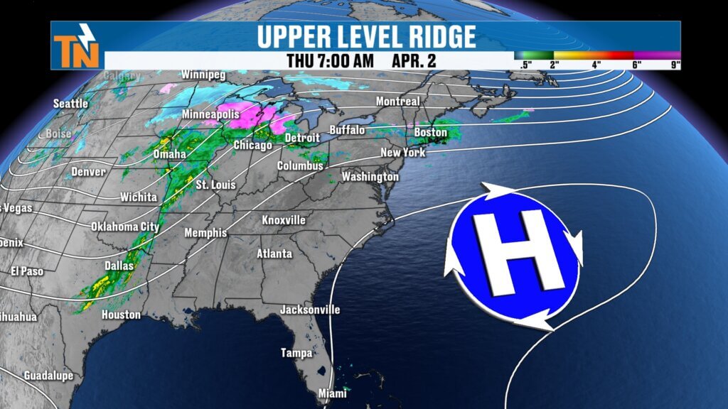
Big Picture: Ridge Keeping Most Rain Away
A ridge of high pressure is still in control.
- Storms this morning remain west of the area
- That ridge forces storms to move north and northeast
- Most of today stays dry across East Tennessee
This setup limits widespread rain—for now.
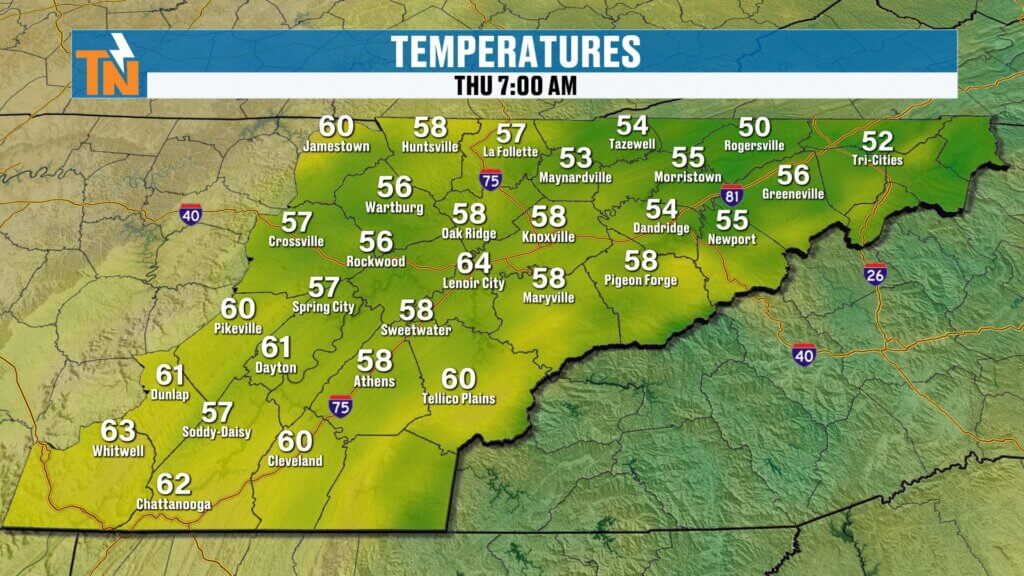
Mild and Muggy Start to the Day
It’s another warm and humid morning.
- Temperatures in the 50s and 60s
- Comfortable but slightly muggy feel
- Little change compared to yesterday
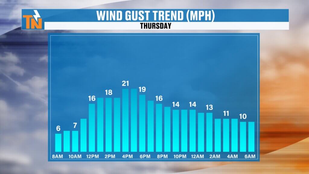
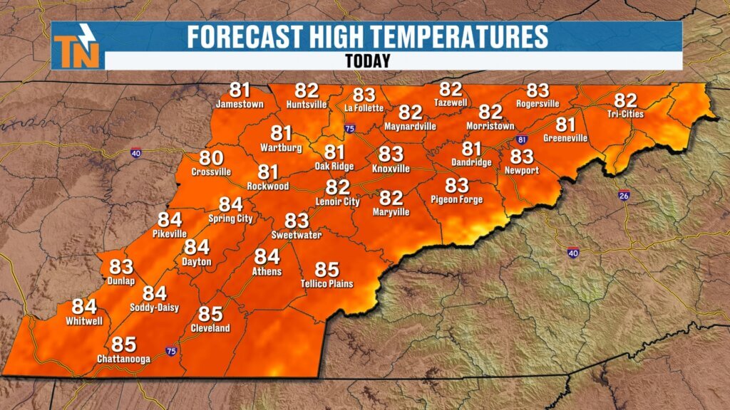
Breezy and Warm This Afternoon
Expect another warm, spring-to-summer-like day.
- Highs climbing into the 80s
- Winds gusting 20 to 25 mph
- Winds easing slightly this evening
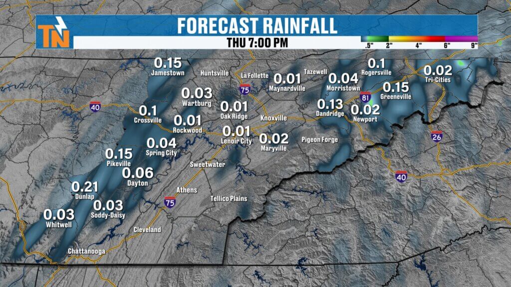
Isolated Afternoon Storms Return
Rain chances are lower today, but not zero.
- Less instability compared to yesterday
- Best chances in the mountains and Cumberland Plateau
- A few storms may drift into Upper East Tennessee and the I-81 corridor
Most areas stay dry, but a quick storm is still possible.
Evening Outlook
Conditions remain warm into the evening.
Otherwise mild and quiet
Around 81 degrees by 7 PM
Watch for a few lingering storms early in the evening
Weekend Cold Front: Timing and Impacts
A stronger system arrives late this weekend.
- Saturday: Warm, breezy, isolated storms possible
- Main line of rain arrives after sunset Saturday
- Heaviest rain overnight into early Sunday
Easter Sunday Forecast
Here’s the early look for Sunday:
- Rain likely during sunrise services
- Showers taper off through the morning
- Increasing sunshine during the afternoon
Not an all-day washout, but a wet start is likely.
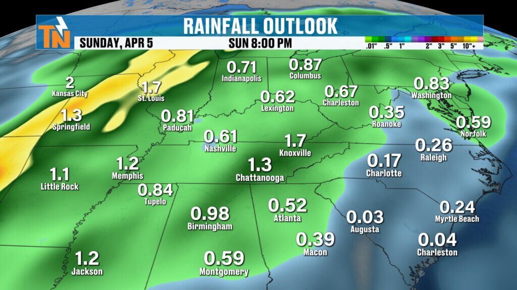
Rainfall Potential
This system brings more widespread rain.
Much-needed moisture for ongoing drought conditions
Around 1 inch of rain expected across the area
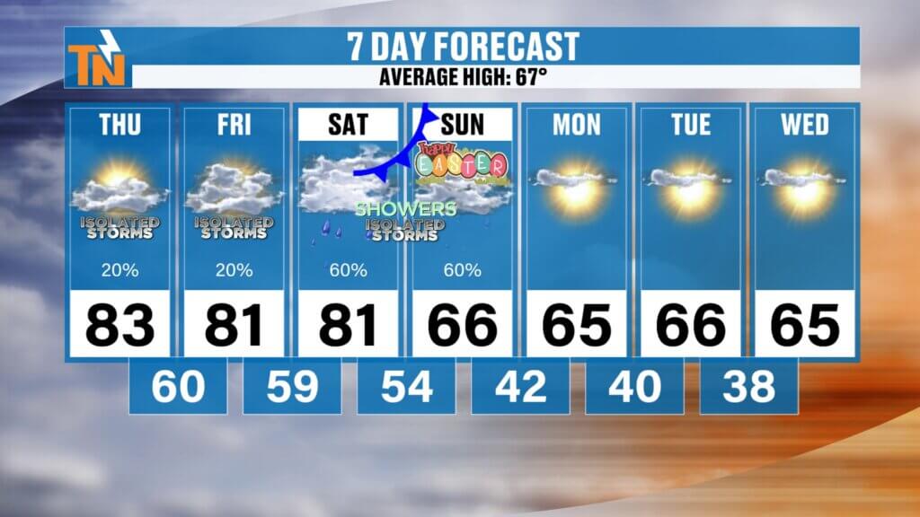
Cooler Air Returns Next Week
Behind the front, temperatures drop back down.
- Sunday: Cooler, near seasonal levels
- Monday through Wednesday: Mid 60s
- Watching for a potential colder push midweek
No major cold snap expected right now, but something to monitor.
Final Thoughts
Today brings another warm and breezy day with a few isolated storms, mainly in the higher terrain. The bigger story is the stronger weekend system, bringing rain Saturday night into Sunday, followed by cooler air next week.
Have a great day, and keep an eye out for those afternoon storms.