
Earth Day Forecast and Midweek Warm-Up
Happy Wednesday and happy Earth Day!A perfect day to get outside and enjoy everything East Tennessee has to offer.
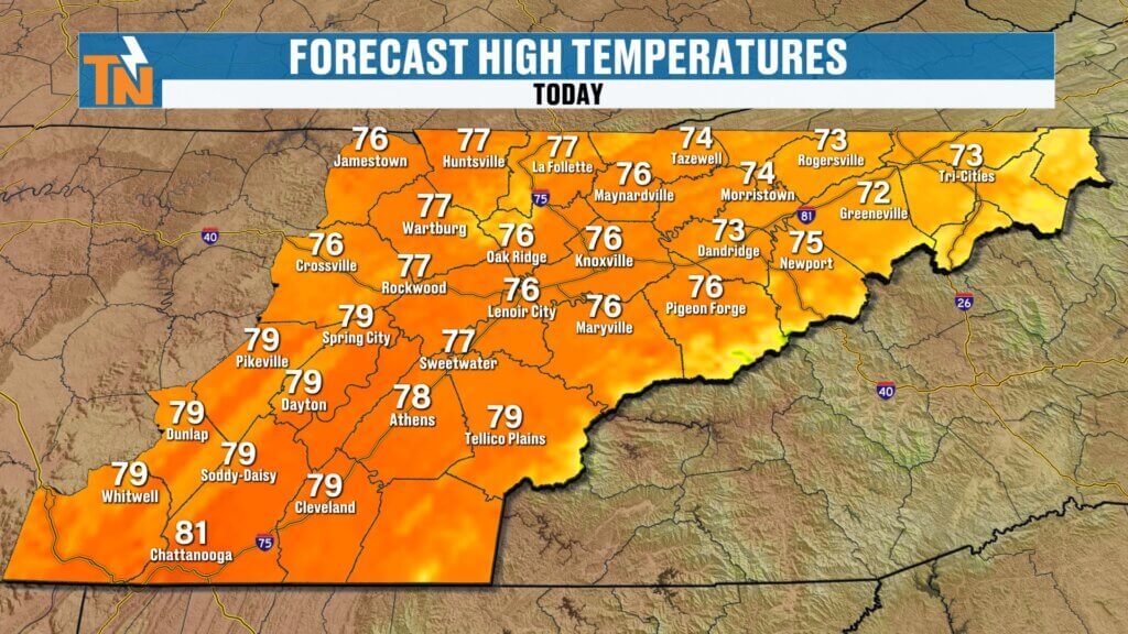

After a solid day yesterday with highs reaching the mid 70s, today turns even warmer. Expect another beautiful spring day with sunshine and a steady warming trend continuing through the end of the work week.
- Morning lows: 40s and 50s
- Afternoon highs: Upper 70s to low 80s
- Winds: Light to breezy at times
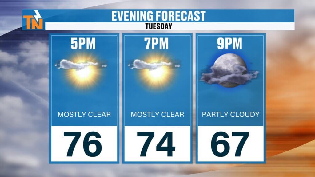
- Evening temps: Around 77° by 7 PM
Pattern Overview: Dry Now, More Active Soon
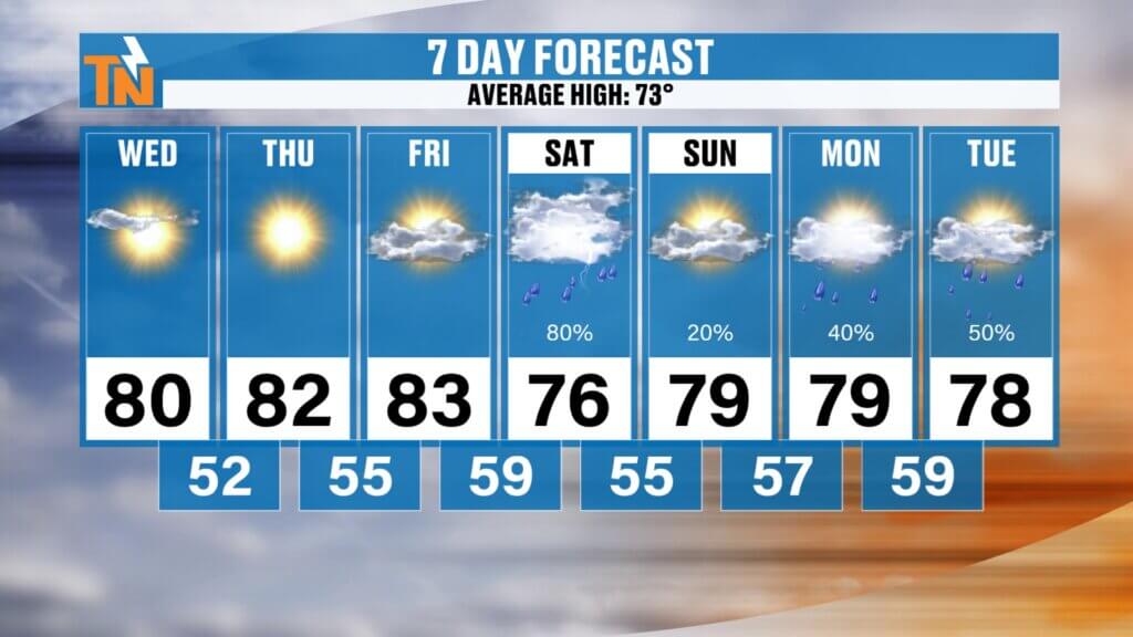
The current setup keeps us warm and mostly dry through Friday. But changes are coming as we head into the weekend and early next week.
Here’s the big picture:
- Dry and warm through Friday
- Cold front arrives Saturday bringing rain chances
- Brief lull Sunday
- Stronger system arrives Monday into Tuesday with more widespread rain and possible storms
This signals a shift toward a more active pattern.
Weekend Forecast: First Round of Rain
The first system arrives late this week.
- Friday: Storms stay mainly west of East Tennessee
- Saturday: Best chance locally for scattered rain showers
- Sunday: Some lingering showers possible, but overall improved conditions
Rainfall through Sunday looks relatively light overall.conditions.
Early Next Week: Stronger System Moves In
A more impactful system arrives early next week.
- Monday: Storms develop to our north and west
- Monday night into Tuesday: System moves into East Tennessee
- Tuesday: Best chance for showers and thunderstorms locally
This second round has the potential to bring stronger storms, so it’s something we’ll be watching closely.
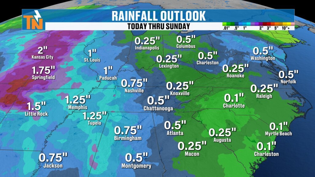
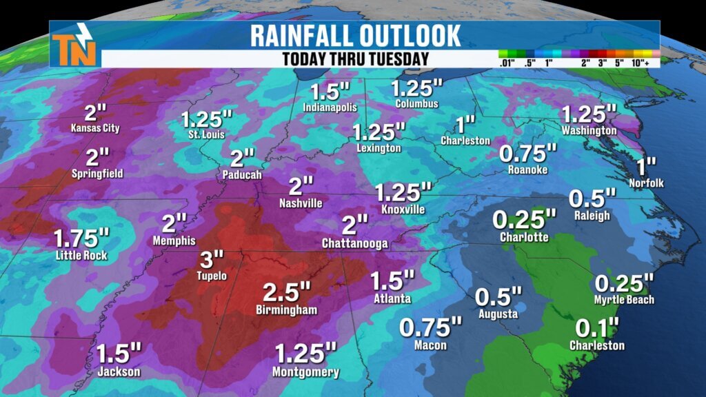
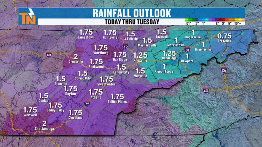
Rainfall Outlook: Beneficial Totals Possible
Rainfall is expected to come in multiple rounds:
- Through Sunday: Around 0.25″
- Monday–Tuesday system included:
- 1″ to possibly 1.5″+ in some spots
That’s good news considering ongoing drought conditions across the region.
Temperature Trends
- Through Friday: Low 80s, well above average
- Weekend: Mid to upper 70s
- Early next week: Cooling into the upper 60s possible behind the front
A gradual step down in temperatures as rain chances increase.
Final Thoughts
Enjoy the warm, dry stretch while it lasts. Rain chances return Saturday, but the more significant system arrives early next week with better opportunities for meaningful rainfall—and possibly some stronger storms.
Have a great Earth Day, and don’t forget to check in daily for updates as we fine-tune the timing of these systems.