
Good morning and happy Saturday, East Tennessee.
Thanks for checking in.
We’ve got an active weather pattern setting up across the region today, and it’s one you’ll want to pay attention to if you’ve got outdoor plans, fireworks, or travel around the area.
A storm system to our west is moving in.
Multiple waves of energy will bring rounds of showers and thunderstorms through the day.
Some of those storms could become strong to severe.
And once we get past the storms?
The hottest weather of the year so far arrives next week.
Let’s break it down.
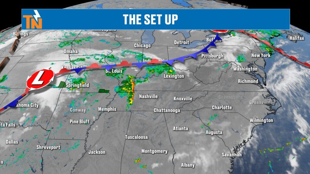
Storm System Moving Into East Tennessee Today
This morning, we’re tracking a larger storm system back across Oklahoma with additional energy already moving through Middle Tennessee.
That energy near Nashville will be our first trigger today.
As it pushes east, showers and thunderstorms will begin increasing across East Tennessee through late morning and into the afternoon.
This is not one single line of storms.
This is multiple waves.
That means:
- Round one: Late morning into early afternoon
- Possible break: Late afternoon
- Round two: Evening into overnight
Timing will matter.
And if you have outdoor plans today, especially fireworks events, stay weather aware.
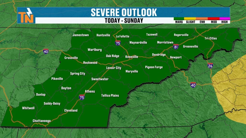
Severe Weather Risk: Damaging Winds Possible
The Storm Prediction Center has placed East Tennessee under a Level 1 risk for isolated severe storms.
That means:
The atmosphere is capable of producing:
- Damaging wind gusts
- Frequent lightning
- Torrential rainfall
- Small hail
The biggest threat today will be strong wind gusts.
Not everyone sees severe weather.
But any storm that strengthens could quickly produce damaging conditions.
This is why having multiple ways to receive weather warnings is critical.
Futurecast: Timing the Rain Today
From now through lunch:
Storms begin developing and increasing.
Late morning into early afternoon:
Scattered storms become more numerous.
Heavy downpours develop.
Localized flooding becomes possible.
Mid to late afternoon:
Many models show a temporary break.
That doesn’t mean we’re done.
Another disturbance arrives this evening.
After 7 PM:
Additional showers and storms possible.
This is especially important if you’re heading to fireworks displays in:
- Alcoa
- Maryville
- Across the greater East Tennessee region
Check radar often.
Storm timing could change.
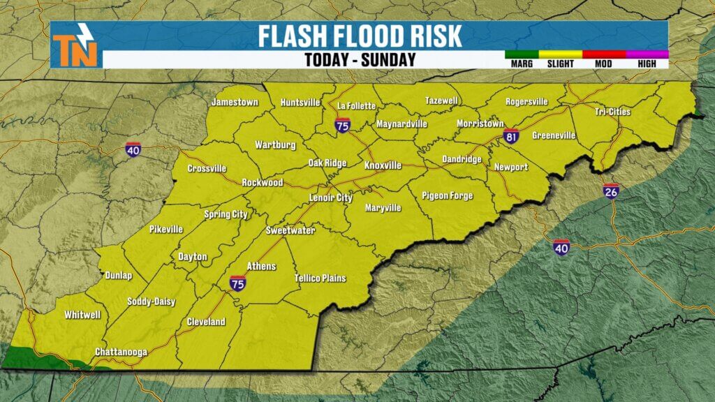
Heavy Rainfall and Flash Flood Risk
The atmosphere is loaded with moisture.
You can feel it.
Dew points are in the 70s this morning.
That tropical air mass means storms will be highly efficient rain producers.
Some areas could see:
- Half inch to 1 inch rainfall
- Localized areas over 2 inches
- Quick ponding on roads
- Isolated flash flooding
This is why flooding concerns remain elevated through the weekend.
Especially if storms train over the same locations.
Saturday Forecast: Hot, Muggy, and Stormy
Morning temperatures started in the 70s.
That’s 10 to 15 degrees warmer than yesterday.
Humidity is high.
Winds increase through the day.
Forecast highs reach the mid to upper 80s.
It’ll feel hotter thanks to the humidity.
Heat index values will push into the low 90s.
Not extreme.
But definitely uncomfortable.
Sunday Forecast: More Storms Early, Improving Later
We’re not done after today.
More energy swings through overnight tonight into Sunday morning.
That keeps storm chances elevated.
Sunday morning:
Scattered showers and storms continue.
Sunday afternoon:
Storms gradually begin shifting east.
Best rain chances will favor Upper East Tennessee.
Areas like:
- Johnson City
- Kingsport
- Greeneville
- Mountain communities
Rain begins winding down later in the day.
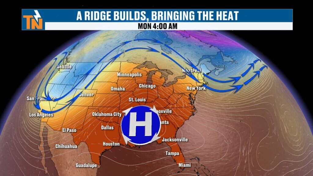
Dangerous Heat Builds Next Week
Once the weekend storms clear out, the weather pattern flips.
A strong ridge of high pressure builds in.
That means:
- Hotter temperatures
- High humidity
- Fewer rain chances
- Dangerous heat index values
Forecast highs next week:
Monday: Low 90s
Tuesday: Mid 90s
Wednesday: Mid 90s
Thursday: Mid 90s
And with dew points staying in the 70s…
Heat index values will push close to 105 degrees.
That’s near Heat Advisory criteria.
This will likely be the hottest stretch of the year so far.
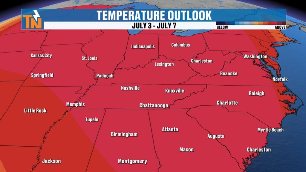
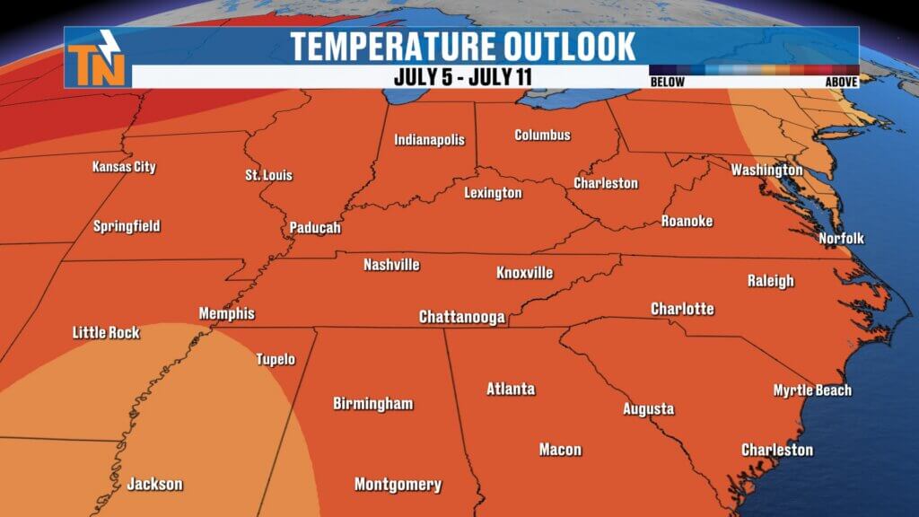
Long Range Outlook: Heat Sticking Around Into July
The pattern doesn’t break quickly.
Current long-range guidance shows this heat likely holding through:
- The first week of July
- Possibly the second week of July
That means prolonged summer heat.
And very little relief.
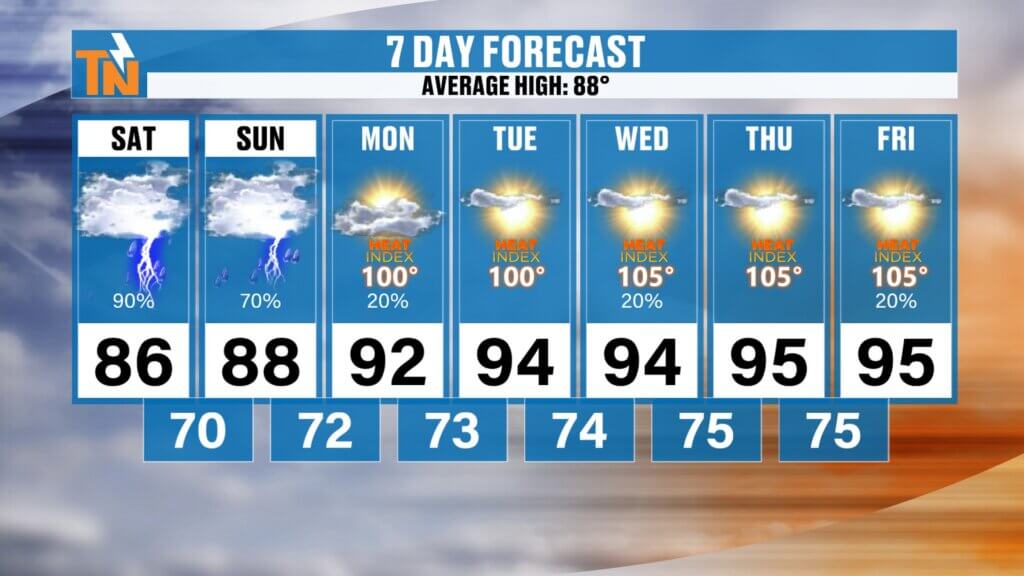
East Tennessee 7-Day Forecast
Saturday
Scattered storms
Heavy rain possible
High: 86°
Sunday
Morning storms, improving later
High: 88°
Monday
Mostly sunny and hotter
High: 91°
Tuesday
Hot and humid
High: 94°
Wednesday
Dangerous heat builds
High: 95°
Thursday
Heat index near 105°
High: 95°
Friday
Continued summer heat
High: 94°
Bottom Line
Today is an active weather day.
Storms increase late morning into afternoon.
A break is possible before another round tonight.
Some storms could be strong.
Heavy rainfall and localized flooding remain concerns.
Sunday starts stormy, ends quieter.
And then the heat takes over.
The hottest weather of the year begins next week.
Stay weather aware today.
And start preparing now for the heat.
Track storms anytime with the East Tennessee Weather app.
Have a great Saturday.