
Published: Monday, November 2, 2026 | By Meteorologist Mike Witcher | eastTNweather
Good morning, East Tennessee, and happy Monday! Thanks for checking in with your morning weather update on this November 2nd, 2026.
Here’s the story this week. A big old surge of moisture, as much as 300% of normal, heads our way on Wednesday, and that’s going to usher in pretty good rainfall around the area.
We’re going to see some gradual clearing throughout the day today. Then more sunshine and warmer weather tomorrow.
Wednesday is the wet one. High precipitable water values mean some locally heavy rainfall can’t be ruled out.
Back behind it, dew points and temperatures come on down a little bit as we head into the first weekend of November. Then potentially another surge of cooler, drier air.
I’m walking you through all of those details, so keep reading.
Yesterday's Almanac: Rain Showers Overproduced
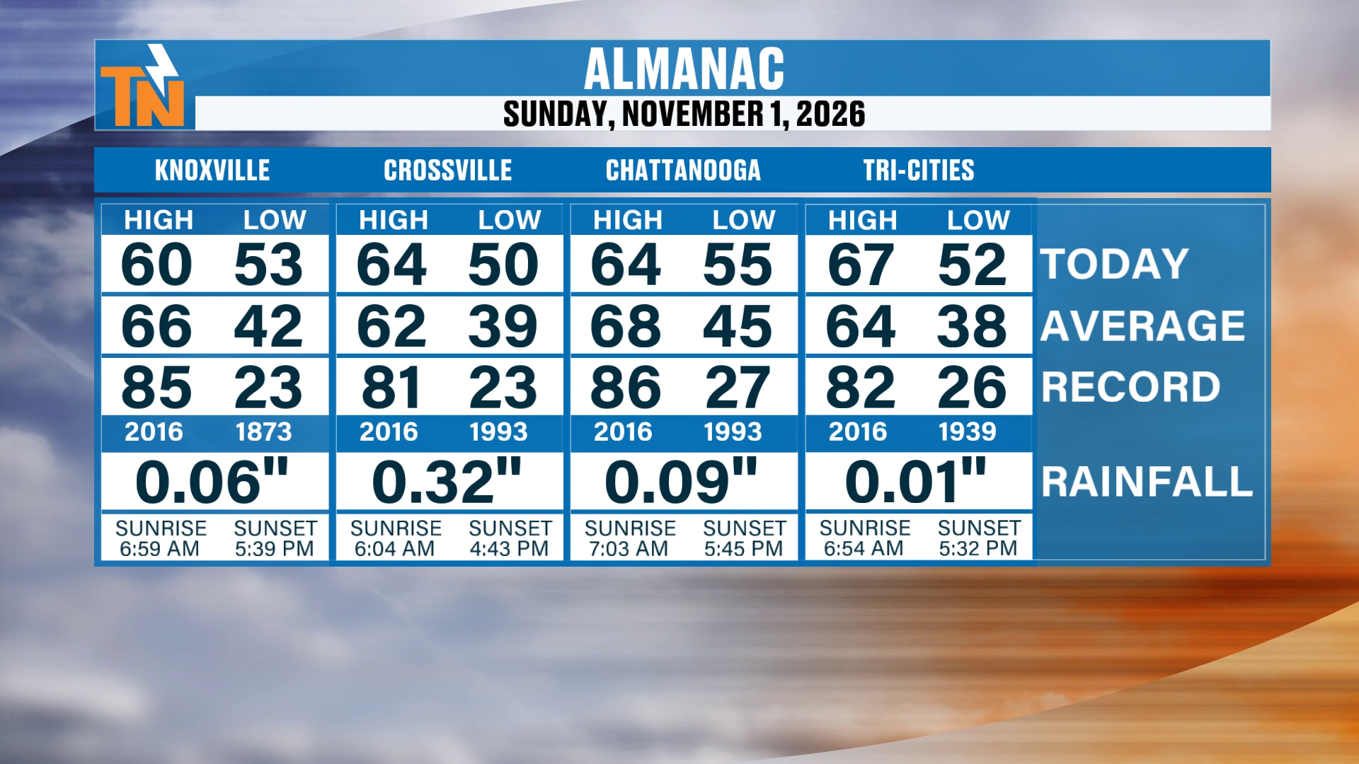
Let’s start with the almanac from yesterday. Those rain showers definitely overproduced.
We talked about that yesterday morning, how our in-house model was really starting to surge in a lot more moisture. And the fact that we saw that early morning rain really set the stage to overcome some of that drier air.
But not everybody picked up on a ton of rainfall. Knoxville picked up 0.06″, Chattanooga 0.09″, and the Tri-Cities just 0.01″. Crossville did better with 0.32″.
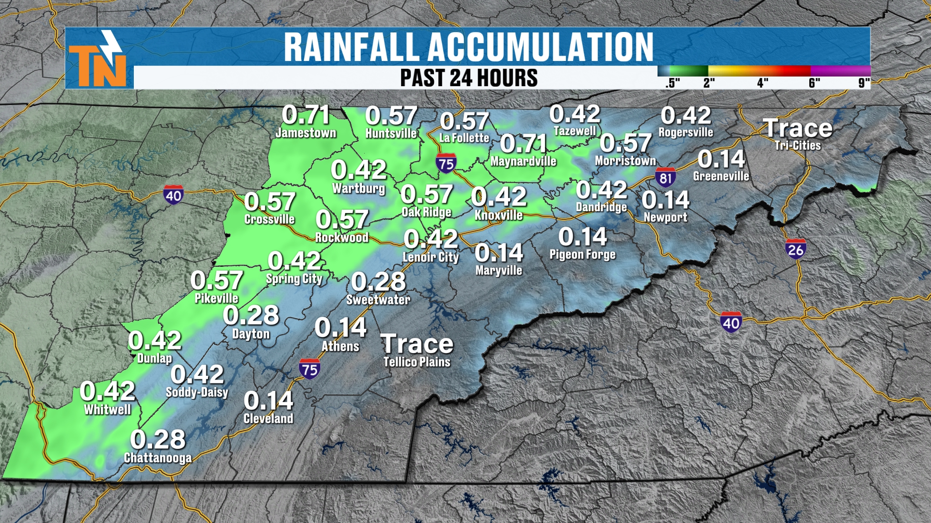
The heaviest rain was across the northwestern sections of town along the Cumberland Plateau. Fentress County to Cumberland County picked up about 3/4 of an inch of rainfall.
So definitely beneficial rain there.
Radar Recap: A Damp, Dreary Start
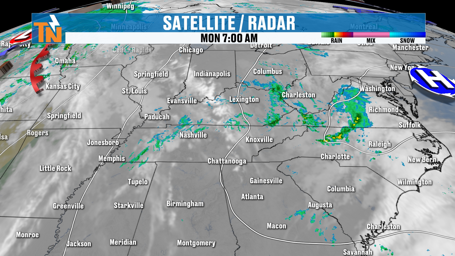
Over the last 12 hours, our radar recap shows how the rain is moving its way on out.
I can’t rule out some light drizzle or some mist this morning. Some damp conditions. Kind of a dreary, damp, cool start to the day.
But this whole system is swinging its way on out of here. And as it does so, it’s going to increase our wind.
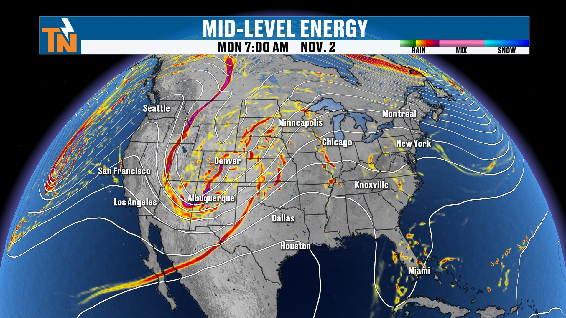
The Big Picture: A Ridge Builds, a Deep Trough Digs
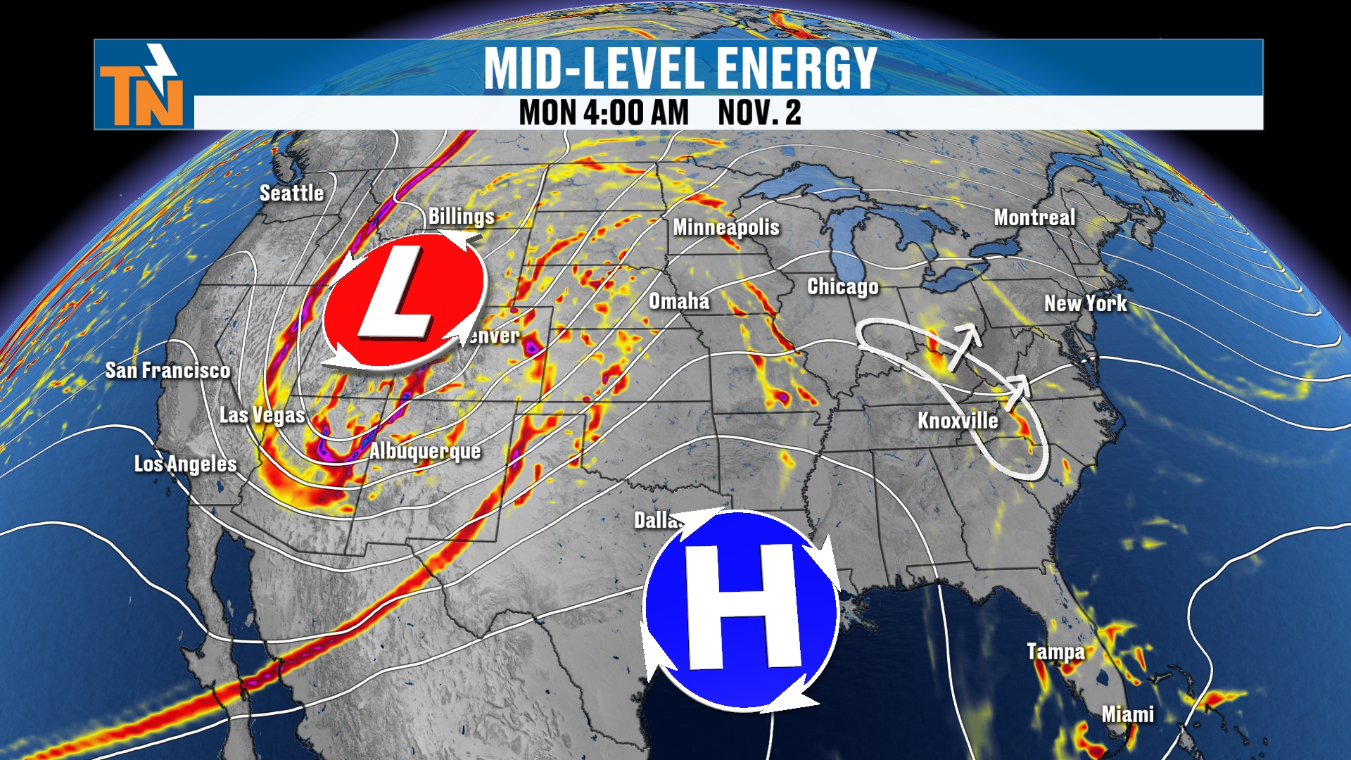
When you look at the big picture around the region, you can see a little bit of rainfall across West Virginia and the Ohio Valley, stretching down into West and Middle Tennessee.
Again, we’re going to start to see that moisture moving its way on out of here. There goes our energy.
Back behind it, we’ve got a ridge of high pressure that’s going to start to build its way on in. That’s going to help to warm our temperatures and clear the skies.
But even further to the west, you can see that big old low pressure system. There’s a deep trough.
That’s our next weather maker. It’s going to be swinging its way through Wednesday, Thursday and Friday. And that’s what’s going to surge in the moisture and bring us the cool down.
Today's Timeline: Gradual Clearing
Let’s walk through the futurecast model throughout the day today. It’s going to be a process.
Again, a couple of light showers, maybe a little bit of drizzle or some mist, from now through noon.
I think by lunchtime we’ll start to see some partial clearing. Just a little bit. The clouds start thinning.
As we get into the afternoon, those clouds thin just a little bit more through the 3, 5 and 7:00 hours.
By the end of the day, I think we’re going to have plenty of sunshine, with a few lingering clouds around the area.
Monday Temperatures: Above Average Again
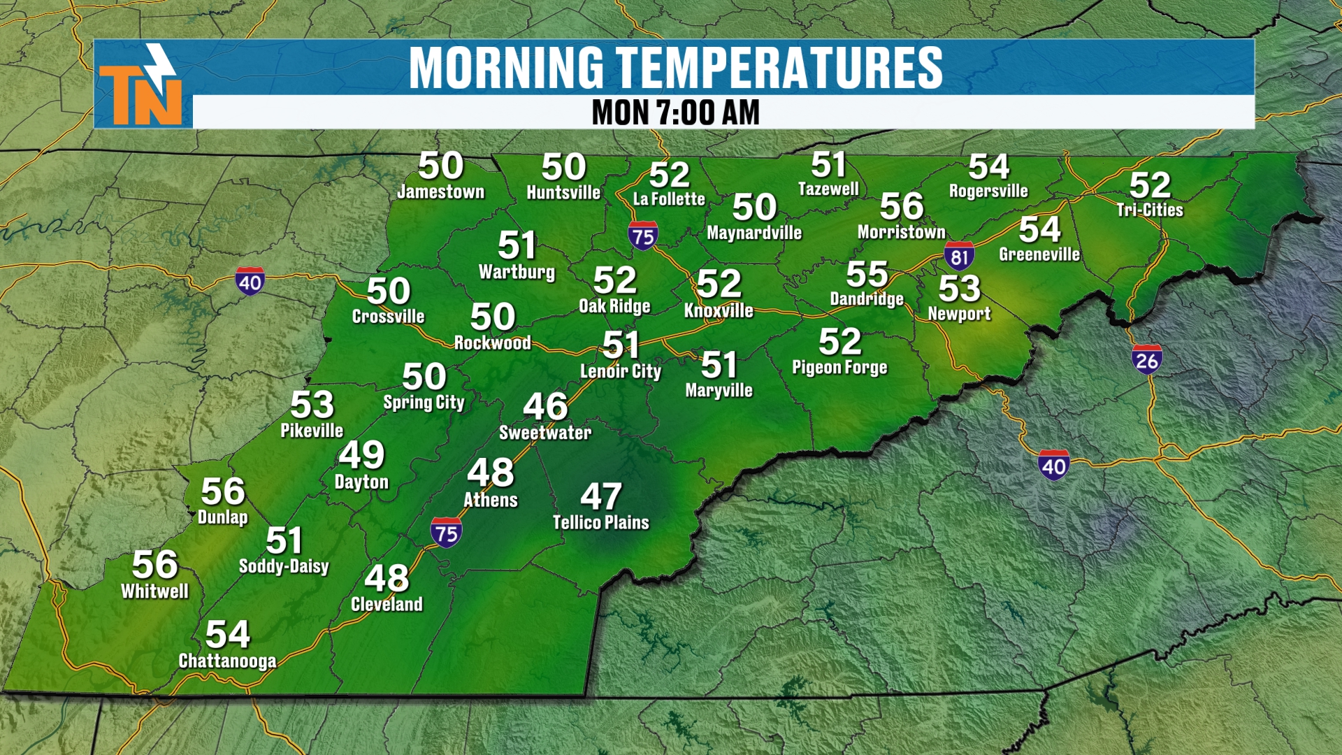
Temperatures this morning started off mainly in the 50s. A nice, quiet, comfortable start, even though that’s trending a little bit cooler than what we had yesterday.
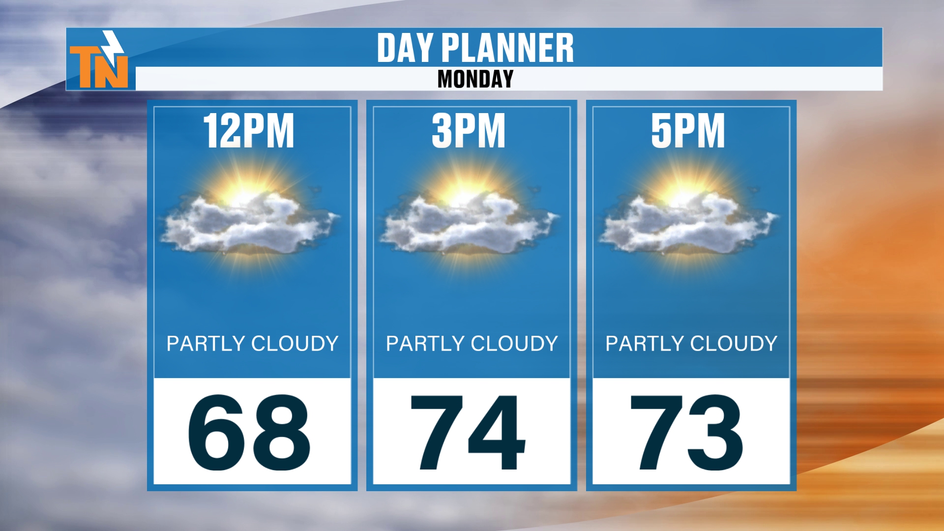
Again, mostly cloudy and 68 degrees by noon.
As we get into the afternoon, the clouds clear, and we’ll see those temperatures climb back into the low to mid 70s today.
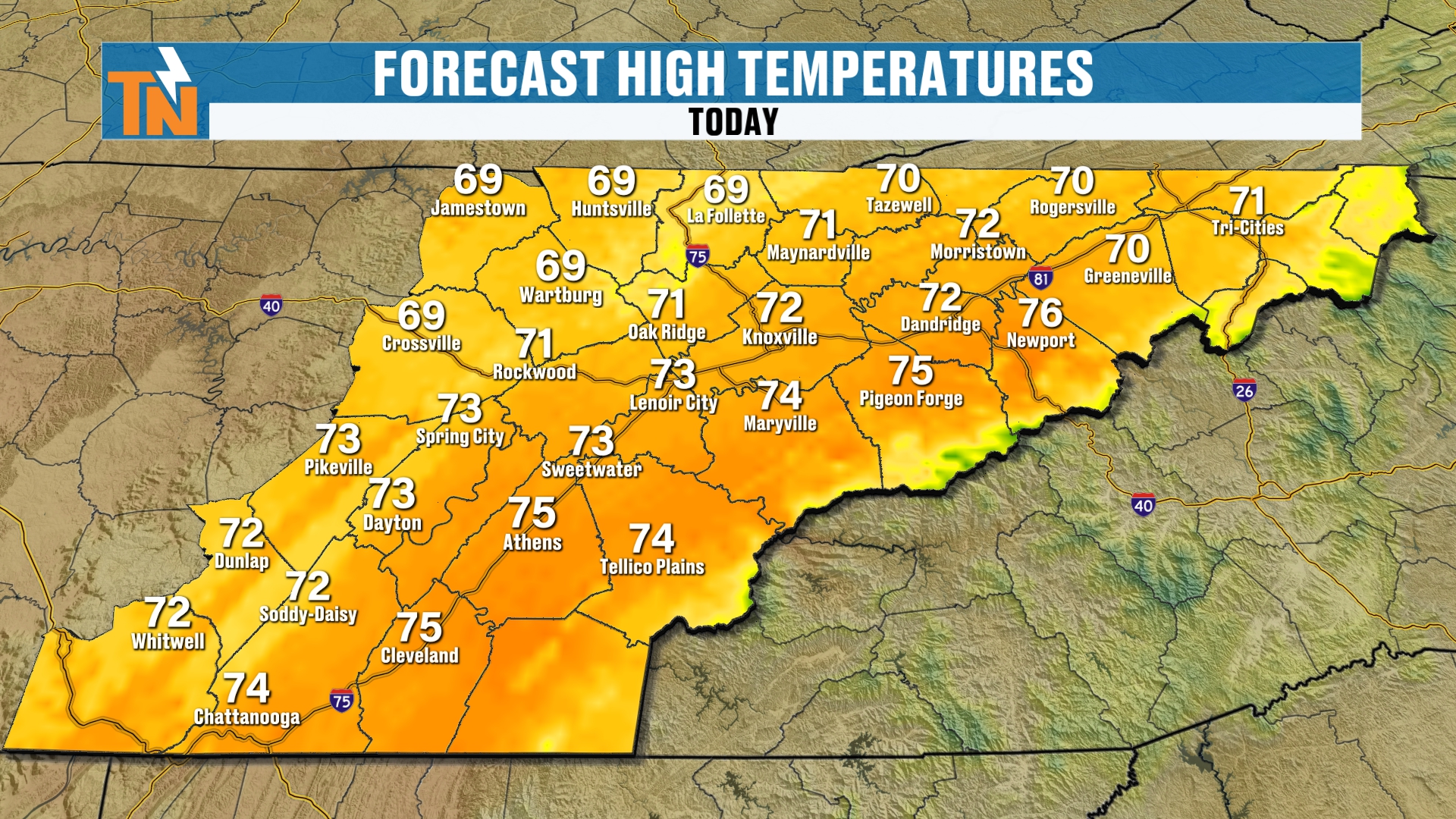
So we’re still technically trending above average, by about six degrees or so. Our average high for this time of year is in the mid 60s.
Breezy Afternoon and the Time Change
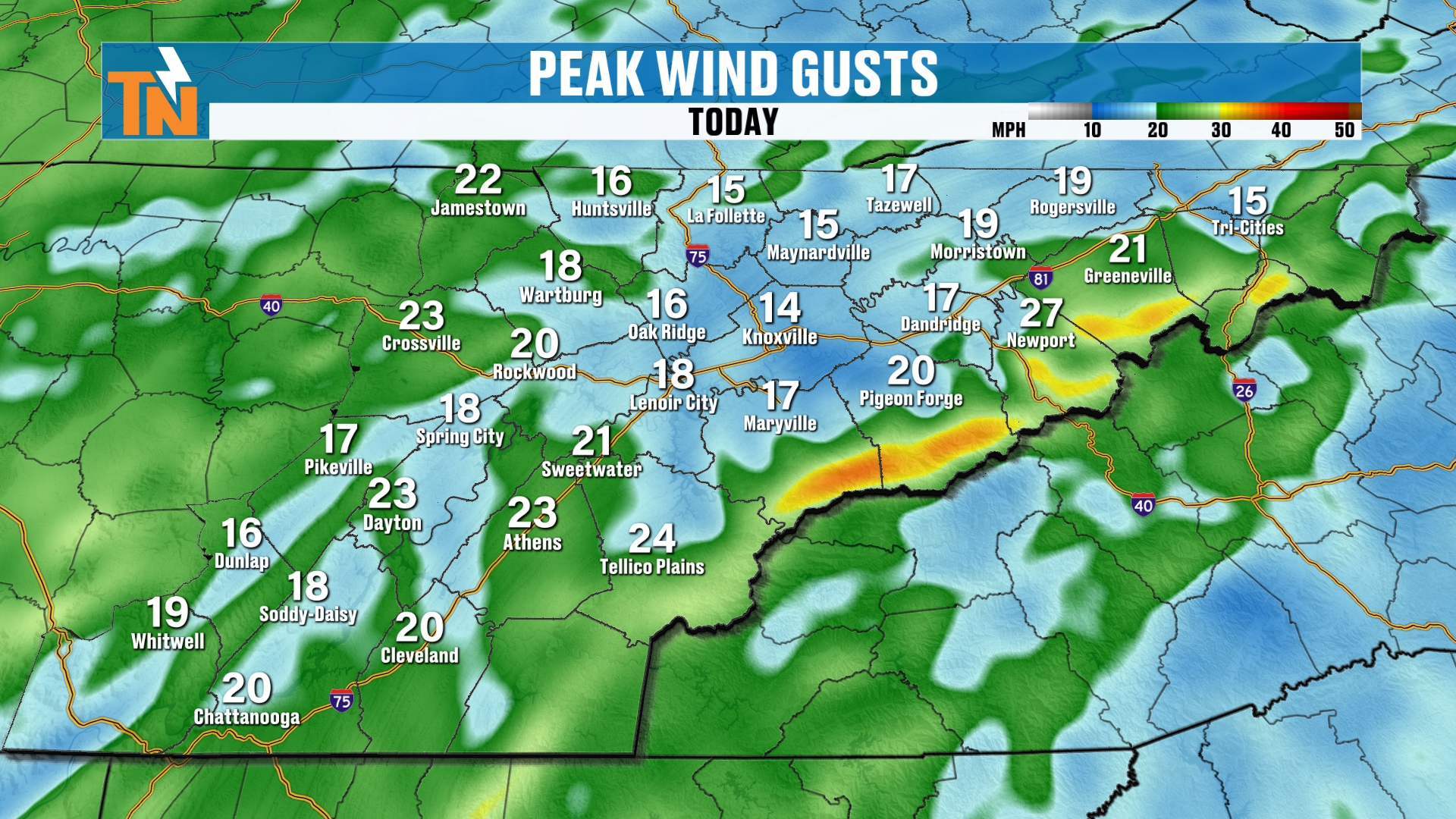
We’re still going to have a little bit of an afternoon breeze. That’s mainly across the Cumberland Plateau, the southern valley and the highest peaks of the Smokies, as those upper level winds start to clear on out of here.
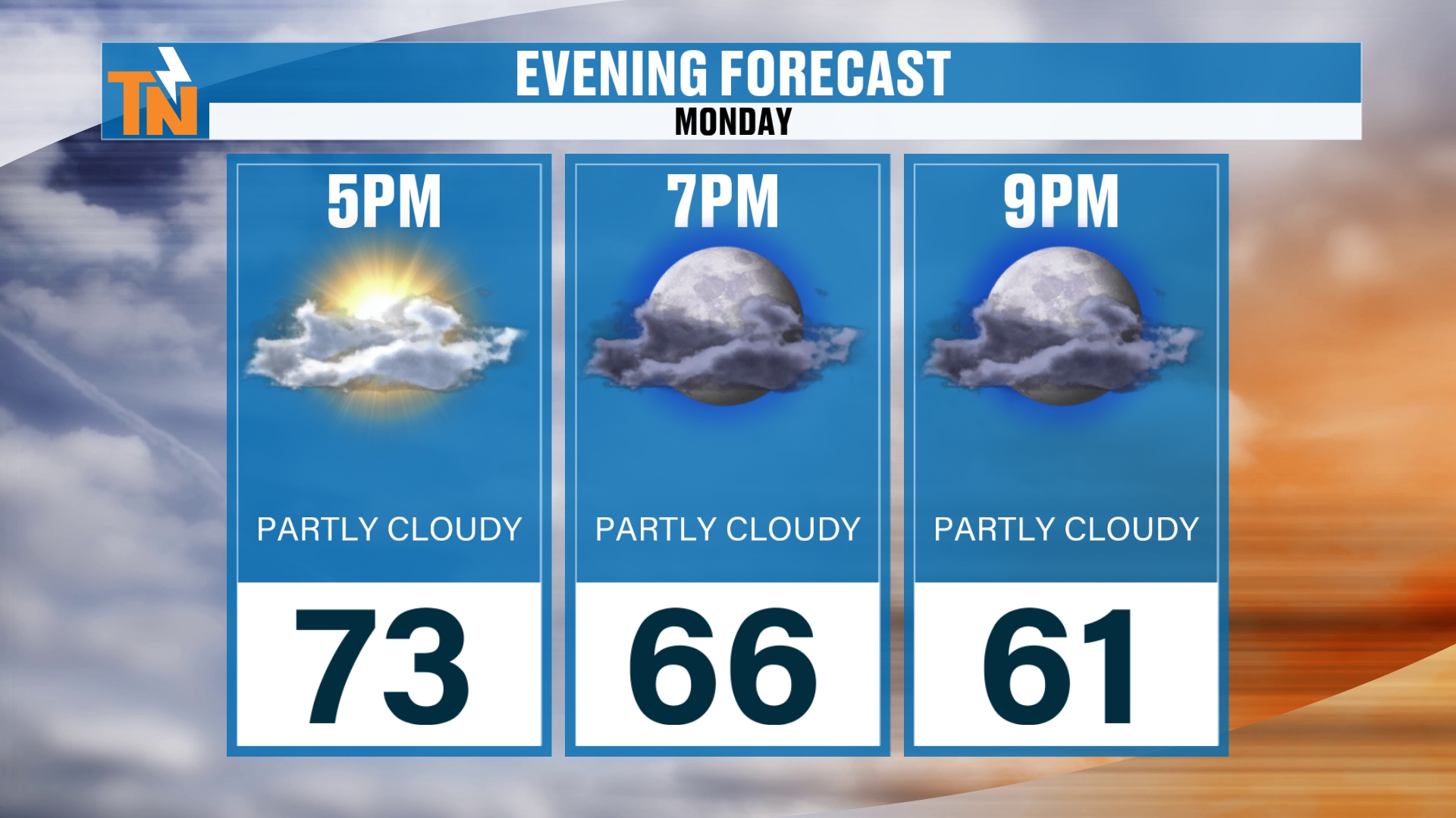
Into the evening hours we go, we should have some nice sun before the sun sets tonight.
But I don’t know about you. The time change has kind of messed us all up a little bit.
Even though we got an extra hour of sleep, last night we were like, “Oh, it’s only 8:30.” Well, no, not really. Technically, our bodies say it’s 9:30.
Kids, we’ve got to go to bed. That’s what we said last night.
Rain Chances: Zero Now, Then a Cold Front
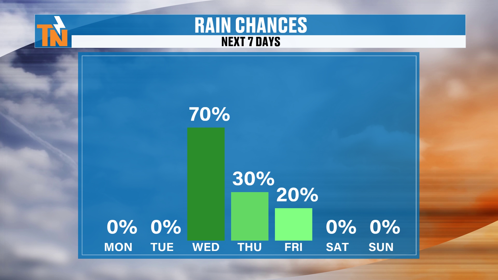
Here are your rain chances. 0% chance of rain today and tomorrow.
Then we ramp those rain chances up on Wednesday. The graphic shows 70%, and as a cold front swings its way on through, that’s likely to become 100% coverage for many of us. I think most of us get some sort of rainfall.
It’s all associated with this deep trough that’s digging across the Four Corners and the intermountain west. It moves its way into the Great Plains and the upper Midwest, and all this energy is just going to be slowly but surely spinning across the country.
That’s going to produce severe weather and locally heavy rainfall.
Severe Weather: Where Are the Storms?
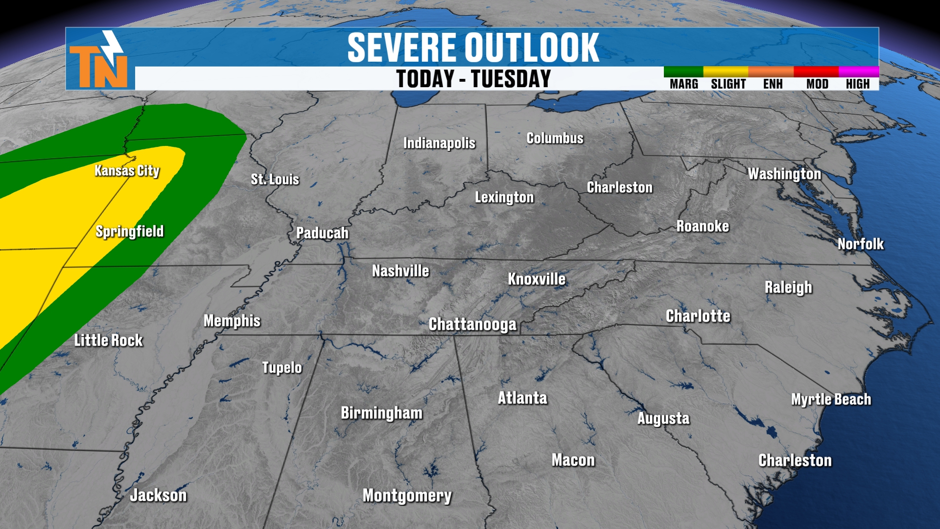
Actually, the Storm Prediction Center has a level one and level two risk for severe storms today and tomorrow back into Kansas City. So basically Missouri, Kansas and Oklahoma.
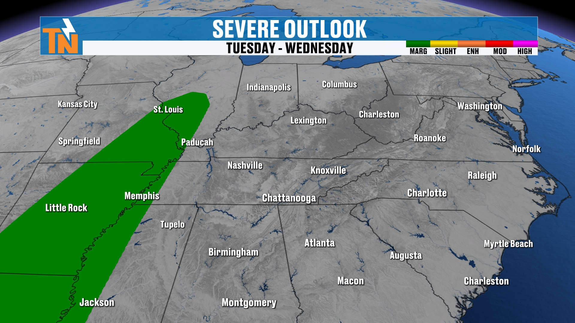
As it swings its way into West Tennessee, it begins to weaken. But we still have a level one risk right along the Mississippi River Valley.
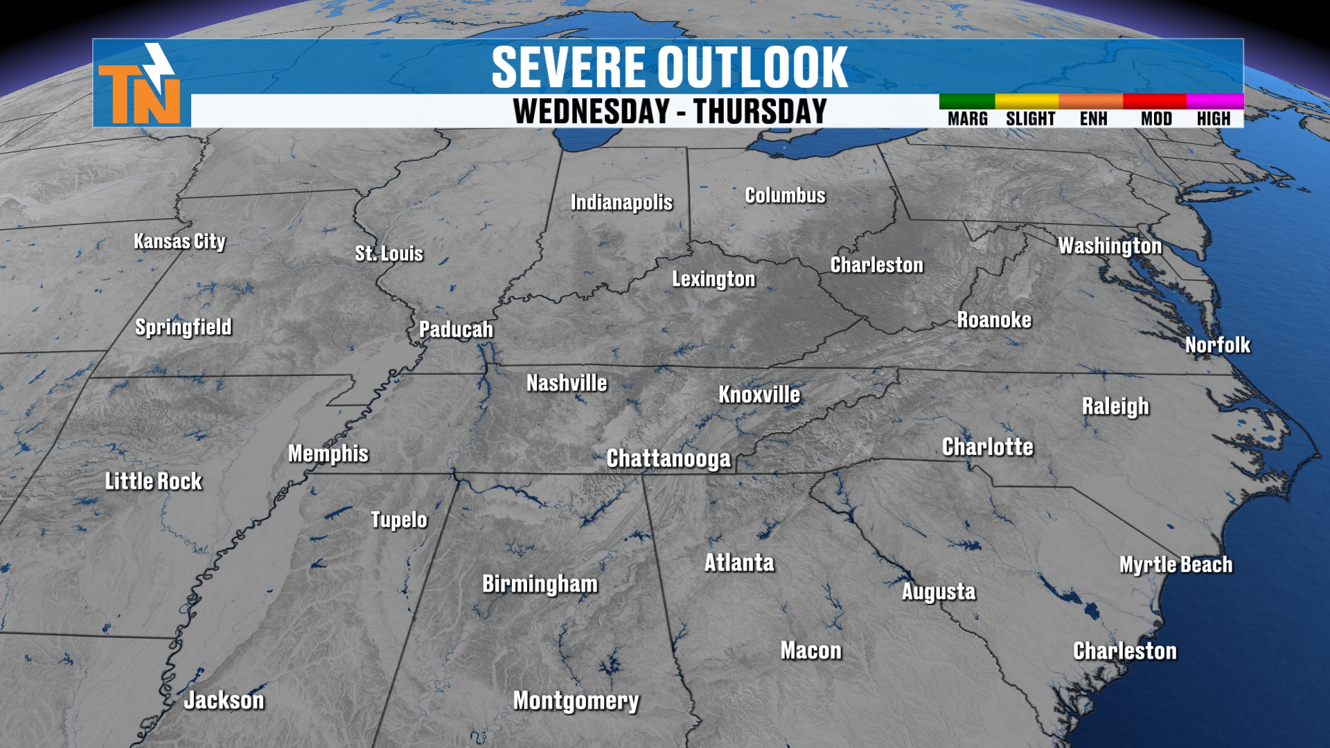
Then as we get into Wednesday and Thursday, as the actual cold front comes through our area, no severe weather risk is expected.
Strong Winds and a Possible Mountain Wave
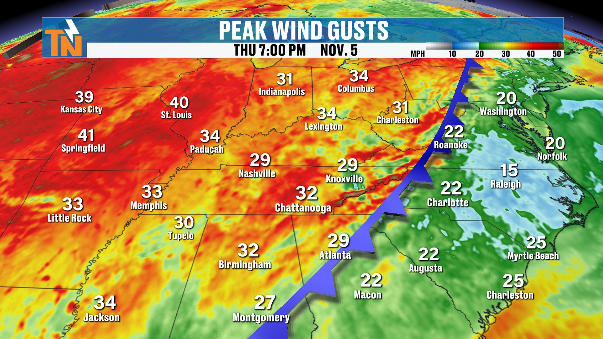
Even though we don’t have a severe weather risk, the cold front is going to bring quite a bit of wind around the area.
We still could have the potential for a mountain wave event across the Smoky Mountains.
That means we get winds perpendicular to the Smokies, and that’s going to crank up the winds, especially across the highest peaks and down into the foothills of the mountains.
So from now through Thursday we’re going to have some pretty strong winds around much of the region.
If you have any travel plans, it is going to be rather breezy and bumpy.
Moisture Up to 300% of Normal
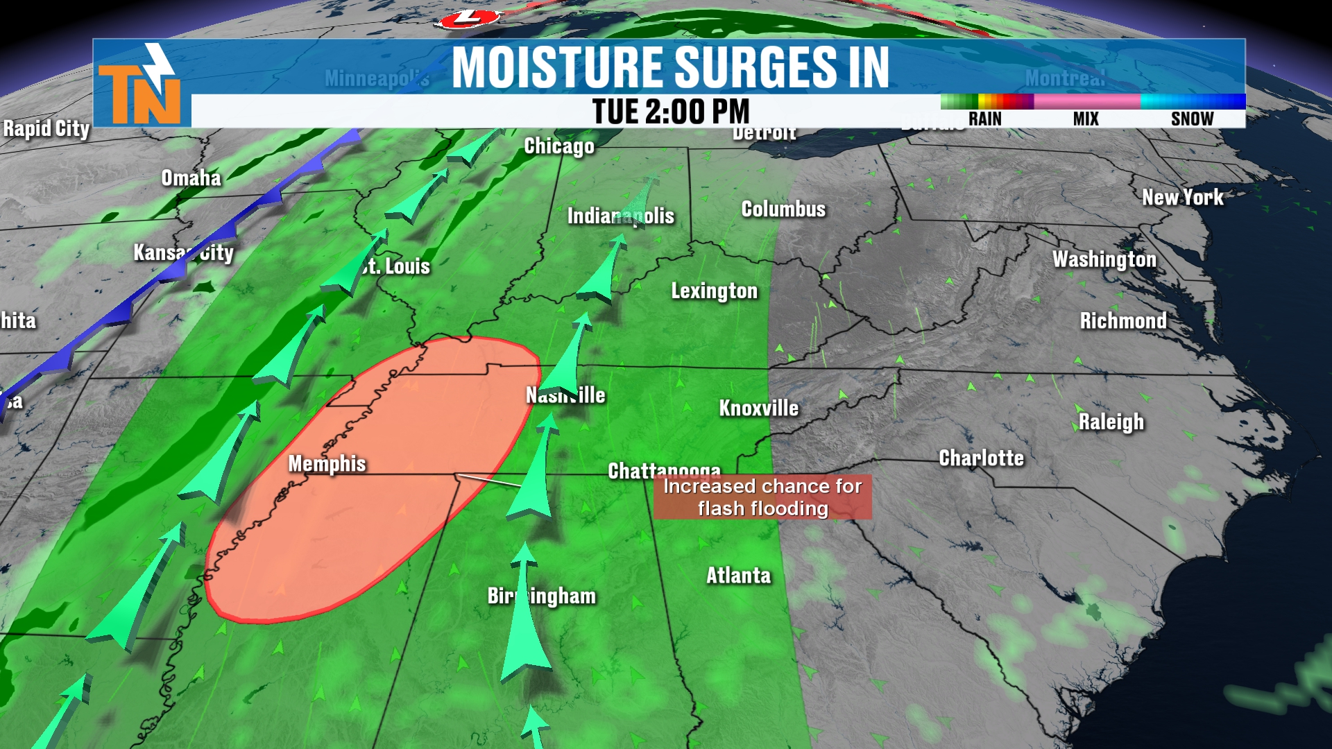
Here’s the big one. A big old surge of moisture is heading our way, out ahead of the cold front.
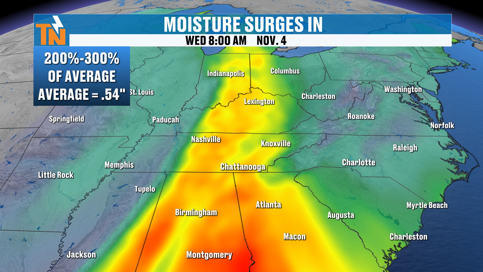
Our precipitable water values are going to be pushing anywhere from 200 to 300% of normal.
Our average precipitable water value around East Tennessee this time of year is about 0.54″. We’re going to be closer to about an inch and a half.
So again, that’s 2 to 300% of normal. That’s moisture in the atmosphere to work with to produce locally heavy rain.
Futurecast: The Cold Front Arrives
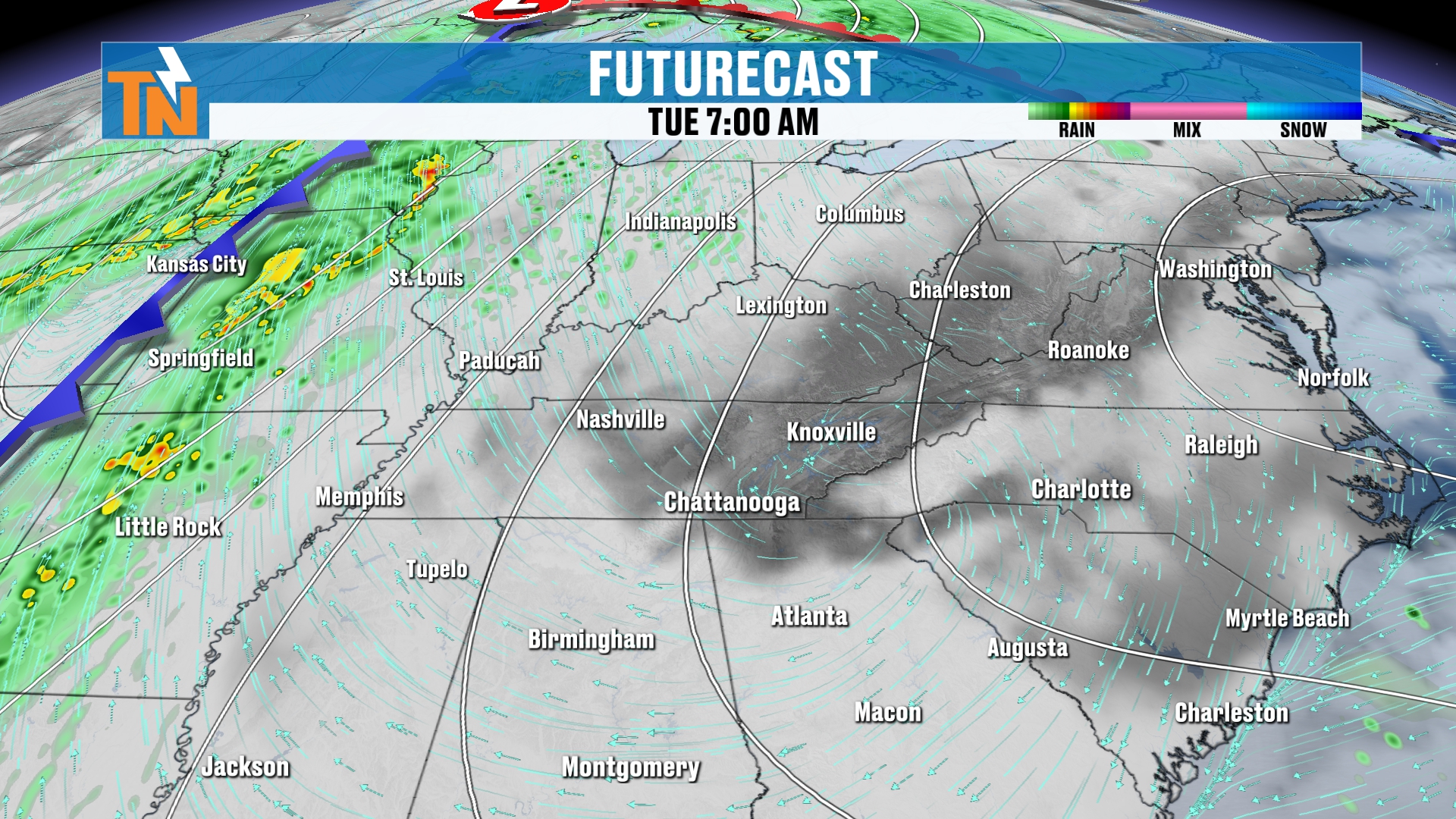
Let’s look at our futurecast, Tuesday night into Wednesday morning.
The cold front starts to slide its way into West Tennessee, then into Middle Tennessee, Tuesday night into Wednesday morning.
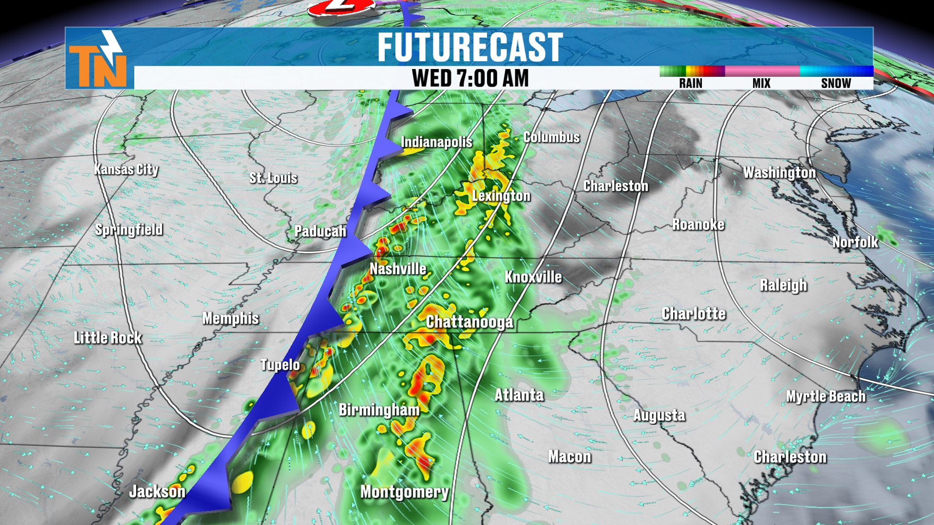
Most of the rain is going to be back off to our west early Wednesday.
But as the cold front comes through throughout the day on Wednesday, that’s going to pump in a surge of moisture around the area, and that’s going to bring us some good solid rain. I think everybody gets rainfall.
Do we see thunderstorms with this system? Maybe a couple of rumbles of thunder. We don’t have a lot of instability in the atmosphere with this.
What we do have is a lot of moisture surging on in, bringing us the rainfall.
Then back behind it, some slightly cooler, drier air slides in from the north and northwest.
So as we get into Friday, we’ll probably have a batch of clouds moving its way back in. I can’t rule out a stray light shower or so on the back edge of that system.
How Much Rain? Comparing the Models
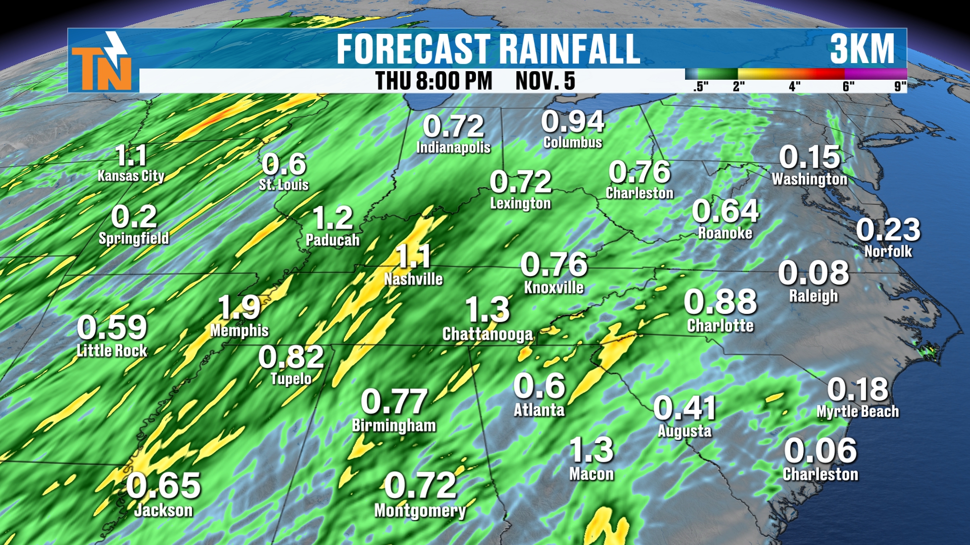
This is our in-house 3 km model. This is the high resolution picking up on those rain showers all the way from Tuesday, Wednesday into Thursday. We’ll stop the clock there at Thursday night.
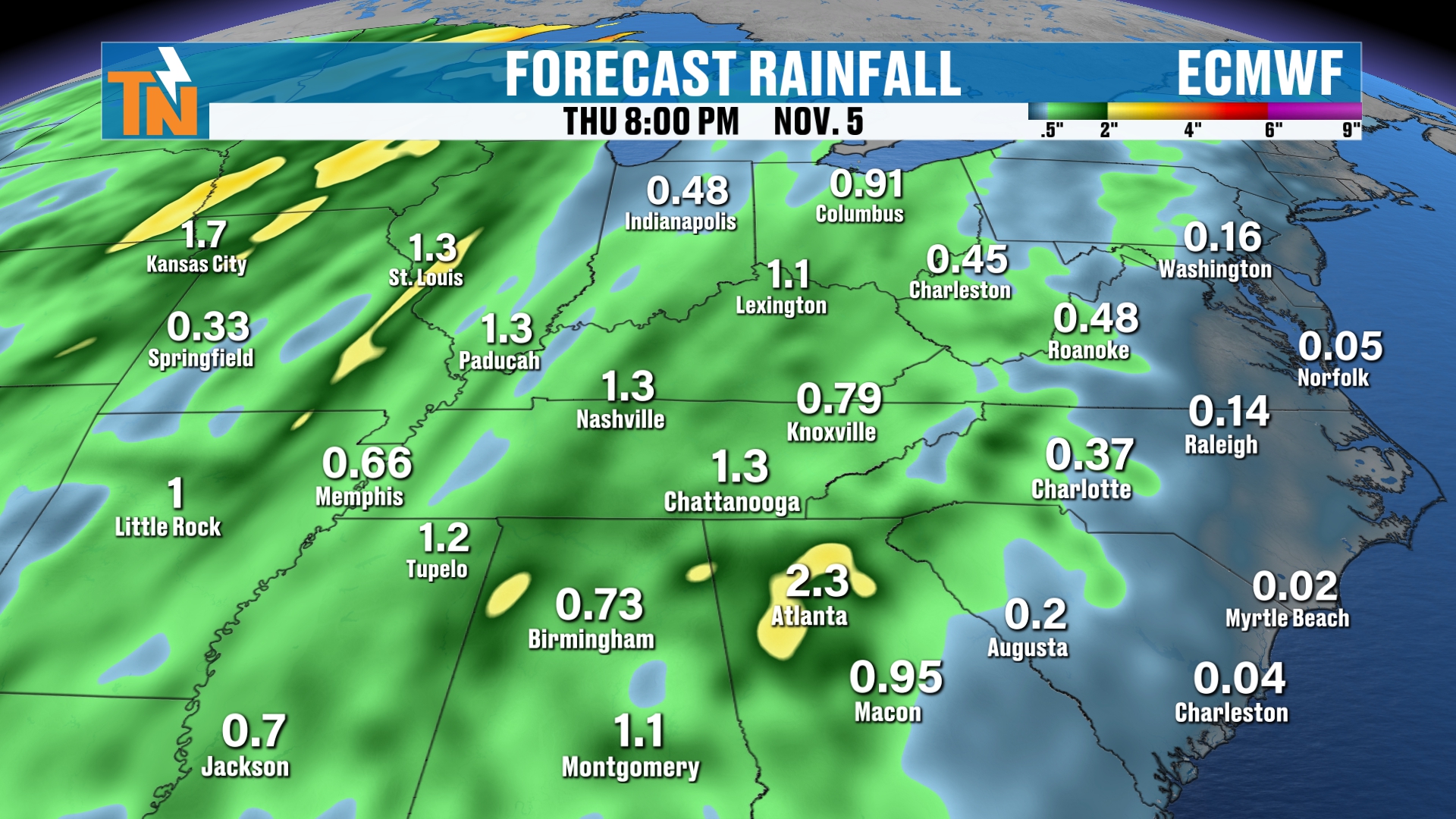
The European model has a broader range. It’s a global model, so the resolution goes down quite a bit, but it’s still picking up on about a half an inch to an inch and a half of rainfall here locally.
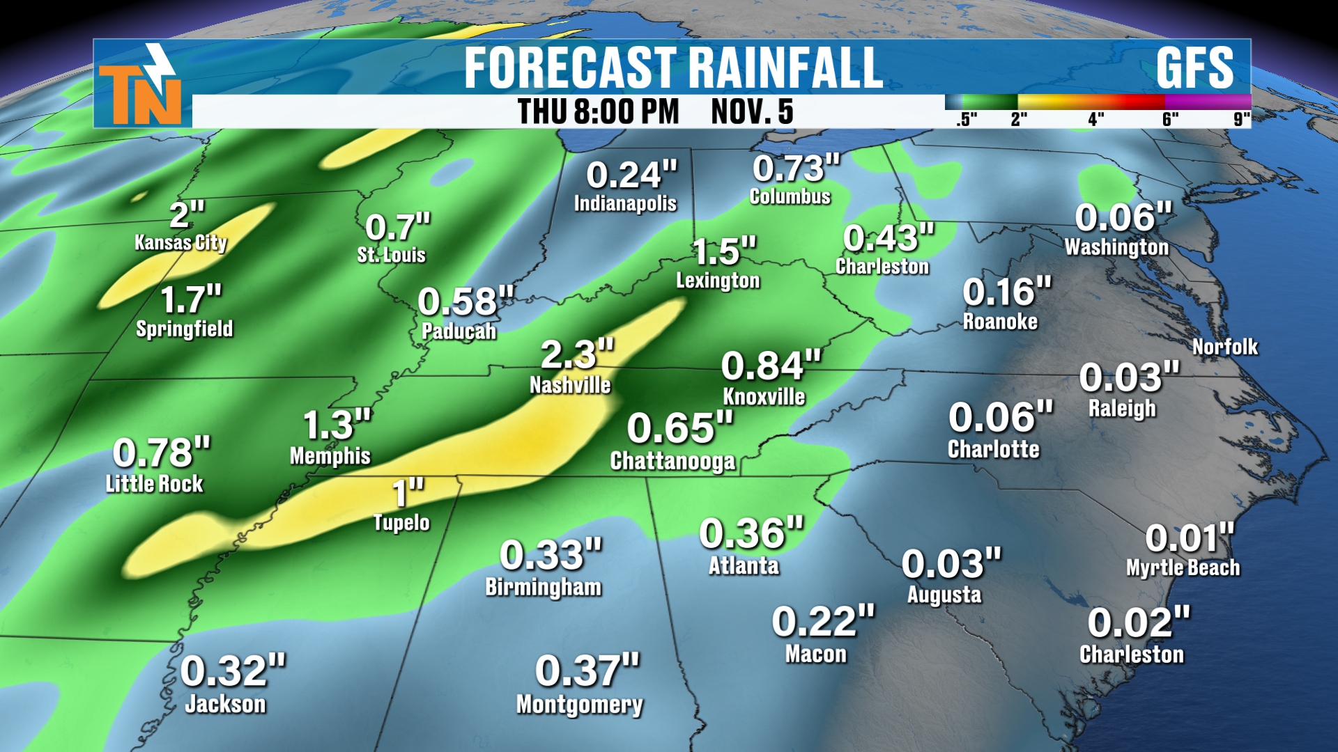
The GFS is picking up on that, and the National Weather Service blend is picking up on that.
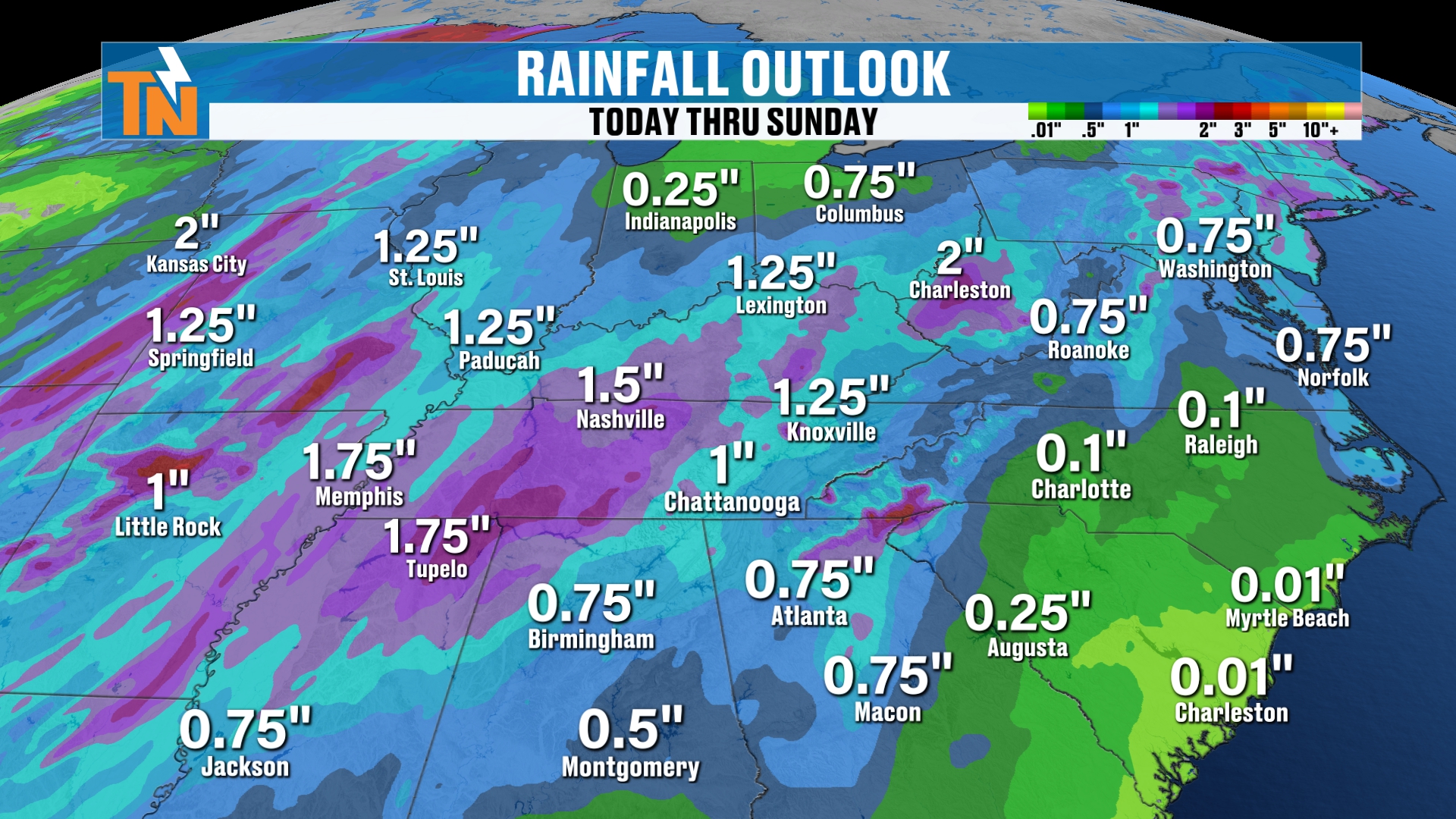
The Weather Prediction Center is picking up on about a half an inch to over an inch and a half of rainfall here locally.
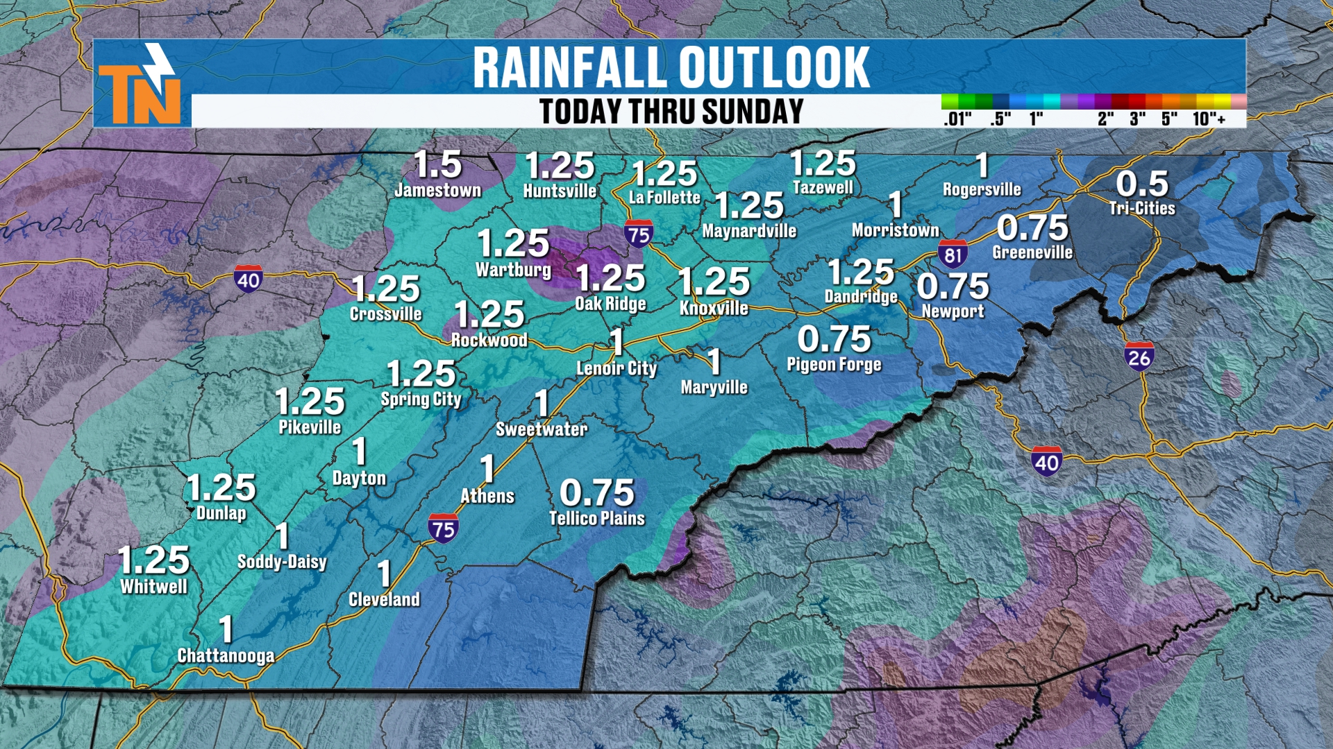
So generally speaking, a half an inch to an inch and a half of rain can’t be ruled out. Probably, broad brush, about 3/4 to an inch of rainfall.
Dew Points Surge, Then Drop
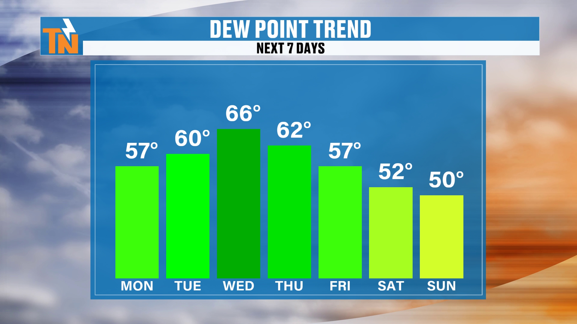
Dew points surge out ahead of this frontal boundary, then they drop back behind it. That’s going to allow that cooler, drier air to set up shop.
Seven-Day Forecast: A Chilly Weekend
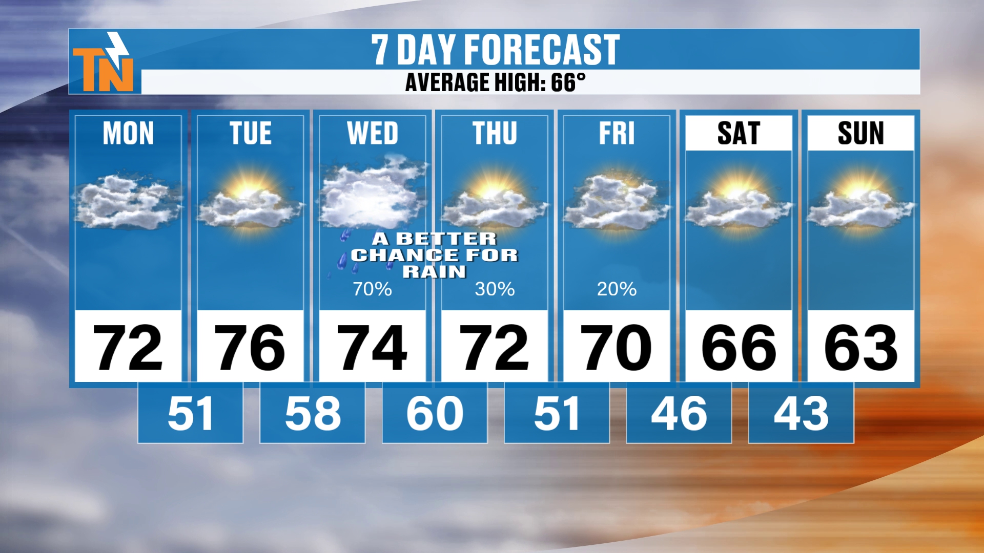
So here’s your seven-day forecast. Again, I said there’s possibly another surge of cooler, drier air settling on in.
We’ll see the rainfall Wednesday, Thursday and Friday. Then we’ll start to see the rain dry out as the storm moves its way on out.
But remember, we’ll have that back edge wrapping around the low pressure system. That’s probably going to bring us some clouds and maybe a couple of light showers.
Friday, Saturday and Sunday, we’re going to dry out.
Now, if you’re heading off to the Kentucky game on Saturday, we’re going to see temperatures basically in the mid to upper 60s. So it is definitely going to be on the chillier side for the Kentucky game.
And it’s a blackout game, by the way. We’re blacking out the stadium. I will be at that football game, so come say hi if you see me around town.
By Sunday we’re down to about 61 degrees. But watch this, here’s that big surge of cooler air. Pick up our timeline Thursday night and see how the cooler, drier air settles on in.
Then watch it move its way on out, and potentially another shot of cooler, drier air as we get into the start of next week.
That could maybe bring in some of the coolest air of the season across the Great Lakes and the Ohio Valley. But it probably doesn’t last very long.
What the Climate Prediction Center Says
The Climate Prediction Center says average weather is on the way. Looking at your 6 to 10 day outlook and 8 to 14 day outlook, we may potentially start to warm right back up, above average anyways.
And again, average highs for this time of year are in the mid 60s.
Bottom Line
MONDAY: Clouds this morning with a little drizzle or mist, then gradual clearing. Mostly cloudy and 68 at noon, low to mid 70s this afternoon. 0% chance of rain. Breezy on the Plateau, southern valley and Smokies peaks.
TUESDAY: More sunshine, warmer and breezy. 0% chance of rain. Mid 70s ahead of the cold front.
WEDNESDAY: Rain and windy. Moisture at 200 to 300% of normal brings good solid rain, locally heavy, with maybe a rumble of thunder. No severe weather expected here.
THURSDAY: Rain tapering, still breezy. Possible mountain wave winds across the Smokies.
FRIDAY: Clouds return with maybe a stray light shower on the back edge, then drying out.
SATURDAY: Dry and chillier, mid to upper 60s for the Kentucky game.
SUNDAY: Dry, about 61 degrees, with another shot of cooler air possible early next week. Falling temperatures, but still comfortable.
Stay Weather Aware
If you’re ever in a hurry, you can check out the quick cast on the East Tennessee Weather app and online at easttnweather.com. It gives you the basics, and this is where you find your in-depth forecast.
Download the FREE eastTNweather app from your app store. Look for the orange TN and the white lightning bolt.
And if you’re watching on YouTube, don’t forget to LIKE, SHARE, SUBSCRIBE and hit the bell.
Catch up on all of my recent daily forecasts anytime.
I’m Meteorologist Mike Witcher. Have a great Monday! Be safe, and be kind to each other. Life is short.
eastTNweather — Weather When You Want It.