
Happy Saturday! Thanks for checking in.
We’re tracking a cold front moving toward East Tennessee today, and it’s going to bring a noticeable shift in the weather. Before it arrives, expect another warm, breezy day. As it moves in later today and tonight, we’ll see increasing chances for showers and thunderstorms, including a few that could turn strong.
Severe Weather Risk: What to Watch
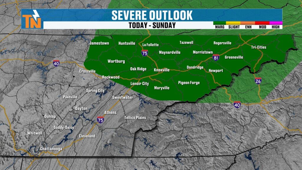
The greatest severe weather threat today is positioned to our north across parts of West Virginia, Ohio, and Pennsylvania. However, that risk does extend into East Tennessee.
- A Level 1 (low-end) risk is in place across the region
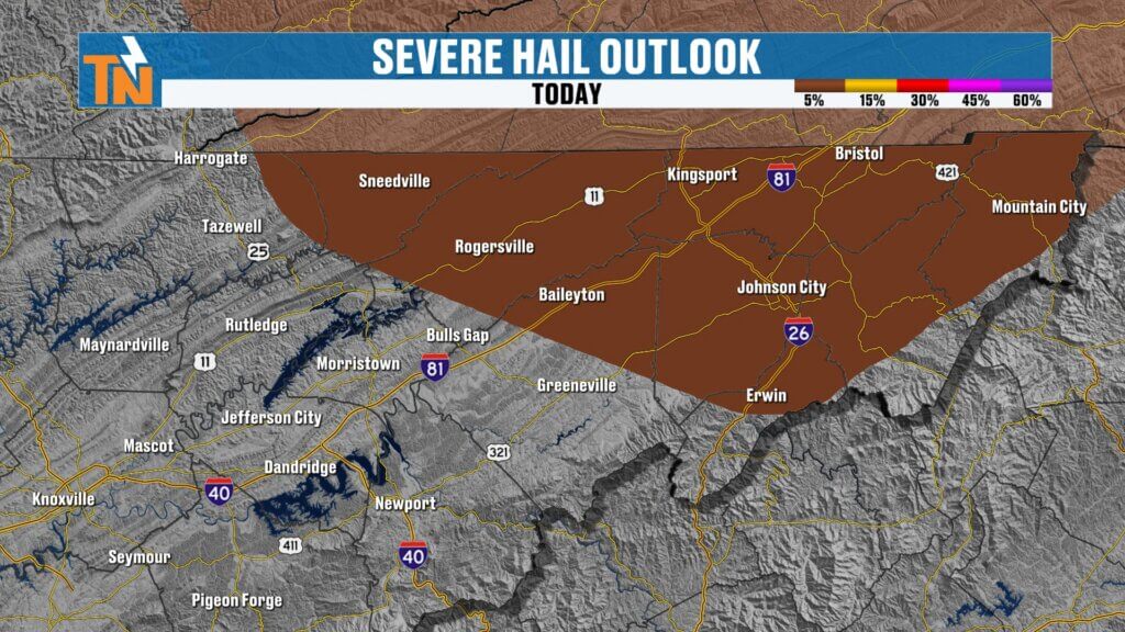
- Upper East Tennessee has the highest chance for stronger storms
- Primary threats:
- Damaging wind gusts
- Isolated large hail (around 1 inch or greater), especially from Sneedville to Rogersville and into the Tri-Cities
While severe weather will be isolated, it only takes one storm to cause problems—so stay weather aware.
Timing the Storms
Here’s how today unfolds:
- Morning through early afternoon: Mostly sunny, warm, and increasingly breezy
- Mid to late afternoon (2–5 PM): A few isolated storms could develop ahead of the main line
- Evening (5–10 PM): Best window for showers and thunderstorms moving through
- Late night (after 10 PM): Storms begin to weaken and move out
A few isolated storms ahead of the main line could briefly turn strong or severe, so keep an eye on the sky later today.
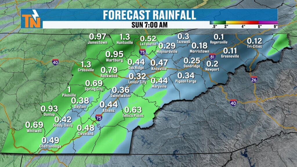
Rainfall Expectations
Rainfall will vary depending on where storms track:
- Upper East Tennessee: Lighter amounts
- Cumberland Plateau and central valley: Higher totals
Most areas can expect:
Locally higher amounts near 1″ in heavier downpoursBottom line: we still need more rain.
Around 0.25″ to 0.75″
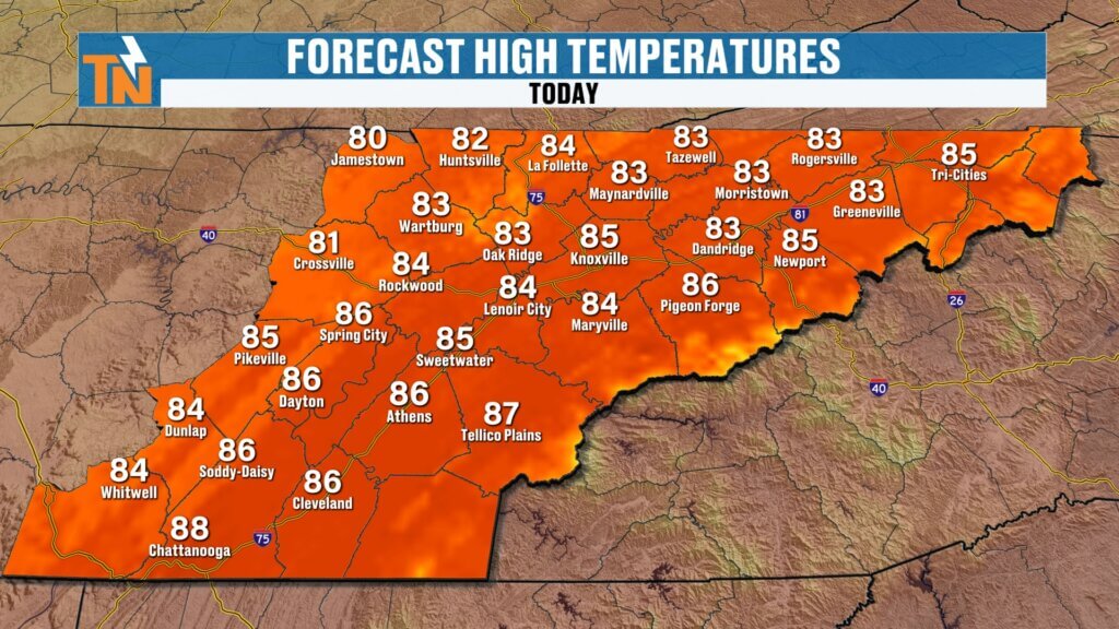
Today’s Forecast: Summerlike Feel
We’re starting the day mild with temperatures in the 50s and 60s.
- Afternoon highs:
- Around 85° in Knoxville and Tri-Cities
- Near 88° in Chattanooga
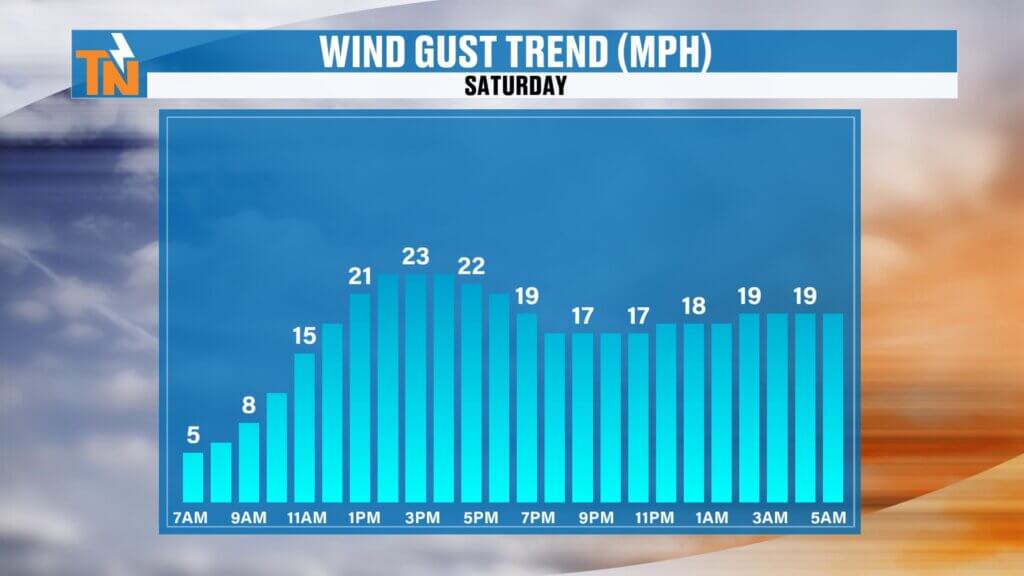
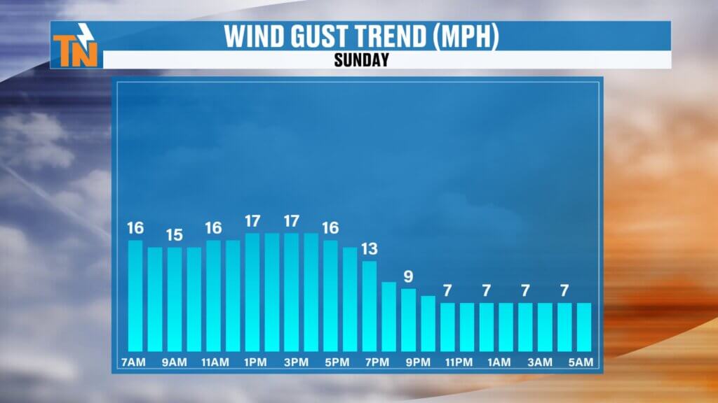
- Winds: Increasing and gusty throughout the day
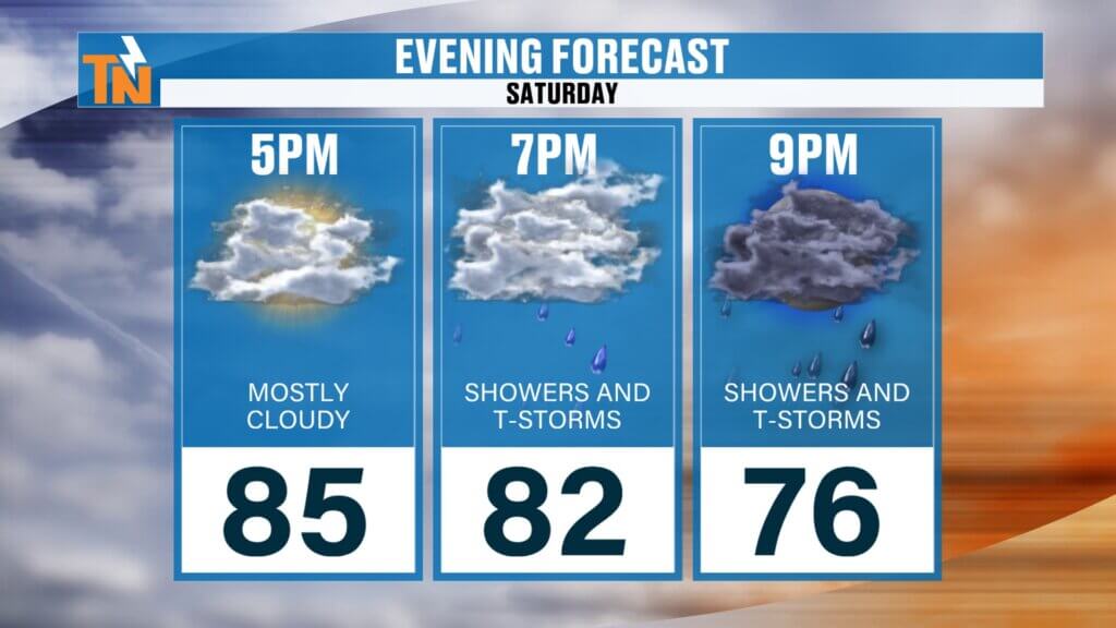
- Evening temps:
- 85° at 5 PM
- 82° at 7 PM
- 76° by 9 PM
Another near-record warm day before the front moves in.
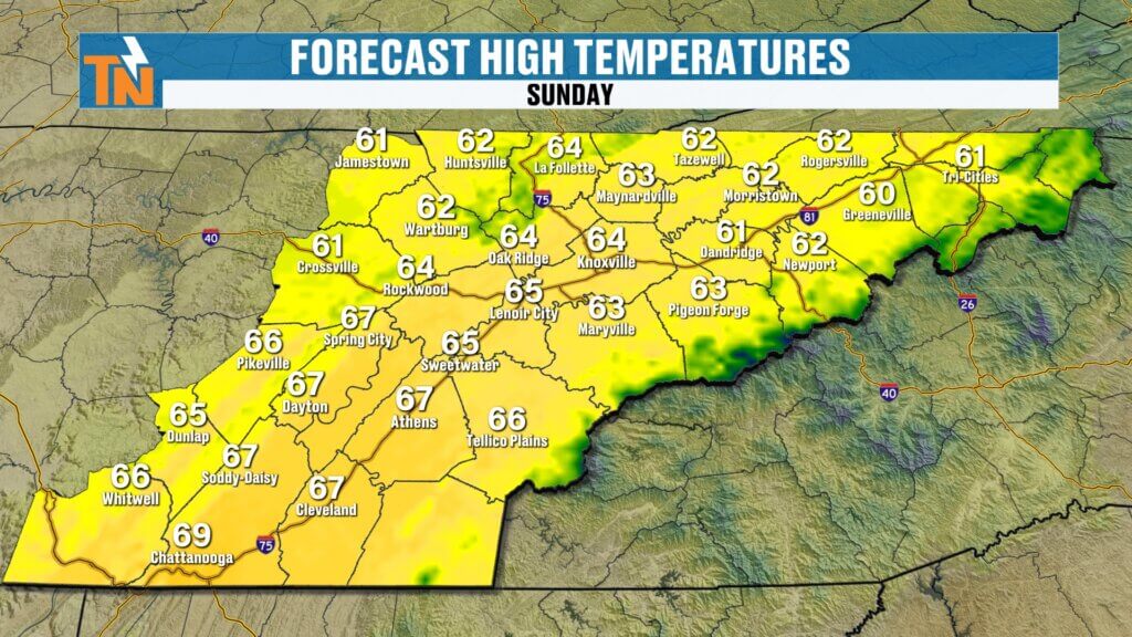
Sunday Forecast: Big Temperature Drop
Behind the cold front, a completely different feel arrives.
- Morning: Wet start with leftover showers
- Afternoon: Clearing skies and sunshine returns
- Highs: Mid 60s (about 20 degrees cooler than today)
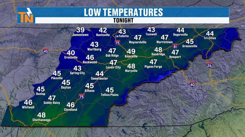
Overnight lows will dip into the 40s, with some 30s possible across the northern Plateau. It will feel much cooler, especially Sunday morning and again Monday morning.This won’t eliminate the drought, but it will provide another round of beneficial rainfall.
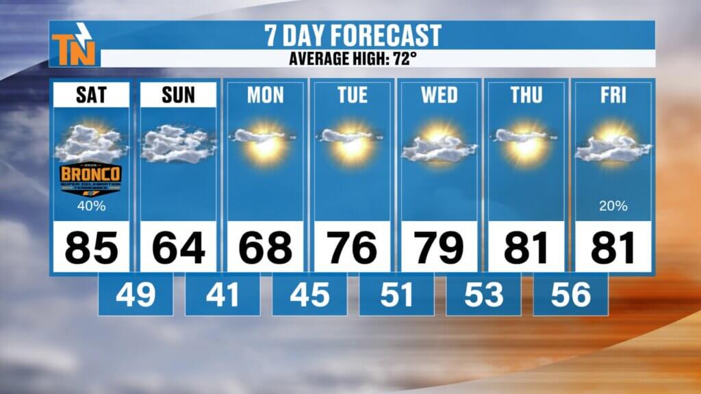
Looking Ahead: Gradual Warm-Up Returns
After the cool down, temperatures begin climbing again:
- Monday: Upper 60s
- Midweek: Back into the 70s
- Late week: 80s return with mostly sunny and dry conditions
A ridge of high pressure builds back in, bringing another stretch of warm, quiet weather.
Local Event Spotlight
Today is the final day of the Bronco Super Celebration in Townsend—the peaceful side of the Smokies.
It’s the 20th anniversary, and the weather will be great through much of the day before storms arrive this evening. If you’re heading out, just keep an eye on the sky later on.
Final Thoughts
Enjoy the warm weather today, but stay weather aware this afternoon and evening as storms move in. A few could pack a punch before a much cooler and refreshing Sunday arrives.
Have a great Saturday!