
Good Morning, East Tennessee
Happy Friday, everybody! Sure hope you have a great day.
After rounds of rain yesterday — and some areas picking up well over an inch of rainfall — we’re now shifting our focus toward flooding and localized flash flooding concerns as this wet weather pattern continues through the upcoming holiday weekend.
Unfortunately, the rain isn’t going anywhere anytime soon.
Why It’s Staying So Wet
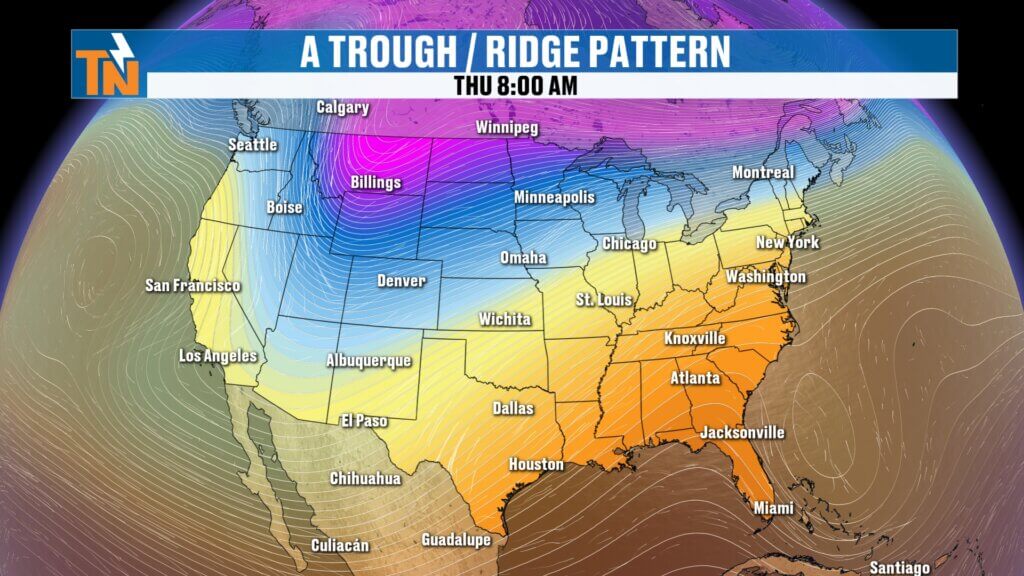
We continue to sit under a stuck weather pattern across the country.
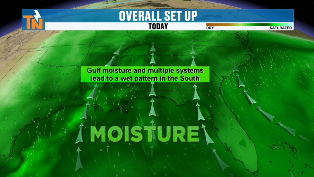
A large trough-and-ridge setup is funneling deep Gulf moisture straight into the Tennessee Valley through a persistent southwesterly flow. That means disturbance after disturbance will continue to move through East Tennessee, bringing repeated rounds of showers and thunderstorms.
The result?
- Tropical-like downpours at times
- Repeated rain over the same locations
- Increasing concerns for ponding, flooding, and isolated flash flooding
With saturated ground beginning to develop in some areas, flooding concerns increase with every round of rain we see.
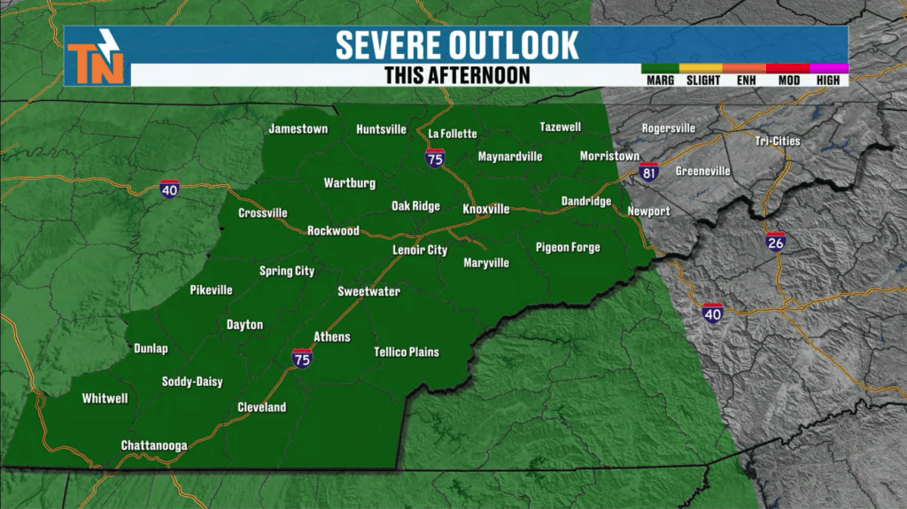
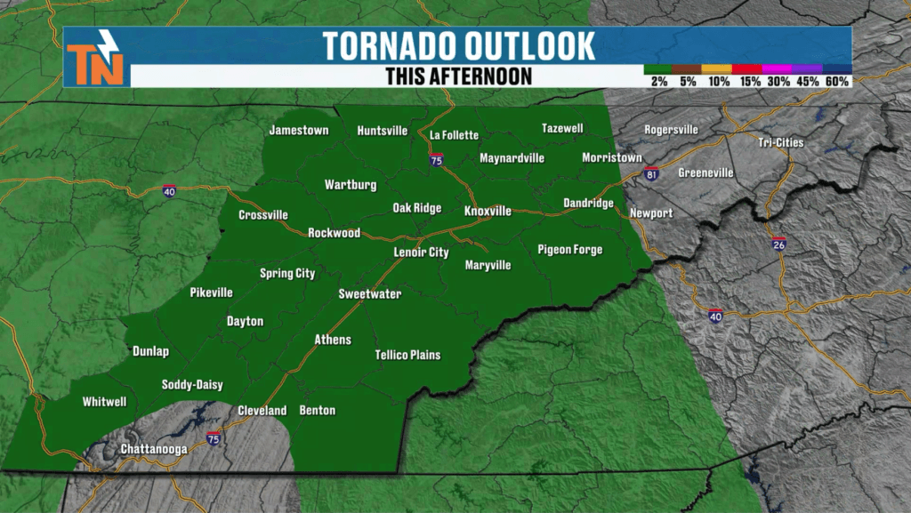
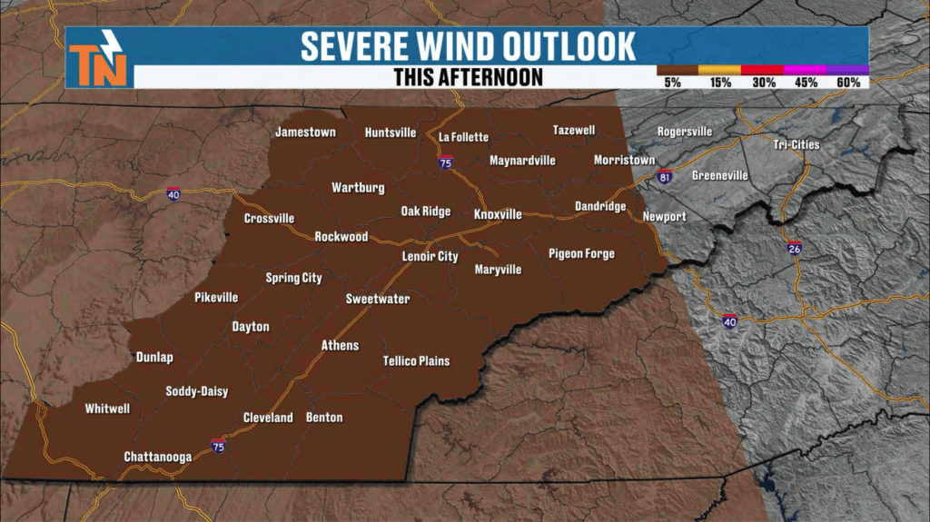
Strong Storms Possible This Afternoon
The Storm Prediction Center has placed East Tennessee under a Level 1 risk for isolated strong to severe storms today.
The biggest question mark: sunshine.
If we can squeeze out enough sunshine this afternoon, the atmosphere may become unstable enough to support a few stronger storms. If clouds and morning rain linger too long, the severe weather threat stays limited.
Potential threats today include:
- Strong damaging wind gusts
- Very small tornado potential
- Heavy downpours leading to localized flooding
The tornado threat remains low, but not zero, due to some wind shear in the atmosphere.
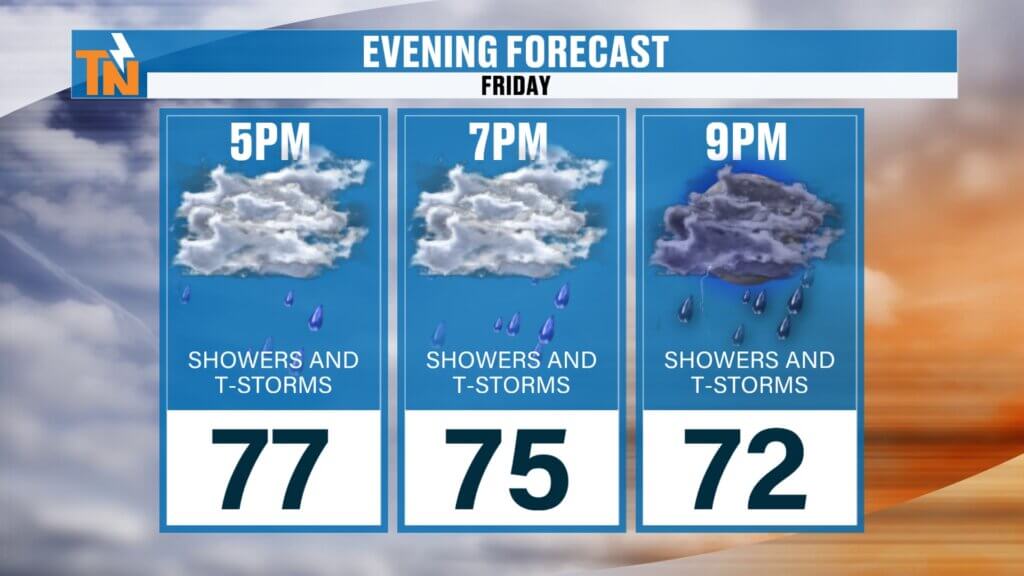
Best Window for Storms Today
Morning rain showers will gradually move out, but don’t let that fool you — more storms are expected to redevelop later today.
Timeline for today:
- Morning: Showers gradually taper
- Noon to 7 PM: Best chance for thunderstorms
- 3 PM to 7 PM: Highest window for stronger storms
- Evening: Storm intensity fades, but scattered rain continues
Not everyone will see storms, but if the atmosphere recovers enough, some could briefly become strong.
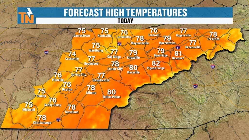
Mild, Muggy, and Humid
You’ll definitely feel the humidity today.
Morning temperatures are starting in the 60s with dew points also in the 60s, making it feel noticeably muggy across East Tennessee.
Temperatures today will remain seasonably warm:
- Highs in the upper 70s to low 80s
- Very close to average for late May
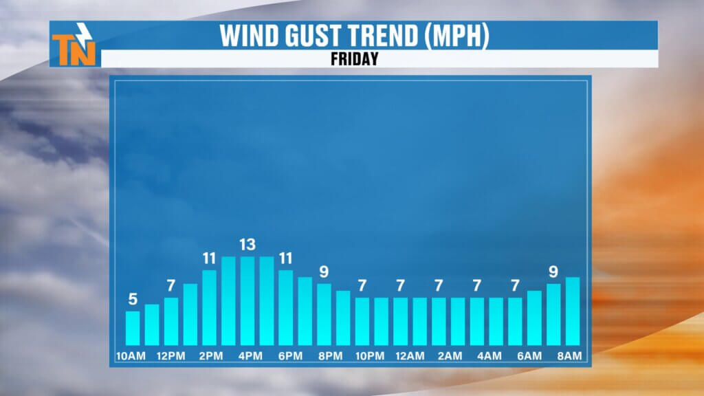
The mountains could also see gusty winds nearing advisory levels at times, especially across the higher elevations. It won’t feel cool, but it also won’t be excessively hot — just warm, humid, and damp.
Savannah Bananas Forecast
If you’re heading to see the Savannah Bananas at Neyland Stadium Saturday night — good news.
While scattered showers and storms remain possible Saturday, right now it looks like game time may stay mainly dry. That forecast could still shift a bit, but at this point, the weather appears more favorable for first pitch.
Rain Adds Up Through the Next 7 Days
This prolonged wet stretch is going to pile up some rainfall totals.
Expected rainfall over the next week:
- 1 to 3 inches widespread
- Localized areas could see 2 to 4 inches
That’s why flooding concerns remain elevated every single day moving forward.
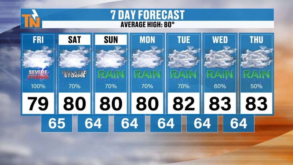
7-Day Forecast: Rain Chances Every Day
The pattern stays active.
Expect:
- Daily shower and thunderstorm chances
- Highs mainly in the upper 70s to low 80s
- Humid conditions sticking around
- Heavy rain possible at times
Bottom line: these are the April showers… arriving late in May.
Track the storms anytime with the interactive radar on the eastTNweather app and keep notifications turned on for any watches or warnings. localized flooding issues may develop where heavier rain lingers.