
Good Morning, East Tennessee
Happy Wednesday, everybody! Thanks for checking in for your latest East Tennessee weather update.
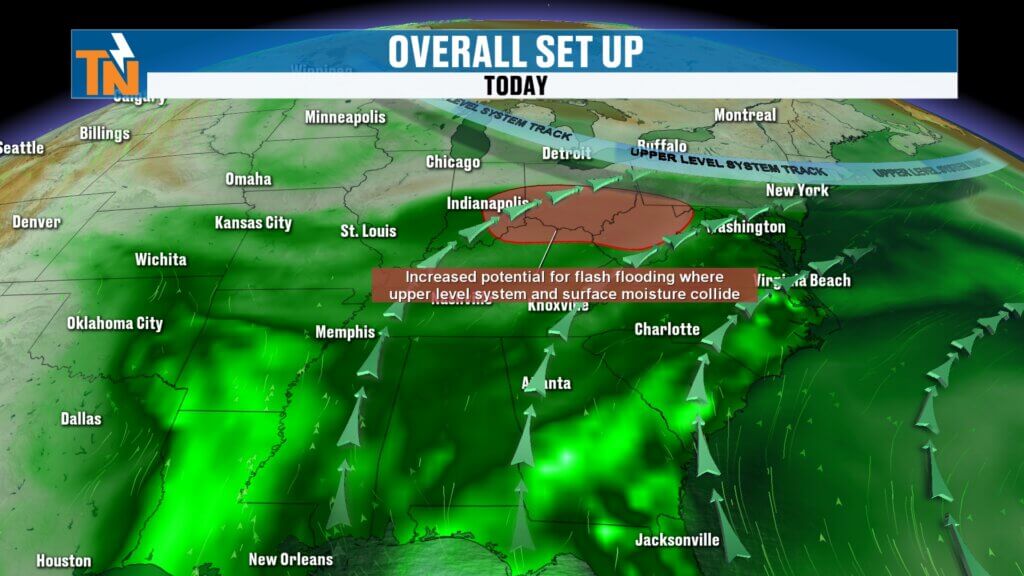
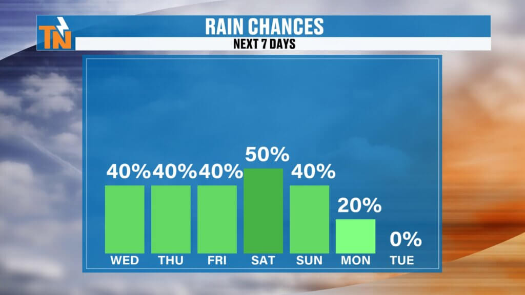
The overall weather pattern really hasn’t changed much over the last several days. We’re still dealing with warm, humid air streaming in from the Gulf, scattered showers and thunderstorms, and localized flooding concerns where heavier rain develops. The good news? Rain chances are beginning to trend downward just a bit as we head toward the weekend.
Why We’re Still Stuck in This Wet Pattern
The setup remains pretty much the same.
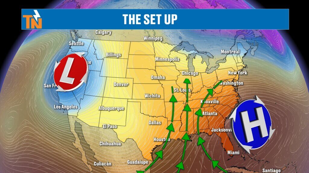
A large low-pressure system remains parked out west while high pressure is anchored across the Southeast. That combination creates a funnel effect, continuously pumping Gulf moisture into East Tennessee.
Add in:
- Plenty of heat and humidity
- Moisture-rich air
- Small disturbances moving overhead
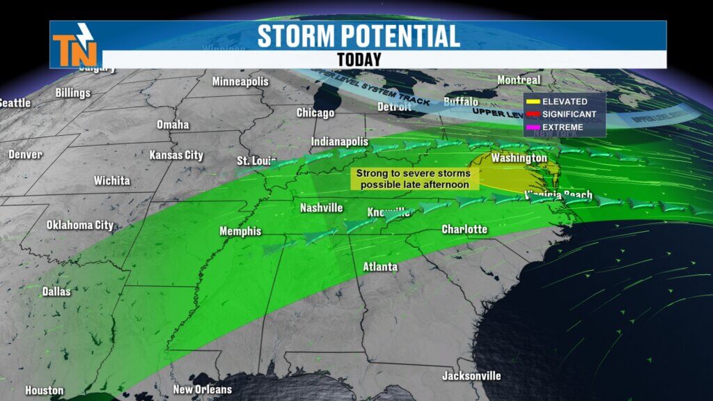
…and that’s why we continue to see scattered showers and thunderstorms pop up each afternoon.
Flooding Concerns Continue
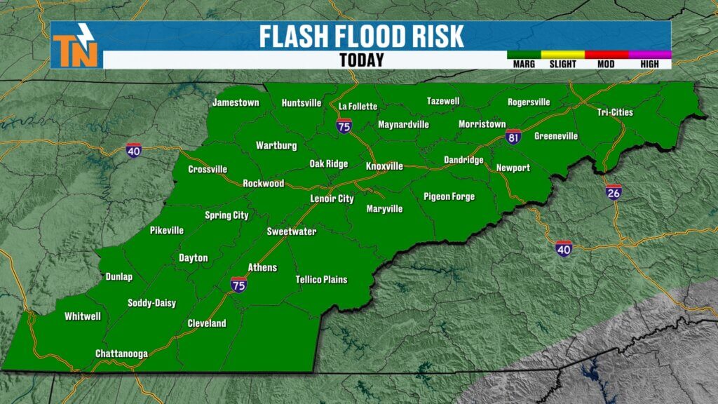
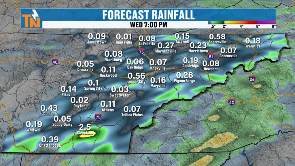
The Weather Prediction Center continues to place East Tennessee under a Level 1 risk for localized flooding and flash flooding today.
The encouraging news:
- Rain coverage is expected to be lower than earlier this week
- Not everyone gets rain today
The downside:
- Any storm that develops could still dump a quick burst of heavy rainfall due to all the available moisture in the atmosphere.
And because the ground is already saturated in some areas, localized flooding can still happen quickly if heavier storms repeatedly move over the same location.
Today’s Forecast: Spotty Showers and Storms
Think of today as a repeat of Tuesday — just a little more isolated.
Timeline for today:
- Morning: Warm, muggy, mostly quiet
- Afternoon: Spotty showers and thunderstorms develop
- Evening: Storms gradually fade as daytime heating decreases
Not everyone will get wet today, but if you do get a storm, expect locally heavy rainfall for a brief time.
Mild, Muggy, and a Bit Breezier
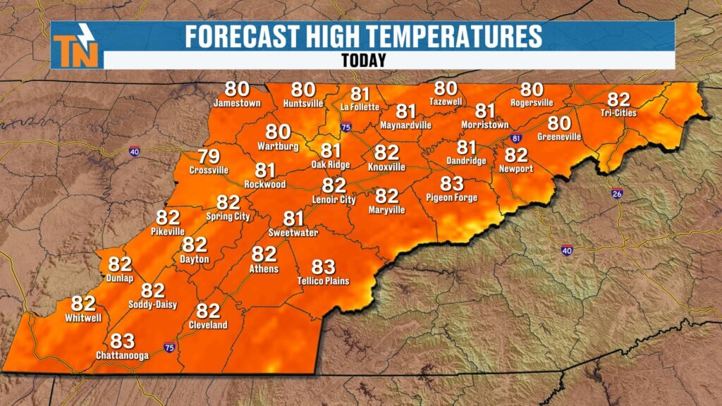
We’re starting the day off in the 60s and 70s once again.
Expect:
- Mild and muggy conditions
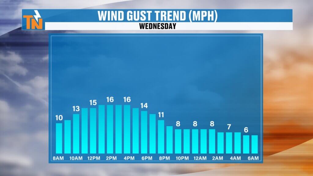
- A little more breeze than the last few days
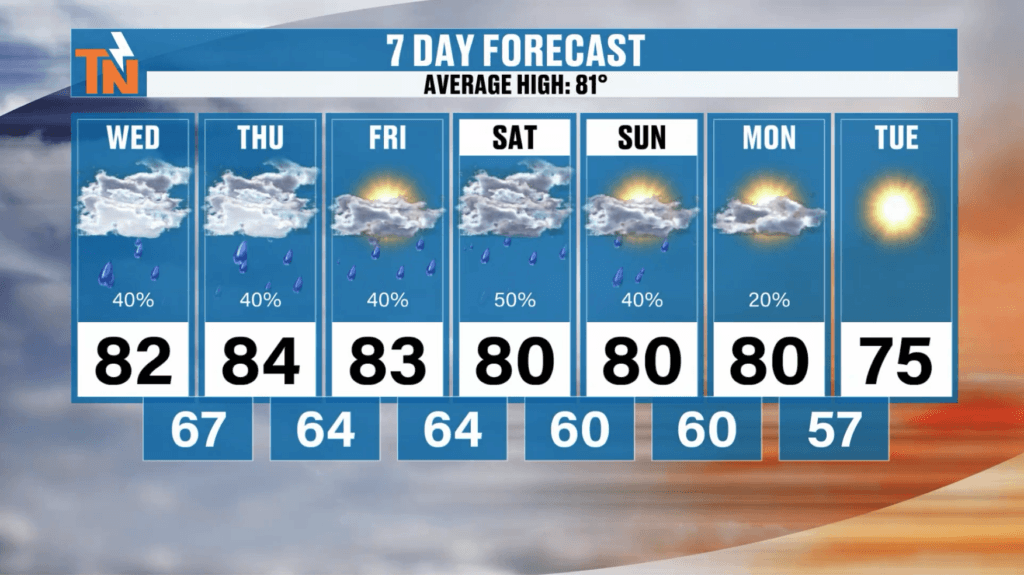
- Highs in the upper 70s to low 80s
Overall, temperatures stay pretty seasonal for late May and early June.
Humidity Slowly Starts to Ease
There’s finally a little relief on the horizon.
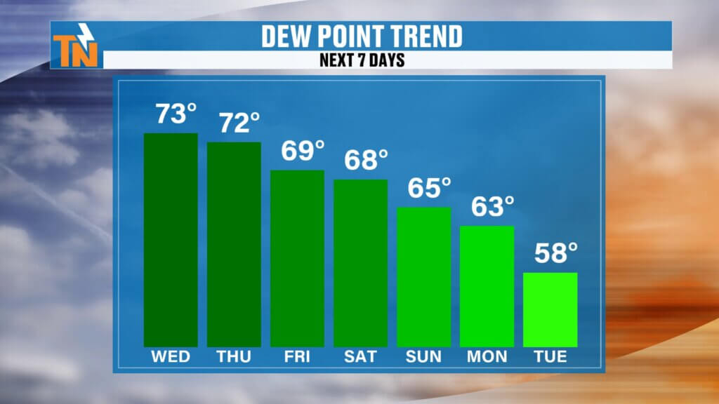
Dew points — a good measure of humidity — stay extremely sticky today and tomorrow, hovering in the 70s. That means it’ll still feel very humid outside.
But by the weekend:
- Dew points begin dropping into the upper 60s
- Humidity becomes a little more tolerable
- Rain chances gradually decrease
And by early next week, we may actually notice some slightly more refreshing air moving into East Tennessee. Winds will be a touch breezier than yesterday, but nothing too significant.
Rain Trends Lower Into the Weekend
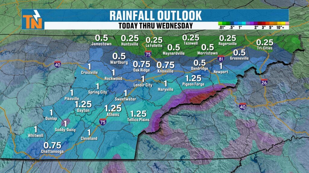
Rain chances remain elevated, but the coverage becomes more spotty.
Best chance for additional rainfall:
- South of Interstate 40
- Southern Valley locations
- Areas closer to Chattanooga and the mountains
North of Interstate 40 may see less overall rain over the next seven days.
7-Day Forecast: Warm Days, Fewer Storms Ahead
Expect temperatures to stay:
- Near average to slightly above average through the weekend
- Highs mainly in the upper 70s to low 80s
Looking ahead into early June, there are signs temperatures may trend slightly cooler than average before leveling back out by the second week of the month.
Bottom line: summer humidity sticks around for now, but rain chances are slowly easing, and slightly drier air is finally on the way.