
A Quiet Start, But Changes Are Coming
Happy Sunday, everybody!
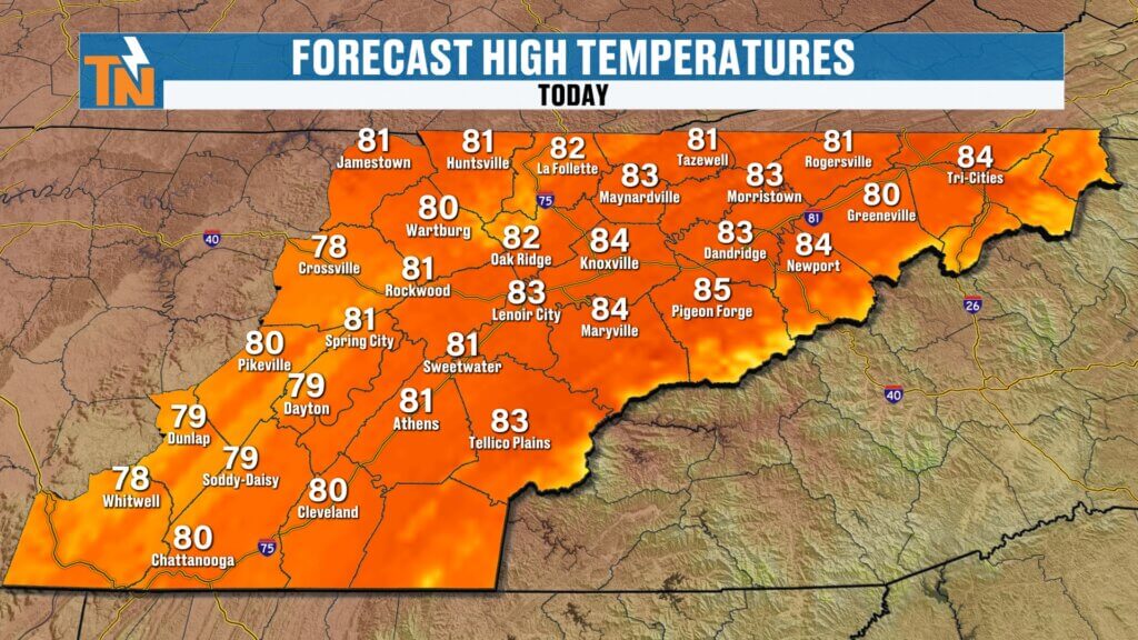
After some beneficial rainfall Saturday morning, today starts off much quieter across East Tennessee. While much of the day will feature warm temperatures and dry conditions, don’t get too comfortable. Several disturbances moving through the atmosphere will bring increasing chances for showers and thunderstorms later this afternoon, tonight, and again on Monday.
The good news? Once these systems move through, a much more comfortable stretch of weather arrives for the middle of the week.
Today’s Setup: Increasing Storm Chances
A disturbance moving in from the west will combine with deep Gulf moisture to increase rain and thunderstorm chances later today.
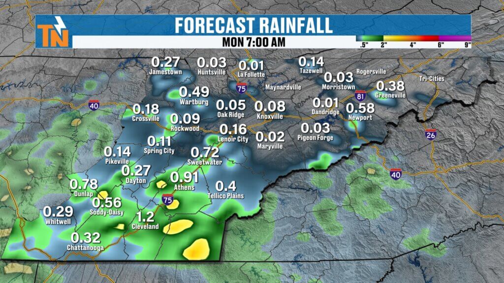
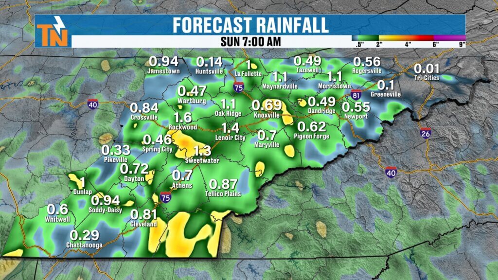
The atmosphere contains plenty of available moisture, meaning any showers or storms that develop could produce locally heavy downpours. While widespread severe weather is not expected today, heavy rainfall remains the primary concern. The Weather Prediction Center has placed East Tennessee under a Level 1 risk for localized flooding and flash flooding through Monday morning.
Sunday Timeline
Here’s how today is expected to unfold:
- Morning: Dry and comfortable with a mix of sun and clouds
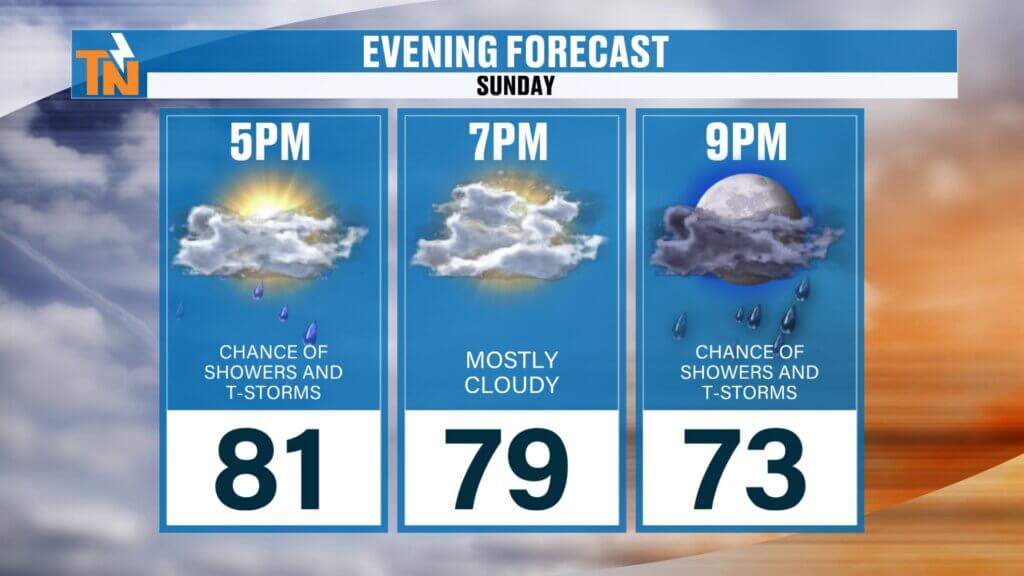
- Afternoon: Showers and thunderstorms begin developing
- Evening: Scattered showers and storms become more numerous
- Overnight: Periods of rain continue before activity diminishes by Monday morning
While storms today are not expected to be particularly severe, some could produce brief heavy rain and localized ponding on roads. Around 81° by 7 p.m.
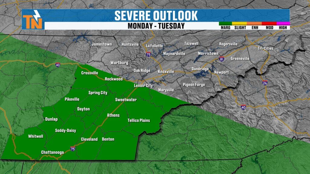
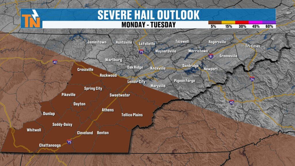
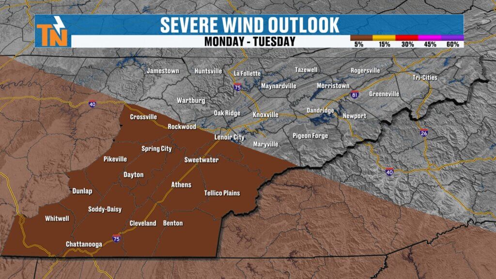
Monday: Higher Severe Weather Potential
After a quieter start Monday morning, attention turns to another disturbance diving southeast from the Midwest.
The Storm Prediction Center has placed areas mainly south of Interstate 40 under a Level 1 severe weather risk. The primary threats with Monday afternoon and evening storms will be:
- Damaging wind gusts
- Large hail
- Frequent lightning
- Heavy rainfall
At this time, tornado potential appears very low.
The greatest concern window currently looks to be from mid-afternoon through early evening Monday as a cluster of thunderstorms races into East Tennessee during peak daytime heating.
Rainfall Totals Continue to Add Up
Additional rainfall today and Monday will be beneficial for drought-stricken areas, especially across the Southern Valley where some of the heaviest rain is expected.
While not everyone will see the same totals, several locations could pick up meaningful rainfall over the next 24 to 48 hours. By Saturday night, rain should begin tapering off, setting the stage for a dry and pleasant Sunday — just in time for the final day of the month.
Cooler and More Comfortable Weather Arrives
Behind Monday’s storm system, a trough moving through the eastern United States will usher in noticeably drier air.
Humidity levels drop significantly Tuesday through Thursday, bringing some of the most comfortable weather we’ve experienced in weeks. Sunshine returns, humidity decreases, and temperatures remain near or slightly below seasonal averages.
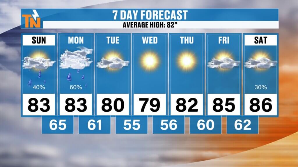
7-Day Forecast Highlights
- Sunday: Warm and humid with increasing showers and storms
- Monday: Storm chances increase, a few strong storms possible
- Tuesday: Cooler, drier, and more comfortable
- Wednesday: Mostly sunny and pleasant
- Thursday: Continued comfortable weather
- Friday: Warming back into the mid to upper 80s
- Next Weekend: Heat and humidity begin increasing again with additional storm chances
Looking Ahead
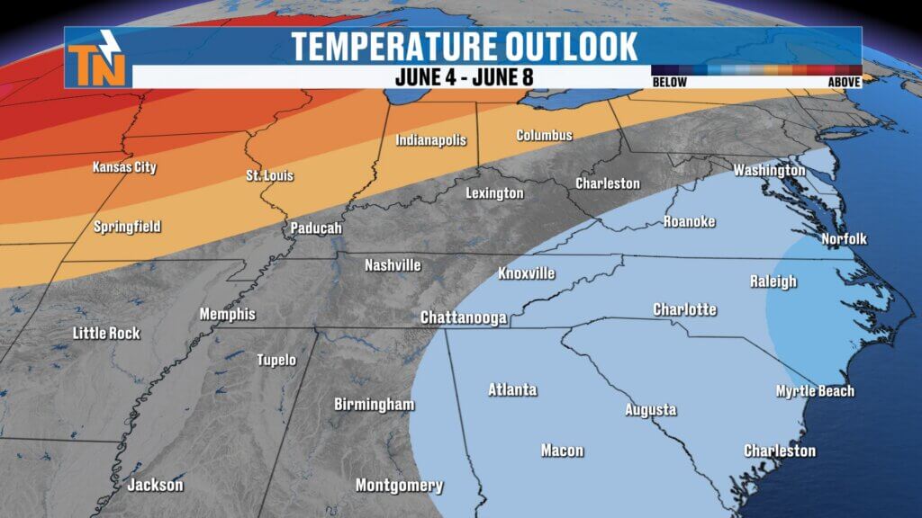
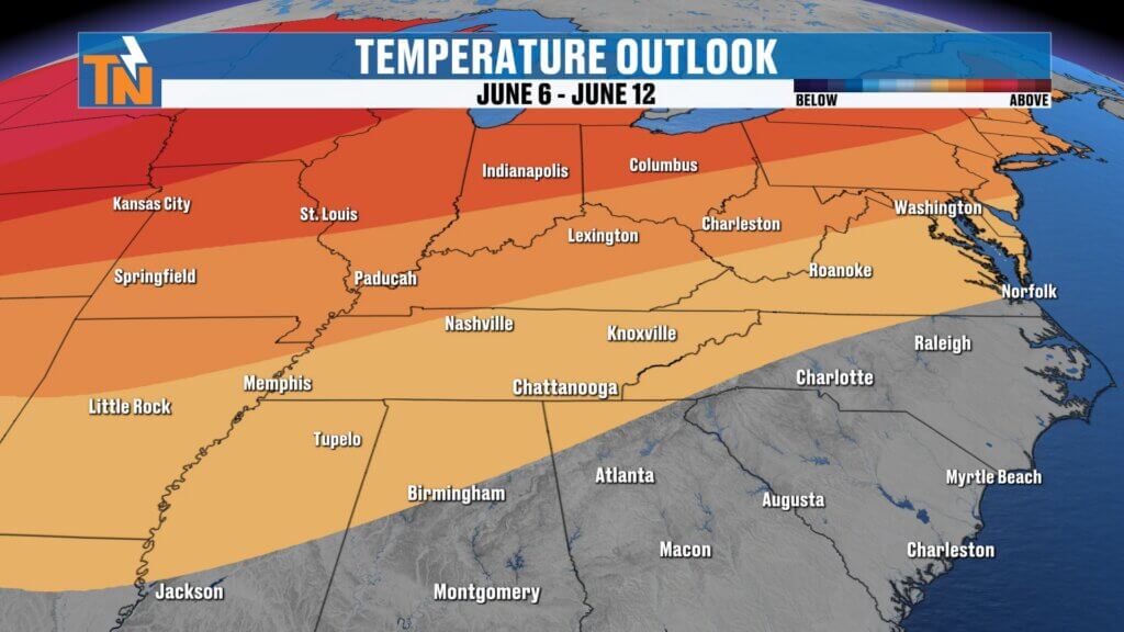
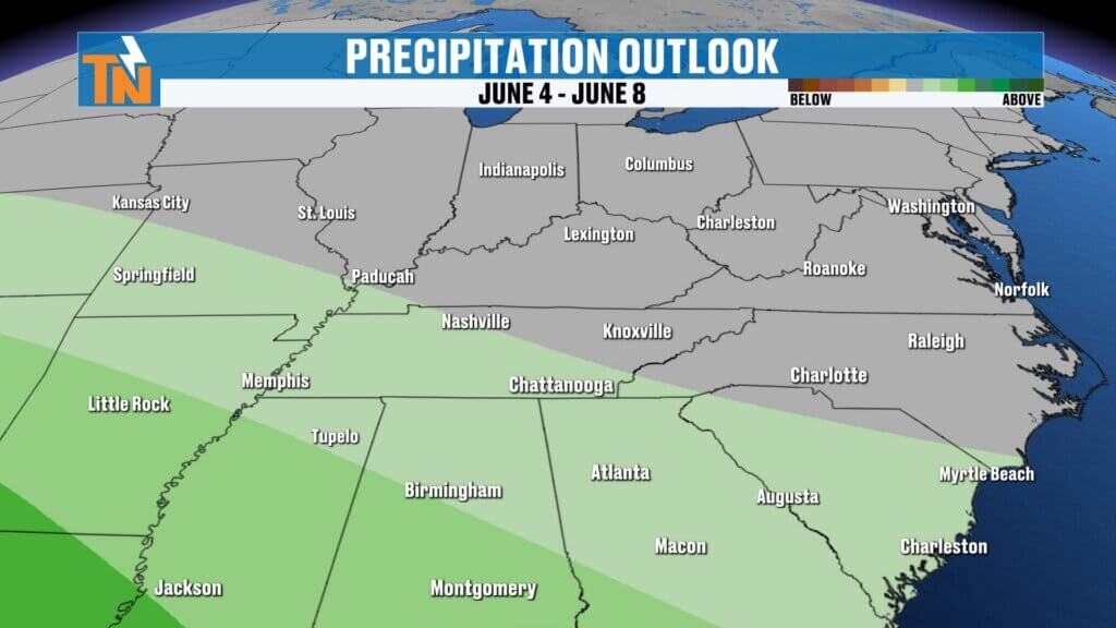
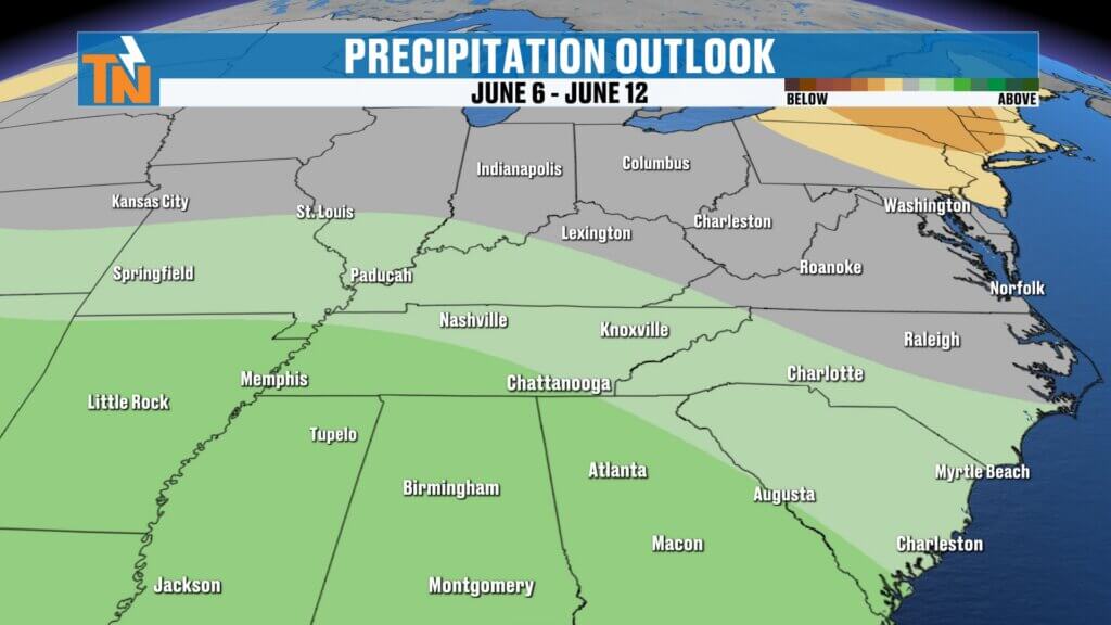
The middle of the week offers a welcome break from the humidity and storm chances. However, longer-range outlooks suggest temperatures could trend above average again by early June, with additional opportunities for rainfall returning as well.
Enjoy the quieter weather today, but keep an eye on the sky later this afternoon and especially Monday as the next rounds of showers and thunderstorms move through East Tennessee.