
Published: Thursday, October 29, 2026 | By Meteorologist Mike Witcher | eastTNweather
Good morning, East Tennessee, and happy Thursday! We’ve got some changes to the Halloween weekend forecast this morning, and they’re good ones.
The rain chances we’ve been talking about are fading.
Saturday has gone dry. I’ve taken the rain chances out completely.
Sunday is trending drier, too, so the Halloween weekend looks better than it did just a few days ago.
But don’t put the umbrella away just yet. Another storm system is still on the horizon for the middle of next week.
Yesterday's Almanac
We continued the trend of above-average temperatures Wednesday.
Knoxville made it to 73°. The average high for this time of year is 67°.
Crossville reached 72° and Chattanooga hit 77°.
And the Tri-Cities, while not quite as warm as the day before at 78°, still made it to 73°. The average high there is 63°.
A Chillier Start, Then Plenty of Sunshine
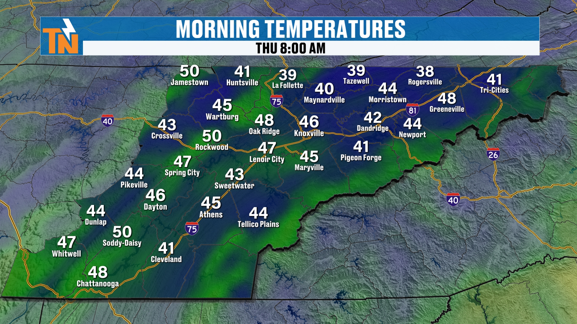
We don’t have as much fog this morning in some of the usual spots.
The good news? We’re looking at a lot more sunshine today.
It’s a little chillier in some locations because we don’t have the cloud cover hanging around like we did yesterday morning. We’re starting out in the 40s and 50s.
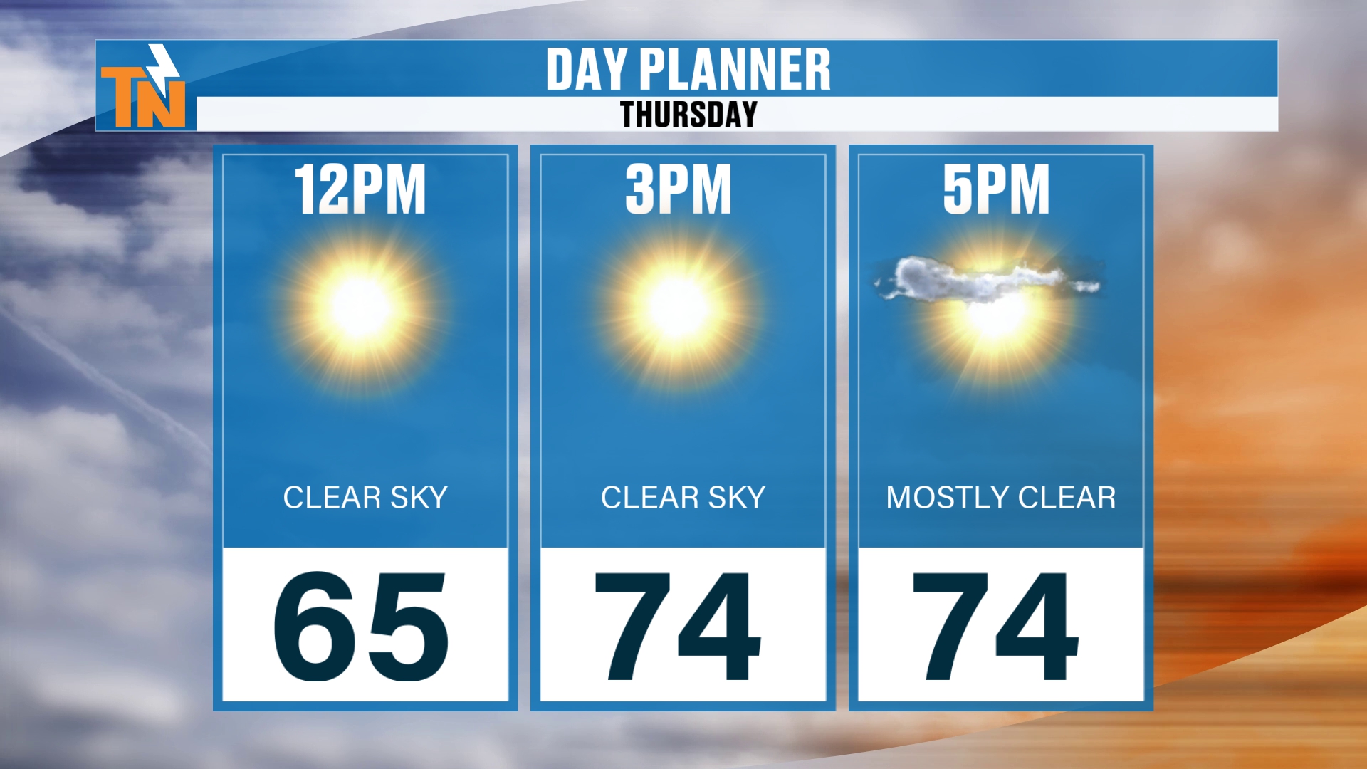
By lunchtime we’re at 65°. By the time the kids head home from school, we’re up to 74°.
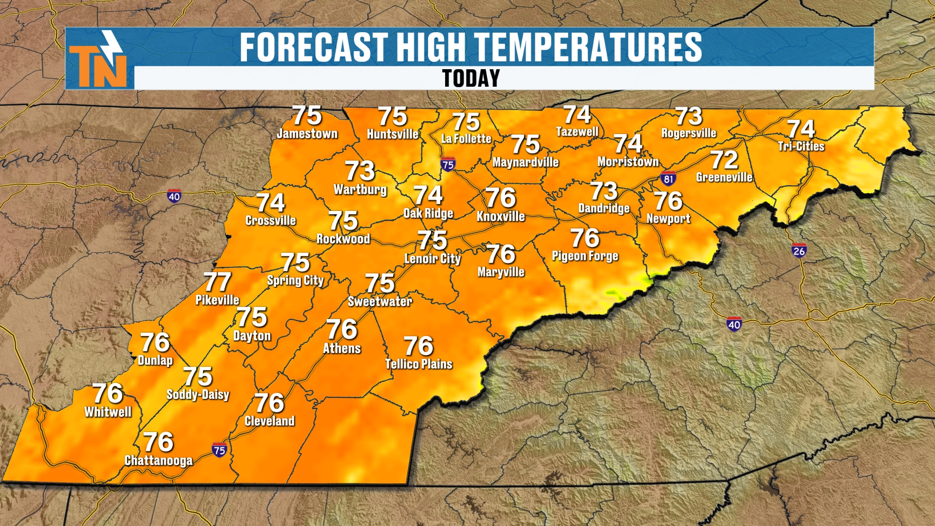
Our goal for all locations today is the mid 70s, which is about 7 or 8 degrees above average for this time of year.
A Little Breeze Today
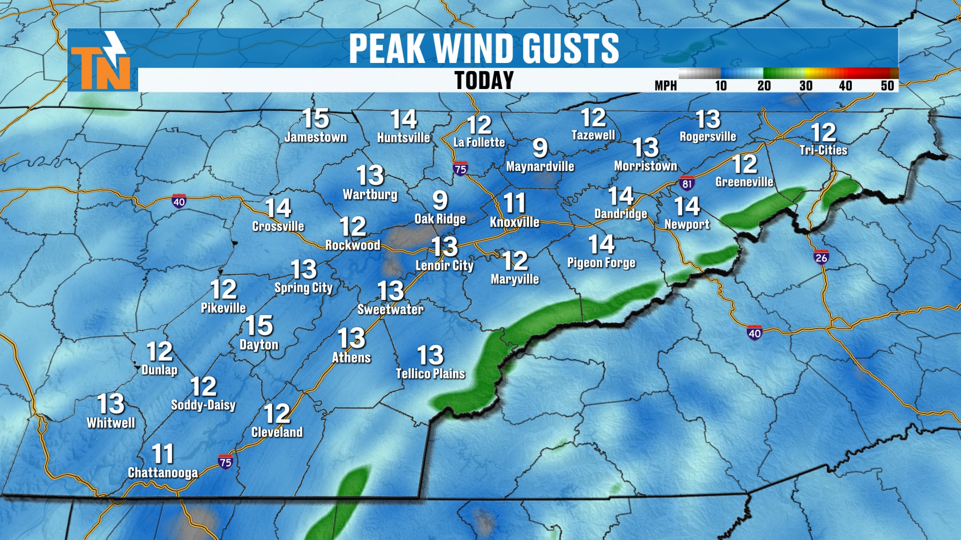
We’ll see a bit of an afternoon breeze, with stronger wind across the mountains.
I think the mountain counties will see some stronger wind as we get into Saturday and Sunday, too.
Tonight's Evening Forecast
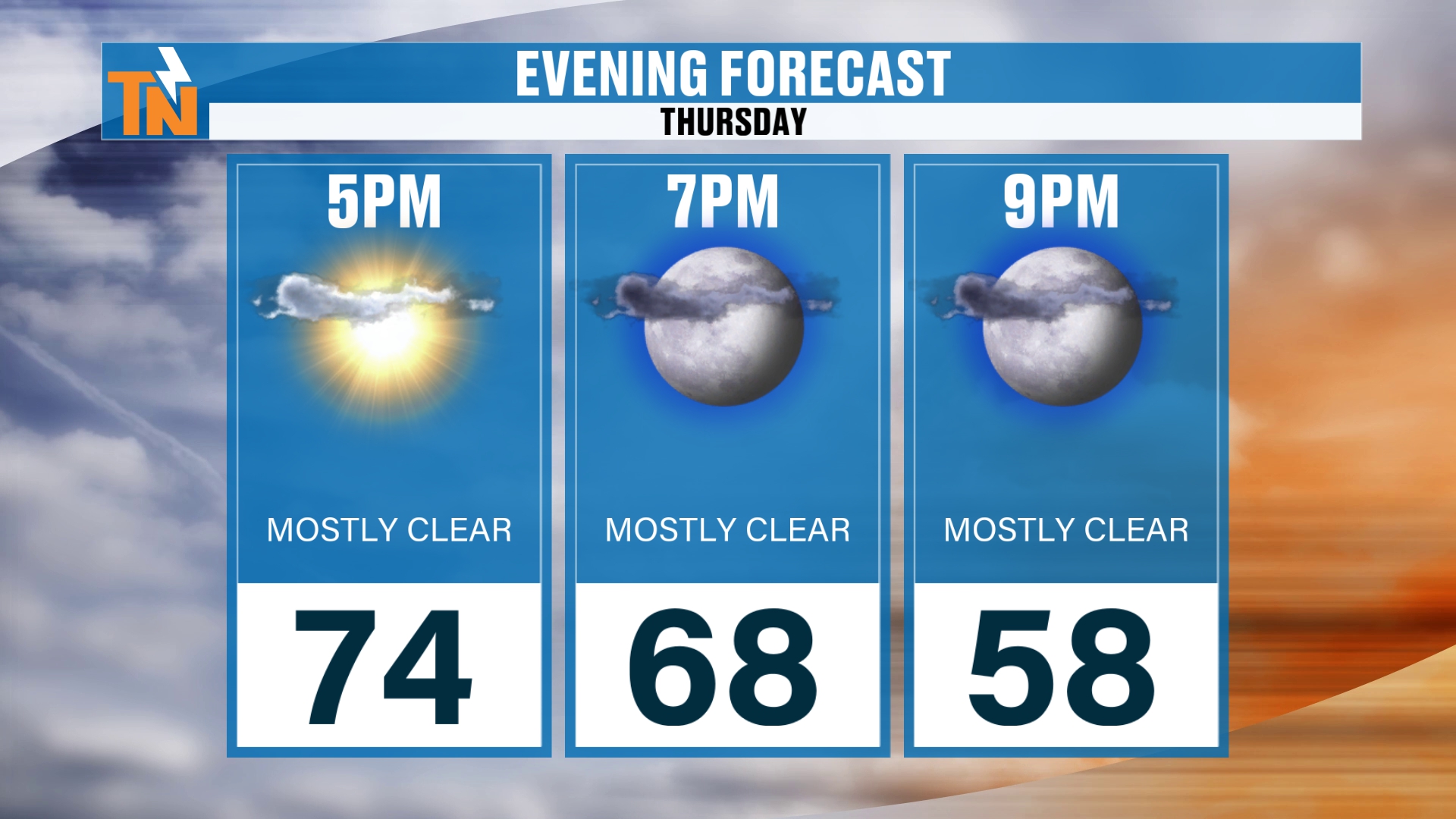
We’re at 74° at 5 PM, dropping to 58° by 9 PM.
If you’ve got evening plans, you’ll want those light jackets.
Dew points climb a little as we get into the weekend and the start of next week, so you’ll feel a bit more moisture in the air. It’s not going to be hot, but you’ll notice it.
Halloween Weekend: Rain Chances Are Coming Down
Here’s the story.
A little piece of energy is coming off the Mexican Plateau into Texas on Friday, then zipping up the Mississippi River Valley and into the Tennessee Valley.
But it’s losing some of its moisture and some of its energy.
That’s why we go slow and low.
Friday will see clouds increasing from the south and southwest. We should still have a nice sunset Friday night, although with the cloud cover it may not be amazing. If some sunshine can peek in underneath that cloud deck, though, we could get some color.
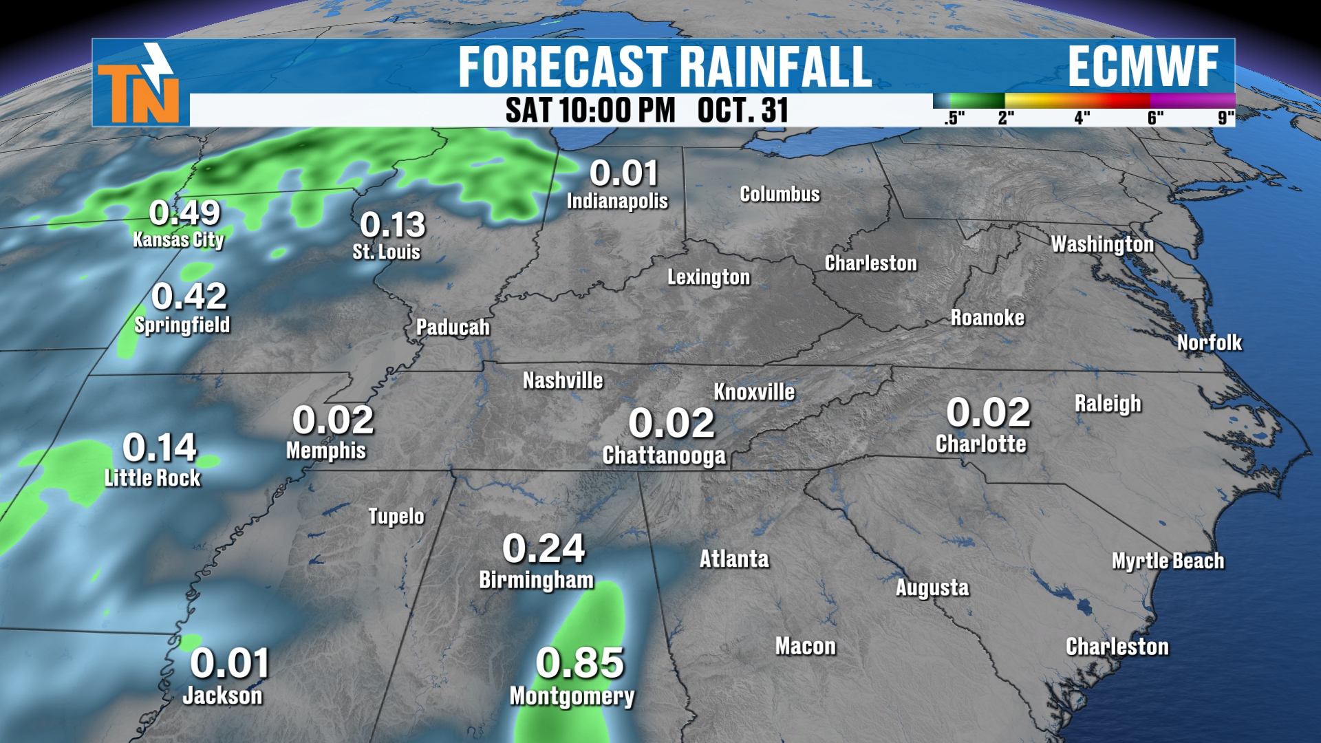
Then Saturday starts off dry and stays mostly cloudy. Maybe a sprinkle here or there, but I’m not expecting much.
And that includes trick-or-treat time.
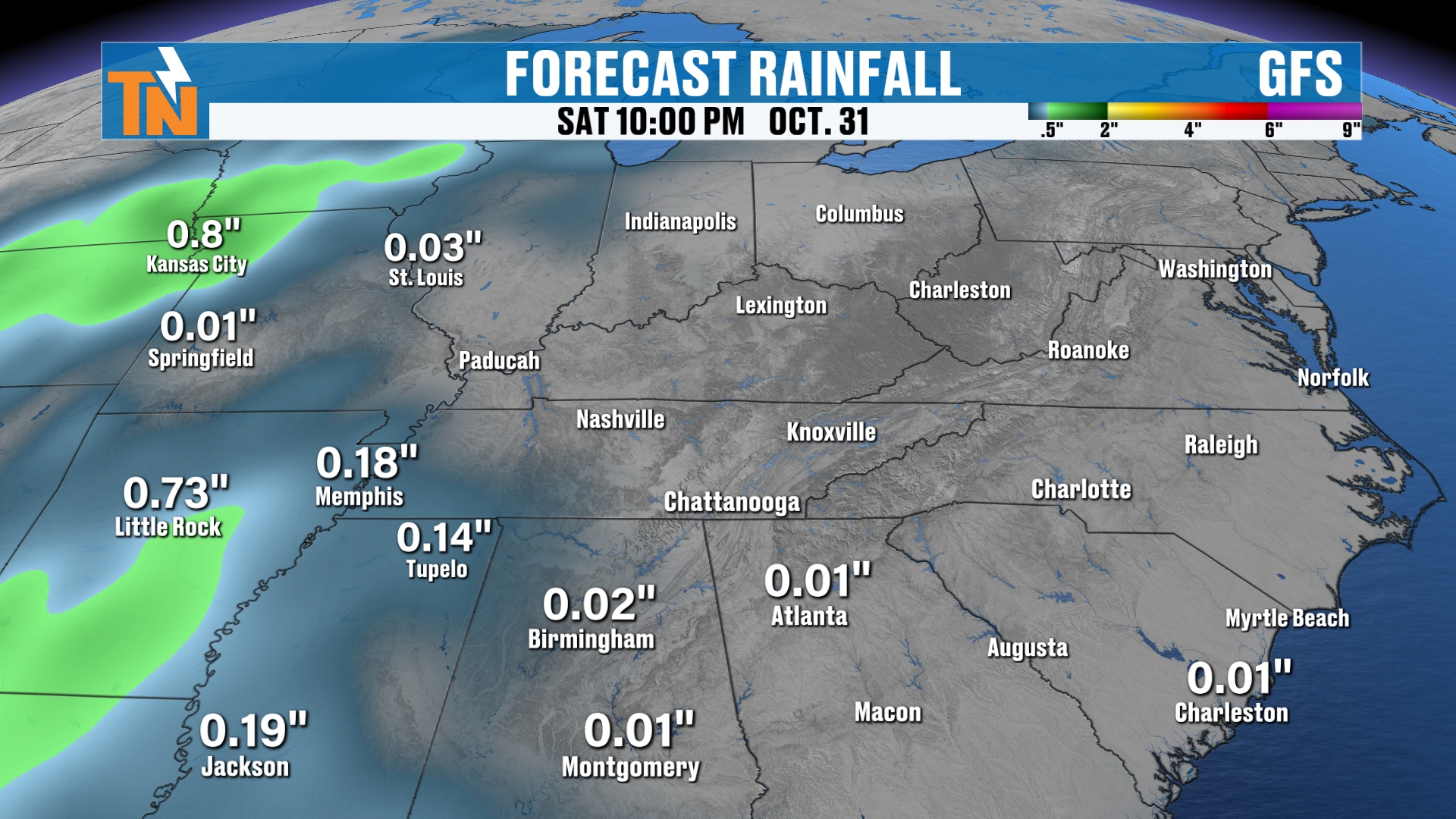
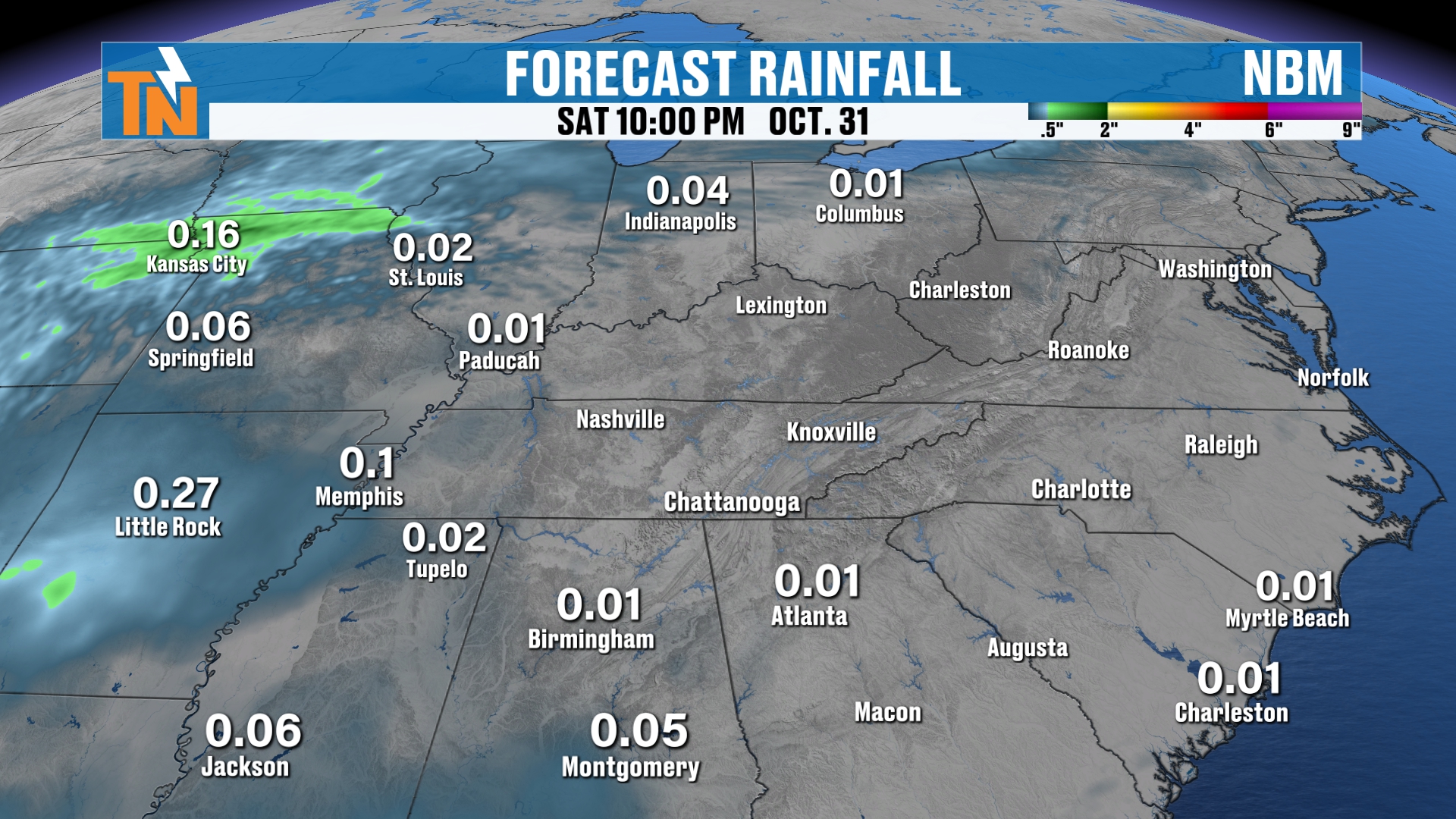
All of the models are keeping us on the drier side for Halloween. They’ve also backed off the rainfall potential further to our west and southwest.
So not expecting much in the way of rain for trick-or-treaters across the state of Tennessee and much of the region.
That’s great news.
What About Sunday?
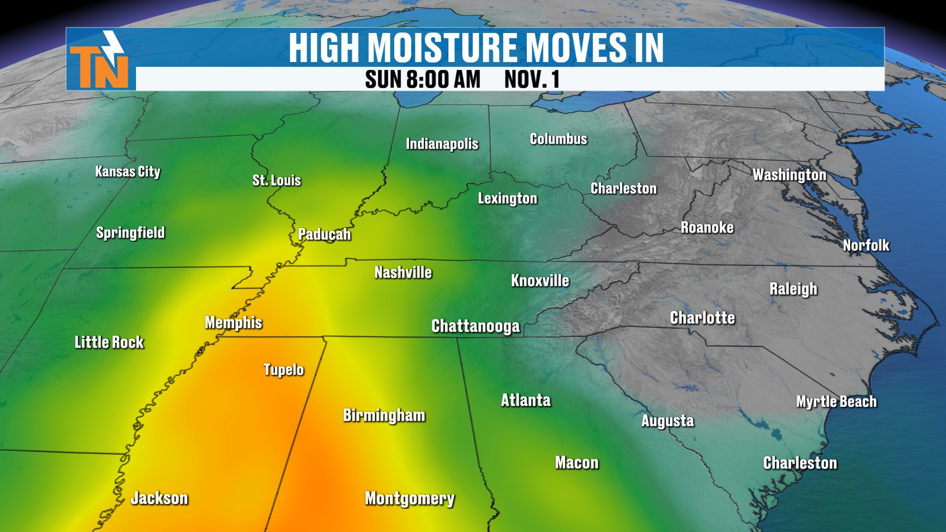
We still have a lot of moisture swinging through. Precipitable water values have dropped a little from what I was talking about the past couple of days, but we’re still trending around 150 to 200% of normal for this time of year.
So we still have the potential for some rainfall.
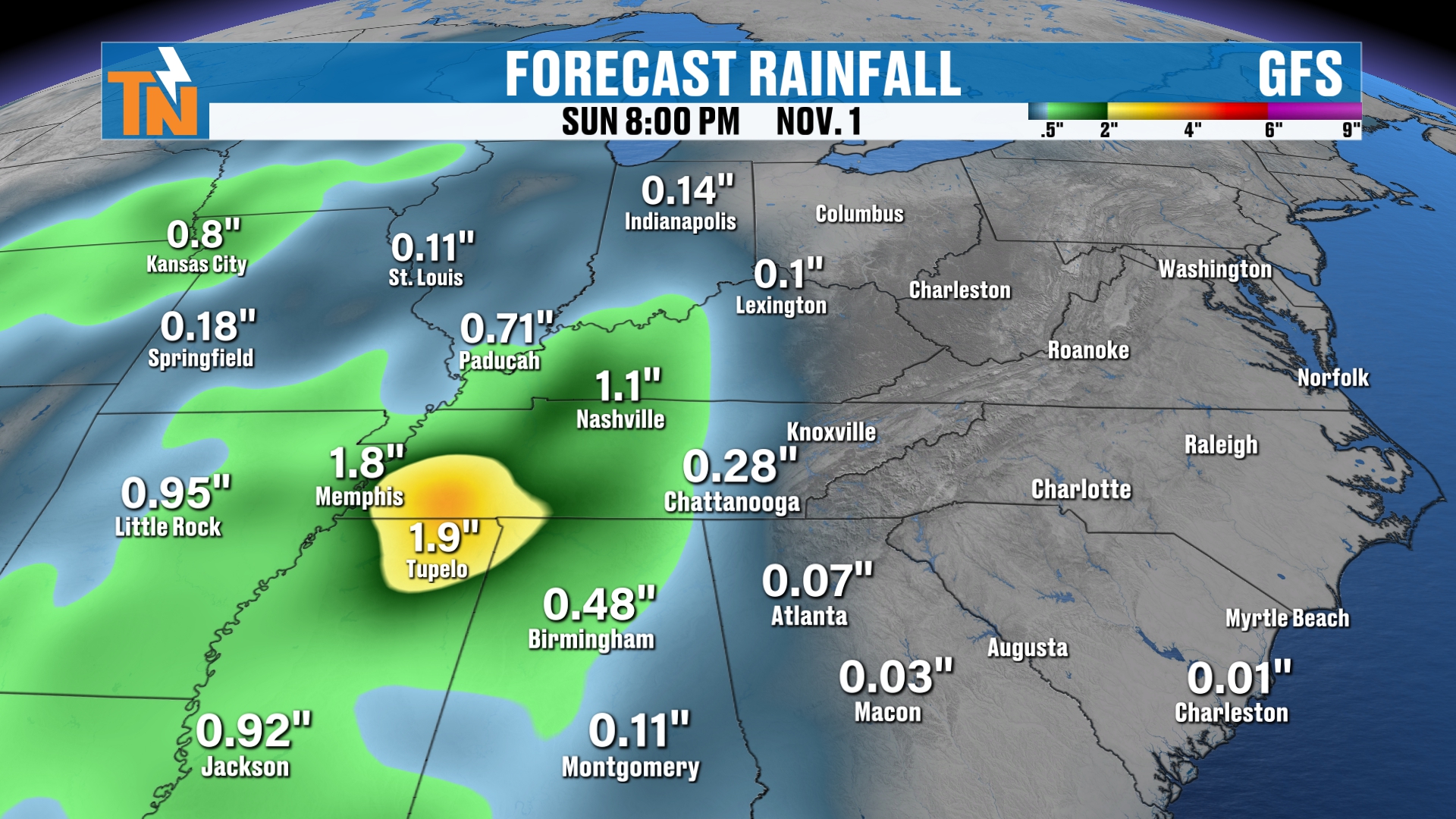
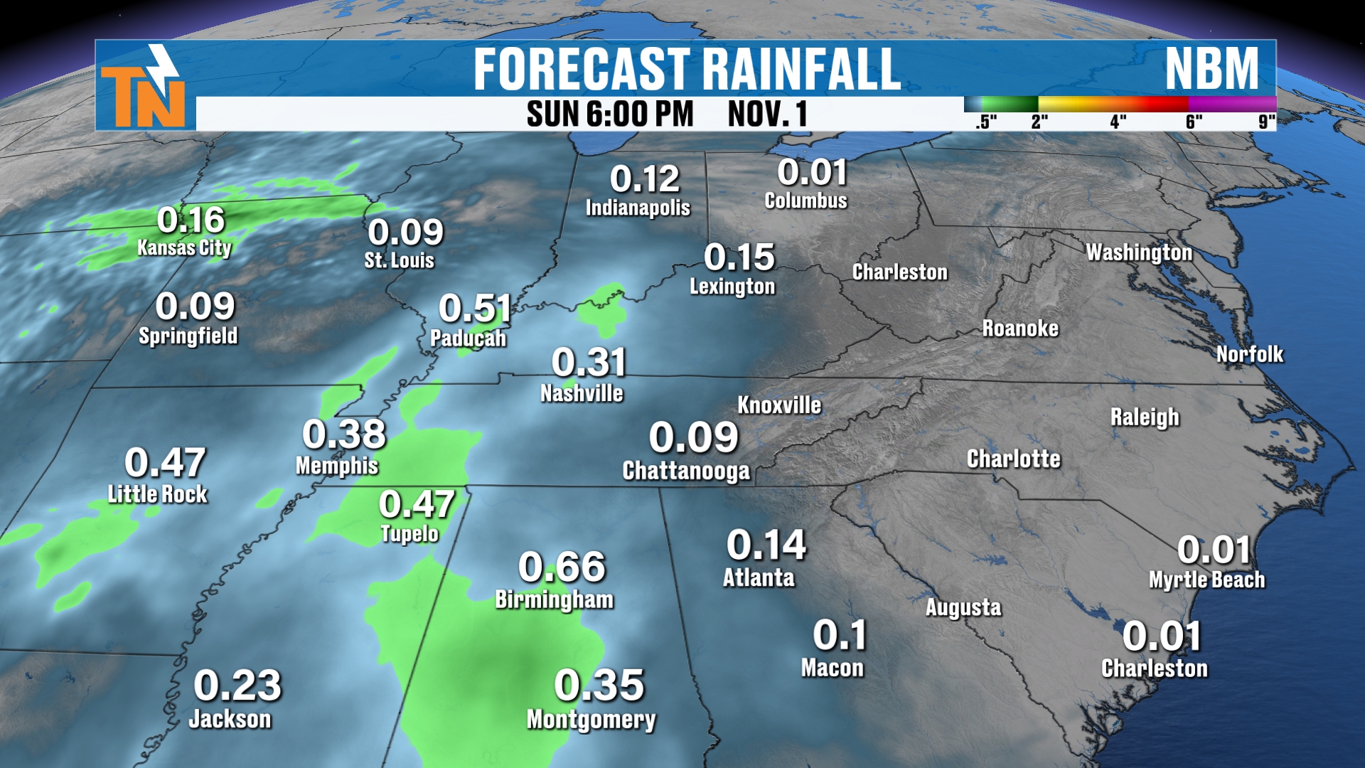
But the trend is clear.
The European model has backed off for four days in a row. The GFS, the American model, had been painting anywhere from a third of an inch to over an inch and a half of rain just a couple of days ago. That’s a big change, and it has backed way off now. And the National Weather Service blend of models has backed off as well.
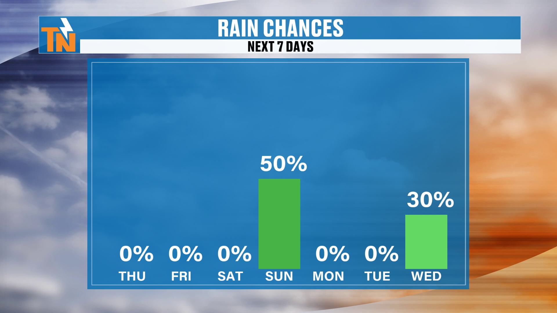
So while I have a 50% chance of rain for Sunday right now, it’s probably going to be less than that.
Remember, that percentage doesn’t tell you timing, duration, intensity or totals.
That’s the story for the rest of your Halloween weekend: a dry Saturday and a Sunday that keeps trending drier.
Check back in tonight. As the models continue to come in, I’ll have a better handle on things.
Another Storm Next Week?
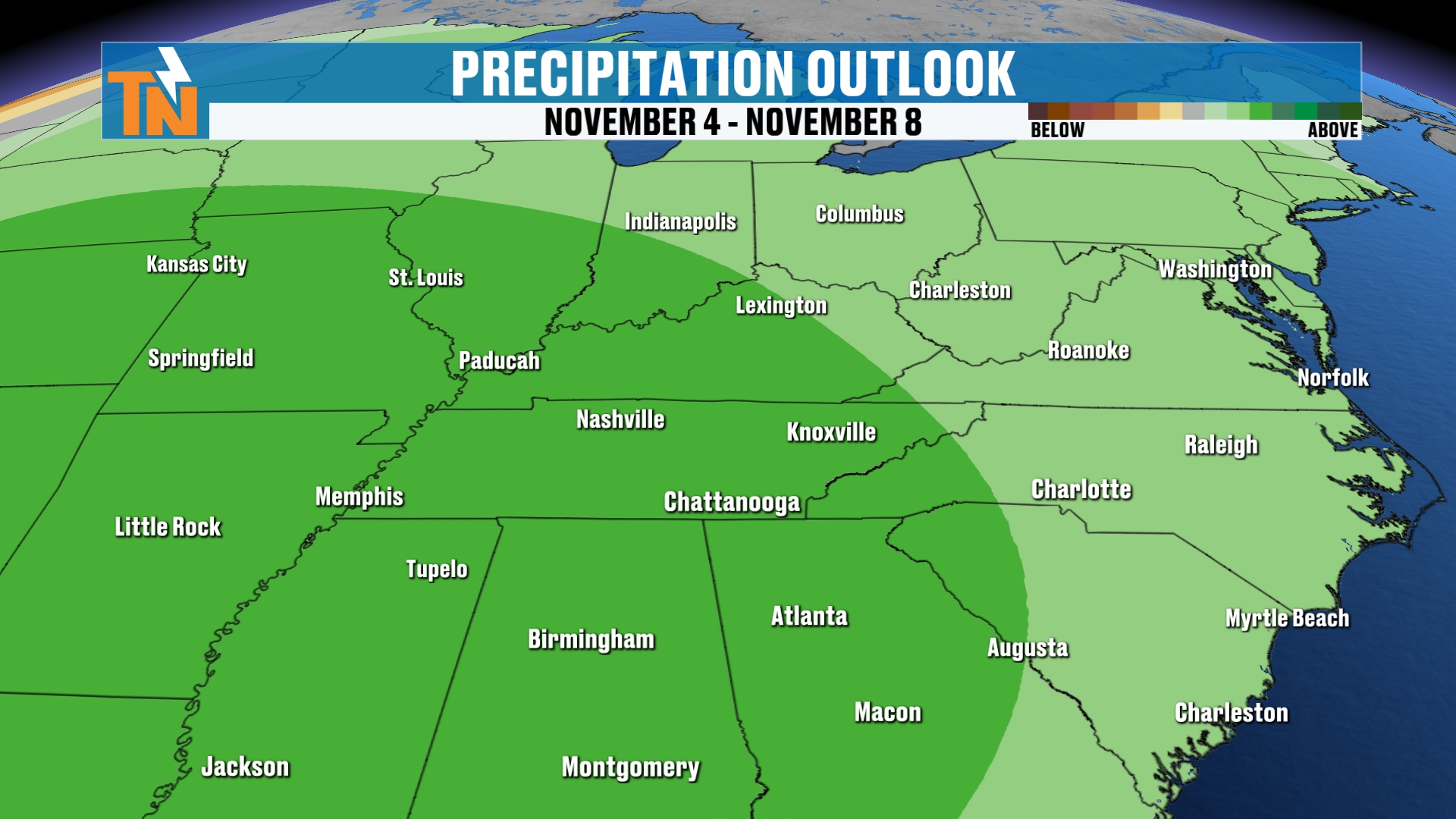
Maybe.
There’s a 30% chance of rain next Wednesday, and that may need to be tailored up as we go through the weekend.
Several models are picking up on another deep upper-level trough digging in from the Pacific Northwest. This is just model guidance, but if it happens, it could cool us down and bring more rainfall.
It looks stronger than the wave we’ve been tracking for this weekend, and most models are hinting that we could see 1 to 2 inches of rain by the middle and latter part of next week.
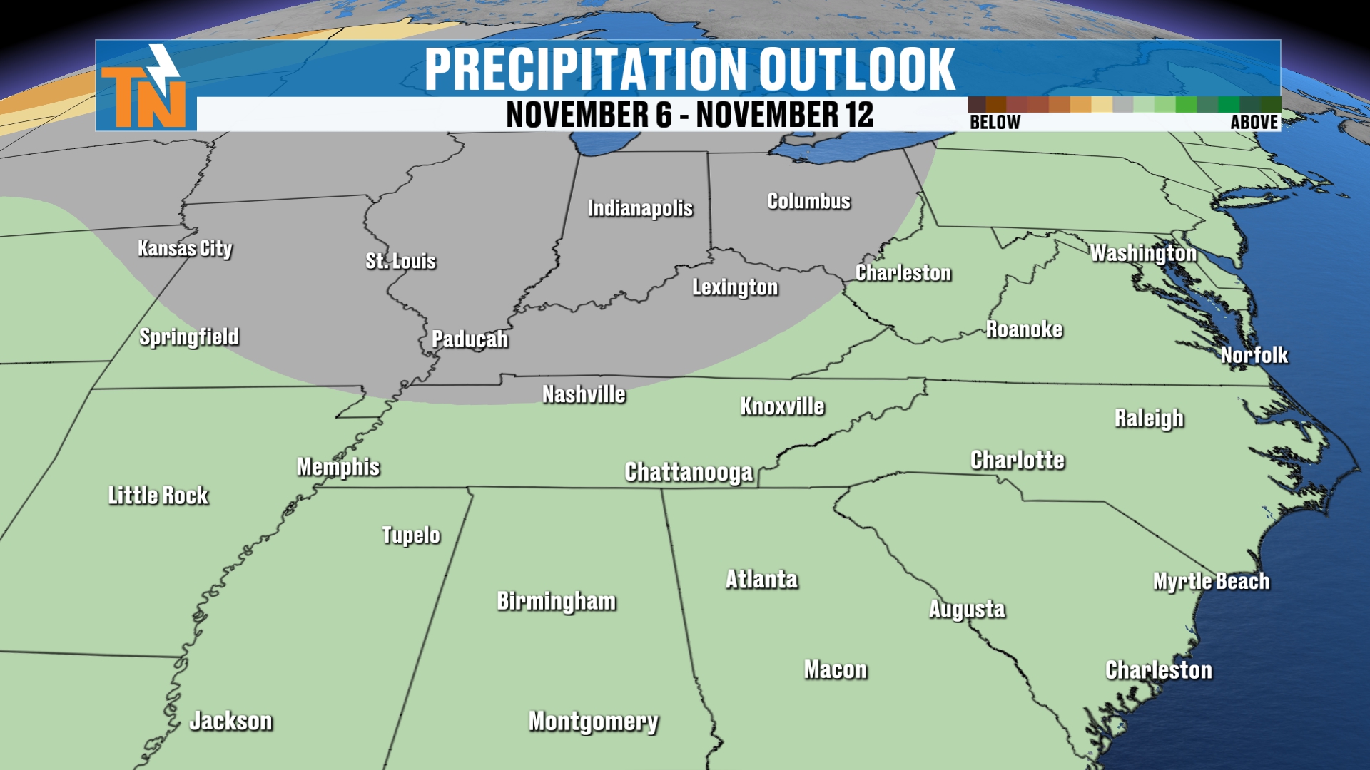
The Climate Prediction Center still has elevated rain chances for that time frame.
I’ll keep you posted.
Bottom Line
THURSDAY: More sunshine. Mid 70s, about 7 to 8° above average. Breezy in the mountains.
FRIDAY: Upper 70s. Clouds increasing. Dry.
SATURDAY (HALLOWEEN WEEKEND): Mostly cloudy and dry. Mid 70s. Trick-or-treaters should be fine.
SUNDAY: Mostly cloudy with a 50% chance of rain, or less. High around 68°.
MONDAY–TUESDAY: Low to mid 70s.
WEDNESDAY: Low to mid 70s with a 30% chance of rain as another storm system approaches.
BEYOND NEXT WEEK: The Climate Prediction Center is still predicting the potential for above-average temperatures.
The fall colors have really been popping around town. A lot of your photos have come through, so thank you for sharing those. I do share them on social media.
Make sure you download the FREE eastTNweather app from your app store. It’s a great tool when the weather really matters, or if you just want to quickly check current conditions where you live.
And if you’re watching on YouTube, don’t forget to LIKE, SHARE, SUBSCRIBE and hit the bell.
Catch up on all of my recent daily forecasts anytime.
I’m Meteorologist Mike Witcher.
Have a great Thursday, or better yet, Friday Eve!
eastTNweather — Weather When You Want It.