
Published: Wednesday, November 4, 2026 | By Meteorologist Mike Witcher | eastTNweather
Good morning, East Tennessee! Thanks for checking in on this Wednesday, November 4th, 2026, a day with a new severe weather risk.
We are talking about a cold front that’s swinging its way through the area today. This is the day we’ve been talking about for the last five or six days or so.
The front is going to produce some showers and thunderstorms, and now there’s the potential for some isolated strong to severe thunderstorms. If you checked in last night, I talked about that possibility, and this morning the Storm Prediction Center has issued a level one severe weather risk.
We’re also talking about the potential for some very small, isolated flooding and flash flood concerns. Low-lying areas are the main threat if we get repeated rounds of locally heavy rain, because we have a lot of moisture in the atmosphere to work with.
Let’s walk through all of the details.
Yesterday's Almanac
We’re going to hit the almanac briefly.
Yesterday was a very warm day. We knew that. That was the warm before the storm.
The clouds increased through the day and we made it to 78° in the Knoxville area.
Today is still going to be a warm day, but we have the showers and thunderstorms and mostly cloudy skies to deal with.
Radar Recap: Showers to Our West
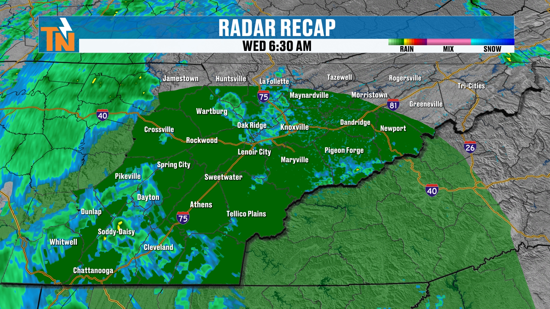
Let’s do a little radar recap. I had a little bit of computer issues this morning, so it’s probably going to pick up just the last couple of frames.
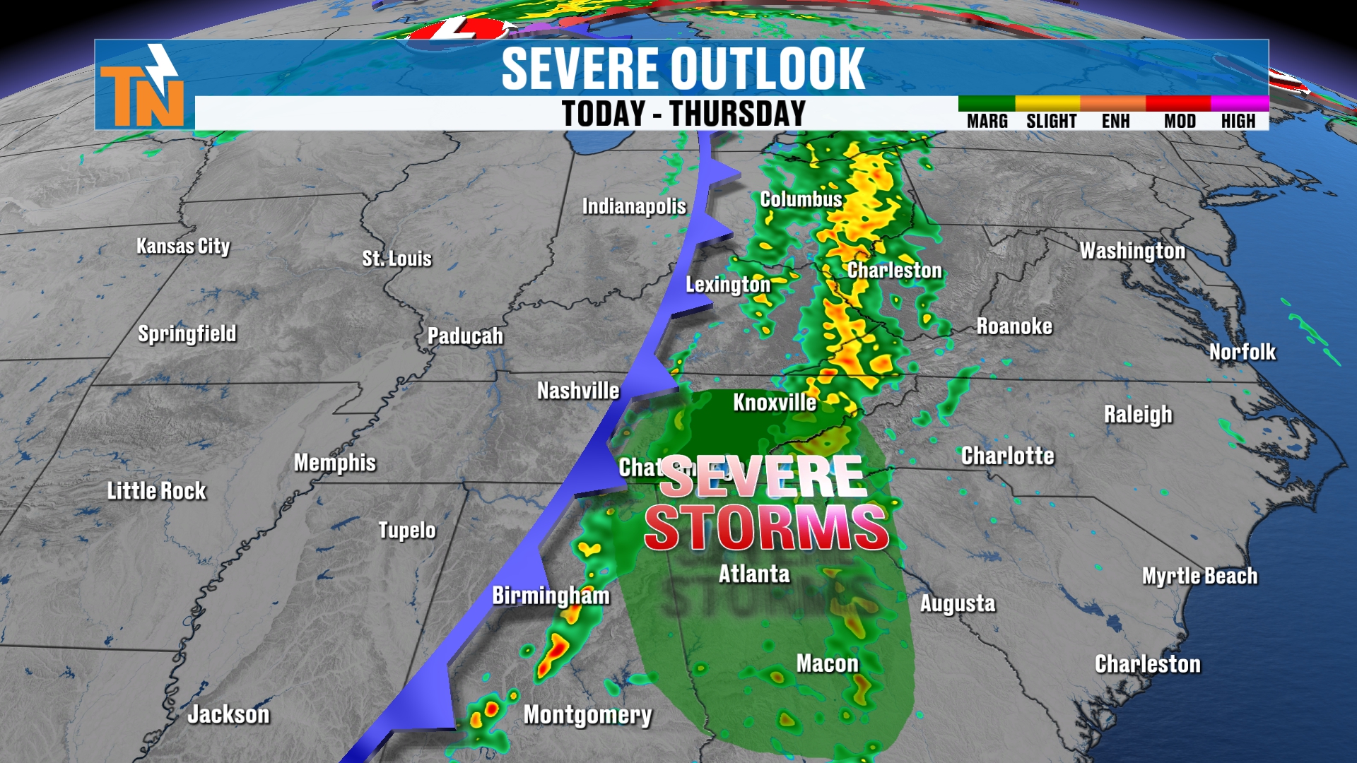
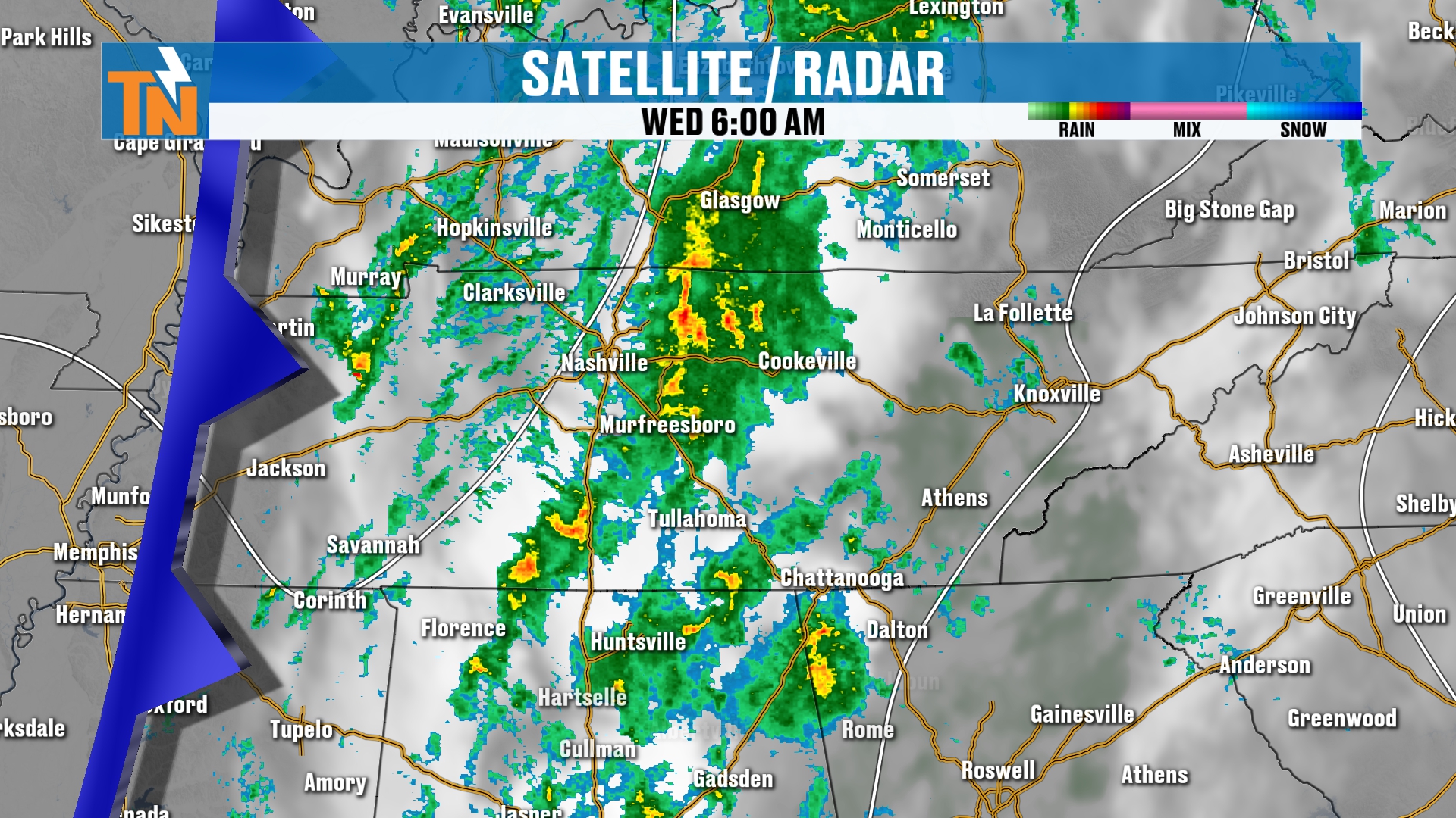
And there’s that risk level for severe storms. This doesn’t really do it justice, because I moved some data around this morning, but in the last couple of frames you can see the showers and thunderstorms back off to our west and into Middle Tennessee.
They’re not too terribly far away, and they will gradually increase throughout the day as this cold front slides into the area.
The Severe Weather Risk and the Timing
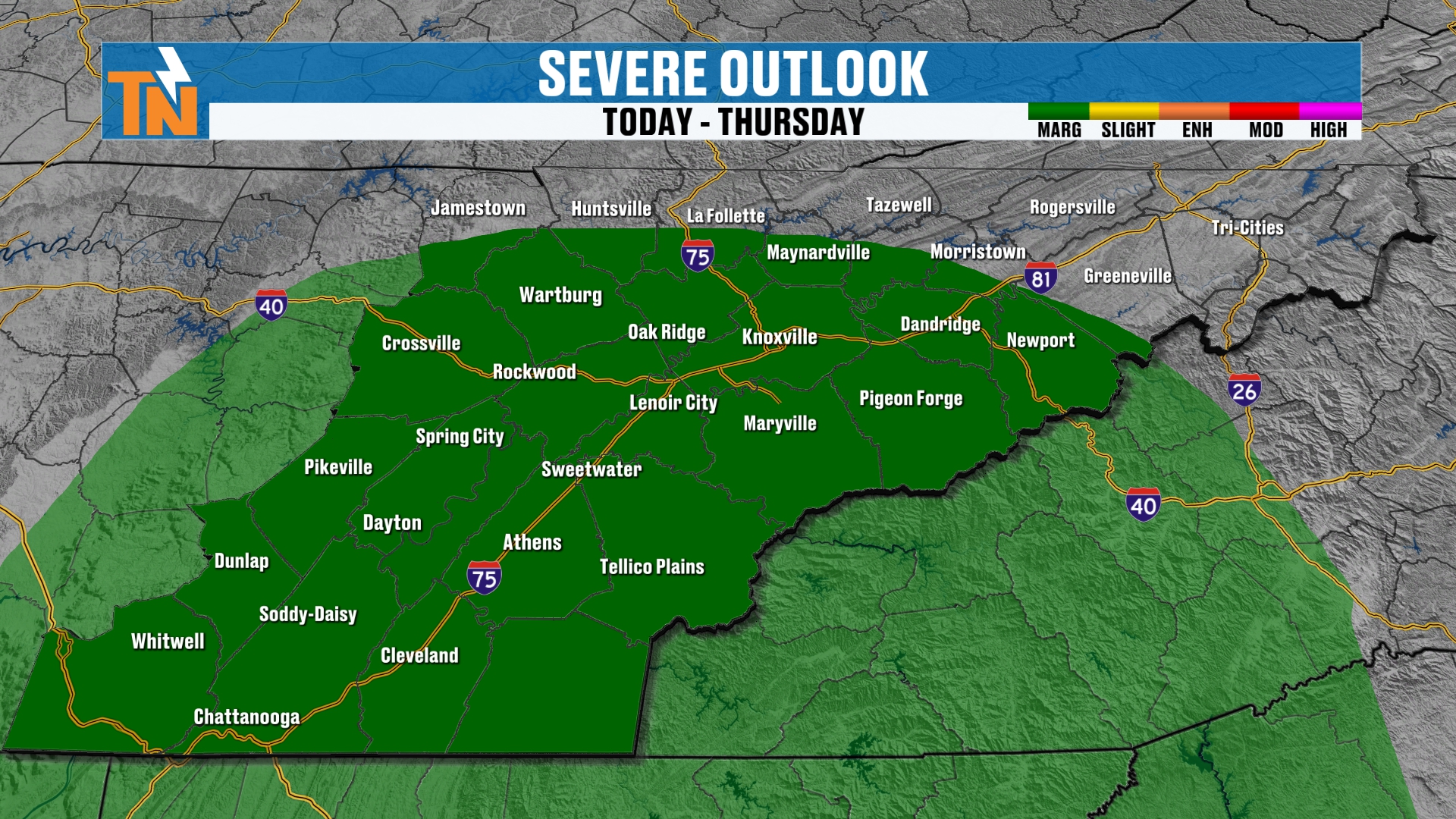
Let’s talk about the risk levels, because we do have a level one severe weather risk that has been issued by the Storm Prediction Center as the cold front comes through later this afternoon.
Here’s the timing. If we’re going to see anything at all, it would be some strong, gusty winds with some of these storms.
That would probably be closer to about 4, 5 or 6 PM tonight. That’s when the greatest instability starts to work its way into the area.
The severe weather risk exists mainly south of Interstate 40. So keep that in mind if you live along and south of that corridor.
A Risk for Flooding and Flash Flooding
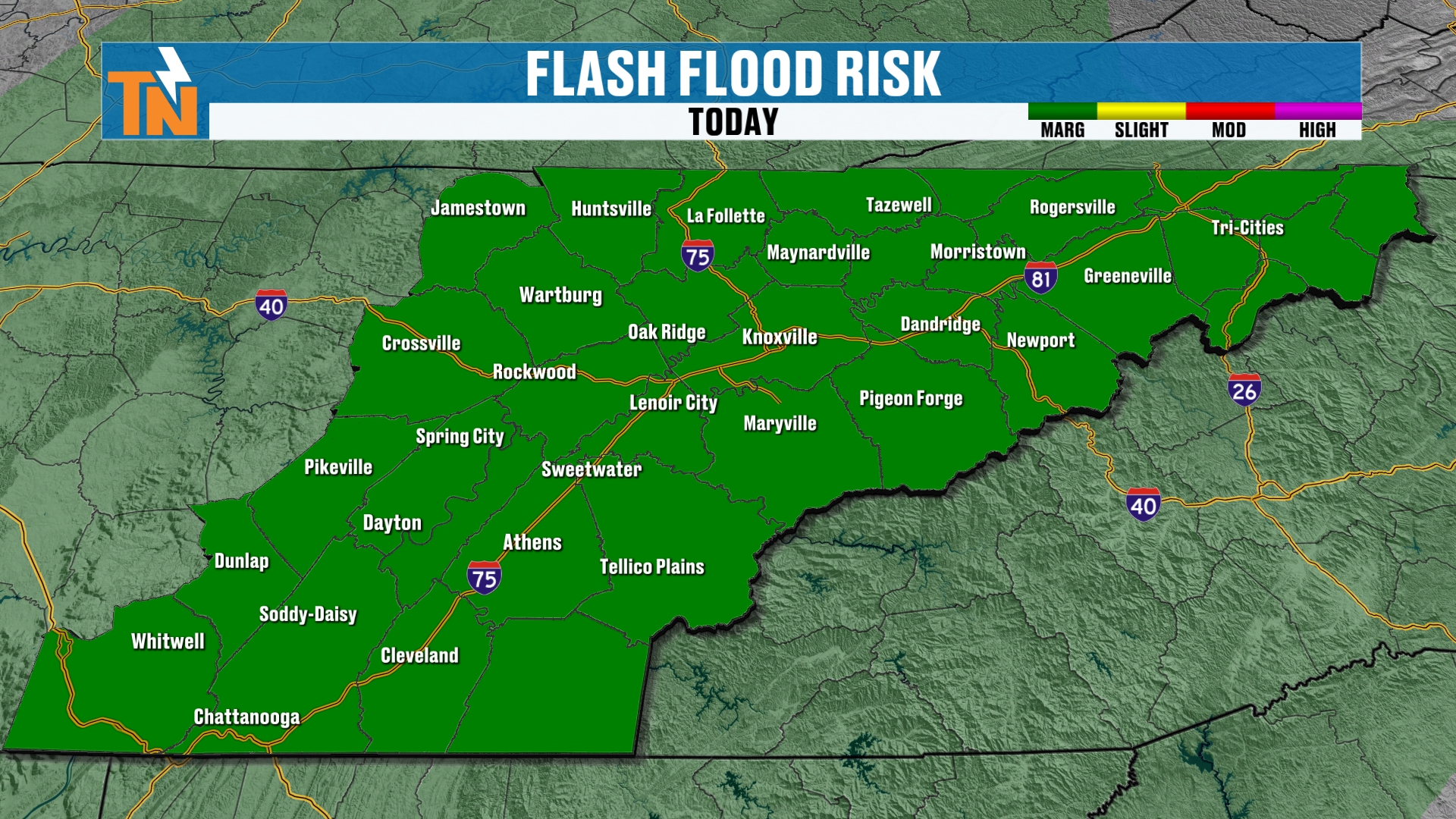
We also have a risk for some localized flooding and flash flooding concerns.
Of course, the ground has been extremely dry. But sometimes too dry can allow the water to run off pretty quickly before it starts to soak in.
Those low-lying, poor drainage areas are probably going to be your best bet for problems.
The rivers and lakes, or creeks I should say, seem to be doing just fine.
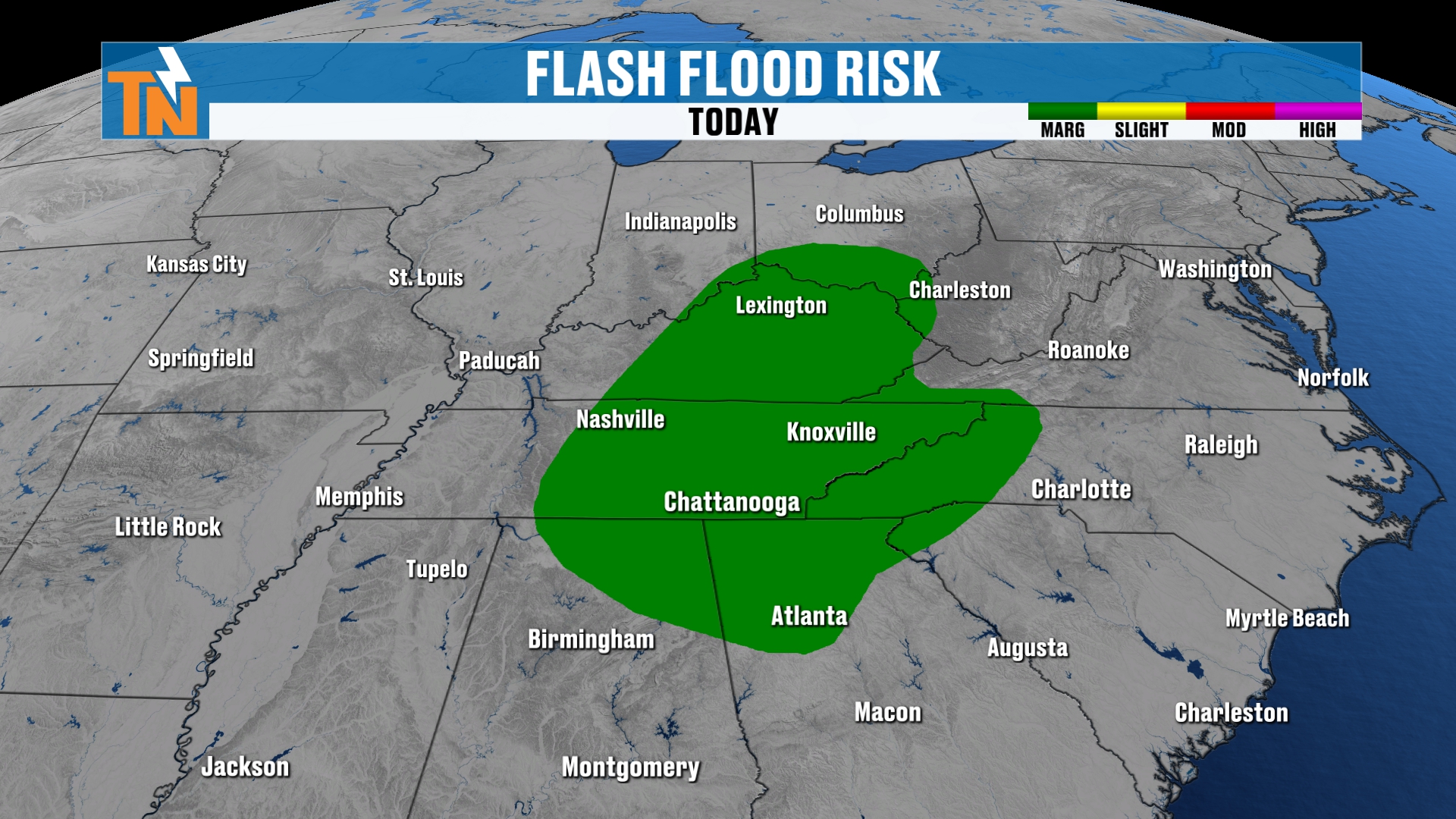
But the Weather Prediction Center has issued a level one risk for flooding and flash flooding concerns as this surge of moisture swings through.
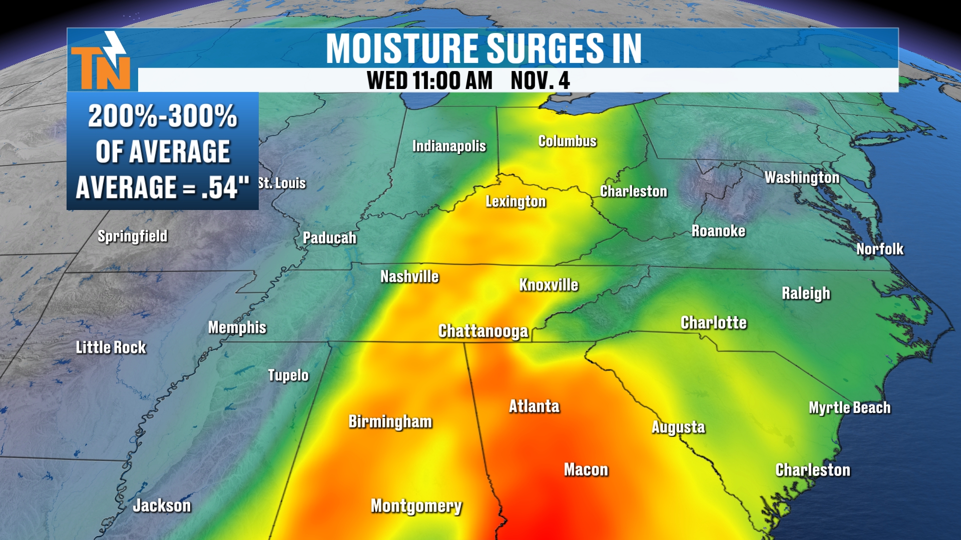
And then, back behind it, we lose that moisture content and we’re back down to seasonal averages when it comes to the amount of moisture in the atmosphere.
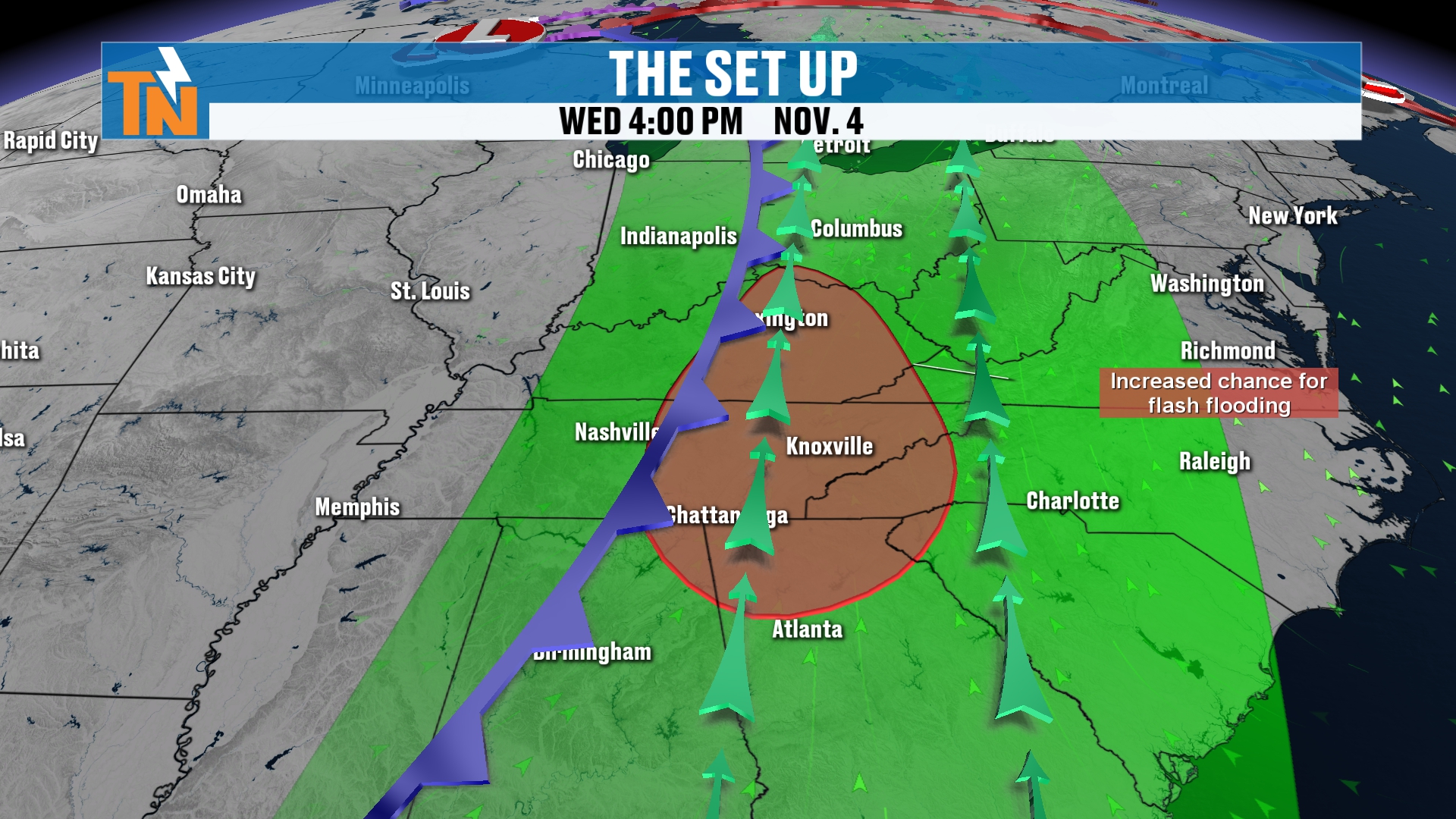
The Regional Futurecast
A quick check of the regional futurecast, and then we’ll bring you down to the local level and walk through hour by hour how this is all going to play out today.
You can see how the evolution of the storm swings through today, tomorrow and into Friday.
On the back side of it, we’ll probably get some wraparound clouds that will zip their way through the area. They don’t have a lot of vertical development, but sometimes they can produce a little bit of light rain, so we have to watch for that as we get into Thursday and Friday.
But at this point of the game, I’ve basically taken the chances for rain Thursday and Friday out of the forecast. Just don’t be caught off guard if you get a stray shower on Friday. I don’t think we’ll see much.
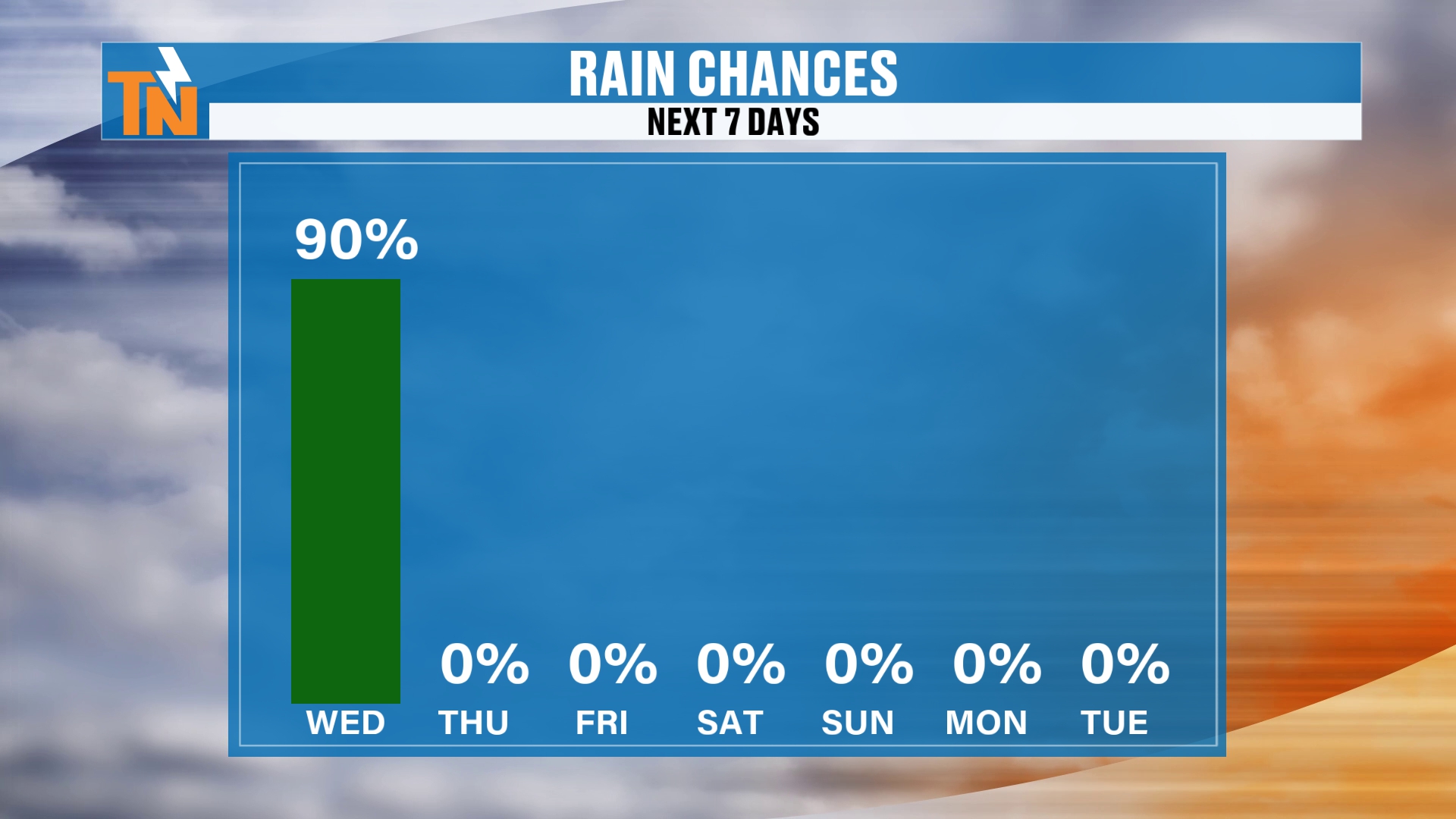
Anyway, everybody is pretty much getting wet throughout the day today. Then we stay rain-free, and there really doesn’t appear to be a whole lot of rainfall over the next five to seven days after today.
A Look Outside
Before we break it down at the local level, I want to take you outside.
The sun is going to be coming up shortly after this recording, and we’re going to have a nice sunrise taking shape. We don’t have too much cloud cover out there, so I think we’re going to see some nice color in the sky.
So grab your cameras. If you’re on my East Tennessee weather app, you can submit photos, and I share those during my live broadcast and on social media as well.
By the way, this is Newport.
And if you want a free East Tennessee weather camera in your community, email me at [email protected] with a photo and a location, and we’ll try to get one installed in your county or your community.
Hour by Hour: Timing Out the Storms
The severe weather risk exists mainly south of Interstate 40, and again, closer to about 4, 5 or 6 PM tonight.
Here’s the latest in-house model guidance. It’s picking up on scattered showers this morning from now through lunchtime.
From lunchtime through about 3 PM, when the kids are heading home from school, we may get a little bit of a break in the activity. This is not going to be an all-day washout, but it is going to bring us scattered showers and thunderstorms.
Then the cold front comes through.
Around 4, 5 and 6 or 7 PM, the model guidance isn’t picking up on a lot of activity. But that would be our window, I think, for the potential for a couple of isolated strong storms.
Some other models are indicating a little more of a line right along the leading edge of the frontal boundary as it comes through. So keep that in mind as we get into the later afternoon and early evening hours, through the evening commute.
The app will help you out there as well. You can check the interactive radar, which gives you a past, current and future radar of two hours.
That two-hour futurecast really helps you navigate at least the next couple of hours of your life, whether you’re leaving work or have ball games or practices tonight.
How Much Rain?
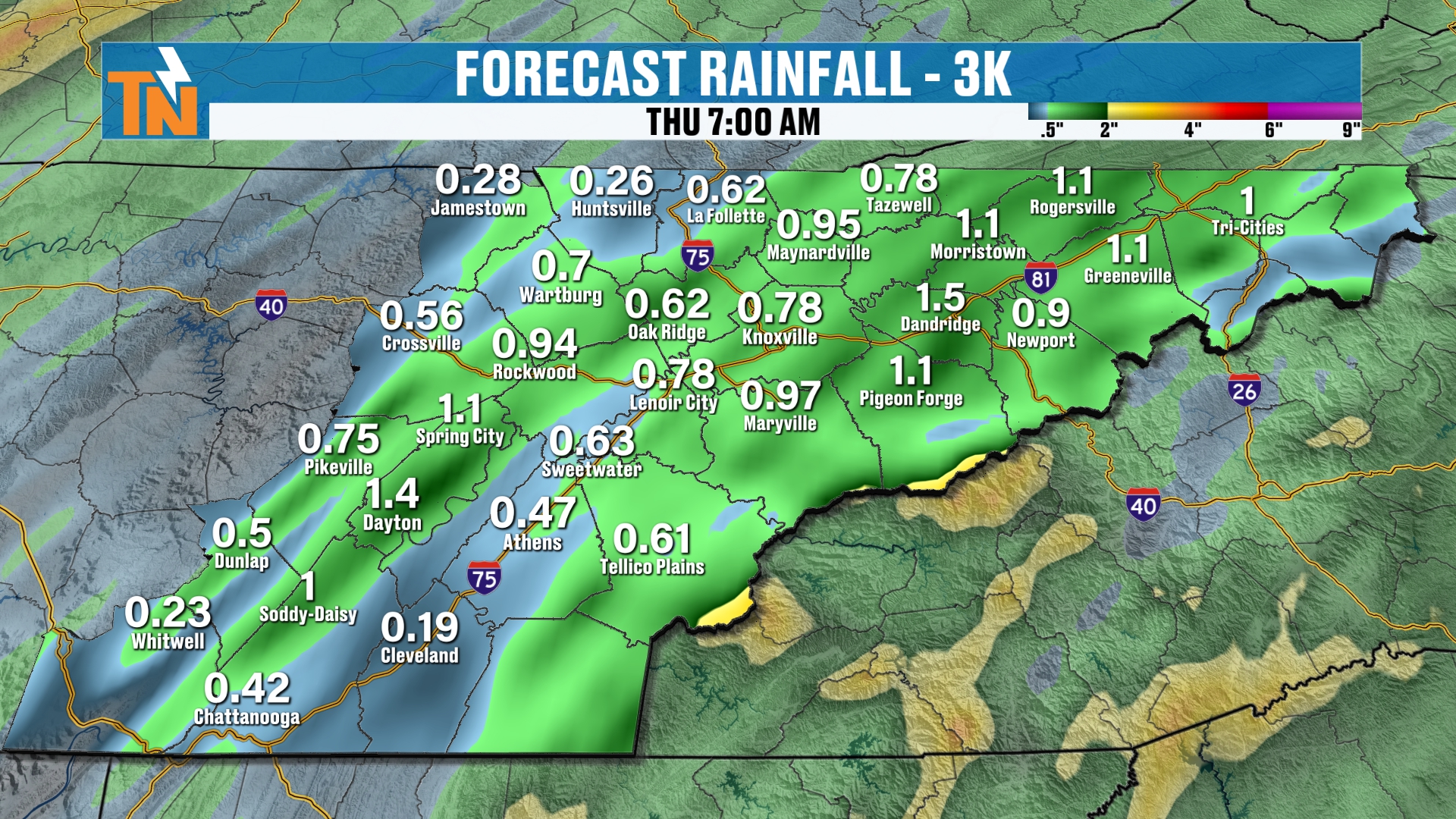
We’ve still been talking about about three quarters of an inch to an inch of rainfall areawide.
That still seems to be the case through the day today, and that takes us all the way through tomorrow morning.
Because of the increased risk for some locally heavy rainfall, we have an increased threat for flooding and flash flooding concerns.
Temperatures: Extremely Mild
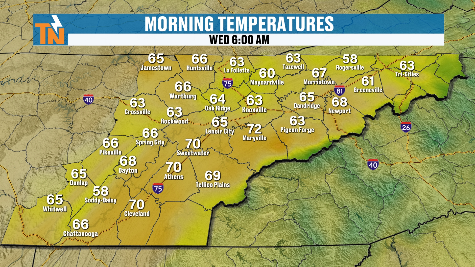
Temperatures this morning are extremely mild. They’re much warmer than yesterday.
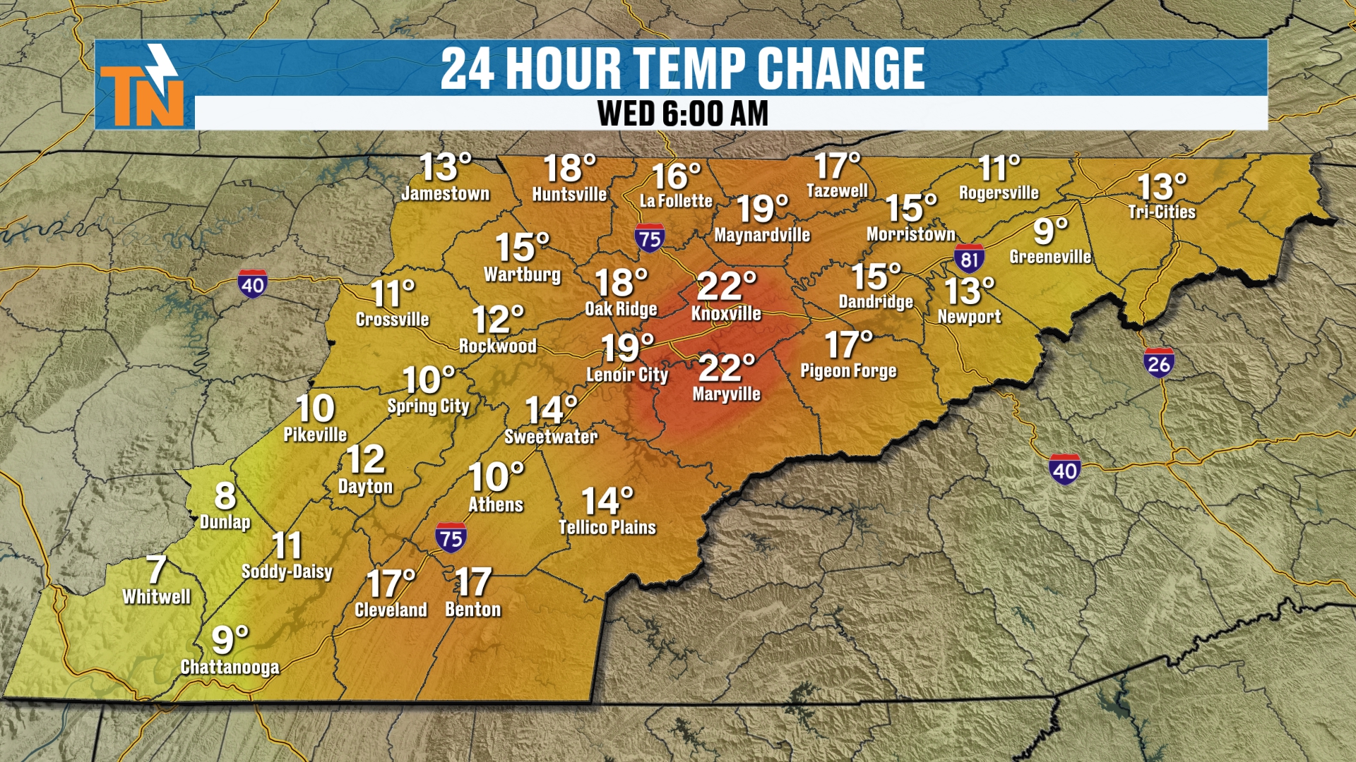
We’re about 10, 15, even 20 or 22 degrees warmer than we were at this time yesterday. So enjoy that. That’s a nice little push of warm air out ahead of the cold front.
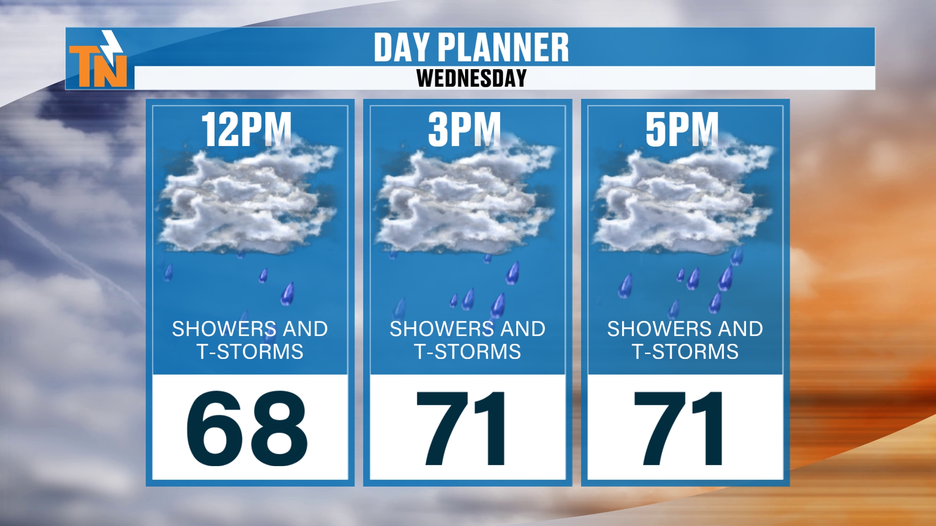
By noon we’re at 68°.
We’re going to see temperatures climb into the low 70s today with those scattered showers and storms. So it is going to be cooler than what we saw yesterday.
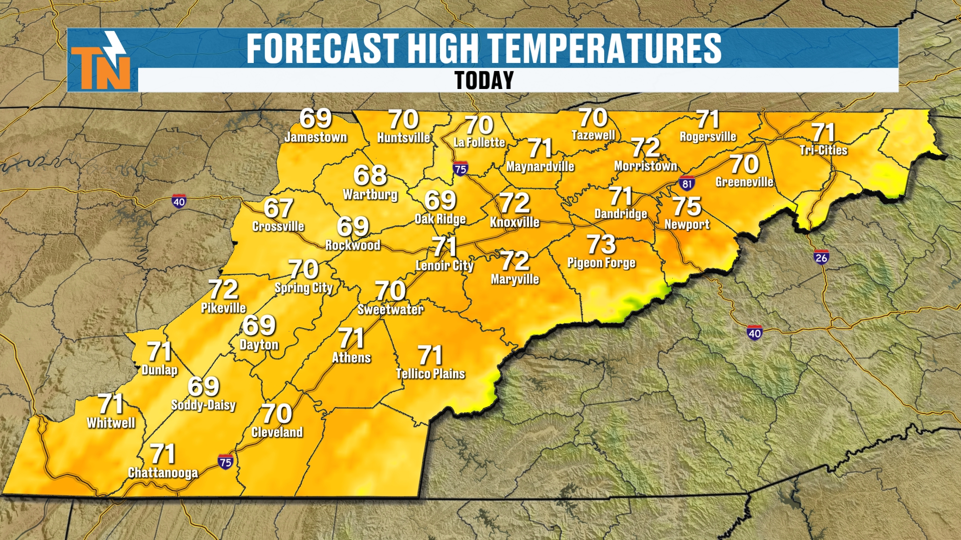
Wind: A Mountain Wave Event
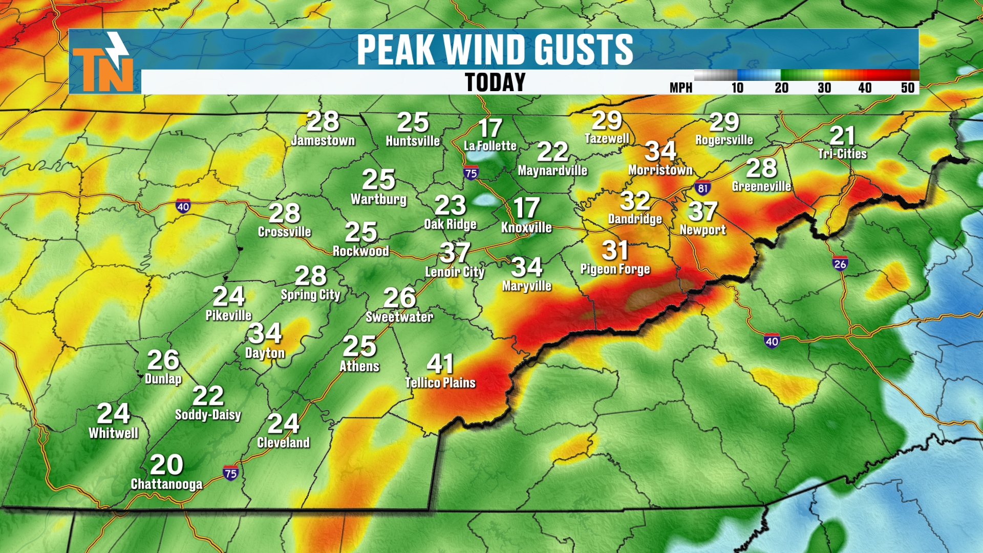
Speaking of wind, we have quite a bit of it. We talked about this yesterday as well.
Winds are going to be gusting about 20 to 25 miles per hour in the lower elevations throughout the day.
But they really crank out ahead of the cold front as the pressure gradient tightens. We’re going to get a wind that’s perpendicular to the Smokies.
So it’s a little bit of a mountain wave event taking shape.
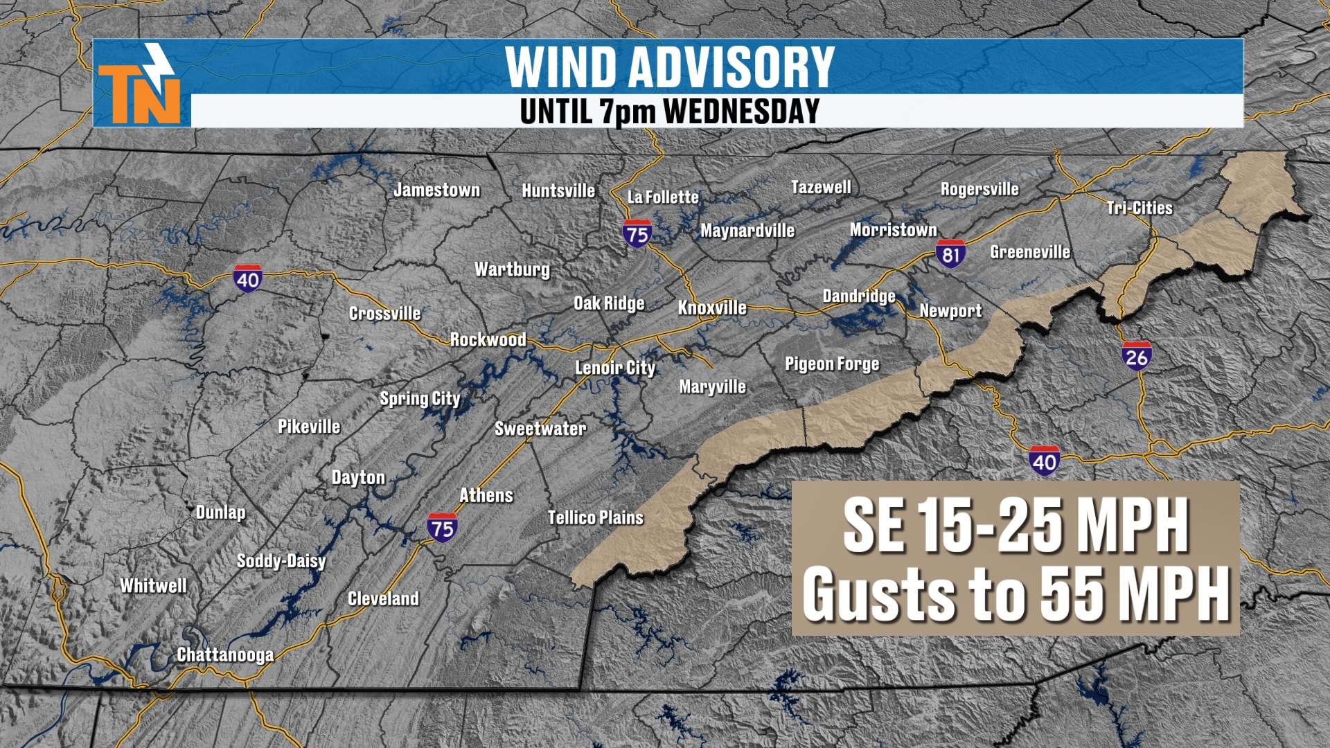
It’s not enough for a high wind warning. It’s just a wind advisory.
But winds could be gusting upwards of about 55 across some of the highest peaks.
And then down across the foothills, 40 to 45 mph winds can’t be ruled out. Keep that in mind in those wind-prone areas, places like Camp Creek and whatnot.
This Evening
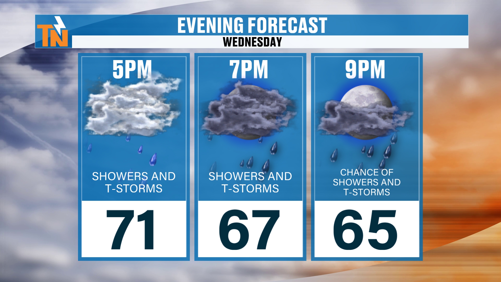
Into the evening hours we go again with some scattered showers and storms.
We’ll drop into the mid to upper 60s between 7 and 9 PM tonight.
Dew Points Drop, Chilly Mornings Ahead
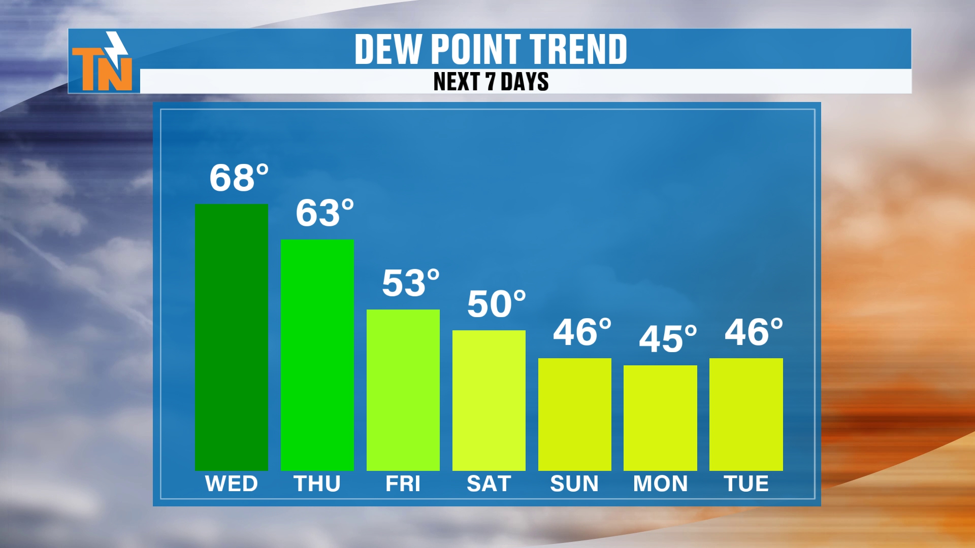
Remember, those dew points are going to come on down.
That’s going to allow our morning lows to come down as well.
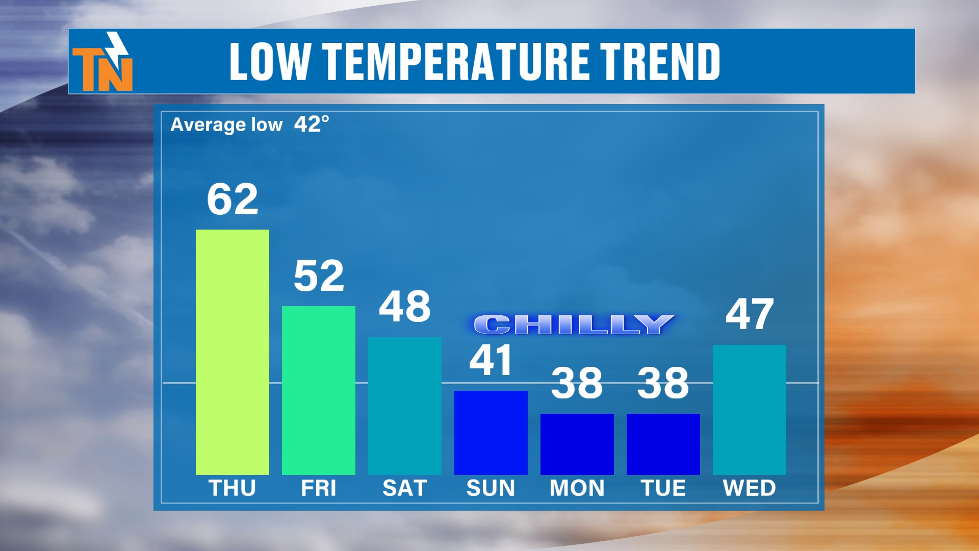
We have a couple of chilly mornings ahead of us. We could have lows in the 30s and low 40s as we get into Sunday, Monday and Tuesday.
It’s not going to be a hard freeze, but maybe some areas could see a little bit of frost developing.
That’s all due to this shot of cooler, drier air that’s going to swing in from Canada, back behind this cold front as the upper level trough swings through.
A Cooler Weekend
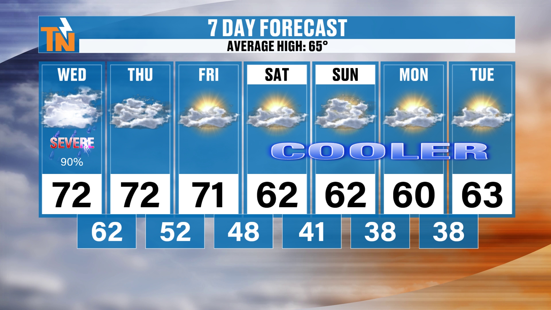
That’s going to keep us on the cool side for the upcoming weekend.
We have highs in the low 70s through the end of the week. That’s still technically above average, because average highs are 65 now.
But we’ll technically be below average as we get into Saturday, Sunday, Monday and even Tuesday.
How Long Does the Cool Air Stick Around?
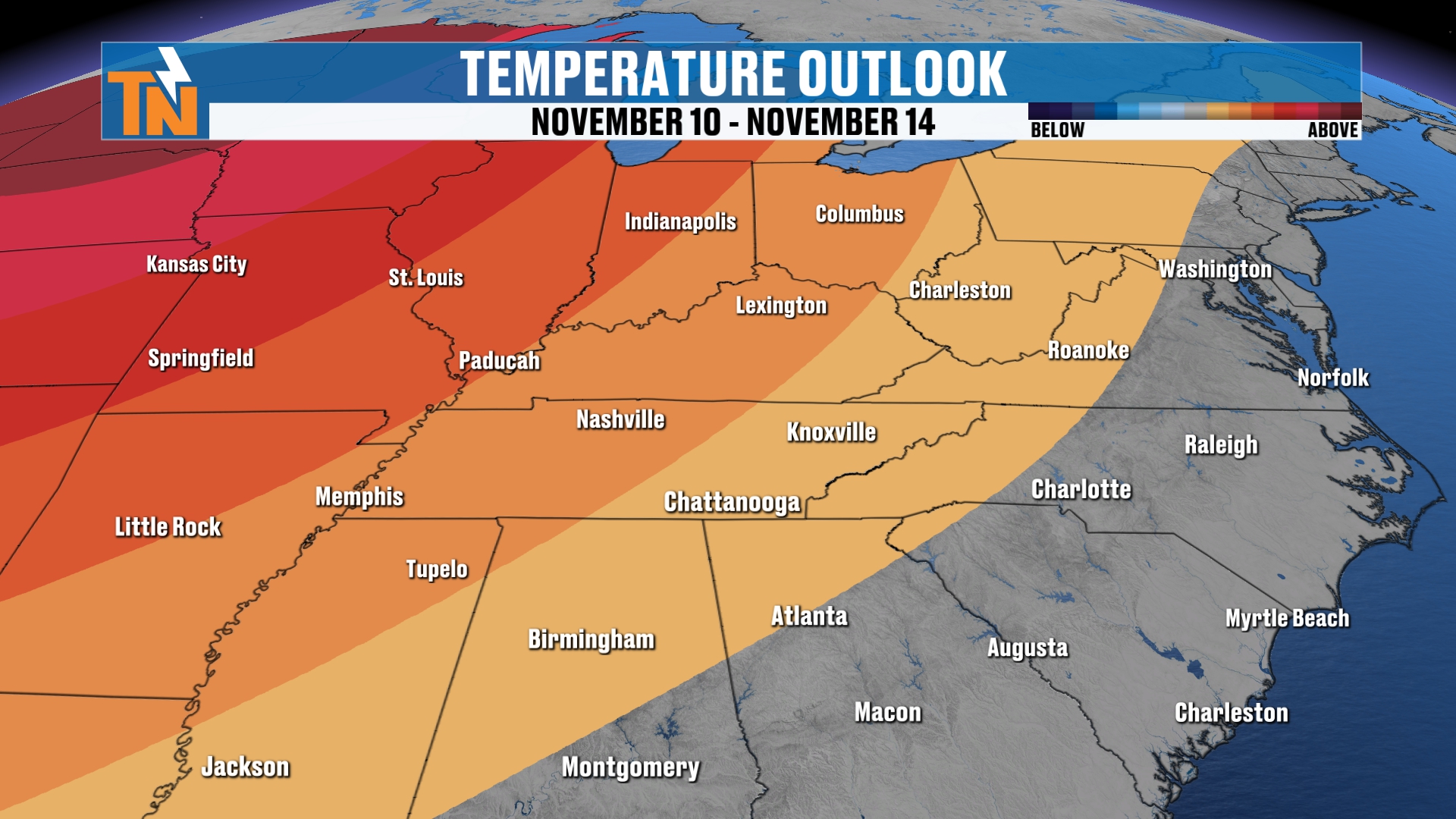
How long does it stick around? Well, per the Climate Prediction Center, it may not last too terribly long.
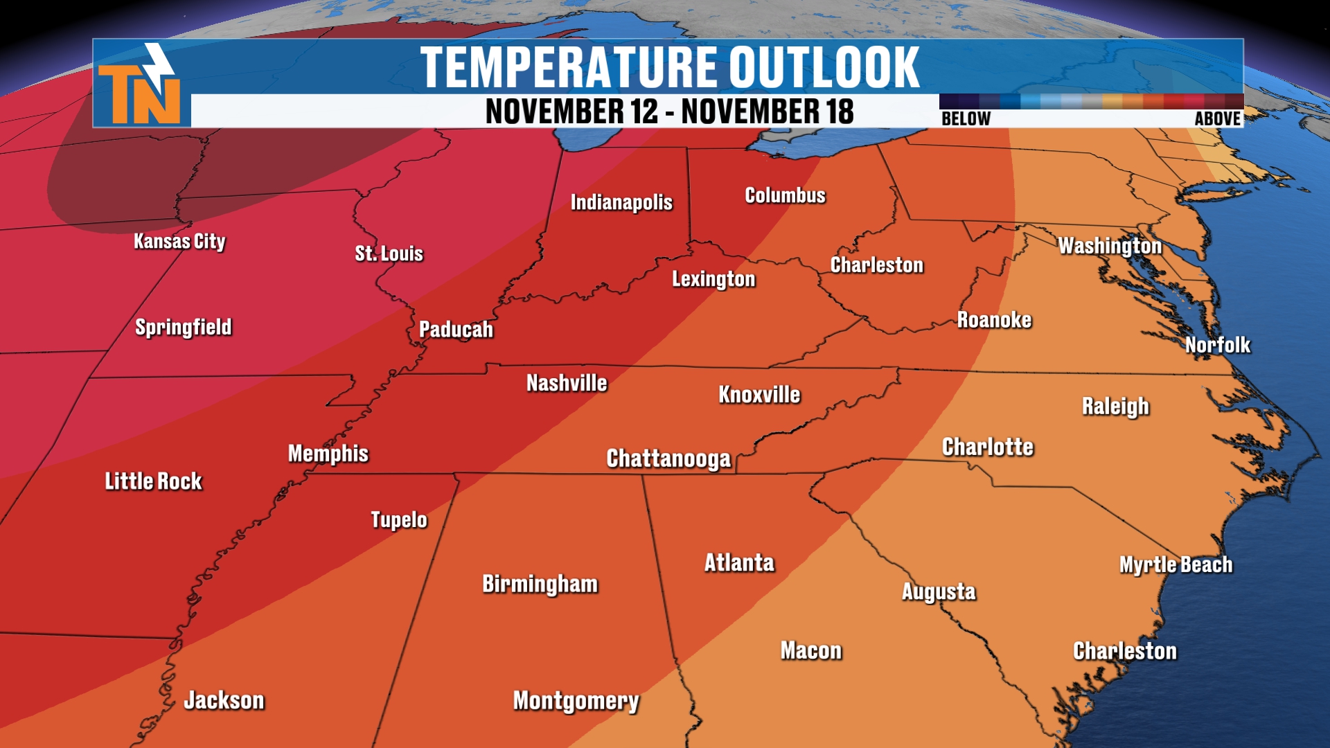
After we get done with those 60s, above average temperatures may start to slowly work their way back into the area.
Bottom Line
WEDNESDAY: Extremely mild start, 10 to 22 degrees warmer than yesterday. Scattered showers this morning through lunchtime, with 68 at noon and highs in the low 70s. A bit of a break from lunch until about 3 PM, then the cold front comes through. A level one severe weather risk, mainly south of Interstate 40, with the greatest timing around 4, 5 or 6 PM and strong, gusty winds the main concern. A level one risk for isolated flash flooding in low-lying areas. About three quarters of an inch to an inch of rain areawide. Wind advisory in the mountains with gusts up to 55 mph, and 40 to 45 mph possible in the foothills. Mid to upper 60s between 7 and 9 PM.
THURSDAY: Rain chances taken out of the forecast. Dew points drop and we dry out.
FRIDAY: Wraparound clouds may zip through, and a stray light shower can’t be ruled out, but I don’t expect much.
SATURDAY, SUNDAY AND MONDAY: Cooler and rain-free, below the 65 degree average. Chilly mornings with lows in the 30s and low 40s Sunday, Monday and Tuesday, and maybe a little frost in spots.
TUESDAY: Still on the cool side.
AFTER THAT: Above average temperatures may slowly work their way back, per the Climate Prediction Center.
So to recap: this severe weather risk is small, but it’s real. A cold front brings scattered showers and storms today, with the best window for a couple of isolated strong storms around 4 to 7 PM, mainly south of Interstate 40. Locally heavy rain could cause some flooding in low-lying areas. Then a shot of cooler, drier air arrives from Canada for the weekend.
Make sure you download the FREE eastTNweather app from your app store. It travels wherever you go, as long as you allow location services and notifications. You can also find it on Roku, Amazon Fire and the YouTube app on your smart TV.
A reminder: the burn permit ban continues now through May 15th.
And if you’re watching on YouTube, don’t forget to LIKE, SHARE, SUBSCRIBE and hit the bell so you’re notified of every weather update.
Catch up on all of my recent daily forecasts anytime.
I’m Meteorologist Mike Witcher. Have a great Wednesday!
eastTNweather — Weather When You Want It.