
Published: Friday, November 13, 2026 | By Meteorologist Mike Witcher | eastTNweather
Good morning, East Tennessee, and happy Friday! We finally made it. Thanks so much for checking in with your morning weather update on this November 13th, 2026.
Snow is falling in the Smokies, and there’s more on the way tonight. A little taste of old man winter has arrived, and it’s going to be rather colder today. After the snow winds down, we get a clear, dry stretch with some hard freezes.
So let’s walk through all of the details: the snow, the timing, the temperatures, and what to wear if you’re heading out to high school football tonight.
Yesterday's Almanac: Chillier Than the Days Before
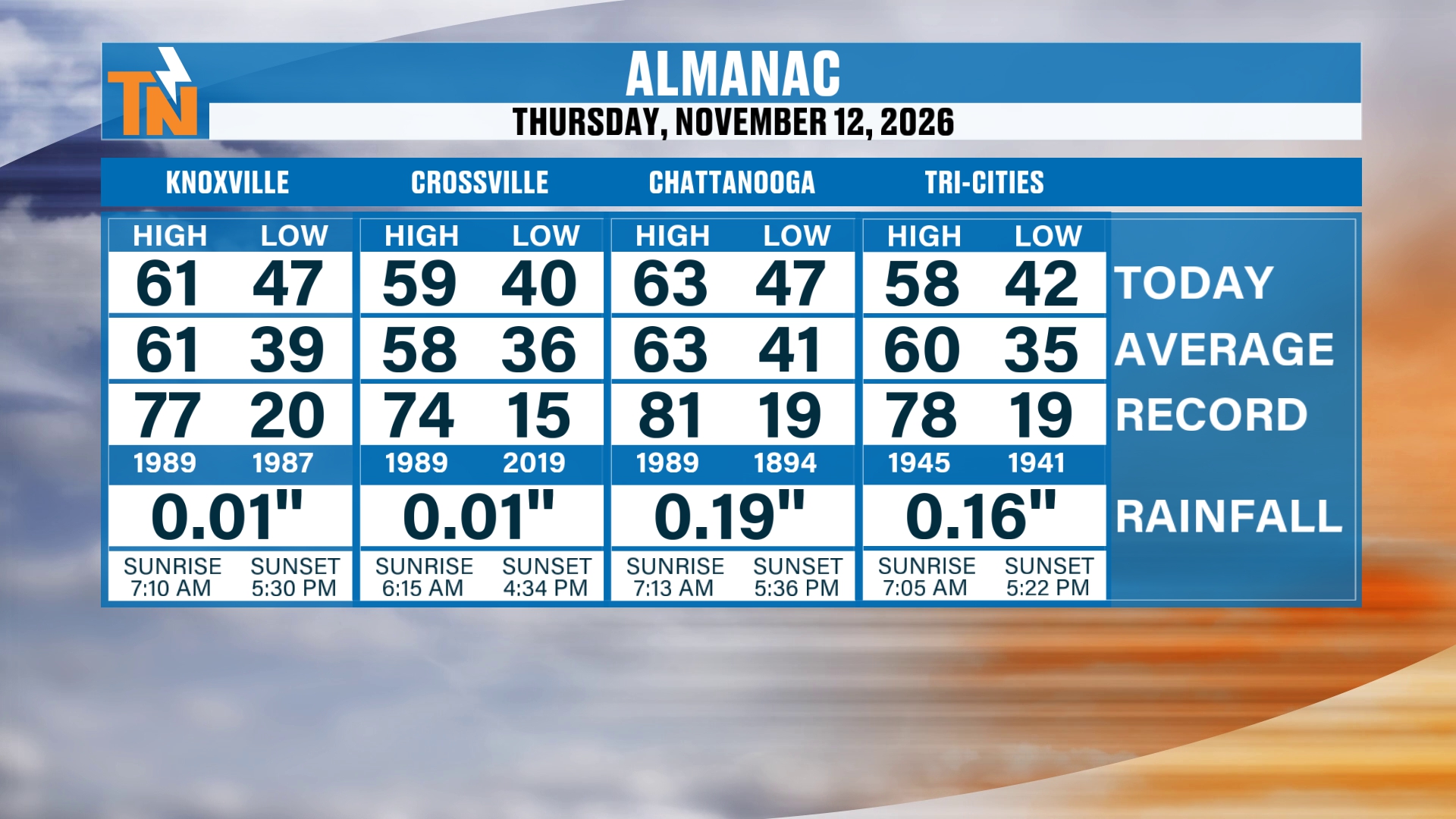
Let’s start you off with the almanac from yesterday. We had a nice, solid, average day. Highs were in the upper 50s to low 60s: 61 in Knoxville, 59 in Crossville, 63 in Chattanooga and 58 in the Tri-Cities.
But that was chillier than the previous couple of days. It’s a sign of a changing weather pattern that has moved its way on in. And that changing pattern continues to give us some chilly weather. Today is going to be rather colder, a little taste of old man winter, if you will.
Snow Is Falling in the Smokies: Where We Stand This Morning
Here’s a look this morning up into downtown Gatlinburg. You’ve got a little bit of water on the camera lens there, so we know there’s some moisture spitting out of the atmosphere.
It’s not a ton in the lower elevations, and no snowfall so far in town. That could change as we get into the evening and overnight hours tonight, as even colder air swings its way into the area. So that’s something to keep in mind.
I’m not expecting a whole lot of snowfall in Gatlinburg today. But that could possibly change later on this evening.
The snow machine in the mountains is going to take a little bit of a lull throughout the afternoon. But snow showers will pick back up later this evening, and here’s the reason why.
We’ve got a big trough of low pressure hanging out with us. There are little disturbances in the mid to upper level pattern, and the next disturbance is expected to arrive in the afternoon and evening hours.
Satellite and Radar: A Little Upslope Snow
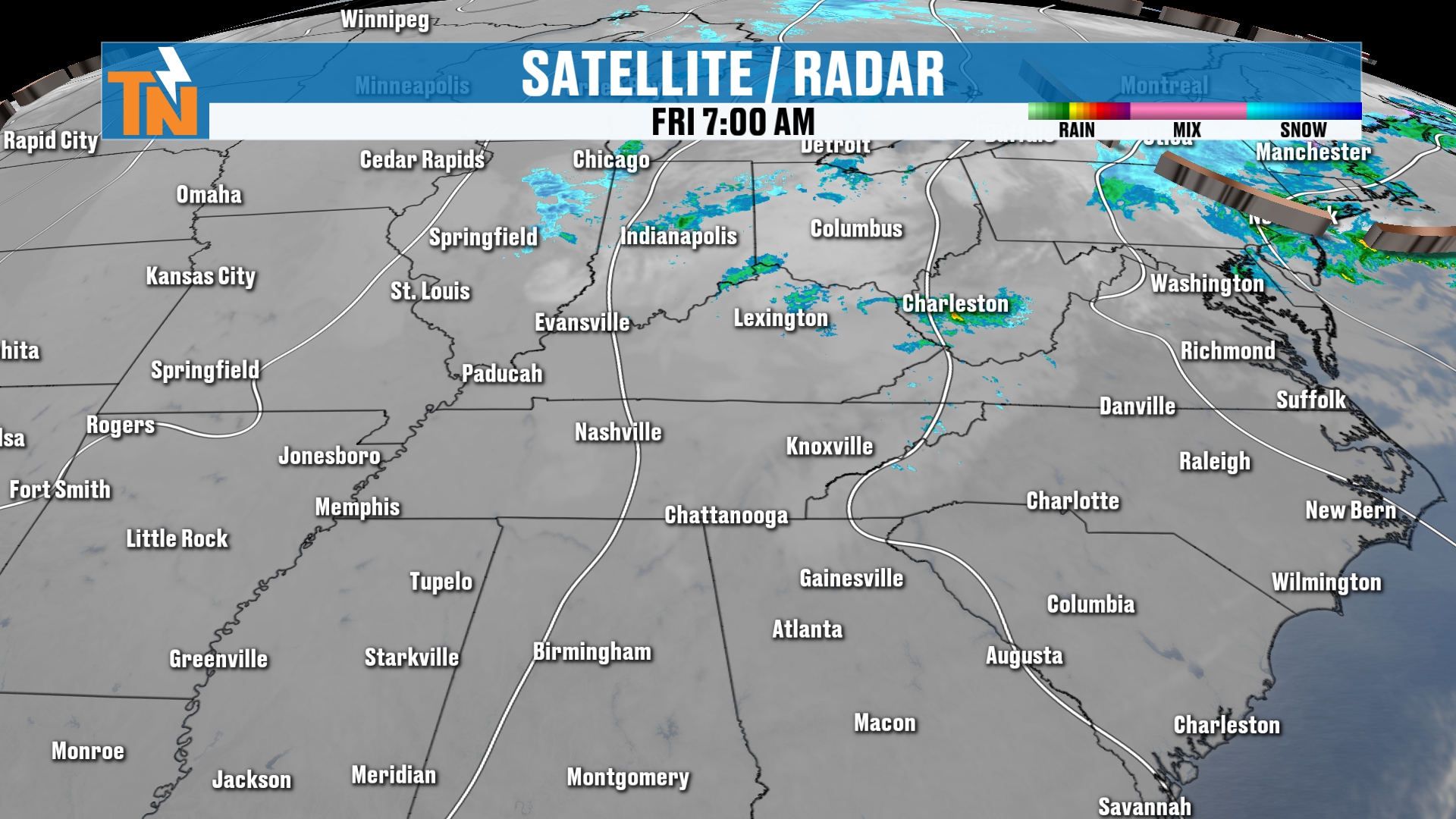
Let’s talk about the satellite and radar as we get the day started. There’s not a ton of precipitation around the region, around the state of Tennessee and North Carolina.
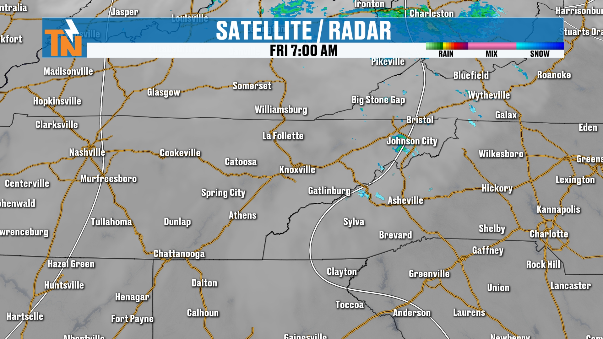
We’ve got a little bit of that upslope snow and a couple of raindrops falling from time to time. So I can’t rule out a couple of spotty light showers.
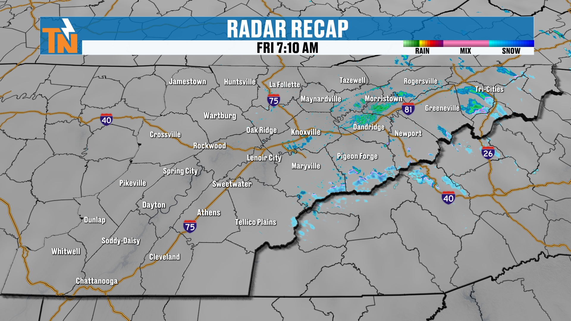
Most of the snow is isolated across the mountain counties as of right now. Again, it takes a little lull in the late morning and early afternoon before it picks back up later today.
It’s in the form of snow across the highest peaks. It started to snow last night on top of Mount LeConte, and I posted that picture on social media.
The upper level temperatures, the 5,000 foot temperatures at 850 millibars, are down to about the low to mid 20s. That’s why it’s snowing across the higher elevations. As long as we have moisture in place and it’s this cold, we’re going to get some snow across the highest peaks.
Today's Futurecast: A Break, Then More Moisture
From now through noon, the moisture takes a break. Then as we get into the afternoon, from noon to 3, we start to see more moisture creeping back in. That’s associated with that next upper level wave coming through.
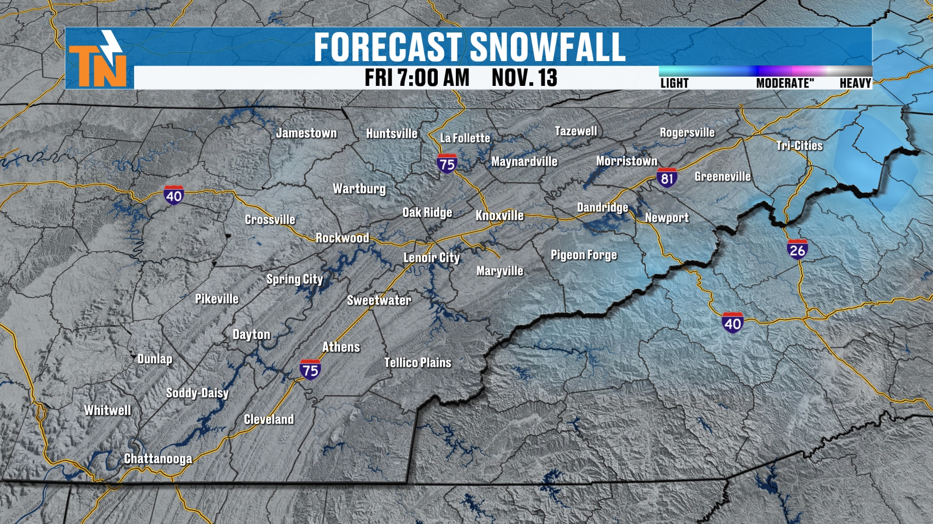
So we’ll see some spotty showers across the lower elevations and some snow showers across the higher elevations.
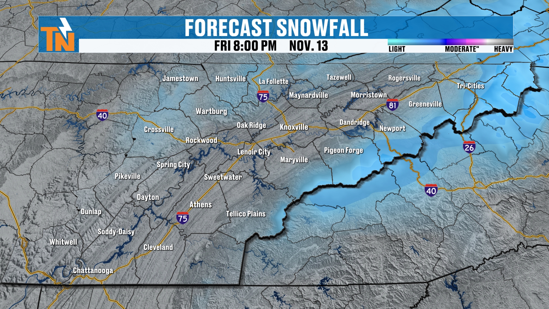
Here’s 7 PM tonight. Most areas in the lower elevations are going to be well above freezing. That’s why it’s all going to be liquid precipitation down low.
But I can’t rule out, as we get closer to sundown tonight, a few light flurries across parts of the northern plateau. Maybe even throughout the day today. I can’t rule that out, but I’m not expecting a whole lot of activity.
Listen, if you get some photos, or you get some snowfall in your area, let me know in the comments below. I’d love to find out what’s going on around East Tennessee in your communities.
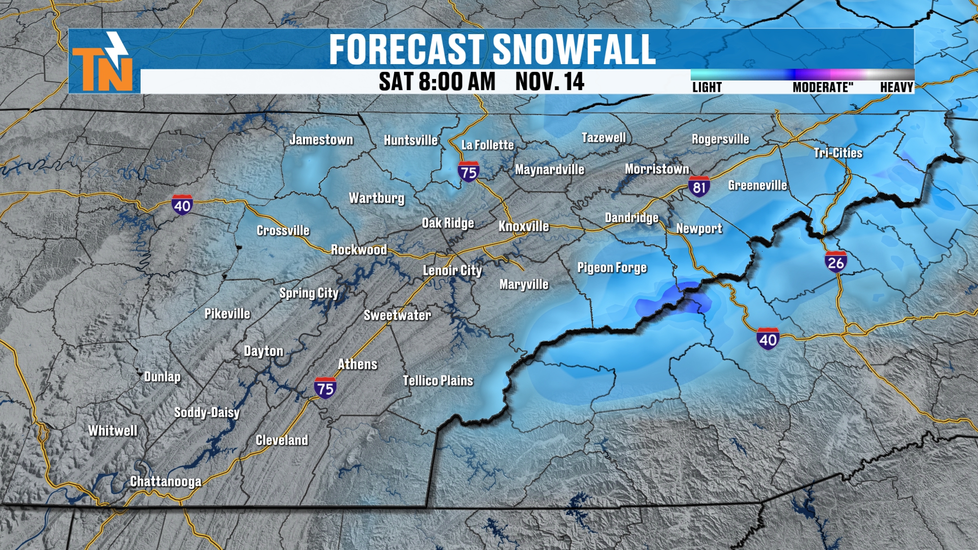
As we get into Saturday morning, the snow machine winds down and the skies begin to clear as high pressure builds back in.
So just through this morning, we’ve had a little bit of light snow across the mountains. That’s going to pick up a little more as we get into the 8 o’clock hour tonight, and even more overnight tonight as that next little wave comes through.
Snowfall Totals: Two to Four Inches on the Highest Peaks
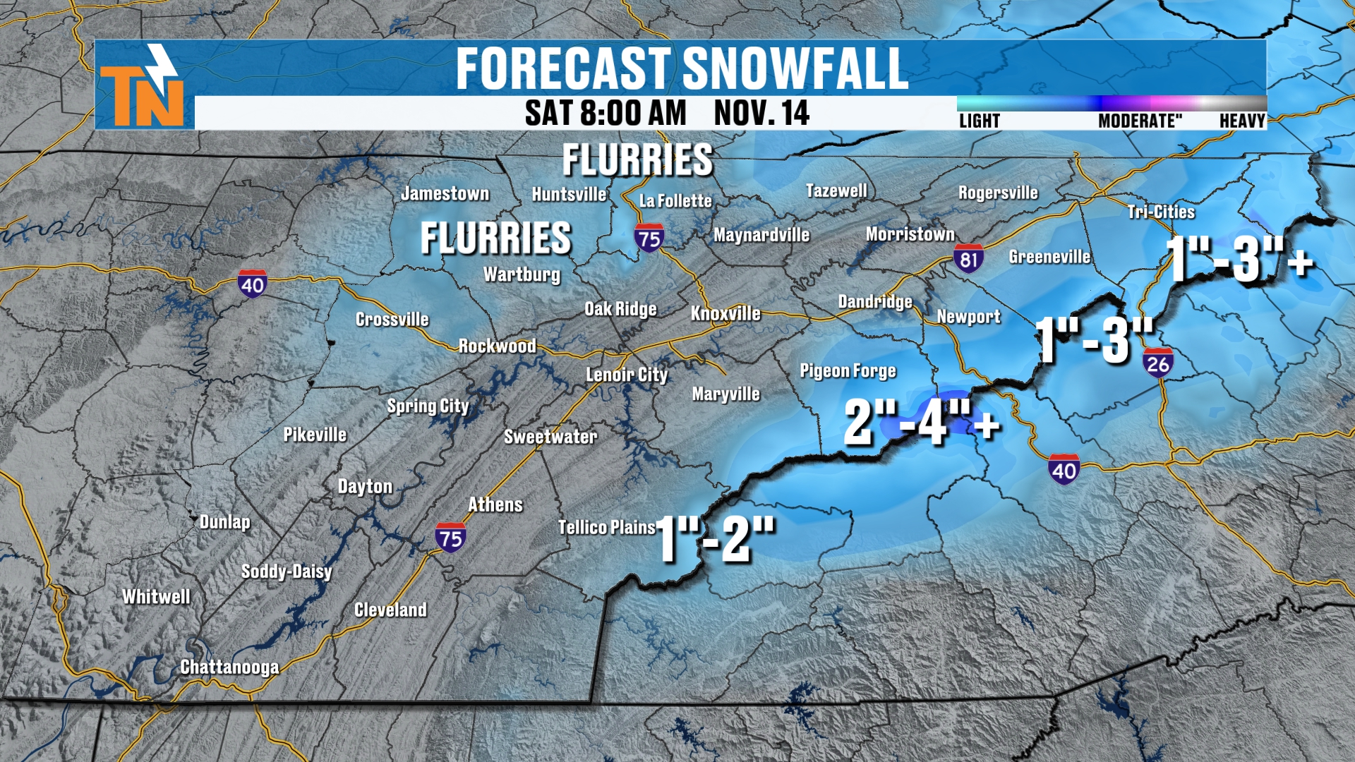
When you add it all up, I’m still holding strong with one to two inches, two to four inches, and pockets of three to five inches, with a few flurries across the Cumberland Plateau.
Some of the highest peaks, the extreme highest peaks, are showing upwards of three to five-plus inches in some of the models. But I think a good, solid two to four inches can’t be ruled out in the higher elevations.
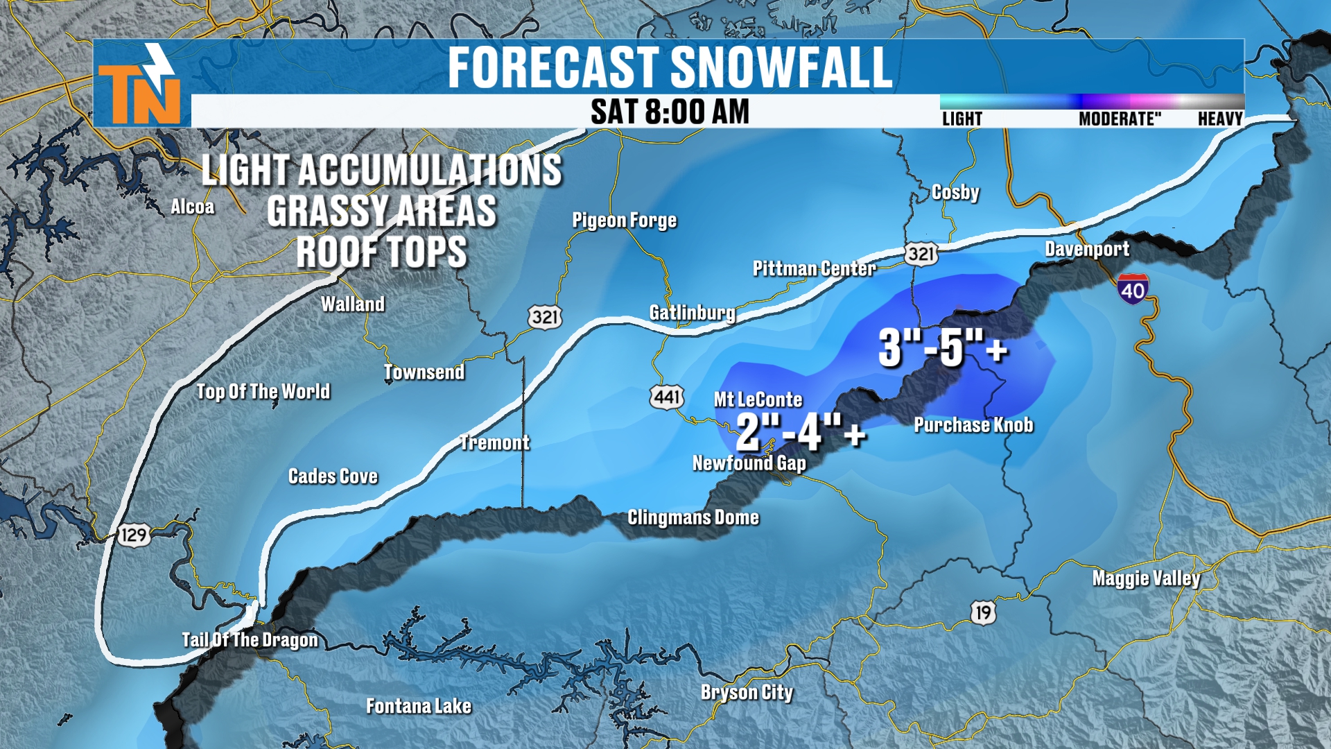
If we do get some snowfall in the lower elevations, and some of the models are still indicating that we could get potential light snow across parts of towns like Gatlinburg, Pigeon Forge and Walland, it’s going to be light accumulations on the grassy areas and the rooftops. I think that’s going to be about the extent of it.
Winter Weather Advisory and Road Closures
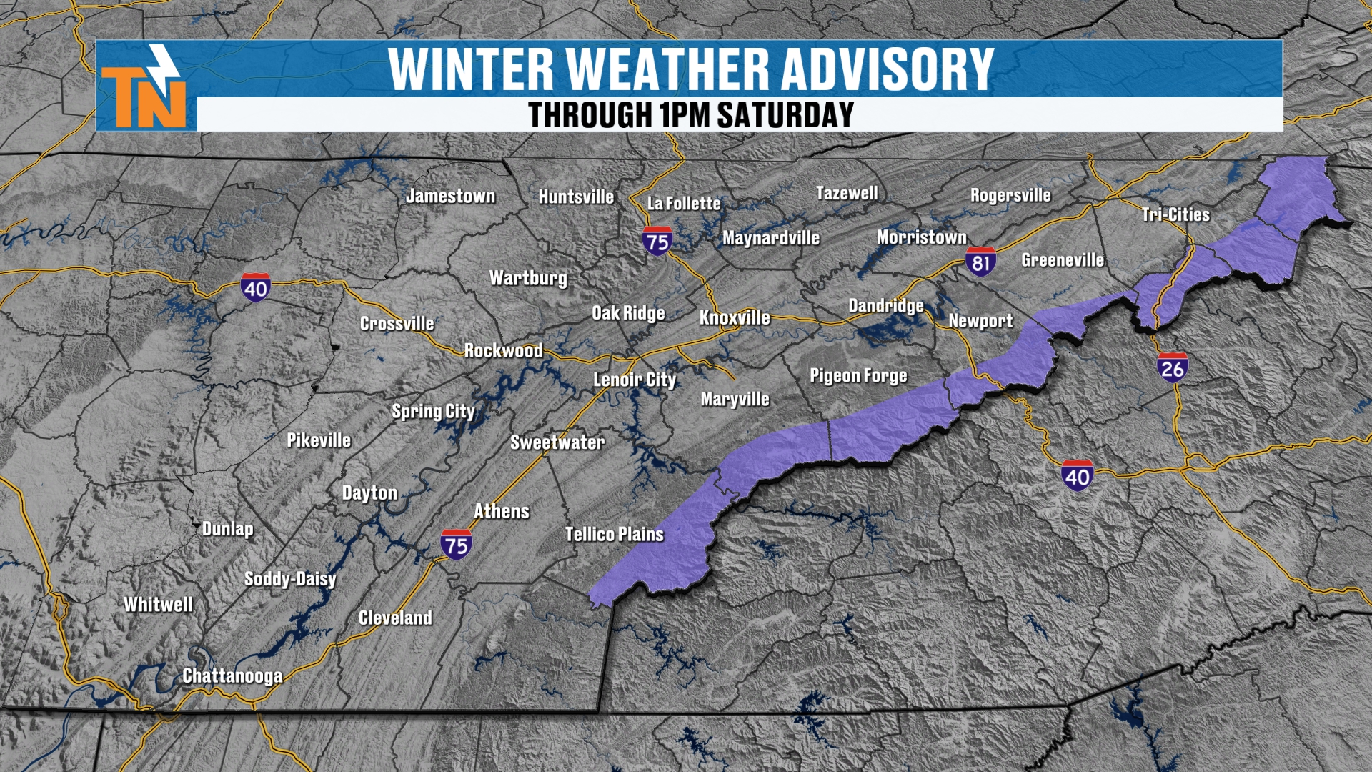
We do have a winter weather advisory in place right now. They’ve extended it until 1 PM on Saturday afternoon.
And remember, Highway 441 over the Smokies is officially closed at this time by the Park Service. So if you had plans to head up that way, keep an eye on the closure.
A Chillier Morning Than Yesterday
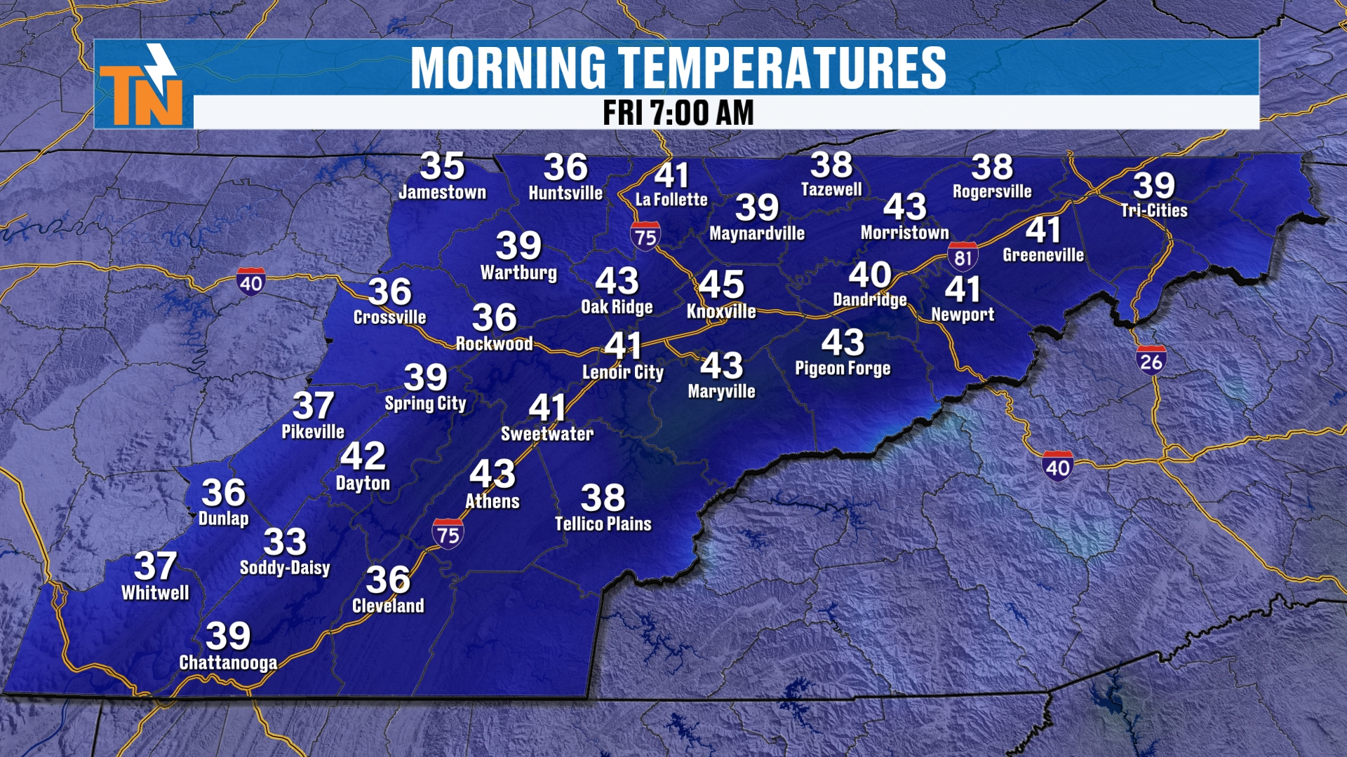
Let’s look at our morning temperatures. We’re starting off in the 30s and 40s. So it’s rather chillier this morning than it was yesterday.
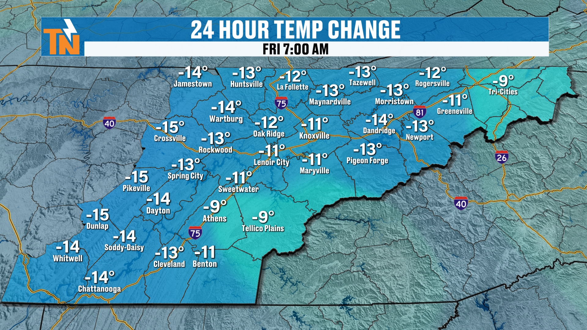
We’re actually trending about 10 to 15 degrees colder. But yesterday morning was a bit on the warmer side and an outlier, considering the time of year, for sure.
Today: Not Much of a Warm-Up
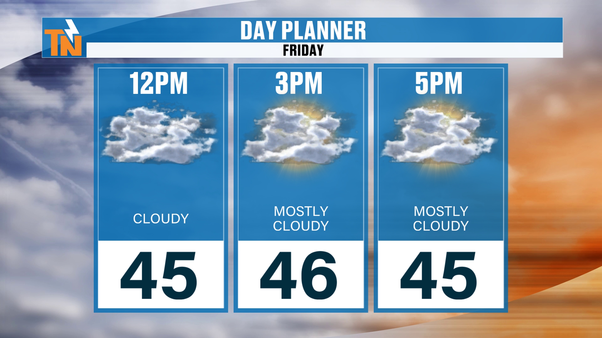
We’re just not going to warm up a whole lot today. We’re making it into the mid 40s as we get into the lunch hour, 45 at noon. As the kids head home from school, we’ll be in the low to mid 40s, with, of course, 30s across the highest peaks of the Smokies.
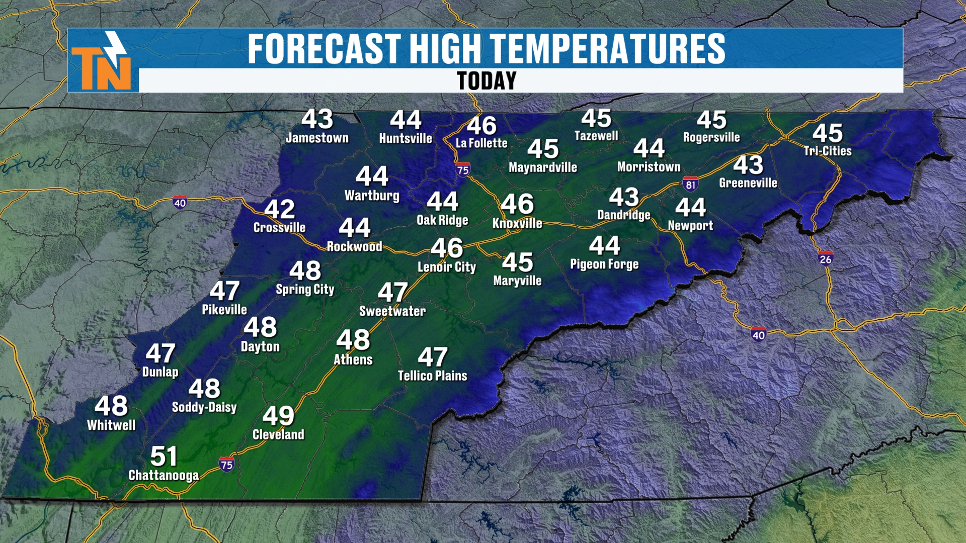
Our highs today are mostly in the mid 40s, a little warmer in the southern valley.
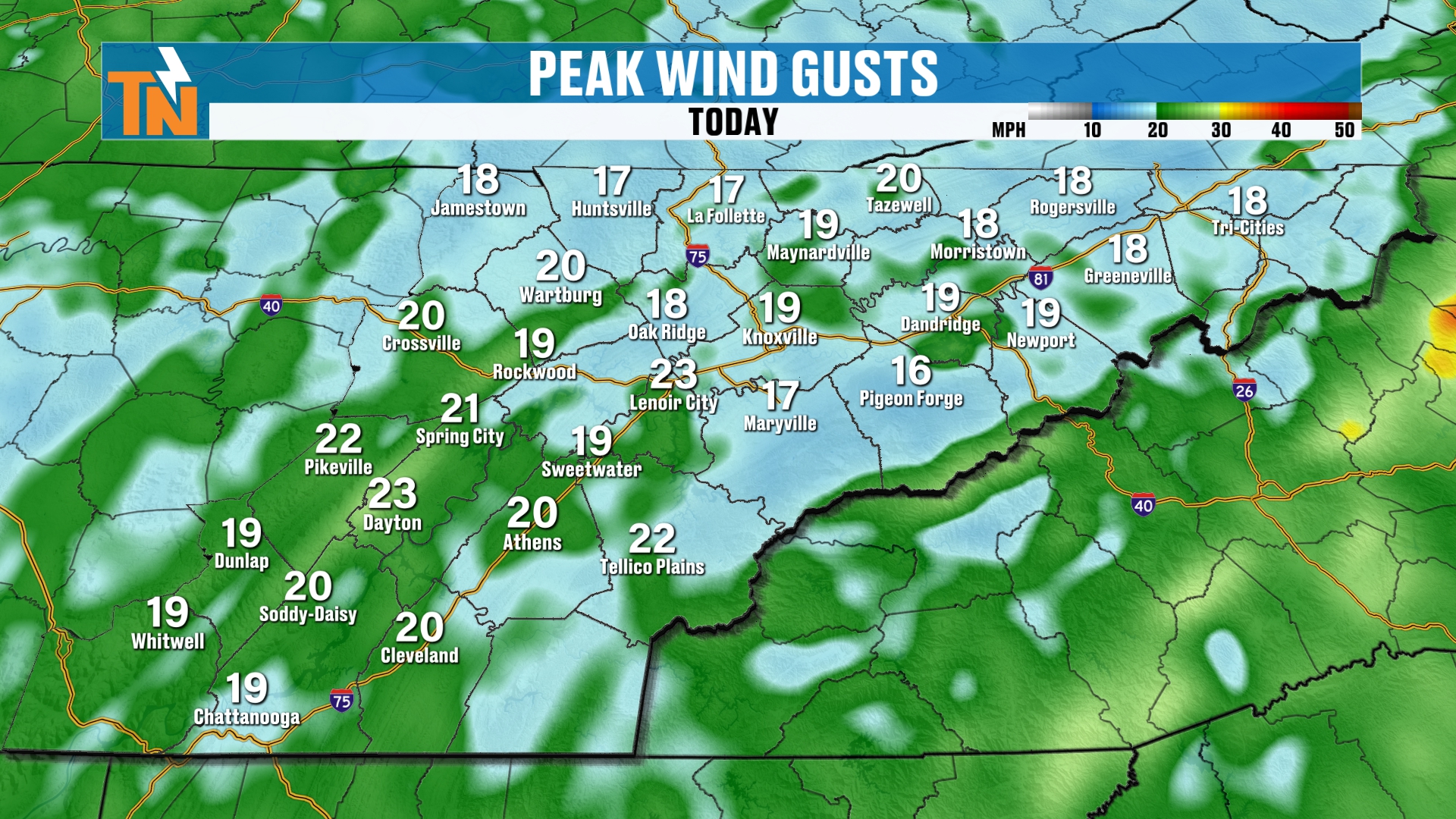
The wind is going to be with us as well. It’s a rather breezy, gusty day, with winds coming in out of the west-northwest.
High School Football Forecast: Grab the Winter Coats
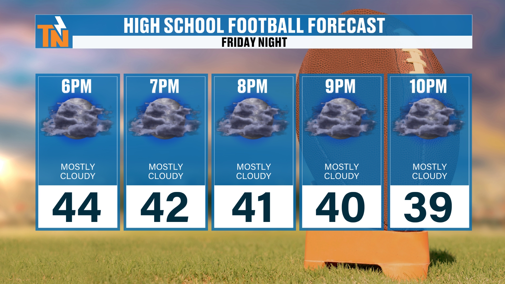
If you are heading off to high school football tonight, and I believe we do have high school football tonight, grab the winter coats. It’s going to be chilly, and some of you may get a couple of showers. Some of you during high school football may even see a couple of snowflakes falling.
So enjoy that, but bundle up. We start at 44 at 6 PM, 42 at 7, 41 at 8, 40 at 9 and 39 by 10 PM.
The Big Picture: Canadian High Pressure Builds In
As our storm system starts to work its way out of here, cold Canadian high pressure builds in from the north. That’s what’s bringing us the cooler air, and that’s what’s bringing us the drier air.
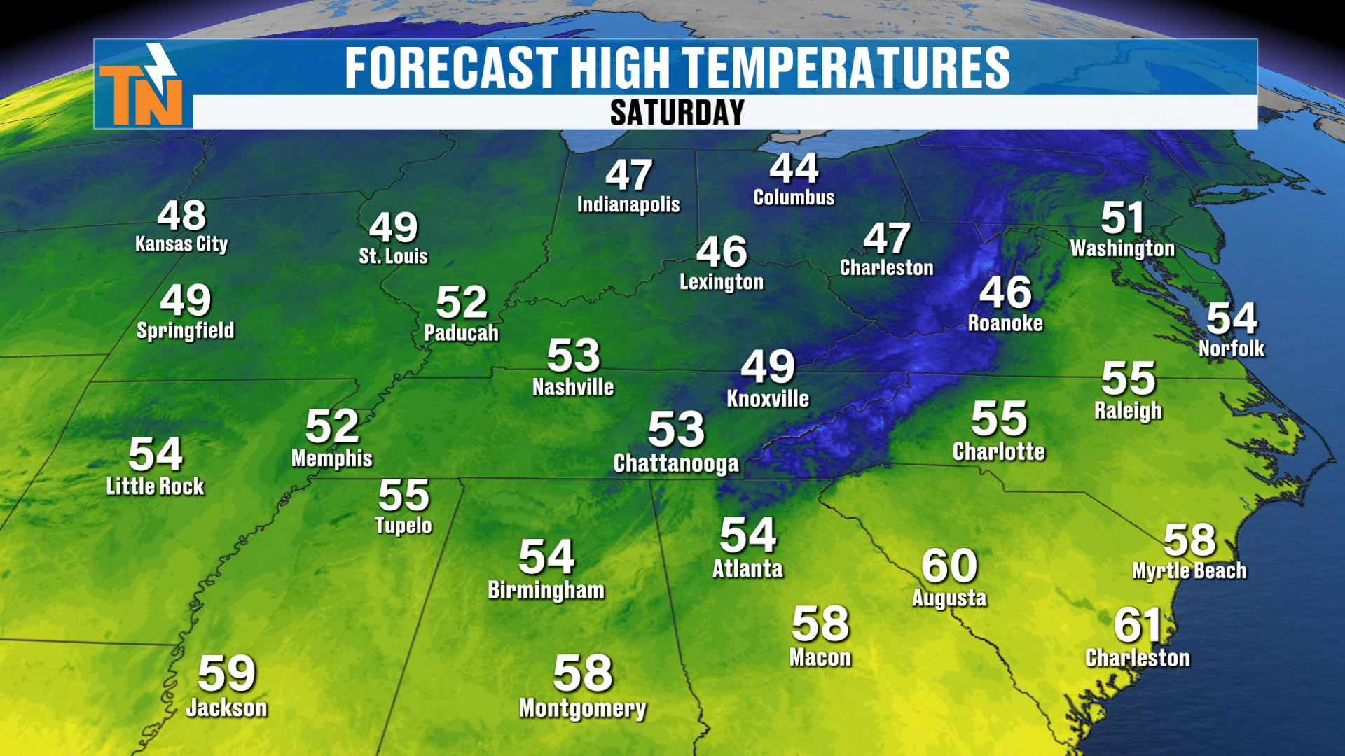
Temperatures today will be in the 40s and 50s. Tomorrow will be a little warmer. We’ll see a little bit warmer weather on Saturday, but we’re going to have clearing skies.
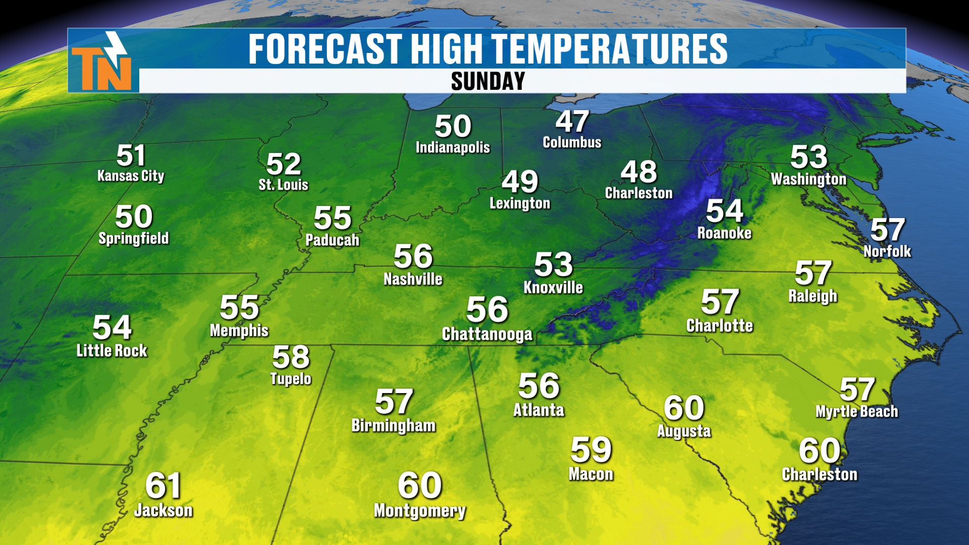
Sunday warms up a little more still.
Clearing Skies Mean a Hard Freeze
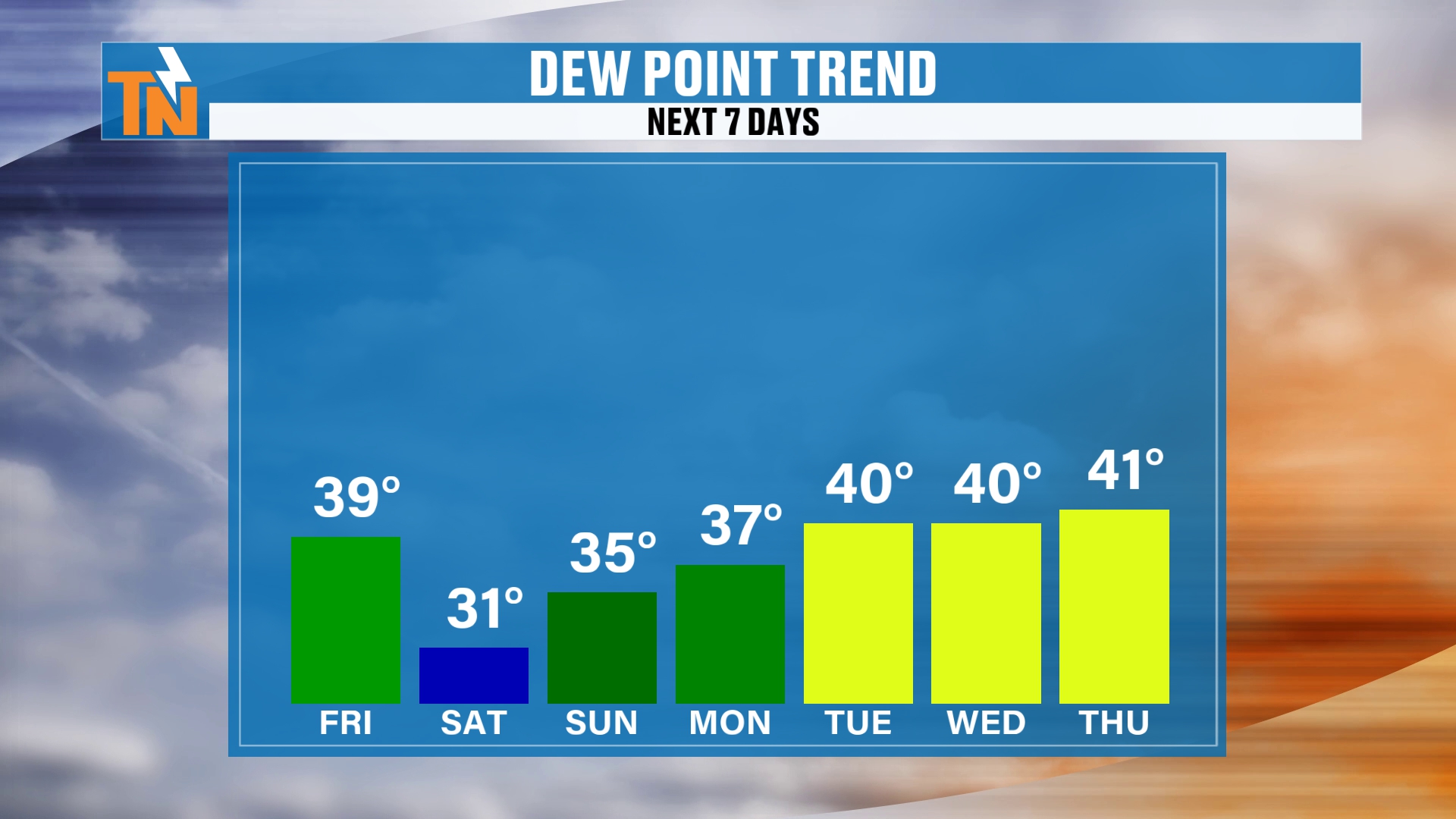
Clearing skies are going to lead to some extremely cold temperatures early in the morning. These are dew points, and the dew points continue to fall off, down to 31 on Saturday morning, then 35 on Sunday and 37 on Monday.
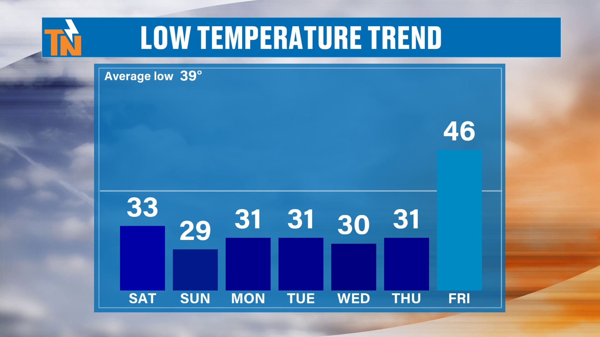
Morning low temperatures will be down into the 20s and low 30s, and that may stick with us all the way until next Thursday. Friday may be an outlier. Oh, did I have 46 degrees for Friday? I think maybe I did.
So we’re looking at a chilly stretch of mornings, with 33 on Saturday, 29 on Sunday, 31 on Monday and Tuesday, 30 on Wednesday and 31 on Thursday. The average low is 39, so we’re well below it.
We’re going to see those temperatures warm nicely as we get into next Friday. And I think next weekend will be fantastic as well.
The 7-Day Forecast
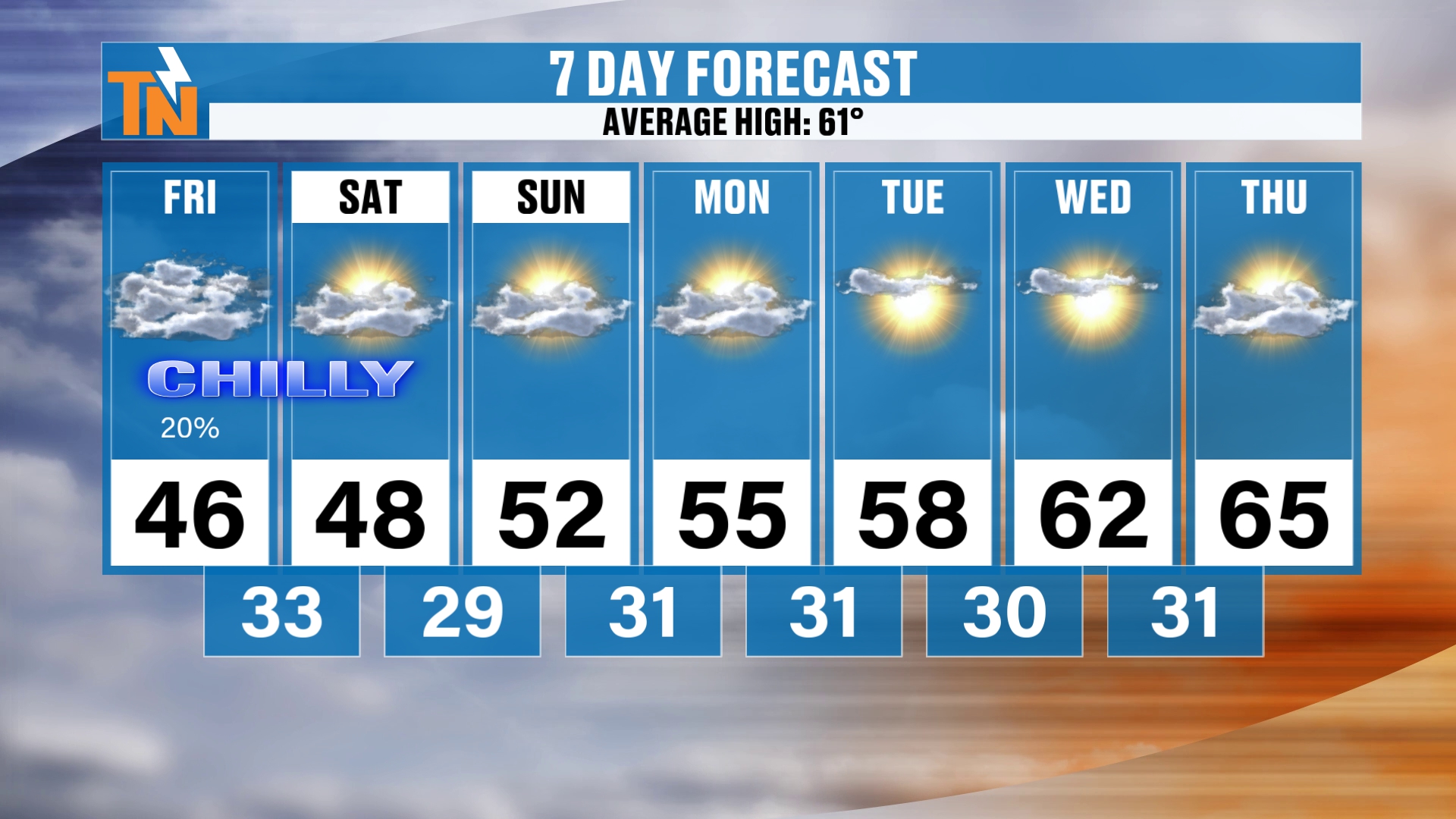
Here’s that all-important 7-day forecast, if you’ve been sticking around for that. Of course, you can always get it on the East Tennessee Weather app for your location.
Make sure you download the East Tennessee Weather app. It’s a great tool to check in on the interactive radar, which gives you past, current and future radar up to two hours out. You also get watches and warnings if you happen to be in a watch or warning area, and just plain fun daily weather forecast stuff.
You can get this forecast there. You can also get your QuickCast there, if you just want a quick weathercast. That answers “what’s it looking like today?” and gives you a quick preview of the extended forecast. That’s what the QuickCast is for.
So we’re going to be in the mid 60s by next Thursday, with highs of 46 today, 48 Saturday, 52 Sunday, 55 Monday, 58 Tuesday, 62 Wednesday and 65 Thursday.
Looking Ahead: Above-Average Temperatures Return
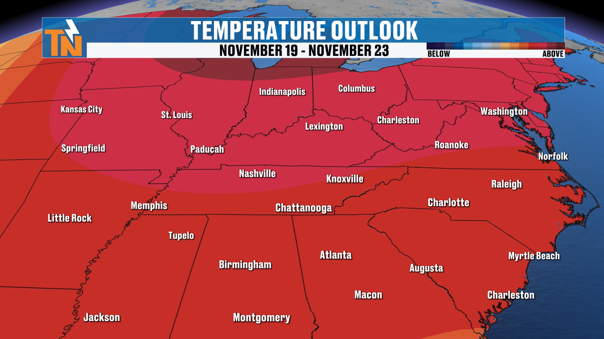
Per the Climate Prediction Center, and we’ve been talking about this, above-average temperatures will likely continue around the area.
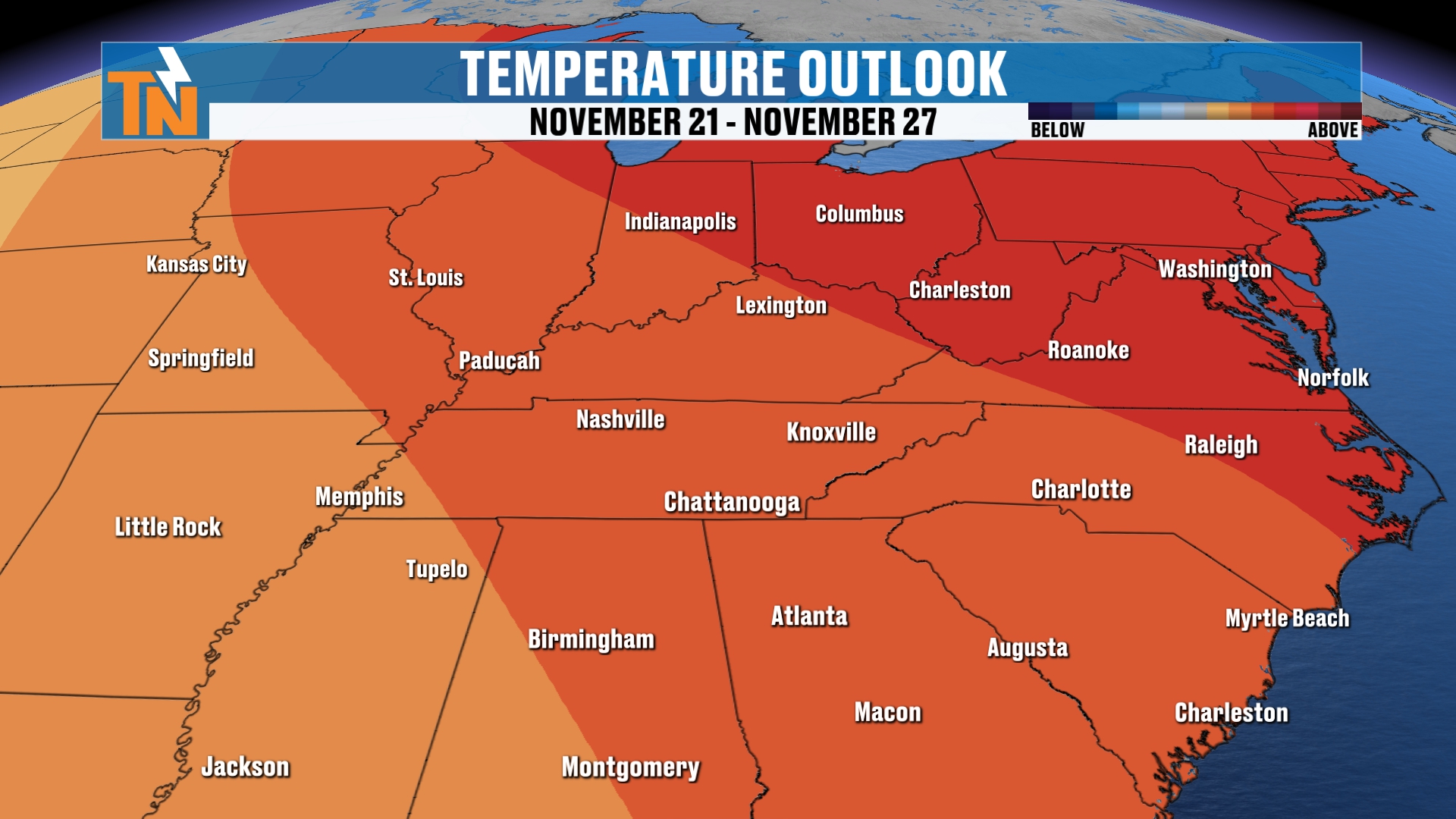
So the cold snap is short-lived. We get our taste of winter, and then the warm-up takes over again.
Bottom Line
FRIDAY (TODAY): Cloudy and chilly, in the 30s and 40s this morning, about 10 to 15 degrees colder than yesterday. 45 at noon, low to mid 40s as the kids head home, and a high of 46. Breezy out of the west-northwest, with gusts around 16 to 23 mph. A lull in the snow through midday, then spotty showers in the lower elevations and snow showers in the higher elevations from the afternoon on. Flurries possible on the northern plateau. High school football: 44 at 6 PM down to 39 by 10 PM, with a few showers or snowflakes possible.
FRIDAY NIGHT: Snow showers pick up in the mountains around 8 PM and increase overnight as the next wave comes through.
SATURDAY: The snow machine winds down and skies clear. The winter weather advisory runs until 1 PM. A hard freeze is possible Saturday morning, with a low around 33 and a high around 48.
SUNDAY: Clear and dry, a cold start near 29, then a high around 52.
MONDAY THROUGH THURSDAY: Cold mornings in the upper 20s and low 30s, with afternoons warming from 55 on Monday to 58, 62 and 65 by Thursday.
NEXT FRIDAY: A big warm-up with a low near 46, and next weekend looks fantastic.
The takeaway: a few flurries on the Cumberland Plateau, one to two inches in some higher elevations, a good solid two to four inches on the highest peaks of the Smokies with pockets of three to five-plus, and light accumulations on grassy areas and rooftops if any snow reaches the lower towns. Highway 441 over the Smokies is closed.
Let me know if you get some snowfall in your area, and let me know what’s good in your world this upcoming weekend. Drop it in the comments below. I’d love to find out.
For more daily updates, check out our Daily Forecast page.
Don’t forget to LIKE, SHARE and SUBSCRIBE to the YouTube channel and hit the bell at the top. It really helps get us out in the algorithm, and the faster you can help me out, the faster we grow East Tennessee Weather together.
Make sure you download my free East Tennessee Weather app. Just go to your app store and search East Tennessee Weather. It’s a wealth of weather information, including the interactive radar, watches and warnings, and QuickCasts.
I’m Meteorologist Mike Witcher. Have a great Friday!
eastTNweather — Weather When You Want It.