
Published: Tuesday, November 17, 2026 | By Meteorologist Mike Witcher | eastTNweather
Good morning, East Tennessee, and happy Tuesday! Thanks so much for checking in with your morning weather update on this November 17th, 2026. Today we’re digging into the first Thanksgiving snow signals in the models, but first things first: we have to get through some fog and freezing fog this morning.
A nice, big old ridge of high pressure is dominating our weather pattern. That has left us with fog and freezing fog to get the day started, but it’s going to burn off pretty quickly. We have a warmer day ahead of us today, and that warming trend continues throughout much of the week.
As we get into the weekend, there’s a wave down to our south and southeast and a cold front that’s going to settle in from the north and west. What does that actually do to our weekend? Does it bring us increasing chances for rain, or just some cloud coverage? I’m talking about that. And of course, we’re still highlighting Thanksgiving week. It does look like it’s going to get a little bit more active, with rain and snow chances, plus your all-important 7-day forecast.
Don’t forget to like, share and subscribe to the YouTube video and the channel. It really helps things out.
Yesterday's Almanac: Where We've Been
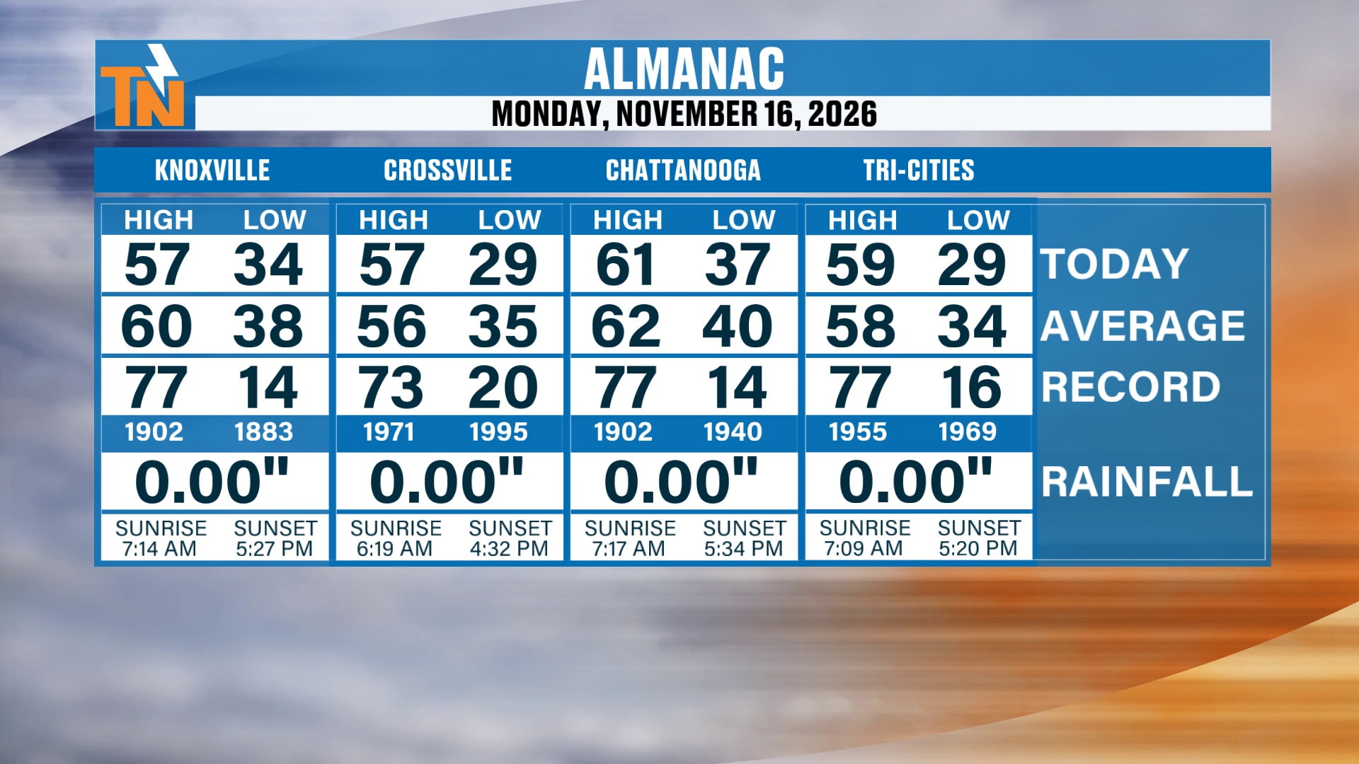
Let’s start you off, first things first, with the almanac from yesterday. It turned out to be a rather beautiful day with pretty seasonable weather. We topped out in the upper 50s, with a few pockets of low 60s. Averages are in the mid to upper 50s to low 60s, so it wasn’t a bad day at all compared to average.
That’s going to be the story throughout the day today, too, as a big old ridge of high pressure builds its way on in.
Ridge of High Pressure: The Big Old Blue Bubble of No Trouble
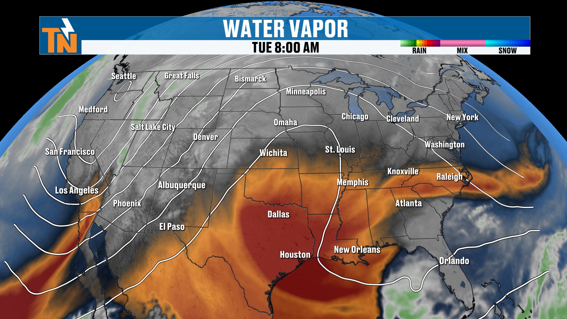
You see the brown showing up there on the map? That is your dry air. The air is going to be definitely a little bit drier here over the next couple of days as well. So we’re going to be tracking that ridge of high pressure that continues to bring us the warmth.
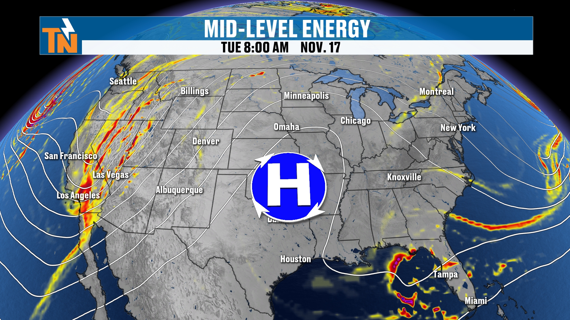
This is what it looks like in the mid-levels of the atmosphere. There’s a big old trough off to our north and west and northwest, and the trough across the eastern seaboard is lifting its way on out.
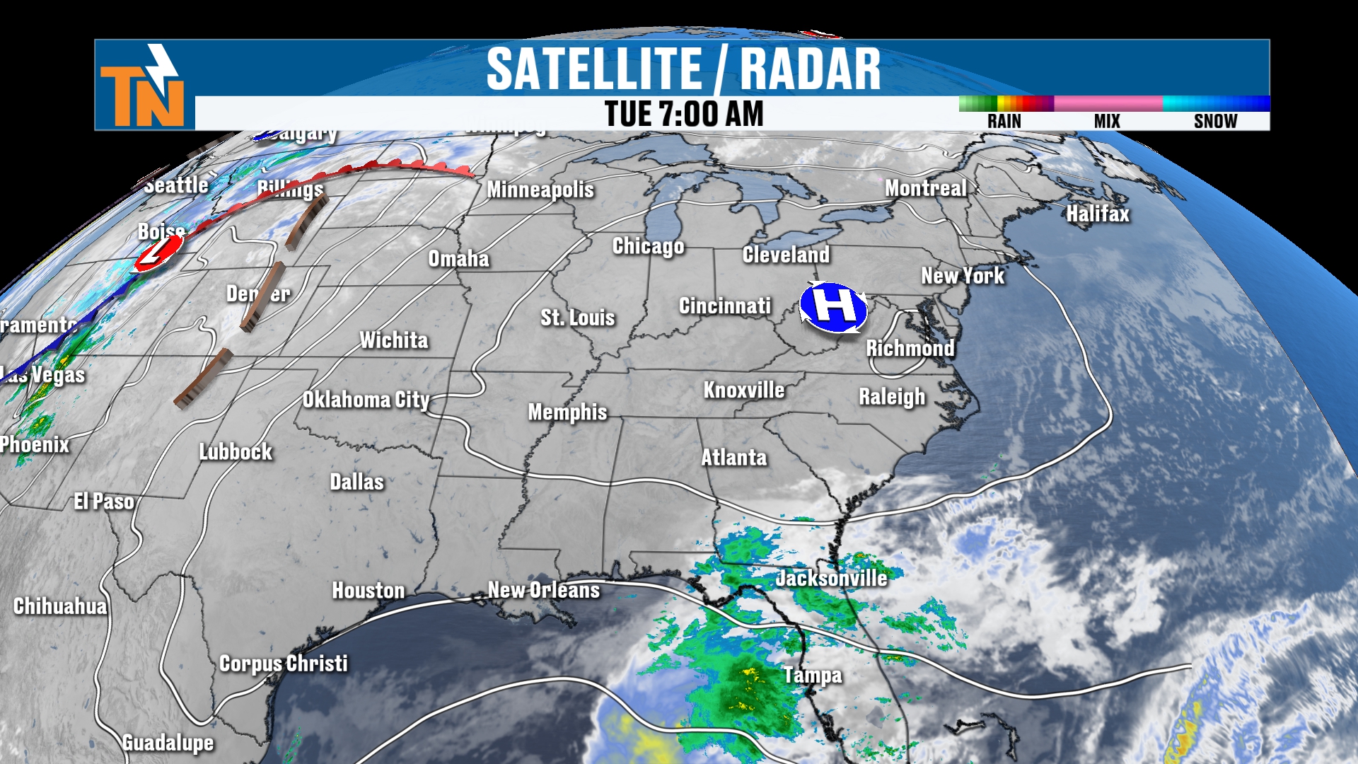
At the surface, this is bringing us what I like to call the big old blue bubble of no trouble. A big old ridge of high pressure brings us sinking air, and that’s what gives us sunshine throughout much of the day today.
Fog and Freezing Fog This Morning
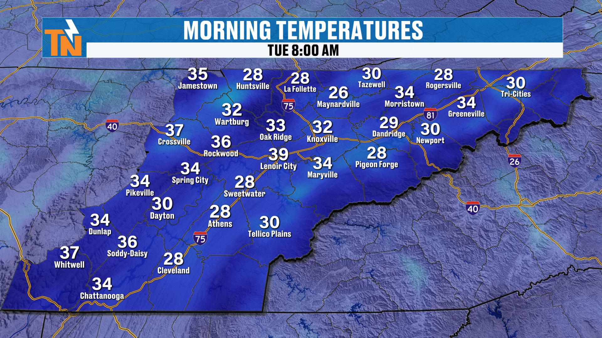
Not so much sunshine down in parts of town, though. Look at the fog and the freezing fog that is taking shape here this morning. It’s going to be rather icy in some spots. Bridges and overpasses could be a little bit of a threat, and cars are definitely going to have to be scraped off this morning.
Temperatures are hovering at or just slightly below freezing in many locations, and that’s why we have the freezing fog issue. The National Weather Service has issued a special weather statement due to the fog and freezing fog. So, travel safely.
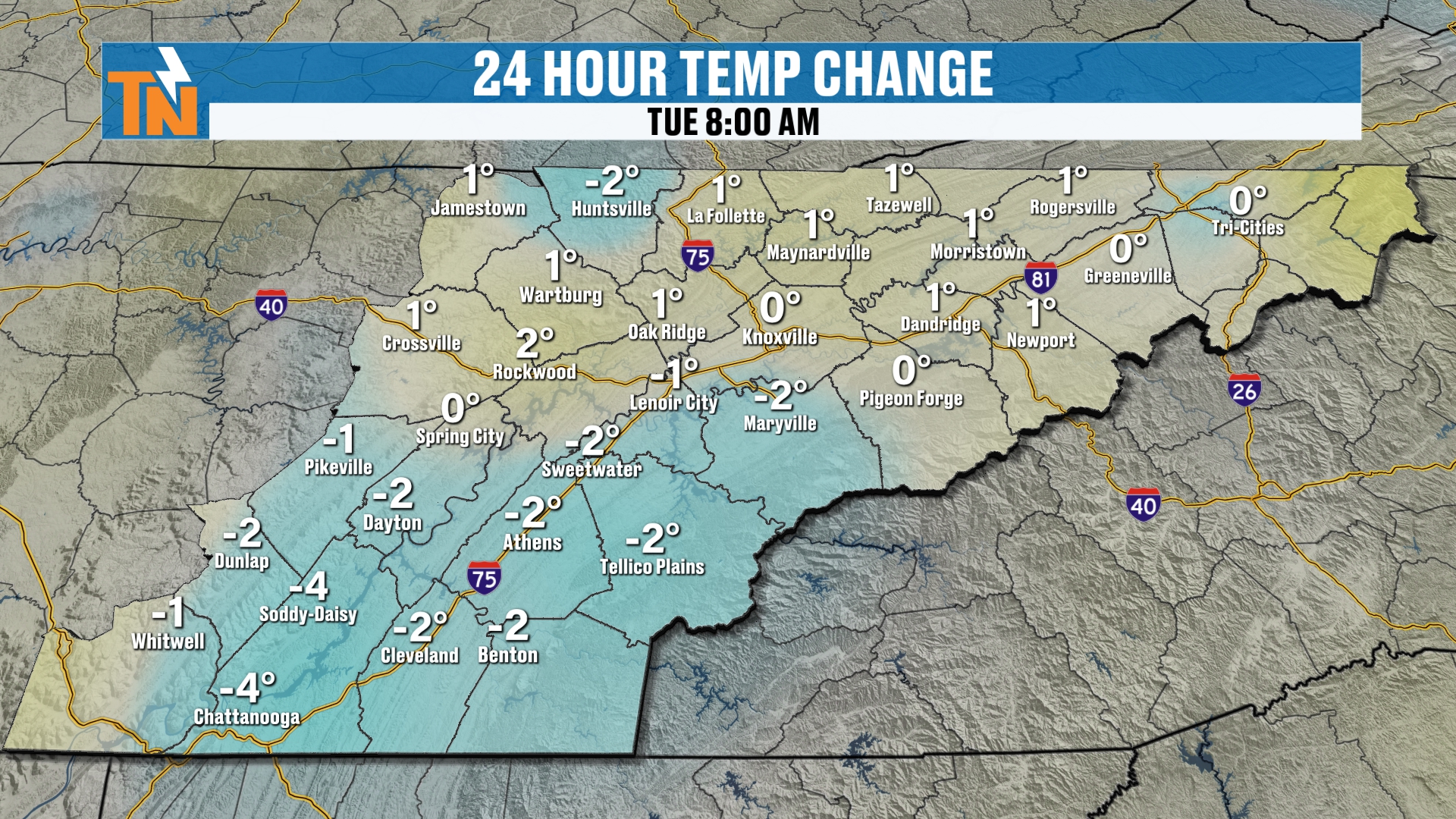
As for the 24-hour temperature trend, we’re trending about where we were yesterday, give or take a degree or two.
Today: A Nice, Seasonable Afternoon
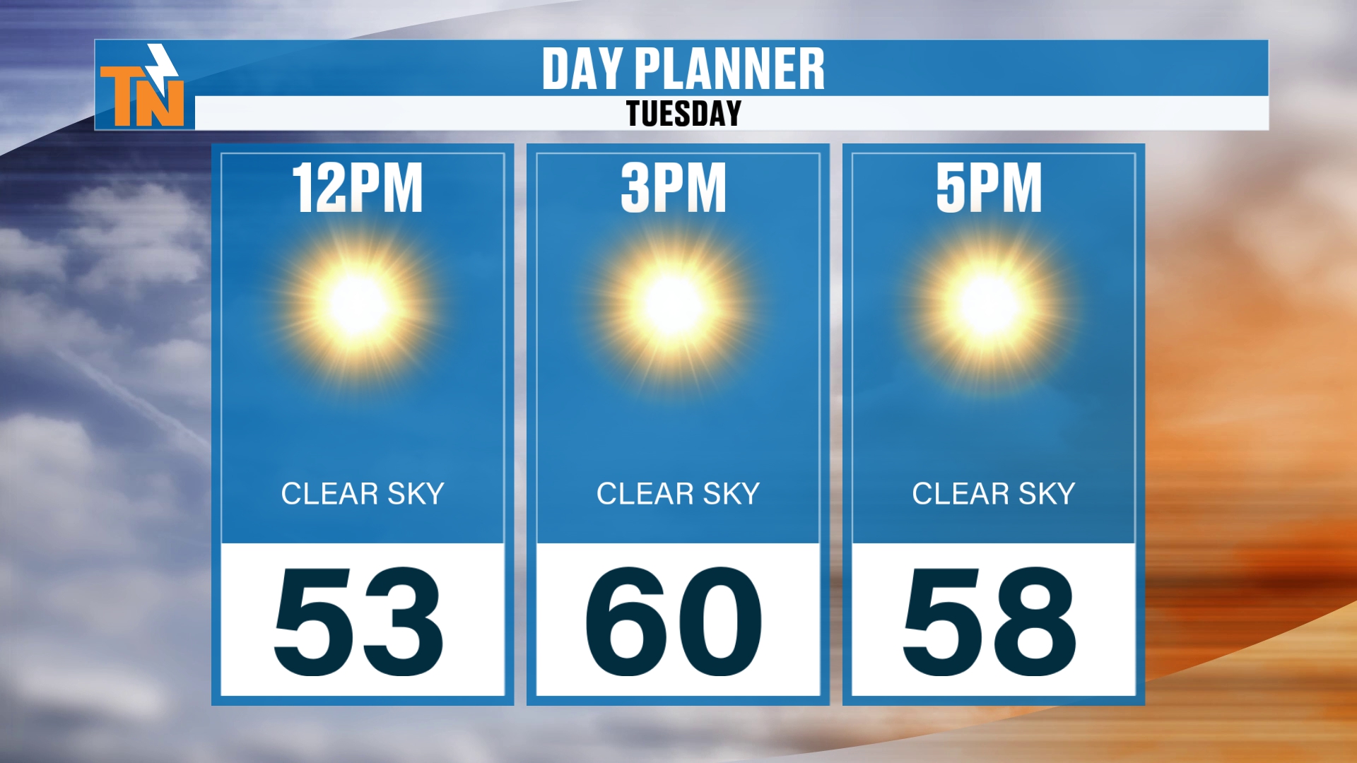
By lunchtime, we’re going to see temperatures climb into the mid 50s. Our goal today, as the kiddos head home from school, should be the upper 50s to low 60s. So it’s another nice, seasonable afternoon, right where we should be.
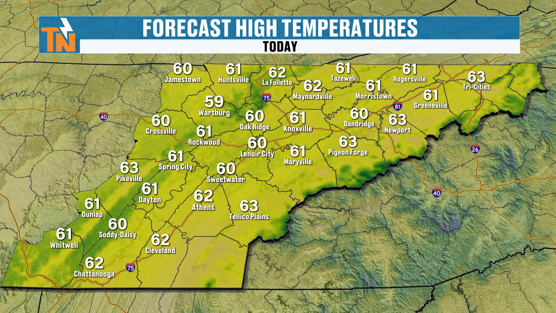
Take a look at the highs on the map. It’s a really nice, pretty day across the Valley once the fog burns off.
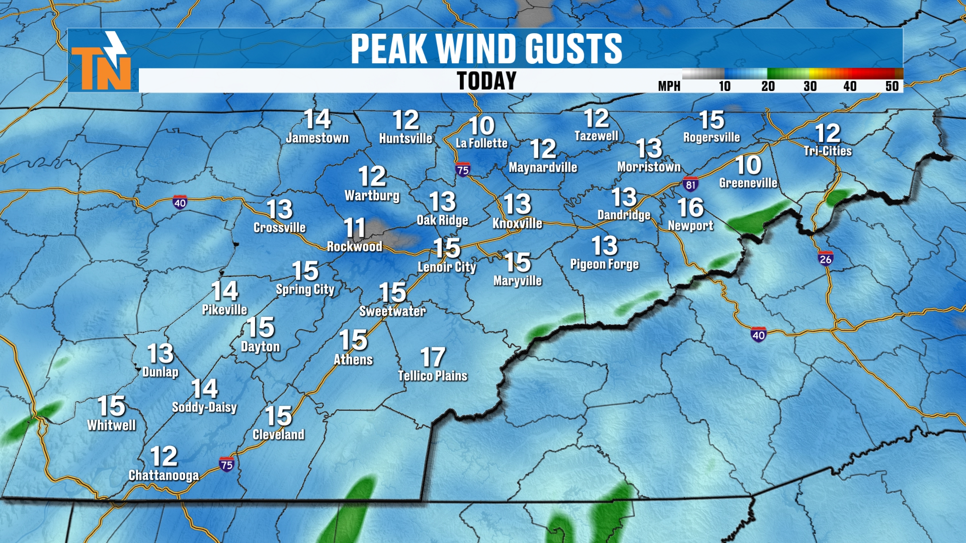
There will be a little bit of an afternoon breeze, gusting to about 10 to 15 mph. Not a big deal there.
Evening and Overnight: Temperatures Drop Quickly
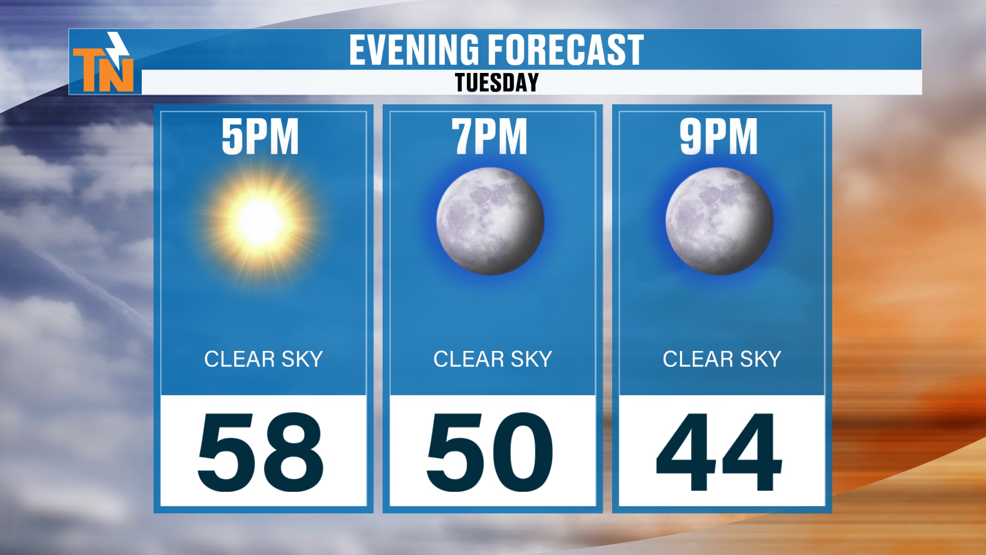
If you have evening plans, once the sun goes down, temperatures drop pretty quickly. That’s typical. We’re down to 52 by 7 PM, which isn’t too bad, and then 46 by 9 PM this evening.
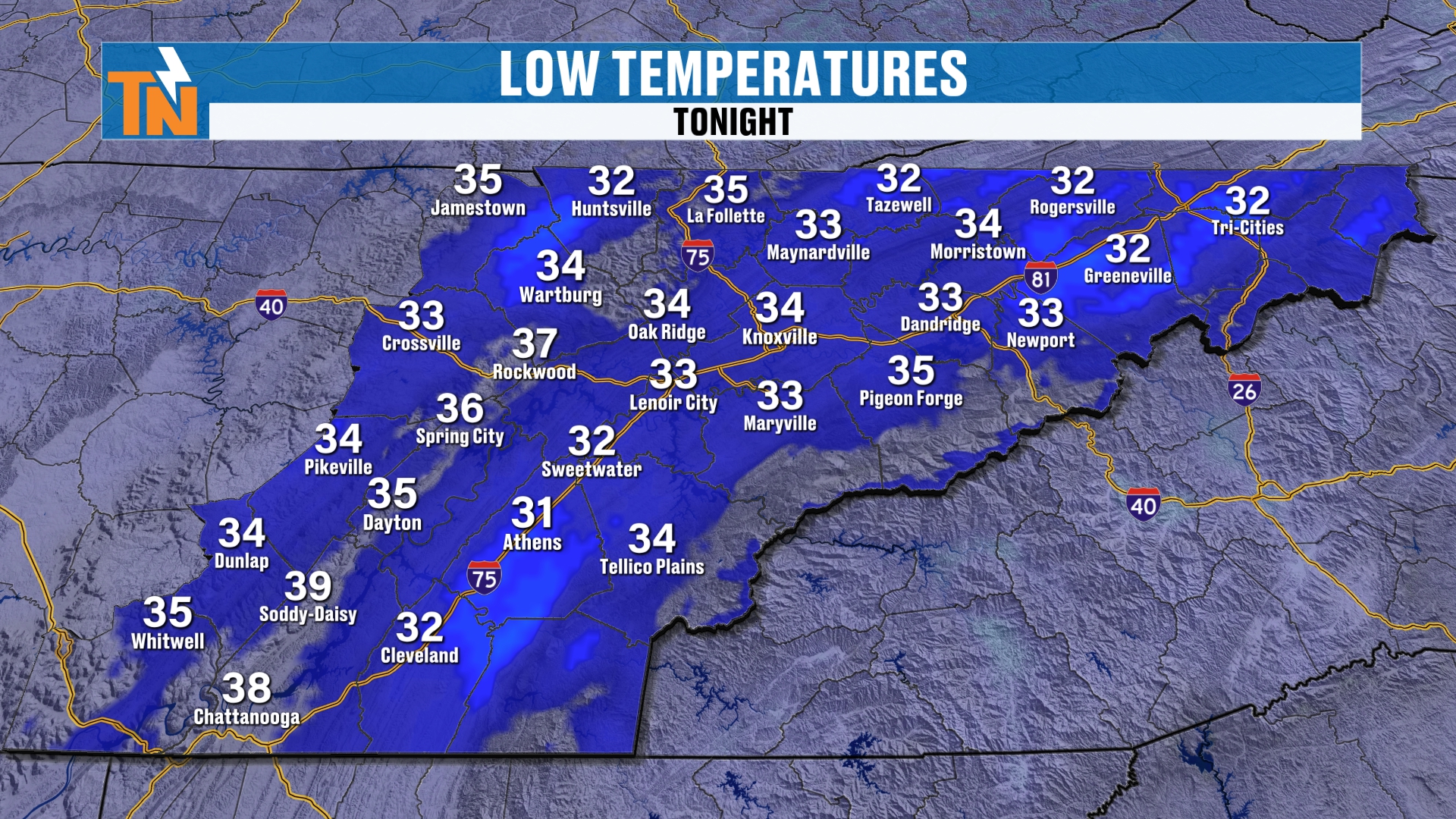
Overnight lows tonight drop back down into the 30s. So we’ll have a little bit of frost and some fog around the area. But we’re going to start to get rid of that morning fog, or at least the frost anyway, as high pressure builds in. That brings us warmer temperatures, not just for highs, but for morning lows.
We’re also going to get a little bit of return flow from the Gulf.
High Pressure Builds In: A Warming Trend
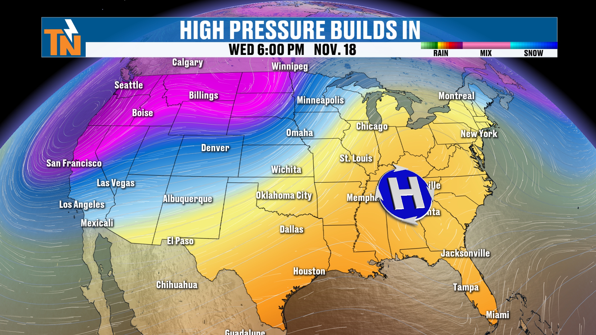
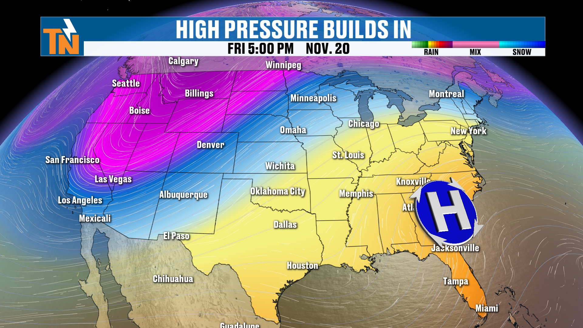
Notice the big, deep trough across the Pacific Northwest. This is the GFS, the American model, and this has not changed much from what we were talking about last night. That’s what we’re going to be talking about as we get into Thanksgiving week. There are several waves, several troughs and several disturbances back behind that, and they could potentially bring increasing rain chances. We’ll talk about that in a second.
The 7-Day Forecast: Nearly 10 Degrees Above Average
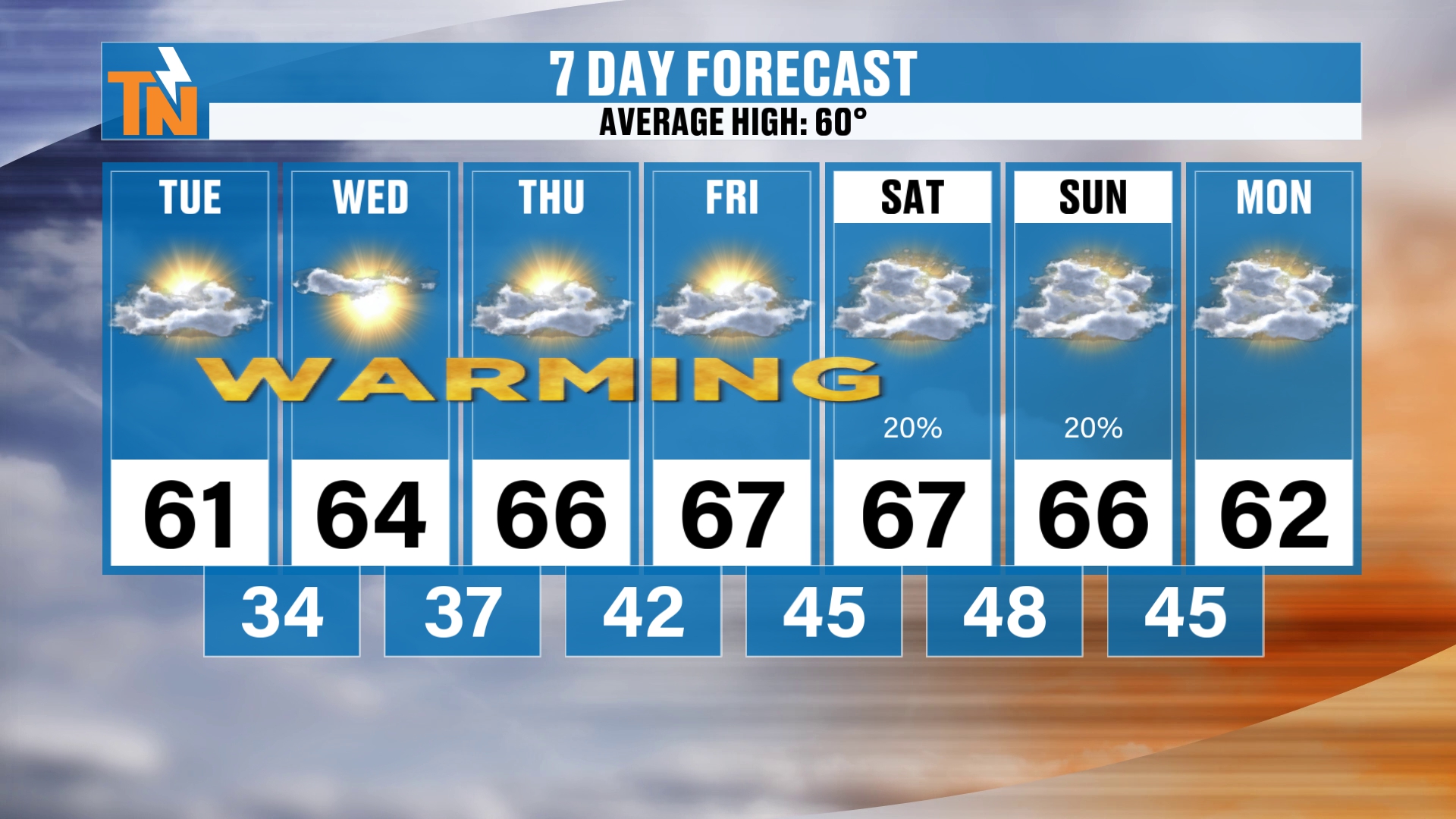
First things first, here’s your 7-day forecast, and it’s a warming trend here this week. We’re going to be nearly 10 degrees above average as we round out the week. Friday and Saturday, we’re going to be in the upper 60s, with lows staying in the mid to upper 30s early in the week and climbing into the 40s by the weekend. Again, not nearly as cold as it is this morning.
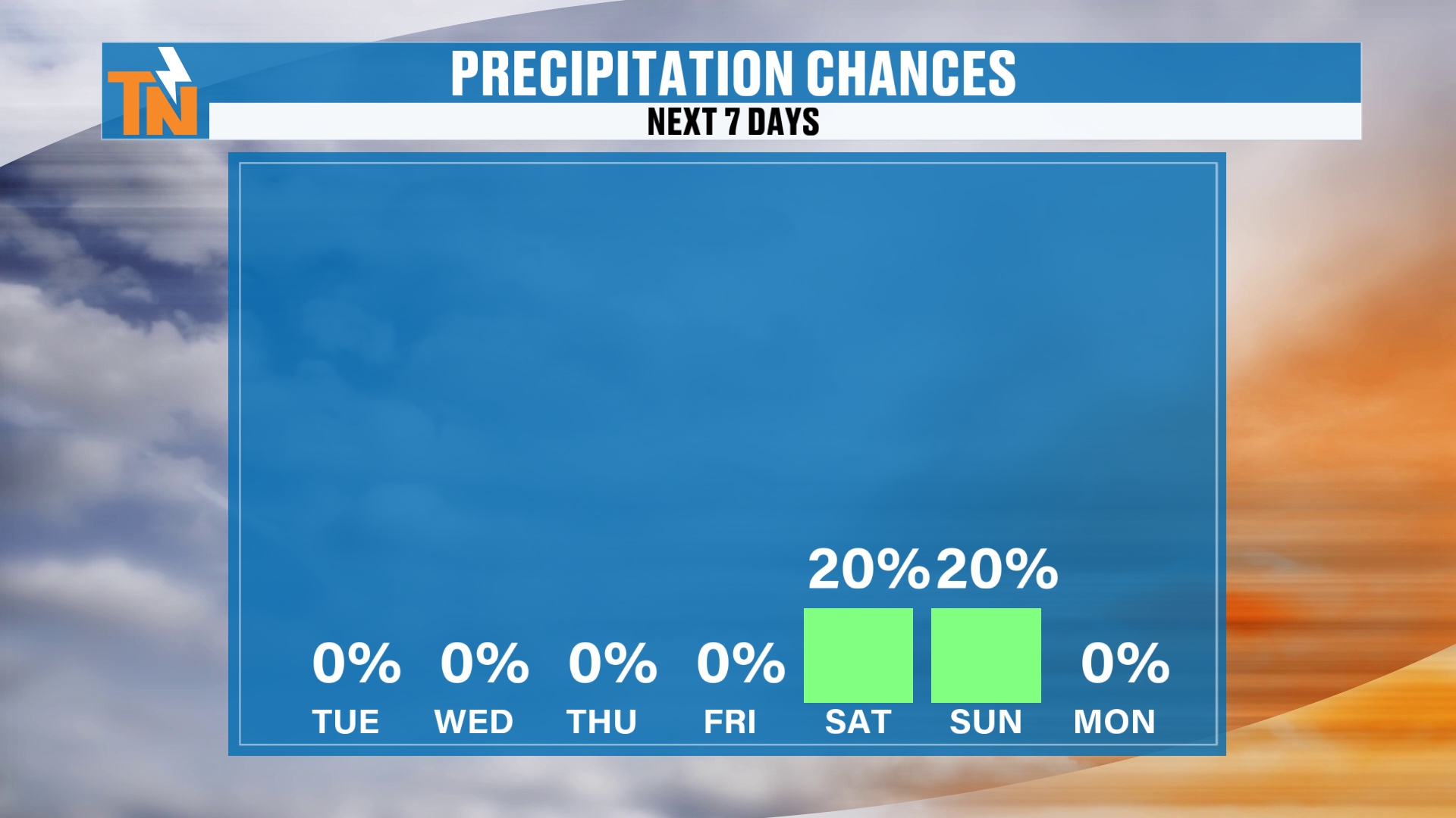
As we get into the weekend, we’ve got that 20% chance of rain for Saturday into Sunday. It’s probably more likely on Sunday, so I’ll tailor that weekend rain chance accordingly. It does look like a cold front is going to potentially bring us a little bit of rain.
Weekend Rain Chances: Where's the Low and Where's the Front?
Let me show you what I’m talking about. There’s an area of low pressure across the southeastern coast in the mid-levels. There’s a surface cold front across the Great Plains and the upper Midwest. That cold front is going to help push that low off to our south and southeast, and so keep it further to our east.
So I don’t necessarily know that we’re going to see the effects of that low pressure system. And if we see any of the effects of the cold front, it’s probably going to come through late in the day on Sunday, giving us a chance for some rain, maybe late Sunday. Either way, I’m going to hold a 20% chance of rain as it stands right now.
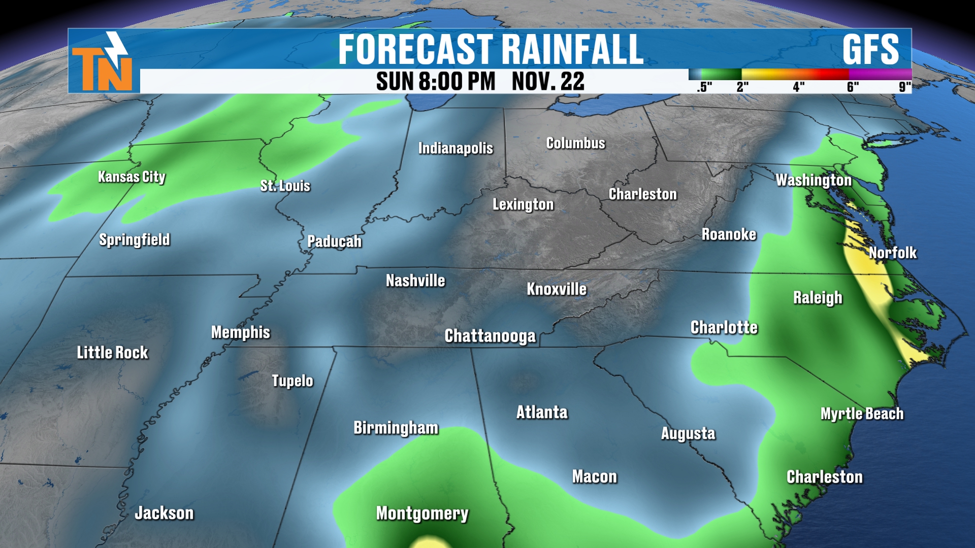
This is the model guidance that takes us all the way through Sunday, November 22nd. The GFS is not picking up on a whole lot of rainfall.
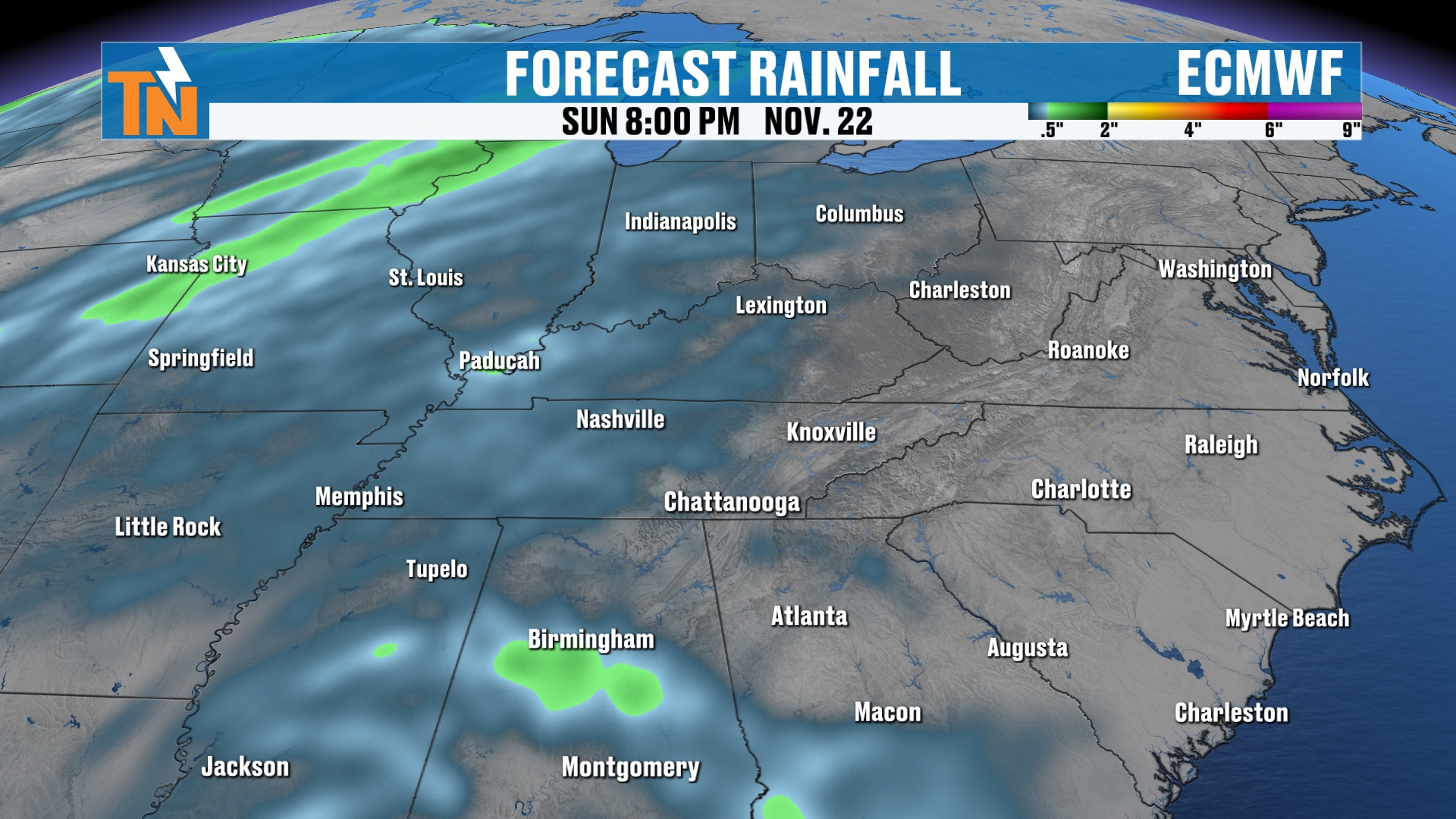
Here’s your European model. It’s not picking up on a lot of rain either.
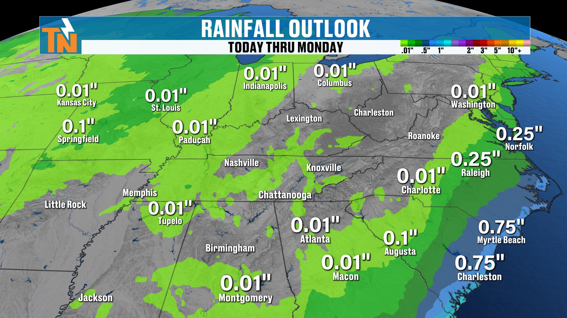
The National Weather Service blend models are picking up on most of the rain across the southeastern coastline. And when you look at the Weather Prediction Center’s forecast, it’s also picking up on most of the rain across the southeastern coastline. Not much rainfall here locally.
So, again, about 20%. I just don’t think we’re going to see a whole lot. I think most of it is going to be to our south and southeast.
Thanksgiving Week: Here Comes That Trough
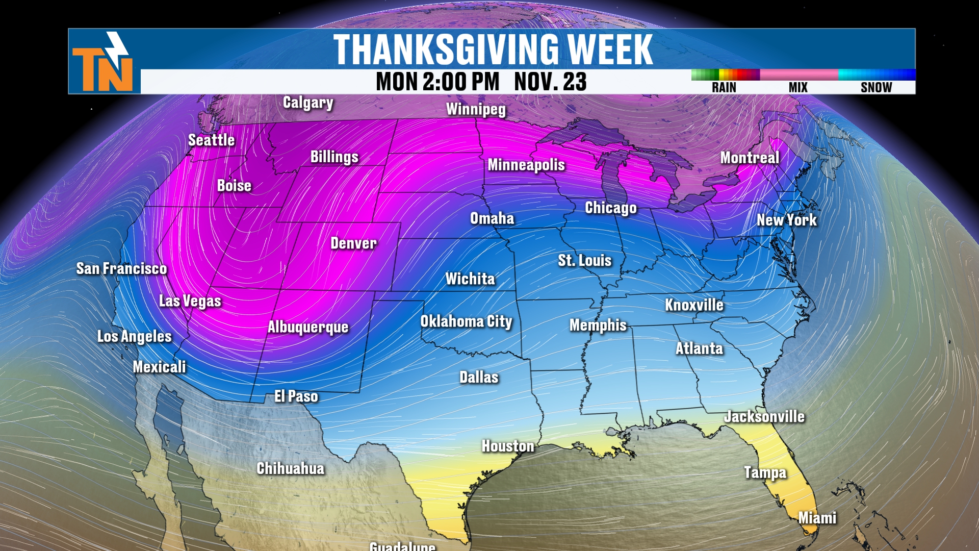
Now, let’s talk Thanksgiving week, because here comes that trough. There’s one trough that digs and stays back further to our west, but still puts us in a southwesterly flow. Then a bigger, deeper trough potentially could be heading our way Thanksgiving Day, Black Friday and into the first weekend of Thanksgiving, I should say Thanksgiving weekend.
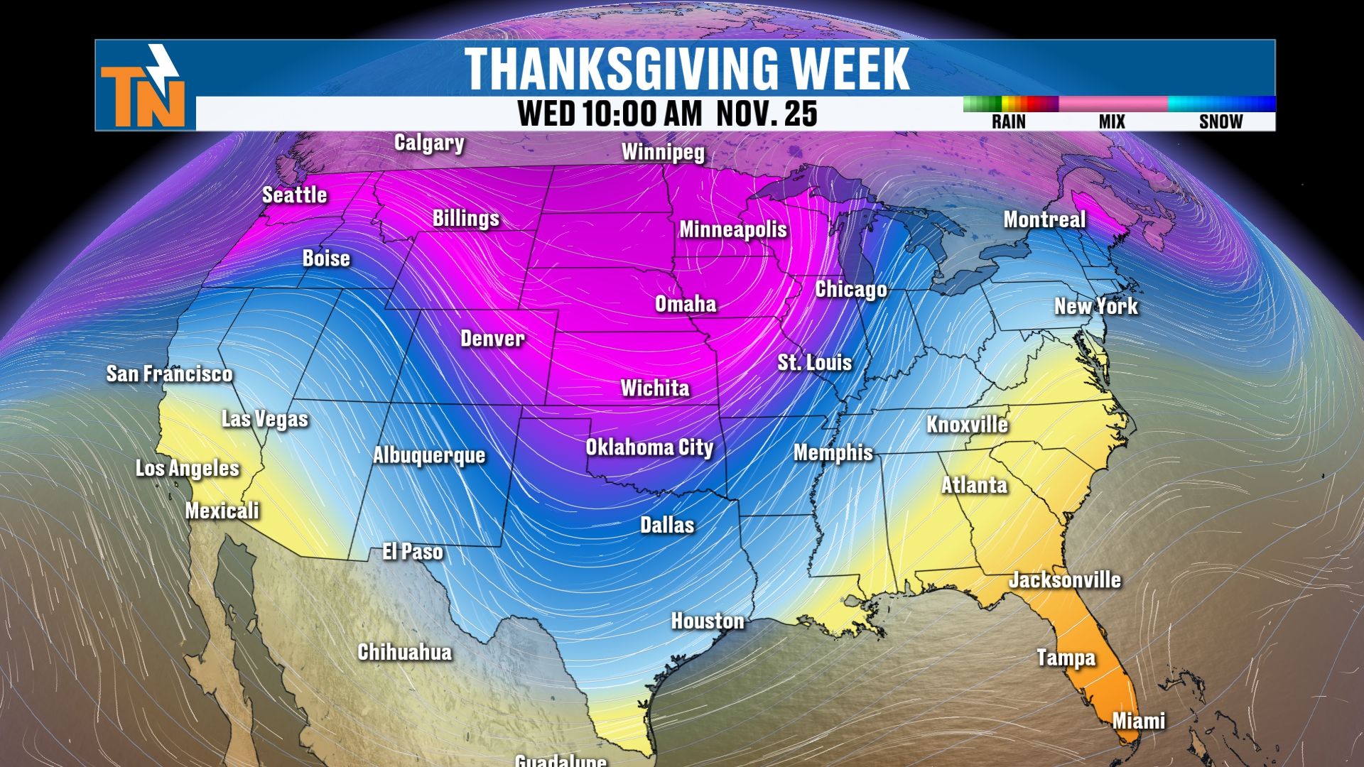
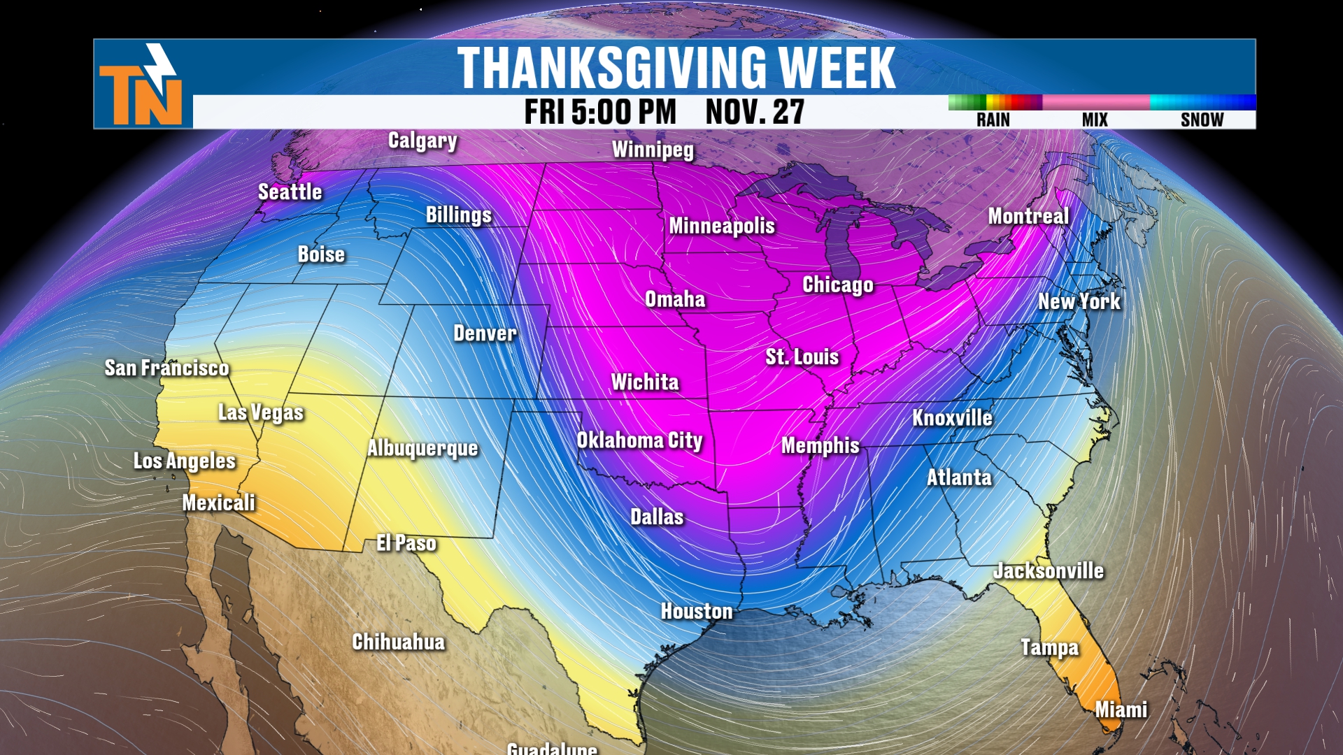
Because of that, this ultimately could lead to increasing rain chances. We’ll pick up our timeline on Monday, November 23rd. That’s a week from yesterday, and that’s where we could potentially see some of the heaviest rainfall.
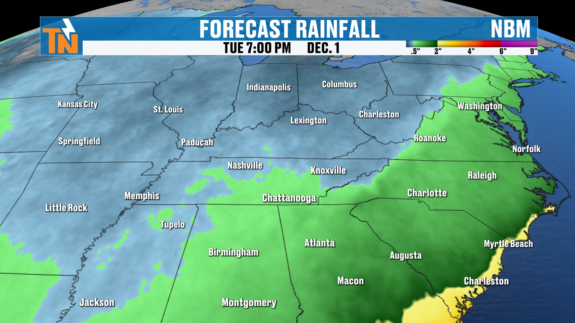
But let’s keep this going into Thanksgiving week. You can see how the rainfall is going to increase as we get into our Thursday and Friday and through the upcoming weekend across much of the southeastern coastline.
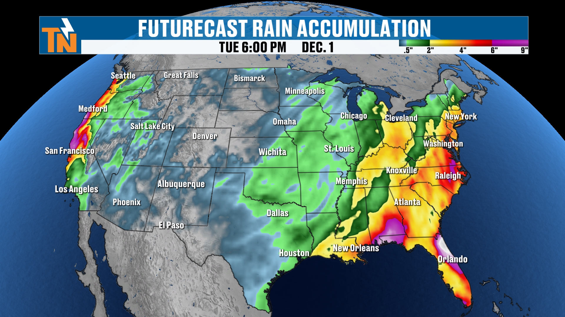
So the eastern part of the U.S. could have some travel troubles in the form of rainfall.
Thanksgiving Snow Signals: Do We Get Any Snow?
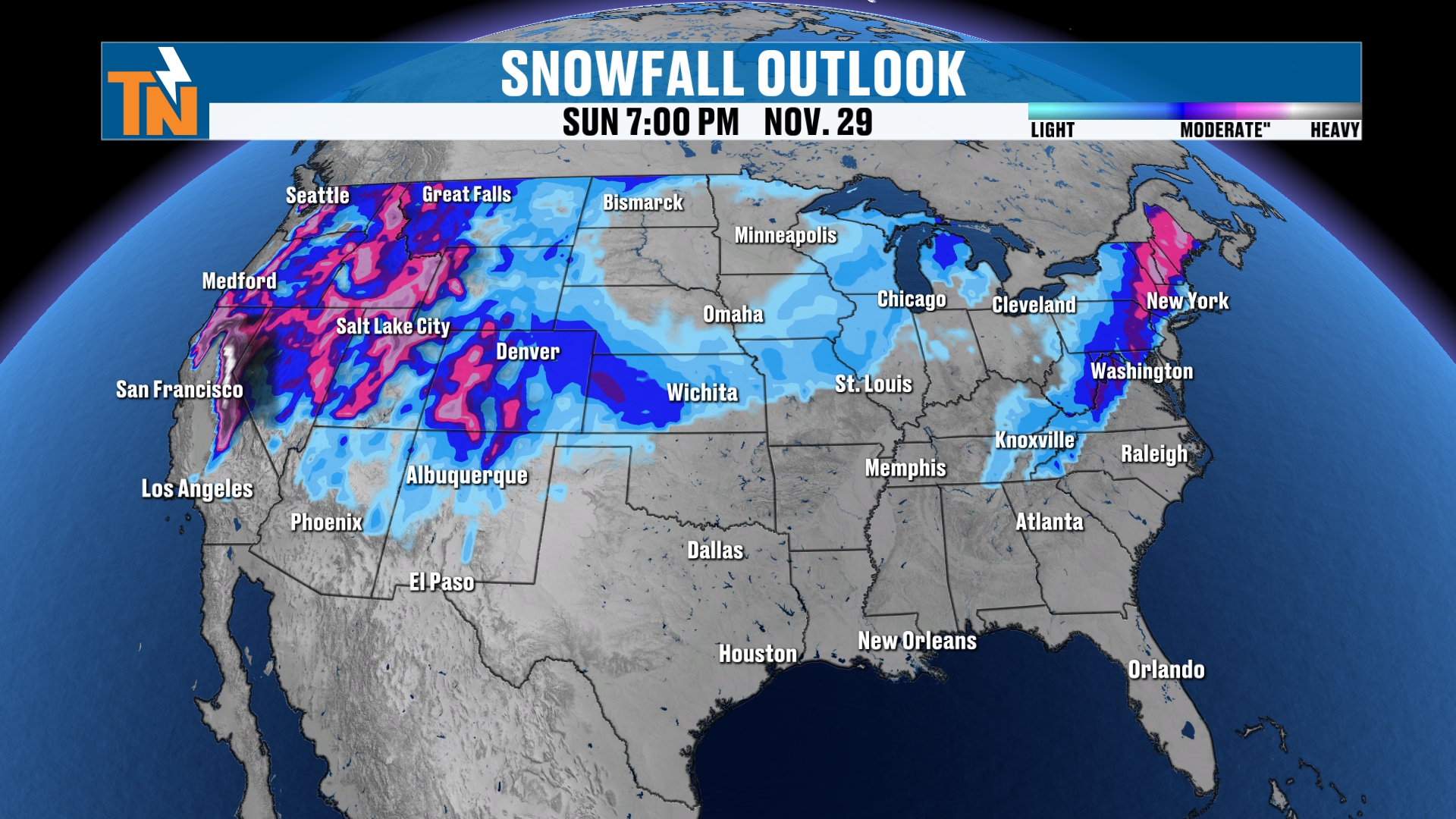
But do we get any snowfall out of this? Well, here’s your snowfall forecast. Again, this is going to change drastically. This is just model guidance, and it’s not gospel by any stretch.
The models have been picking up on those snowfall chances across parts of the upper Midwest. This has kind of been flipping back and forth, closer to Montana, back to South Dakota, Minnesota, and now it’s over Chicago and Interstate 40 and 70. So we’ll see what that looks like. The models are picking up on the fact that we’ll see some snow showers as we get into Thanksgiving week across parts of the upper Midwest and the northern Great Plains.
But notice that the latest model guidance is also picking up on snowfall here at home and across the Northeast. If that happens, that’s going to cause some major travel troubles across the eastern U.S.
Again, this is guidance, not gospel. So we’ll see how this all plays out. Keep checking back as these Thanksgiving snow signals evolve.
One More Look Outside
I want to take you back outside here for a second. We do have patchy dense fog and freezing fog showing up in Townsend, on the peaceful side of the Smokies. So do travel safely. We’ve got a special weather statement in place this morning due to the potential for fog and freezing fog.
Bottom Line
TUESDAY (TODAY): Patchy dense fog and freezing fog this morning, with temperatures at or just below freezing in many spots. Watch for icy bridges and overpasses, and plan to scrape the cars. The fog burns off quickly, then it’s sunny and seasonable: mid 50s by lunchtime, upper 50s to low 60s after school, with a high around 61. Winds gusting 10 to 15 mph. Down to 52 by 7 PM and 46 by 9 PM, with lows in the 30s and a little frost and fog.
WEDNESDAY THROUGH FRIDAY: The ridge of high pressure builds in and the warming trend continues, with highs of 64, 66 and 67. Lows climb from the 30s toward the 40s.
SATURDAY AND SUNDAY: Highs near 67 and 66, nearly 10 degrees above average, with a 20% chance of rain. A cold front could bring a little rain, most likely late Sunday, but most of the rain stays to our south and southeast.
THANKSGIVING WEEK: A trough digs in to our west, then a bigger, deeper trough could head our way Thanksgiving Day, Black Friday and the weekend. Rain chances increase, and the models are showing snow in the upper Midwest and northern Plains, and possibly the Northeast and here at home. Guidance, not gospel, so keep checking back.
The takeaway: a warm, quiet week once the morning fog burns off, a small chance for rain late in the weekend, and a Thanksgiving travel week we’ll keep a close eye on.
For more daily updates, check out our Daily Forecast page. For longer-range outlooks, you can also check the Climate Prediction Center.
Don’t forget to LIKE, SHARE and SUBSCRIBE to the YouTube channel and hit the bell at the top. It really helps things out.
Make sure you download my free East Tennessee Weather app for your cell phones and tablets. It’s 100% free, made available by local sponsors like Monster Tree Service. I’m also on Roku TV and Amazon Fire, as well as YouTube, for my 24-hour weather channel.
I’m Meteorologist Mike Witcher. Have a great Tuesday! We’ll see you back here tonight.
eastTNweather — Weather When You Want It.