
Published: Monday, November 16, 2026 | By Meteorologist Mike Witcher | eastTNweather
Good morning, East Tennessee, and happy Monday! I sure hope you had a great weekend. Thanks for checking in with your morning weather update on this November 16th, 2026. We’re back at it, my friends.
This week is actually turning out to be a nice one. We have a nice little ridge of high pressure that’s dominating the weather pattern. But there are a couple of things I’m going to be watching in the long term as we get into next weekend.
Two weather systems could merge: a cold front and a low pressure system that are going to come together somewhere in the Southeast. Who gets rain and who doesn’t? We have the potential for some rain showers as we get into the upcoming weekend.
And above and beyond that, we’re going to be highlighting Thanksgiving week travel. There’s another trough, or a couple of troughs, that could dig their way into the area and bring some travel troubles during the busiest travel week of the year.
Yesterday's Almanac: Where We've Been
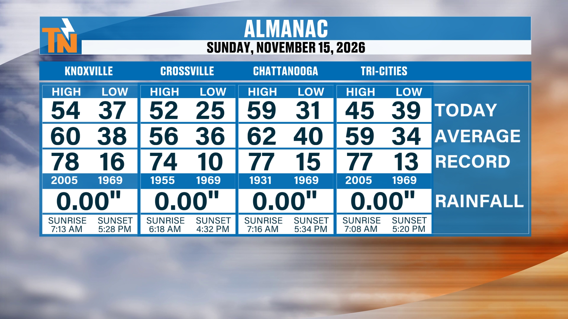
Let’s start you off, first things first, with the almanac from yesterday. I always like to guide you on where we’ve been. Then we can get an idea of where we’re going, and it sets the stage, because you can see where our averages are.
Knoxville made it to 54. Our average is 60 degrees, so put that 60 in the back of your head, because we’re going to be trending above average as we progress through the week. Crossville made it to 52, Chattanooga reached 59, and the Tri-Cities had a chillier 45.
We talked about this last night: we had that cloud coverage hanging out across the northern valley. Clouds during the daytime hours keep things a little bit on the chillier side.
A Beautiful Sunrise and a Gorgeous Day
Let’s take you outside for just a second. We’ve got a beautiful sunrise getting ready to take shape as our Monday morning gets started. There are some nice starry skies out there to begin the day as well.
It’s going to be a gorgeous day. And believe it or not, temperatures will be a little bit warmer today than they were yesterday. That trend is going to continue as the ridge of high pressure dominates and moves on in.
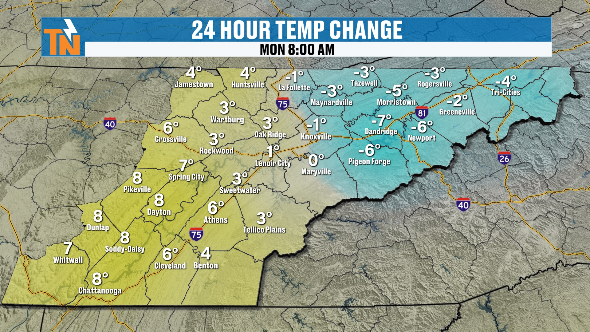
Speaking of trending warmer, temperatures this morning are warmer than they were yesterday in most locations.
Today: A Nice Afternoon and a Good Solid Fall Breeze
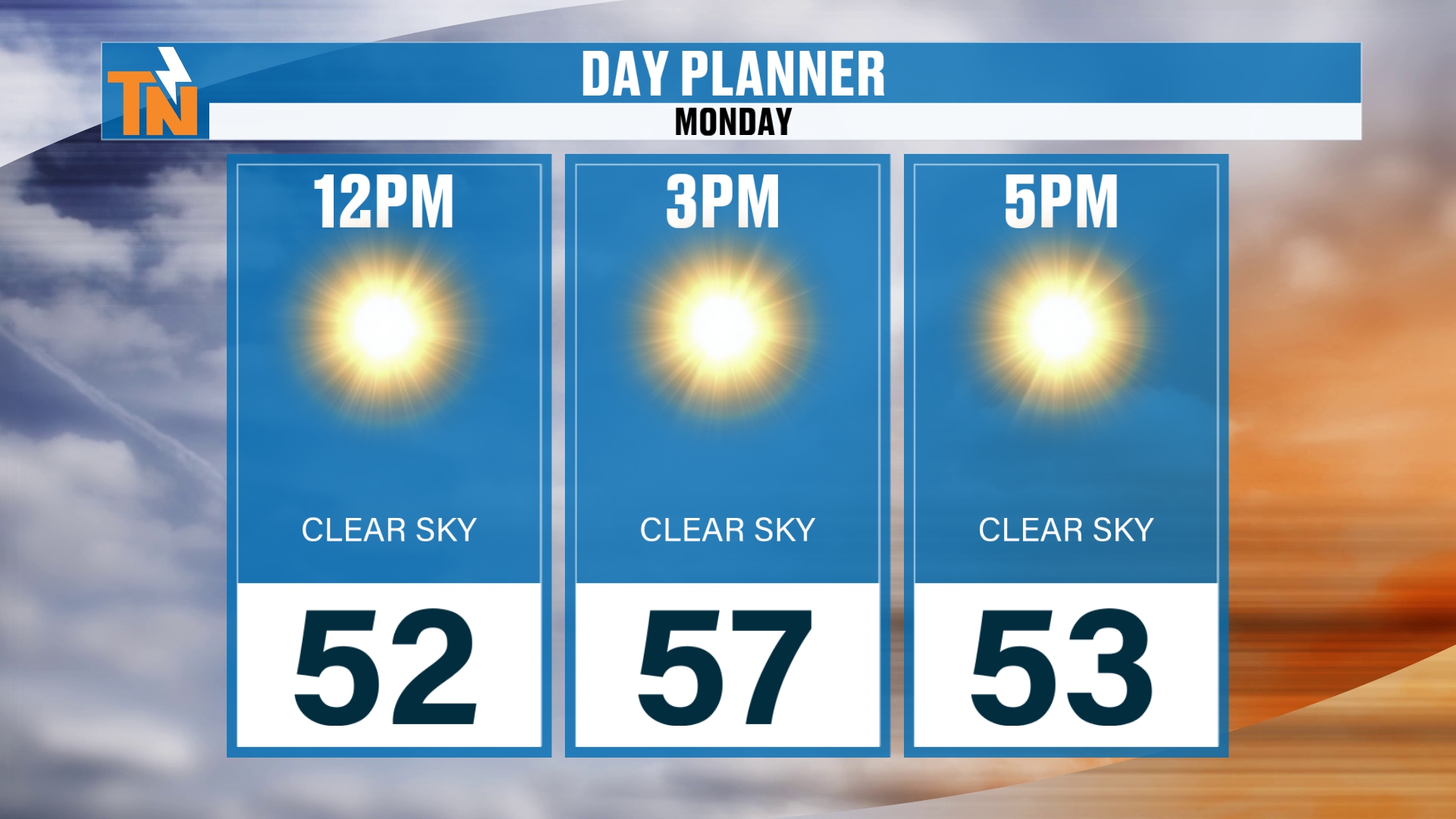
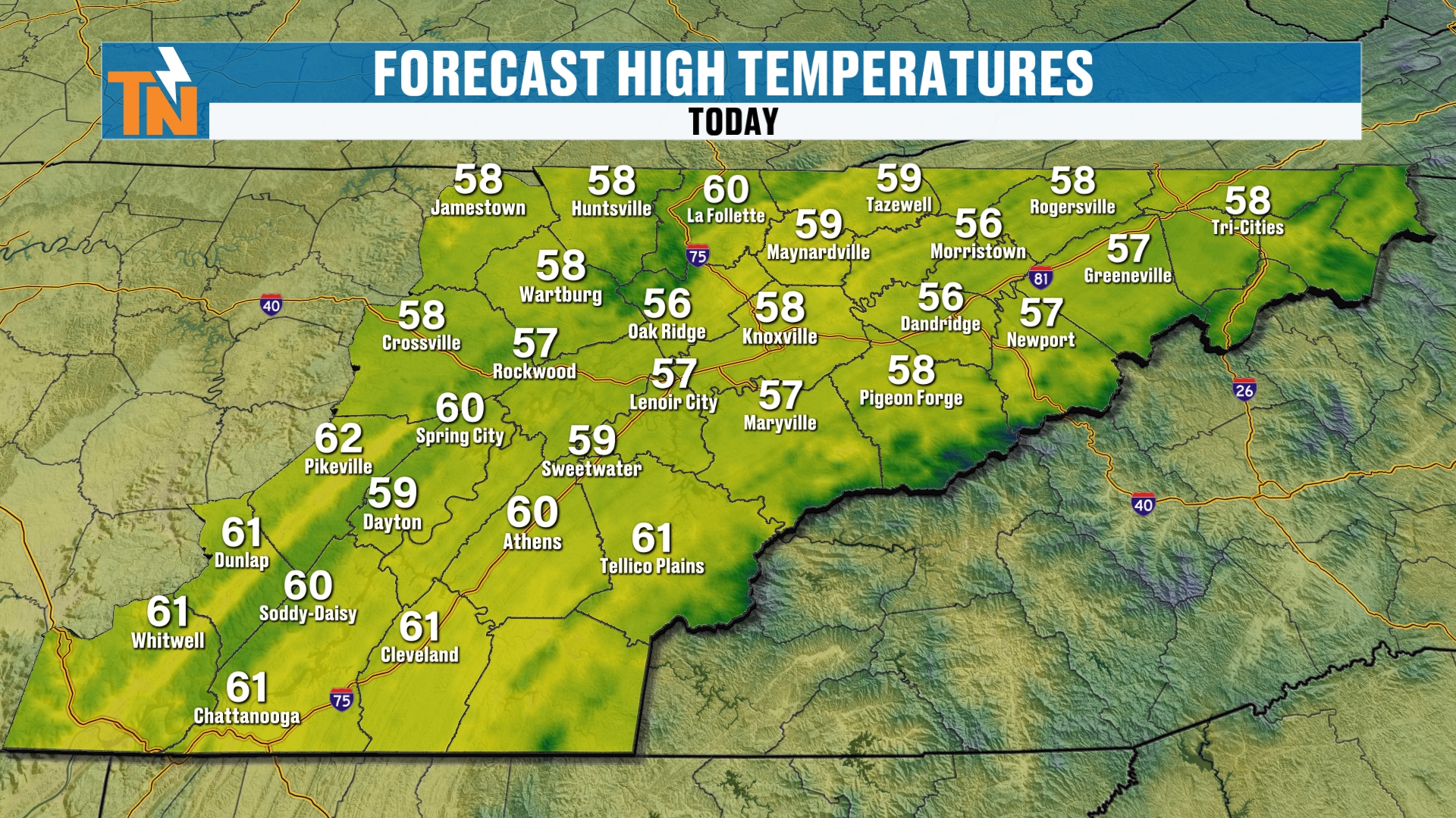
By lunchtime, we’re going to see temperatures climb into the low 50s. By the time the kids head home from school, we’ll be in the mid to upper 50s, with some low 60s. So it’s a really nice afternoon between 3 and 4 PM today.
There’s a little bit of a breeze, too.
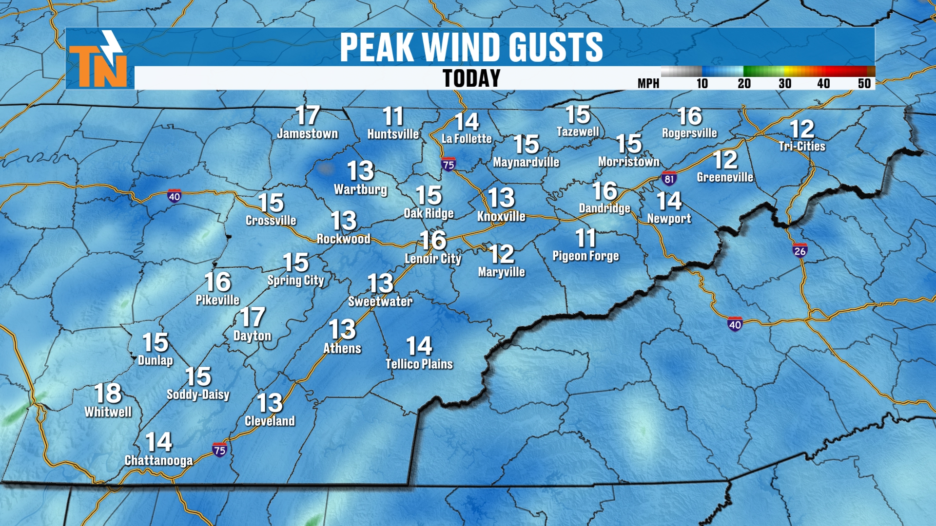
Winds are gusting to about 10 to 15 miles per hour. It’s just a good, solid fall breeze hanging out with us again today.
Evening: Chilly Once the Sun Goes Down
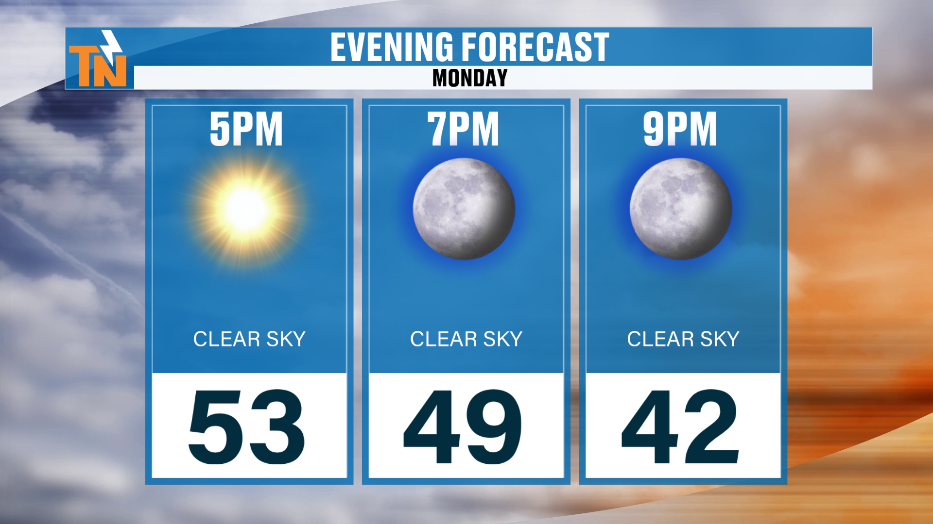
That’s going to make for a nice, chilly evening, because we have clear skies. Once the sun goes down, those temperatures fall pretty quickly. By 7 PM we’re already down to 49. And by 9 PM, we’re already down to 42.
If we’re already down to 42 by 9 PM tonight, it’s going to be a rather chilly start to our Tuesday morning. I think that’s going to be the story this week: afternoon highs are warm, but morning lows stay on the colder side.
The Big Picture: High Pressure Anchored to the North
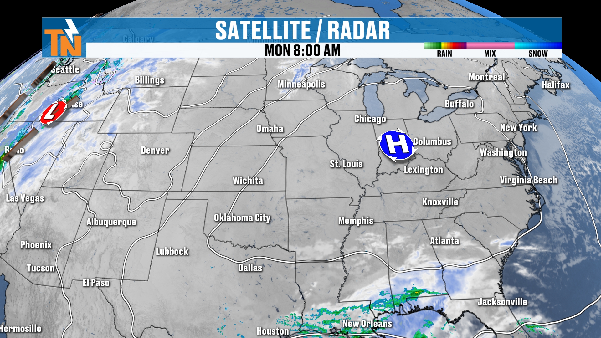
High pressure at the surface is anchored across the Great Lakes. We’ve got a little low pressure system and a disturbance that we’ve been talking about, which has been shifting from, say, Oklahoma, Kansas and Texas down into the Gulf.
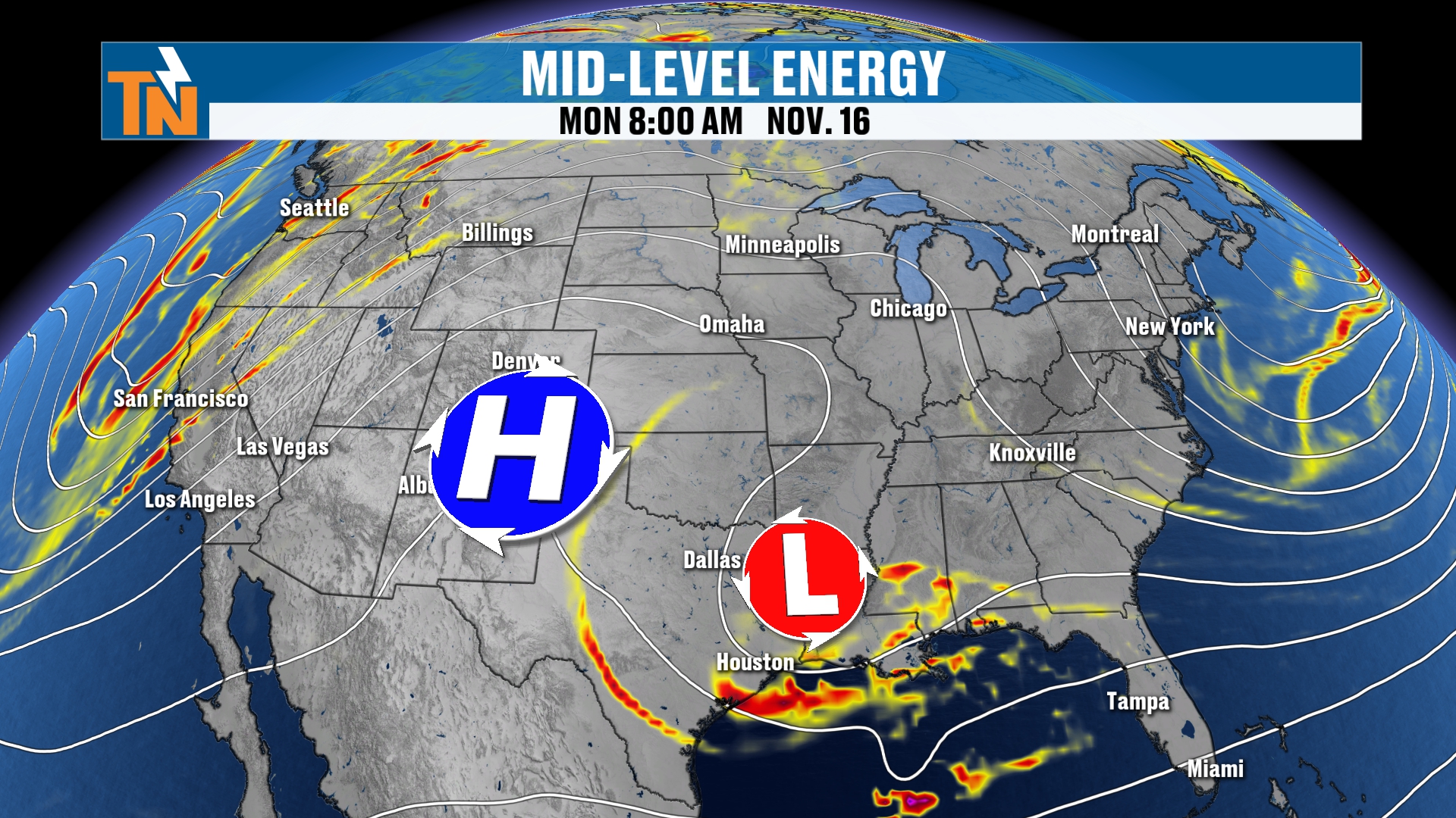
That has not done anything to our weather. High pressure has blocked it from coming on through. But you can see that little dip over Texas and Oklahoma. That’s the low pressure system in the mid-levels.
Back further to our west, we’ve got a ridge of high pressure, and that ridge is going to start to build its way in here this week. So these little waves and this upper level troughing move on out, and a ridge builds back in.
The Ridge Boosts Our Temperatures
This ridge is going to be responsible for boosting our temperatures as we get into the latter part of the week and into next weekend.
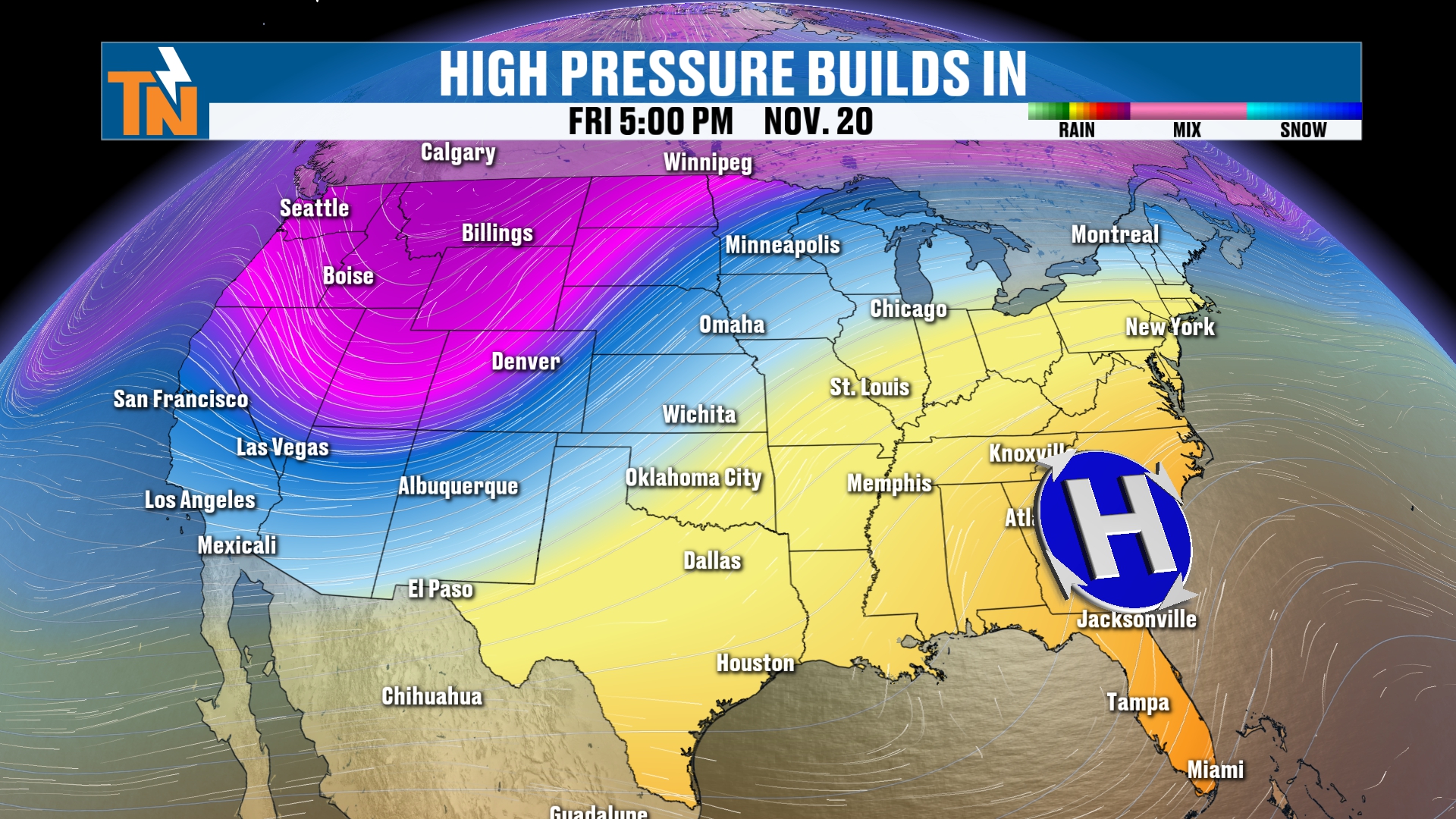
I’m going to stop the clock here at Friday night at 5 PM. Notice that next little trough in the Pacific Northwest. That’s going to be a storm system we’re going to be watching, and I think potentially several waves of energy as we get into Thanksgiving week and folks start traveling across the country.
Two Weather Systems Could Merge This Weekend
So let’s pick up our timeline from Friday night and run through our Futurecast. There’s that low pressure system associated with that trough. This is the GFS model, and notice in the bottom right-hand side of the screen there’s another low pressure system.
We’ve got a cold front and a low pressure system that are going to merge in the Southeast somewhere. As this happens, it’s probably going to bring us rain showers.
However, the GFS and the American model are not picking up on much in the way of rainfall. This takes us all the way through Sunday, November 22nd, a week from yesterday.
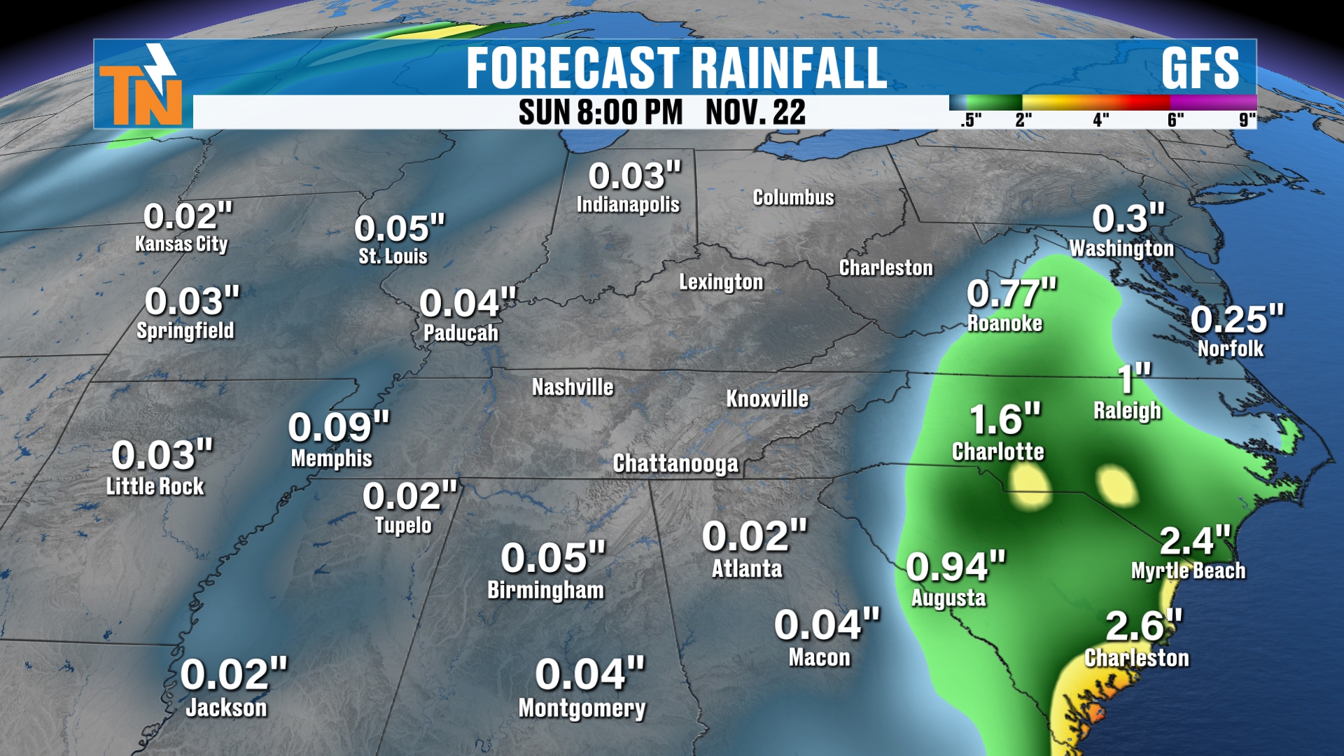
But again, that low across the Southeast is going to bring a lot of rainfall to the Southeast, and the cold front comes in from the north. The timing of those is going to be everything. Does the southern moisture move in, or does the cold front push its way out? Does the moisture starve the cold front?
The GFS model is picking up on a mostly dry setup. The Weather Prediction Center is also picking up on the fact that we’re probably not going to see a whole lot of rainfall all the way through next Sunday. So we’ll see how they progress over time.
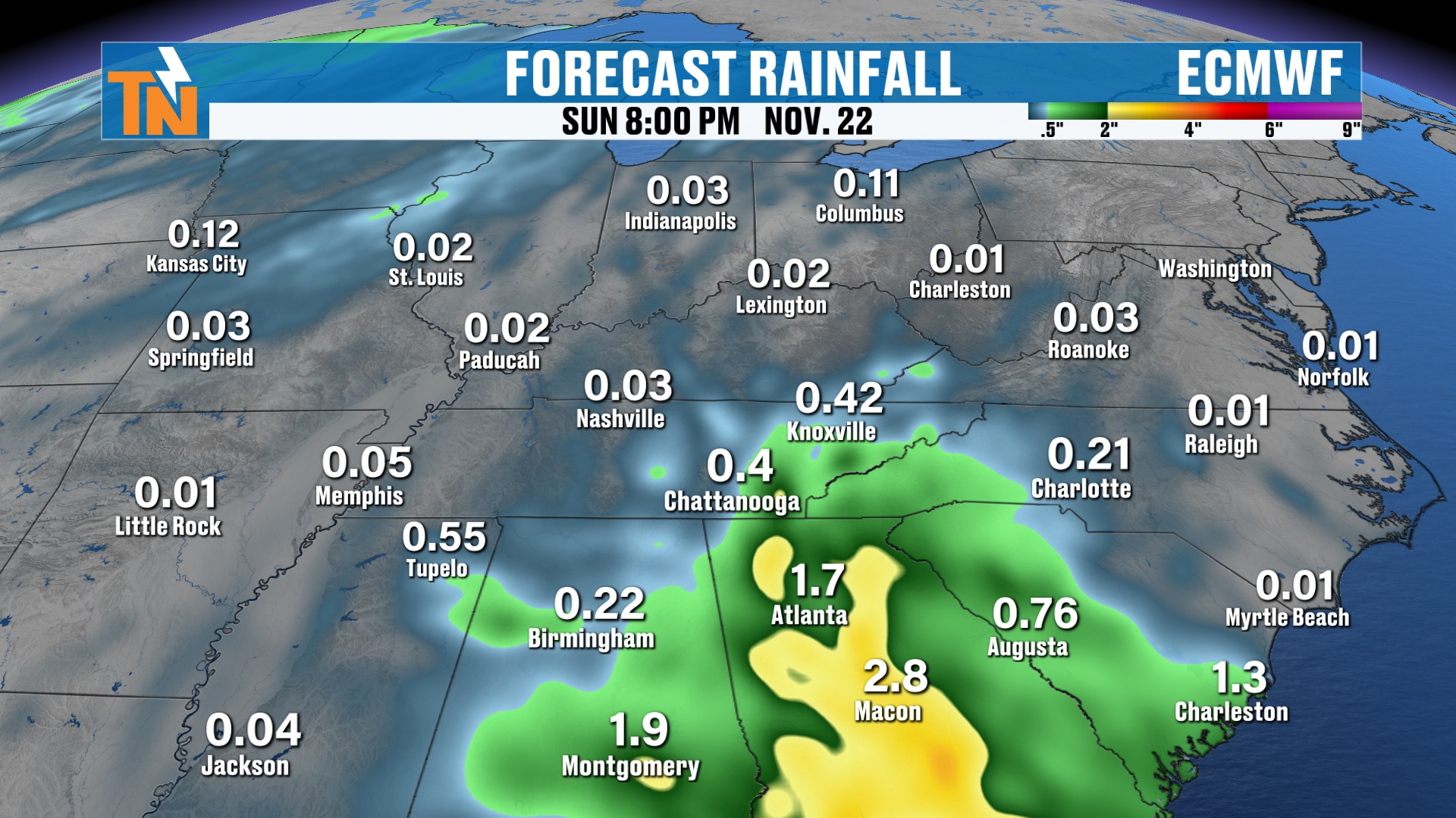
The National Weather Service blend of models is picking up on some rain, but not necessarily a big low across the southeastern U.S. Maybe just a cold front coming on through. That’s coming up this Friday, Saturday and Sunday, somewhere around that time frame. That’s what we’re going to be watching for at that point of the game.
So when you look at your rainfall potential, or precipitation chances anyway, I’ve got about a 20% chance on Saturday and Sunday.
The 7-Day Forecast
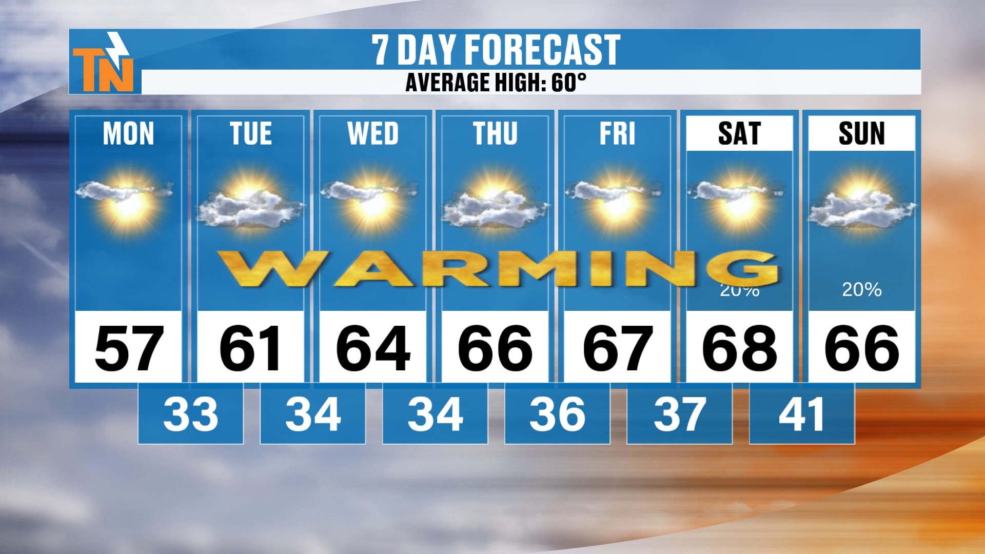
Here’s your 7-day forecast. We’re going to keep going into Thanksgiving week, but let’s talk about the 7-day first. It’s a nice little warming trend. We’re going to be back into the upper 60s to low 70s, so we’re trending nearly 10 degrees above average.
Morning lows are going to be average to slightly below average, in the 30s. So there are definitely some chillier morning low temperatures.
Thanksgiving Week: Another Trough to Watch
Now let’s talk about Thanksgiving week. As I mentioned, we’ve got that little trough that’s going to be off to our west, and a few more troughs that try to get their act together. It really depends on how those evolve and how Thanksgiving week plays out.
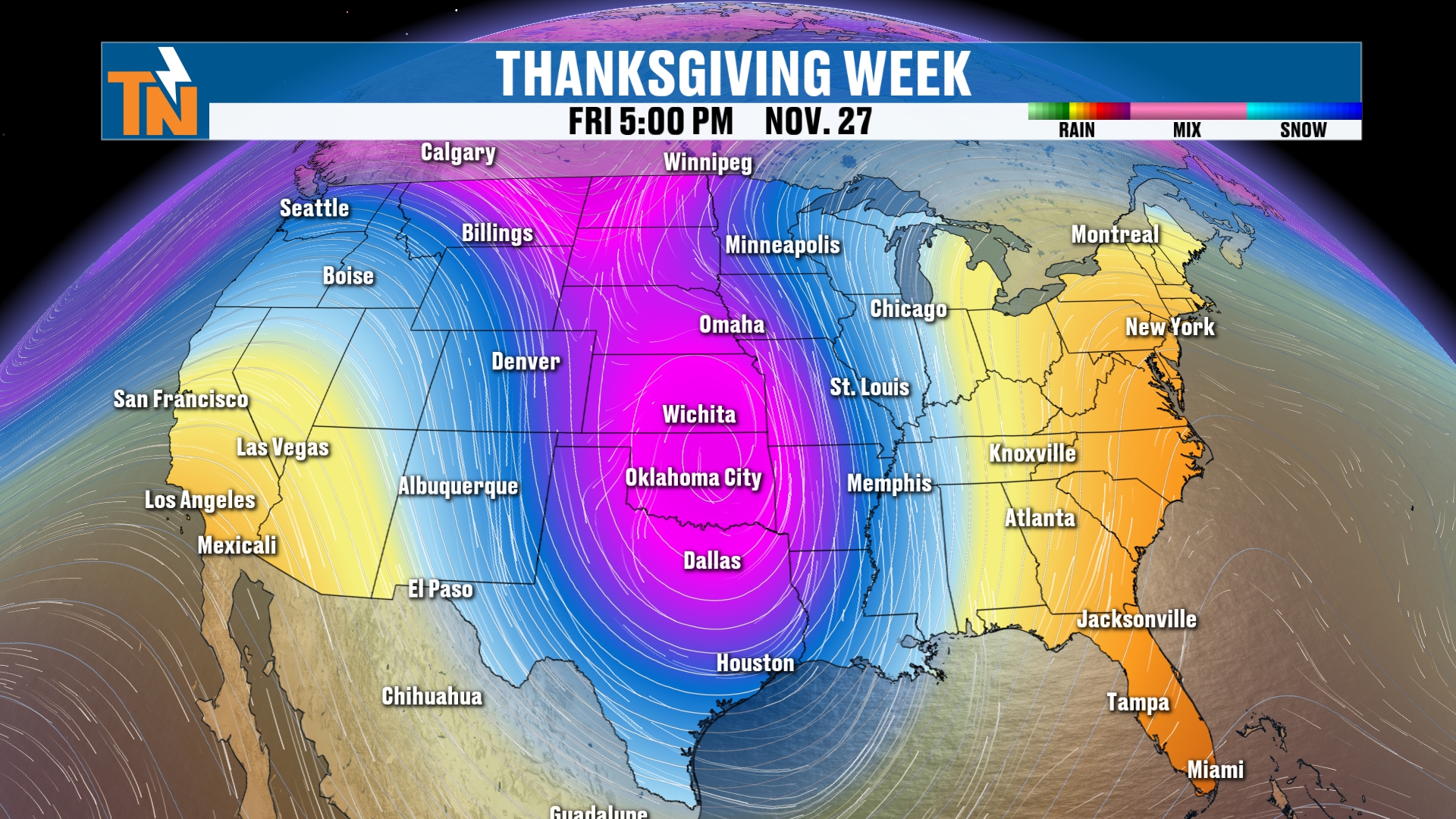
I do think we’re going to have more active weather back to our west and across the northern tier. This is Friday, Black Friday, November 27th, and the big, deep trough is being advertised by, again, the GFS, the American model.
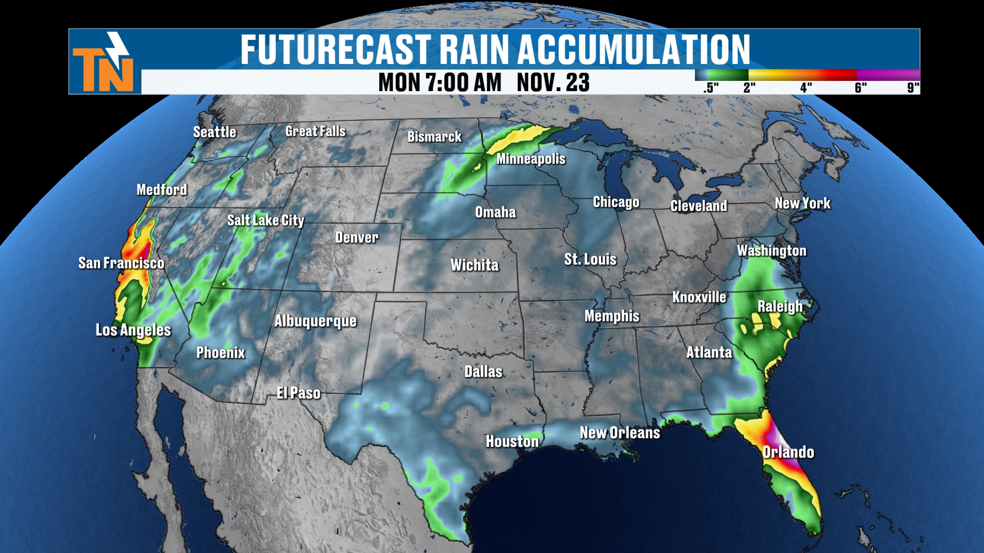
As we paint a picture of travel week, this is all next week.
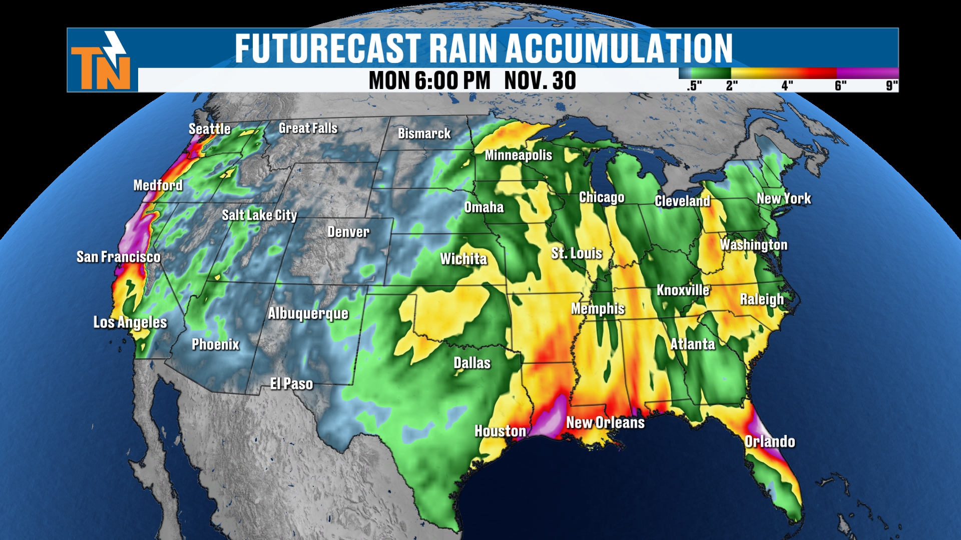
Rain showers spread across the eastern half of the U.S., and that’s going to be with us for maybe a couple of rounds of rain, taking us all the way through Thanksgiving weekend. This is, again, the GFS model.
Thanksgiving Travel: Snow Potential in the Middle of the Country
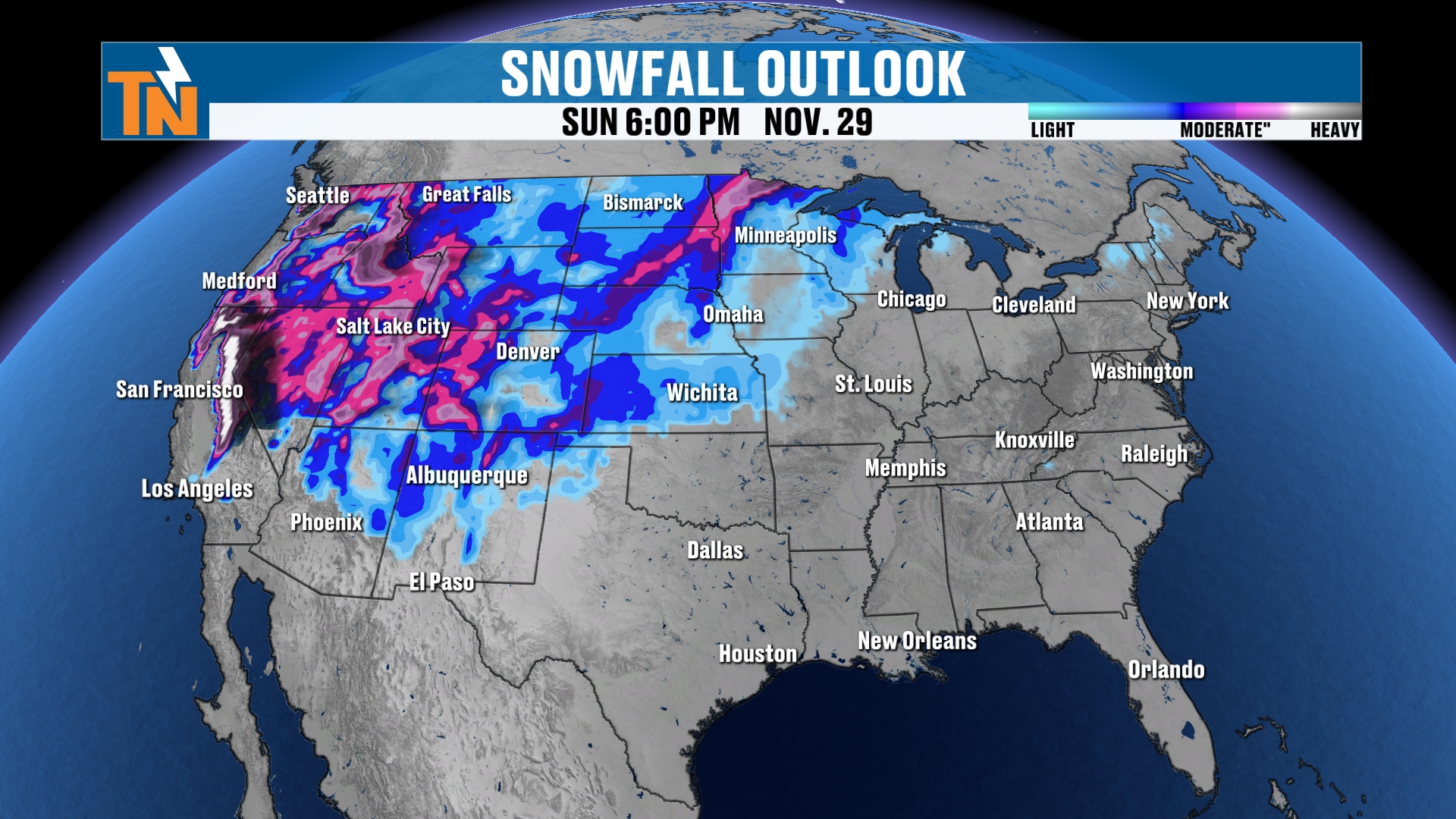
When we’re talking about snowfall, well, here we go. This is the snowfall potential. We’re going to be watching the areas right around the upper Midwest and, of course, the Rocky Mountains. But also parts of the Great Plains, from Kansas all the way to Minnesota, could potentially see a storm.
So keep that in the back of your head over the next few days as we continue to see these models flip-flop back and forth. What actually takes place? Well, we have plenty of time. We still have a whole other week to get through before we really start painting a picture of what’s going to happen for Thanksgiving week.
But I want to give you an idea. If you have any sort of travel plans, this is something to keep in mind. We’ll be posting a lot more on social media, so if you have any questions, ask as many as you can. I try to answer as many questions as I possibly can.
Bottom Line
MONDAY (TODAY): Sunny, a gorgeous day and a little warmer than yesterday. Low 50s by lunchtime (52 at noon), mid to upper 50s with some low 60s between 3 and 4 PM, and a high around 57 or 58. Winds gusting 10 to 15 mph. Clear skies mean a quick cool-down: 49 by 7 PM and 42 by 9 PM.
TUESDAY THROUGH THURSDAY: The warming trend continues, with highs of 61, 64 and 66. Afternoons are warm, but mornings stay chilly in the 30s.
FRIDAY: Highs near 67. Watching a cold front and a low pressure system that could merge in the Southeast, with a trough digging into the Pacific Northwest.
SATURDAY AND SUNDAY: Highs of 68 and 66, about 10 degrees above average, with a 20% chance of rain. Most of the models show little rain, but the timing of the front and the moisture will be everything.
THANKSGIVING WEEK: Watching a trough, and possibly several waves of energy, that could bring rain across the eastern half of the U.S. and snow from Kansas to Minnesota and the Rockies. Plenty of time for the models to flip-flop, so keep checking back.
The takeaway: a warm, quiet week with chilly mornings, a small chance for weekend rain as two weather systems could merge, and a Thanksgiving travel week we’ll keep a close eye on.
For more daily updates, check out our Daily Forecast page. For longer-range outlooks, you can also check the Climate Prediction Center.
Don’t forget to LIKE, SHARE and SUBSCRIBE to the YouTube channel and hit the bell at the top. It really helps things out quite a bit.
Make sure you stay up to date with the latest forecast right from your fingertips with my free East Tennessee Weather app. It’s all free and all local, brought to you by local sponsors and local businesses right here in East Tennessee. I couldn’t be more thankful for that.
I’m Meteorologist Mike Witcher. Have a great Monday! Be safe, be kind to each other, and remember, life is short.
eastTNweather — Weather When You Want It.