
Published: Friday, November 20, 2026 | By Meteorologist Mike Witcher | eastTNweather
Good morning, East Tennessee, and happy Friday! Hey, thanks for checking in with your morning weather update on this November 20th, 2026.
We are less than a week away from Thanksgiving. We’re getting into that busy holiday travel week next week, and Thanksgiving week is going to turn a little more active across parts of the country. That includes us here in the Southeast, mostly in the form of rain, but there are some signals out there for a little bit of snowfall as we head through Thanksgiving week.
We are looking at increasing clouds, but before all of this moves on in, we stay warm. By the way, we’re going to continue to stay above average today, tomorrow, and even into Sunday as well.
Yesterday's Almanac: Another Warm Day
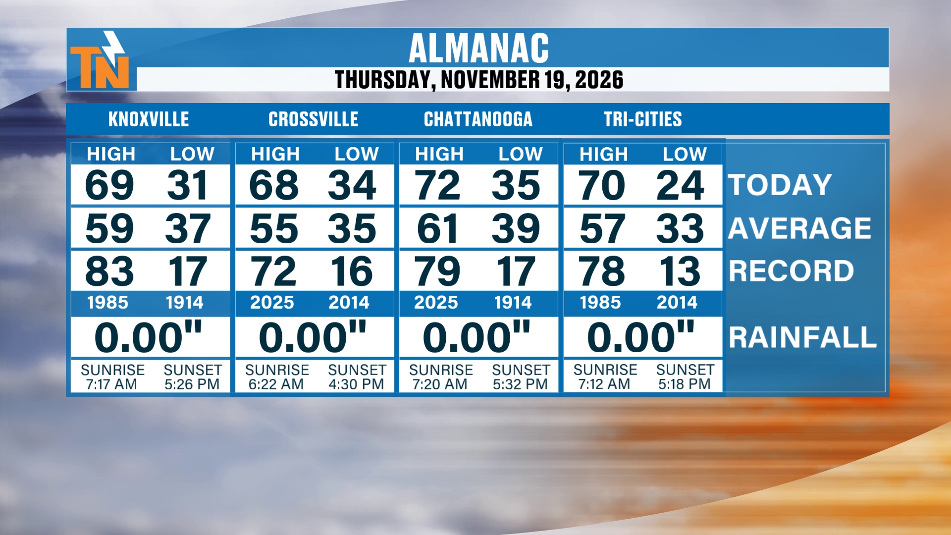
So let’s talk about the almanac. Yesterday, we did top out at 69 degrees in Knoxville. The average is 59. Yesterday, I was forecasting 67, so we were close. We made it to 68 in Crossville, 72 in Chattanooga and 70 in the Tri-Cities area. So definitely another warm day yesterday, and there was no rainfall anywhere.
The Big Pattern: High Pressure Ahead of a Thanksgiving Week Change
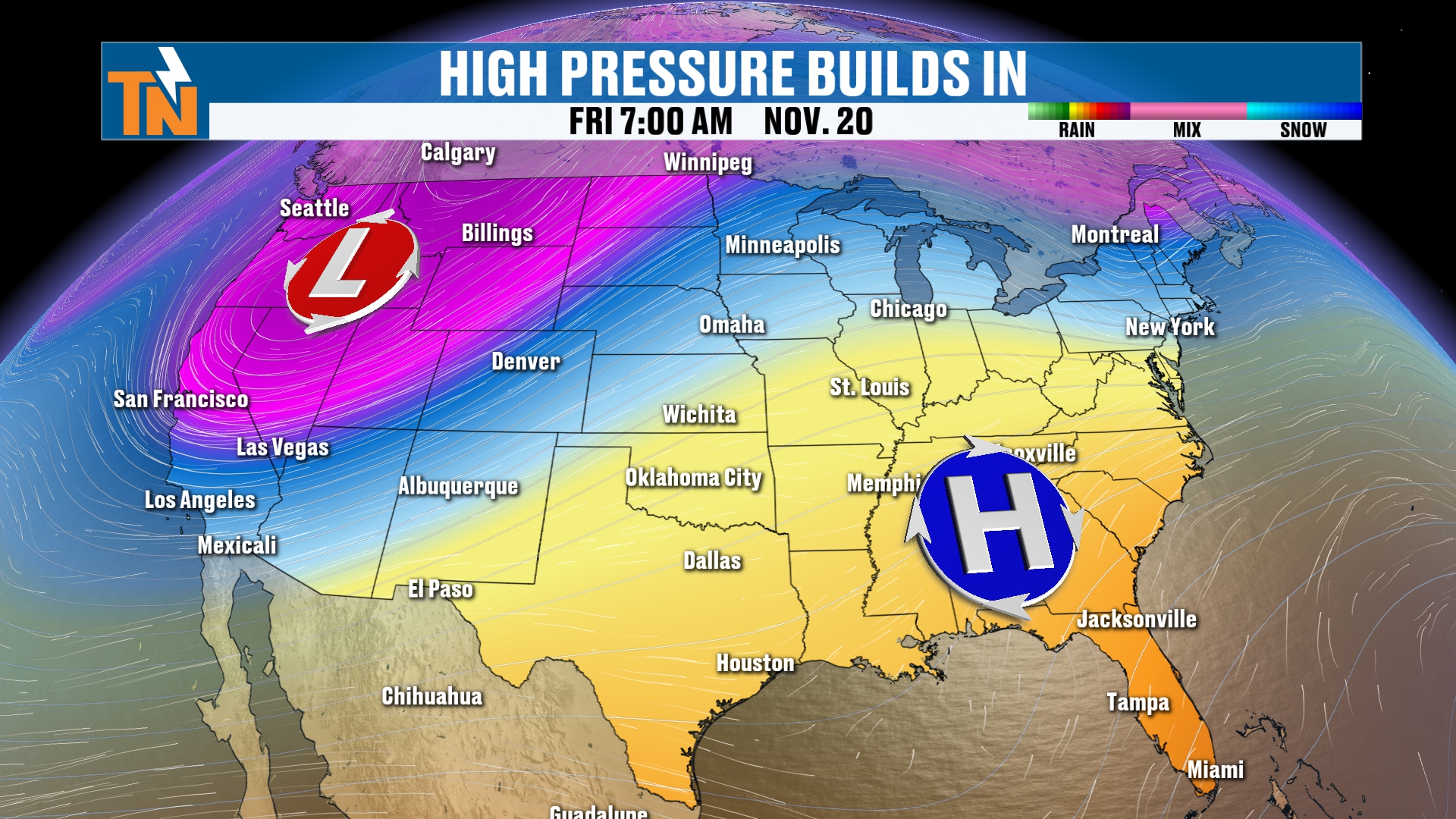
That trend continues thanks to this ridge of high pressure that’s dominating the weather pattern here in the southeastern U.S., with a big old trough of low pressure across the Pacific Northwest. That trough has been battering folks across the intermountain West, the Rocky Mountains and the coastal areas. But it’s going to be moving its way inland and northward.
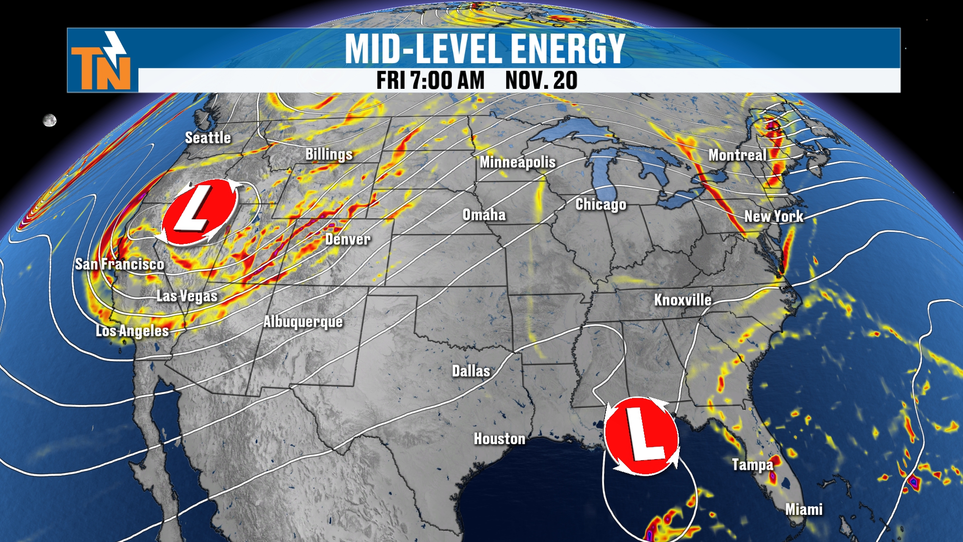
We’ve got another area of low pressure down along the southeastern coast that has been battering parts of Florida with lots of flooding. That flood threat continues. But this is going to become a little bit more of a closed low and zip its way up the eastern coast.
I highlight that for a second because there is the potential for maybe a little bit of rain on Sunday to squeeze its way at least into the northern valley, along the I-81 corridor and the Smoky Mountains. Of course, we’re going to walk you through that Futurecast model coming up in a second.
You can see all the rainfall down along the southeastern coastline. A few clouds are starting to scoot their way up the Tennessee Valley, some mid to high level clouds, so do anticipate a few more high level clouds throughout the day today.
High pressure is in control, and that’s what’s dominating the weather pattern. But that’s also what’s been bringing us the cooler temperatures in the mornings.
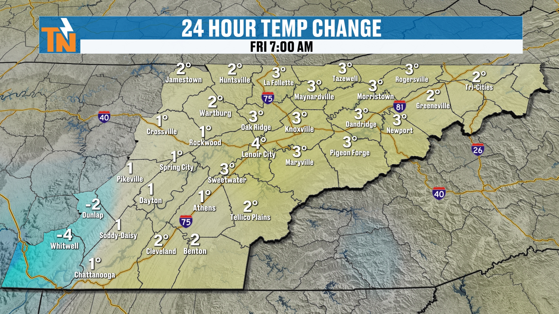
Although it has been trending a little bit warmer each and every morning, consecutively, over the last three or four mornings.
Today: Mild and Breezy, Near 70 This Afternoon
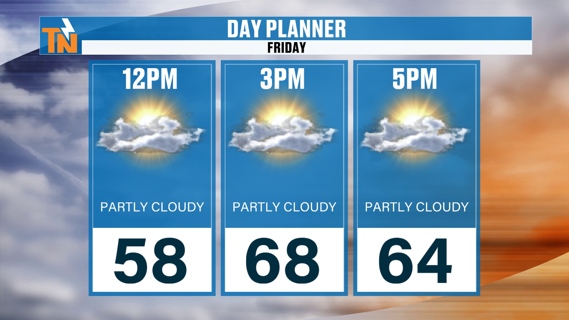
By lunchtime, we’re going to be at 58 degrees.
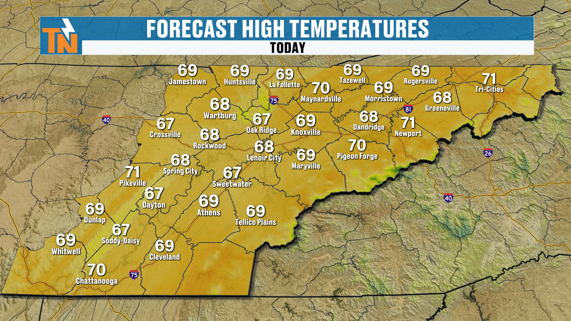
Then, with the forecast high temperatures, as the kids head home from school, we’re quickly warming into the upper 60s to near 70. So it’s going to be another very warm day.
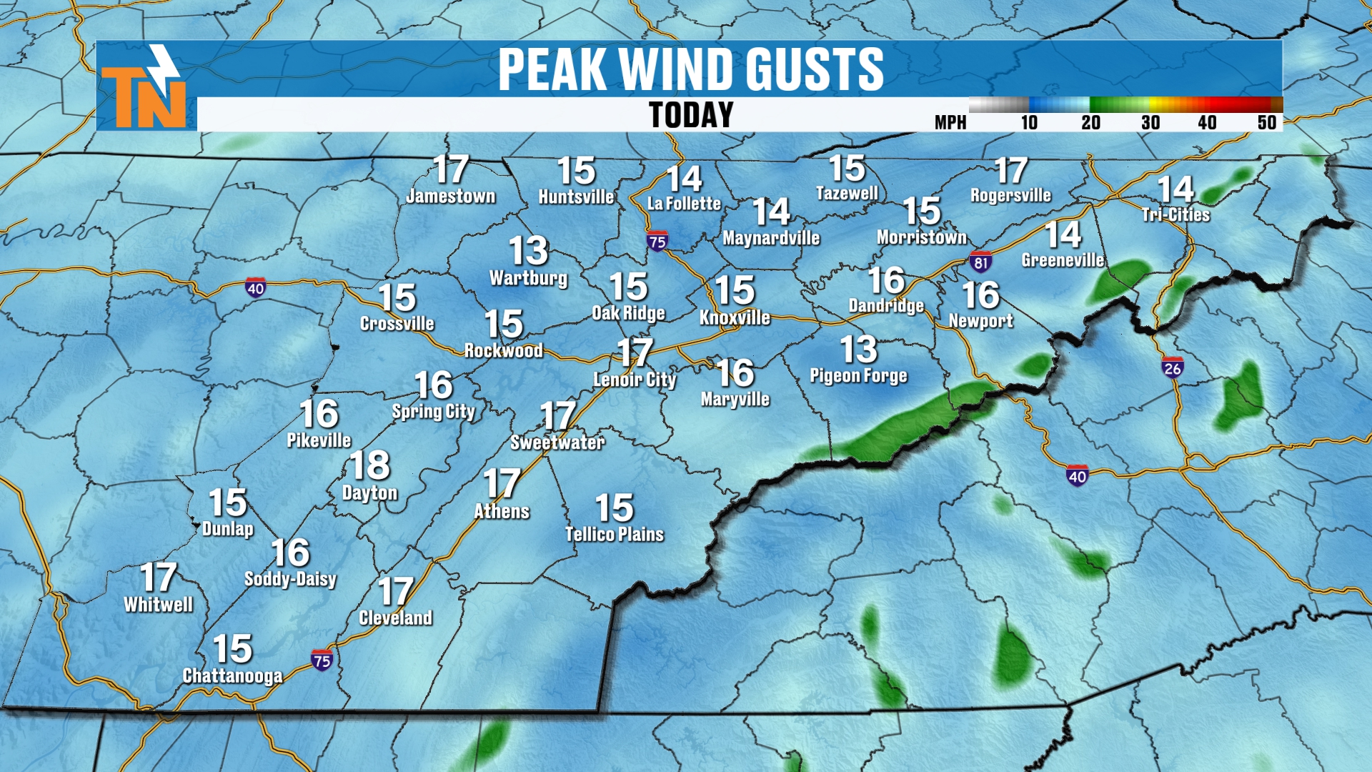
There’s a little bit of an afternoon breeze, but not too much, with gusts of about 10 to 15 mph.
Friday Night Football and Saturday's Game
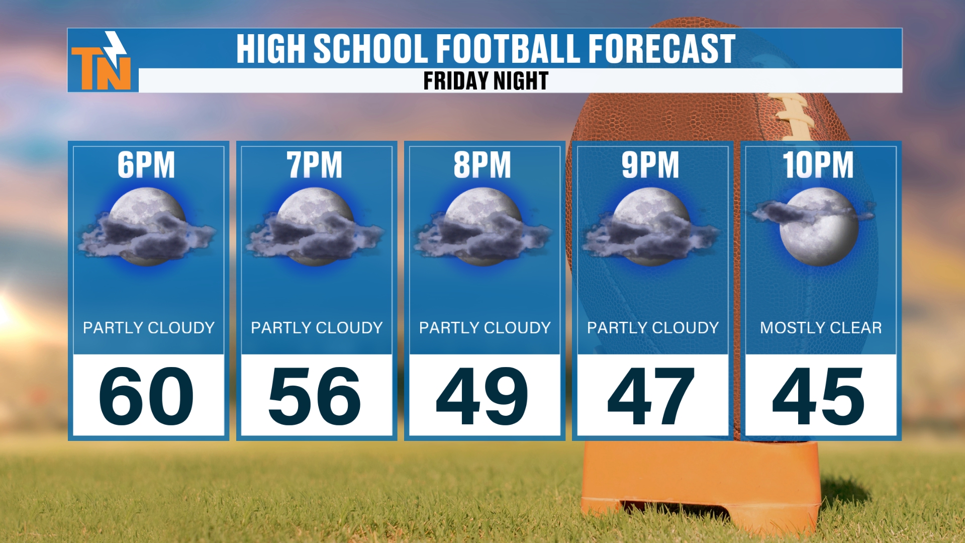
If you are heading off to high school football here tonight, by 7 o’clock we’re at 56, and we drop down to about 47 by 9. So you’ll need the jackets for sure.
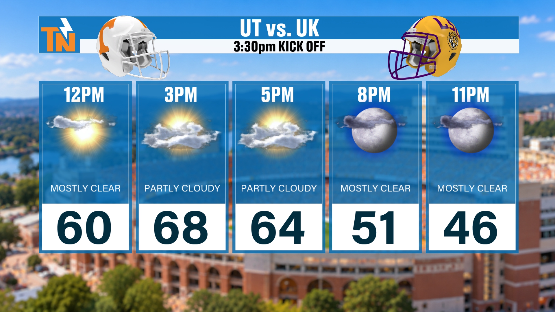
And if you’re headed to the game on Saturday, here’s the game day forecast for the 3:30 PM kickoff: 60 at noon, 68 at 3 PM, 64 at 5 PM, then 51 by 8 PM and 46 by 11 PM.
The 7-Day Forecast: Thanksgiving Week Is Now on the 7-Day
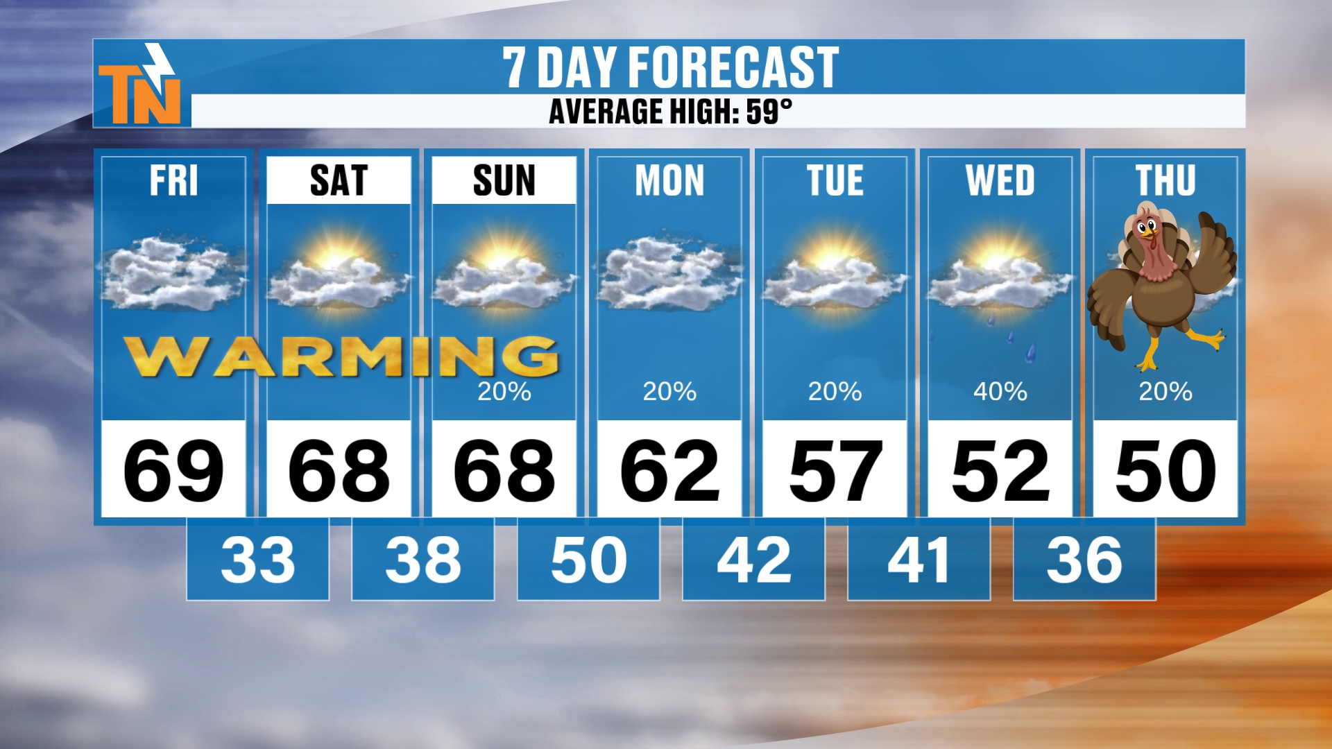
All right, let’s highlight your 7-day forecast for a second. Thanksgiving is on the 7-day now, officially. After our cold front comes through on Sunday, we warm to 68. It’s going to become mostly cloudy and breezy on Sunday.
The cold front doesn’t have a whole lot of moisture, but I have added a 20% chance back to the forecast on Sunday. That’s basically across the mountain counties, and I’ll show you what that looks like in a second.
Then, back behind that cold front, temperatures fall into the low 60s on Monday and the upper 50s on Tuesday. Wednesday and Thanksgiving Day are likely to be trending below average, in the low 50s. So it is definitely going to be on the cooler side.
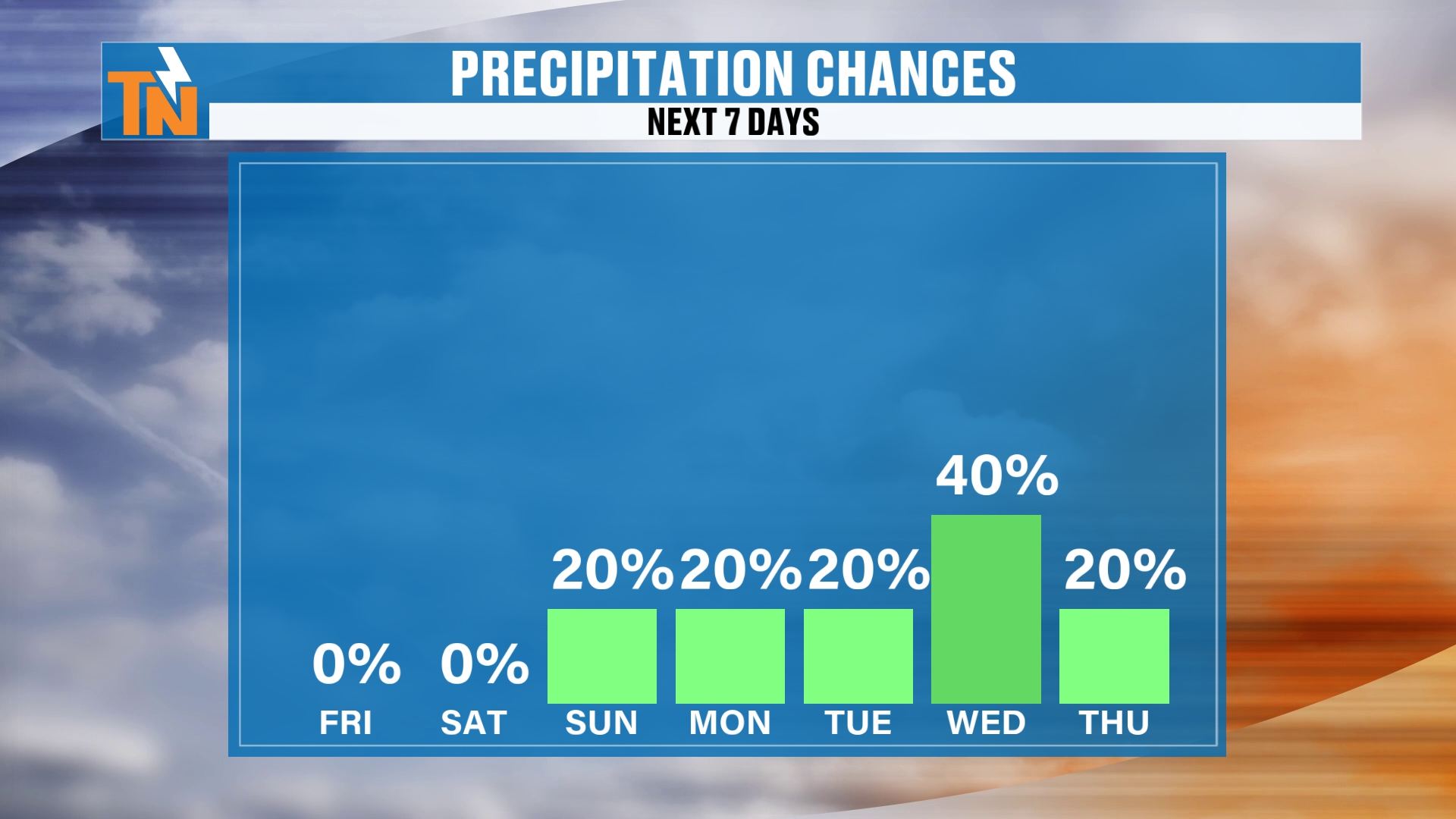
But notice those rain chances. Rain chances are going to be with us during Thanksgiving week. Wednesday is probably going to be the best day for rain, although some models are indicating that we could continue some rain showers on into Thanksgiving Day on Thursday.
Sunday's Cold Front: A Little Light Rain
So let me show you the Futurecast model. We’ll pick up our timeline here and start you off first thing this morning, and run you through the next couple of days as that coastal low comes up the coast.
You can see how it has moved its way inland a little bit more. Because it’s moved inland a little bit more, that’s why we have a chance for maybe a little bit of light rain across the mountain counties and the northern valley as we get into Sunday and the cold front comes through.
High pressure builds in back behind that cold front, and that’s going to dry us out and cool us down as we get into Monday and Tuesday.
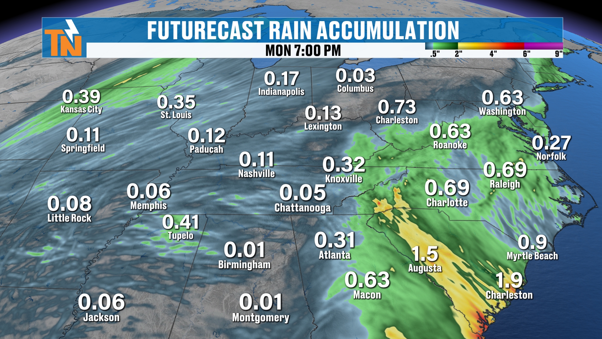
Now, rainfall amounts just through Monday evening, associated with that storm and the cold front, are lackluster, but there’s a little bit of rainfall. It’s picking up on less than two tenths of an inch of rain looking likely Sunday into Monday.
Thanksgiving Week Turns Active: A Deeper Trough Arrives
But a lot more is possibly on the way. That’s associated with another deeper trough ahead and a more active pattern as we head through Thanksgiving week. We’ll pick up our timeline on Wednesday and look at this big old deep trough that’s being advertised.
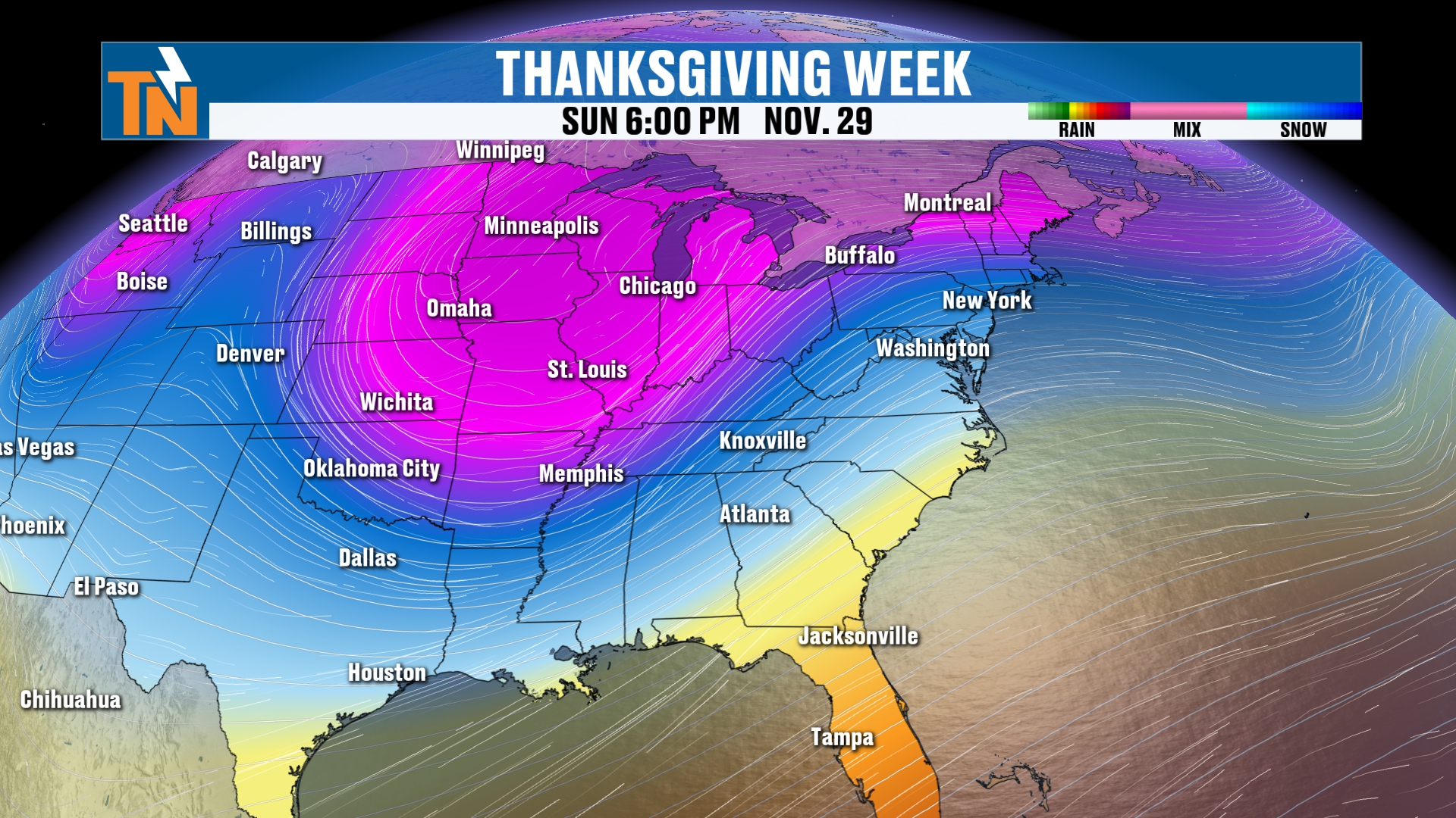
There’s Thanksgiving morning, and that’s potentially going to pump in some moisture, especially across parts of the southeastern U.S. So if you have travel plans along the South, across the Southeast, you’re going to run into some rain showers.
Then another disturbance dives its way in Saturday into Sunday. That potentially could bring a little taste of maybe some mountain snow showers, as we’ll have some colder air back behind it as well.
So you can see how Thanksgiving week we’re going to be trending on the cooler side. I show you that on the 7-day, but maybe even a little bit colder as we get into Friday, Saturday and Sunday, thanks to that deeper trough that’s going to swing on through.
Rain Chances: Wednesday, Thursday and Maybe Sunday
So let’s talk rainfall with this forecast. We’ll pick up our timeline on Wednesday morning, because we’re going to be dry on Monday and Tuesday.
For Thanksgiving week, we are looking at some rain showers. So maybe some rain showers on Sunday, maybe some rain showers on Wednesday, and the potential for some rain showers on Thursday. Black Friday is probably going to be on the drier side.
Snow Outlook: No Major Travel Concerns
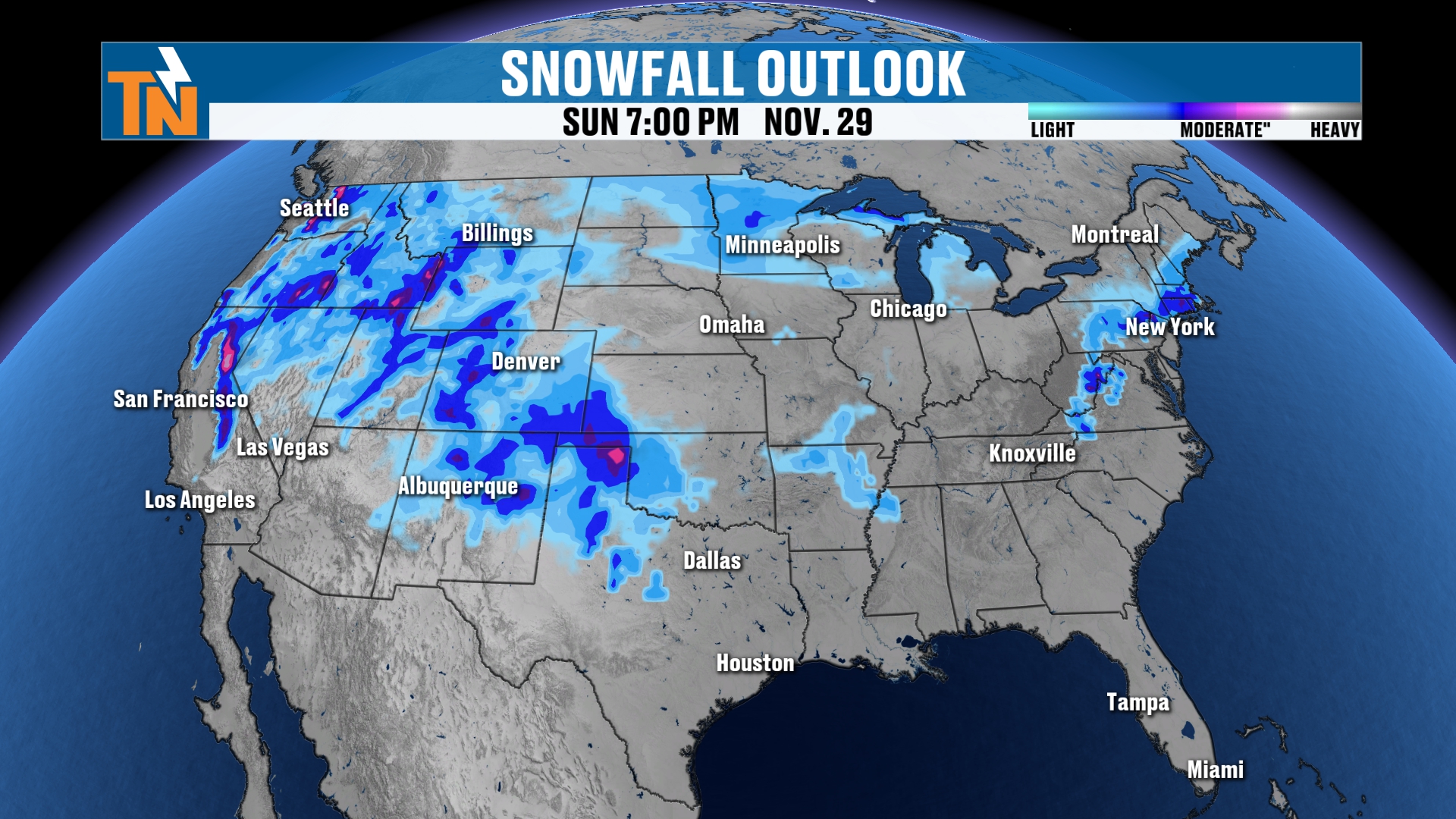
Look at the snow signals across the Appalachian region, all the way up into West Virginia and Pennsylvania. There’s a little bit of snow back off to our west, although most of that snow to our west is associated with that big old low pressure out there right now.
So again, when it comes to the snowfall forecast, we’re not looking at any major travel concerns across the country, which is great news. But we are looking at some rain showers as we get into Wednesday, Thursday, Friday, Saturday and Sunday of Thanksgiving week.
So Thanksgiving week is right around the corner, my friends. It is Friday, though, and I do appreciate you checking in here this morning.
Bottom Line
FRIDAY (TODAY): Partly cloudy and very warm. 58 at noon, upper 60s to near 70 this afternoon (68 at 3 PM, 64 at 5 PM) with a light breeze gusting 10 to 15 mph. A few more mid and high clouds. Friday night football: 56 at 7 PM and 47 by 9 PM, so bring a jacket.
SATURDAY: Another warm day with a high near 68. Game day temperatures run from 60 at noon to 68 at 3 PM and 51 by 8 PM.
SUNDAY: A cold front arrives. Mostly cloudy and breezy with a high around 68 and a 20% chance for a little light rain, mainly across the mountain counties and the northern valley along I-81 and the Smokies.
MONDAY AND TUESDAY: High pressure builds back in behind the front. Drier and cooler, with highs in the low 60s Monday and upper 50s Tuesday.
WEDNESDAY AND THURSDAY (THANKSGIVING): Trending below average, in the low 50s. Rain chances increase, with Wednesday likely the best day for showers and some models keeping showers around on Thanksgiving Day.
FRIDAY THROUGH SUNDAY AFTER THANKSGIVING: Black Friday is probably on the drier side. Another disturbance dives in Saturday into Sunday with colder air behind it and maybe a few mountain snow showers. No major travel concerns across the country.
The takeaway: stay warm and above average through Sunday, then watch for a cooler, more active Thanksgiving week with rain returning.
For more daily updates, check out our Daily Forecast page. For longer-range outlooks, you can also check the Climate Prediction Center.
Don’t forget to LIKE, SHARE and SUBSCRIBE to the YouTube channel and hit the bell at the top. It really helps things out quite a bit.
Make sure you download my free East Tennessee Weather app for your cell phones, tablets and your smart TVs on Roku and Amazon Fire, and right here on YouTube. Check out the 24-hour weather channel. That’s the easiest, most convenient and most family-friendly way to get your weather forecast every single day.
I’m Meteorologist Mike Witcher, owner, operator and chief meteorologist for East Tennessee Weather. We are three years and running and growing every day. Have a great Friday!
eastTNweather — Weather When You Want It.