
Happy Saturday, everybody.
I sure hope you have a great day today.
If you’ve got outdoor plans, today is your day.
It’s going to be the most comfortable day in the 7-day forecast before heat, humidity, and storm chances start ramping back up across East Tennessee.
Let’s break it all down.
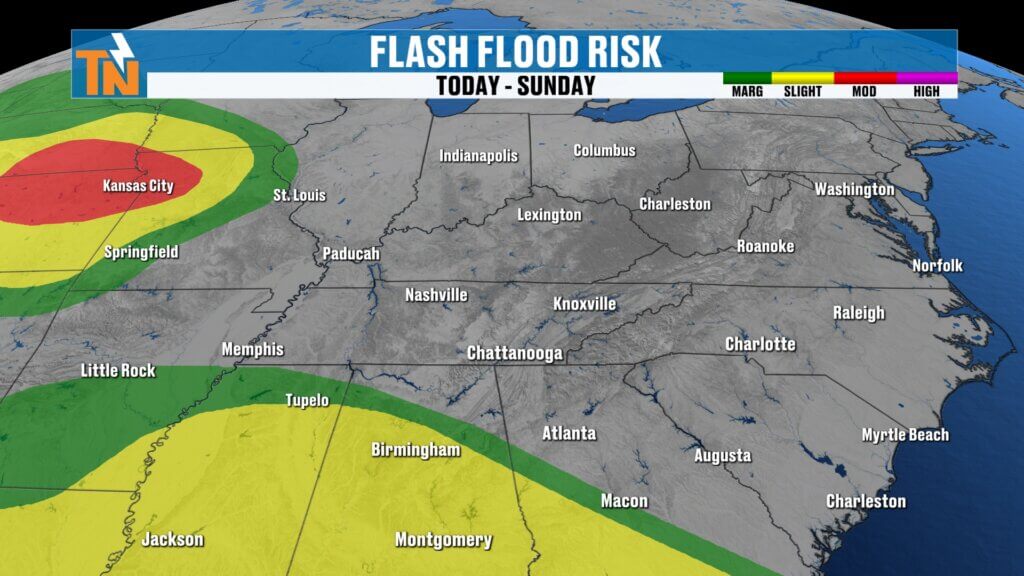
High Pressure Keeps East Tennessee Dry Today
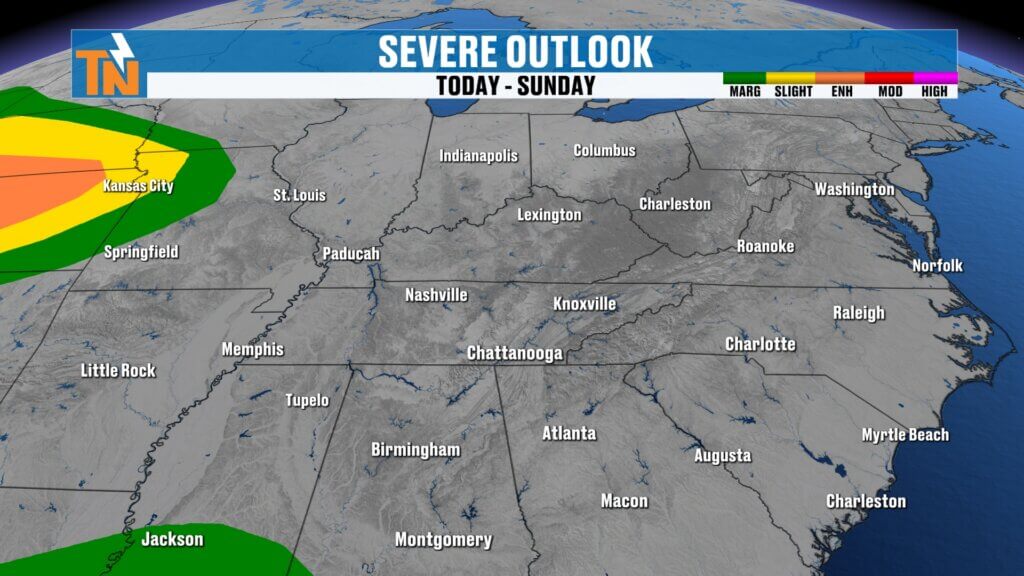
High pressure remains in control across the Tennessee Valley today, and that’s keeping our weather quiet and comfortable.
Now, we are starting off with some mid and high-level cloud cover streaming overhead. We’ve been talking about that over the last couple of days, and while those clouds may hang around through part of the morning, they’ll gradually break apart.
That means sunshine returns this afternoon.
So yes — you’ll definitely need the sunglasses.
The key today?
Dry air.
And that’s making all the difference.
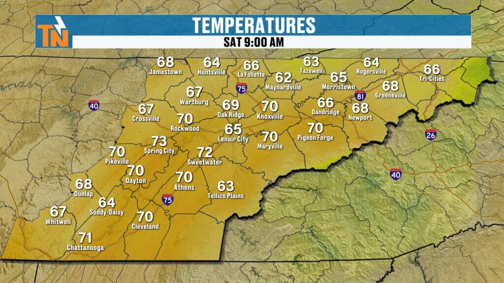
Cooler Start to the Morning
Temperatures this morning are running cooler than they were yesterday thanks to that drier air settling in behind our last system.
We started the day in the 50s and 60s across much of East Tennessee.
That’s a much more refreshing start compared to the muggy mornings we’ve been dealing with.
And with lower humidity in place, it actually feels comfortable outside.
That’s rare for mid-June.
Saturday Forecast: Sunshine Returns and Comfortable Air Sticks Around
Futurecast keeps us mostly dry all day long.
Some models continue hinting at a little moisture clipping the southern Valley, but honestly, I don’t think much comes from it.
Maybe a stray sprinkle at best.
Most of East Tennessee stays dry.
Through the afternoon:
- Clouds thin out
- Sunshine increases
- Light winds continue
- Humidity stays lower
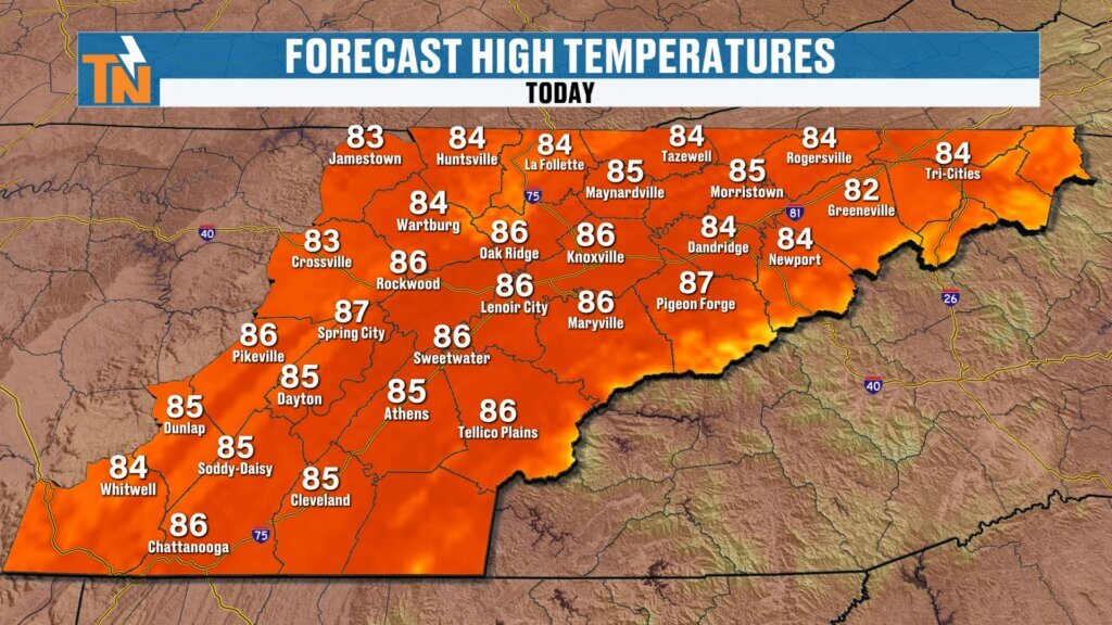
Forecast highs today:
- Low to mid 80s for most locations
- Near seasonal averages
- Comfortable for June standards
This is the best-feeling day we’ve had in a while.
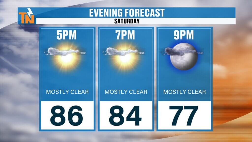
Saturday Night Looks Fantastic
If you’ve got dinner plans, patio time, a movie, or anything outside tonight — it’s going to be a great setup.
By this evening:
- Temperatures fall into the upper 70s
- Humidity remains manageable
- Light winds continue
- Comfortable conditions stick around
By 9 PM, temperatures should still be sitting around 77°.
That’s about as nice as it gets this time of year.
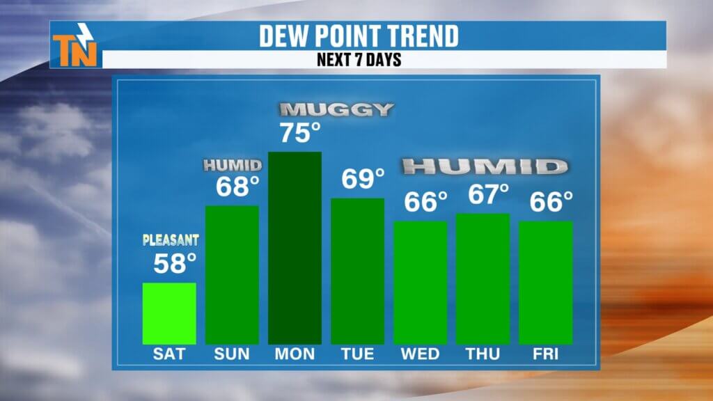
Humidity Starts Building Back Sunday
This is where things start changing.
Today’s dry air doesn’t last.
By Sunday:
- Humidity starts increasing
- Dew points rise
- The air feels heavier
- Heat index values start climbing
And by Monday?
That muggy summertime feel is back in full force.
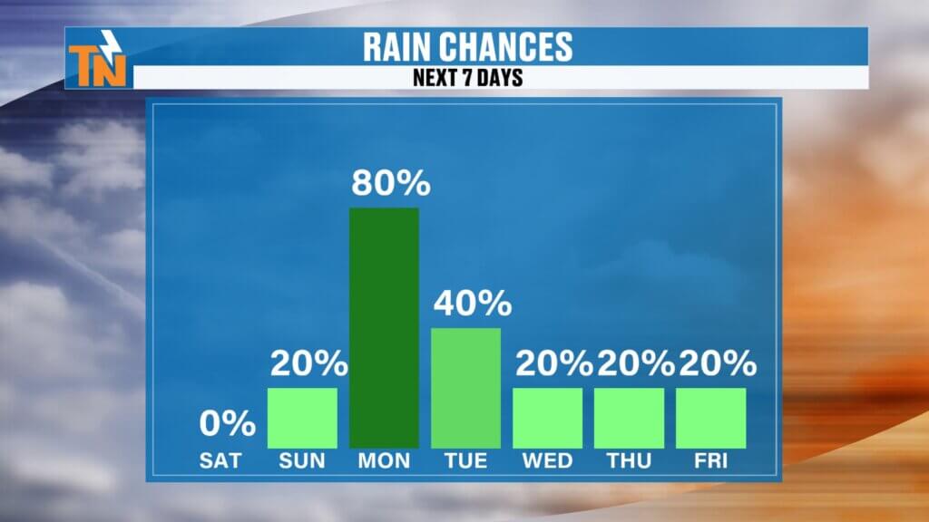
Monday Brings the Best Chance for Rain and Storms
This next system is what we’re watching.
An upper-level disturbance will swing into the Tennessee Valley late Sunday into Monday, bringing:
- Scattered showers
- Thunderstorms
- Locally heavy rainfall
- Isolated strong storms
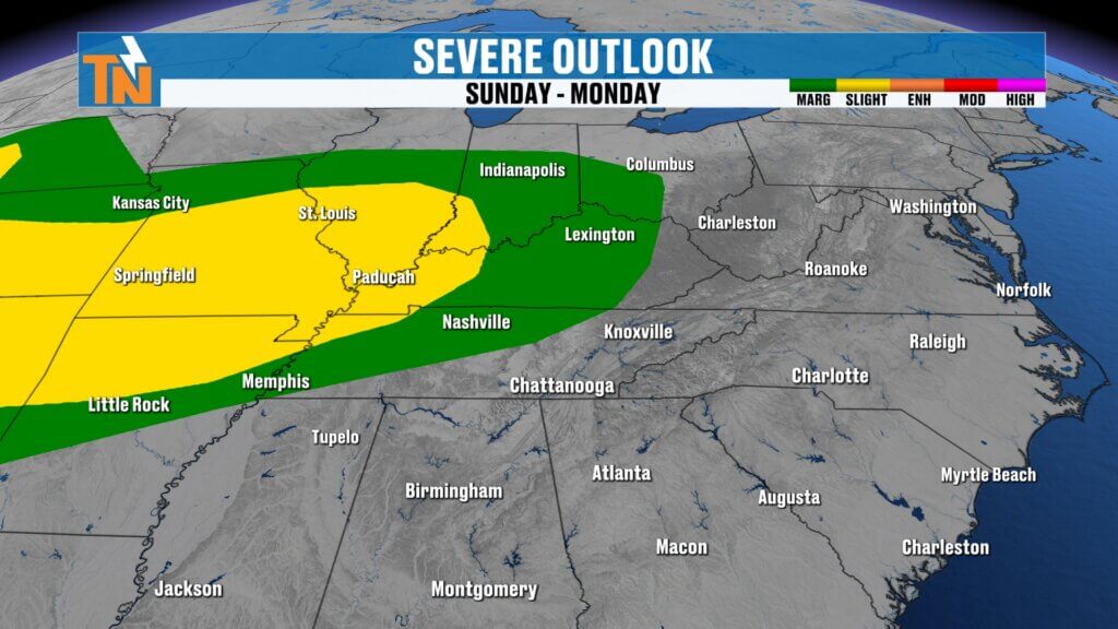
The Storm Prediction Center has already highlighted parts of East Tennessee under a Level 1 severe weather risk for Monday into Tuesday.
Main threats:
- Gusty winds
- Frequent lightning
- Heavy rainfall
Nothing widespread or major right now, but enough to watch closely.
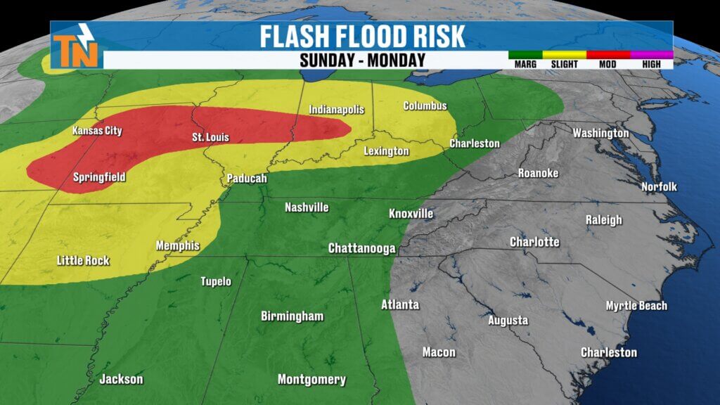
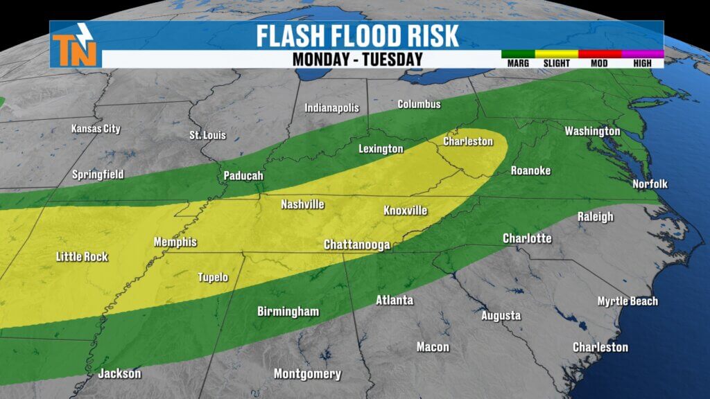
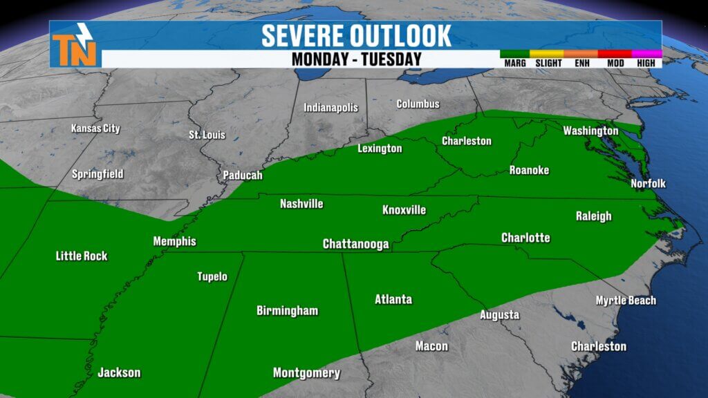
Flooding Concerns Increase Early Next Week
The Weather Prediction Center is also highlighting East Tennessee for localized flooding and flash flooding concerns.
Why?
Because the atmosphere is going to be loaded with moisture.
That means any storm that develops could become an efficient rain producer.
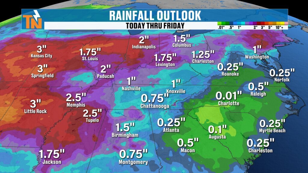
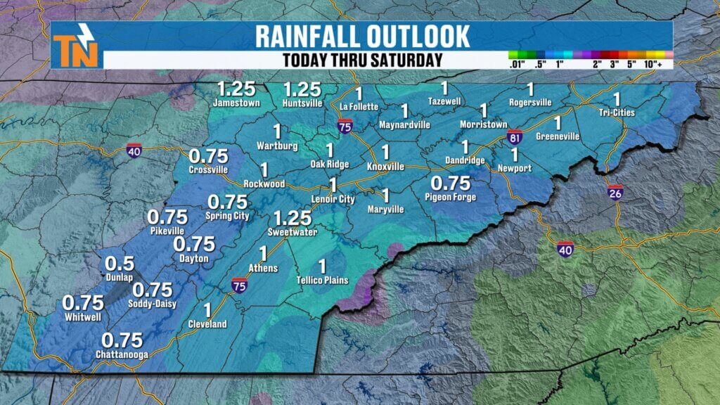
Rainfall estimates:
Monday alone:
- Half inch to one inch possible
Through midweek:
- Around one inch total for many areas
Localized higher amounts will be possible where storms repeatedly move over the same spots.
The Rest of Next Week Looks Typical for June
After Monday’s bigger rain chance, the weather pattern settles into a more summer-like setup.
That means:
- Warm temperatures
- Higher humidity
- Hit-or-miss afternoon storms
Not a washout.
But definitely more unsettled than what we’re seeing today.
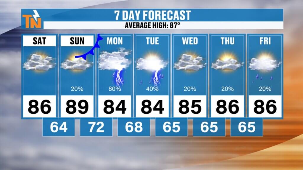
East Tennessee 7-Day Forecast
Saturday
Dry and comfortable
Low to mid 80s
Sunday
Warmer and more humid
Upper 80s to near 90°
Monday
Best rain chance of the week
Showers and storms likely
High: Mid 80s
Tuesday
Scattered storms possible
Humid
Mid 80s
Wednesday
Partly sunny
Spotty storms
Mid 80s
Thursday
Warm and muggy
Scattered storms
Mid 80s
Friday
Typical summer weather
Hit-or-miss storms
Mid 80s
Bottom Line
Today is your best day over the next seven days.
Lower humidity.
Comfortable temperatures.
Dry weather.
Enjoy it.
Because by tomorrow, the humidity starts creeping back up.
And by Monday, rain and storms return.
If you’re new here, I’m Meteorologist Mike Witcher. I’ve been forecasting weather in East Tennessee for more than 20 years, and that’s exactly why I launched East Tennessee Weather — an all-digital weather platform built for our backyard.
And remember — the app goes wherever you go.
Track the radar, get alerts, and stay ahead of the storms.
Download the East Tennessee Weather app today.
Have a great Saturday.