
Published: Sunday, November 15, 2026 | By Meteorologist Mike Witcher | eastTNweather
Good morning, East Tennessee, and happy Sunday! I do appreciate you checking in with your morning weather update on this Sunday, November 15th, 2026.
If you’ve been sticking with me and checking back in, we are talking about a ridge of high pressure that’s building its way back in as we get into next week. That’s going to ultimately bring us warmer temperatures, so yes, there’s a big warmup ahead.
But we’re also previewing Thanksgiving week. Now, I know we’re more than a week away from beginning our travel plans, but this is the time to start talking about things. I’m going to show you a couple of models, and we’ll talk about the potential for rainfall, and the potential for snowfall, if you’re traveling across the country.
Yesterday's Almanac: Mid to Upper 40s
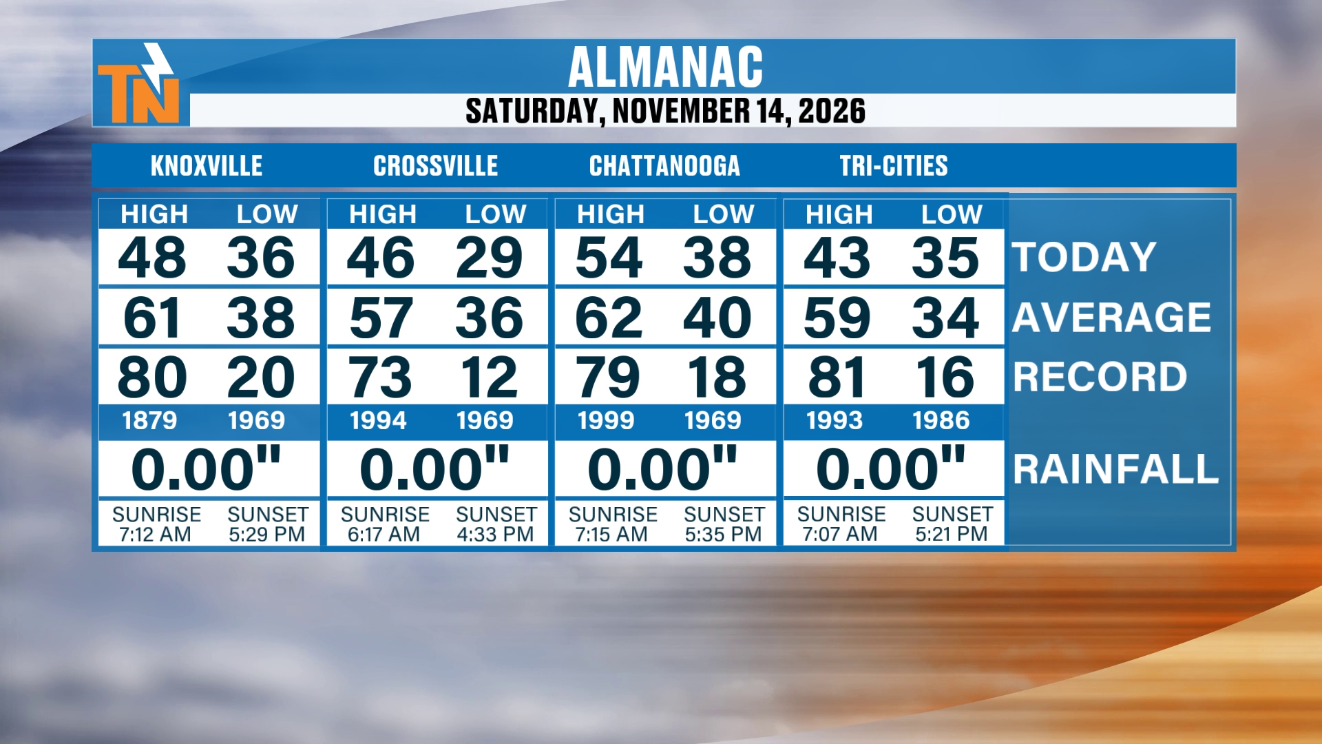
Let’s start things off with the almanac from yesterday. We topped out in the mid to upper 40s, with a couple of pockets of mid 50s across the southern valley. Knoxville reached 48, Crossville 46, Chattanooga 54 and the Tri-Cities 43. There was no rainfall anywhere.
The skies are beginning to clear on out of here, and some beautiful sunshine is starting to work its way back in. We saw that yesterday, too.
The storm system is still working its way off to the north and northeast, and that’s going to continue to take the clouds with it as high pressure builds on in. It’s been a little bit more mild across parts of the northern valley, thanks to the fact that we had a few more clouds during the overnight hours.
Mid-Level Energy: A Weak Wave to Our West
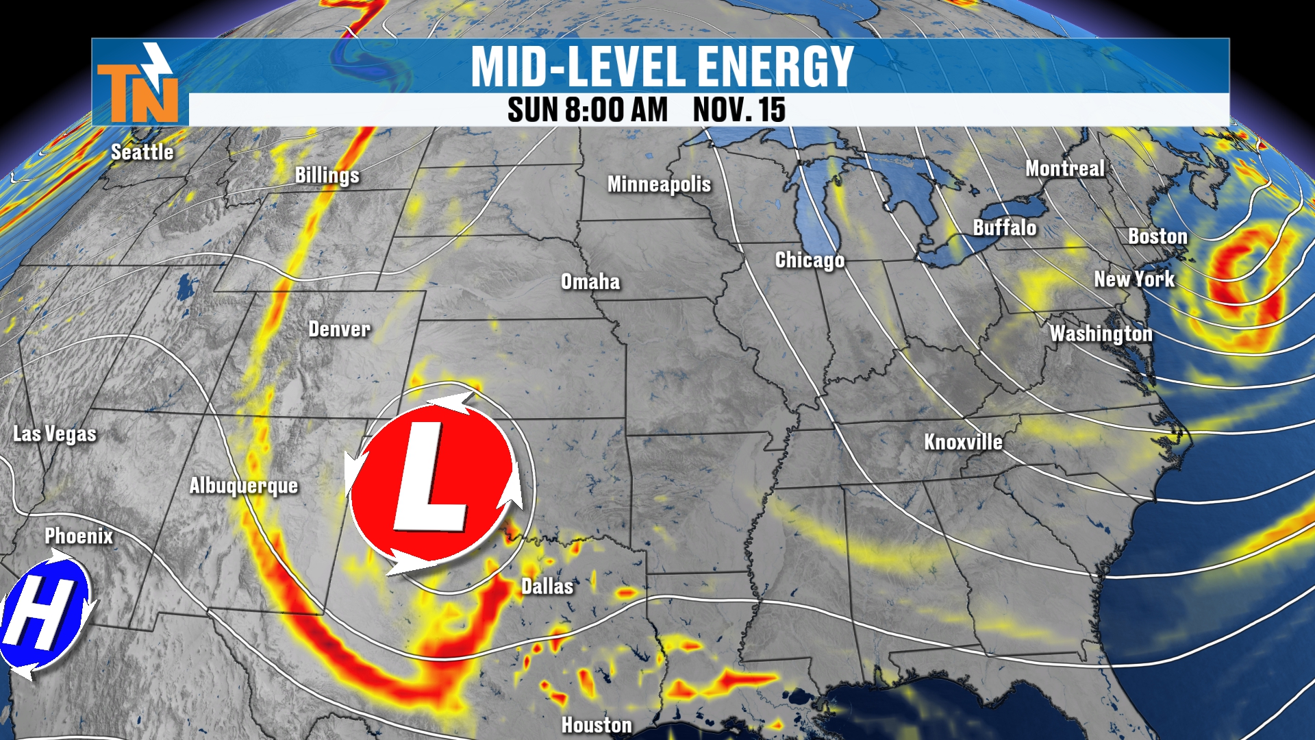
We’ve got a weak little upper level wave swinging its way through parts of the panhandle of Texas and Oklahoma right now. That wave is going to dive further to the south.
You can see our trough across the eastern seaboard is beginning to lift out of here. But again, there are no major effects from that little wave in the central part of the country. There it is right there when you look at the mid-level energy and spin.
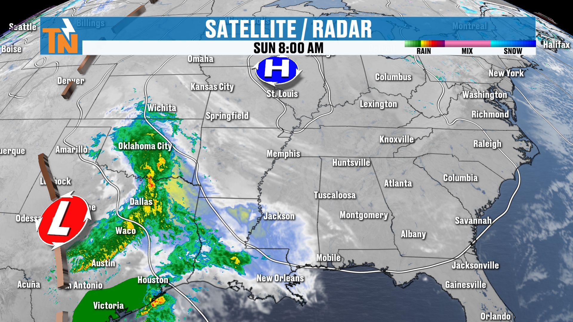
That wave is actually producing some pretty good rain showers back to our west, and a few clouds. But high pressure is sinking in from the north, and that’s basically going to block all of that moisture and leave it further to our west and southwest.
So we’re not going to see much in the way of high clouds. We’re going to see plenty of sunshine, thanks to our ridge of high pressure. This ridge is not originating from Canada, and that’s what’s brought us the cooler than average weather that we’ll experience once again today.
Radar Recap and Morning Temperatures: A Quiet, Chilly Start
There’s no rainfall out there. A few clouds have been hanging across parts of the northern valley early this morning, keeping our temperatures a little bit more mild compared to the Cumberland Plateau.
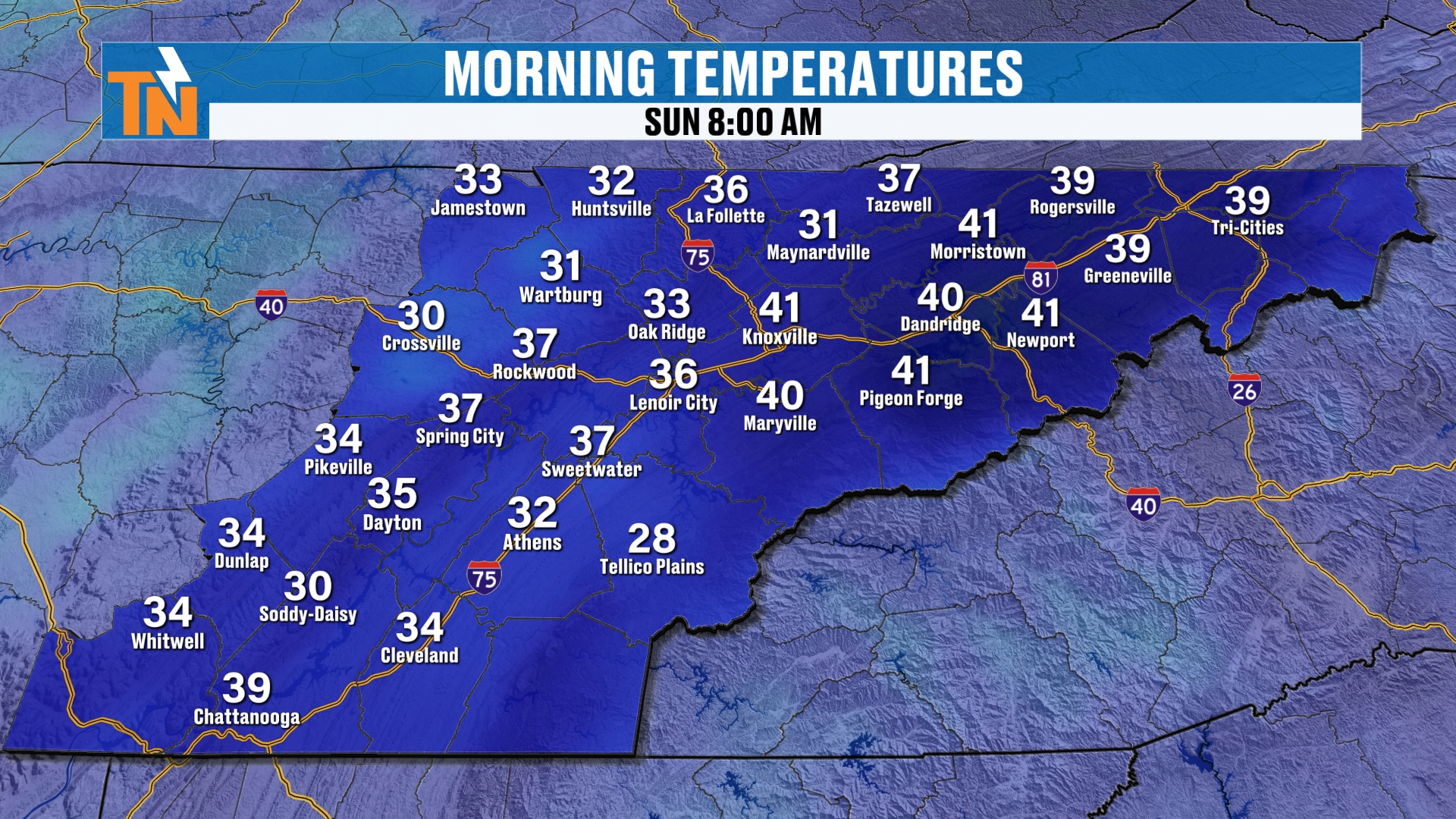
We started the morning off at 27 at the 8 o’clock hour in Crossville and 39 in the Tri-Cities. Knoxville, right there in the middle, was at 37, and Chattanooga was at 34.
So it’s a nice, quiet, chilly start. We had a hard freeze across the Cumberland Plateau. But because of those clouds, we did not see a hard freeze in most locations, even though we’ve been talking about the potential.
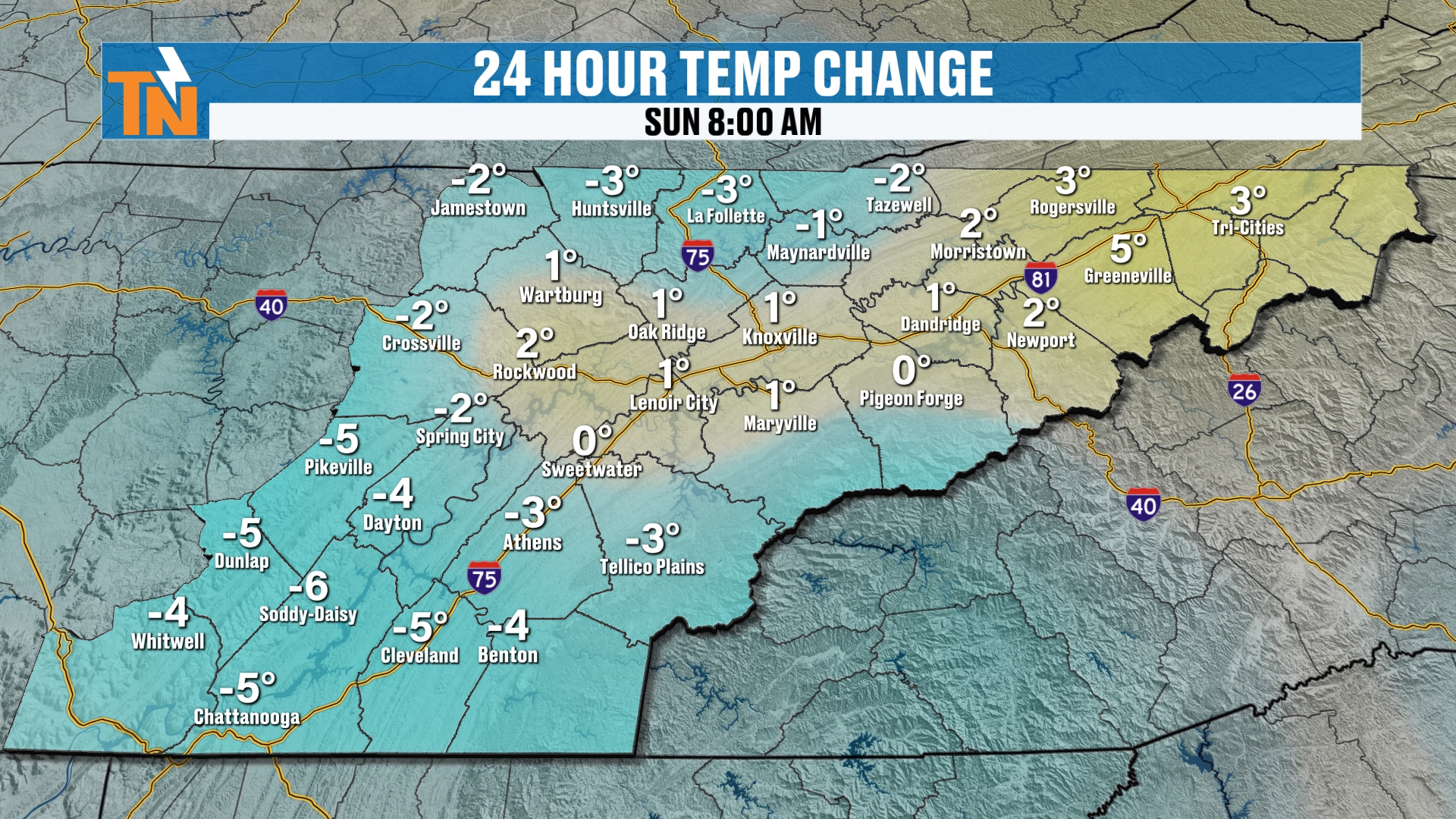
Temperatures this morning have been trending a little bit colder than they were yesterday in many spots.
Today: Fantastic Lunchtime Temperatures
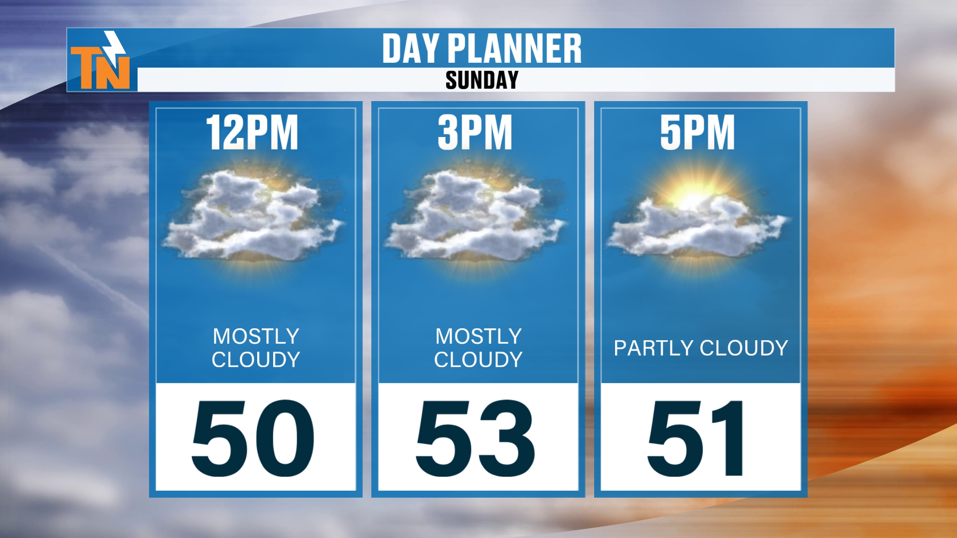
But listen, lunchtime temperatures are going to be fantastic. The clouds will zip on out of here, and we’ll have plenty of sunshine. We’ll be at 50 degrees by noon.
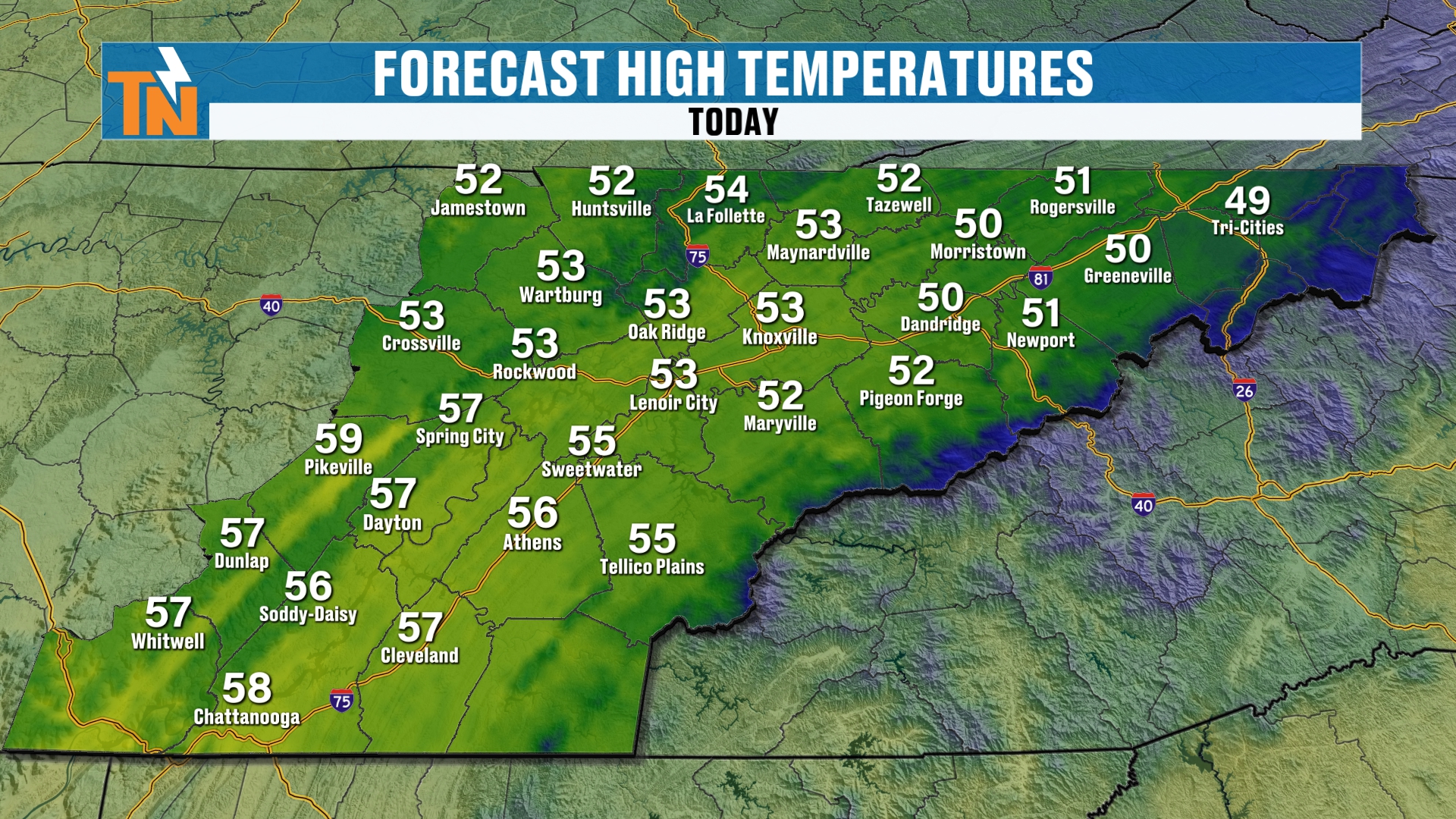
As we get into the afternoon, we’ll be in the low to mid 50s, with some upper 50s across the southern valley. So we’re still trending almost 10 degrees below average for this time of the year, but it’s warmer than what we had throughout the day yesterday.
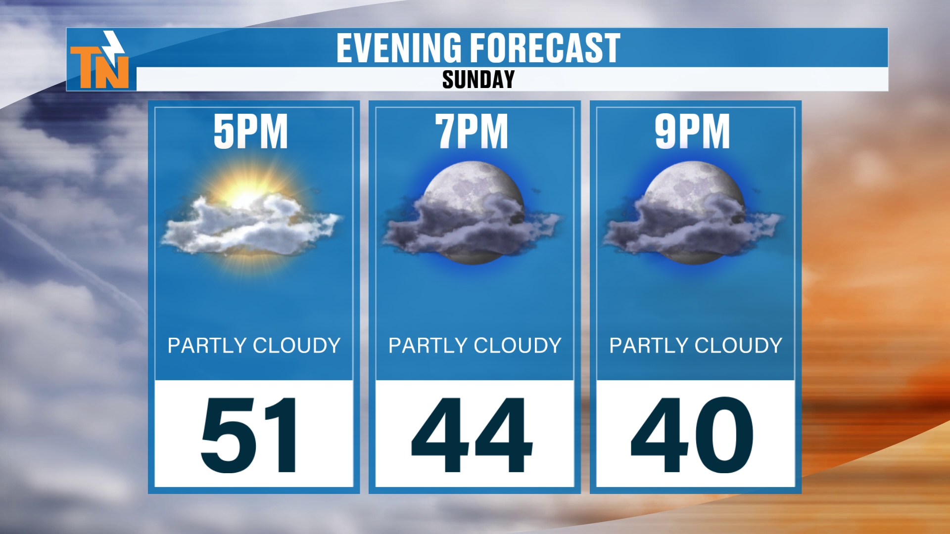
If you have evening plans tonight, by 7 PM we’re down to about 44 degrees.
The Extended Forecast: A Big Warmup Ahead
Let’s talk about the extended forecast. We’ve got a ridge of high pressure over the desert Southwest, and that’s going to be ushered eastward. As it does so, that’s going to bring us warming temperatures.
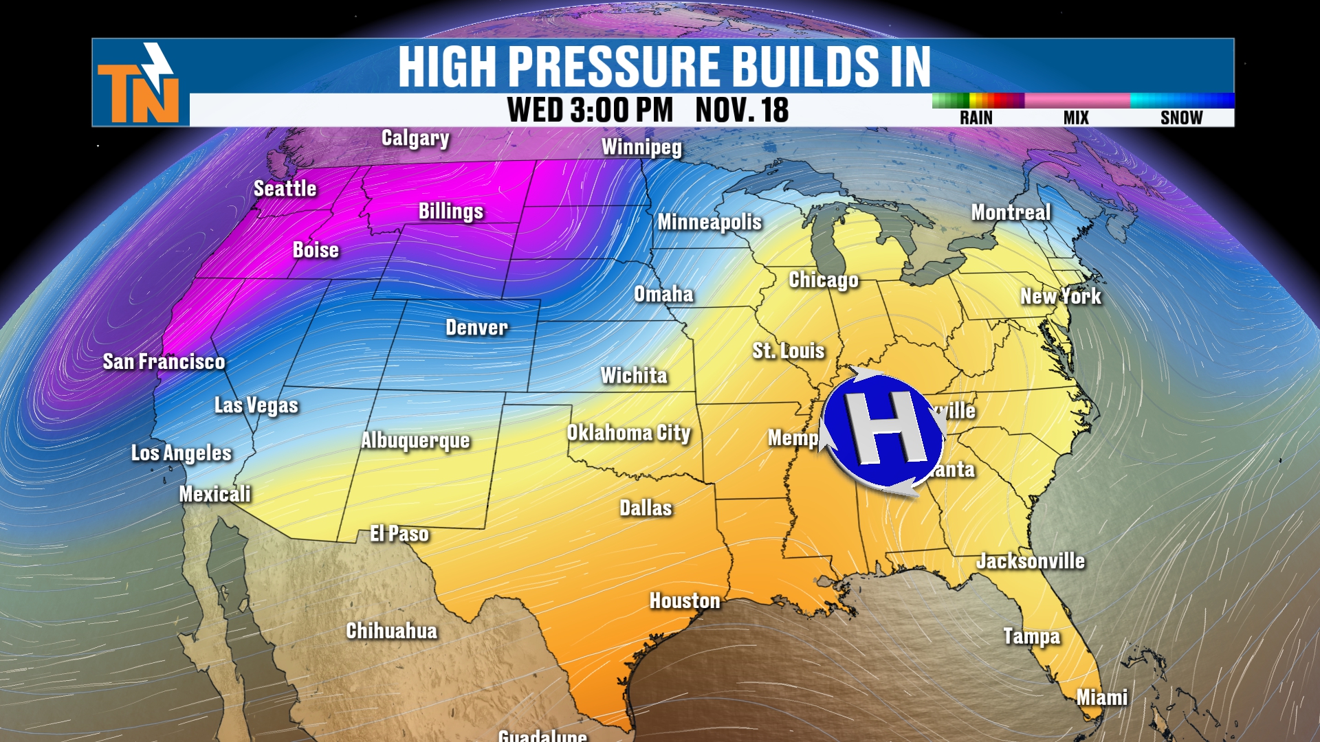
Notice I’m going to take you all the way through Friday, November 20th, and that ridge of high pressure is dominating. That takes us through the entire week next week.
There’s also a trough that’s going to start digging its way across the Pacific Northwest. That takes us to Friday. We’re going to be watching this trough, or a couple of series of troughs, that are going to be heading our way as we get into Thanksgiving week.
I’m still previewing Thanksgiving week, so hold on a second. Don’t go anywhere yet.
The 7-Day Forecast
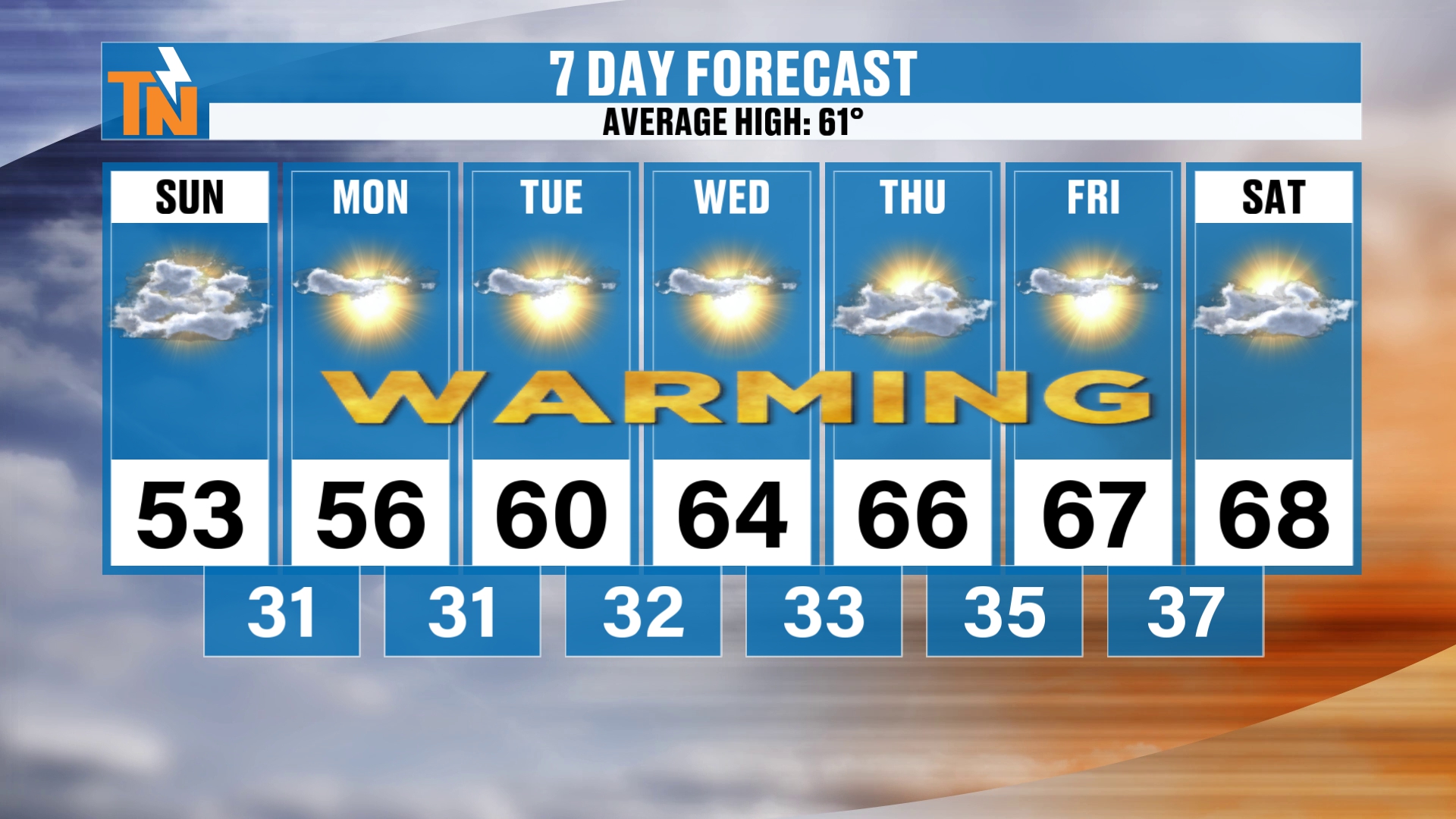
Here’s your 7-day forecast. Again, the average high is 61. We’re going to be below average by nearly 10 degrees today at 53. And then we continue to warm all week long.
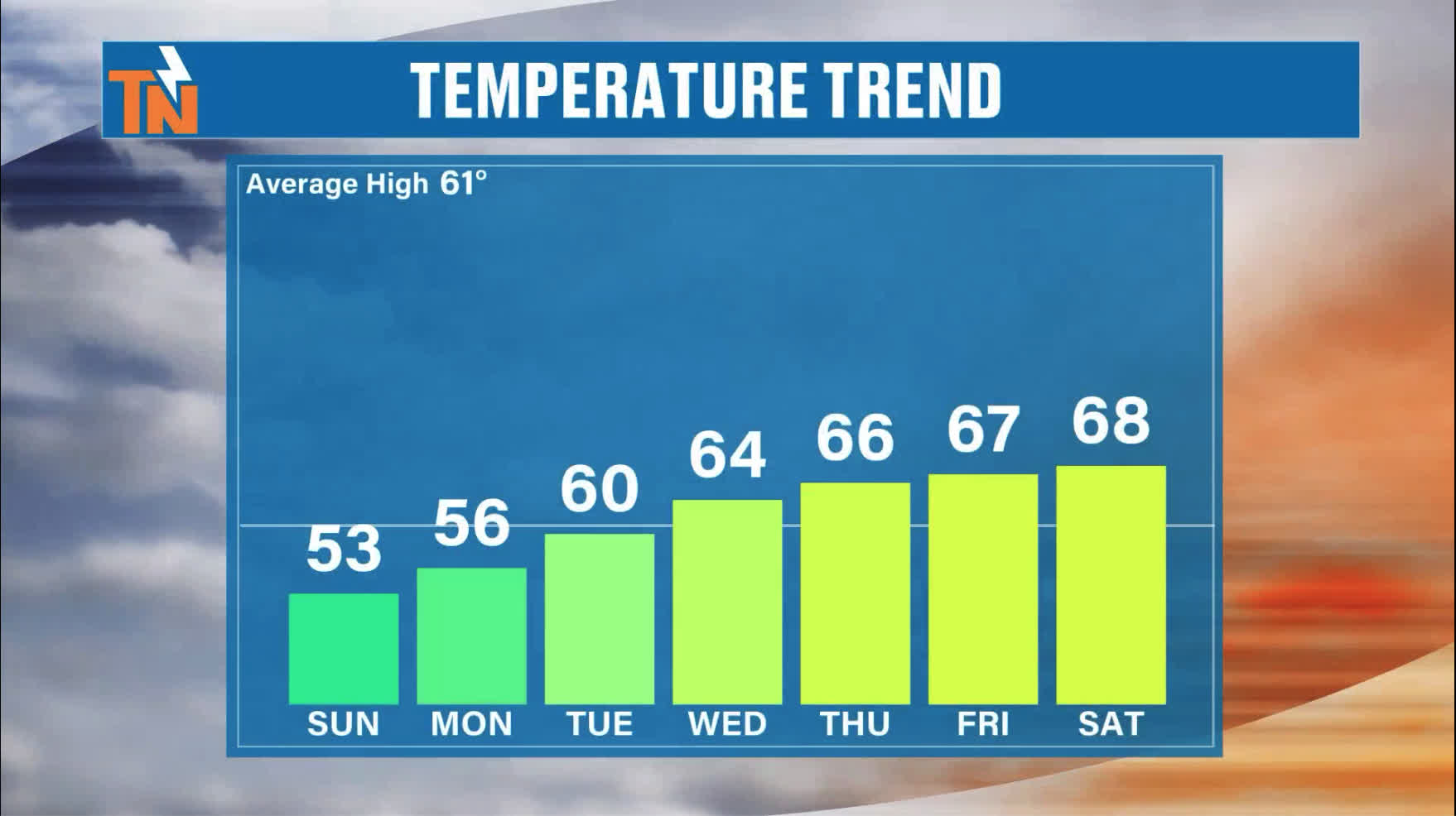
We’re actually trending above average by almost 10 degrees as we get into the latter part of the week. Thursday and Friday, we’ll be in the mid to upper 60s. Even Saturday. That’s going to be that ridge of high pressure, the warm before the storm.
So it’s quiet, dry, sunny weather all week, with a big warmup ahead.
Thanksgiving Week: A Trough Has My Attention
Let’s talk about your Thanksgiving week, because we’ll pick up our timeline on Monday, and we’ll probably have a little more seasonable temperatures.
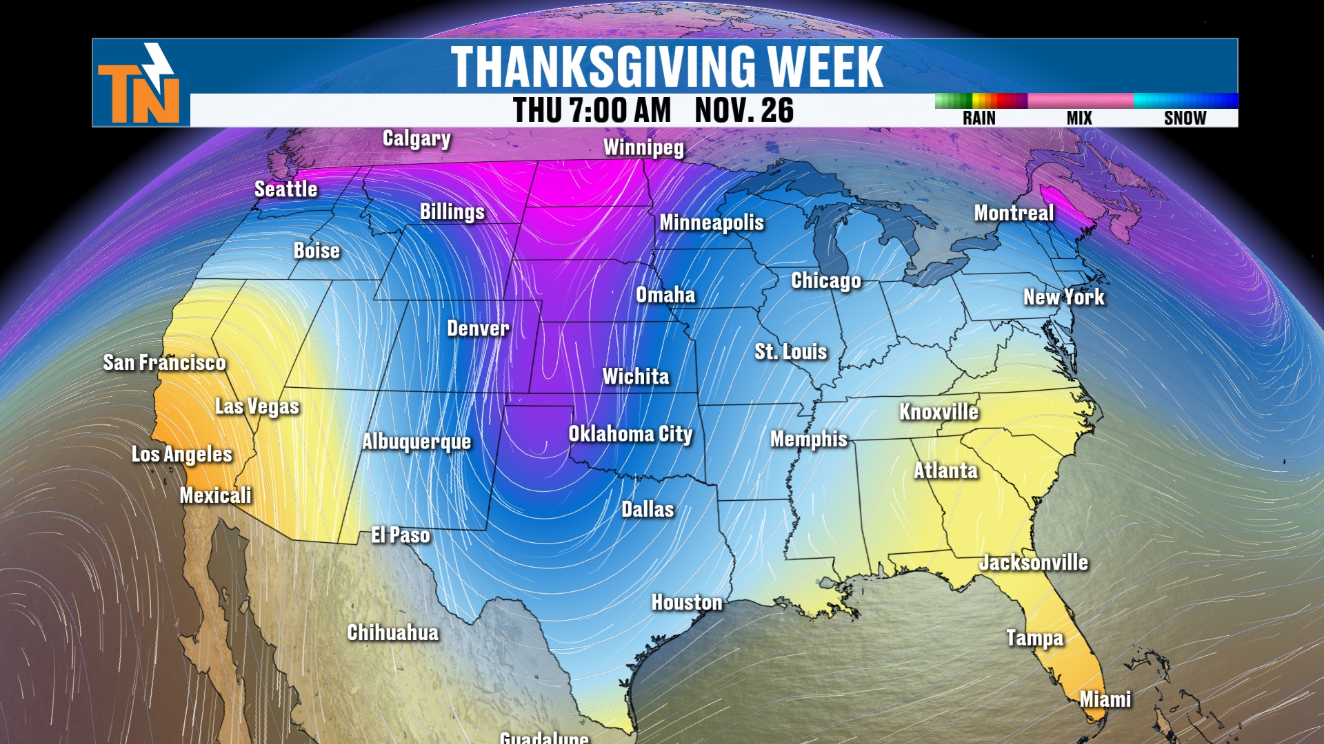
But look at this little trough that’s being advertised here, digging across the intermountain West and the northern Rockies, and then potentially digging its way across some parts of the southern or central part of the country.
If this happens, and this is the American model, by the way, it’s going to elevate our rain chances. So our rain chances will gradually increase.
Rain Chances: Increasing Through Thanksgiving Week
Let’s pick up our timeline. From now through Monday, November 23rd, we’re going to see some rain showers. Those rain showers down in Texas are associated with that wave I just talked about, which is going to slide off to our south.
There’s a lot of rain across parts of the West Coast, in California, from now through Monday morning. Again, this takes us through Monday the 23rd. That’s a week away from right now, so there’s quite a bit of rainfall there.
But look at the rainfall that’s going to be increasing through Thanksgiving week. As that potential trough develops, it may bring rain showers across the eastern part of the country at some point, say from Wednesday, the day before Thanksgiving, through the Thanksgiving Day weekend.
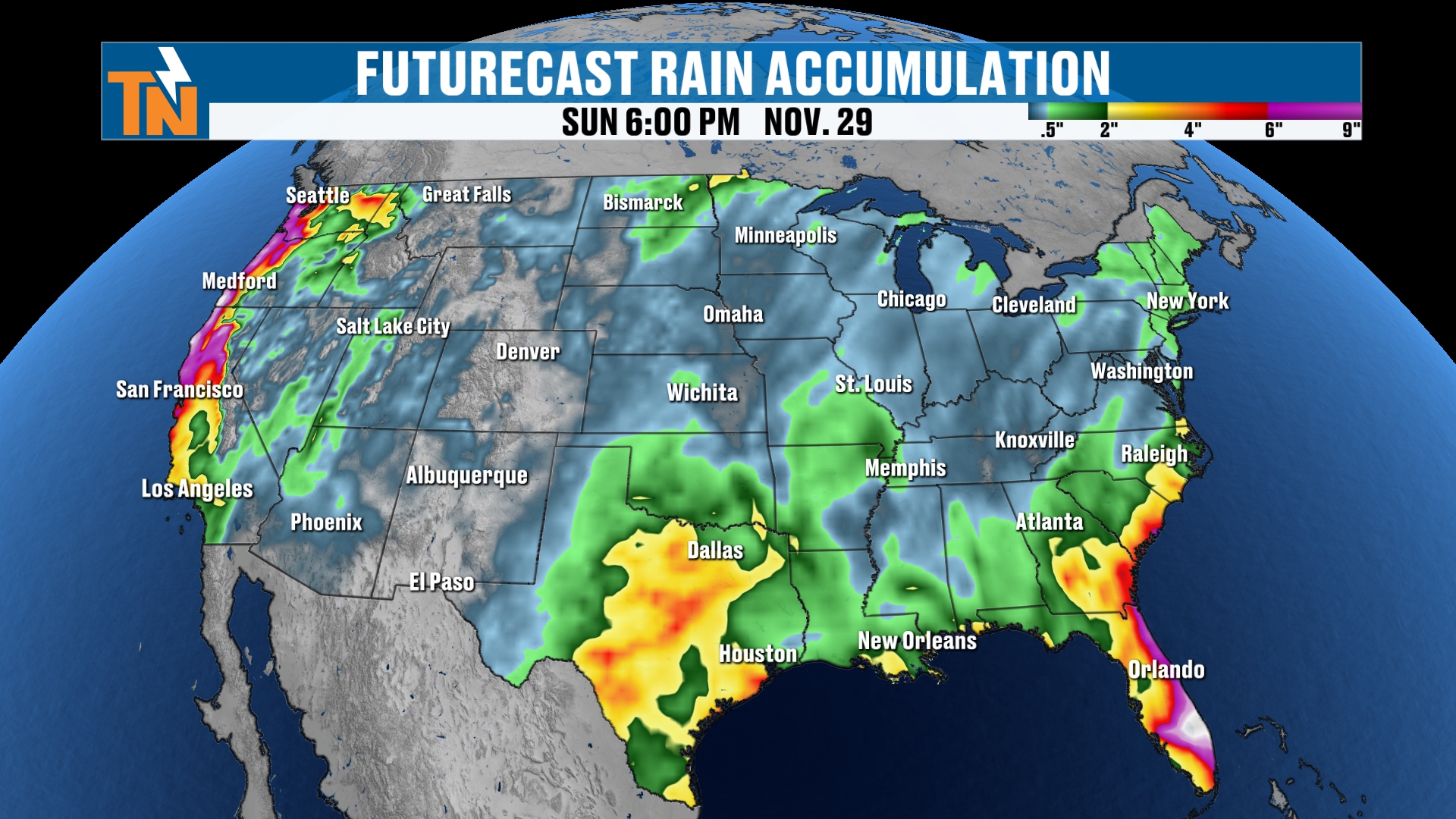
It does appear that most of that activity is going to be across the eastern part of the country. The West Coast is probably going to see some rain showers across the coastal areas, and the intermountain West may stay dry.
Snow Outlook: Good News for Ski Country
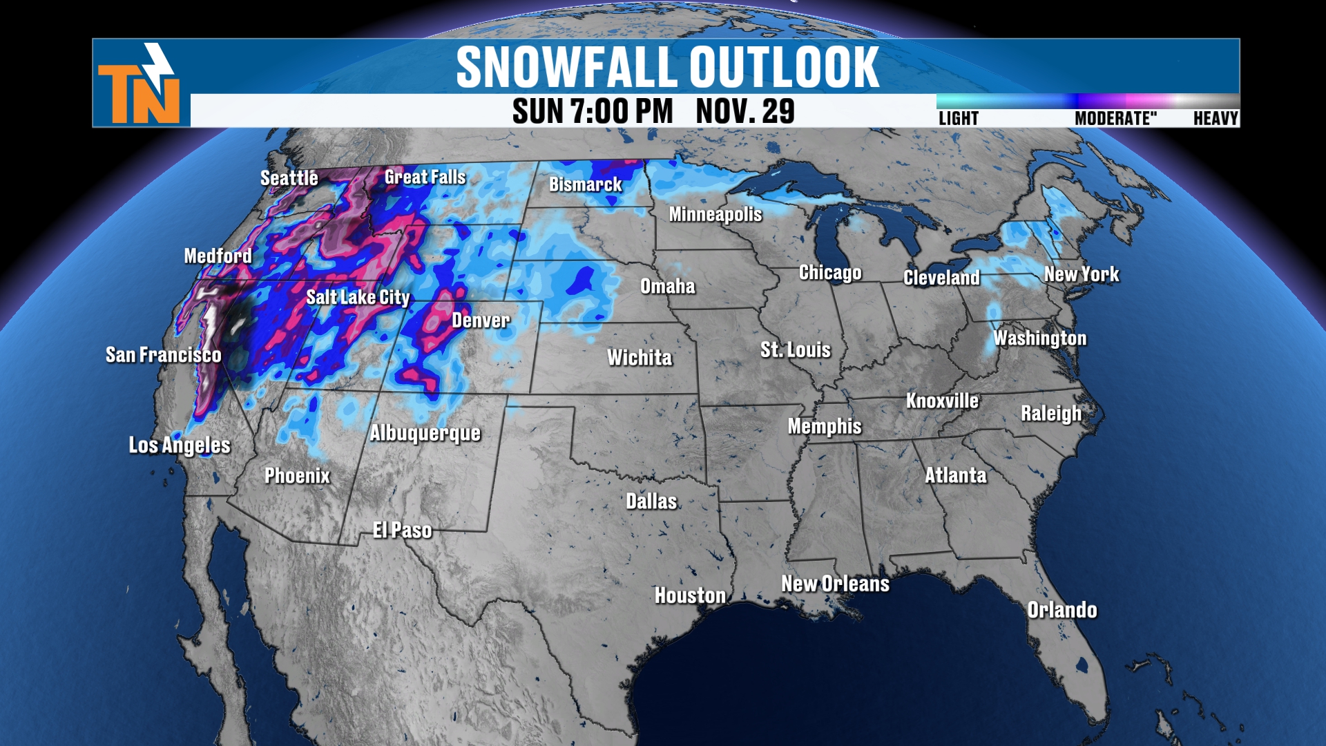
A lot of folks go out West to do some skiing for Thanksgiving. It looks like the Colorado Rockies, the Sierra Nevada and the Cascades will all get snowfall from now through Monday, and then we’ll probably add a little more of that as the next little wave comes through.
But the good news is, when you’re looking at any major storm system across the country, this takes us all the way through Thanksgiving weekend, and it’s not going to be any major player at this point of the game.
That’s good news, because a lot of times this time of year we’ll get big snowstorms during Thanksgiving weekend, and it really just hampers the travel across the board.
Bottom Line
SUNDAY (TODAY): Clouds zip out and sunshine takes over. Quiet and dry, with a morning start in the upper 20s to 30s. 50 at noon, a high around 53 (almost 10 degrees below average), up to the upper 50s across the southern valley, and 44 by 7 PM.
MONDAY THROUGH WEDNESDAY: The big warmup begins, with sunshine and highs of 56, 60 and 64.
THURSDAY THROUGH SATURDAY: Quiet, dry weather and highs in the mid to upper 60s: 66, 67 and 68. That’s almost 10 degrees above average, the warm before the storm.
THANKSGIVING WEEK: A disturbance or trough swings in, bringing increasing rain chances starting around the Wednesday before Thanksgiving, but not necessarily any snow chances. Above-average weather continues until that disturbance comes through, and then we’ll probably trend a little below average. No major storm is showing up, so travel looks good at this point.
The takeaway: enjoy the sunshine and the warmup this week, and keep checking back as we fine-tune your Thanksgiving week forecast.
For more daily updates, check out our Daily Forecast page.
Don’t forget to LIKE, SHARE and SUBSCRIBE to the YouTube channel and hit the bell at the top. It really helps put things out in the algorithm and lets people get to know East Tennessee Weather.
Make sure you download my free East Tennessee Weather app. Just go to your app store, scan the QR code, search East Tennessee Weather, and allow location services and notifications. The app works anywhere in the country you travel to, but it’s designed for us here in East Tennessee. It’s also available on Roku and Amazon Fire for your smart TVs.
Wake Up With Witcher starts off again at 7:30 in the morning on Monday.
I’m Meteorologist Mike Witcher. Have a great Sunday! I’ll see you back here later tonight or tomorrow morning.
eastTNweather — Weather When You Want It.