
Weekend Forecast Overview
Happy Friday everybody, and thanks for checking in.
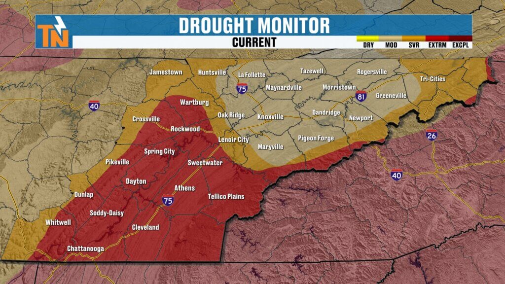
After several days of much-needed rain across East Tennessee, we’re heading into a quieter weather pattern for the weekend. The best news? Most of the rain fell south of Interstate 40 where drought conditions have been the worst.
Now we transition into a drier, calmer setup—but there are still a few question marks for Mother’s Day.
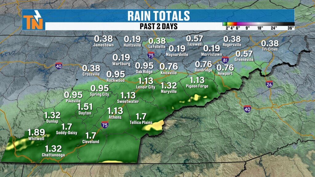
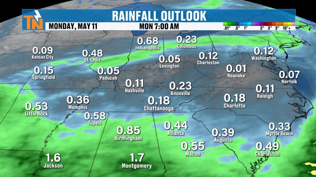
Rain Recap and Drought Update
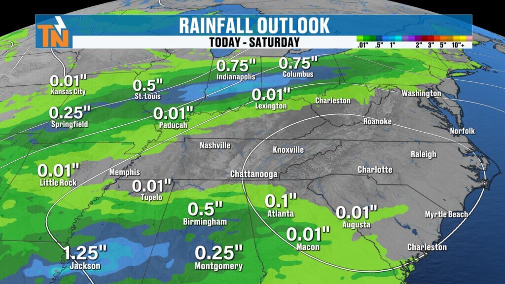
Rain totals over the last couple of days varied quite a bit:
- McGhee Tyson Airport picked up 0.07″
- Chattanooga picked up 0.31″
- Higher totals generally fell south of Interstate 40
That’s important because southern sections of East Tennessee continue to deal with the most severe drought conditions.
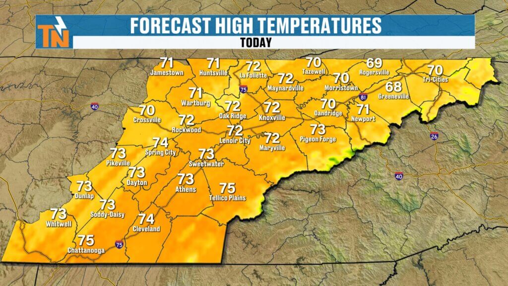
Friday Forecast: Cool Start, Beautiful Finish
This morning is noticeably colder:
- Temperatures: 30s and 40s
- Patchy frost: Tennessee/Kentucky border and Upper East Tennessee
- Patchy fog: Some valley locations
The fog shouldn’t become dense enough for advisories, but it could slow down the morning commute in spots.
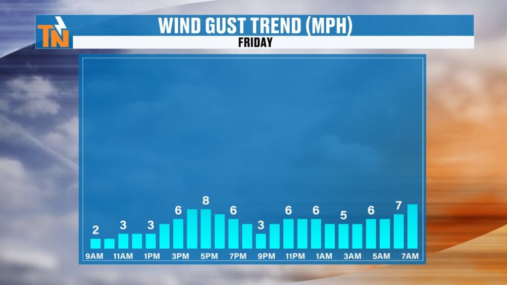
By this afternoon:
- Sunshine returns
- Light winds
- Highs in the low to mid 70s
A fantastic spring day overall.
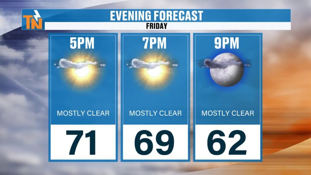
Friday Evening Plans
Heading out tonight?
Temperatures fall into the upper 60s by 7 PM, so you may want a light jacket for outdoor plans.
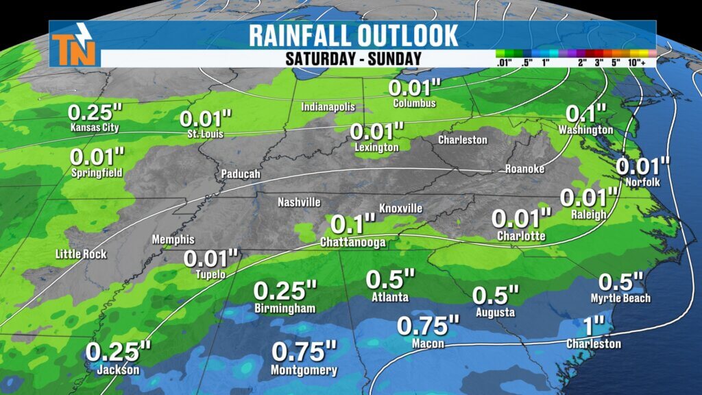
Saturday Forecast: Mostly Dry with a Tiny Rain Chance
Saturday continues the quiet pattern.
A weak disturbance may brush parts of the southern Tennessee Valley early Saturday morning, but moisture remains very limited.
Rain chances:
- Around 10% south of Knoxville
- Most areas stay dry
Overall:
Highs near 80 degreesuickly, it could lead to localized flooding issues.
Mix of sun and clouds
Warm afternoon temperatures
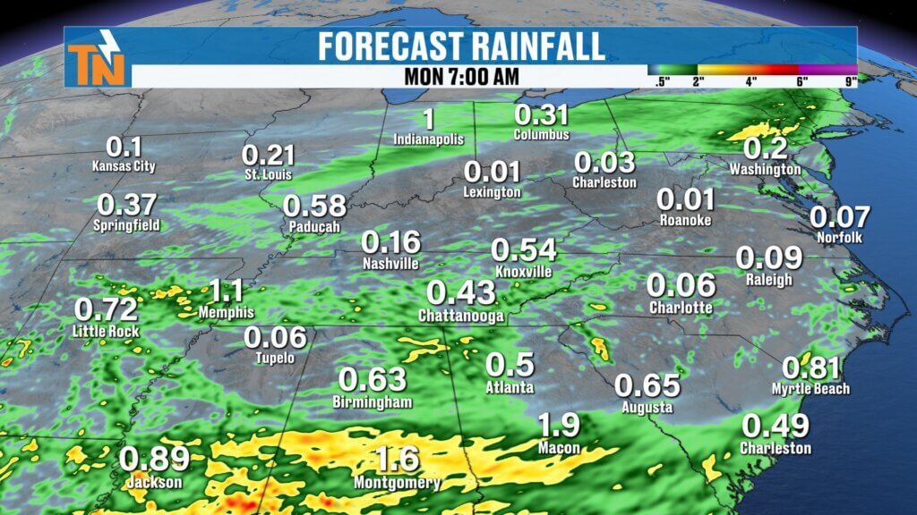
Mother’s Day Forecast: Still Some Uncertainty
Sunday is where things get a little more complicated.
Most forecast models keep East Tennessee largely dry, but one high-resolution model suggests a system could bring a more noticeable round of rain Sunday night into Monday morning.
Right now:
- Daytime Sunday looks mostly dry
- Late Sunday into early Monday carries the better rain chance
- Forecast confidence remains lower than usual
Because models disagree, this is definitely a forecast worth checking back on over the next 24–48 hours.
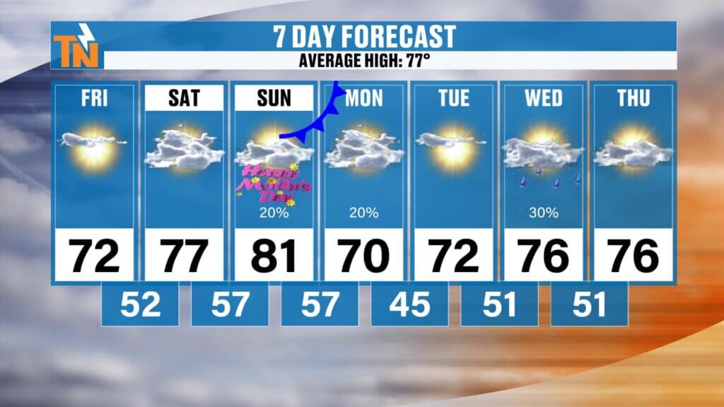
Temperature Trend
- Friday: Low 70s
- Saturday–Sunday: Upper 70s to low 80s
- Monday–Tuesday: Back into the low 70s
- Midweek: Mid 70s return
Looking Ahead
The overall pattern remains fairly quiet without any major storm systems expected through early next week.
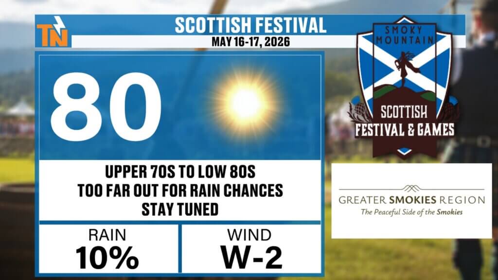
And if you’re already planning ahead:
- The Scottish Festival coming up May 16–17 is currently trending warm with highs in the upper 70s to low 80s.
Final Thoughts
The weekend forecast is shaping up nicely overall with plenty of dry time, comfortable temperatures, and only small rain chances. The one thing to watch closely is the late Sunday into Monday timeframe as forecast models continue to sort out that next weak system.
Enjoy the beautiful spring weather!