
Happy Mother’s Day, East Tennessee!
Happy Mother’s Day everybody, and thanks for checking in.
The good news? Today is shaping up to be a beautiful day around East Tennessee. Warm temperatures, plenty of dry time, and only a very small chance for a stray shower later this evening. A weak cold front is on the way, but it’s not expected to bring much rain.
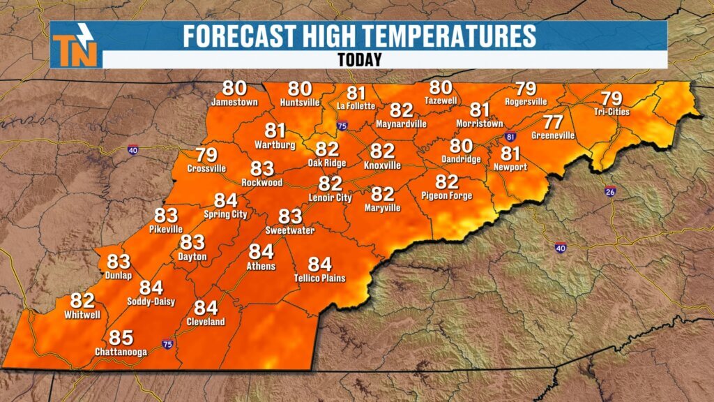
Sunday Forecast: Warm and Mostly Dry
If you’ve got plans with mom today, the weather cooperates nicely.
Today’s setup:
- Morning: Patchy dense fog in spots
- Afternoon: Warm and pleasant
- Highs: Low 80s
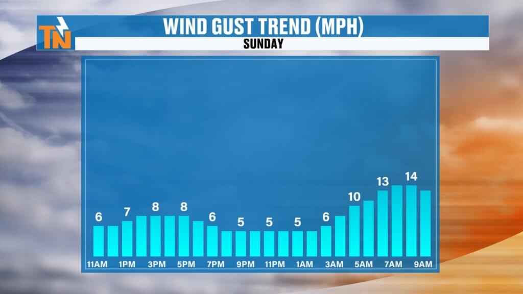
- Winds: Light breeze
Whether you’re headed to church, brunch, lunch, or dinner, conditions look great for getting out and enjoying the day.
Dense Fog Early This Morning
We are starting off with some areas of dense fog across parts of East Tennessee.
Travel tips:
- Allow extra time this morning
- Slow down in low visibility areas
- Conditions improve quickly after sunrise
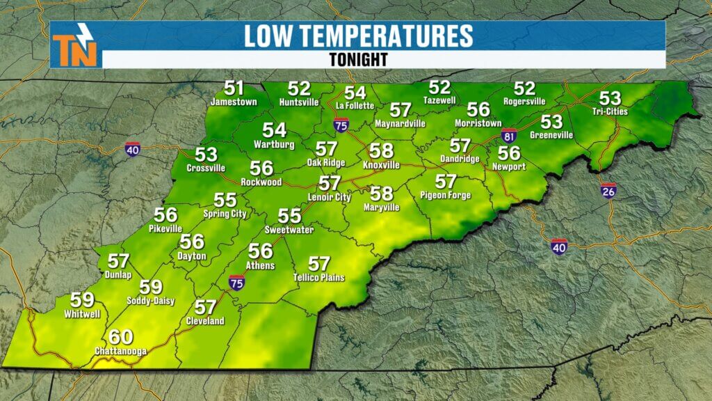
Temperatures this morning are generally in the 40s and 50s before warming quickly this afternoon.
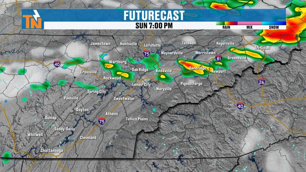
Could We See Rain Tonight?
Here’s where the forecast gets a little tricky.
Most of today stays dry, but one model hints at a few isolated showers or storms trying to sneak into East Tennessee later this evening.
The important thing:
- This is an outlier scenario
- Most locations likely stay dry today
- Better rain chances hold off until overnight and Monday morning
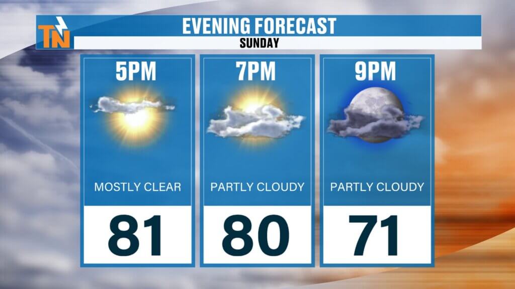
By 7 PM:
Slight chance for an isolated showernue to deal with the most severe drought conditions.
Temperatures near 80°
Partly cloudy skies
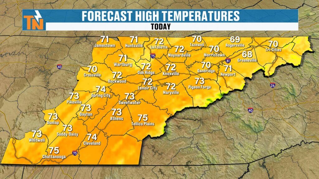
Friday Forecast: Cool Start, Beautiful Finish
This morning is noticeably colder:
- Temperatures: 30s and 40s
- Patchy frost: Tennessee/Kentucky border and Upper East Tennessee
- Patchy fog: Some valley locations
The fog shouldn’t become dense enough for advisories, but it could slow down the morning commute in spots.
By this afternoon:
- Sunshine returns
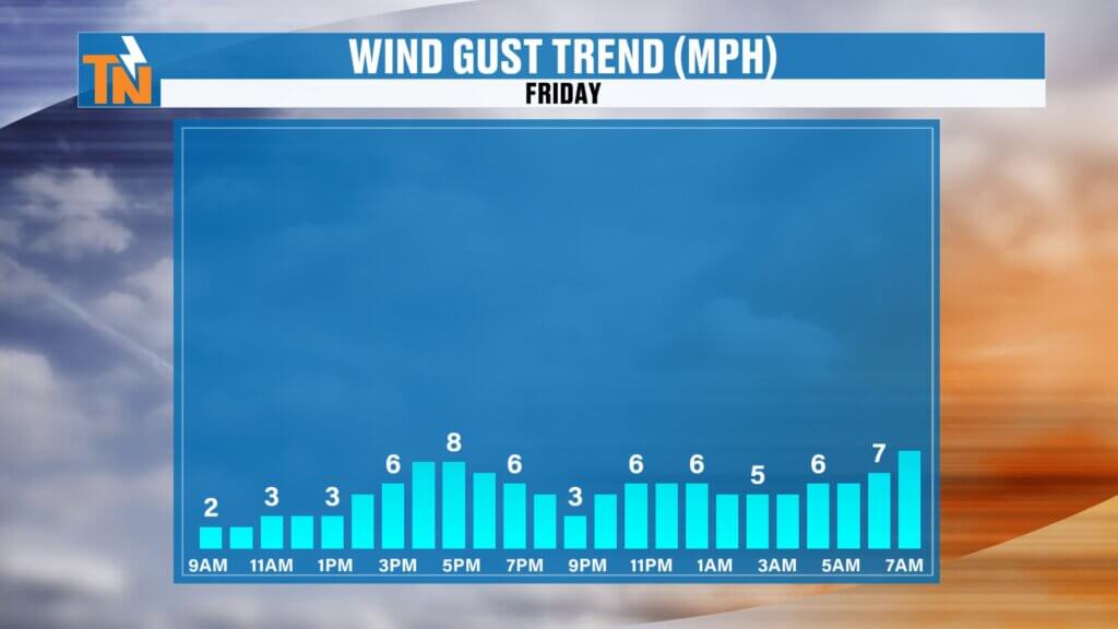
- Light winds
- Highs in the low to mid 70s
A fantastic spring day overall.
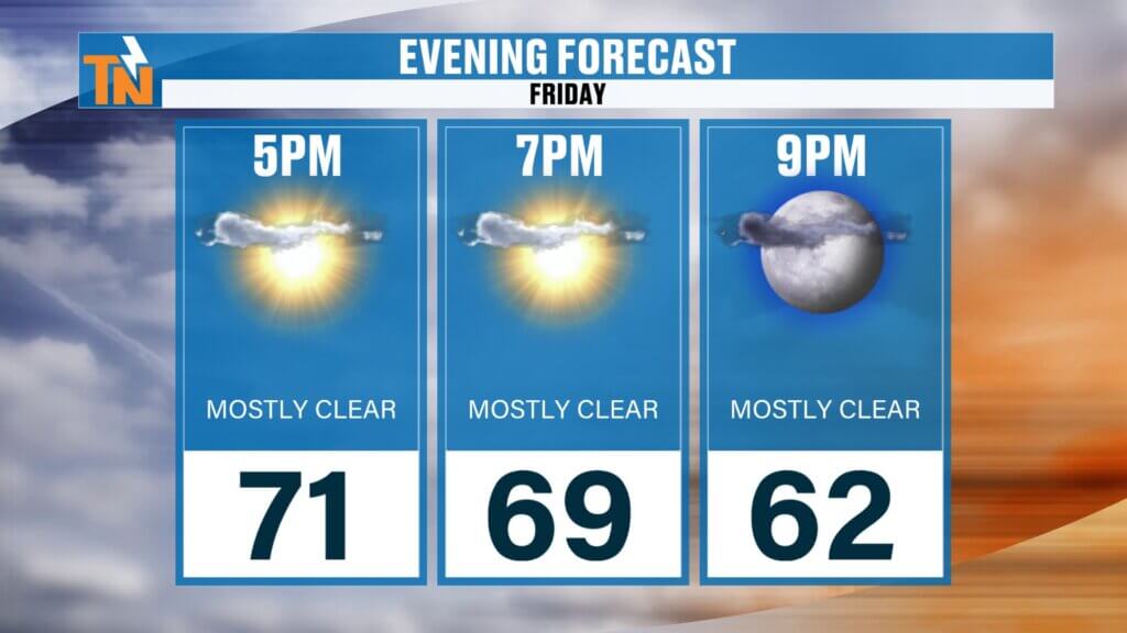
Friday Evening Plans
Heading out tonight?
Temperatures fall into the upper 60s by 7 PM, so you may want a light jacket for outdoor plans.
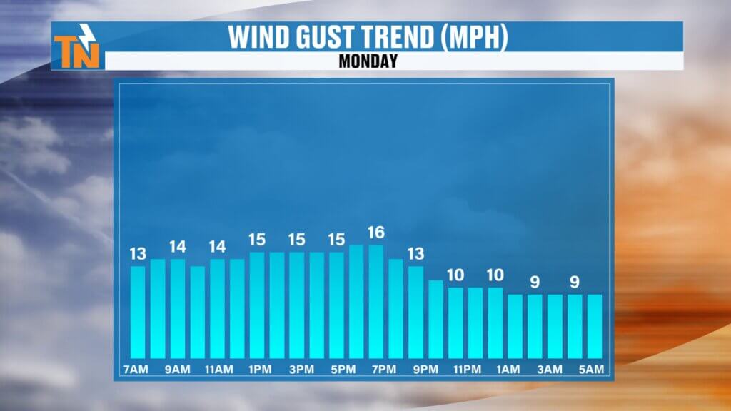
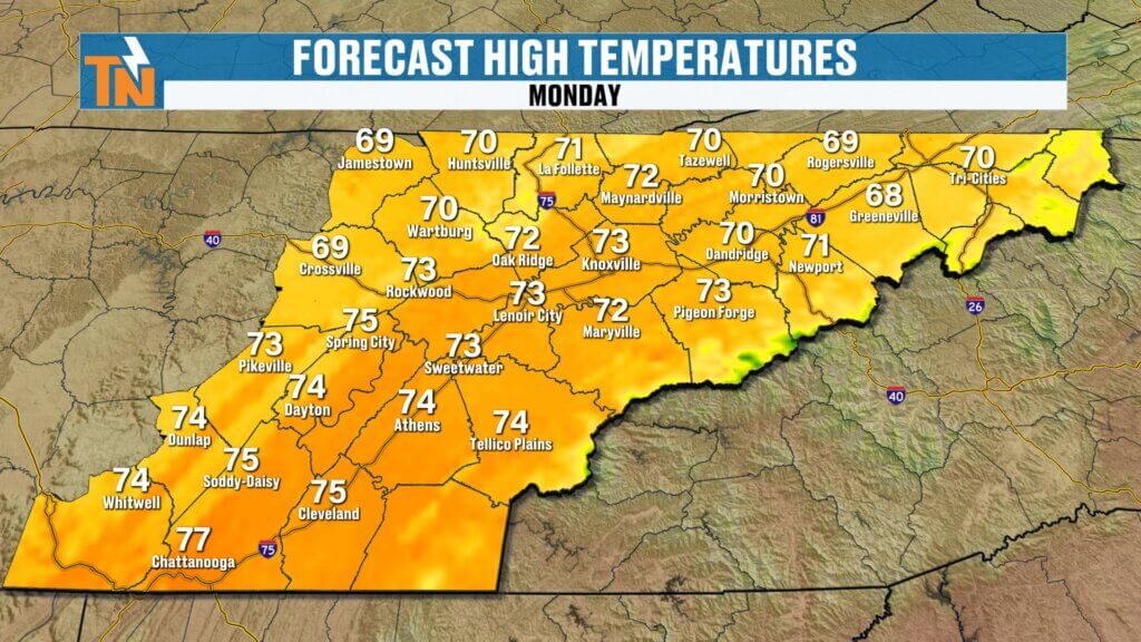
Monday: Cooler with Spotty Rain
A weak cold front swings through Monday morning.
What to expect:
- Scattered light showers early
- Mostly cloudy skies
- Cooler temperatures in the 60s and 70s
- Breezier conditions with north winds developing
Rainfall totals:
- Around 0.10″ to 0.25″ at most
Not a major rainmaker—just enough for a gloomy start to the work week.
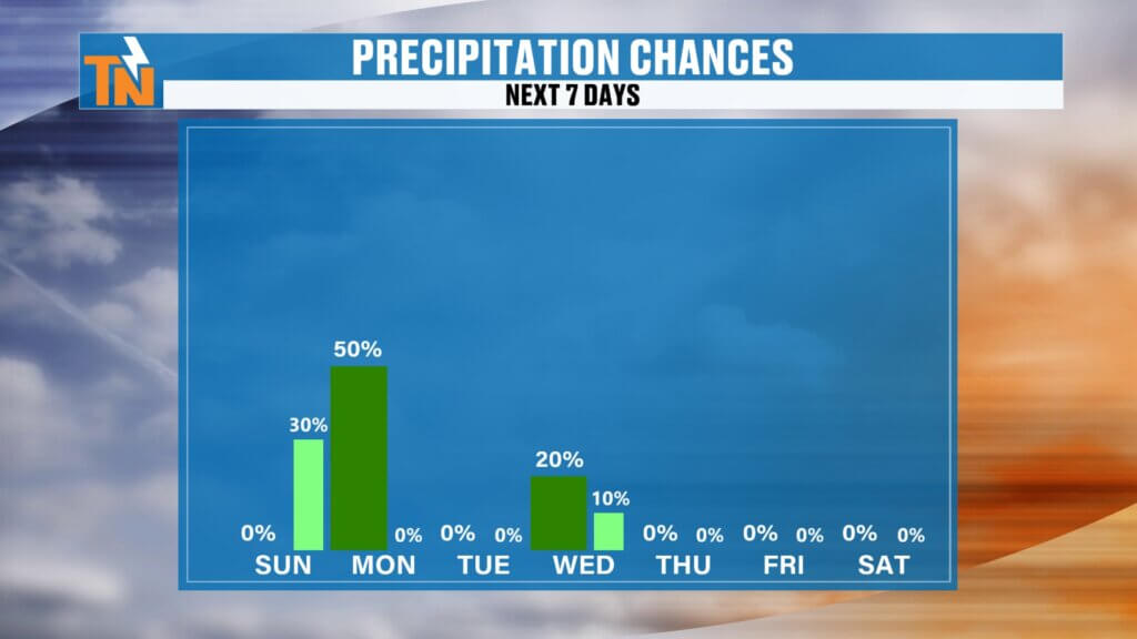
Another Midweek Rain Chance
We’re also tracking another weak system for Wednesday into Thursday.
Expected impacts:
- More clouds
- Breezier weather
- A few light showers
Again, rainfall totals look limited.

Summerlike Warmth Returns
After a brief cool-down, warmer air quickly takes back over.
Temperature trend:
Next weekend: Mid to upper 80s
Sunday: 82°
Monday: 73°
Wednesday: Upper 70s
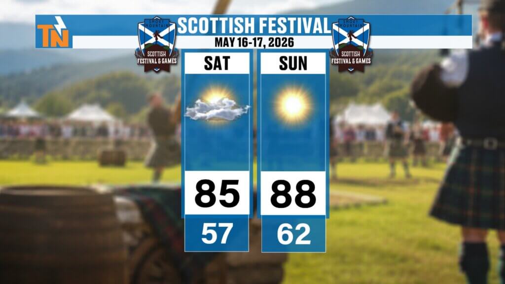
Scottish Festival Forecast Looks Fantastic
If you’re headed to the Scottish Festival May 16–17 in Townsend:
- Highs: Mid to upper 80s
- Lows: 50s and 60s
- Mostly dry weather expected
A warm, summerlike setup is taking shape.
Final Thoughts
Enjoy the beautiful Mother’s Day weather today. Most of us stay dry, warm, and comfortable with only a slim chance for a stray evening shower. A little rain arrives overnight into Monday morning, followed by another weak system midweek before summerlike warmth settles back in.
Happy Mother’s Day!