
Overview: 50/50 Weekend Ahead
Happy Friday! Hope you have a great day.
We’re wrapping up another warm and pleasant stretch today before a cold front brings rain into the region this weekend. It won’t be a total washout—but it will be a split weekend with one wet day and one dry day.
Looking ahead, the pattern turns more active next week with multiple rounds of rain and even the potential for a few stronger storms.
Friday Forecast: Warm, Breezy, and Mostly Dry
We start the morning off in the 40s and 50s with a comfortable feel.
- Afternoon highs: Upper 70s to low 80s
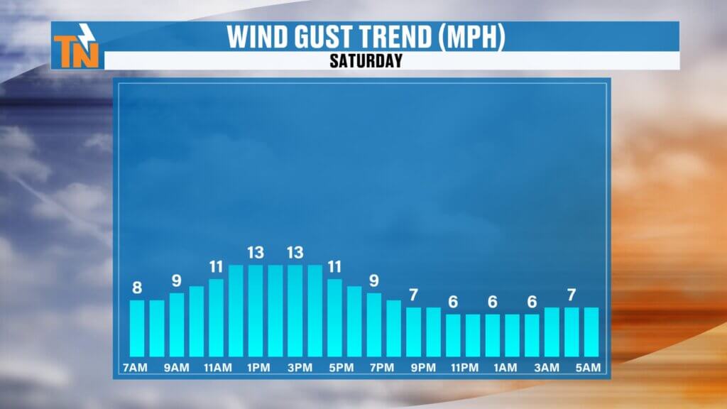
- Winds: Breezy at times
- Sky: Mostly sunny with a few clouds
A couple of isolated, terrain-driven showers or storms can’t be ruled out this afternoon, mainly across the Cumberland Plateau and mountain areas. Most locations stay dry.
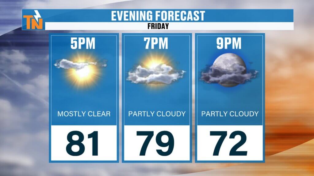
By this evening:
- Around 79° at 7 PM
- Great conditions for any outdoor plans
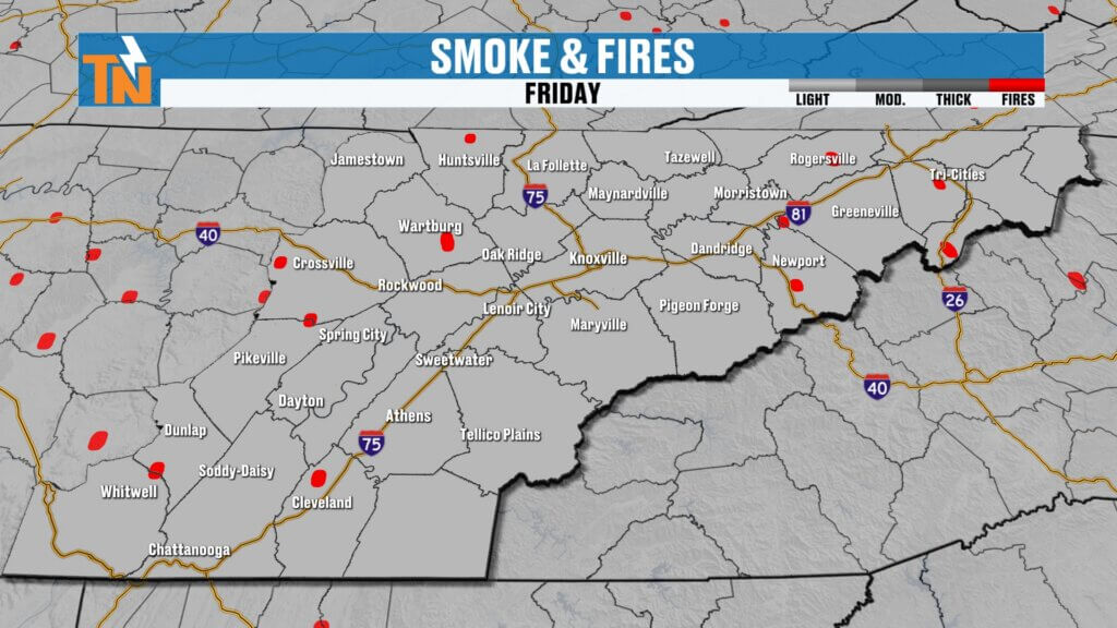
Air Quality: Haze and Smoke Lingers
If you’ve noticed the haze, you’re not alone.
Air quality may be a concern for sensitive groups
Ongoing fires around the region are contributing to smoke
Expect hazy skies at times today
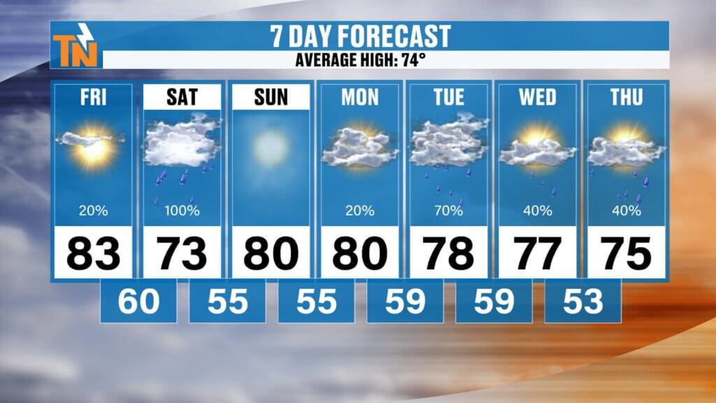
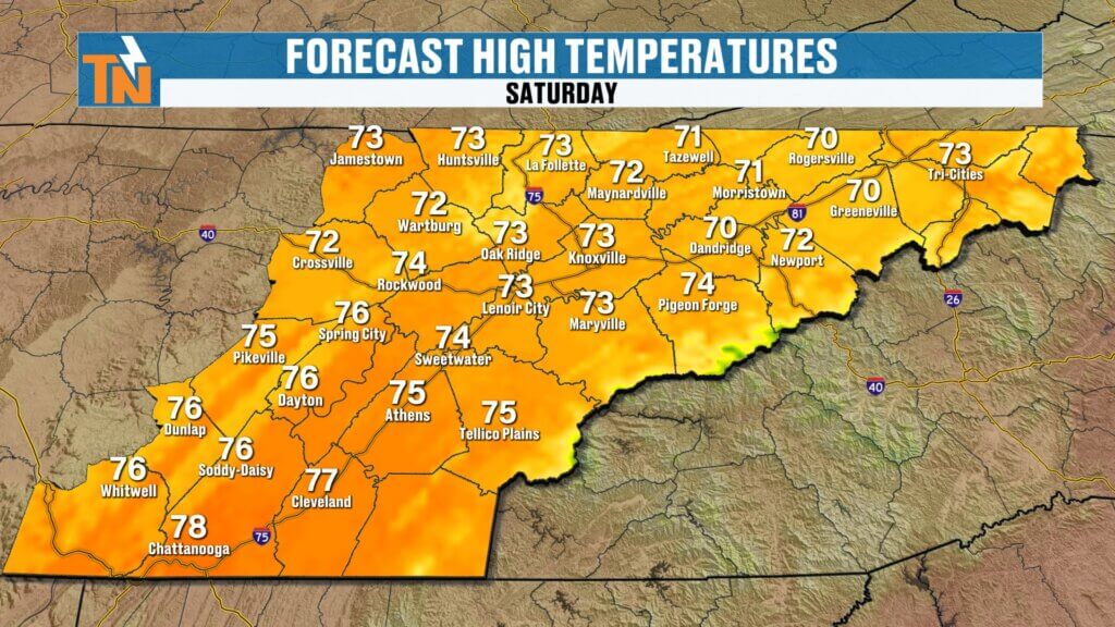
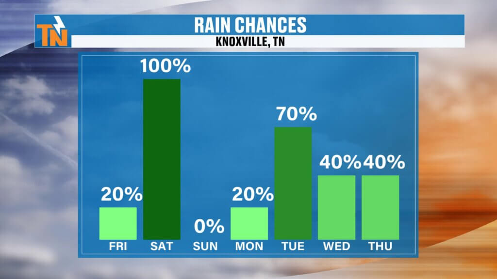
Saturday Forecast: Wettest Day of the Weekend
Saturday is the day to watch.
- Rain develops early in the morning
- Steadiest rain expected from sunrise through early afternoon
- Additional scattered showers and storms possible late afternoon into evening
Timing breakdown:
- Morning through noon: Best chance for widespread rain
- Afternoon: Rain tapers somewhat
- Evening (3–7 PM): Additional scattered showers/storms possible
Rainfall amounts:
- 0.25″ to 0.75″ common
- Isolated areas could see up to 1″ in heavier downpours
Temperatures:
- Morning: 50s
- Afternoon highs: 70s (cooler due to clouds and rain)
Sunday Forecast: Drier and Warmer
Behind the cold front, conditions improve.
- Drier weather returns
- Highs rebound to around 80°
- A much better day for outdoor plans
Next Week: More Active Pattern Returns
The weather doesn’t stay quiet for long.
A few storms could become strong at times
Monday–Wednesday: Additional rounds of showers and storms
Stronger system arrives Monday night into Tuesday
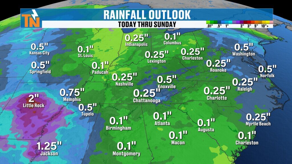
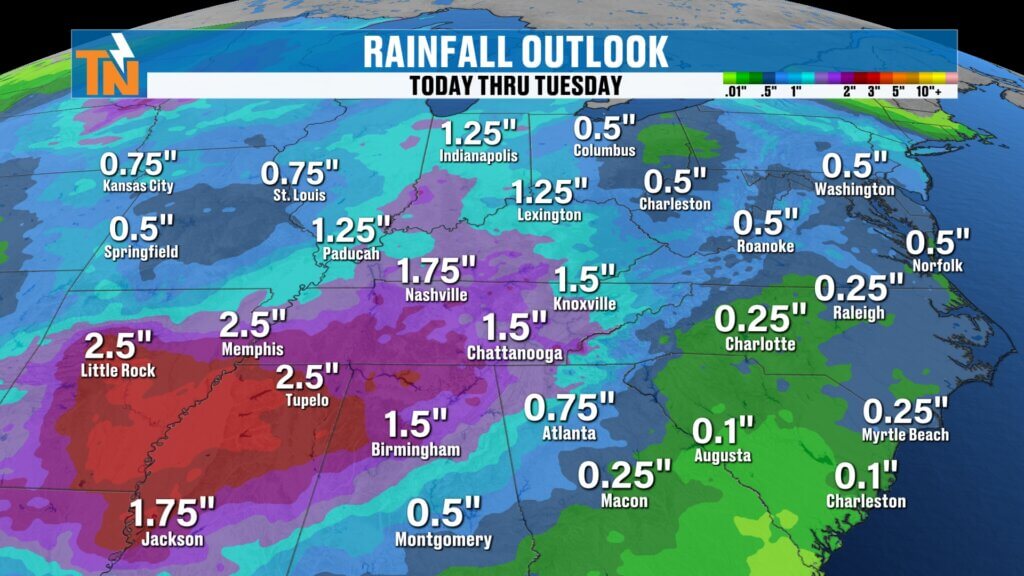
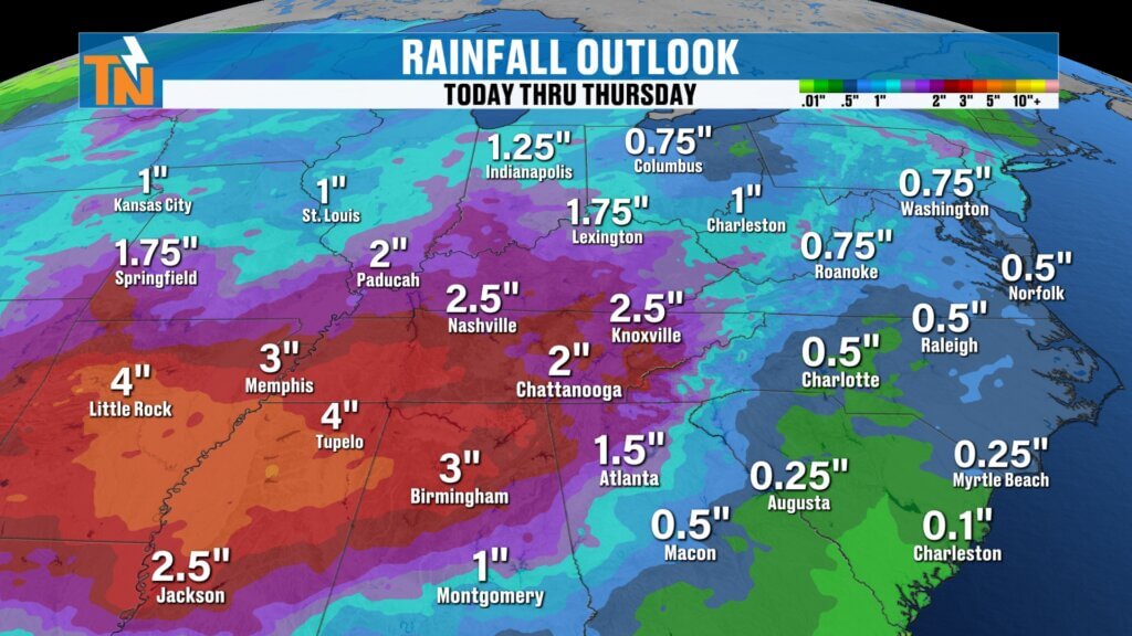
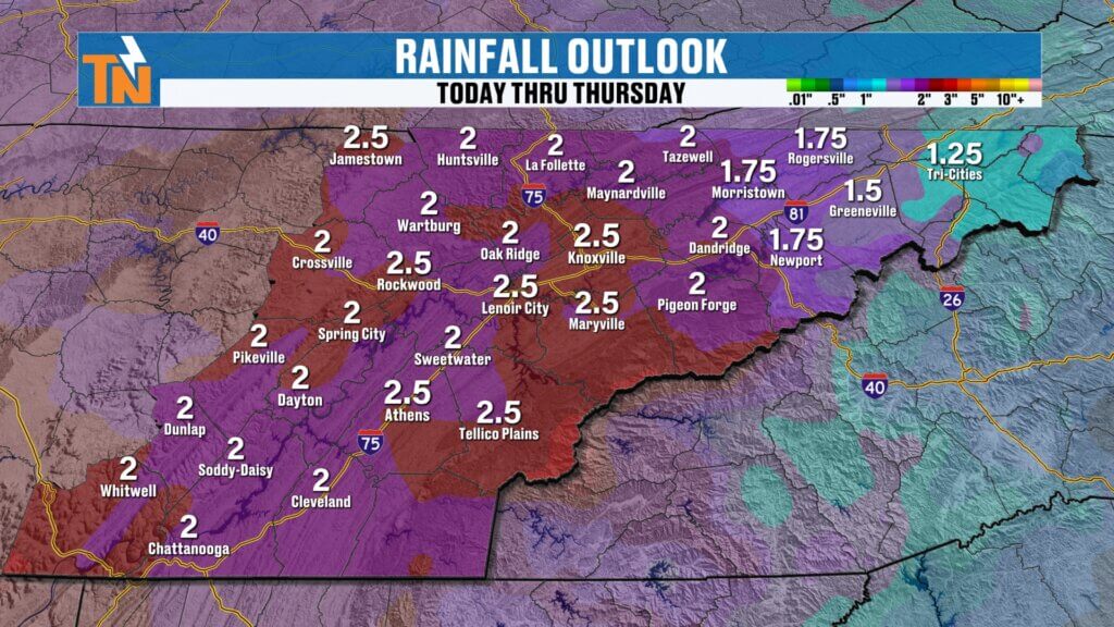
Rainfall Outlook: Much Needed Moisture
Between this weekend and next week:
- Saturday system: Up to around 1″
- Early next week systems: Additional rainfall
Total potential:
- 1″ to 2″+ possible over the next 7 days
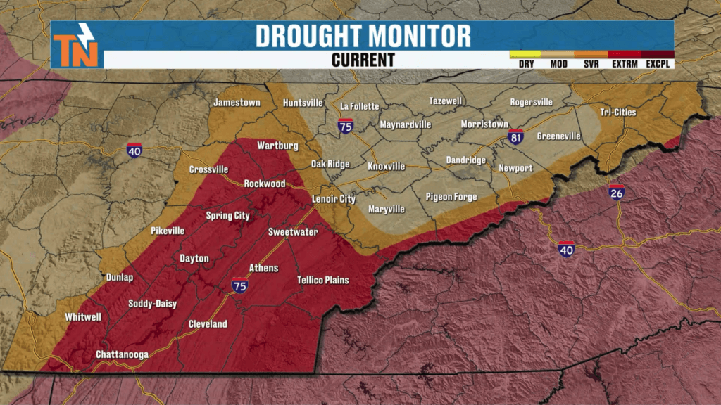
This is very beneficial given worsening drought conditions across East Tennessee.
7-Day Temperature Trend
- Friday: 83°, warm and breezy
- Saturday: 70s with rain
- Sunday: Near 80°, drier
- Next week: Upper 70s to low 80s with rain chances
Temperatures stay above average overall.
Final Thoughts
Enjoy today—it’s the pick of the weekend. Saturday brings the rain, Sunday brings the recovery, and next week brings more opportunities for much-needed rainfall.
Have a great Friday, and don’t forget to track the storms with the East Tennessee weather app!