
Weekend Overview
Happy Saturday! Thanks for checking in.
After a warm and above-average Friday, today brings a more typical spring feel with clouds, scattered showers, and a few isolated thunderstorms. The good news? It’s not a total washout. Even better—Sunday looks fantastic.
Looking ahead, next week turns more active with increasing rain chances and even a cooler-than-average trend by the end of the week.
Saturday Forecast: Scattered Showers, Not a Washout
A cold front is moving into the region, bringing:
- Scattered showers throughout the day
- Isolated thunderstorms, especially this afternoon
- Mostly cloudy skies with a few breaks of sunshine
Timing breakdown:
- Morning through noon: Spotty showers around
- Afternoon: A few rumbles of thunder possible as temps warm
- Evening (5–7 PM): Rain begins to wind down
Rain coverage won’t be uniform:
- South of I-40: Better chance for more consistent rain
- North of I-40: More limited and spotty coverage
So while rain is in the forecast, not everyone gets wet all day.
Event Impact: Outdoor Plans Today
There’s a lot happening across East Tennessee today:
- Zoo Knoxville’s Zufari fundraiser
- Dogwood Arts Festival
- Smokies baseball
Plan for occasional showers, but also dry breaks. Keep the umbrella handy, but don’t cancel plans just yet.
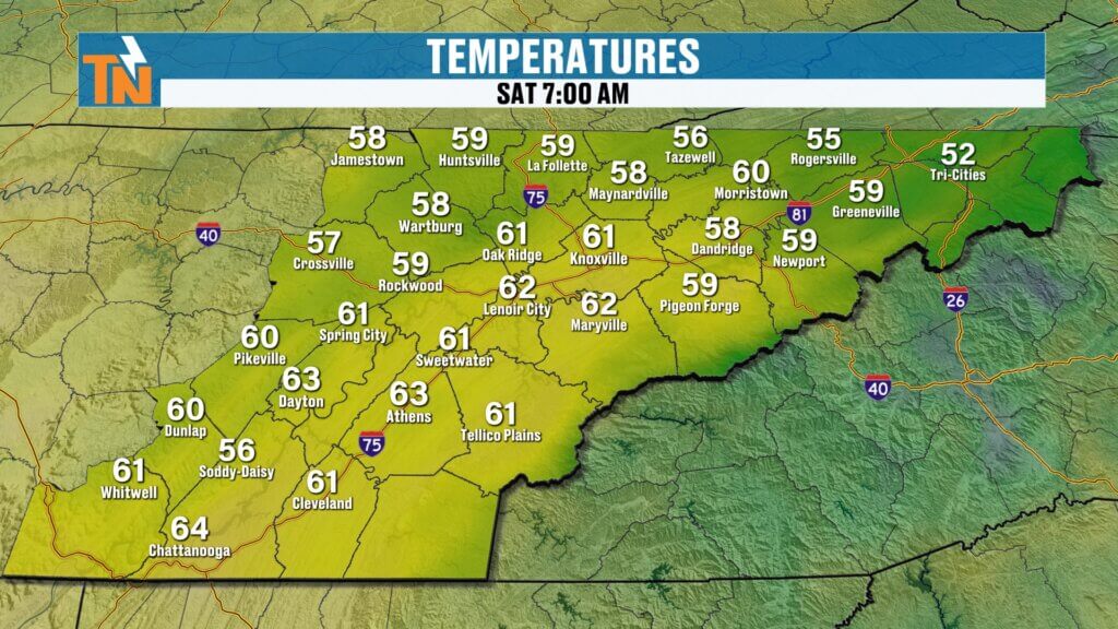
Temperatures and Wind
- Morning lows: 50s to low 60s
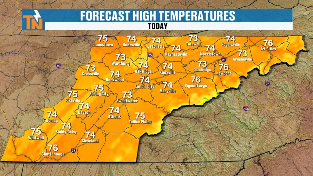
- Afternoon highs: Mid 70s (right near average)
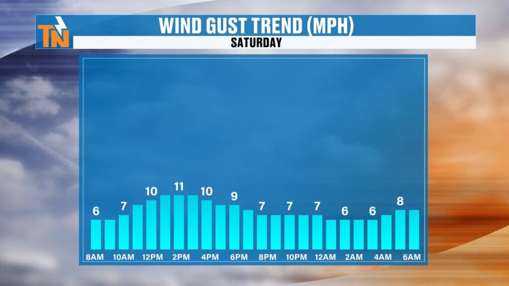
- Winds: Light to breezy at times
Cloud cover and rain will keep temperatures in check compared to recent days.
Sunday Forecast: A Perfect Spring Day
Sunday is the winner of the weekend:
- Dry conditions return
- Plenty of sunshine
- Highs around 80°
If you have outdoor plans, Sunday is your day.
Next Week: Unsettled with Increasing Rain
The pattern turns more active heading into next week:
- Monday–Tuesday: Increasing rain chances
- Best timing for stronger storms: Late Monday into Tuesday morning
- A Level 1 risk for isolated strong storms may clip parts of East Tennessee
Beyond that:
A stronger system may bring additional rounds of rainStronger system arrives Monday night into Tuesday
Continued chances for showers through midweek
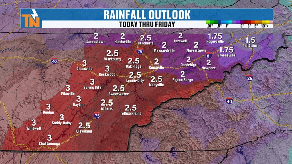
Rainfall Outlook: Much Needed for Drought
Over the next 7 days:
- 1 to 2 inches likely
- Isolated spots could see up to 3 inches
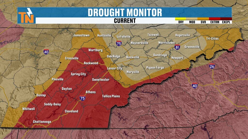
This is very beneficial rain as drought conditions continue to expand across the region.
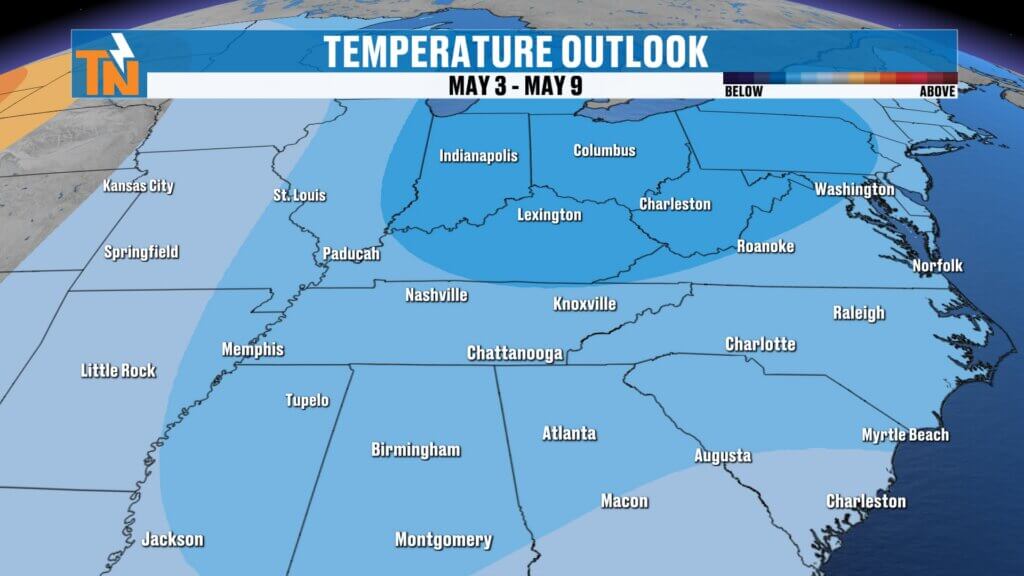
Temperature Trend: Cooling Late Week
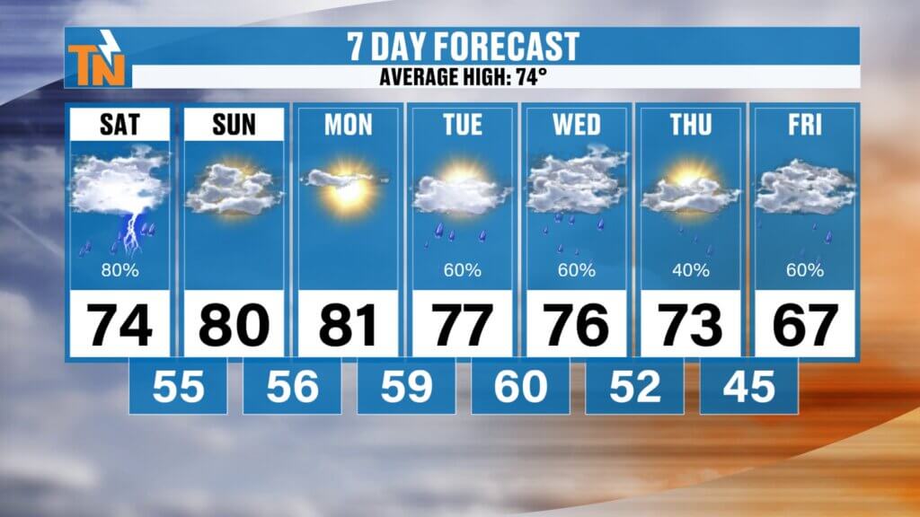
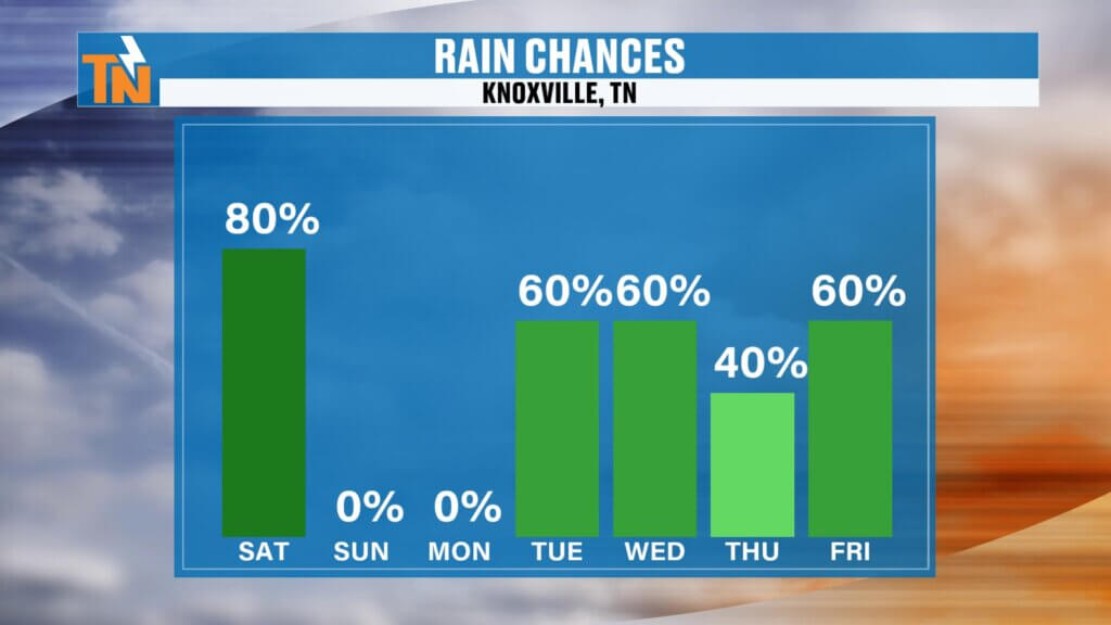
- Saturday: 74° with showers
- Sunday: 80° and sunny
- Monday: Low 80s
- Tuesday–Wednesday: Mid to upper 70s
- Friday: Potential drop to upper 60s
We’re watching a shift toward below-average temperatures by the end of next week.
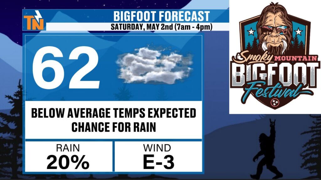
Bigfoot Festival Preview
Looking ahead to next weekend in Townsend:
- Bigfoot Festival: Saturday, May 2
- Early outlook: Cooler than average with a chance for rain
Still a week out, so expect adjustments—but definitely something to keep an eye on.
Final Thoughts
Today brings scattered showers but not a washout, Sunday looks fantastic, and next week delivers the rain we need—with cooler air eventually settling in.
Have a great Saturday, and don’t forget to check in with the East Tennessee weather app for the latest updates!