
Happy Thursday, everybody!
What a stretch of weather we’ve been enjoying across East Tennessee. If you noticed the deep blue skies yesterday, you’re certainly not alone. Many of you pointed it out on social media, and for good reason. The combination of low humidity, sunshine, and comfortable temperatures has created nearly perfect early June weather.
The good news? We get another day of it today.
The bad news? Summer is slowly working its way back into the Tennessee Valley.
Let’s break down what’s happening and what you can expect over the next several days.
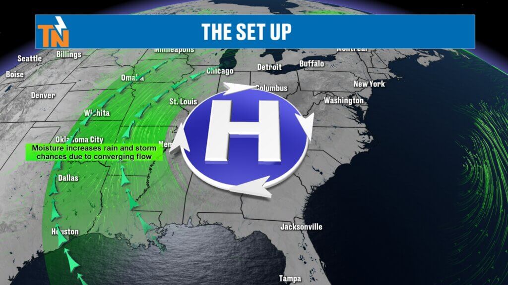
High Pressure Continues to Control the Weather
A strong ridge of high pressure remains centered over East Tennessee this morning, and that continues to be the driving force behind our beautiful weather.
High pressure promotes sinking air, which suppresses cloud development and storm formation. That’s why we’ve enjoyed several days of sunshine, low humidity, and virtually no rain chances.
As we head through the rest of the week, this ridge will slowly shift toward the southeastern United States and eventually off the Atlantic Coast. As that happens, winds around the system will begin pulling moisture back into East Tennessee from the south.
That means our comfortable weather won’t disappear immediately, but gradual changes are already beginning.

Another Comfortable Morning Across East Tennessee
Temperatures this morning are running just slightly warmer than yesterday, but it still feels fantastic outside.
Many communities are starting the day in the 50s, while a few locations have already climbed into the lower 60s.
What really stands out is the humidity.
Dew points remain in the 40s and lower 50s across much of the region, especially across the Tri-Cities, Rogersville, Greeneville, and other portions of Upper East Tennessee.
For June, that’s remarkably comfortable air.
Typically, by this point in the year, we’re already dealing with much stickier conditions. Instead, we’re getting one more taste of spring-like comfort before summer humidity begins to build.
Today’s Forecast: Sunshine and Seasonal Temperatures
The weather remains quiet today.
A weak disturbance will ride over the top of the ridge during the next 24 hours, but its impacts will be minimal. At most, it may produce a few passing clouds.
Otherwise, expect:
- Mostly sunny skies
- Light winds
- Comfortable humidity
- Dry conditions
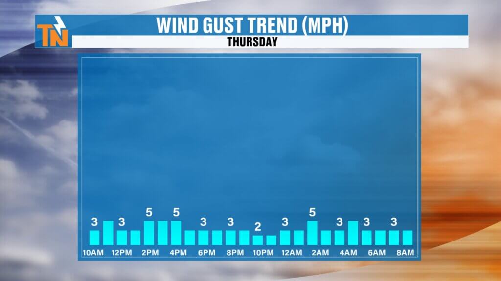
Because the center of high pressure remains nearby, wind speeds will stay relatively light throughout the day.
Afternoon temperatures will climb into the lower to middle 80s, which is right on par with average highs for early June.
Forecast highs include:
- Knoxville: 84°
- Chattanooga: Mid 80s
- Tri-Cities: Lower 80s
- Crossville: Upper 70s to lower 80s
- Smoky Mountains: Cooler with elevation
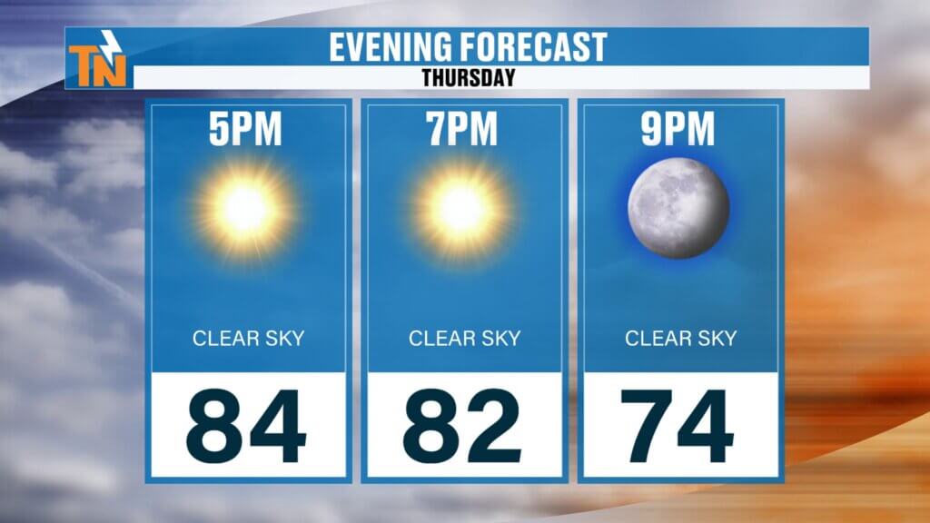
Another Great Evening Ahead
If you have outdoor plans this evening, take advantage of it.
Whether you’re heading to the ball field, enjoying dinner on the patio, taking a walk, or spending time outdoors with family, conditions will remain extremely pleasant.
Temperatures should still be hovering in the lower 80s around 7 p.m., with humidity levels remaining comfortable enough to truly enjoy being outside.
This is the kind of weather that reminds us why June can be one of the best months of the year in East Tennessee.
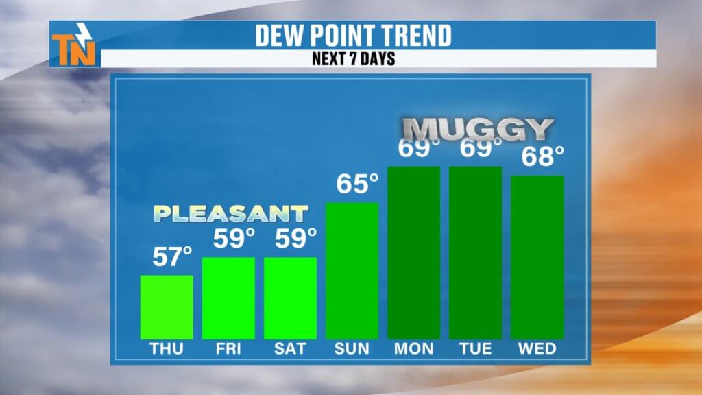
Humidity Gradually Returns This Weekend
While the weather remains pleasant through Saturday, subtle changes will begin taking place.
As high pressure shifts away from the region, winds will begin turning more southerly. That will allow Gulf moisture to gradually return to the Tennessee Valley.
The first thing you’ll notice won’t be rain.
You’ll notice the humidity.
Dew points will slowly climb Friday and Saturday before increasing more noticeably Sunday through the middle of next week.
As that happens:
- Mornings become less crisp
- Evenings feel warmer
- Haze begins returning to the atmosphere
- Skies lose some of that deep blue appearance
- The air starts feeling more “summer-like”
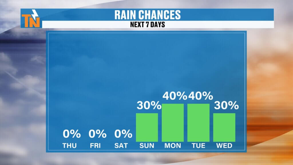
Rain Chances Return Next Week
With increasing humidity comes increasing moisture in the atmosphere.
While rain chances remain very low through Saturday, scattered showers and thunderstorms will begin returning Sunday and continue into next week.
The setup doesn’t currently favor widespread heavy rainfall.
Instead, this looks like a typical summertime pattern featuring:
- Pop-up afternoon showers
- Isolated thunderstorms
- Hit-or-miss rainfall
- Greater storm coverage over the higher terrain
Historically, the Cumberland Plateau and the Great Smoky Mountains tend to see the highest storm coverage during these types of summer weather patterns.
Most valley locations will likely experience a feast-or-famine setup where some neighborhoods receive rain while others remain completely dry.
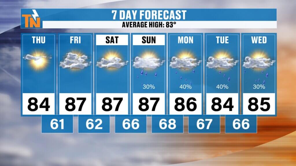
East Tennessee 7-Day Forecast
Thursday:
- Sunny and comfortable
- High: 84°
Friday:
- Mostly sunny
- Slightly warmer
- High: 87°
Saturday:
- Partly sunny
- Increasing humidity
- High: 88°
Sunday:
- Warmer and more humid
- Isolated afternoon thunderstorms
- High: 88°
Monday:
- Partly sunny
- Scattered afternoon storms
- High: 87°
Tuesday:
- Summer-like conditions
- Pop-up showers and storms possible
- High: 86°
Wednesday:
- Warm and muggy
- Scattered thunderstorms
- High: 85°
Long-Range Outlook for Mid-June
Looking beyond the seven-day forecast, the Climate Prediction Center continues to favor above-average temperatures across East Tennessee through at least the middle portion of June.
That means:
- More 80-degree temperatures
- Increasing humidity
- Typical summertime afternoon thunderstorms
- No signs of any prolonged cool spells
While some model guidance suggests rainfall may remain somewhat limited beyond next week, we’ll continue monitoring trends closely as we move deeper into the month.
Bottom Line
Enjoy the comfortable weather while it’s here.
Today through Saturday will feature sunshine, pleasant mornings, comfortable evenings, and near-average temperatures. By Sunday and early next week, humidity levels begin increasing, haze returns, and scattered afternoon showers and thunderstorms become more common.
Summer isn’t fully here yet, but it’s definitely knocking on East Tennessee’s door.