
Good morning and happy Wednesday!
Thanks for checking in with your East Tennessee weather update. A warm and dry pattern continues across the region, but changes are on the horizon as two disturbances move in over the next several days. While elevated fire danger remains a concern today and tomorrow, increasing rain chances this weekend will bring much-needed relief and a return to more seasonable temperatures.
Big Picture Weather Pattern
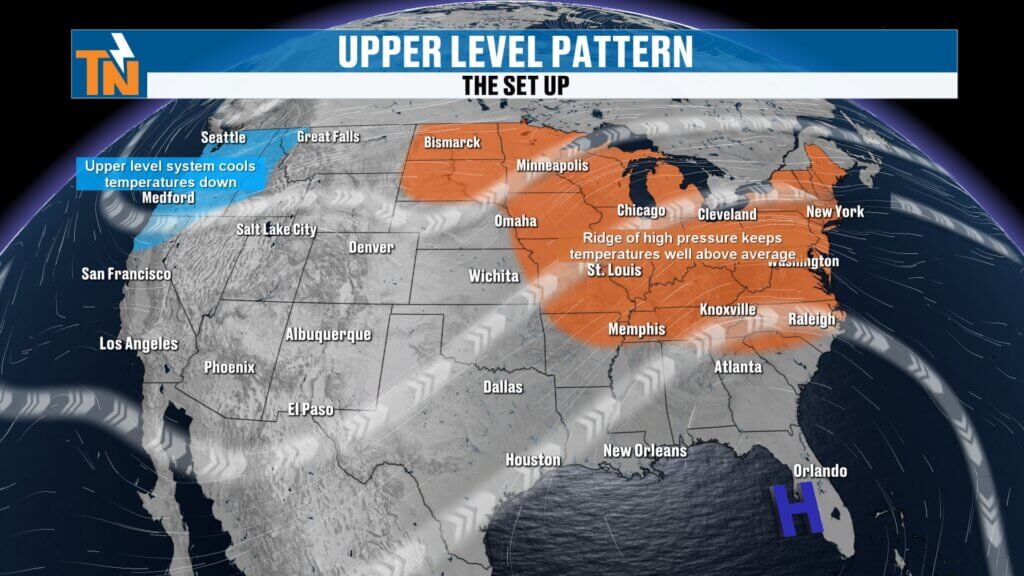
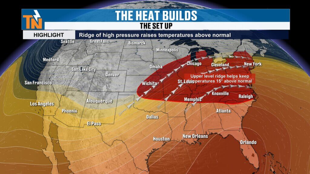
A strong ridge of high pressure dominating the eastern seaboard is the primary driver of our current weather.
- Temperatures are running about 15 degrees above average.
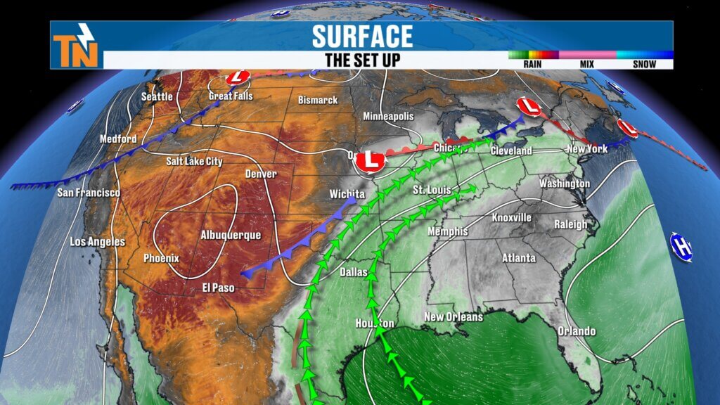
- Most of the atmospheric moisture remains west of the Mississippi River.
- Dry conditions and breezy winds are contributing to elevated fire danger across the Appalachian region.
This setup keeps East Tennessee warm and mostly dry through the end of the workweek.fire.
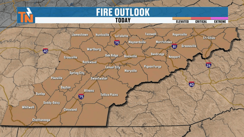
Elevated Fire Danger and Local Wildfires
Fire weather concerns remain significant.
- Elevated fire danger is expected today and Thursday.
- Breezy southwesterly winds and low relative humidity increase the risk of fire spread.
- Ongoing fires near House Mountain in northeast Knox County and in Polk County may continue to produce areas of smoke.
- Even contained fires can generate lingering smoke, especially with shifting winds.
Residents should avoid outdoor burning and remain cautious with any activities that could ignite a fire.This pattern keeps East Tennessee warm and predominantly dry through the remainder of the week.
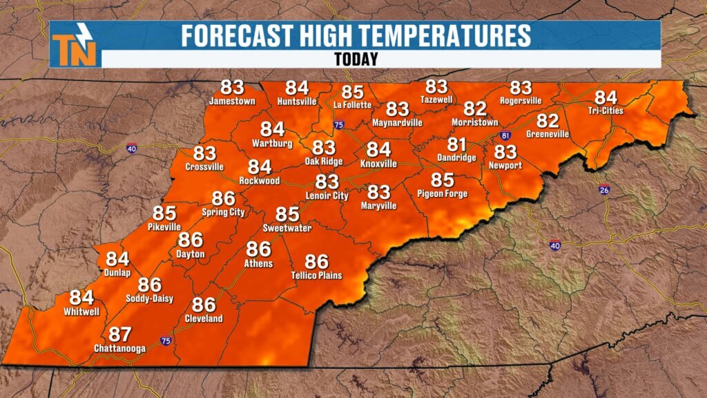
Today’s Forecast
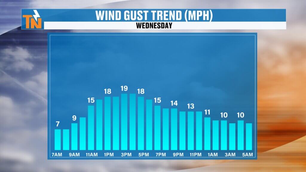
Expect another warm and breezy day across East Tennessee.
- Morning temperatures: 50s and 60s.
- Afternoon highs: Low to mid 80s.
- Sky conditions: Mostly sunny with some lingering smoke possible.
- Winds: Breezy, contributing to lower relative humidity and elevated fire danger.
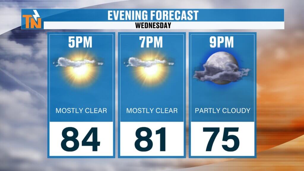
Evening Outlook
Conditions remain pleasant for outdoor activities.
Mild and comfortable with mostly clear skies.
Temperatures around 81 degrees by 7 PM.
Futurecast Timing
Early Next Week: Cooler and more seasonable temperatures settle in, with highs returning to the 60s.
Thursday Night into Friday Morning: First disturbance brings a slight chance of light rain.
Friday and Saturday: Mostly sunny, warm, and breezy.
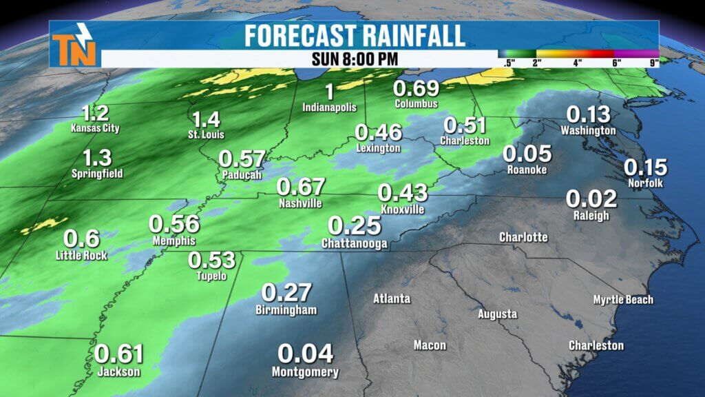
Saturday Night into Sunday Morning: Second disturbance brings widespread showers and a wet start to Sunday.

Bronco Super Celebration Forecast
The Bronco Super Celebration, celebrating its 20th anniversary in Townsend, Tennessee, will experience excellent weather conditions.
- Wednesday: Mid 80s and sunny.
- Thursday: Mid 80s and dry.
- Friday: Warm with sunshine.
- Saturday: Mostly dry and warm before rain arrives Saturday night.
Overall, the event should enjoy favorable weather, with only minimal impacts expected late Saturday.
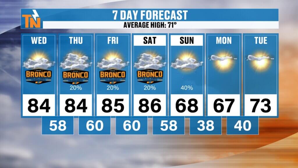
Temperature Trend
- Through Saturday: Summerlike warmth with highs in the 80s.
- Sunday through Tuesday: Cooler, with highs returning to the 60s.
- This shift provides a refreshing break from the recent heat.
Final Thoughts
East Tennessee will continue to experience warm and dry conditions for the next couple of days, with elevated fire danger remaining a key concern. Two approaching disturbances will introduce limited rainfall, with the most significant impacts arriving Saturday night into Sunday, followed by a return to more comfortable, seasonable temperatures.
Have a fantastic Wednesday, and thanks for checking in! Don’t forget to catch “Witcher’s One Minute Weather” on the East Tennessee Weather app for quick and convenient updates.