
Weekend Recap and What’s Ahead
Hope you had a great weekend!
We picked up some much-needed rain on Saturday—though not everyone got in on it—followed by a beautiful Sunday.
That quiet weather continues today, but changes are coming.
This week brings multiple rounds of rain, a risk for strong to severe storms, and a noticeable cooldown by the weekend.
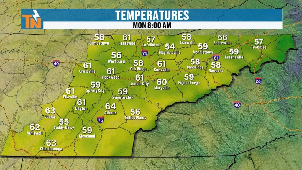
Monday Forecast: Calm Before the Storm
Today is the setup day:
- Mild morning with temperatures in the 50s and 60s
- Highs climbing into the upper 70s to low 80s
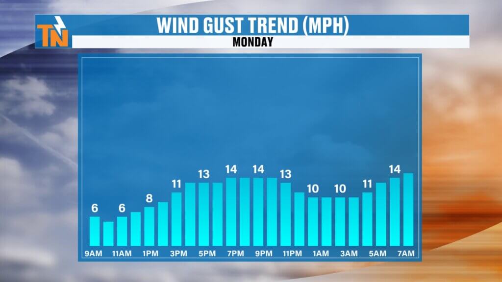
- Partly sunny with a light breeze
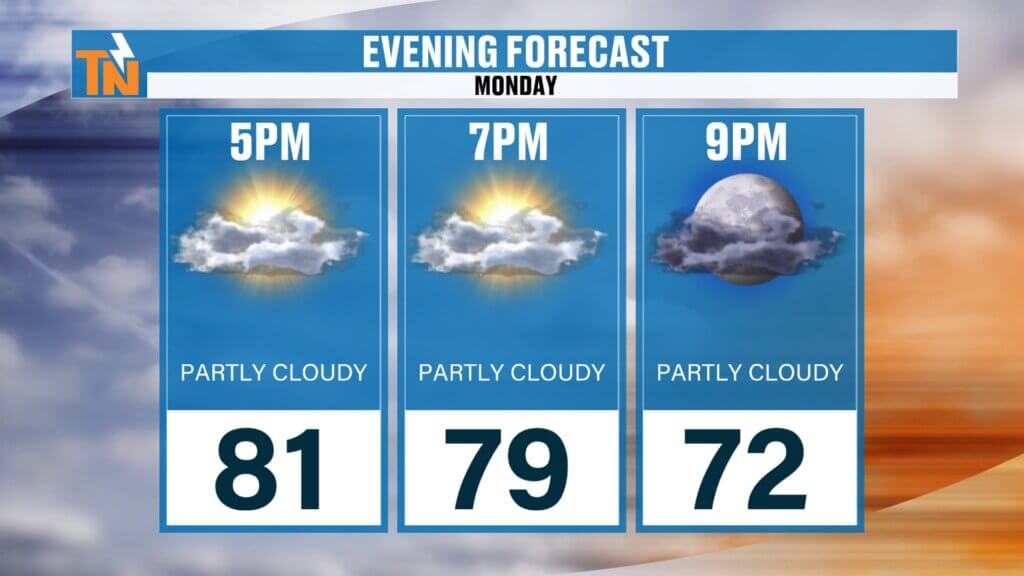
If you have plans this evening, you’re in good shape:
Temperatures in the 70s at 7–9 PM
Dry conditions through the evening
Big Picture Setup
A cold front is approaching, and it’s going to bring two rounds of active weather to East Tennessee.
- Round one: Early Tuesday morning
- Round two: Late Tuesday into Wednesday
Both rounds will bring showers and thunderstorms, with the potential for some stronger storms mixed in.
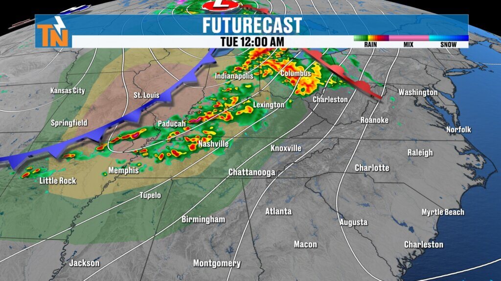
Round One: Early Tuesday Morning Storms
The first wave arrives overnight into early Tuesday:
- Timeline: 4 AM to 10 AM
- Heaviest impacts during the morning commute
- Expect wet roads and slower travel
The Storm Prediction Center has placed the region under a Level 1 risk for isolated strong storms.
Main impacts:
- Heavy rain
- Gusty winds
- Occasional lightning
Rainfall totals:
Around 0.25″ to 0.50″ from this first round
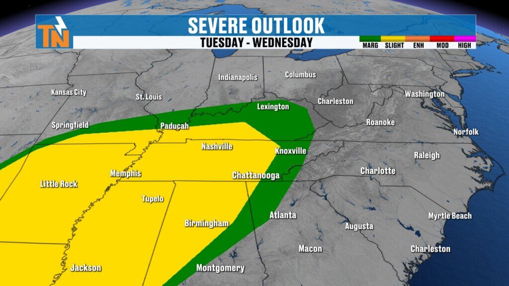
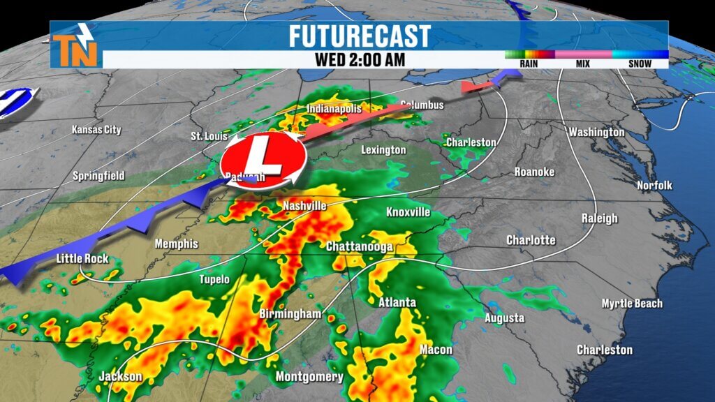
Round Two: Tuesday Night into Wednesday
The second, more impactful round arrives late Tuesday:
- Timeline: Tuesday evening through early Wednesday
- Additional showers and thunderstorms
- Stronger storms possible
Risk levels increase slightly with a Level 1 to Level 2 risk in place.
Primary threat:
- Damaging wind gusts
Rainfall:
- Additional moderate to locally heavy rain
- Southern Valley may see the highest totals
This is especially important as those areas are still dealing with ongoing drought conditions.
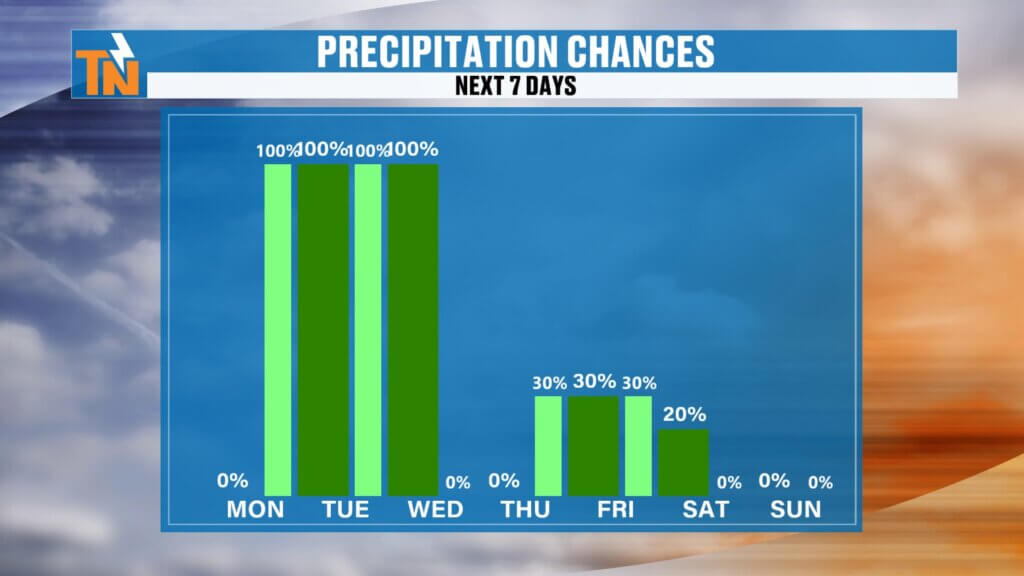
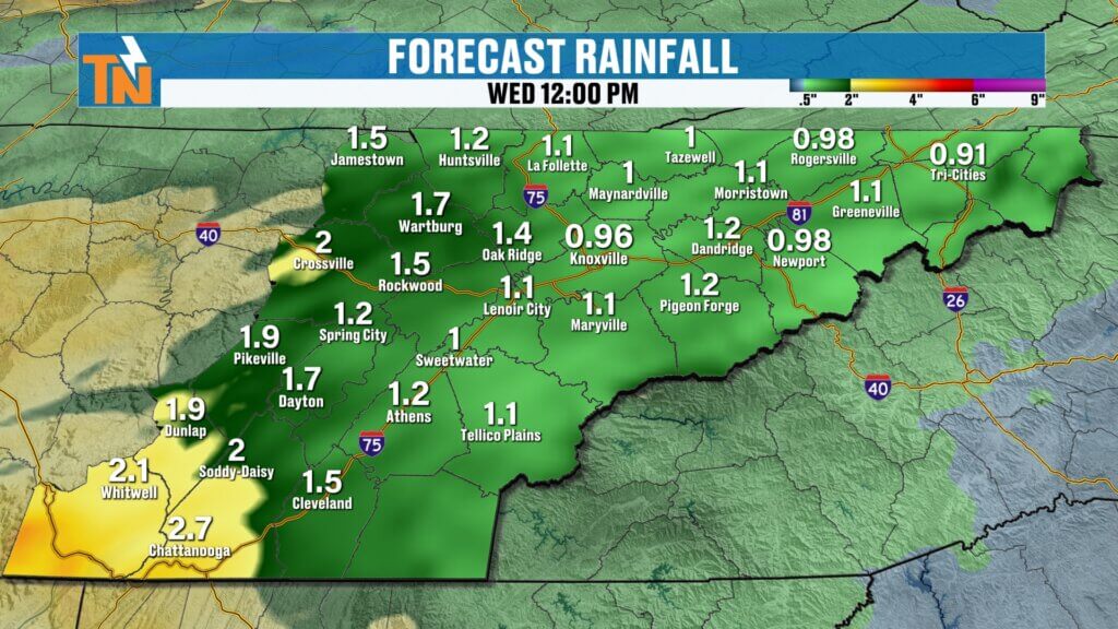
Rainfall Totals: Beneficial Moisture
Combined rainfall from both rounds:
- Widespread beneficial rain expected
- Totals will help ease drought conditions across East Tennessee
Everyone should see rain over the next couple of days.

Temperature Trend: Cooler Air Arrives
After the storms move out, cooler air settles in:
- Monday: 81°
- Tuesday: 75°
- Wednesday: 74°
- Thursday–Friday: Upper 60s
- Weekend: Mid to upper 60s
That puts us slightly below average heading into the first weekend of May.
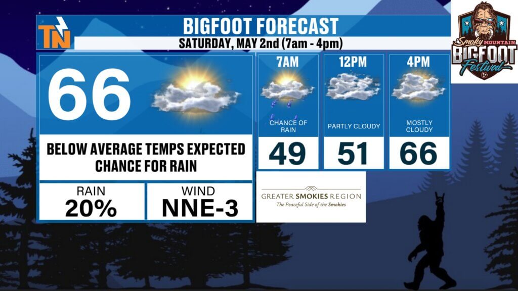
Bigfoot Festival Preview
Looking ahead to Saturday in Townsend:
- Bigfoot Festival: 7 AM to 4 PM
- Highs around 66°
- Morning temps in the 40s
- Slight chance for rain
There’s even a small chance for patchy frost in colder spots early this weekend.
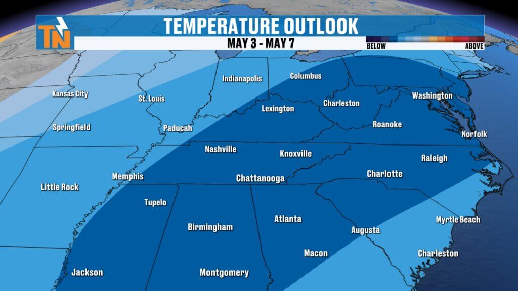
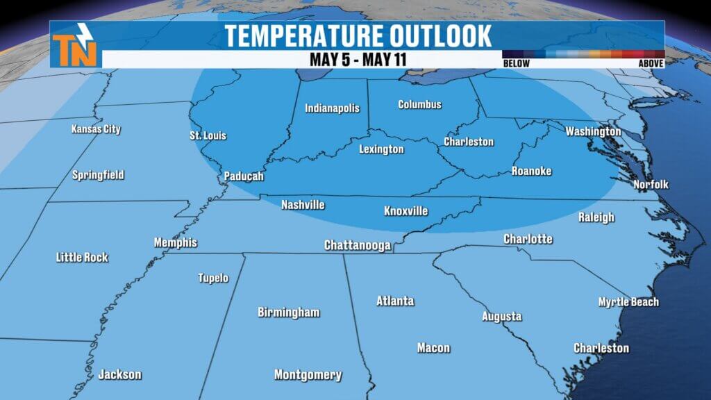
Longer Range Outlook
- Cooler pattern may linger into early May
- Temperatures could stay below average for the first week or two
- Rain chances taper off after midweek
Final Thoughts
Today is your quiet weather window before things turn active. Expect a soggy Tuesday morning, another round of storms late Tuesday, and then a shift to cooler, more comfortable air.
Make sure you’re weather-aware for the Tuesday morning commute and again Tuesday night.
Have a great Monday, and don’t forget to track it all on the East Tennessee weather app.