
Published: Monday, November 9, 2026 | By Meteorologist Mike Witcher | eastTNweather
Good morning, East Tennessee, and thanks for checking in on this Monday, November 9th, 2026. I sure hope you had a great weekend.
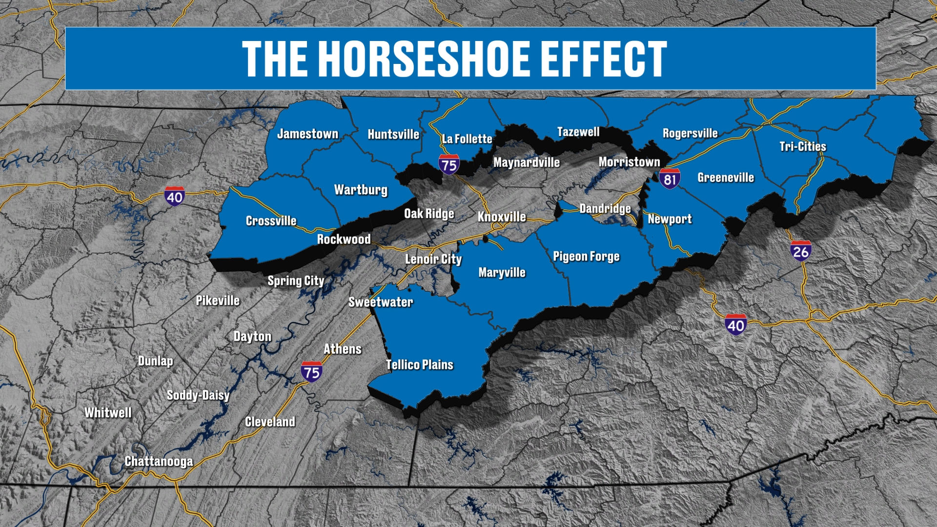
It was a chillier weekend, and the story today is the return of the horseshoe effect. The higher terrain around the Tennessee Valley is the part of our area with the better chance of seeing snow, and this week it just might get some.
Temperatures are going to come up a little bit here, but we’re still talking about a storm system that moves through on Wednesday, bringing us some rain showers.
We’re also talking about the potential for some mountain snow showers and some chillier weather as we wrap up the week and get into the upcoming weekend.
Maybe even a hard freeze for some of us, and the horseshoe effect is a big part of why. So we’re going to be talking much more about that.
A Peaceful View of the Smokies
We’ll start off first things first this morning with a view from the peaceful side of the Smokies. This is Townsend, and they had a Grits and Grains festival going on this past weekend. Hence all the tents there.
It was kind of cool to see all the folks enjoying the festival.
But there’s a little bit of frost out there to get the day started, and I think that’s going to be the story pretty much all week long.
Even more so as we get into the weekend, with the potential for a hard freeze in some spots.
Yesterday's Almanac
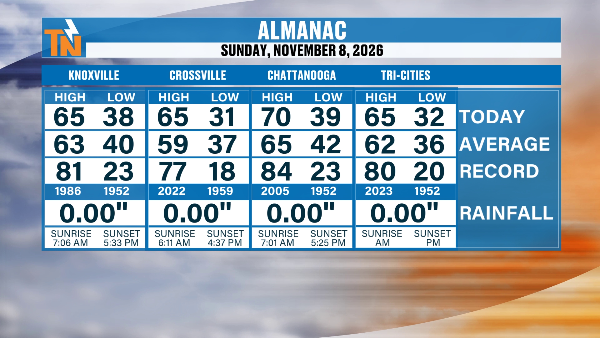
Yesterday we had temperatures in the 60s and 70s. Chattanooga made it into the 70s.
So it really turned out to be fantastic.
A Quiet, Chilly Start Monday
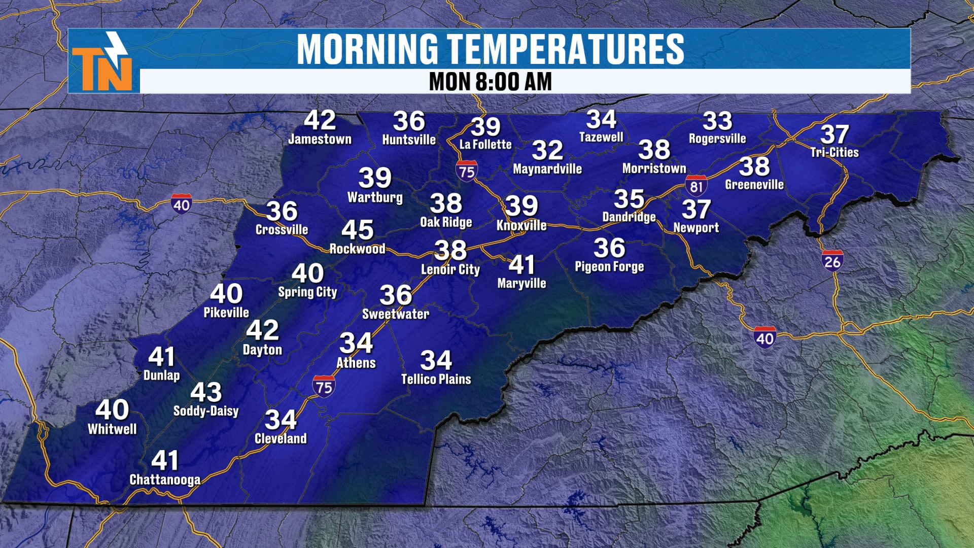
This morning we start off with temperatures in the 30s, and well, a few pockets of near 40° across the southern valley.
So it’s a really nice, quiet start to the day.
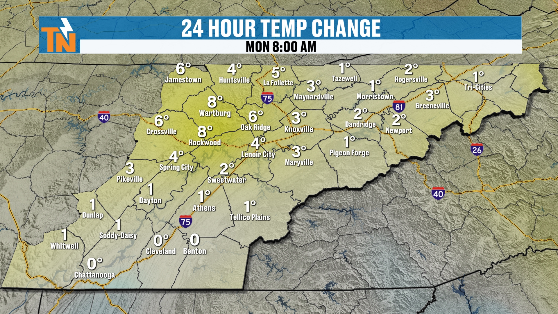
Temps are trending warmer this morning than they were yesterday.
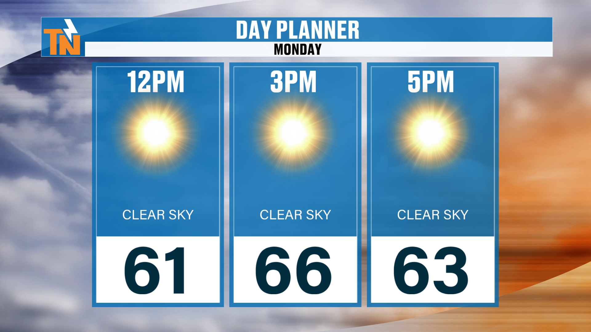
By lunchtime, we’re going to be in the low 60s. Afternoon temps, when the kids are heading home from school, will be in the mid 60s.
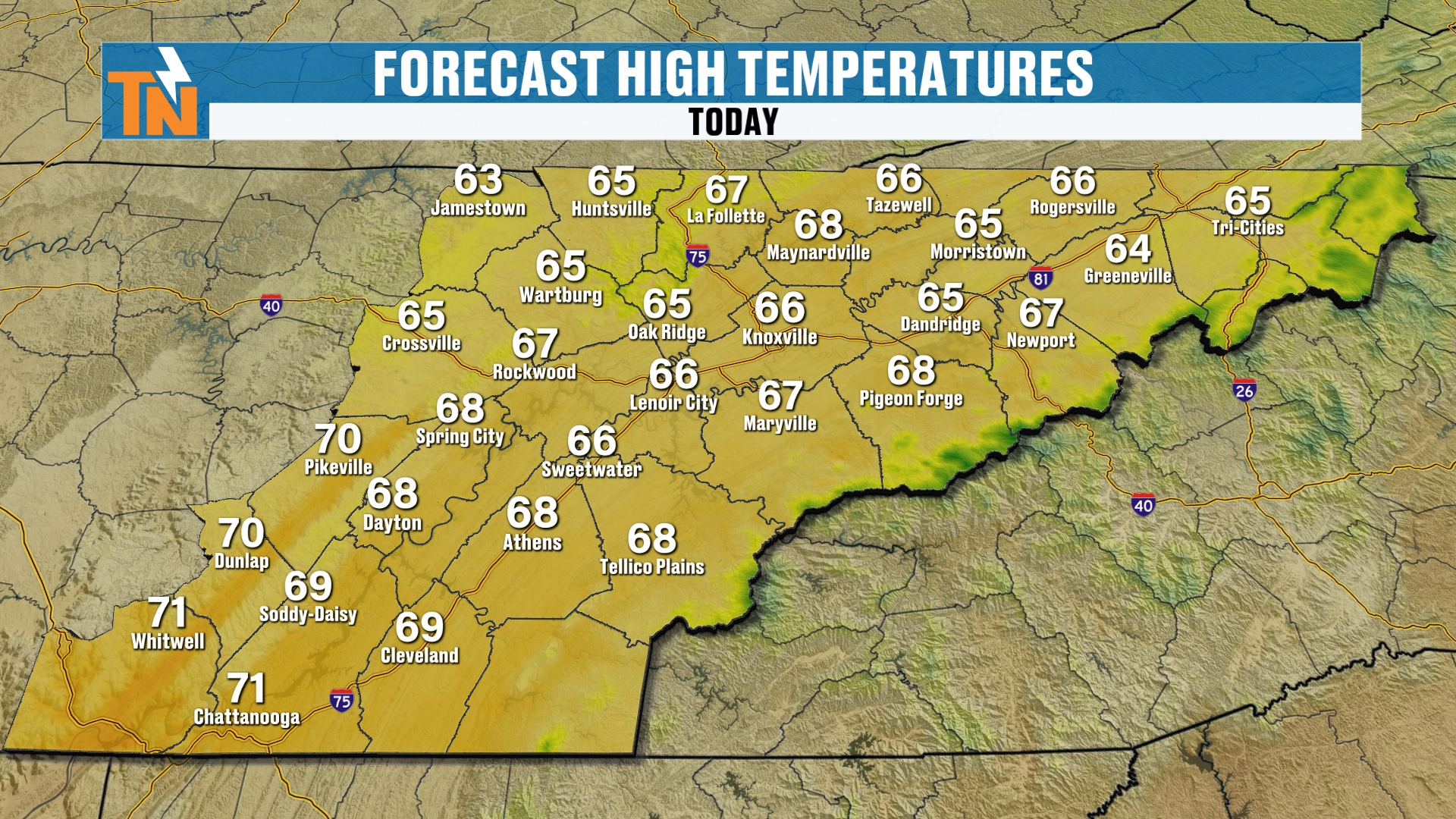
So again, a few pockets of 60s and 70s. Above average weather is expected here for the day today.
Wind Is Not an Issue Today
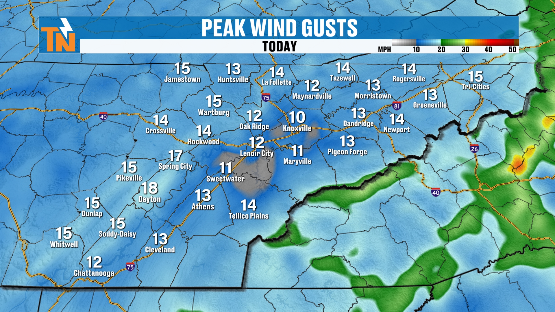
The wind is not going to be an issue today.
But the wind will gradually increase as we get into Wednesday, as that cold front comes through and ushers in that drier, cooler air mass from Canada.
Your Monday Evening Forecast
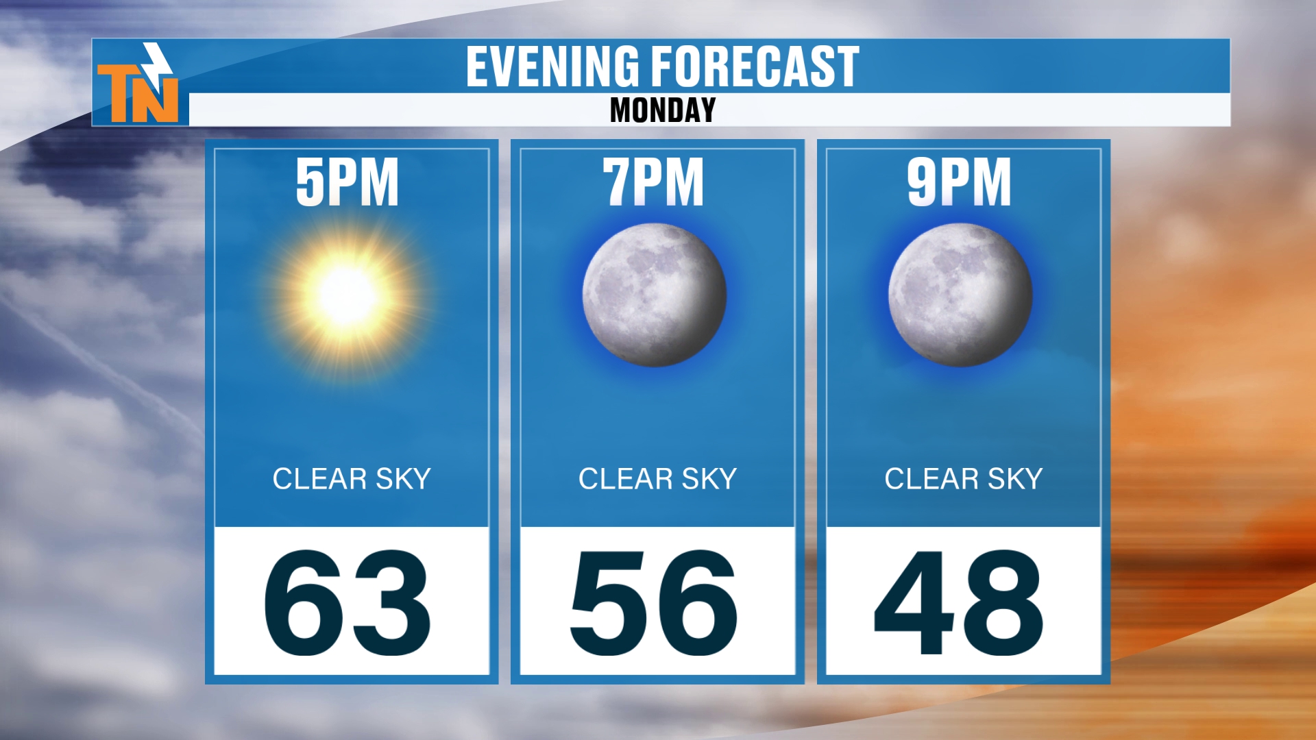
If you have evening plans here tonight, we’re at 63° by 5 PM and 56° by 7 PM.
The Deep Trough Sets Up Shop
Here’s that deep trough coming through during the middle part of the week. It’s going to set up shop and stick with us through the weekend.
That’s going to bring us some rain showers around the area.
It also has the potential of bringing us some snow showers, mainly across the higher terrain. A very strong upslope snowfall is possible.
We’re going to break all of this down, and that’s exactly what we’re talking about here this morning.
Colder Air Through the Weekend
Here’s our next shot of colder air. It’s going to be swinging its way on through, so we’re going to talk about the cold aspect of this first, and then we’ll talk about the potential for some precipitation.
It is still indicating that we’re going to get a good shot of colder air all the way through the weekend.
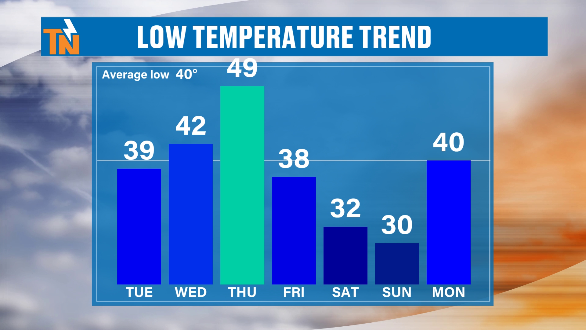
Okay, so low temperatures come up as the cold front approaches, and then they fall off.
Notice Friday, we’re down to about 38. But notice Saturday and Sunday. Those are going to be the coldest mornings, where we actually have the potential for a hard freeze.
Freeze and Hard Freeze Chances
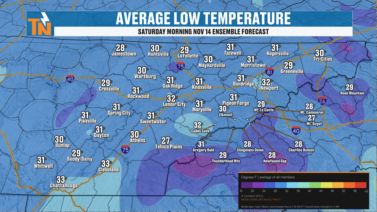
The average low temperature on Saturday by the ensembles is hovering right around 30°.
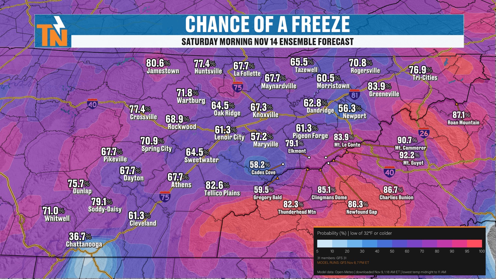
So when you look at our chance for a freeze, we’re still looking at about a 60 to 80% chance for a freeze.
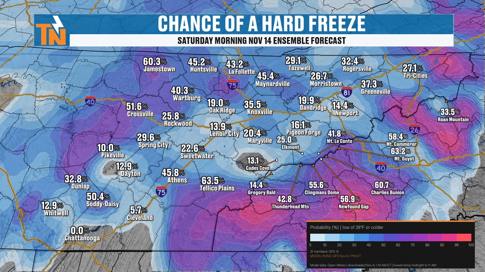
And a hard freeze looks possible across some of the higher terrain.
So again, it is still trending colder behind the system.
Rain Chances Midweek
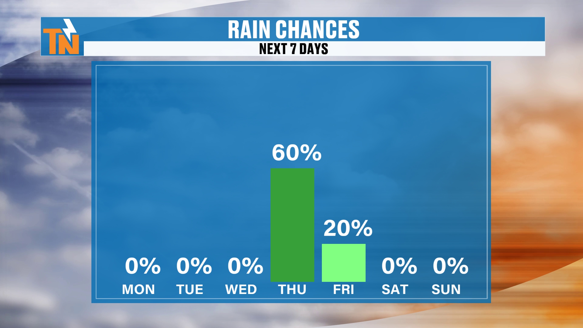
Now, precipitation-wise, we’re pumping it up to about a 60 to 80% chance of rain now for our Wednesday, Thursday time frame.
I keep saying Wednesday, but it’s Thursday.
The Horseshoe Effect: Mapping Out the Snow
Let’s map it out for you.
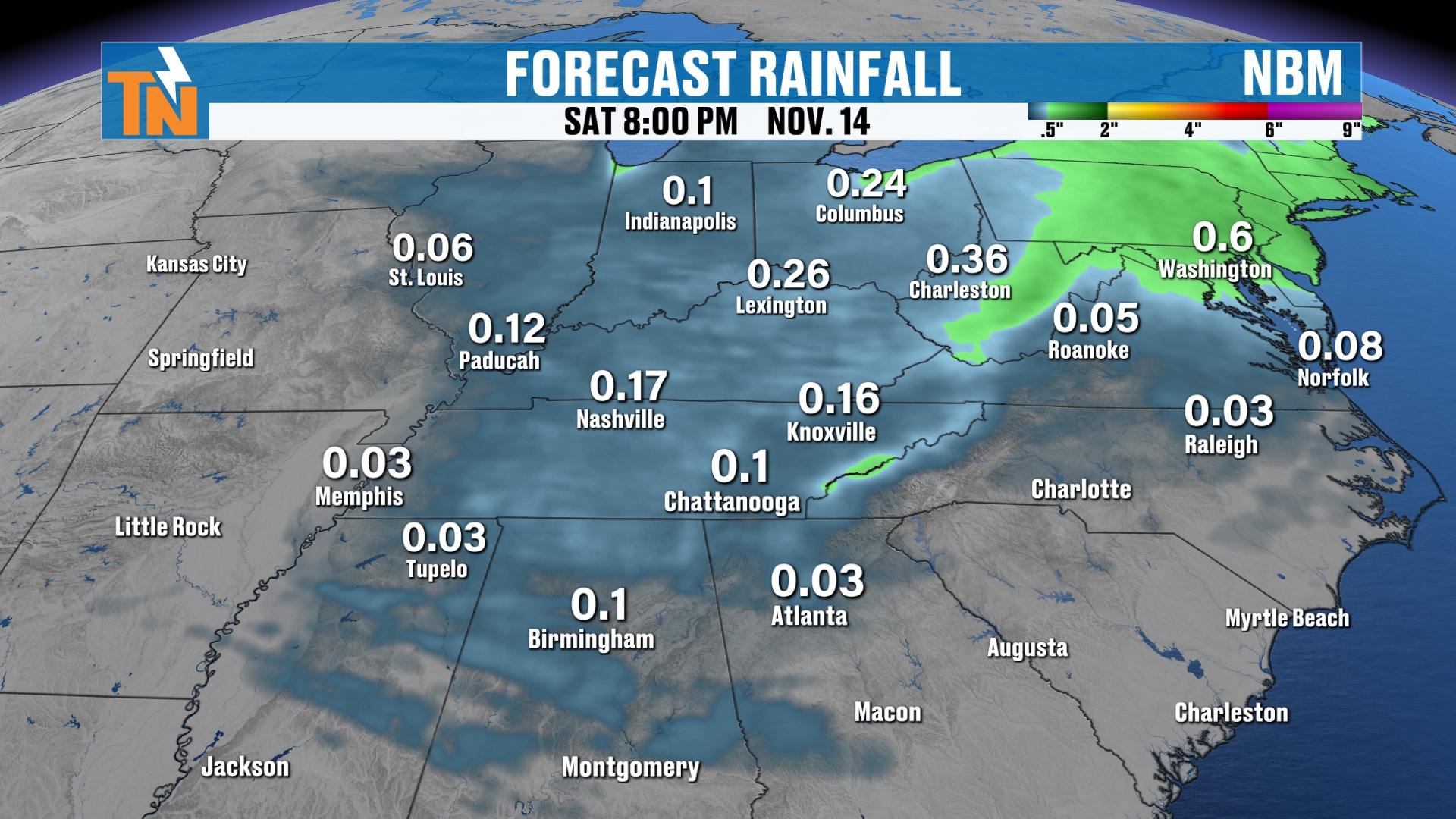
Here’s Wednesday at 5:00 in the evening. Here comes our cold front. It’s going to come through Wednesday night into the Thursday morning time frame.
But notice the wraparound moisture. Watch this.
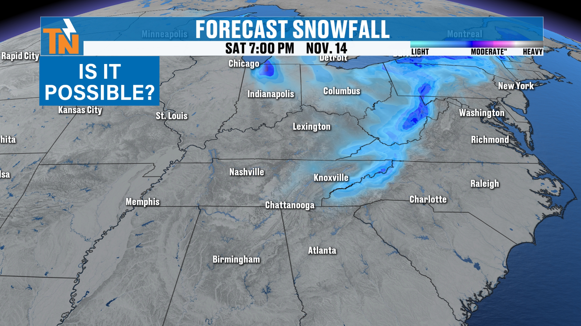
We’re going to see the blue showing up right there across the higher elevations. The Appalachian Mountains, the spine of the Appalachians I should say, are the ones that look like they’re going to really get the snowfall with this one.
Up towards West Virginia, we’ve got Snowshoe. We’ve got Mount LeConte and Clingmans Dome. Those areas are going to see some snow, likely, out of the situation.
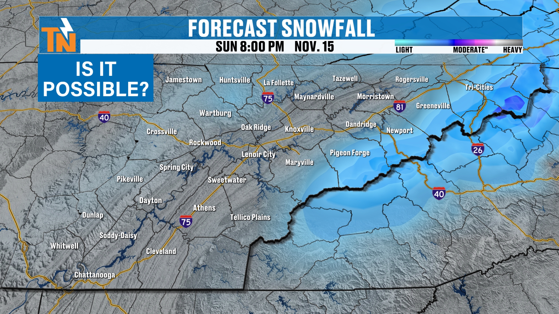
What about the plateau and the valley? Likely not the case. Maybe a few snowflakes across the Cumberland Plateau.
When we’re talking about the classic horseshoe, the horseshoe effect, that’s what we’re going to be talking about this winter. This is the higher terrain across the area, which has a better chance of seeing some snowfall in the wintertime.
Mountain Snow Timing and Amounts
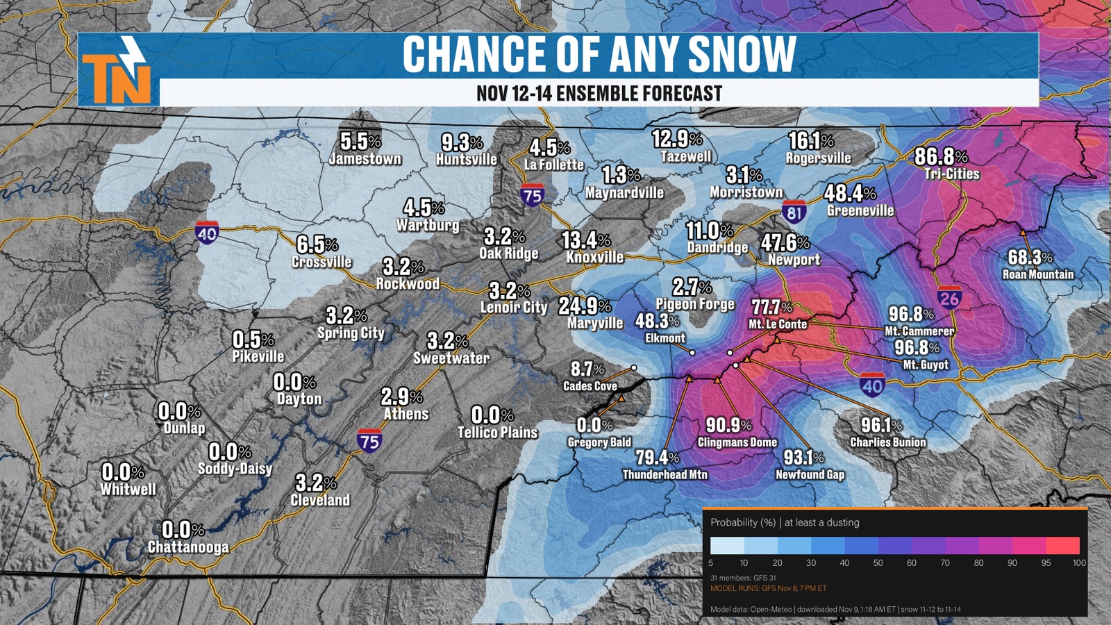
So, the probability of snowfall Thursday night at 7:00. It may start to increase Thursday night into Friday morning, the chance for snow anyway across the mountains.
And that’s going to be the story all day Friday across the highest peaks.
Then as we get into Friday into Saturday, we’ll start to lose that chance, and the snow machine kind of quiets down and comes to an end.
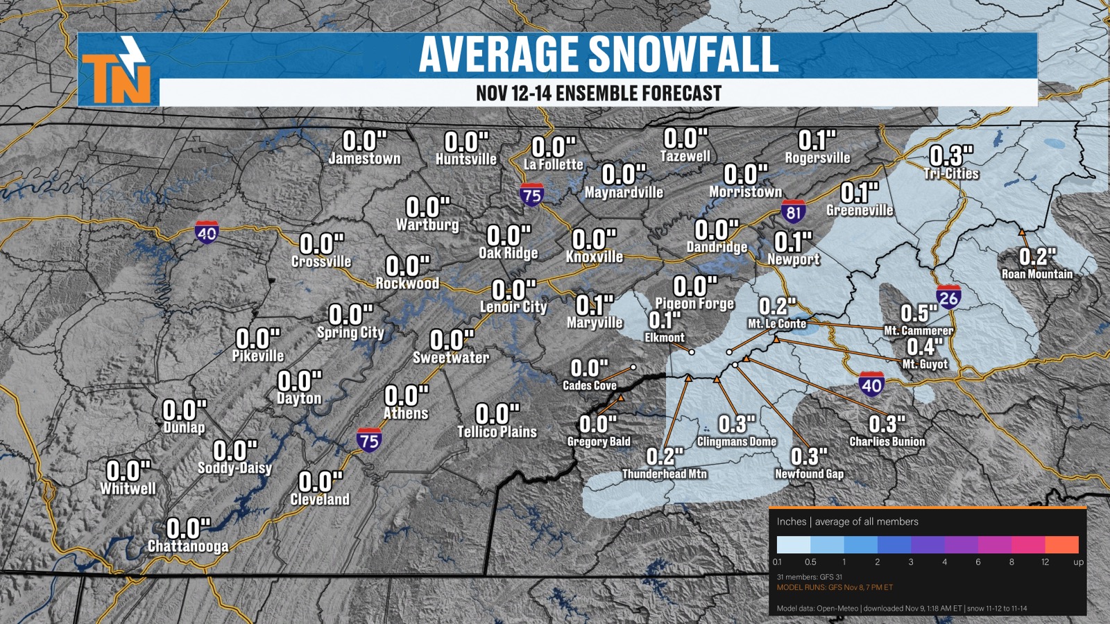
So, any chance of snow? The ensembles for the 12th through the 14th are picking up on a good shot for some snowfall to occur across the mountains.
On average, about a half an inch of snowfall is looking more probable than anything else.
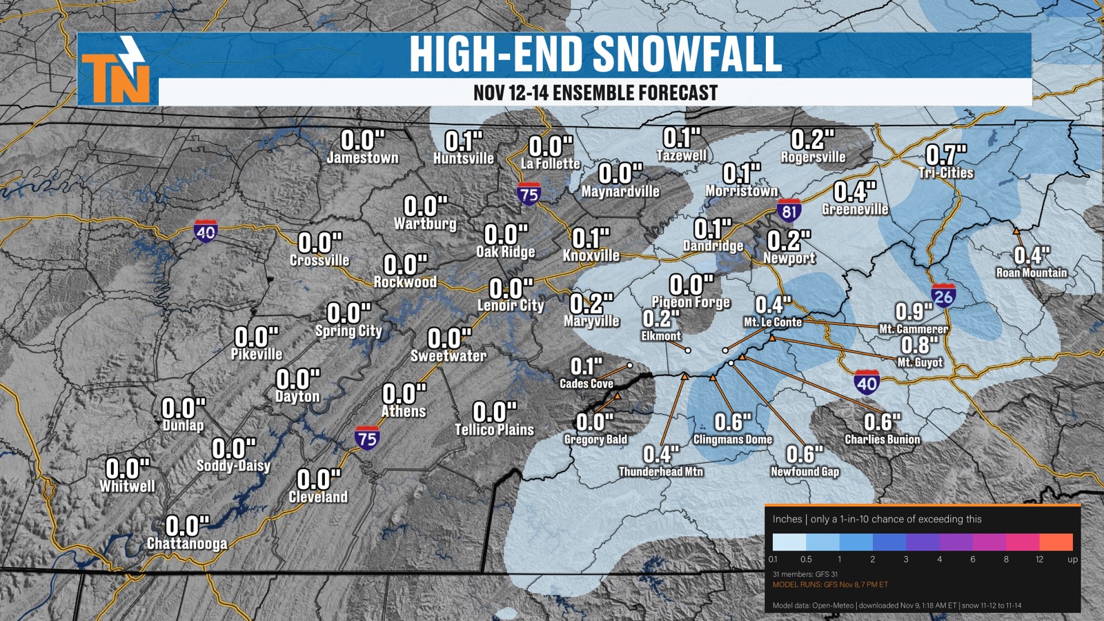
But we could potentially see maybe upwards of about an inch of snowfall.
Colder and Drier Behind the System
We are going to see some precipitation out of this system, which is good, because when we look above and beyond the 7-day forecast, we are looking at relatively drier than average conditions.
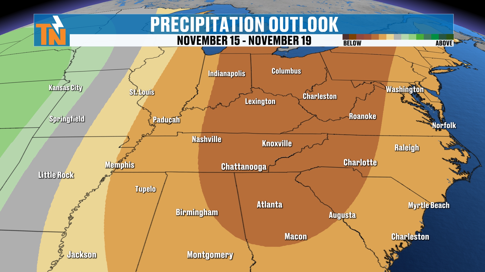
So we’re going to be trending colder and drier than average back behind the system.
Your 7-Day Forecast
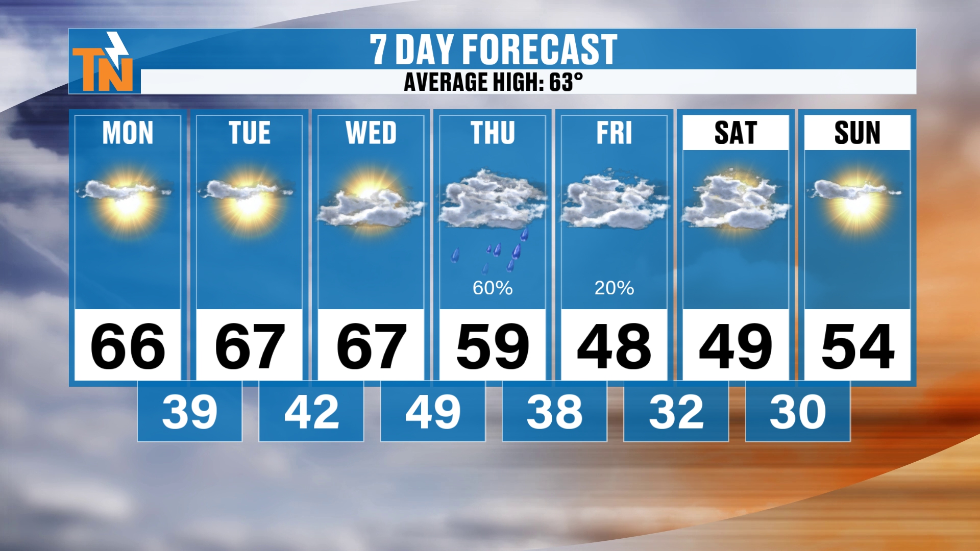
Here’s your 7-day forecast. We’re going to be in the upper 60s today, Tuesday, and Wednesday.
Then we drop into the 50s on Thursday and the 40s on Friday. Saturday and Sunday, we’re going to be in the 40s and 50s.
And those temps come back into the 60s as we get into next week.
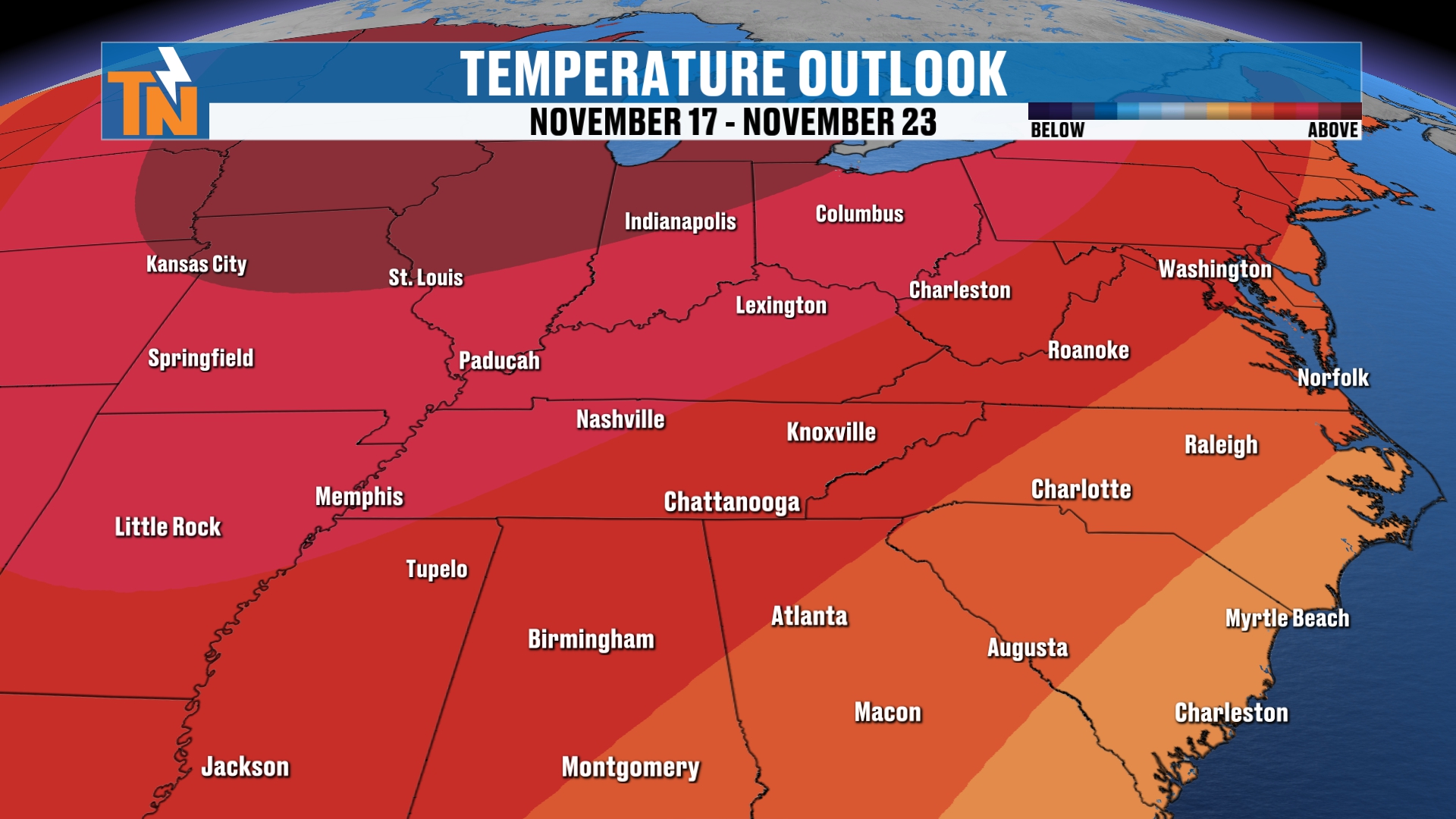
Above and beyond the 7-day forecast, the Climate Prediction Center has been predicting the potential for above average temperatures as well.
Bottom Line
MONDAY: Chilly start with frost and some fog, then upper 60s. Low 60s by lunchtime, mid 60s when the kids head home. Wind is not an issue. 63° at 5 PM, 56° at 7 PM.
TUESDAY: Upper 60s. Quiet.
WEDNESDAY: Upper 60s. The wind gradually increases as the cold front comes through. Rain showers arrive Wednesday into Thursday.
THURSDAY: 50s. A 60 to 80% chance of rain as the front moves through Wednesday night into Thursday morning. Snow showers possible across the mountains Thursday night.
FRIDAY: 40s. A chance of snow across the highest peaks all day, with an upslope snowfall possible. Low around 38°.
SATURDAY: 40s and 50s. The snow machine quiets down. Coldest morning with lows near 30° and a 60 to 80% chance of a freeze. A hard freeze is possible across the higher terrain.
SUNDAY: 40s and 50s. Another cold morning with a potential hard freeze in some spots.
NEXT WEEK: Temperatures come back into the 60s, and the Climate Prediction Center is predicting the potential for above average temperatures.
That’s kind of the story. We are looking at that midweek storm to come on through. This morning we’re starting off with a little bit of frost around the area, and some fog and some frost have developed. I think that’s going to be the story all the way through the week and even more so into the upcoming weekend.
I sure hope you have a great day.
Don’t forget to LIKE, SHARE, SUBSCRIBE to this YouTube video and this channel itself. It really helps things out.
If you like what I’m doing here with East Tennessee weather, giving you these long range forecasts and really walking you through the details, make sure you download my FREE eastTNweather app. It’s free for your cell phones, tablets, and of course your smart TVs on Roku and Amazon Fire.
Catch up on all of my recent daily forecasts anytime.
I’m Meteorologist Mike Witcher.
Welcome back to the work week, my friends. Happy Monday! Have a great day!
eastTNweather — Weather When You Want It.