
Published: Tuesday, November 10, 2026 | By Meteorologist Mike Witcher | eastTNweather
Good morning, East Tennessee! Thanks for checking in with your morning weather update on this November 10th, 2026. Meteorologist Mike Witcher here for you, and winter’s first warning shot is on the way.
We’re still talking about our midweek storm system that starts to really head our way tomorrow. Thursday is when it comes on through. Then as we get into the upcoming weekend, we’re talking about some tanking temperatures thanks to a big old deep trough.
The ultimate question, I know for some of you, is how much snowfall we actually see around town. Well, it does look like the opportunity for some snow has dwindled a little bit. But we are still looking at some snowfall for the Smoky Mountains.
So let’s walk through all of it, starting with the almanac.
Yesterday's Almanac
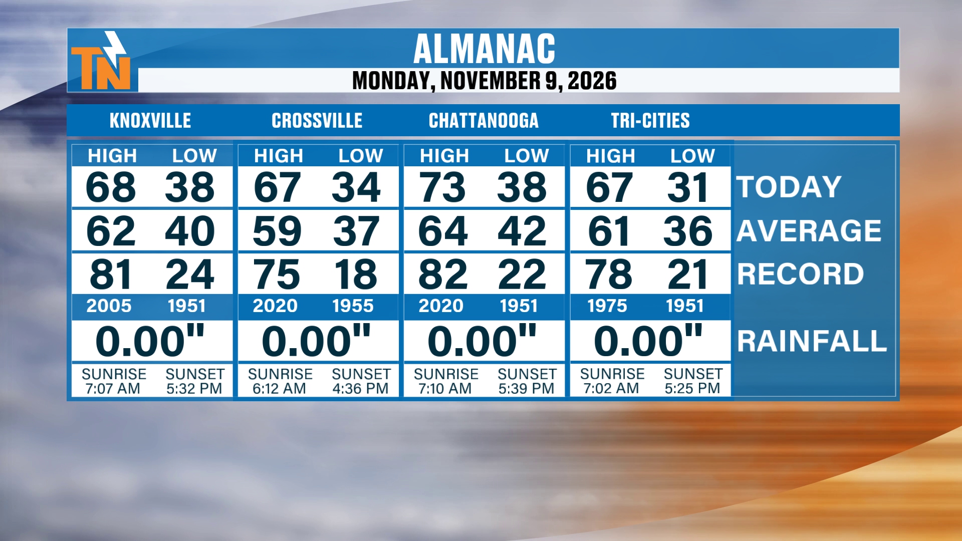
First things first, here’s the almanac from yesterday.
We topped out in the upper 60s to low 70s. So it trended to be on the warmer and above average side.
The almanac shows Knoxville with a high of 68 and a low of 38. Crossville reached 67 with a low of 34. Chattanooga topped out at 73 with a low of 38, and the Tri-Cities had a high of 67 and a low of 31. No measurable rainfall at any of the four.
Winter's First Warning Shot: The Big Deep Trough
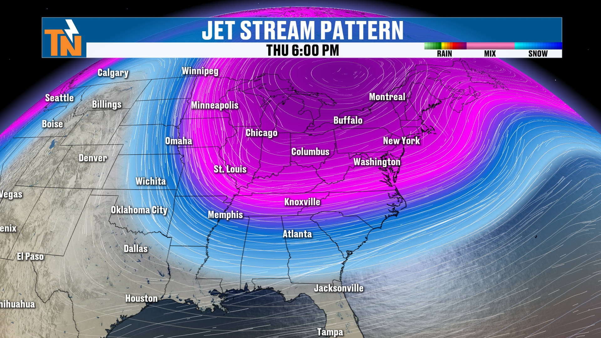
As we get into our Wednesday and Thursday, here comes this big old deep trough that’s going to spread some moisture around the area in the form of some light rain.
So we’re looking at a little bit of moisture. But some of that is going to be in the form of frozen precipitation, in other words some snow showers.
Notice it’s mainly across the higher terrain of the plateau, the classic horseshoe, if you will. And the Appalachian Mountains stretching all the way from Tennessee, North Carolina up into Virginia.
We’re going to walk you through all those details here.
Chillier Start With Some Fog
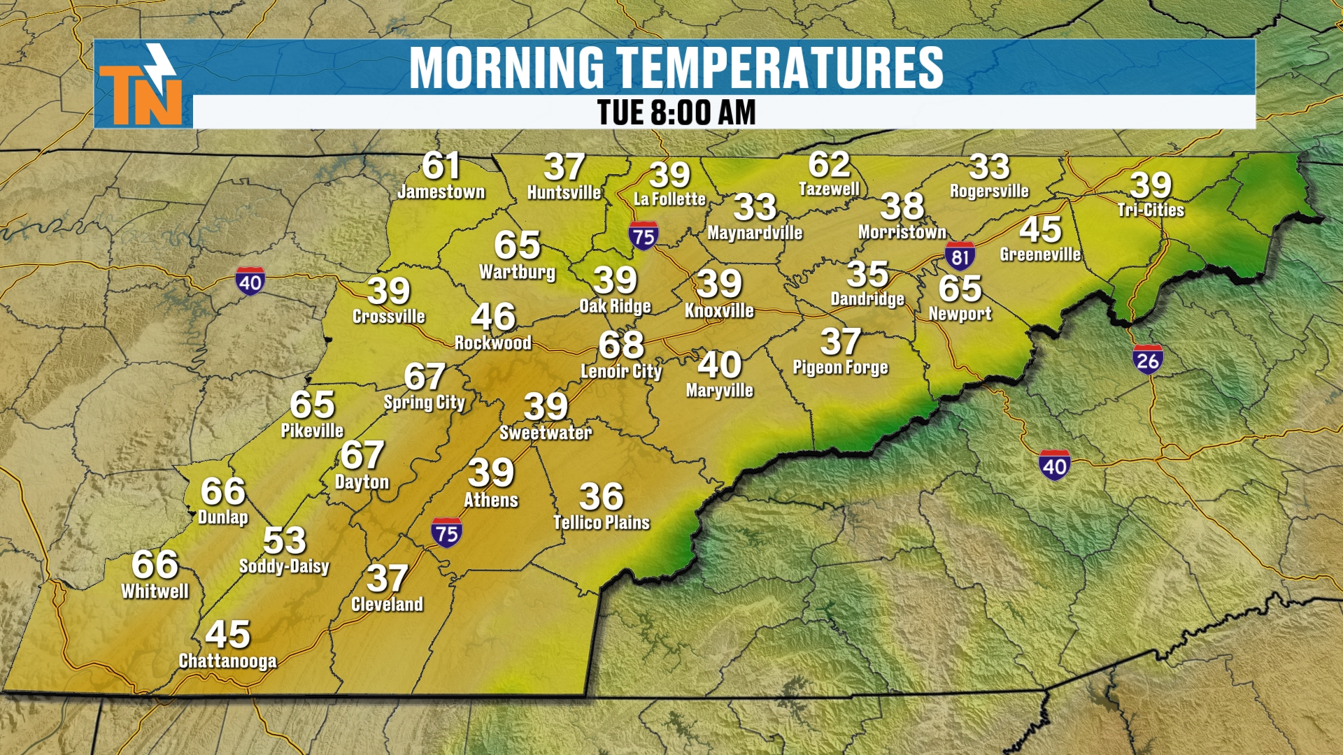
Right now, let’s start you off with low temperatures this morning. It’s a chillier start for sure. We’re in the 30s and 40s.
Most locations are trending a couple of degrees warmer than what we were yesterday.
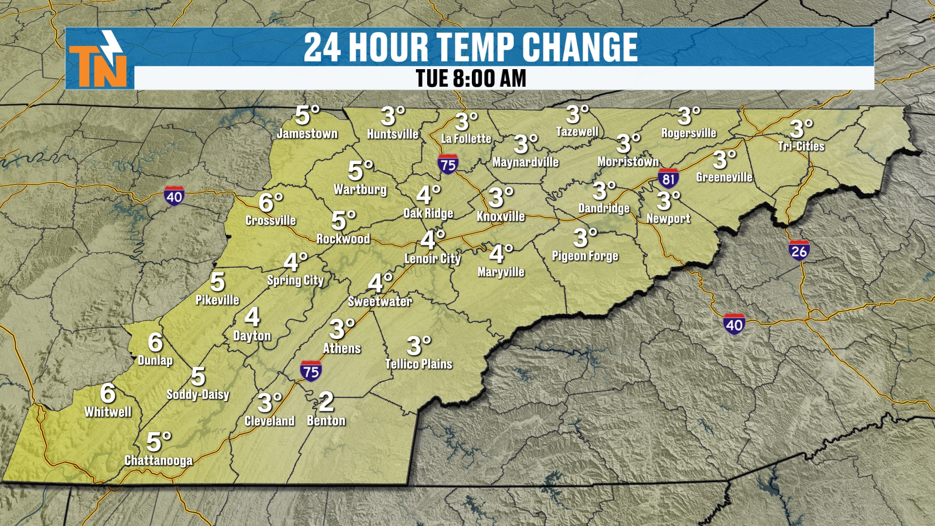
The 24 hour temperature change shows the same thing: a few degrees warmer than yesterday across the area.
We don’t have the frost necessarily forming this morning like we did the last couple of days. But we do have the fog that’s forming.
So if you’re watching this video forecast update early, just do travel safely in the fog.
Today: Back to the 60s and 70s
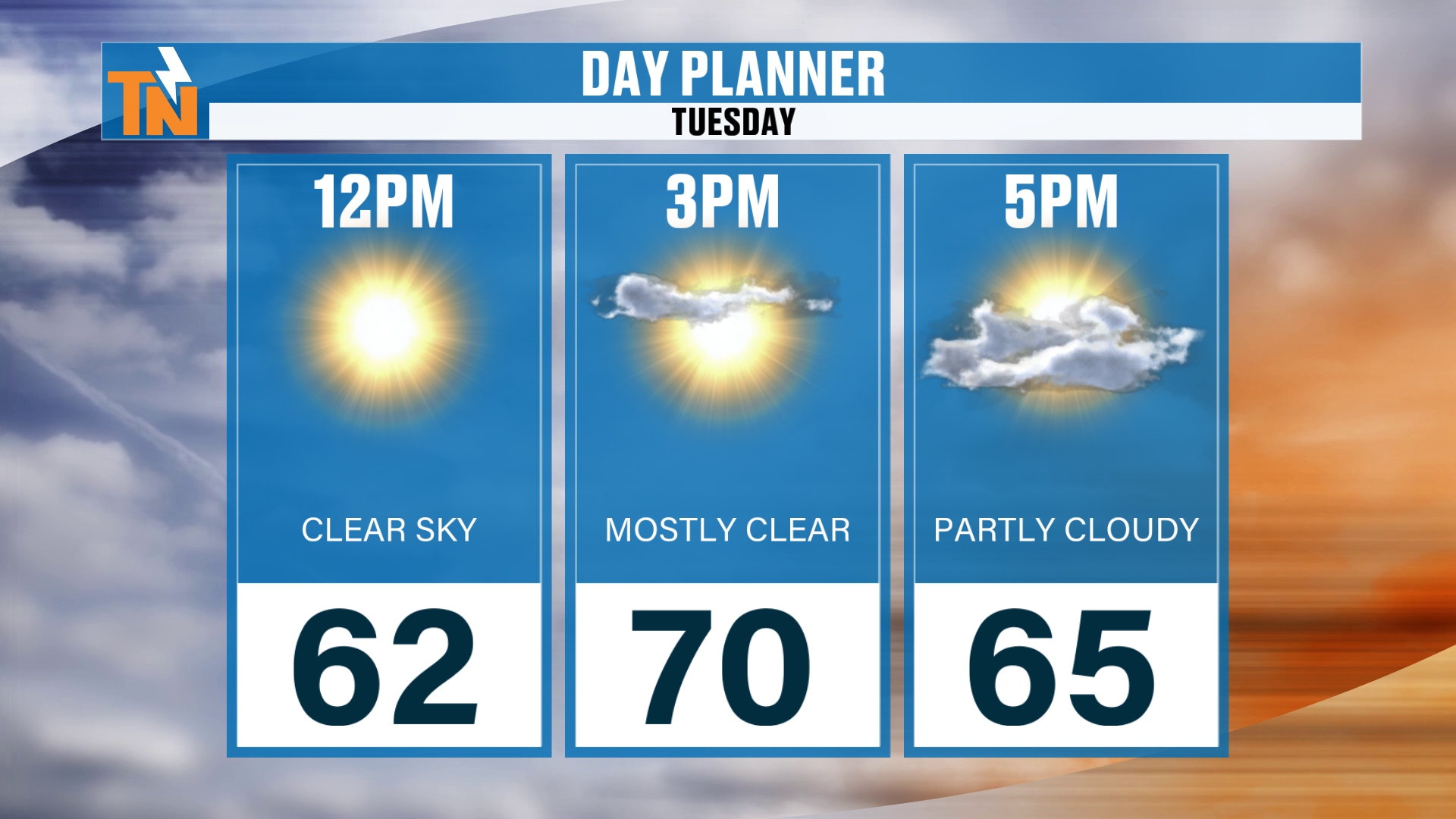
By lunchtime, the fog is going to burn off nicely and quickly, and we’re going to be in the low 60s. The day planner shows 62 at noon.
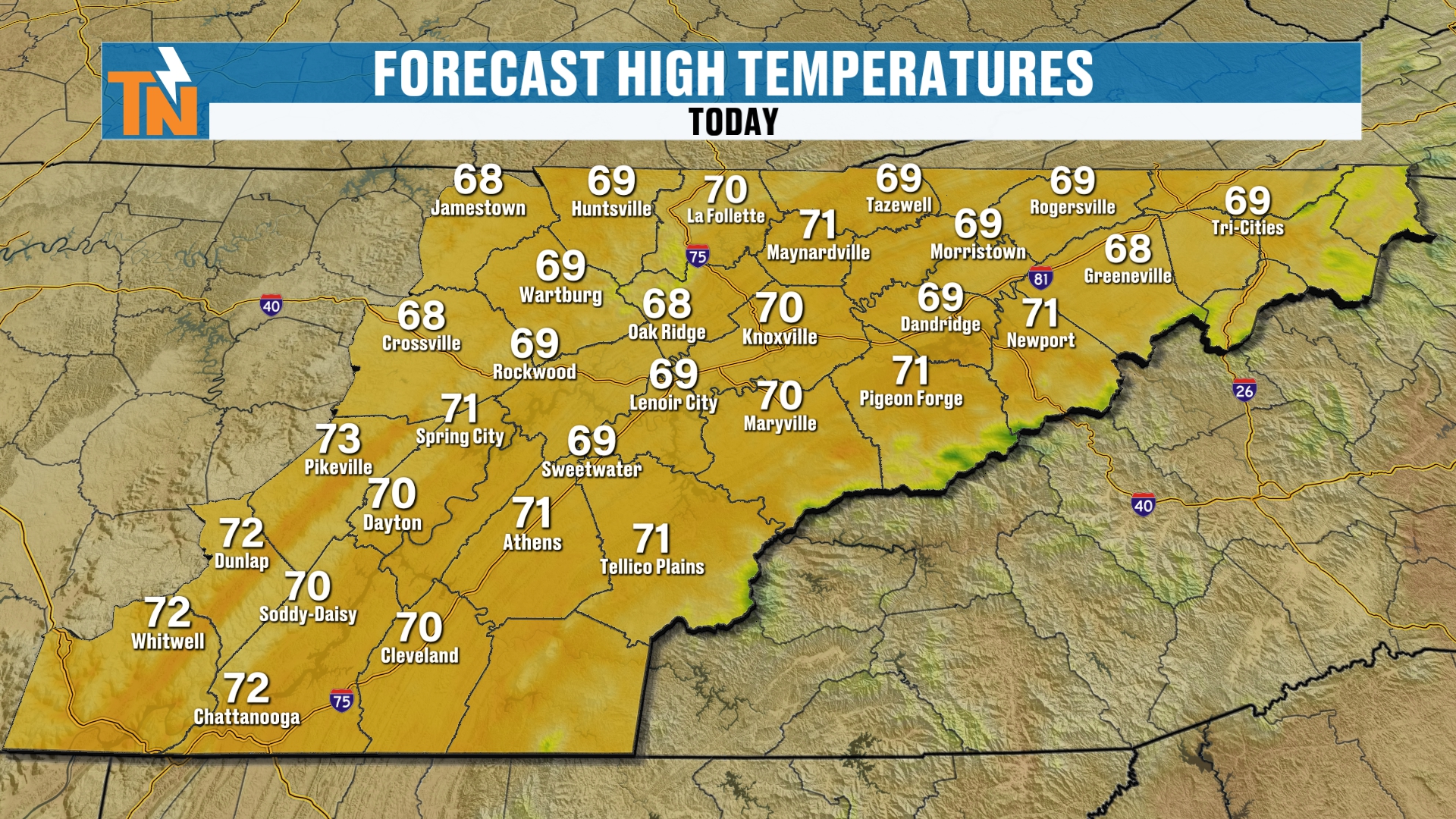
Forecast highs today are going to be a little bit warmer than yesterday. Upper 60s to low 70s. So again, that trend for above average weather continues.
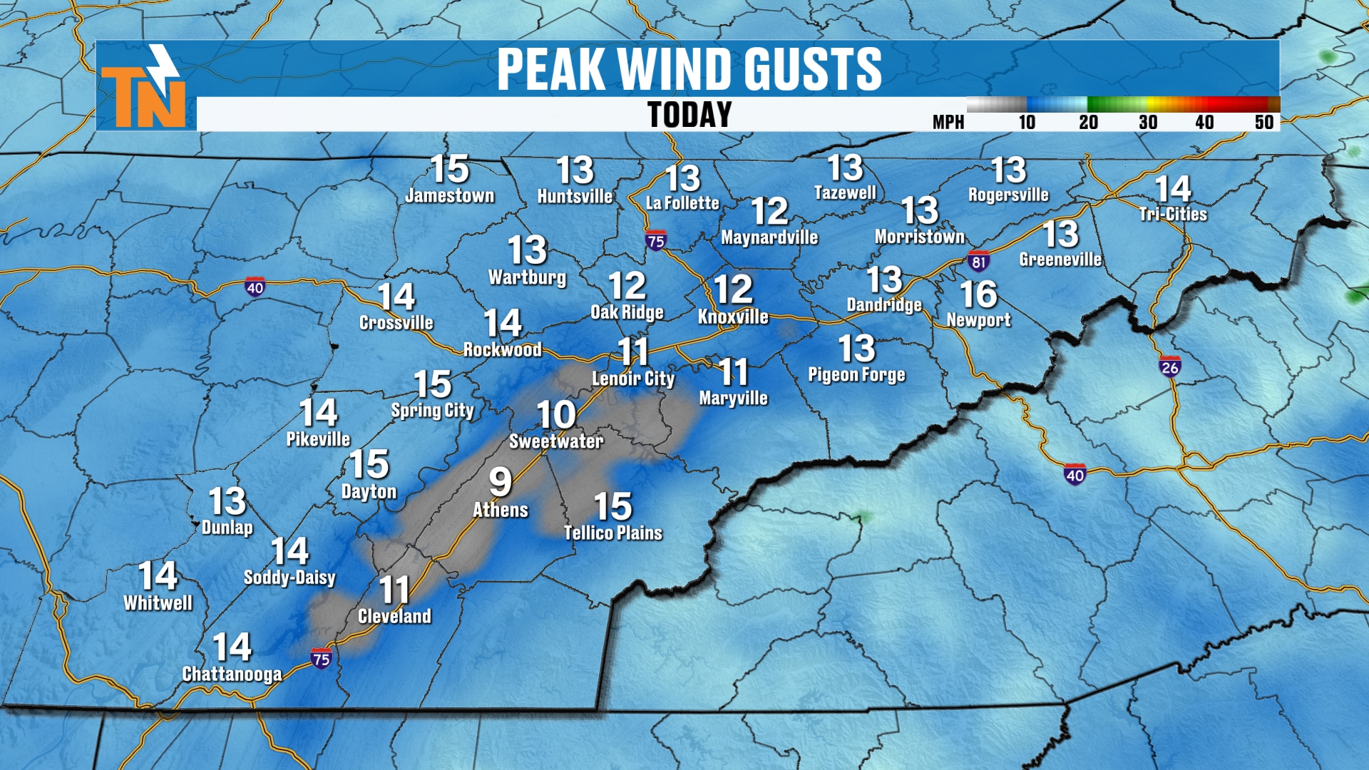
When it comes to the wind, it’s not going to be a big issue. Gusting to about 10 to 15 mph. That should be about the extent of it.
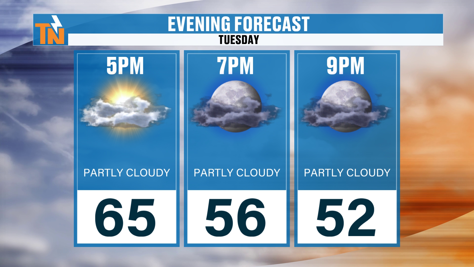
We’ll be down to about 56 degrees by 7 tonight. So if you have evening plans, enjoy it. It’s going to be a nice, cool, comfortable evening.
Of course, once the sun goes down, those temperatures drop pretty quickly.
The Trough: Coldest Air of the Season
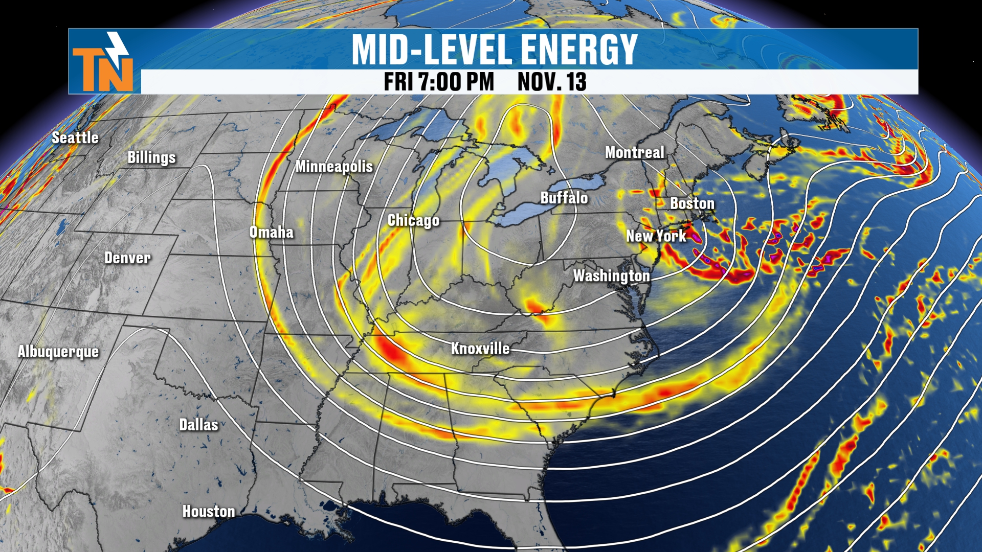
Speaking of dropping, we’re talking about a big old deep trough that’s dropping like it’s hot. Don’t let me do that again.
A big old deep trough is going to be spinning its way across the Great Lakes and the eastern seaboard. And this is going to bring in the coldest air of the season, along with all that precipitation we were just talking about.
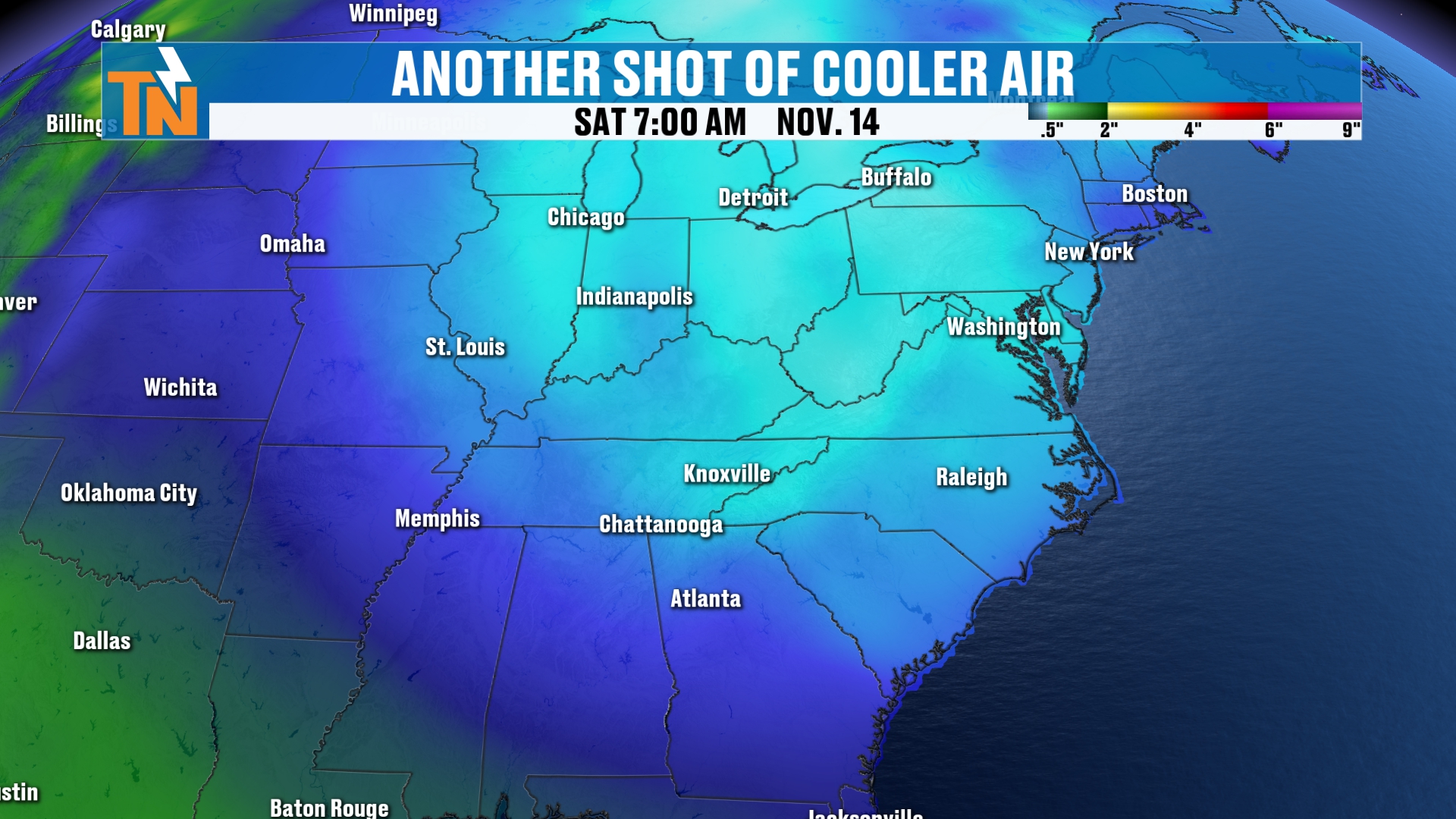
So let’s talk about the cold air for a second, because we do have the potential for a hard freeze as we get into mostly our Sunday morning.
That’s thanks to a reinforced shot of colder, drier Canadian air. So the dew points are going to continue to fall here through the weekend. The temperatures will continue to fall too.
And we’ll see a little bit of light snow developing across the highest peaks of the Smokies.
A Hard Freeze on Sunday Morning
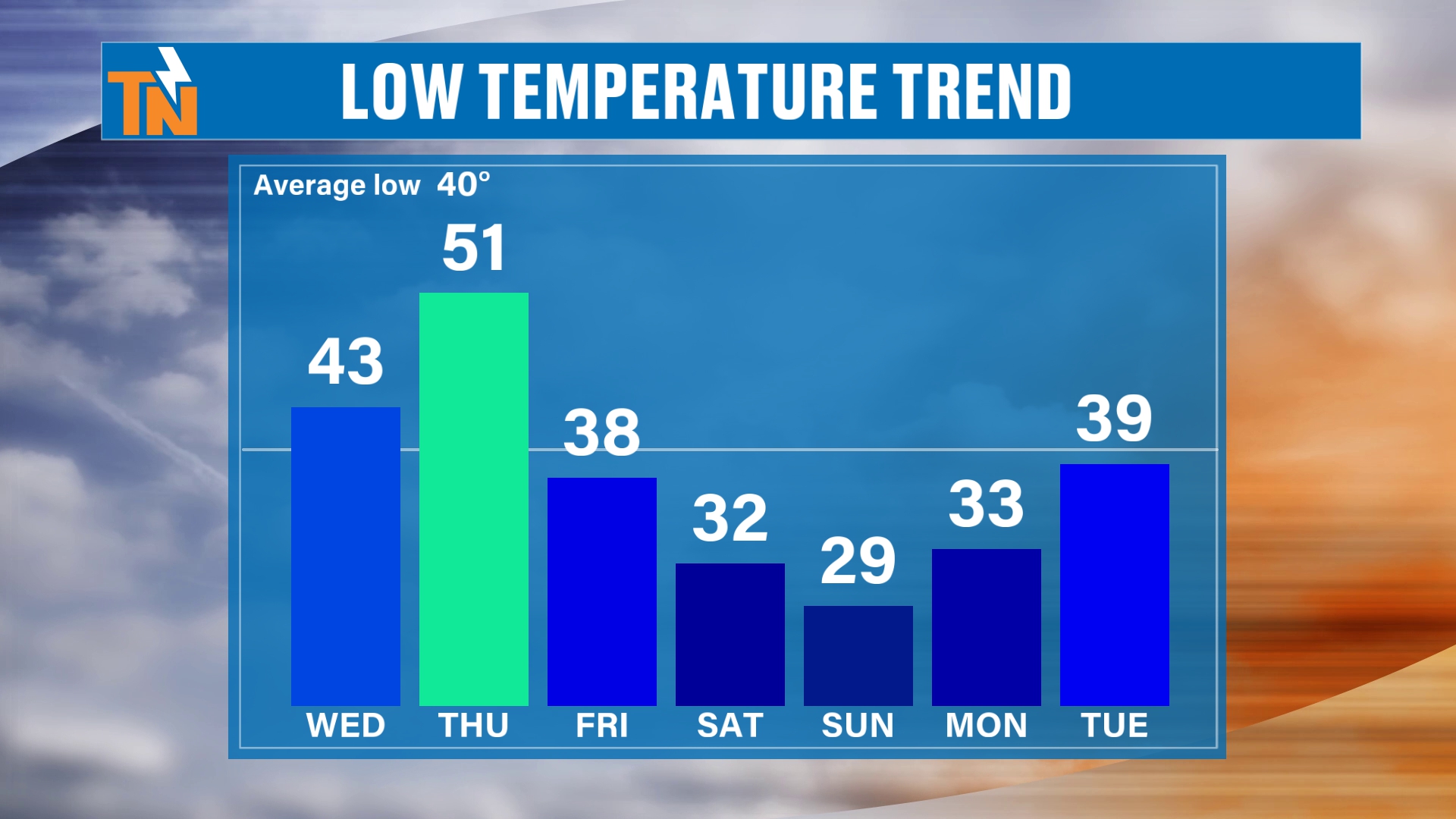
Here’s the low temperature trend. We’re going to warm from the low 40s on Wednesday to the low 50s on Thursday.
And then notice the colder air Saturday, Sunday and Monday. We’re going to see widespread frost, not to mention a hard freeze possible on Sunday morning.
The probabilities have gone up for us on Sunday morning to have more of a widespread hard freeze. So that’s something to keep in mind here.
Rain Chances Wednesday Night Into Thursday
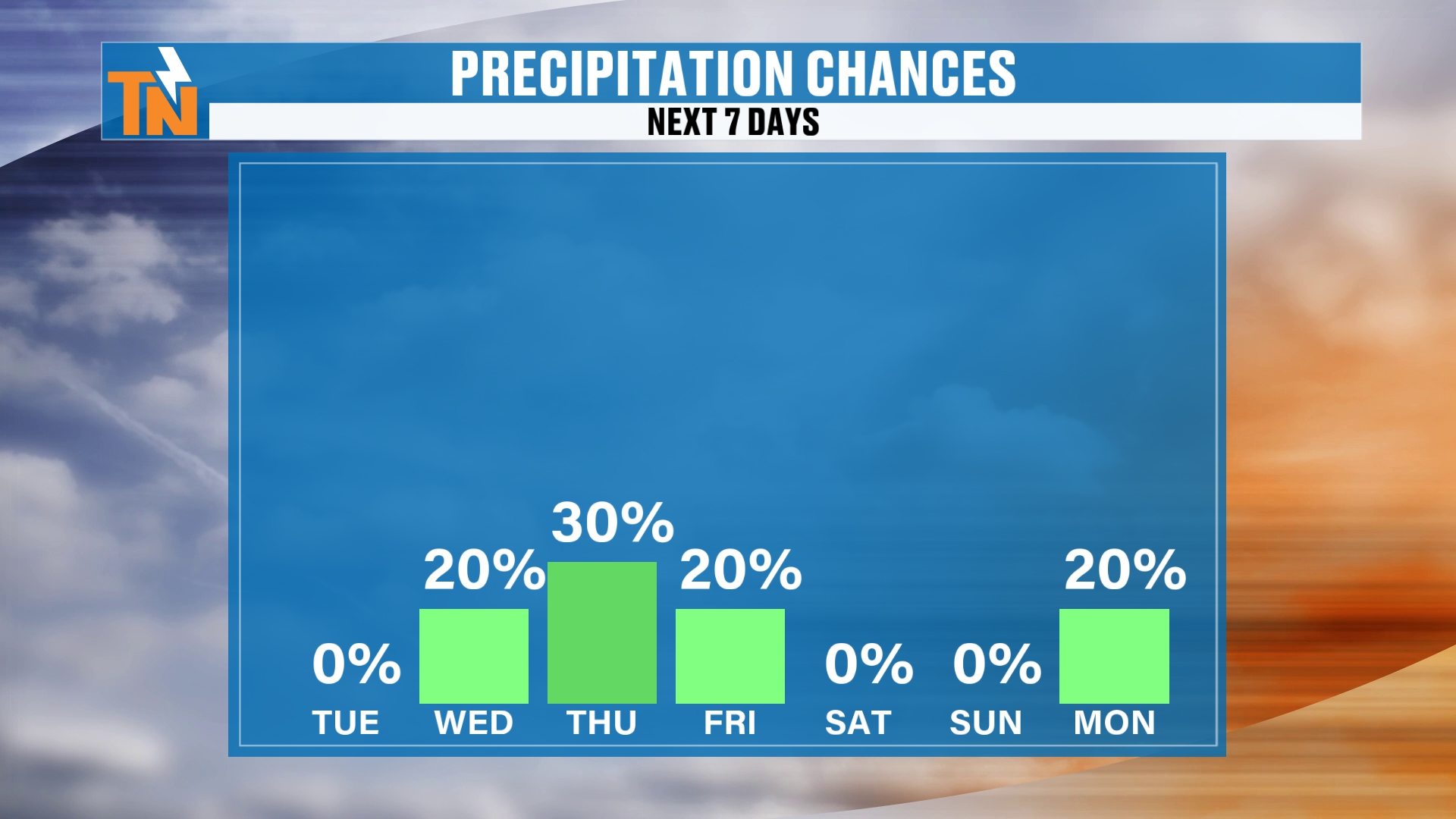
Precipitation chances, well, we’re only going about 20 to 30% while we’re awake.
Now, Wednesday night into Thursday morning, we’re likely to have about a 70 to 100% chance of rain. But that’s going to come after sundown Wednesday night and last through about early Thursday morning.
The Futurecast Timeline
Let me show you the Futurecast model. We’ll pick up our timeline here Tuesday morning, and we’ve got a little boundary to our north. It’s not going to do a whole lot.
A few high, thin clouds start to head our way. Clouds thickening up tomorrow morning.
There’s Wednesday evening. And again, most of Wednesday is going to be on the dry side.
Then after sundown, here come the rain showers. That’s going to be with us early Thursday morning.
And then here comes that wraparound colder air mass. It’s going to start to transition some of that wraparound moisture, in the form of some light rain across the mountains, into the form of some light snow showers.
Will There Really Be Snow? The Odds
So what are the probabilities of us actually seeing some snowfall in the mountains? Does it actually really exist, or are these models just kind of picking up on some stuff, right?
Well, I will say that the probability for increasing snow is going to happen late Thursday into early Friday, and then through the day on Friday. Friday into Saturday, it starts to dwindle and the snow machine starts to wind down.
So it’s not a huge chance. We’re still looking at about a 40 to 50% probability of seeing some good snow across the highest peaks of the Smokies.
Let’s talk about snowfall chances, though, because it’s not going to really start snowing across the highest peaks until late Thursday into early Friday. Then through the day on Friday into Saturday morning is really when we’re going to start to see that more wraparound moisture.
We have a pretty good moisture flow, or moisture transport anyway. And we’re going to have the colder air in place.
That colder air, really across the highest peaks, comes in after about 7 or 8 PM Thursday night. That’s when the colder air starts to really settle on in.
Official Snowfall Forecast
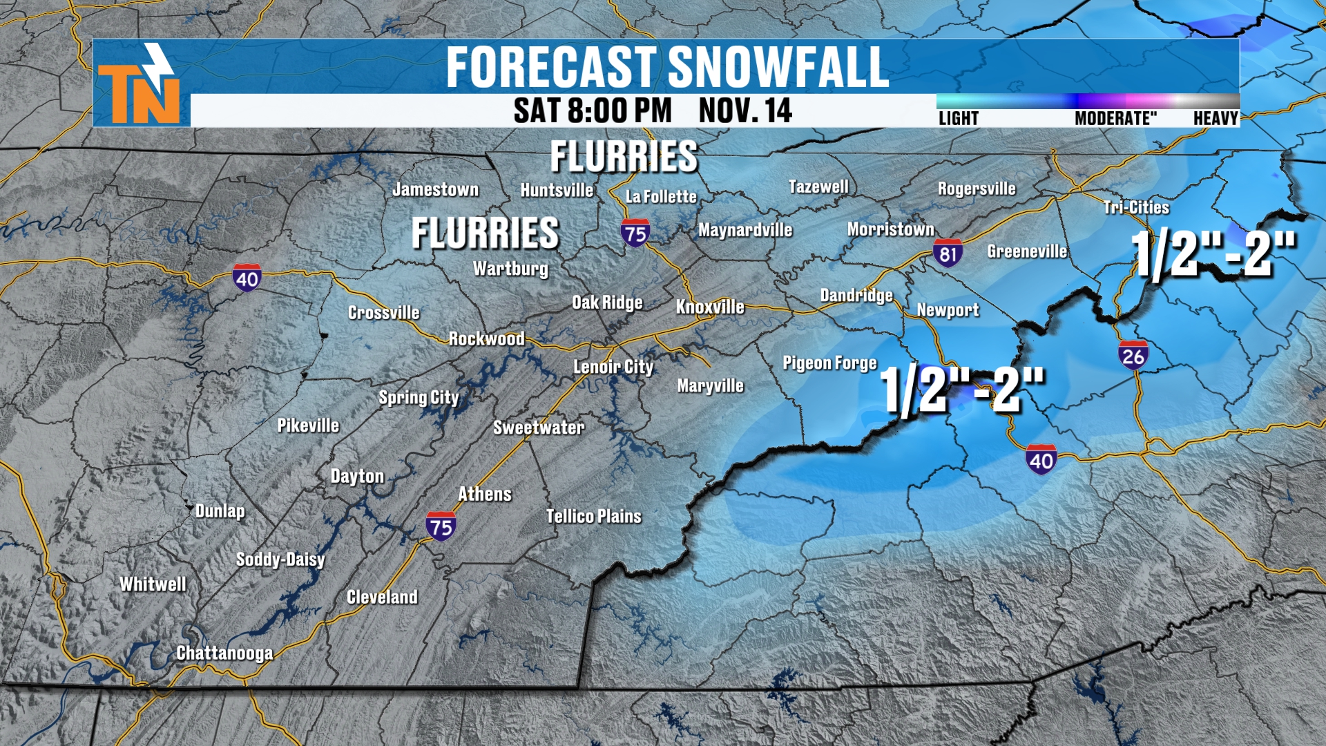
So when you look at your snowfall forecast, this is going to be an official snowfall forecast.
We’re looking at a few flurries to fly across parts of the higher elevations of the Cumberland Plateau. We’re probably not going to see any snowflakes here in the valley.
But we could see anywhere from a half an inch up to 2 inches across the highest peaks.
Again, we’re not expecting a huge snow maker. We’re probably not going to see much in the way of wintry weather. We may have a Winter Weather Advisory issued by the National Weather Service.
The Classic Horseshoe Effect
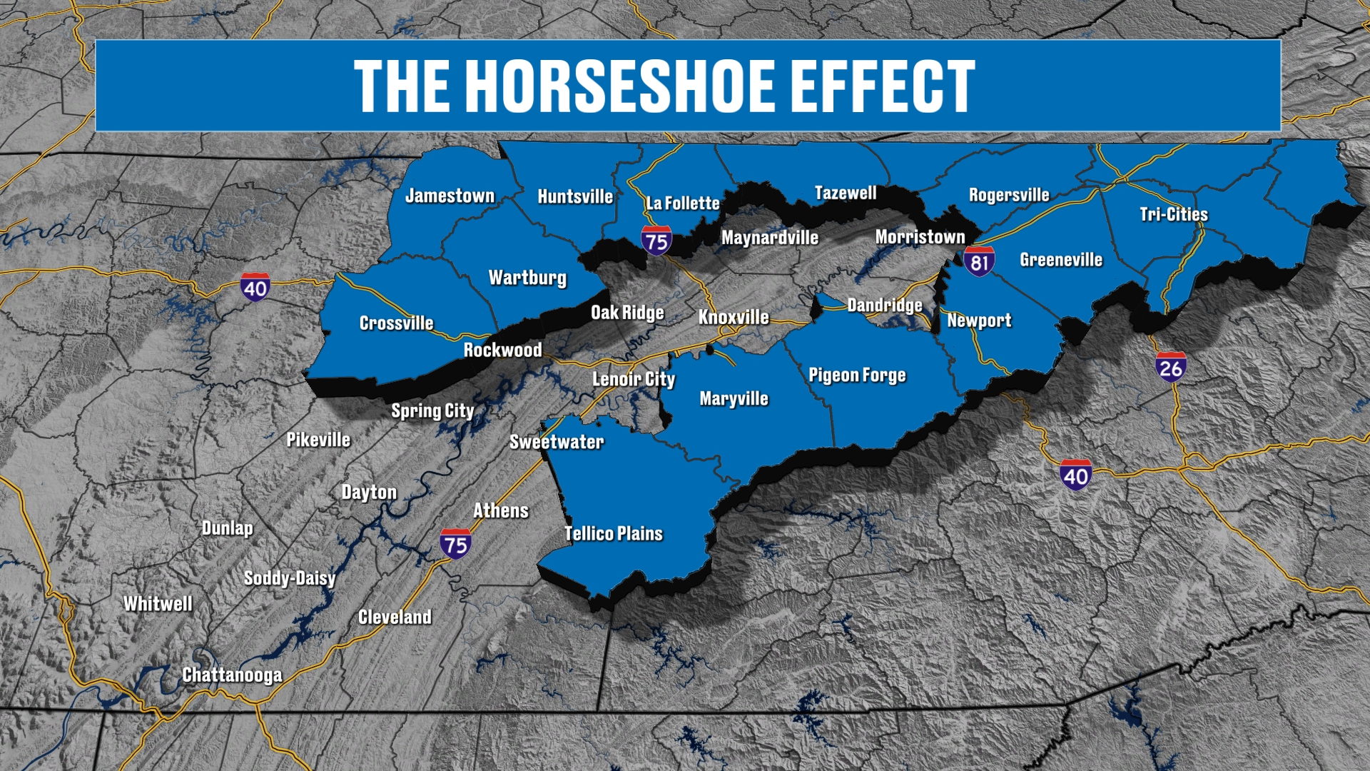
We talk about the horseshoe effect here in East Tennessee a lot during the wintertime months. As you clearly saw, the snow is going to be falling across the higher terrain, the plateau and the Smokies, and that does include the northern valley.
So again, we have this classic horseshoe look. That’s what the snowfall map looks like a lot during the wintertime months.
Either way you look at it, we are looking at some moisture to move its way on through. We could pick up upwards of a quarter of an inch of rainfall.
So we are looking at some rainfall, with the highest enhancement across the mountains.
Generally speaking, we’re going to be trending dry towards the end of the 7-day forecast. But then we may start to see some rain chances slowly but surely ramp their way back up.
Your 7-Day Forecast
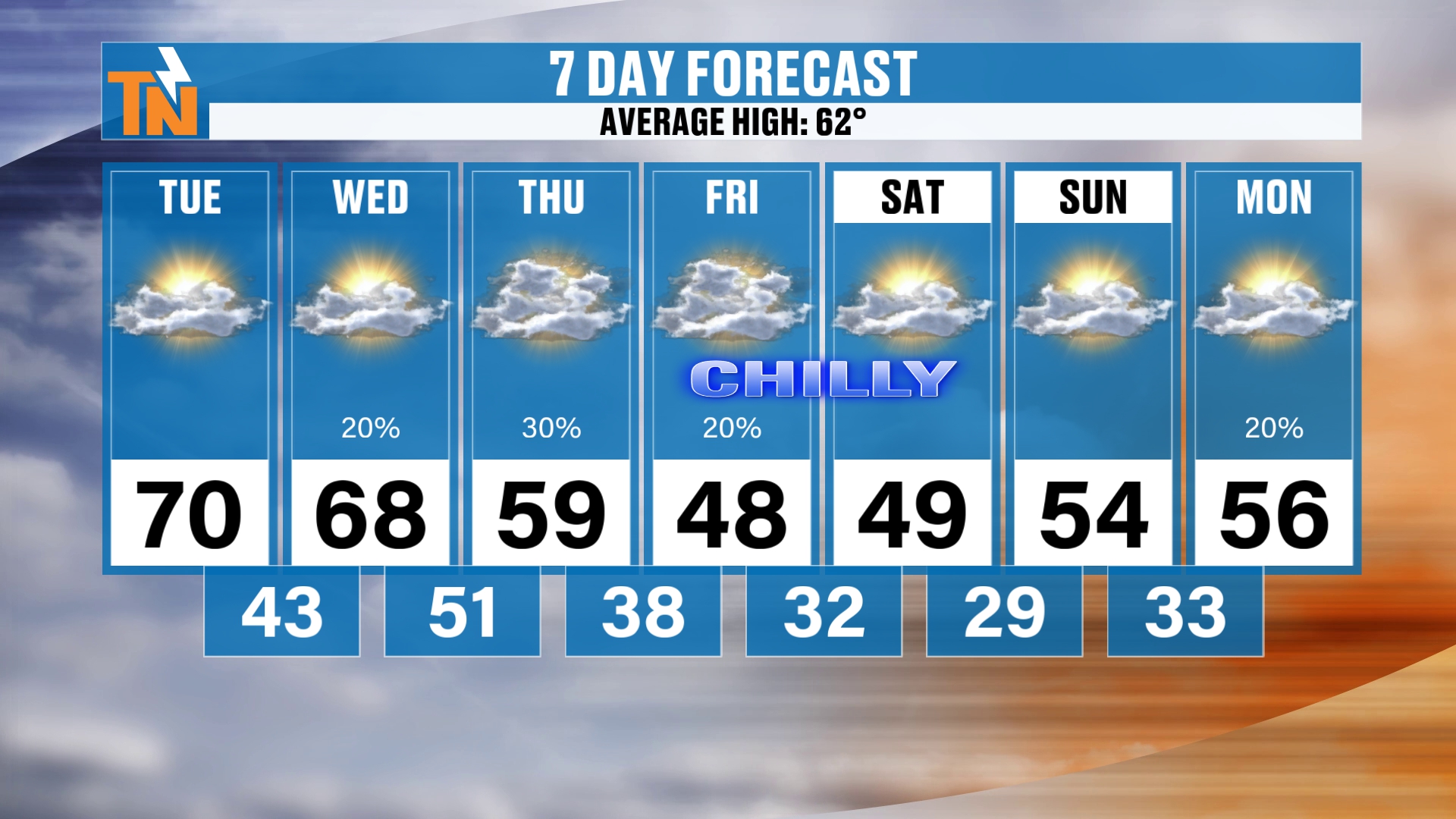
All right, here’s your 7-day forecast. Chilly weather is on the way.
70 today. 68 tomorrow. Down to 59 on Thursday.
Falling temperatures Thursday afternoon and evening. Here comes the colder air, and that’s going to set up shop for some chilly weather Friday and Saturday, with highs in the 40s. Lows are going to be in the 20s and 30s.
And then Sunday morning, it’s going to be probably a hard freeze for most locations around town. Especially along and north of Interstate 40, and along the plateau and the Smokies.
Warming Back Up Next Week
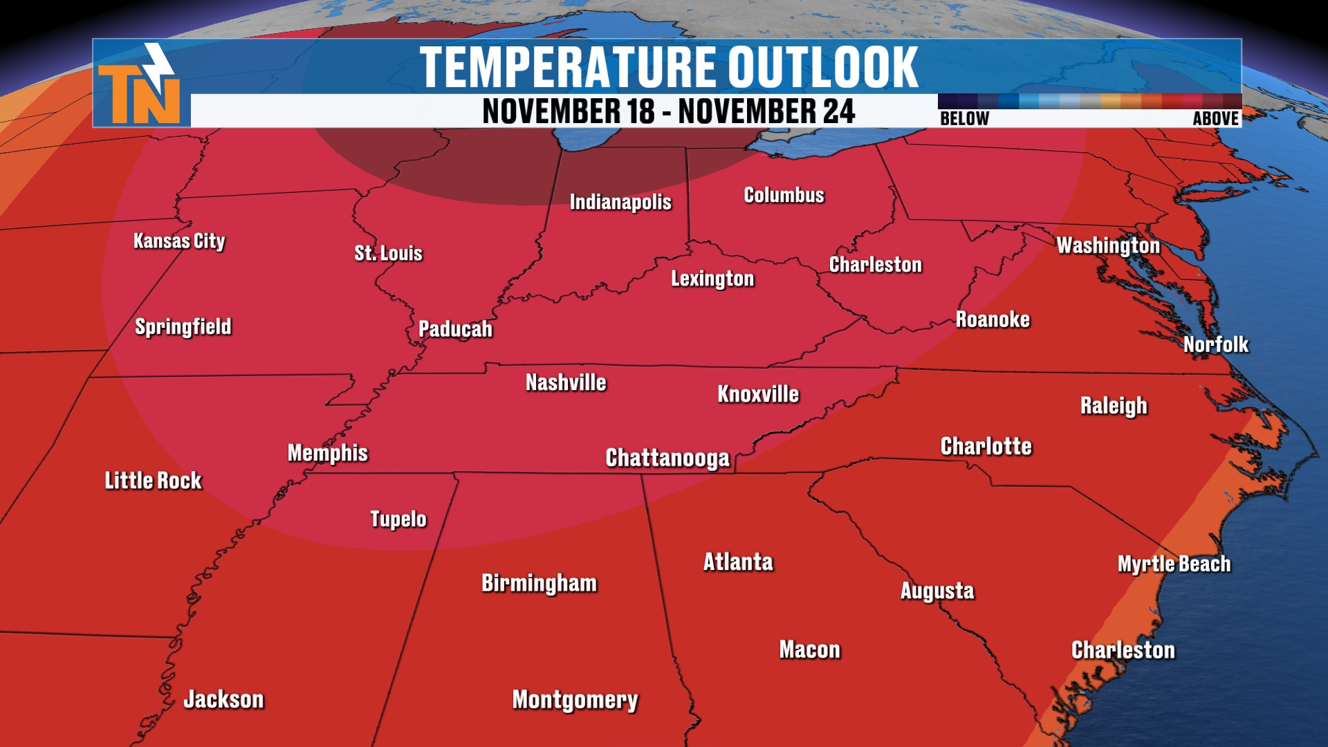
Then we’re back in the mid-50s as we get into the middle part of next week. At that point, the Climate Prediction Center is predicting the potential for above average temperatures to slowly but surely creep their way back into the area.
So we are looking at warmer than average weather to work its way back in.
But it is going to be a chilly weekend. Highs in the 40s on Friday and Saturday, lows in the 20s and 30s. You’re going to be cranking up the heaters for sure this weekend.
Bottom Line
TUESDAY (TODAY): Fog early, then it burns off quickly. Low 60s by lunchtime, a high near 70, and 56 by 7 PM. Gusts only 10 to 15 mph. Above average again.
WEDNESDAY: A high near 68. Mostly dry through the day, with clouds thickening. Rain showers arrive after sundown, with a 70 to 100% chance Wednesday night into early Thursday morning.
THURSDAY: Light rain early, then falling temperatures through the afternoon and evening. A high near 59. Wraparound moisture turns to light snow showers across the mountains as the colder air settles in after 7 or 8 PM.
FRIDAY: Chilly, with a high in the 40s. Snow chances continue through the day across the highest peaks, with a 40 to 50% chance of good snow in the Smokies.
SATURDAY: Chilly, with a high in the 40s and a widespread frost. The snow machine winds down.
SUNDAY: A likely hard freeze, especially along and north of Interstate 40 and across the plateau and the Smokies, with lows in the 20s and 30s.
NEXT WEEK: Back to the mid-50s by midweek, with above average temperatures creeping back in.
For more daily updates, check out our Daily Forecast page.
Don’t forget to LIKE, SHARE and SUBSCRIBE to the YouTube channel. It really helps to put things in the algorithm. If you like this kind of forecasting update, comment below and let me know that you check these out almost every single day.
Download the East Tennessee Weather app for your smart TVs and, of course, your cell phone and tablets.
I’m Meteorologist Mike Witcher. Have a great Tuesday!
eastTNweather — Weather When You Want It.