
Published: Saturday, October 31, 2026 | By Meteorologist Mike Witcher | eastTNweather
Happy Saturday, East Tennessee, and happy Halloween! It’s candy day, and it’s the last day of October.
Can you believe it? And what an interesting October it has been.
Here’s the big story: Sunday rain fades away before it can do much of anything. The low levels of the atmosphere are so dry that much of it will evaporate on the way down.
That’s called virga.
We haven’t had rain in 12 to 17 days around the area, so we desperately need it. The better chance comes next week.
A Warm Halloween With a Few More Clouds
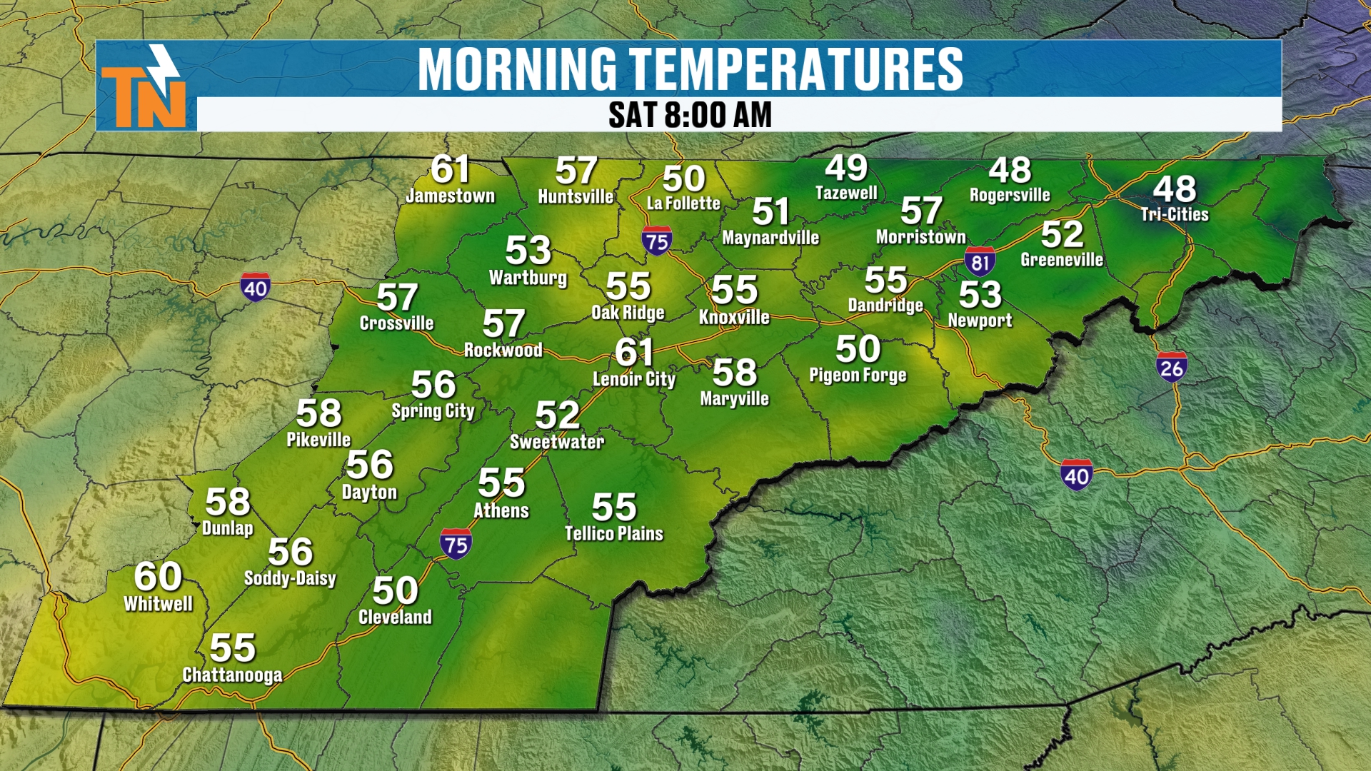
If you’re stepping outside this morning, we’re in the mid to upper 50s. That’s about 10° warmer than yesterday morning.
Why? Clouds at night act like a nice little blanket. They keep us on the warmer side.
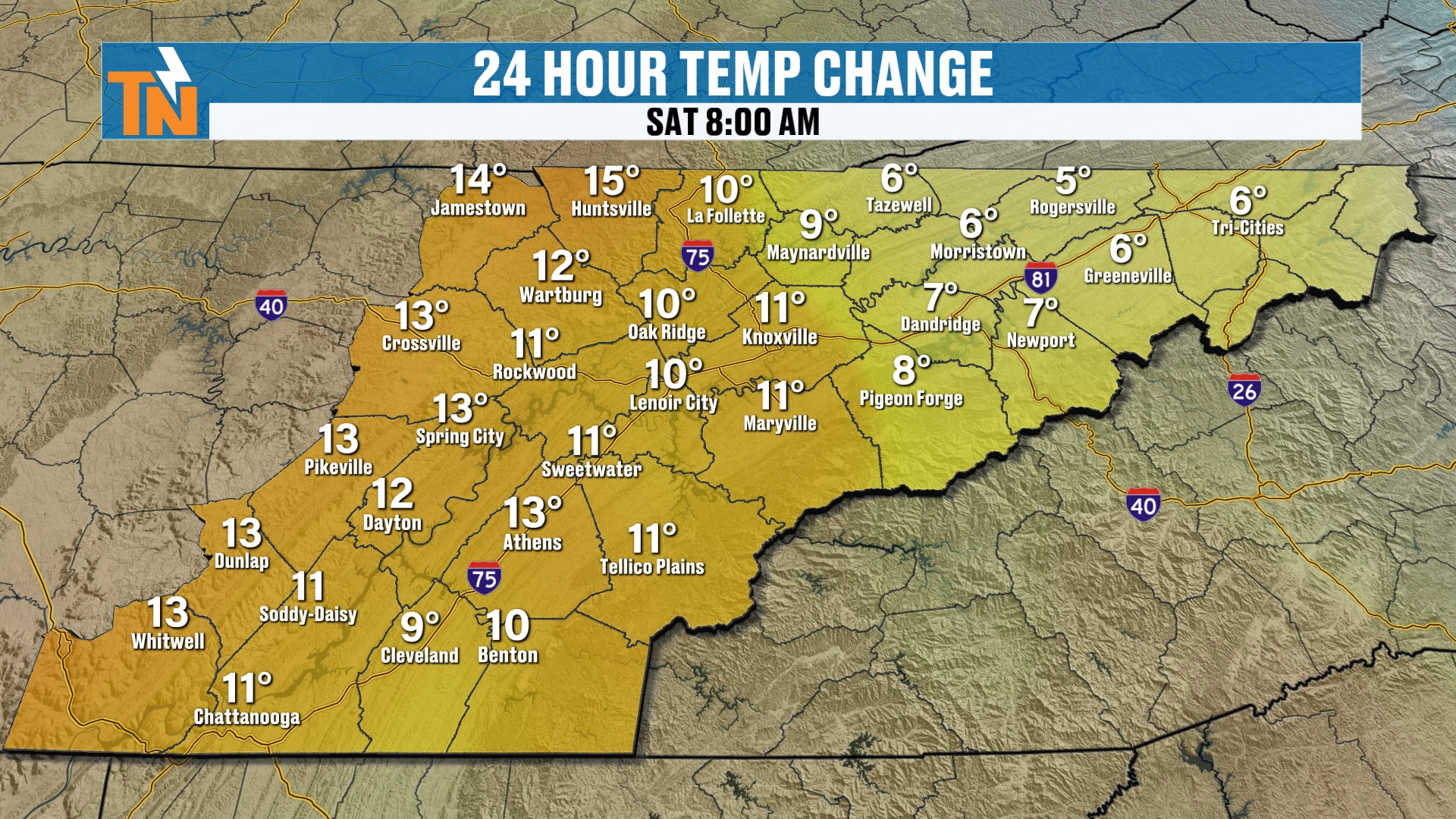
Yesterday was a warm one. We were 12° above average in Knoxville.
Knoxville’s high was 78°, Crossville hit 77° and Chattanooga reached 81°. Definitely a warm October day.
Our ridge of high pressure is starting to break down a little, so temperatures come down a bit today.
Saturday Forecast: Cloudy, Dry and Mild
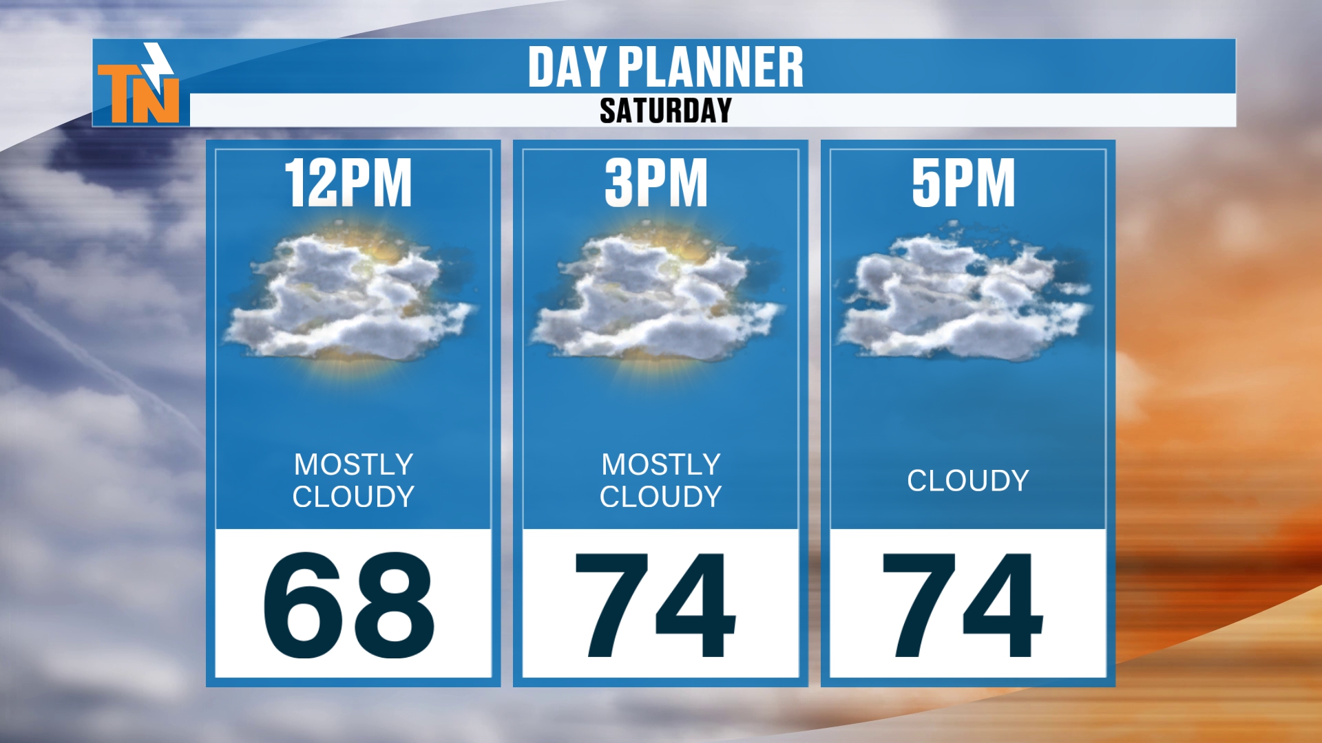
We’ll stay mostly cloudy, with some filtered sunshine at times. 68° by noon, 74° by 3 PM, and 74° at 5 PM.
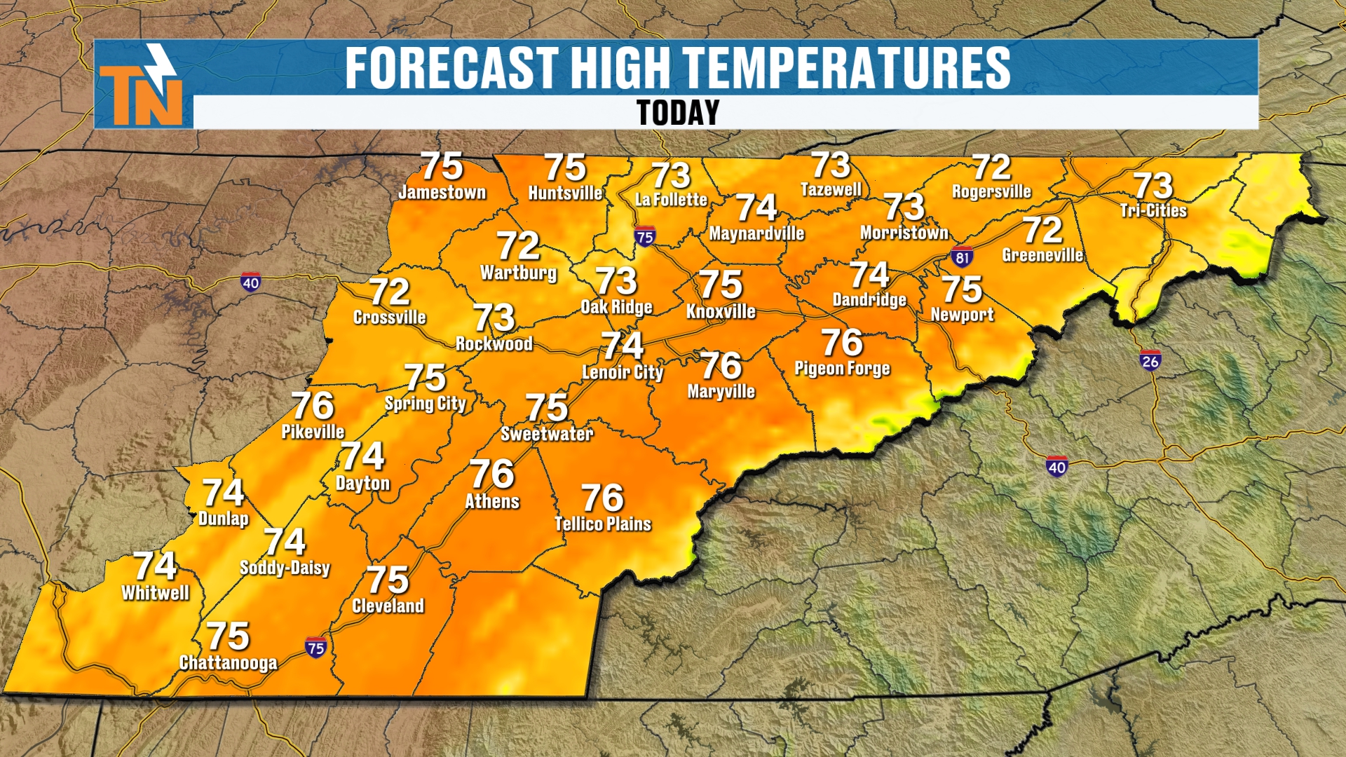
High temperatures won’t be as warm as yesterday, but still well above average. We’re in the low to mid 70s, so nearly 10° above average.
Those light radar returns you may see up above us? That’s moisture way up in the atmosphere. I don’t expect any rain on the ground today.
Smokies Winds Today
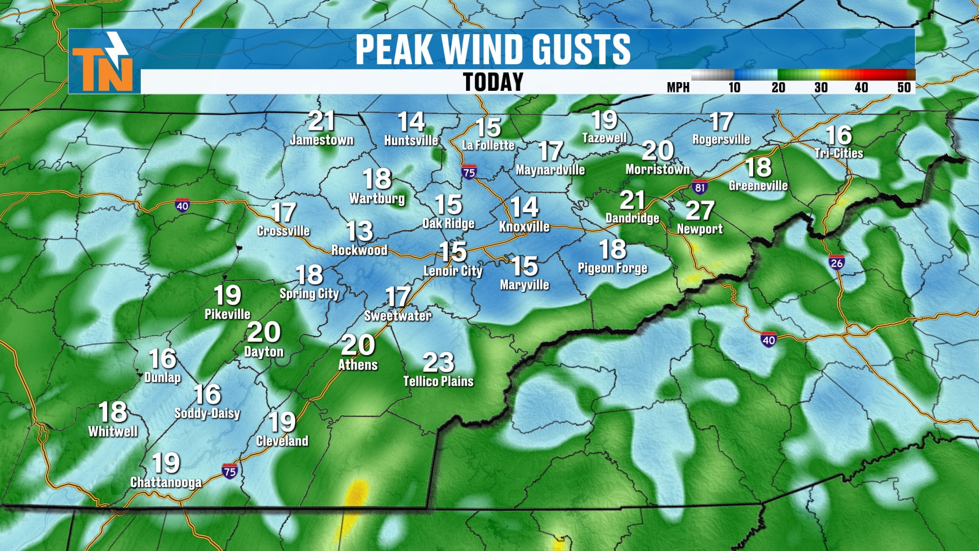
If you’re heading to the Smokies for hiking or fall foliage, the winds will be a little stronger, especially on the highest peaks. Keep that in mind if you’re going up to Clingmans Dome.
In the valleys, peak gusts will be about 10 to 15 mph, maybe up to 20 at times. Just a little October afternoon breeze at trick-or-treat time.
Your Official Trick-or-Treat Forecast
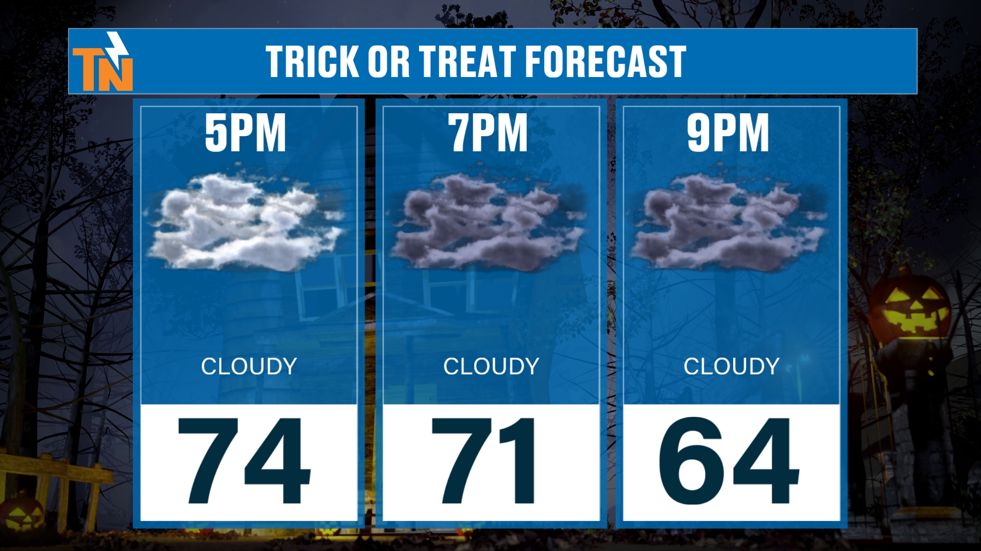
We pick up the timeline at 5 PM in the low to mid 70s. By the end of trick-or-treating, we drop into the mid 60s.
To be honest with you, tonight is going to be a fantastic night.
It should feel very similar to last night. Dry, mild and cloudy.
Sunday Rain Fades: More Bark Than Bite
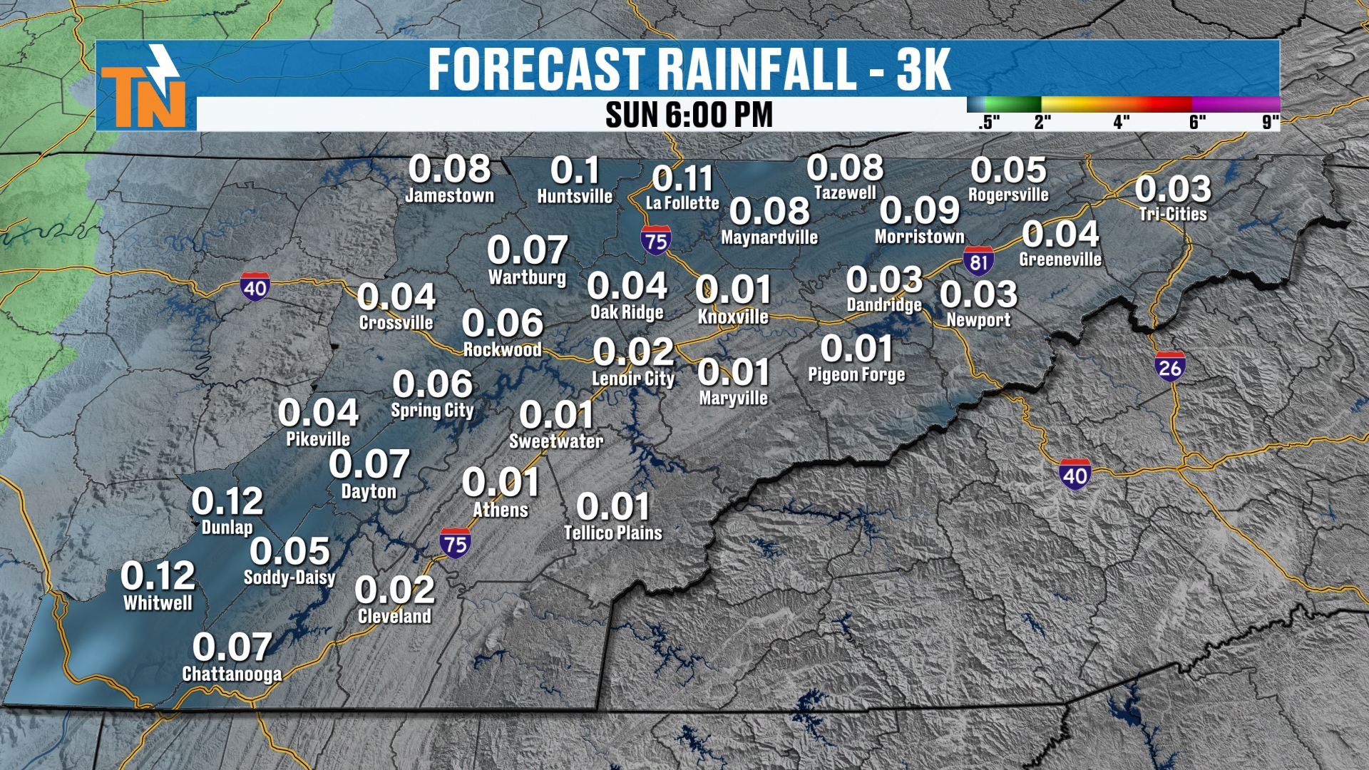
That wave of energy swings right over the Tennessee Valley on Sunday. Will Sunday rain fade away completely? Not quite. We may see a couple of sprinkles around 6 AM.
But I think this is going to be more bark than bite.
What do I mean? It may look impressive on composite radar. But the National Weather Service low-level radar scan will tell a different story.
The low levels are dry, so a lot of that evaporation is going to happen. If we can saturate the column a little bit, we’ll get a bit more rainfall.
But when you look at how much actually falls out of the sky, that’s the story.
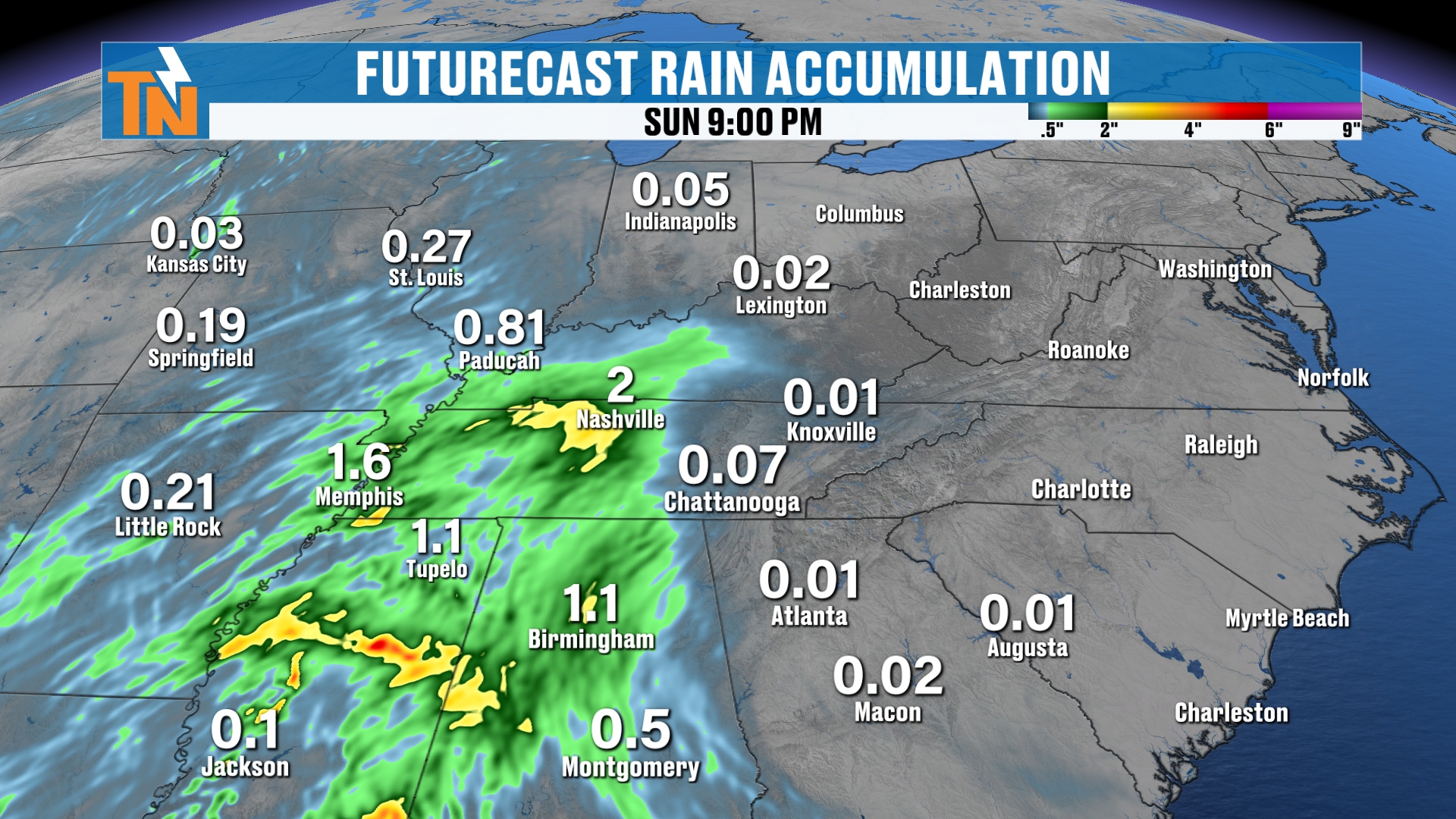
The heaviest rain stays to our west, basically between Memphis and the Nashville metro.
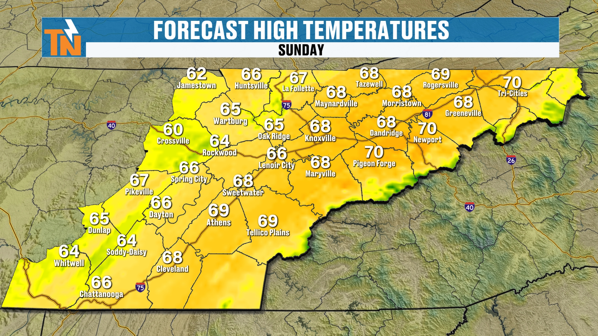
It will be cooler Sunday, too, with highs in the mid to upper 60s.
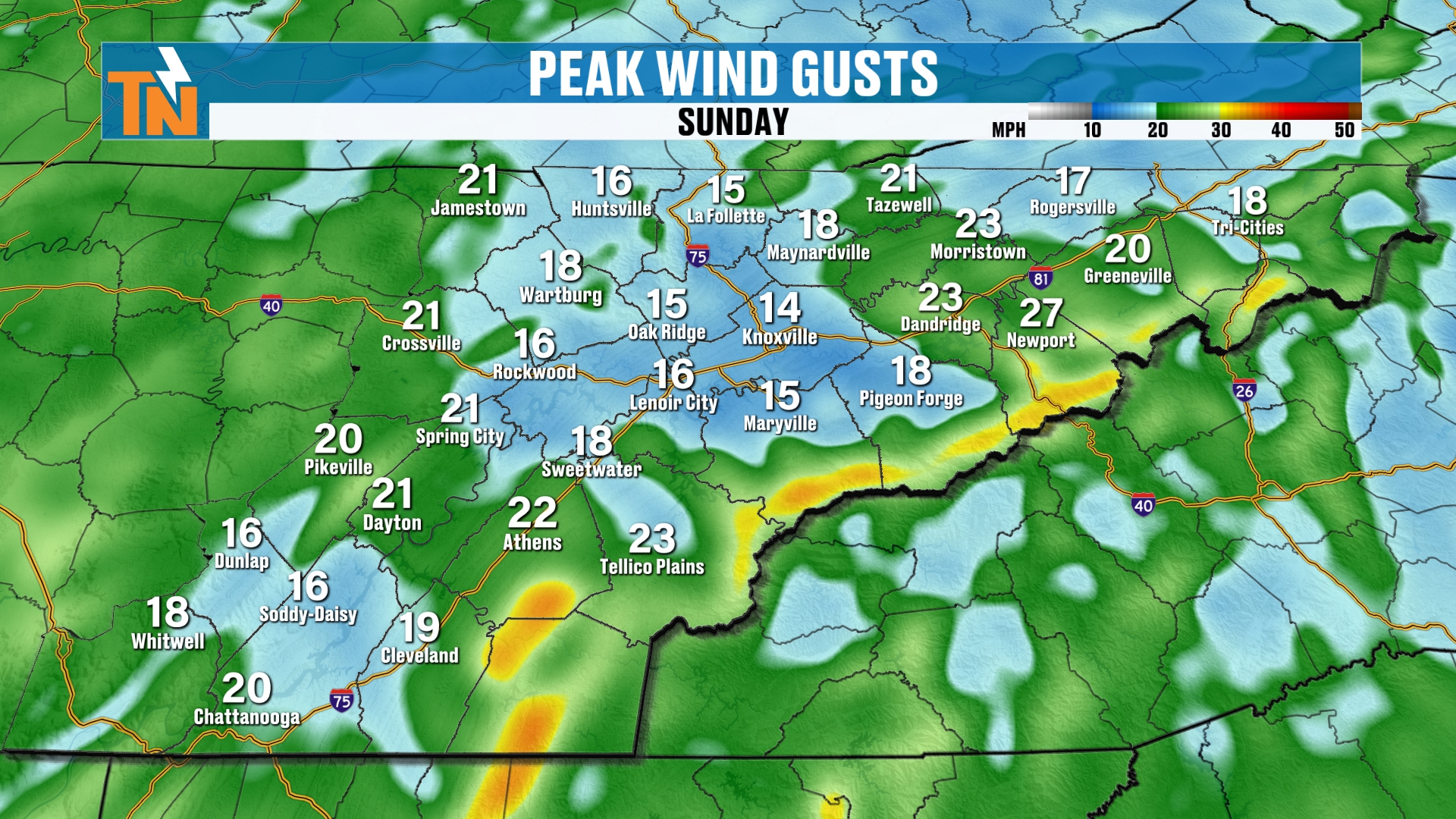
It will also be breezy again across the highest peaks of the Smokies.
Next Week: A Stronger Storm
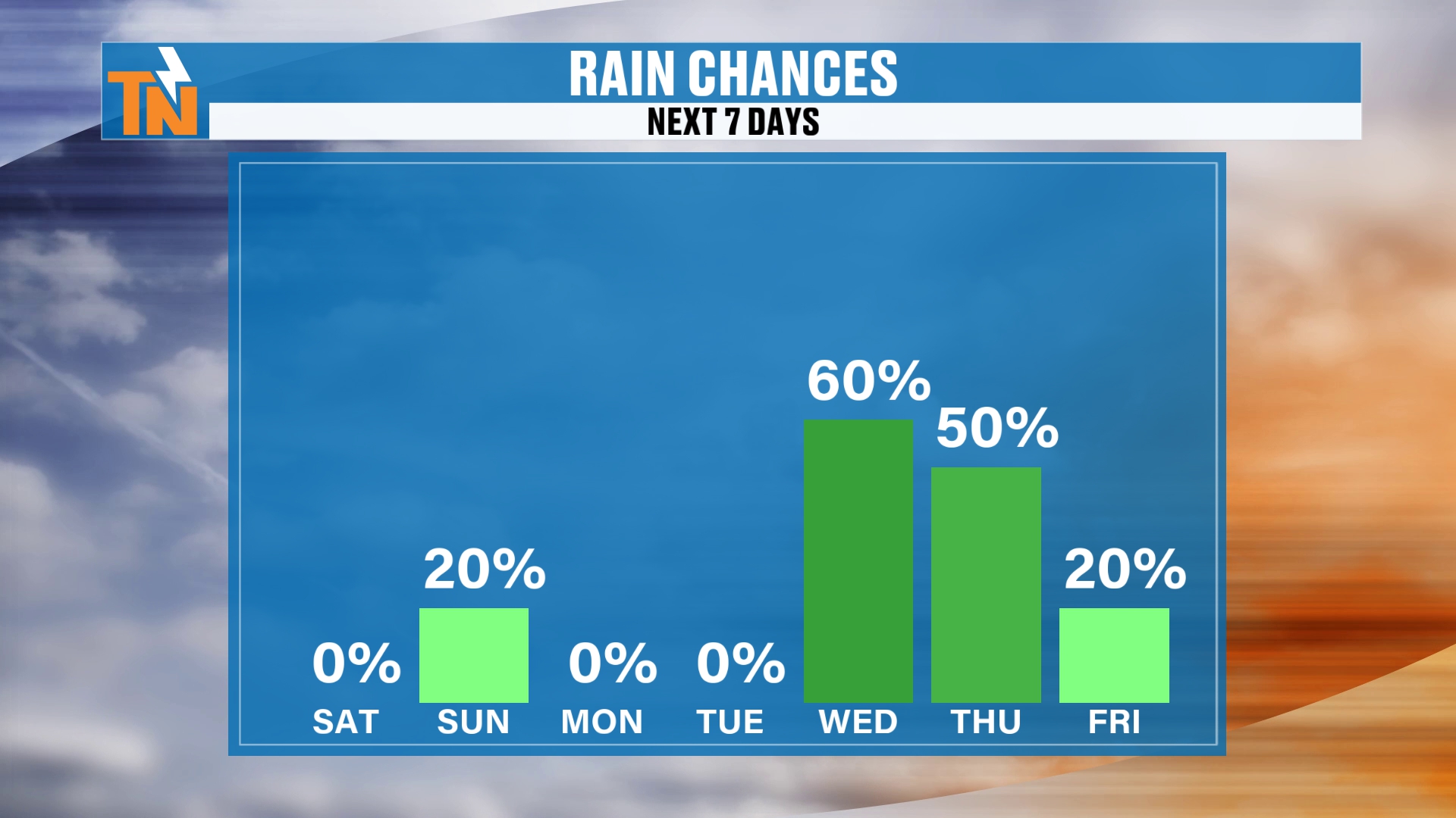
I’m going with a 20% chance of rain on Sunday. Zero today, zero Monday, zero Tuesday.
But Wednesday I’ve bumped up to 60%, from 50% yesterday. Thursday is at 50%. Then we wrap that storm system up on Friday.
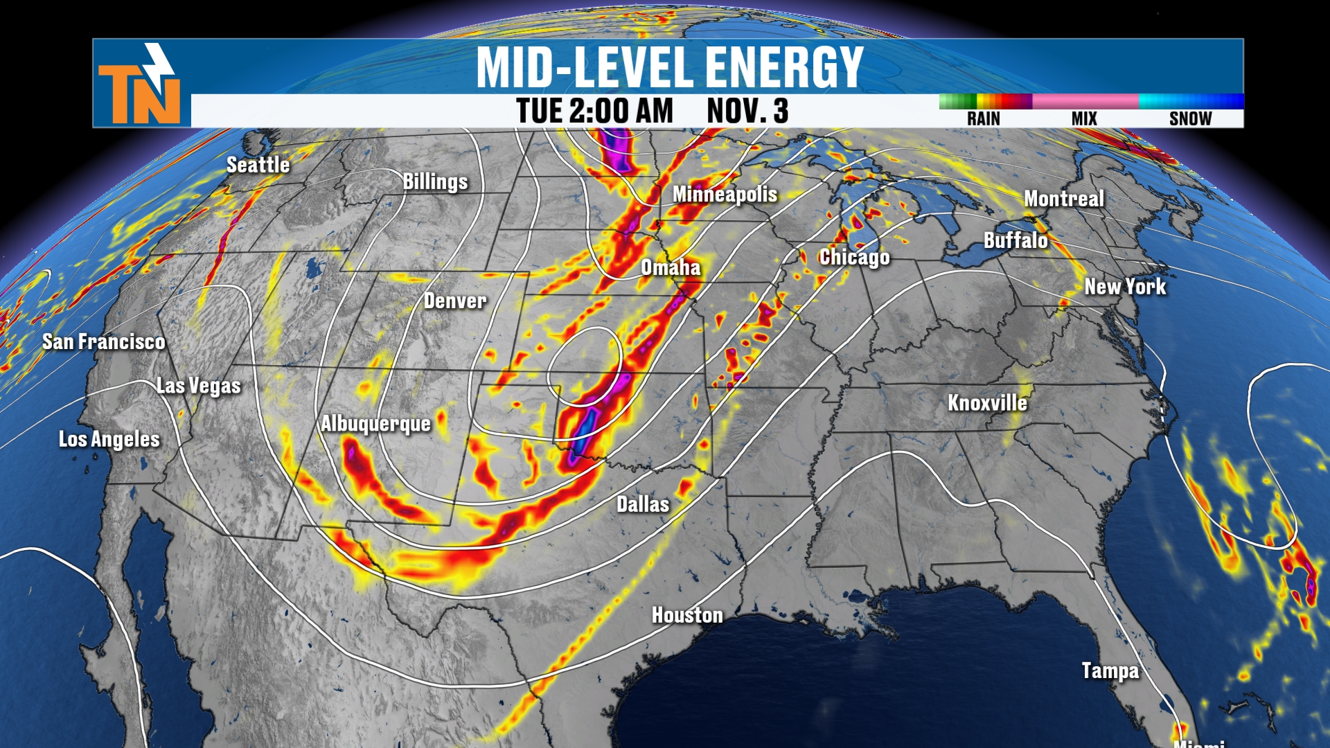
Look at this big, deep trough. It’s a stronger trough with a stronger cold front.
It may split based on some of the model guidance. A little goes south, a little goes north. But it will usher in a strong flow out of the Gulf and bring more moisture. Humidity goes up. Our water in the atmosphere will be above average.
By the time the rain arrives, we could be pushing 18 to 25 days without a drop around East Tennessee.
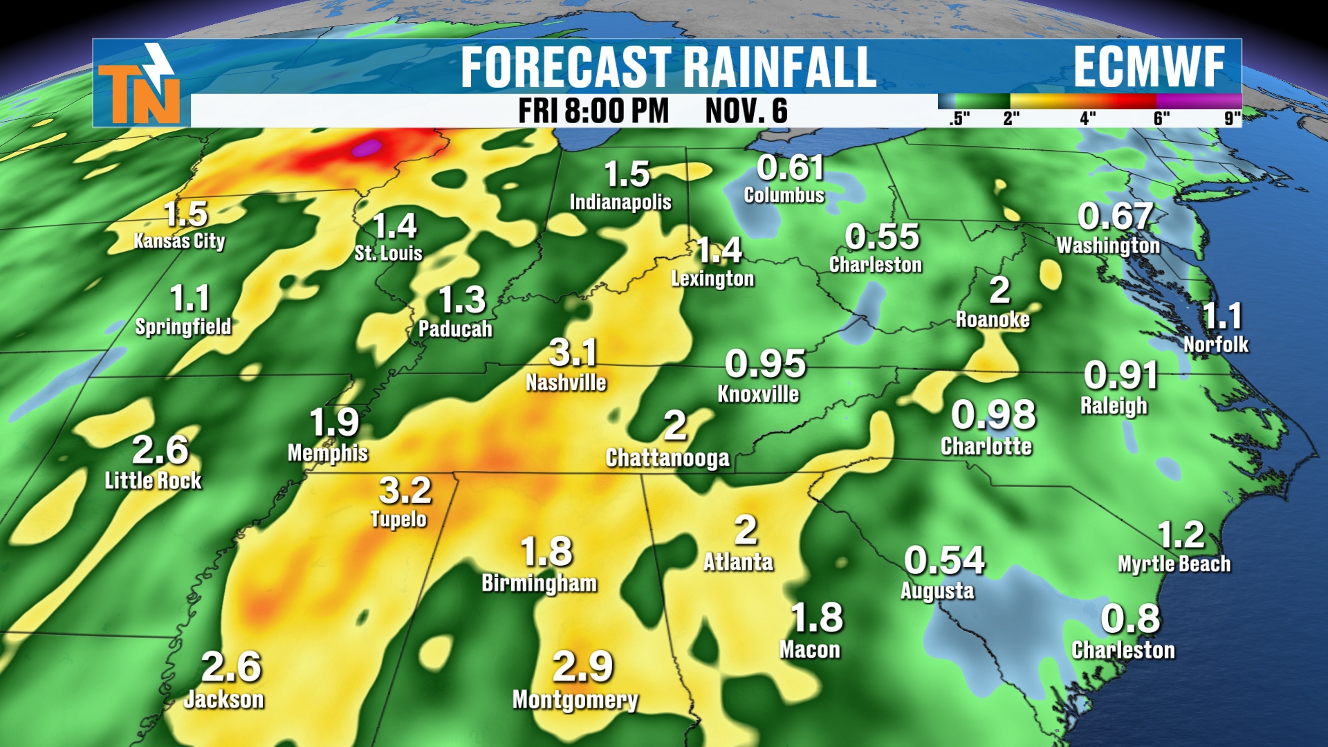
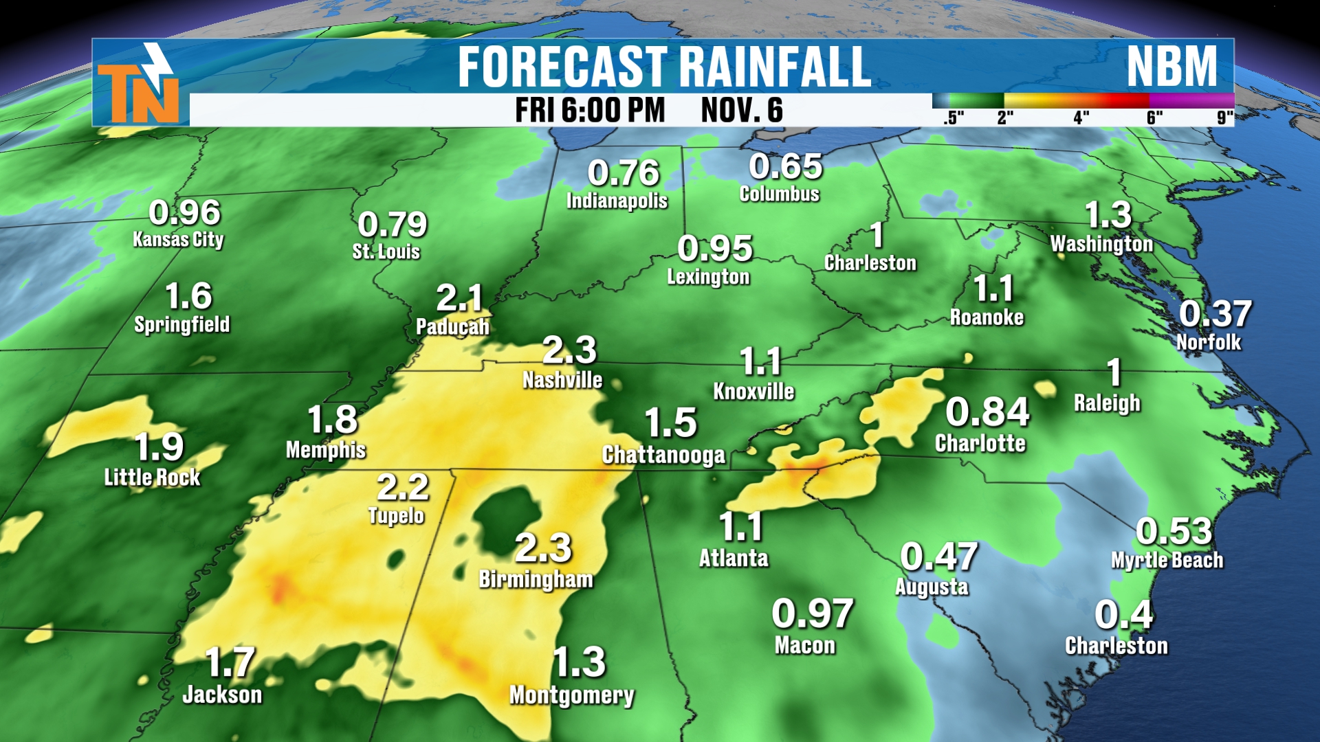
Here’s where I want to be careful. Don’t look at the numbers specifically, because these are deterministic models. They’ll change.
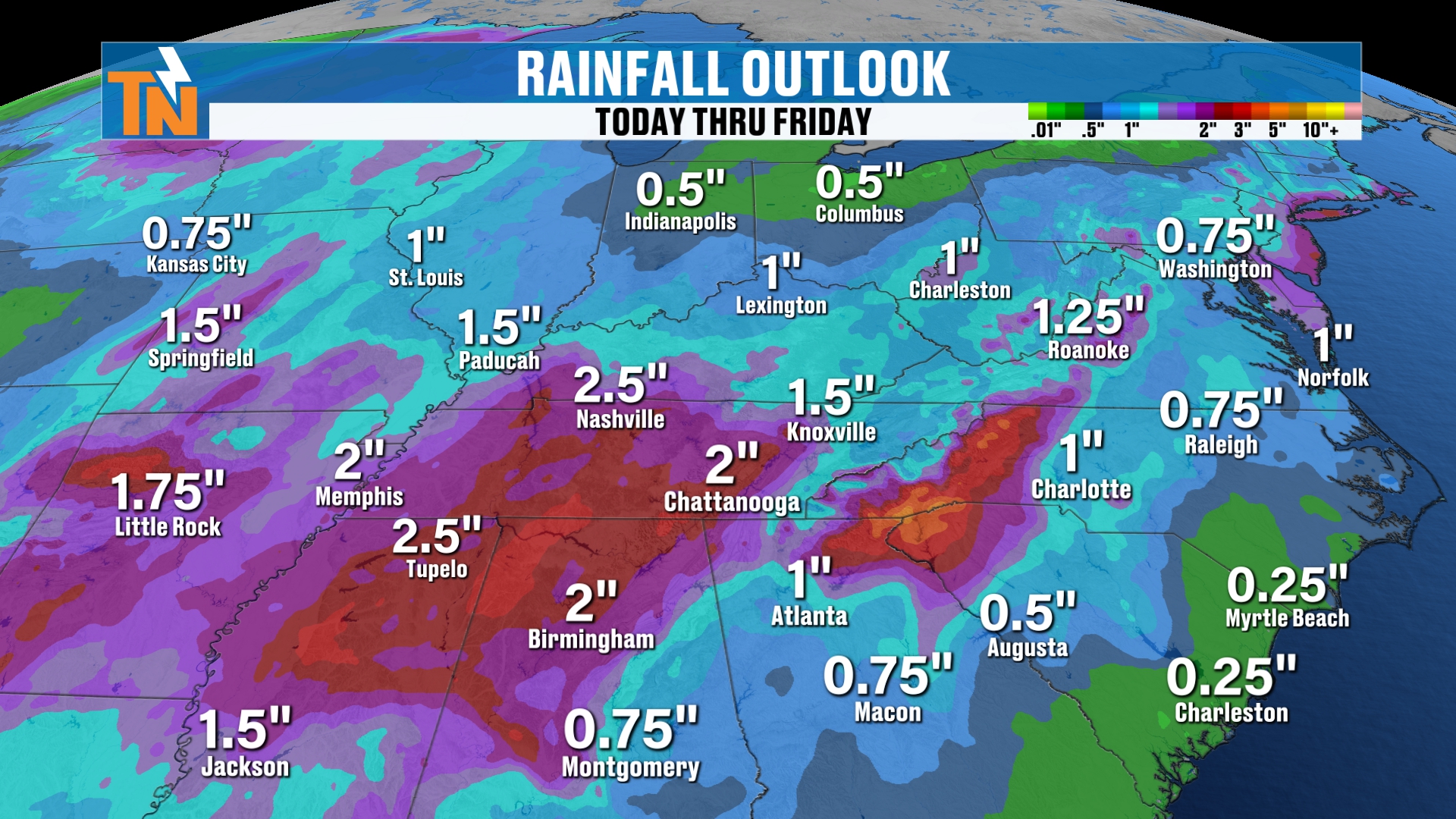
But generally, the models are suggesting 1 to 2 inches or more across our region. The bullseye is probably across the Cumberland Plateau, and further west and southwest into Mississippi and Alabama.
Here at home, I think a good solid half inch to over an inch, maybe an inch and a half of rain is possible by the middle and latter part of next week.
After the system moves through, the models are showing a northwesterly flow behind it. That means slightly cooler and drier air, or maybe significantly cooler and drier.
I’m not talking about a first frost or freeze. But we could see temperatures in the low to mid 60s next weekend.
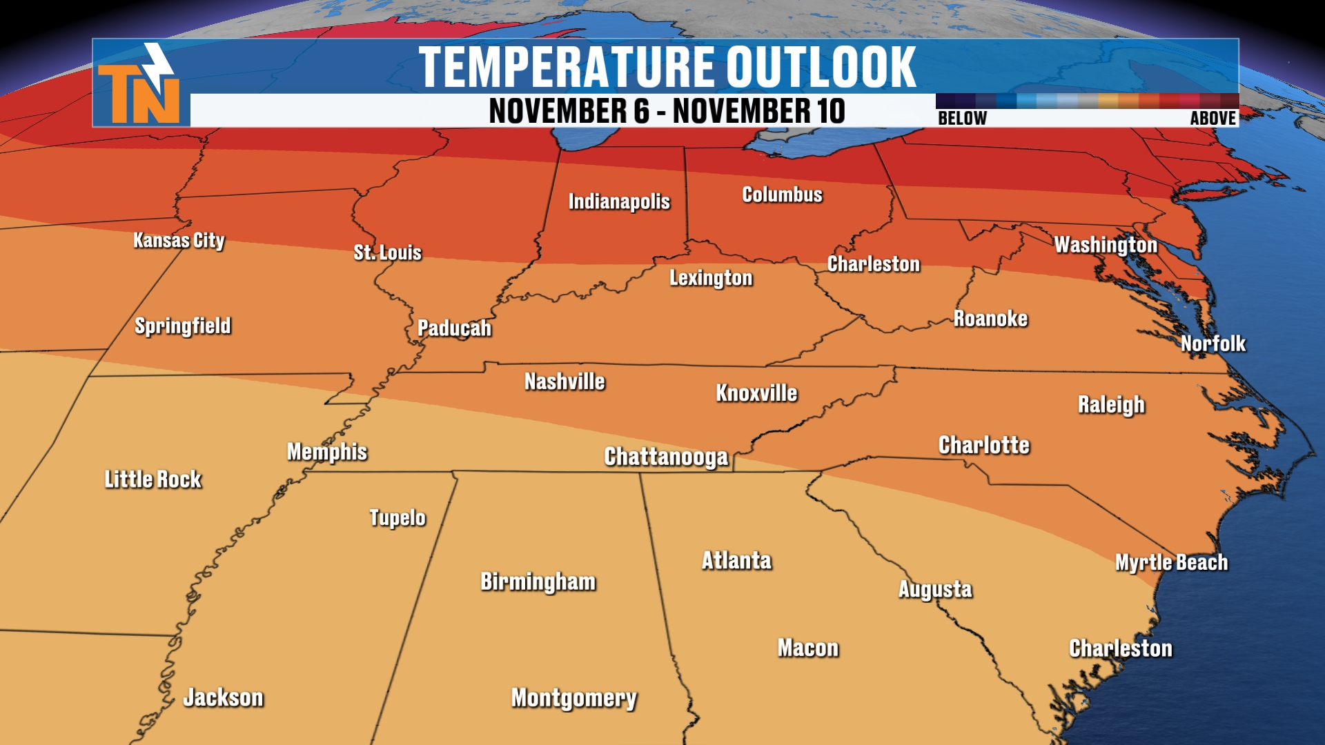
The Climate Prediction Center temperature outlook isn’t painting that picture necessarily. We’ll see how it plays out.
Make sure you check back in.
Bottom Line
SATURDAY: Mostly cloudy and dry. Low to mid 70s. Trick-or-treat: 74° at 5 PM, mid 60s by the end.
SUNDAY: Sunday rain fades. 20% chance of a sprinkle or light rain, more bark than bite. Highs in the mid to upper 60s.
MONDAY–TUESDAY: Dry and warmer. Low to mid 70s, about 10° above the average high of 66°.
WEDNESDAY: 60% chance of rain as a stronger storm arrives.
THURSDAY: 50% chance of rain.
FRIDAY: The storm wraps up.
NEXT WEEKEND: Cooler and drier behind the front, with temperatures possibly in the low to mid 60s.
Download the FREE eastTNweather app from your app store. It’s available on your phones, tablets and smart TVs, including Roku and Amazon Fire.
And if you’re watching on YouTube, don’t forget to LIKE, SHARE, SUBSCRIBE and hit the bell.
Catch up on all of my recent daily forecasts anytime.
I’m Meteorologist Mike Witcher. Have a great Saturday!
eastTNweather — Weather When You Want It.