
Winter’s First Warning Shot! Mountain Snow and a Sunday Hard Freeze
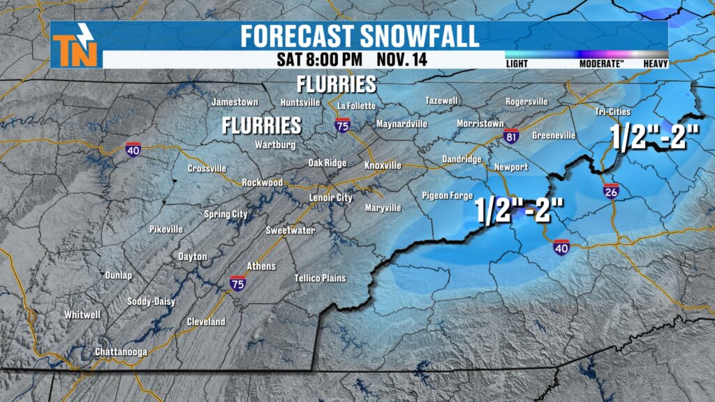
Winter’s first warning shot arrives Thursday: light rain, then mountain snow showers, the coldest air of the season and a likely Sunday hard freeze.
The Horseshoe Effect Returns! Who Could See East Tennessee’s First Snow?
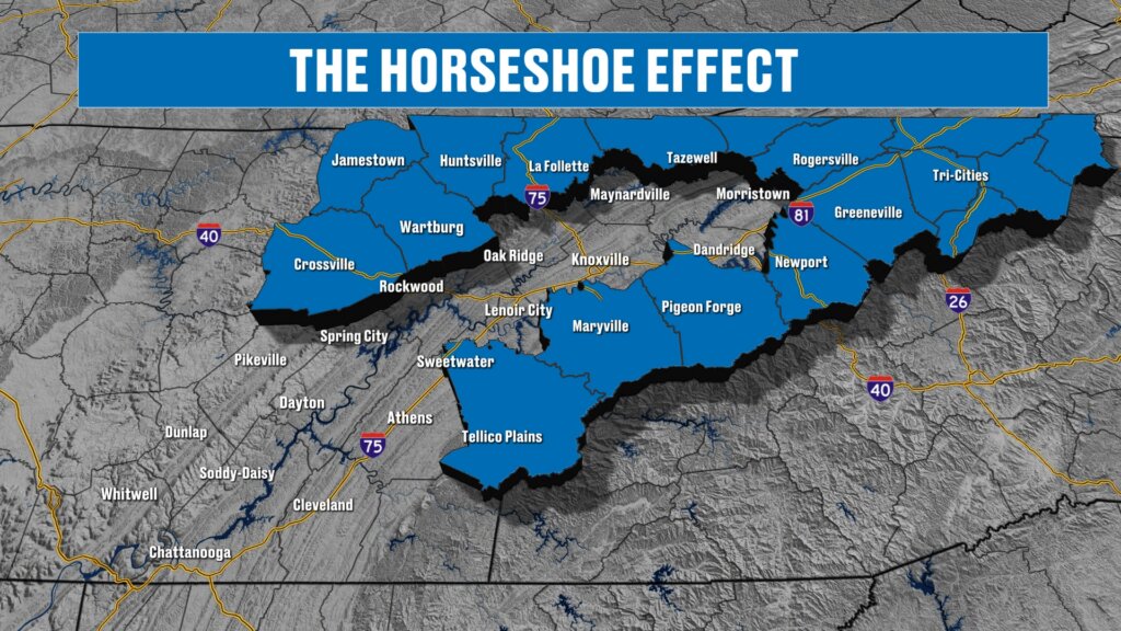
The horseshoe effect returns: a midweek cold front brings rain Thursday, mountain snow showers Thursday night into Friday, and a possible hard freeze.
FIRST SNOW CHANCES! Where East Tennessee Could See Flakes
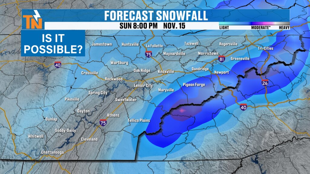
First snow chances are on the table next Thursday and Friday. Ensemble data shows the best odds for flakes in the Smokies, plus a likely freeze Saturday.
FIRST SNOWFLAKES? A Deep Trough Could Bring Snow to East Tennessee!
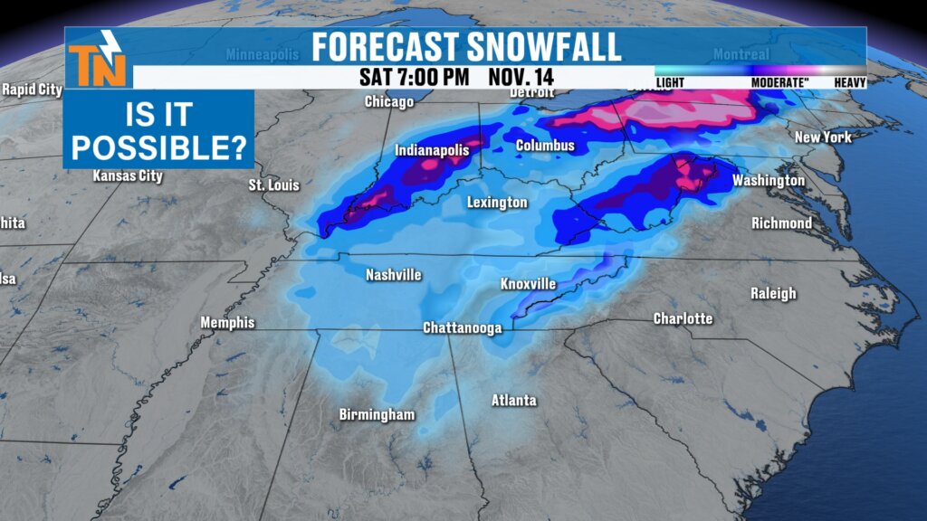
First snowflakes? A deeper trough next week could bring a chance of light snow to East Tennessee, with up to 3 inches on the highest Smokies peaks.
Another Cold Front Arrives TODAY!
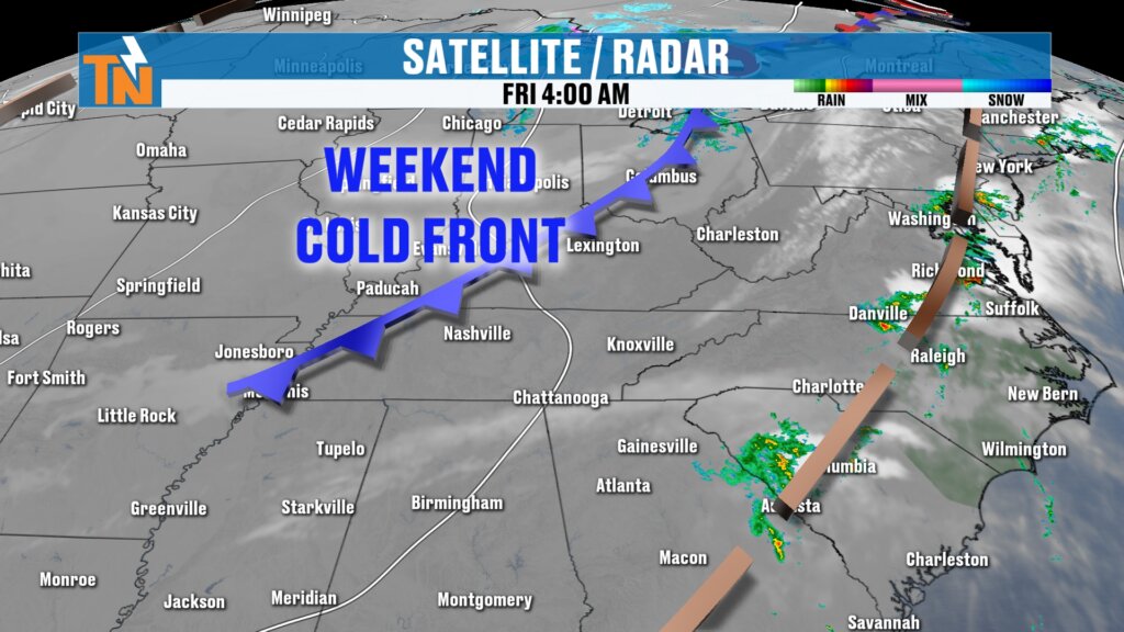
Another cold front arrives today in East Tennessee with clouds, a breeze and a cooler weekend ahead: frost possible, a chilly UT game and 0% rain chances.
A Pattern Change Is On The Way!
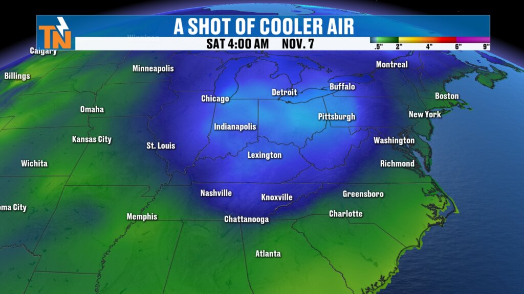
A pattern change is on the way for East Tennessee: a secondary cold front brings cooler, drier air this weekend, with frost possible Sunday to Tuesday.
NEW Severe Weather Risk! Damaging Winds Possible After 4 PM
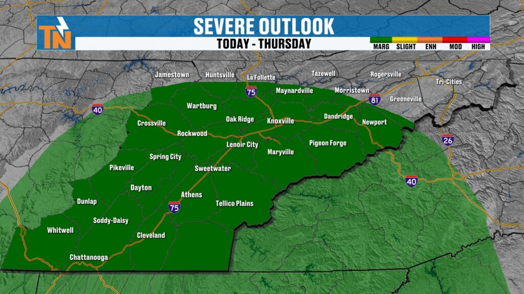
A new severe weather risk for East Tennessee: isolated strong storms and gusty winds are possible around 4 to 6 PM as a cold front moves through today.
A Water-Loaded Atmosphere! Tracking Wednesday’s Rain and Wind Threat
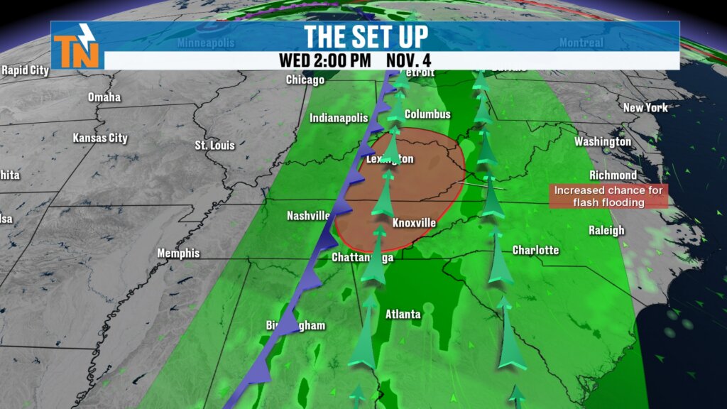
A water-loaded atmosphere is headed for East Tennessee: heavy rain, flash flood concerns and gusty wind Wednesday, then cooler, drier air for the weekend.
300% of Normal Moisture! Heavy Rain Wednesday, Then a Chilly Weekend.
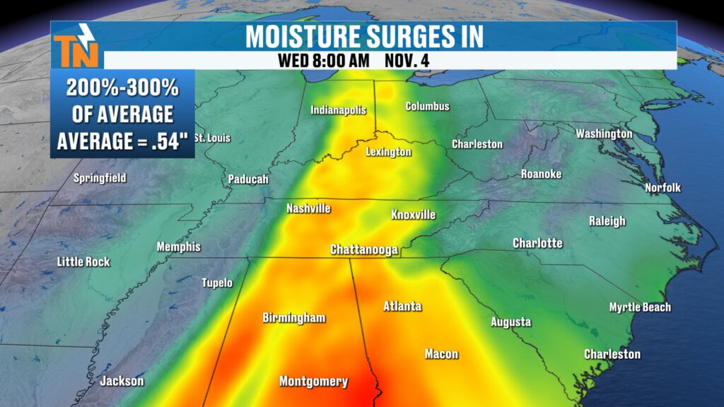
A surge of moisture up to 300% of normal brings locally heavy rain Wednesday, then cooler, drier air for the weekend. Full East Tennessee forecast inside.
Rain Is Falling! But a Much Stronger Storm Is Coming Next Week.
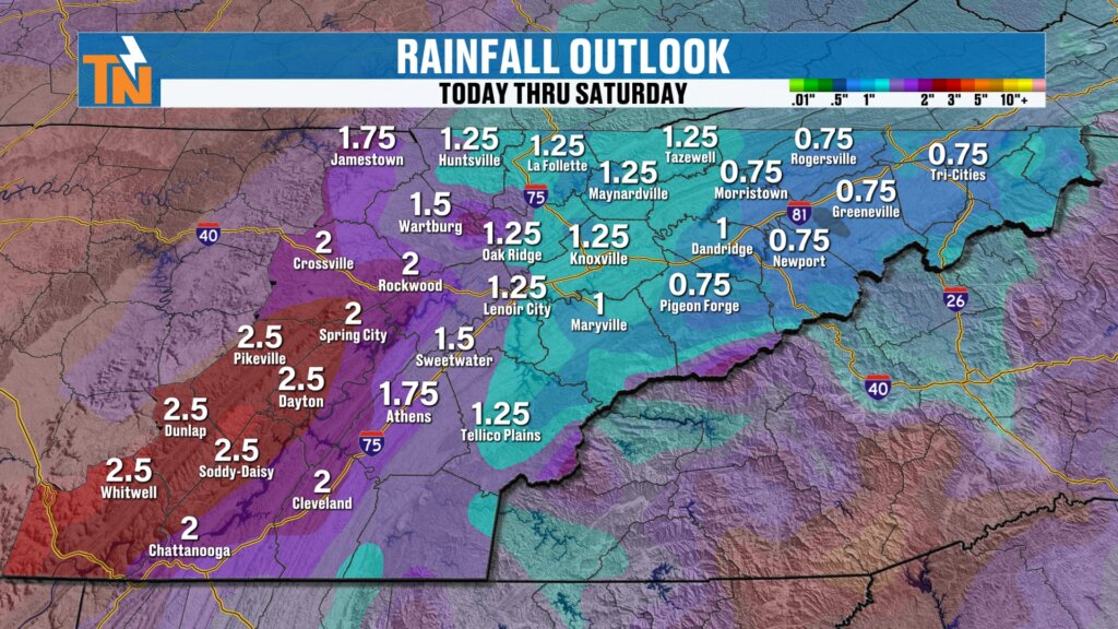
Rain is falling across East Tennessee this Sunday, but it is light and fading. A much stronger storm with 1 to 2 inches of rain arrives Wednesday.